Erhalten Sie Zugang zu diesem und mehr als 300000 Büchern ab EUR 5,99 monatlich.
- Herausgeber: Birlinn
- Kategorie: Geisteswissenschaft
- Sprache: Englisch
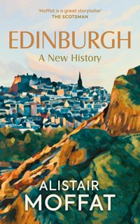
From prehistory to the present day, the story of Edinburgh is packed with incident and drama. As Scotland's capital since 1437, the city has witnessed many of the key events which have shaped the nation. But Edinburgh has always been much more than just a political centre. During the Enlightenment, it was one the intellectual powerhouses of Europe, and in the twentieth century it became the arts capital of the world with the founding of its many festivals. Finance, religion, education and industry are also important parts of the story. Alistair Moffat explores these themes and many more, showing how the city has grown, changed and adapted over the centuries. He introduces Edinburgh's famous places and people – including monarchs, murderers, writers and philosophers – as well as the ordinary citizens who have contributed so much to the life of one of the world's best-known and most beautiful cites.
Sie lesen das E-Book in den Legimi-Apps auf:
Seitenzahl: 283
Veröffentlichungsjahr: 2024
Das E-Book (TTS) können Sie hören im Abo „Legimi Premium” in Legimi-Apps auf:
Ähnliche


Edinburgh
A New History
The endpapers are taken from an 1804 map by John Ainslie, showing part of the Old Town (front) and the New Town (back) just before its second major expansion (Trustees of the National Library of Scotland)
Edinburgh
A New History
ALISTAIR MOFFAT
First published in 2024 by
Birlinn Limited
West Newington House
10 Newington Road
Edinburgh
EH9 1QS
www.birlinn.co.uk
Copyright © Alistair Moffat 2024
The right of Alistair Moffat to be identified as Author of this work has been asserted by him in accordance with the Copyright, Designs and Patents Act 1988.
All rights reserved. No part of this publication may be reproduced, stored or transmitted in any form without the express written permission of the publisher.
ISBN: 978 1 78027 905 3
British Library Cataloguing-in-Publication Data
A catalogue record for this book is available from the British Library
Typeset by Hewer Text UK Ltd, Edinburgh
Map by Helen Stirling
Papers used by Birlinn Ltd are from well-managed
forests and other responsible sources
Printed and bound by Clays Ltd, Elcograf S.p.A.
For Sandy McCall Smith
Contents
Foreword
Map
1 Royal David’s City
2 Fire and Ice
3 The Pioneers
4 The Kings of Edinburgh
5 The Emperor and Edinburgh
6 English Edinburgh
7 The High Life
8 Commerce in the Cowgate
9 Edinburgh Reformed
10 The Town’s College
11 The Rider with the Ring
12 Jinglin’ Geordie, Mary, Watson and Stewart
13 Not Roman Law
14 Jenny and the Dean
15 The Chosen People
16 The Burning City
17 Tipple Town
18 Gala Days in the High Street
19 Tee Town
20 Banks in the Wars
21 Disunion
22 Exotic Edinburgh
23 The Beast of Edinburgh
24 The Rookeries
25 Tartan Town
26 Bearford’s Parks
27 Old Town Down
28 Enlightened Edinburgh
29 The Four Lives of Deacon Brodie
30 Book Town
31 New New Town
32 The Dumbiedykes
33 The Kiltie King
34 Edinburgh’s Disgrace
35 Edinburgh Medics
36 Expanding Edinburgh
37 The Great Disruption
38 Edinburgh Photographed
39 The Waverley
40 Edinburgh-on-Sea
41 Elementary, Edinburgh
42 Precipitous City
43 Round and Oval Balls
44 War City
45 Ugly Edinburgh
46 Almost a Capital
47 Festival City
48 Edinburgh on the Edge
49 Reconvened
50 The Tenth Century
51 Envoi
Further Reading
Index
Foreword
Edinburgh has selected 2024 to mark the start of the 900th anniversary of our city. It was at this time that King David I founded Edinburgh as a royal burgh, marking the beginnings of self-governance for a small hilltop settlement that was to become the thriving capital city it is today.
The city’s past means many things to many people. For some, it’s a city of medieval kingship, faith, ideas, celebration and commerce; for others, a place of industry, conflict, leisure, finance and diversity. This book recognises these themes and so much more. It takes us on a journey from Edinburgh’s glacial beginnings and prehistoric past through major events, such as the Reformation, the Enlightenment and the establishment of the world’s greatest festival of the arts, until we arrive at today’s modern metropolis.
Focusing on individuals, events and places, Alistair Moffat skilfully tells Edinburgh’s many stories in an exciting and accessible way. He does not, however, shy away from the more challenging and darker aspects of Edinburgh’s past, including the city’s links to witchcraft and slavery. He provides a timely reminder that we must continue to learn from our past to shape a better future.
The book demonstrates that, through the efforts of its merchants, trades and citizens of all faiths and backgrounds, Edinburgh has grown to become a modern, vibrant and inclusive city.
As we look to its future, this new history is a testament to the efforts of those who have gone before, and a timely reminder of what can be achieved locally, nationally and internationally through the united efforts of all Edinburghers.
Robert AldridgeThe Rt Hon. Lord Provost of the City of Edinburgh
1
Royal David’s City
Nine centuries ago, a scribe sat down at his writing board on a summer’s day and with a knife sharpened a quill into a nib. Having dipped it into ink made with oak gall, he began to write history:
David dei gratia Rex Scottorum, Roberto electo Sancti Andree et omnibus comitibus et baronibus et omnibus fidelis suis salutem . . .
David, by the grace of God, King of Scots [to] Robert, Bishop-Elect of St Andrews and to all his courtiers and barons and all his faithful men [sends] greetings . . .
Know that I give and concede in perpetual free gift to the Priory [later the Abbey] of Dunfermline the whole tenth part of all my demesne revenues of Dunfermline, save for those rents which belong to other churches.
Et unam mansuram in burgo meo in Strivelin, at aliam in burgo meo de Perth, et aliam in burgo meo de Edenesburg.
And one toft [house plot] in my town of Stirling, and another in my town of Perth, and another in my town of Edinburgh.
When the scribe at last put down his quill, having been careful with every detail of this legal document, he had indeed written history, the earliest surviving record of the name and existence of the settlement of Edinburgh. The document, known as a charter, was dated 17 July 1124 and was one of a series of grants given by the king. It carried the Great Seal of Scotland impressed in wax and was for the clergy at Dunfermline indisputable proof of ownership of land in three of the king’s towns.
As the sixth and youngest son of Malcolm III and his saintly Queen Margaret, David would not have expected to become king. To keep him out of harm’s way (for his brothers could be ruthless), his sister, Maud, took the boy south to England where he quickly found himself at the centre of power. Henry I married Maud, and David was styled ‘Brother of the Queen’ and given land as well as status. As a refugee from the Gaelicspeaking court at Dunfermline and all its roistering martial traditions, David macMalcolm soon became David fitzMalcolm and was raised as a Norman Frenchman. Henry I not only gave him swathes of land in England, he also forced David’s brother, Alexander I, to agree to the grant of a vast area of southern Scotland to the young man, the whole of the Tweed Basin and part of Lanarkshire. As Prince of Cumbria, he began immediately to innovate in ways that would have profound influence on the early history of Edinburgh.
Towns were very important to the prince. He owned Berwick, then part of Scotland, and profited greatly from the tax revenues on trade through the busy port. Much of this came from his other large town, one that has completely disappeared. Roxburgh stood at the confluence of the Teviot and the Tweed, opposite Kelso, and it held great markets for the sale of wool and hides that attracted international buyers, merchants from Flanders, Germany and Italy. These goods were exported through busy Berwick. Towns made kings wealthy and powerful.
David’s other important initiative showed indirectly how lucrative trade was. In 1113 he brought a community of monks from France first to Selkirk and then to Kelso (to be nearer Roxburgh and its mighty castle) and, just as he did for Dunfermline, endowed them with lavish gifts of land and cash revenues, most of the latter from his towns and their trade. These were freely given for the sake of the immortal souls of himself and his family – piety was profound in the twelfth century as well as transactional – but also because David wanted to modernise, to have his literate, record-keeping monks (who answered directly to him through their abbots) develop the economy and create more wealth.
The toft in Edinburgh that the king gave to Dunfermline is not specifically located, but it was nevertheless a precise term. One of the witnesses to the document, Bishop Robert, commissioned Mainard the Fleming to supervise the layout and building of the new town at St Andrews sometime between 1145 and 1150, and what he did helps visualise how early medieval Edinburgh probably looked. There needed to be a marketplace, and at its eastern end, Market Street in the middle of St Andrews is wide enough to accommodate stalls, which it still does most Saturdays. A toll booth to collect taxes, and houses for tradesmen, merchants and others were also required. For the latter, ‘tofts’ were pegged out by ‘liners’. These plots were usually about 7.6 metres wide and included room at the side for a ‘closeur’ (perhaps from closerie, a French word for an enclosed garden), or a close as it became known, a private passage that allowed access to the backlands, or gardens. In twelfth-century Edinburgh these were probably about 130 to 140 metres long and ran steeply downhill to the north and south.
The enduring shape and subsequent history of the High Street strongly suggest that the liners who laid out King David’s town followed Mainard’s protocols. Below St Giles’ Kirk, the street is more than 30 metres wide, indicating a similar pattern of building to St Andrews. From an early date, a toll booth was built next to the church, in the centre of the new town. The other essential requirement was enclosure and security. Tolls had to be paid by those farmers and producers who wanted to come to the markets, so access was strictly controlled. Stone walls were expensive and out of the question, so ditches were often dug and sowed with ‘quickset’, impenetrable thorn bushes, and these were almost certainly policed on market days. David’s town of Edinburgh was small, limited from the beginning to 143 acres, a restriction that would greatly influence its history for centuries. A church already existed as a focal point. St Giles is very old but was certainly endowed by the king’s older brother, Alexander I, in 1120, and the wooden buildings on the tofts of the early High Street stood on either side.
Nine hundred years ago, Edinburgh was not a city, not even a town, but in reality what we might think of today as a village of a few hundred souls where regular markets were held. Unlike St Andrews, Roxburgh or Berwick, it stood on a narrow, steeply sloping site with poor access to natural sources of water. But these awkwardnesses were less important than the reason for Edinburgh’s existence – the mighty rock to the west and the fortress that stood on its summit.
2
Fire and Ice
No urban skyline is as distinctive as Edinburgh’s. While other cities use notable buildings or structures as visual shorthand, such as the Houses of Parliament, or the Eiffel Tower, Edinburgh has been uniquely blessed by geology. The outline of the Castle Rock with the long tail of the Old Town flowing downhill to the east, and the deep declivities of the Grassmarket/Cowgate and Princes Street Gardens/Waverley Station on either side, is immediately and universally recognisable. And it is majestic. Anyone looking west from Calton Hill sees a stunning vista, and how geology and history made a city. On one side is the jagged spine of the medieval settlement and on the other the rectilinear formality of the Georgian New Town, while in the centre, leading the eye into the distance, Princes Street runs arrow-straight. Others will argue with passion for their own hometowns but objective observers know that Edinburgh is without rival.
Fire and ice made it so. More than 300 million years ago the crust of the Earth was dangerously dynamic. Volcanic eruptions tore through it, sending vast tonnages of ash and dust rocketing into the atmosphere; rivers of red-and-white hot magma spewed down the flanks of these black mountains; the boom of thunder everywhere rent the air and the ground shook with an elemental violence. Out of such spectacular convulsions Edinburgh was created.
Like the Bass Rock and Traprain Law to the east, the Castle Rock was once the top of a volcanic pipe. Forced from the molten core of the Earth, magma boiled upwards and often found its way out into the air through cylindrical vents. When the eruptions settled, over millions of years, and the magma simmering in the pipes cooled, their tops formed a very hard and rounded shape, known as a volcanic plug. Worn down by erosion caused by the wind, frost and rain of millions of winters, the Bass Rock, Traprain Law and the Castle Rock began to assume their modern appearance.
Some time around 24,000 BC the weather grew unusually severe and stormy in the north, in what was to become Scotland. Temperatures dropped, and snow did not melt in the spring, staying on the hilltops through the summer. The last Ice Age was beginning. Even summer skies darkened, growing seasons shortened, vegetation died back and the animals that depended on it retreated further southwards every year. As the snow fell and the frosts deepened, the early peoples of Scotland also fled, and the landscape emptied and became silent.
At its height the Ice Age created a pitiless white vista, stretching away on every side. It was dominated by the ice domes, huge hemispherical mountains of compacted ice, sometimes several kilometres thick. Scotland was crushed under a massive dome that formed over the ranges north of Loch Lomond. Incessant hurricanes blew around its symmetrical slopes, buffing them smooth, and often the downward flow of wind created sustained periods of anti-cyclone and clear, bright blue skies. It was a landscape of devastating beauty.
The ice obliterated all life, and at its zenith, around 16,000 BC, the glaciers reached down as far as the English Midlands and South Wales. When temperatures at last began to rise, change would be rapid. Within the span of only two or three generations, the ice sheets and the tundra to the south of them would retreat several miles. And as they did so, the impact on the environment was dramatic. When the glaciers on the flanks of the Lomond ice dome groaned and cracked and moved slowly eastwards, they bulldozed our geography into recognisable features. Frozen inside these wide rivers of ice, all sorts of debris were carried along, and huge boulders and pods of gravel scarted and ground across Scotland’s midland valley, moving vast volumes of earth and soft stone. When the glaciers at last turned into meltwater torrents, the effect could be almost immediate. River courses were broken out, deep valleys created, and the character of the landscape profoundly altered.
As gravity and rising temperatures drew the Lomond glaciers eastwards, they collided with the hard rock Edinburgh Castle now sits on, and they were forced to divide. Having scoured and buffed the old volcanic pipe down to the bare, sheer cliffs now visible on three flanks, the ice flow scraped out the deep ravines on either side: what became the Grassmarket/Cowgate and Princes Street Gardens and the site of Waverley Station. And crucially for the development and later nature of the city, the glaciers left a long tail in the eastern lee of the Castle Rock, the tail on which David I’s medieval town would be built.
It was in Edinburgh that these geological processes were first recognised. In the middle of the nineteenth century, the idea that the northern hemisphere had endured an ice age was still seen as revolutionary, difficult to prove. Some conservative souls still preferred to believe in Noah’s Flood as the cataclysm from which God delivered the world. In 1840 the Swiss scientist, Louis Agassiz, arrived in Scotland to tour the Highlands and look for evidence of the impact of glaciers on the landscape. In his native Switzerland, he had noticed that in the valleys below glaciers there were places where rock formations had clearly been smoothed and striated by the movement of ice and the debris locked inside it that had long since retreated. But it was not until he came to Edinburgh that he became certain that Scotland had once been covered by an ice sheet, had been emptied of its people as the land turned white. Agassiz surveyed the western crags of Blackford Hill, to the south of the city, and when he saw the scoring and gouging on the overhanging rocks and the long tail down to Liberton behind them, he declared ‘that is the work of the ice!’ His findings marked the beginning of the science of glaciology – and gave The Scotsman newspaper one of its greatest scoops.
3
The Pioneers
By 11,000 BC Scotland was at last ice-free. A vast green canopy carpeted the land, trees sprang up over many of the hill ranges, only the wind stunting their growth. Like a temperate jungle, the great wood was dense and often shaded by thick and lush cover as the trees reached up for the light. Willow, aspen, birch, pine and hazel were the first to flourish, and they remain our most hardy and adaptable native trees. Broadleaved oaks, elms and limes followed, and behind them came the animals who thrived in the abundance of the wild-wood. Birds fluttered above the treetops, their songs incessant in the long summers. Squirrels scuttled through the canopy, as did pine martens and polecats. While roe and red deer moved warily among the trees, larger, more aggressive animals – wild boar and the mighty cattle known as aurochs – thrashed through the undergrowth. Aurochs, standing over six feet high at the shoulder and with a horn-spread of seven feet, were giants, as big as rhinoceros. By the streams, rivers and lochs, otters and beaver fished, and waterfowl lived on the rich vegetation.
Predators waited in the shadows of the wildwood. Lynxes, bears and packs of forest wolves stalked the unwary. And behind them came the most dangerous killers of all – human beings. Prehistoric men, women and their families usually preferred to travel by water, and the first pioneers who came north to the Firth of Forth arrived in boats. Probably coasting up from the south, they reached the mouths of rivers and streams first. The outfalls of the rivers around Edinburgh – the Almond, the Water of Leith and the Esk – were almost certainly among the first sites in the Lothians to be colonised. They were good places to live, almost Edenic in a warm summer and a ripening autumn, offering food from the sea, the river and the land – and security. The only tracks through the wildwood were made by animals, and under the dense shade of the crowding trees, it was easy to get lost. Water was always a reliable way to regain a hunter’s bearings: follow the fall of the ground to a stream and then follow that until it joins a river, which will eventually find the sea and the familiar shore.
The southern hinterland of the Forth, the place now covered by the centre and suburbs of Edinburgh, was likely the hunting and gathering territory of no more than one extended family, and perhaps one or two satellite groups. But around 10,000 BC it was a workable, familiar environment. Handy landmarks stood high on every side: the Pentland Hills to the south, the unmissable Castle Rock, Arthur’s Seat, Blackford and Braid Hills, and Craiglockhart and Corstorphine Hills to the west. It was a defined homeland for the hunter-gatherer-fishers who first came north. And it may well have been a good life. Temperatures had risen close to modern levels, and by 10,000 BC the leaves of a thousand autumns had fallen and enriched the great wood and allowed it to nurture and sustain many animals. A wild harvest of fruits, berries and nuts was available, and the long and well-fed evenings of the late summer on the banks of the Almond or the Esk might well have been pleasant as people took their ease, talked, joked and gossiped. But it proved to be a false arcadia.
Far away to the west a last, devastating legacy of the Ice Age was about to be unleashed. In the north of what is now Canada a vast freshwater lake of ice melt had gathered. Held back only by frozen dams bulldozed into place by massive glaciers, it had begun to leak, at first only slowly. The overspill at first drained south, carving out the great central American river systems of the Missouri and Mississippi. Then, very suddenly, perhaps in thirty-six hours, the mighty lake broke down the ice dams to the east and, with a deafening roar, flooded into the Mackenzie River Basin, out to the Beaufort Sea, the Davis Strait and into the Atlantic Ocean. Sea levels rose by 30 metres overnight and the tsunamis wiped out countless coastal communities, including those on the southern shores of the Forth. Even more disastrously the huge volume of cold freshwater turned the Gulf Stream off course, pushing it away from the coasts of Northern Europe. Almost immediately the weather changed, and the deathly cold crept back over the face of the land. Storms blew, snow lay thick and long, and the pioneers who had survived the tsunamis shivered and fled south.
As the ice dome reformed over Ben Lomond and the western mountains, the north was empty and silent once more. Around the Castle Rock and Arthur’s Seat the winds whistled, and although the ice sheets probably did not reach the eastern coasts, the tundra was sterile. For seventy generations, around 1,500 years, it seemed as though Scotland would stay locked in the grip of the ice – but then gradually the weather improved. Out in the Atlantic the clear skies had helped the ocean recover its salinity. The baleful effects of the Canadian dam burst eventually evaporated and the Gulf Stream once again flowed northwards. Snow and ice melted, the trees grew high once again, and very slowly the pioneers returned. The continuous human history of what would become Edinburgh had at last begun.
As the ice melted after what historians and archaeologists have called the Cold Snap, between c. 9400 BC and c. 8000 BC, sea levels rose once more. The Firth of Forth reached as far inland as Aberfoyle, where the bones of whales have been found, and the Clyde also encroached from the west. For several generations the land bridge connecting southern Scotland with the north was only eight miles wide. Much of what became the site of the city of Edinburgh was submerged under the prehistoric sea.
Nevertheless, pioneers did venture north again, and soon after the ice melt. At Cramond gossamer traces of a hunter-gatherer-fisher camp have been found and dated to before 8000 BC. Little more than soil stains now, the site shows where a group, perhaps a family, spent time on what was probably a summer expedition. Perhaps their purpose was to fish and trap animals and preserve their meat by smoking or air-drying. Berries, nuts and fungi could also be dried or roasted to provide good staples through the hungry months of the winter.
With only wisps of evidence to go on, archaeologists have long believed that the early pioneers did little more than rustle the leaves as they moved through the ancient wild-wood. Putting up only makeshift shelters – some of them similar to bender tents, held up and given tension by green stakes driven into the ground and then covered with hides (as seems to have been the case at Cramond) – and lighting fires, theirs was a transient, sparse presence. But a sensational recent discovery near Edinburgh has forced a radical revision of that view.
When routine investigations took place prior to the construction of the Queensferry Crossing, the new road bridge over the Forth, archaeologists uncovered something startling. At Echline in South Queensferry they found the remains of one of Scotland’s oldest houses. Dating to c. 8000 BC, it would have resembled a giant tipi. Postholes dug in an oval arrangement held thick tree trunks or boughs and were canted inwards so that they could be secured at the apex. Probably made weathertight with a covering of turf, inside was a shallow pit about seven metres in length and blackened areas where several hearths held fires that burned in the darkness. The house could have happily made a snug home for six to eight people.
If archaeologists find organic matter preserved on a site, they can date it. At Echline they came across hazelnut shells, and since they grow and ripen in only one year, they can give precise results. And this is what turned out to be sensational. It was the shells that showed that the house was built some 10,000 years ago. More than that, its discovery completely dispelled the notion of the pioneers as transients, as shadows flitting through the wildwood. The effort and organisation required to build a solid wooden house more than implies ownership and the exercise of customary rights to the land around; it insists on it. And given the wide area needed to sustain even a small group living in one place (a continuous supply of firewood was only one of the most pressing logistical problems), these customary rights must have been vigorously defended. Their names will never be known, their short lives pieced together only by fragments of archaeology, but it is certain that by c. 8500 BC, the area around Edinburgh had its first recorded inhabitants.
4
The Kings of Edinburgh
Cities and their suburbs obliterate much of the archaeology beneath them. There was almost certainly a house like the great wooden tipi at Echline in the Edinburgh area, but it is highly unlikely that it will ever be found.
No precise date, or indeed the names of any individuals, can be linked to a profound historical event, perhaps the greatest revolution in human history, that took place only a thousand years after the family of hunter-gatherers built their wooden tipi at South Queensferry. In the fertile lands between the rivers Tigris and Euphrates, in much of what is now modern Iraq, animals were being domesticated and wild grasses were being modified and cultivated to produce a reliable annual harvest of cereals. Farming was the greatest revolution in human history, and yet very little is known about how it was developed and adopted. These new ways of producing food reached Scotland around 3500 BC, and the area around Edinburgh was a good place to make them work.
As communities began to create small fields and pastures by clearing the wildwood, sometimes using fire, they looked for places that had natural drainage. Until very recently, as late as the eighteenth century, valley bottoms and flat ground were often boggy and impossible to cultivate. What early farmers wanted was the sort of gently sloping terrain found to the south of the Castle Rock. For example, the ridge now leading from Church Hill eastwards along Strathearn Road offered inclines on either side steep enough for run-offbut not too steep to plough and plant. Terracing was also dug, and the remains of this system can still be clearly seen on the eastern flanks of Arthur’s Seat.
Farming pinned people to the particular places they worked on and improved, and, in turn, that commitment fostered ideas of ownership. Competition for fertile land must have taken place, and in the millennia following 3500 BC a hierarchical society developed. In Orkney spectacular farmers’ monuments have survived at Maeshowe, the Ring of Brodgar, the Ness of Brodgar and the Stones of Stenness. They suggest a well organised society sufficiently prosperous to afford the time to build these elaborate religious structures – and also a directing mind, either a king or a powerful elite. And the houses at Skara Brae show real sophistication. There is no reason to believe that the farmers of Midlothian were less skilled or successful: the major difference is in the materials they used. They probably built in perishable wood rather than stone, and their sites have seen much more intensive use as waves of historical change washed over the landscape, obliterating almost all traces of the early farms.
One of the most dynamic changes in society was the evolution of the warrior. As family groups coalesced into tribal societies and patriarchs established themselves as chiefs, it is likely that their supporters or bodyguards began to practise specialist military skills. When metal appears in the archaeological record of the third and second millennia BC, it is often found as weapons, not all of them designed for hunting. Swords, for example, were made for one purpose, and that was fighting and killing.
In 1778 Duddingston Loch, at the eastern foot of Arthur’s Seat, was being dredged for marl, a carbonate-rich mud used as fertiliser. When the buckets were lifted and emptied onto the banks of the little loch, workmen were amazed to see scores of iron and bronze objects embedded in the mud. Almost all were weapons: swords (including a rapier) and spearheads. Valuable and prestigious objects owned by a warrior elite, they had first been damaged and burned before being thrown into the loch with no intention to retrieve them. It seems they were sacrifices made to the gods whose presence or spirit was associated with water. As they sank to the bottom of the loch, the weapons were preserved in the anaerobic mud for almost 3,000 years. Now the Duddingston Loch Hoard is in the National Museum of Scotland in Edinburgh.
By 1300 BC to 1200 BC it is likely that swordsmen rode horses, what we would call ponies. Terrets, the metal parts of harness, have been excavated, and by the beginning of the first millennium BC, small posses of cavalrymen might have formed the retinues of tribal chiefs, perhaps even of men who could call themselves kings. Hillforts were where they lived, at least for part of the time, and on Arthur’s Seat and Easter Craiglockhart Hill stone ramparts and prehistoric ditching have been identified. Most spectacularly, at Newbridge, on the western outskirts of Edinburgh, a chariot burial was discovered. Dating from 400 BC, the chariot had been set into the ground upright and intact. Usually drawn by two ponies yoked to a central pole and driven by one man while another threw javelins or fired arrows, these trim little vehicles were certainly the prerogative of a warrior elite, perhaps even of kings. Burial in a chariot speaks of high status and elaborate ritual, to say nothing of a belief in an afterlife.
The highest status of all probably belonged to the man who ruled from Edinburgh’s Castle Rock. Recent archaeology has uncovered evidence of a fortress that was occupied at the beginning of the first millennium BC. Fragments of animal bone, charcoal and other organic material were radiocarbon dated to between 972 BC and 830 BC, and the remains of two roundhouses, the characteristic dwellings of the period, were found. The archaeologists believed that they were part of a larger settlement across the summit of the Castle Rock. No traces of ramparts or defences were discovered, but the dig was very restricted in its scale. These finds mean something surprising – that Edinburgh Castle can claim to have been continuously occupied for 3,000 years, longer than any other site in Britain.
By the end of the first millennium BC it is possible to catch some fleeting sense of what the kings, the warriors and the society that supported them were like. They spoke a Celtic language, but not Gaelic, as might be casually assumed. Place names and later poetry confirm that the rulers of Edinburgh spoke a dialect of Old Welsh. From Caithness to Cornwall this was the common tongue of Celtic Britain. Gaelic was at that time the language of the Irish and, probably, Argyll. The name of Edinburgh itself is partly Old Welsh in origin, although mysterious in derivation.
The modern name has the Anglian ‘burgh’ attached, a relatively late change, occurring after ad 638 when the Northumbrian armies captured the Castle Rock, calling it ‘Etin’. At that time ‘burh’ meant a defended settlement. The older version of the Edenesburg of the charter of David I was Din Eidyn, and in Old (and modern) Welsh it simply denoted a fortress or a settlement. Eidyn was probably a personal name, perhaps a divine ancestor, perhaps an early king, and it may have stood for the district, the ancient equivalent of Lothian. Which allows a simple but not very informative meaning of the Fortress of Eidyn, whoever he, she or it was.
Much later, Old Welsh poetry composed in the fortress described a warrior society that saw itself in emphatically heroic terms. Glory in battle was the chief end of life for the cavalrymen of Din Eidyn as they spurred their ponies out of its gates and down the slopes of what would become the medieval town.
5
The Emperor and Edinburgh
In ad 79, lookouts on the ramparts of Din Eidyn saw a Roman army marching towards them. Eagle standards glinting and fluttering, flanked by screens of cavalry and led by the governor of Britannia, Gnaeus Julius Agricola, three legions had come to bring the north of Britannia into the empire. And the king on the Castle Rock had agreed to help them do it. Known as the Votadini, later the Gododdin, the native peoples of the Lothians and southern Scotland had probably agreed a deal with Roman emissaries. In return for a decent price for their corn (needed to feed the advancing legions), a degree of independence and a promise of protection from neighbouring kingdoms, the Votadini kings would wave the invasion through their territory.


