Erhalten Sie Zugang zu diesem und mehr als 300000 Büchern ab EUR 5,99 monatlich.
- Herausgeber: Birlinn
- Kategorie: Gesellschafts- und Liebesromane
- Sprache: Englisch
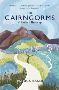
Cairngorms: A Secret History is a series of journeys exploring barely known human and natural stories of the Cairngorm Mountains. It looks at a unique British landscape, its last great wilderness, with new eyes. History combines with travelogue in a vivid account of this elemental scenery. There have been rare human incursions into the Cairngorm plateau, and Patrick Baker tracks them down. He traces elusive wildlife and relives ghostly sightings on the summit of Ben Macdui. From the search for a long-forgotten climbing shelter and the locating of ancient gem mines, to the discovery of skeletal aircraft remains and the hunt for a mysterious nineteenth-century aristocratic settlement, he seeks out the unlikeliest and most interesting of features in places far off the beaten track. The cultural and human impact of this stunning landscape and reflections on the history of mountaineering are the threads which bind this compelling narrative together.
Sie lesen das E-Book in den Legimi-Apps auf:
Seitenzahl: 266
Veröffentlichungsjahr: 2014
Das E-Book (TTS) können Sie hören im Abo „Legimi Premium” in Legimi-Apps auf:
Ähnliche


THE CAIRNGORMS
A Secret History
Patrick Baker studied Business, Finance and Economics at the University of East Anglia and gained a postgraduate qualification in Publishing from the Robert Gordon University, Aberdeen. He has worked in the publishing industry for many years editing and producing academic journals and is currently a writer for an investment management company. A keen outdoor enthusiast, he has walked and climbed throughout Scotland and Europe. His book Walking in the Ochils, Campsie Fells and Lomond Hills (Cicerone) was published in 2006.
This eBook edition published in 2014 by
Birlinn Limited
West Newington House
Newington Road
Edinburgh
EH9 1QS
www.birlinn.co.uk
Text and photographs © Patrick Baker, 2014
The right of Patrick Baker to be identified as the author of this work has been asserted by him in accordance with the Copyright, Design and Patent Act 1988.
All rights reserved. No part of this publication may be reproduced, stored, or transmitted in any form, or by any means, electronic, photocopying, recording or otherwise, without the express written permission of the publishers.
ISBN: 978-1-78027-188-0
eBook ISBN: 978-0-85790-809-4
British Library Cataloguing-in-Publication Data
A catalogue record for this book is available from the British Library
Contents
List of Illustrations
Dedication
Secret Histories
Ghost River
Landseer’s Bothy
The Lost Shelter
Final Flight
Cairngorm Stone
The Big Grey Man
The Cat’s Den
Ravine
Acknowledgements
References and Sources
Illustrations
Looking into Garbh Choire Mòr.
The interior of Ruigh-aiteachain bothy.
The two engines of the Oxford Mk I on a spur of Beinn a’ Bhuird.
The Shelter Stone Crag and Cairn Etchachan.
The Shelter Stone.
The path between Ben Macdui and Loch Etchachan.
Looking down on the El Alamein Refuge and the slopes of Strath Nethy.
The inscription on the El Alamein Refuge, bearing the insignia of the Highland Division.
The ruins of Slugain Lodge in Upper Gleann an t-Slugain, the Fairy Glen.
A small stone tablet, once part of the St Valery refuge and inscribed with its name.
The Sappers’ Bothy near the summit of Ben Macdui.
The surreal granite tors on the vast expanse of the Ben Avon plateau.
Looking south into the wide breach of the Lairig Ghru from Braeriach.
The Lairig Ghru, looking north, with the Devil’s Peak in the centre.
Dedication
For my wife Jacqui, and for my children Isla, Rory and Finn, with all my love.
Secret Histories
‘The exploratory urge moves every man who loves the hills.’
W. H. Murray
For a few fleeting seconds, my mind defaulted to known surroundings: to my bed at home and a drowsy feeling of safety and cosiness. The sensation quickly passed; I came to shuddering in the darkness, temporarily disorientated by the cold, but slowly remembering where I was. It was midnight on the summit of the Cairngorm plateau and I hunkered down further into my sleeping bag, suppressing a mild sense of panic about the possible onset of hypothermia and questioning the wisdom of spending the night alone at over 4,000 feet.
For almost an hour I lay awake watching the sky’s patterns. Jigsaw patches of cumulus clouds scudded overhead, tesselating and decoupling from each other against the dark firmament. An icy north-westerly rolled across the night’s empty spaces. It rattled through my bivouac bag, inflating, then collapsing, pockets of cold mountain air all around me. Sleep seemed impossible, and eventually a restless, nervous energy got the better of me. Tired of shivering and too cold to stay still, I left my shelter and began to tread the nightscape of the plateau.
I walked roughly eastwards following a tiny spring-fed stream whose surface glinted like molten metal. The wind gusted steadily at my back, hustling against the material of my jacket and nudging me forward with every step. On the plateau’s western rim the moon drifted large and low, and ahead of me the land dipped into a shallow depression at least half a kilometre wide. Dozens of wellsprings collected there, each throwing back the moonlight like tiny droplets of mercury. Beyond the watershed, the horizon rose in a gentle incline, edging towards its uppermost point, the summit of Braeriach: the second-highest mountain in the Cairngorms and the third-highest peak in Britain.
From the abstract thoughts that accompany complete solitude, a daft, random notion entered my mind: unless, for some equally unfathomable reason, someone else was spending the night on either of the UK’s two higher places, Ben Nevis or Ben Macdui, I realised that I was, at that moment, the highest human being in Britain. I was, in fact, probably higher than anyone else on the western peripheries of Europe.
For a few seconds, the thought unbalanced me, tipping me back again towards panic. What was I doing? I was dozens of kilometres and a thousand elevated metres from the nearest place of human habitation, effectively stranded until sunrise in one of the country’s most inhospitable natural environments. Alone in the high-altitude darkness, the realisation of my self-enforced remoteness sent a brief, electric current pulsing through my stomach. I felt foolhardy, and a bit naive.
Suddenly my plan seemed rather ridiculous. Several months earlier, sitting at my kitchen table with the last shafts of evening sun cutting into the room, the thought of making a series of journeys to explore some of the most desolate and seldom visited parts of Britain’s wildest mountain range had seemed like a good idea. What better way to find out more about a place that over the years I had become slightly obsessed with?
Back then, the practicalities of the project had hardly even registered with me. It would take a while, of course: a year perhaps, in between the commitments of work and family life; but it would be feasible, even enjoyable. They were to be adventures, unconventional mountainous escapades to places I would have never normally thought of venturing.
Now, though, at one o’clock in the morning, jogging on the spot to keep warm, on top of Britain’s third-highest mountain, I couldn’t help wondering if this was more than I had bargained for.
I had first visited the Cairngorms when I was in my early twenties. I was on a training course for would-be mountaineers, learning the rudiments of winter hillcraft from an instructor hell-bent on leaving behind any of us who were too slow to keep up. By early afternoon we had picked our way up a steep ice bank in Coire an t-Sneachda, one of the towering, snow-encrusted Northern Corries. Perhaps it was the oxygen-depleted exertion, the rush of endorphins or the elation at finally pulling up on to the plateau edge, but I was momentarily overcome by what I then saw.
I stood breathless, staring out across a snowbound territory of ice-fields, turreted island summits and kilometres of crystalline brightness that stretched as far as my eyes could see. Then, as now, I felt an utter bewilderment at the sheer size of the Cairngorms. No other area of Britain is so immensely high over such an immensely large area. Its elevation and geographical extent make it unique: a monolithic expanse of mountainous granite landmass equivalent in size to Luxembourg and containing five of the sixth highest peaks in Britain.
Accordingly, it is known as a place of extremes and cruel asperities, of unparalleled topographical and altitudinal circumstance. Snow falls here in every month of the year and lies permanently in its coldest recesses. Gales regularly batter the plateau with such ferocity that wind-speeds have reached over 170mph. Temperatures and conditions are subarctic in their severity and fatalities are recorded here regularly.
But beyond its immediate first impressions, its hostile bleakness and prodigious expanse, an alternative identity of the range also exists. It is a corresponding but often concealed character, described by the modernist poet and novelist Nan Shepherd, as the ‘living mountain’, in her unashamedly eulogistic book of the same name. For like all wild places, the Cairngorms harbour hidden narratives: geological, animal and human – past events and contemporary passages which are rarely acknowledged in the same way as urban and industrialised histories, but are nonetheless evidenced within the landscape; if, of course, you know where to look.
It was the Cairngorms, more than any other remote or mountainous area that I knew, which seemed to retain and perpetuate these secret histories. It seemed, as well, that despite – or perhaps because of – its fearsome wildness, there were stories and mysteries here that were more potent and intriguing than anywhere else I could think of.
The journeys I hoped to make would be to explore the Cairngorms’ secret histories. To search for the relics and rumours that marked the unofficial, unrecorded character of the range. Seemingly anomalous vestiges like the high-level shelters of the plateau – the refuges once used by generations of climbers, but now all but crumbling into obscurity. Elsewhere, I plotted expeditions to find the unlikeliest and most interesting of features: the skeletal remains of aircraft debris; an ancient gem mine; the cave of a local fugitive; a mysterious aristocratic settlement; ghostly apparitions; geological oddities; and a secluded, little-known ravine. I also intended to follow the natural routes of the landscape, to track the course of the River Dee, trailing its backwards slant into the tundra of the Braeriach plateau, in search of the highest river source in Britain. I even tried to deduce the most likely place to see a wildcat.
There would be no ground-breaking discoveries or grand revelations, I was sure of that. I had no real idea of what, if anything, I would find. My leads were questionable at best: a dubious collection of obscure publications, out-of-print books and unsubstantiated online chatter. At worst, they were distinctly flimsy: dimly remembered conversations, drunken anecdotes and spurious pub stories. But that, in many ways, was the point. I was looking for the alter ego of these hills, something of the overlooked, the obscure and the unobserved in Britain’s greatest mountain wilderness.
Ghost River
‘Though actually I have one small idea – I intend to walk a certain river to its source.’
Neil M. Gunn, Highland River.
In late July 1829, a high-pressure system situated in the Atlantic Ocean, between southern Iceland and northern Scotland, retreated south-westwards. In its wake, a chain of atmospheric events began to unfold. Cold air swept south from the Norwegian Arctic, through Scandinavia and the Baltic Sea, and by 1 August a substantial depression had begun to make its ways southwards from Iceland, gaining momentum as it travelled.
Weather conditions on land would have begun to deteriorate correspondingly, but for the people of north-east Scotland, blissfully unaware of the extraordinary meteorological changes that were taking place at sea, daily life continued as normal. Little could anyone have known that within days, one of the most cataclysmic natural events ever recorded in Britain would take place.
On 3 August 1829 the full force of the Atlantic depression eventually reached mainland Scotland. As the cold weather systems from the north collided with existing cyclonic systems from the south, a massive, unstable air mass formed, unleashing torrential rain as it passed slowly across the uplands of the Moray Firth and the Grampian Mountains. The result was a catastrophic flood of Biblical proportions.
The ‘Muckle Spate’, literally meaning ‘large flood’, of 1829 remains historically unparalleled in its destructive force. Thousands of people across the northeast of Scotland were rendered destitute by the rising water. Farms were swept away and vast tracts of fertile land were ruined. In one district alone, thirteen bridges and three sawmills were destroyed by the swollen rivers. Elsewhere, roads were inundated and whole communities left stranded. Eight people lost their lives and many more had their livelihoods obliterated. Within a matter of hours, the rivers that had been the lifeblood of the region had become the conduits of its destruction.
It was hardly surprising. The rivers of north-east Scotland possess a latent ferocity. They are mountain rivers, capable of rapid and violent transformation, falling further and faster than anywhere else in the country: rivers such as the Spey and the Avon whose waters rise disparately in the Cairngorm and Monadhliath mountains; and the River Dee whose headwaters on top of the Braeriach plateau have the highest and most enigmatic river source in Britain.
I once idly traced the backwards course of the River Dee, letting my finger run gradually northwards and upwards along its representation on the Ordnance Survey map. The river’s depiction on the map steadily changed the further my finger moved against its downward flow, tapering from fat blue curves, looping and bending across the map, through green forestry and salmon-pink villages, to a narrow line, split thinner and thinner at each V-shaped confluence.
Eventually the river became a slender cobalt filament surrounded by the compressed orange of merging contour lines and the black symbolism of cliffs. I followed the blue strand on the map until it could divide no further, to the river’s ultimate source, in the middle of the Cairngorm Mountains.
A few small blue circles were scattered at the place where my finger finally rested, too small to be lochans or tarns, but large enough to make it onto the map. Next to them was a name in the same blue typeface, ‘The Wells of Dee’. I was immediately intrigued. Every other river that I could see on the map eventually subdivided backwards into obscurity. The River Dee was different. I was able to follow its headwaters back to one of the highest points on the map.
Not only that, its source had a name. It made the starting point of the river seem almost official. The inclusion of the triangle of blue circles on the map hinted at a sense of permanence, a geographical feature present year after year, a constant supply of water. But from where? There was no higher ground from which rainwater could drain, and to my knowledge the plateau summit was a hard, boulder-strewn landscape, not a marshland. The ‘Wells’ had to be wellsprings, the source of the river flowing from within the very mountain itself.
Years later, there now seemed to be an exploratory logic to walking the course I had once plotted with my finger. Travelling upstream, back to the source of the Dee, meant moving within the landscape, and understanding something of the water’s anarchic progression to lower ground. It would also be an unravelling of the river, witnessing its life-history unfolding in reverse.
The Linn of Dee is the furthest place upstream on the River Dee that you can reach by public road. The Linn, from the Gaelic meaning a pool or a cascade of water, is a 300-metre-long chasm cleaved deep into the bedrock where the Dee suddenly converges from a broad-spanning river to a raging torrent just a couple of metres wide. It is spectacular, but concealed until you are close by, hidden amongst thick stands of larch and lodgepole pine. It was dusk when I arrived and the place was deserted. The air was still warm and smelt strongly of pine resin.
A small stone bridge spanned the gorge, arching above a narrow channel of spluttering white-water. The bridge’s wooden predecessor was one of first significant victims of the Muckle Spate, pulled apart despite being ten metres above the water. Other bridges further downstream suffered similar fates during the deluge. Not even the engineering prowess of Thomas Telford could have foreseen the destructive power of the 1829 flood. His huge, newly-built stone bridge at Ballater was completely dismantled by the rising waters.
I peered down into the gorge, leaning over the cliff edge, hearing the water before I could see it. On the underside of the bridge the Dee fell in a series of cascades. Recesses had been carved into the rocks in wide curves and scoops that suggested dramatic movement and indicated much higher water levels.
Remarkably the Linn had once been challenged, and tamed. In an act of incredible athleticism but utter recklessness, the celebrated English climber, John Menlove Edwards, swam the length of the falls in 1935. The river was in full spate at the time, but Edwards astonishingly survived the feat and later went on to be at the forefront of British climbing in the 1930s and ’40s, pioneering many routes previously thought of as unclimbable. Edwards’s life story was not a happy one, though. The apparently self-destructive compulsion that led him to swim the Linn of Dee perhaps underpinned his complex, troubled personality. He later committed suicide in 1958.
Twilight gathered quickly. The sky was cloudless and shifting from blue to purple. I walked westwards, leaving the forestry and moving out into the grassy moorland of Glen Dee, keen to cover as much ground as possible before full darkness. My route ran parallel with the river, separated from it by a floodplain that held some of the largest Scots pines I had ever seen. The trees were colossal and stately: russet-tinged branches and huge blue-green crowns, each with its own wide circumference of territory.
My eyes began to refocus as I walked, adjusting to the grainy half-light. I caught outlines and patterns instead of close detail. Then, several kilometres in, I noticed something partially covered amongst the heather: linear profiles that in their configuration and placement somehow seemed out of place. The track swung close to the shapes, and I paced across the moorland to see them.
I found rows of small boulders, linked at right angles and half hidden by moss and turf that had grafted on top of them: the architectural footprints of a long-deserted building. This was once a homestead, a place of family life and part of a succession of dwellings scattered along the plains of the Dee: to the south of the river, the farmsteads of Dalvor and Dubrach; to the north, Tonnagaoithe and the ruins of Tomnamoine in which I stood. In the darkness, the building’s remains seemed poignant, ghostly: distinct archaeological signifiers of one of the most shameful periods of social upheaval in Scotland’s history.
By the early nineteenth century the agricultural landscape of Scotland was rapidly changing. Influenced in part by the erosion of the clan system and the gradual agrarian change that had already occurred in England, farming communities that had lived for centuries in Glen Dee and across the Highlands of Scotland swiftly began to vanish. The landowners and large estates of Highland Scotland no longer believed their tenant farmers represented a commercially viable proposition. The old systems of croft and enclosure were rapidly beginning to disappear.
Wholesale clearances took place, swiftly and efficiently depopulating the Highland landscape. Communities were comprehensively eradicated; tens of thousands were removed from their homes by systematic violence and deception. Men, women and children faced starvation, destitution and death as the land they had worked for generations was given up to the rearing of sheep, and in the case of Glen Dee, the servicing of wealthy sporting parties.
There is little direct evidence to suggest that the tenants of Glen Dee experienced the same cruel regimes of clearance witnessed in other parts of Scotland. Instead, the eviction of the glen’s farmsteads appears to have happened relatively gradually.
The first two settlements of Tomnagaoithe and Dalvorar to be cleared in 1829 could also have been prompted in no small part by the events of the Muckle Spate.
Sir Thomas Dick Lauder’s meticulous chronicle of the floods details the effects of the River Dee’s rising flood waters on some of the inhabitants of Glen Dee, suggesting the impact of the flood may have simply rendered the land unusable for agricultural use:
The river surrounded the house on the night of the 3rd, with so much rapidity, that the husband, the wife and seven or eight children, had hardly time to escape by wading; and they were compelled to trudge through the pelting and pitiless storm . . . The whole of their crop was destroyed, as well as eleven acres of arable land.
However, it is clear that by 1872, like many other parts of rural Scotland, the once thriving Glen Dee had been completely relieved of its tenant families. The area became a deer forest, its primary function the provision of land for hunting.
The Clearances wrought new dimensions of loss upon Scotland. There was of course the immediate physical loss of communities, occupations and lives, but also a less tangible sense of sacrifice. It was a forfeiture not immediately obvious in the shuffling demographics or huddled masses crowding boats set for the New World. As the people left the land and the glens fell silent, an intimate human connection with the landscape of Scotland was irrevocably severed. The population had shifted: a full-scale exodus from the agrarian to the industrial, from the rural to the urban, and in the act the ancient associations with the land were abruptly halted.
In Glen Dee, evidence of centuries of human habitation still remains, in shapes and patterns embossed on the landscape: the serpentine track of the ancient droving route, the geometric outlines of ruined townships and the shadow-lines of partitioned fields. Most poignantly, though, the human legacy exists on the map, in the naming of each intricate landmark and noteworthy geographic feature.
The landscape of Glen Dee simultaneously took form and became informed by its inhabitants, its features christened in usage. Likewise, the link with the land was to be reciprocated. People took the names of the places they were closely connected with, either through birth or enduring occupation. The land and the people came full circle, finding a union of identity between place and person; none more so, perhaps, than the most famous inhabitant of the glen, Peter Grant, who was known simply as ‘The Auld Dubrach’.
Grant was born during a time in Scottish and British history when the bonds of land, kinship and religion were at their most fervently disputed. A year after his birth at the croft of Dubrach, less than a kilometre from the Linn of Dee, a series of skirmishes between forces loyal to the deposed Stuart monarchy and the Hanoverian government resulted in the first Jacobite uprising of 1715, led ostensibly by the 22nd Earl of Mar in a gathering of the clans at Braemar, just a few kilometres downriver from the Dubrach farmstead.
The first rebellion failed in its aim of installing the only legitimate son of James VII and II to the throne. The Jacobite revolt was roundly quelled, with its leaders fleeing to France. Attempts were made by the government forces to further subdue Jacobite uprisings in the Highlands, with the reinforcement of military garrisons at Fort William, Fort Augustus, Ruthven and Inversnaid. General Wade raised an independent militia, the Black Watch, based in the Highlands to deter crime and stifle revolt, and constructed a network of roads for the rapid mobilisation of his troops.
But the Hanoverian government’s attempts to suppress the Jacobite insurgencies succeeded only partially. Fierce regional loyalties and the traditions of the clan system in the Highlands proved a fertile breeding ground for the Jacobite cause. Glen Dee and the Braemar area, in particular, largely remained rebel country, and by the age of thirty-one, Peter Grant, son of the Dubrach crofter, was bearing arms for the Stuart cause in the second Jacobite uprising of 1745.
Grant fought in the Monaltrie’s and Balmoral Regiment of the Jacobite army as a Sergeant Major. He saw notable action in the Jacobite victory at the Battle of Prestonpans, where the Hanoverian army was thoroughly routed by Jacobite forces able to gain tactical advantage through a close familiarity with the battlefield terrain. His armed revolt ended, however, along with that of every other Jacobite soldier, at the Battle of Culloden, the last pitched battle on British soil. Grant survived the carnage of Culloden, but was taken prisoner and incarcerated in Carlisle Castle.
Incredibly, though, Grant not only succeeded in avoiding the likely fates of execution or deportation, but also managed to escape. He became a fugitive, his instincts leading him northwards, back to the safety of the Highlands.
Although no actual account exists of Grant’s journey back to his native lands it is safe to assume the route would have been fraught with hardship and danger. Penniless and with a bounty on his head, he crossed the countryside of Scotland, evading capture by roaming bands of Hanoverian troops.
In the years after the war, Grant gradually managed to regain a semblance of normality. He was able to return, undetected by government forces, to his former life as a tailor. He later also married Mary Cummings, a woman from the Braemar area, and they had two children. Grant lived the rest of his life in peace, and, so the story goes, in relative anonymity until 1820.
Seventy-five years after the second Jacobite uprising, two wealthy gentlemen encountered Peter Grant on a hillside in Glen Lethnot. The ‘Auld Dubrach’, as he had then become known, took them back to his cottage and regaled them with his exploits in the Jacobite army, even demonstrating how to wield a broadsword. So impressed were the men at discovering a survivor of the Battle of Culloden and veteran of the Jacobite rebellion, they organised a petition for Grant to live out the rest of his days in a modicum of comfort. Shortly afterwards, Grant received a lifetime pension and was presented to King George IV on his visit to Edinburgh.
The Auld Dubrach died at the astoundingly old age of 110 years – his passing marking an historical watershed: a farewell not only to the claims for a Stuart monarchy, but a clear division between two epochs, a turning away from the old allegiances to land and clanship and an inexorable shift towards the compelling new forces of industrialisation, urban expansion and the awfulness of the Clearances. Peter Grant was buried in Braemar churchyard, his grave only a few miles east of his birthplace in the Dubrach croft.
My plan had been to travel as close to the river as I could, shadowing its twists and turns all the way to the Wells of Dee. By the next morning, however, the task had soon become too difficult. I struggled over every metre, wading through knee-high knots of heather and slipping into pockets of thick, liquid peat. Abandoning the attempt, I tramped the ancient pathway of the glen: the centuries-old drovers’ route that ran parallel to the river and headed north towards the Lairig Ghru.
For two hours as I followed the rise and fall of the undulating track, the glen hummed with a constant movement: meadow pipits and small brown butterflies flitted above the heather and midges swarmed in tiny clouds whenever the breeze dropped. At ground level, countless numbers of frogs sprang from the undergrowth and spiders scuttled across boulders. Deeper into the glen, I spotted two deer by the river’s edge: a hind and her calf. The pair moved in perfect synchronism until they sensed my presence. They held a motionless stance for almost a minute, kestrel-red against the bright green grass, sniffing the air.
I had walked the Lairig Ghru several times before. Each time, I had made the trek from north to south – Speyside to Deeside. To arrive from the south however, wandering upstream, was to witness the full panoramic sweep of the valley: the deep glacial trench of the Lairig Ghru and its kilometre-wide opening in the plateau. At the southern end of the glen reared the Devil’s Point, the imposing gatekeeper mountain that marked the entrance to the Lairig Ghru.
It was here that the river temporarily and unexpectedly widened, suddenly bloated by the inflow of water from the Geusachan Burn. It became surrounded by mosaics of dark, swampy pools in a large delta of soft, yielding peat bog. Even during the full heat of summer this was difficult terrain, almost impossible to move across. The land here retained a perpetual dampness, a permanent state of moisture locked within layers of sphagnum mosses and absorbed deeply within thick deposits of peat. No flora of any great size could grow here. The vast expanse of blanket bog was too sodden and leached with acidity.
There were however, vestiges of the ecosystems that had once dominated the glen, exposed occasionally in cross-sections of the eroded peat or glimpsed in the wash of burns: petrified tree stumps and marble-smooth roots of the ancient pines. These were the genetic ancestors of the giant Scots pines I had seen at the start of the glen. They were frozen in their final state, preserved in what the poet Seamus Heaney described as the ‘kind, black butter’ of the bogland, most still unseen beneath the surface of the peat hags, interred for kilometres all around me in a huge arboreal graveyard.
By early afternoon I had reached the headwall of the valley. The established track climbed towards the top of the pass but I cut left, stumbling steeply uphill over thick heather and ankle-twisting boulders. There was nowhere else in the British Isles where I could have been surrounded by greater height. Encircling the skyline above me were four of the five highest mountains in the country.
I headed north-west, gaining height as I tracked the upward slant of the Allt a’ Gharbh-choire. This was the last stretch of the Dee I would trail, and its first significant tributary: a wild, free-falling cataract, spilling down the hillside in hasty cascades.
A third of the way up, I caught sight of a low structure. Blending in colour and texture against the slopes of the opposing hillside, it was barely visible at first. It was marked on the map as Garbh Coire Bothy, a formation of rounded, loaf-shaped boulders stacked in a teetering, ramshackle mound barely six-feet high by six-feet wide.
The shelter had a strangely contradictory poise: curiously melded with the landscape yet conspicuously at odds with the wildness of its surroundings; simultaneously primitive, yet inviting and homely. From the outside it looked creaturely and snug, like some Tolkien-esque hobbit lair. I crossed the burn to see it, rooting each step solidly against the strength of the down-flowing current.
The entrance was a tiny Alice-in-Wonderland-style door, hinged in a gap in the boulders; far too small for me to enter without crouching down low – hobbit-sized, in fact. Inside, the air was cold and damp like a cellar. It was only just possible to stand fully upright. This was no bothy. It was a shelter of the most basic kind, a refuge built by climbers for climbers.
A rusting apex frame formed the internal support with sack cloths and plastic sheeting lining the inner walls. Draught-funnelling holes had been plugged with an assortment of improvised insulation materials: expanding filler foam, newspaper, food-wrappers and a sock. I tried to imagine spending the night there. It would, I presume, accommodate two people with significant discomfort and, if needs be, four in complete adversity.
A faint path led upwards from the refuge, heading towards the two giant escarpments at the head of An Garbh Choire: the scallop-shaped corries of Garbh Choire Mor and Garbh Choire Dhaidh. It was a long walk for climbers to make to the start of their routes, an hour or more, I guessed, in full winter conditions. But this was some of the most isolated and committing climbing to be experienced in the Cairngorms.
The northeast face of Garbh Choire Mor collects and retains more snow than anywhere else in Britain. Huge quantities are blown from the surface of the plateau, emptying over the cliff-face in wind-driven torrents and deposited in deep slabs at the base of the corrie. In the later stages of winter, colossal cornices also form here on the plateau rim, protruding deceptively above the vertical drops, deadly balconies of friable snow.
Such is the amount of snow that collects in Garbh Choire Mor and the nature of its sheltered position that snow can often be found here at any time of the year. This is normally a place of continual snow. Yet, in an augury of shifting environmental conditions, these year-long snow packs have been disappearing. During the last century the snow only completely melted on three occasions. In the first decade alone of the twenty-first century, the thaw had already happened twice.


