Erhalten Sie Zugang zu diesem und mehr als 300000 Büchern ab EUR 5,99 monatlich.
- Herausgeber: Luath Press
- Kategorie: Lebensstil
- Sprache: Englisch
If you enjoy walks in the countryside, Scotland should be on your list of places to visit, and you should bring this book as your guide. Anyone who has ever visited Scotland will mention the Highlands with its rolling hills and unspoiled landscape, and this book will guide you along some of the best routes the area has to offer. The routes are graded according to difficulty so walkers can easily choose a suitable route from the 50 included in the book. Put on your hiking shoes, and head for the hills with 50 Classic Routes on Scottish Mountains.
Sie lesen das E-Book in den Legimi-Apps auf:
Seitenzahl: 179
Veröffentlichungsjahr: 2020
Das E-Book (TTS) können Sie hören im Abo „Legimi Premium” in Legimi-Apps auf:
Ähnliche


RALPH STORER is an experienced hillwalker who has hiked extensively around the world. Despite being a Sassenach by birth, he has lived in Scotland since studying psychology at Dundee University and has a great affinity for the Highlands. As well as disappearing into the hills for a regular fix of nature, he also writes fiction, is a contributing editor to Jade, the magazine of the Guild of Erotic Artists, and produces darkwave music on his home computer.
His books are exceptional… Storer subverts the guidebook genre completely.
THE ANGRY CORRIE
THE ULTIMATE GUIDE TO THE MUNROS series
Picks up where others – including my own – leave off, with lots of nitty-gritty information on alternative routes, levels of difficulty and aids to navigation, all in a very up-beat style. Given that all this extra Munro-info would fill a gigantic Bumper Fun Book of the Munros, Ralph has chosen to break the list down into volumes, of which the Southern Highlands is the first. I look forward to seeing the rest of his fun-packed Munros series.
CAMERON MCNEISH
Fabulously illustrated… Entertaining as well as informative… One of the definitive guides to the Munros.
PRESS & JOURNAL
Irresistibly funny and useful; an innovatively thought-through guidebook that makes an appetising broth of its wit, experience and visual and literary tools. Brilliant.
OUTDOOR WRITERS & PHOTOGRAPHERS GUILD
With the winning combination of reliable advice and quirky humour, this is the ideal hillwalking companion.
SCOTS MAGAZINE
This is a truly indispensable guide for the Munro-bagger. Bursting with information, wit and delightful irreverence rarely found in this type of guide, it is a joy to read. An absolute gem!
ALEX MACKINNON, MANAGER, WATERSTONE’S, EDINBURGH
BAFFIES’ EASY MUNRO GUIDE series
A truly outstanding guidebook.
UNDISCOVERED SCOTLAND
Packed to bursting with concise information and route descriptions. There should be room for this guide in every couch potato’s rucksack.
OUTDOOR WRITERS & PHOTOGRAPHERS GUILD
It is perfect for anyone exploring Scotland’s beautiful mountains, whatever his or her level of experience.
GUIDEPOST
THE JOY OF HILLWALKING
A treat for all hillwalkers active or chairbound.
SCOTS INDEPENDENT
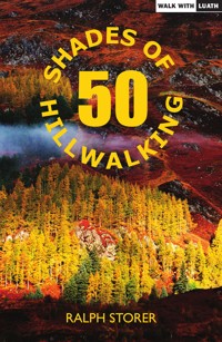
50 SHADES OF HILLWALKING
A fantastic celebration of this addictive pastime.
DON CURRIE, SCOTLAND OUTDOORS
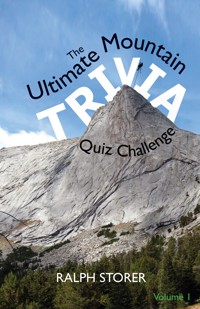
THE ULTIMATE MOUNTAIN TRIVIA QUIZ CHALLENGE
A thoroughly fascinating way to kill time – every bothy should be furnished with one.
ROGER COX, THE SCOTSMAN
Books by Ralph Storer
100 Best Routes on Scottish Mountains (Little Brown)
50 Best Routes on Skye and Raasay (Birlinn)
Exploring Scottish Hill Tracks (Little Brown)
The Ultimate Guide to the Munros series (Luath Press):
Volume 1: Southern Highlands
Volume 2: Central Highlands South (including Glen Coe)
Volume 3: Central Highlands North (including Ben Nevis)
Volume 4: Cairngorms South (including Lochnagar)
Volume 5: Cairngorms North (including Cairn Gorm and Ben Macdui)
Baffies’ Easy Munro Guide series (Luath Press):
Volume 1: Southern Highlands
Volume 2: Central Highlands
Volume 3: The Cairngorms
The Joy of Hillwalking (Luath Press)
50 Shades of Hillwalking (Luath Press)
The Ultimate Mountain Trivia Quiz Challenge (Luath Press)
First published in hardback by David & Charles 1998
Revised paperback edition 2005
Revised edition 2018
e-ISBN: 978-1-912387-50-2
The paper used in this book is recyclable. It is made from low chlorine pulps produced in a low energy, low emission manner from renewable forests.
Printed and bound by Bell & Bain Ltd., Glasgow
Typeset by 3btype.com
© Ralph Storer
To those who follow in our footsteps
A Message from the Publishers
Hillwalking and mountaineering are not risk-free activities and may prove injurious to users of this book. While every care and effort has been taken in its preparation, readers should note that information contained within can change following publication and may not be accurate. Neither the publisher nor the author accept any liability for injury or damage of any kind arising directly or indirectly from the book’s contents.
Acknowledgements
Investigating a route for a hillwalking guidebook involves more than simply climbing a mountain. It may mean exploring more than one approach, checking different ascent routes, pausing repeatedly to take notes, redescending to find a missed path, starting early or chasing a patch of blue sky to obtain the best light for a photograph. It is not the kind of day on the hill that many hillwalkers would be prepared to endure (at least, more than once). I would therefore like all my hillwalking companions to know that, although it may not have seemed like it on occasion, I shall be forever grateful for their patience, understanding and help in the writing of this book.
All maps by Don Sargeant and the author.
All photographs by the author.
Contents
Preface to the Third Edition
Introduction
The Scottish Highlands
Routes
Route Grid
Map of Scotland
Grade
Terrain
Navigation
Seriousness
Route Assessment
Seasons and Weather
Weather forecasts
Sketch Maps
Measurements
Mountain Names
Access
THE SOUTHERN HIGHLANDS
1 Ben Vorlich (Arrochar)
2 Ben Vane
3 Beinn Ime and Beinn Narnain
4 Beinn an Lochain
5 Ben Oss and Beinn Dubhchraig
6 Ben Challum
7 Beinn Achaladair and Beinn a’ Chreachain
8 Creag Mhor
9 Stuchd an Lochain
10 The Glen Lyon Horseshoe
THE CENTRAL HIGHLANDS
11 Beinn a’ Chochuill and Beinn Eunaich
12 Stob Coir’ an Albannaich and Glas Bheinn Mhor
13 Beinn Sgulaird
14 Beinn Fhionnlaidh
15 Sgor na h-Ulaidh
16 Creise and Meall a’ Bhuiridh
17 The Giant’s Staircase of Stob Ban
18 The Treig Traverse
19 Carn Dearg and Sgor Gaibhre
20 The Ardverikie Trio
21 Beinn a’ Chaorainn
THE WESTERN HIGHLANDS
22 Beinn Resipol
23 Sgurr Dhomhnuill
24 Sgurr Ghiubhsachain
25 Gulvain
26 Sgurr na h-Aide
27 Sgurr nan Coireachan
28 Sgurr Mor
29 Meall na Teanga
30 The Druim Chosaidh
31 Ben Aden
32 Gairich
33 Sgurr a’ Mhaoraich
34 The South Glen Shiel Ridge
35 The Conbhairean Group
THE NORTHERN HIGHLANDS
36 The Round of the Hundred Hills
37 Beinn Dearg (Torridon)
38 Beinn an Eoin
39 The West Fannichs
40 The Glensguaib Circuit
41 Cul Mor
42 Arkle
THE CAIRNGORMS
43 Glas Tulaichean
44 Broad Cairn
45 The Glen Feshie Hills
46 The Devil’s Point
47 Beinn Mheadhoin
48 Beinn a’ Bhuird
THE ISLANDS
49 Ullaval and Oreval (Harris)
50 Teilesval and Uisgnaval Mor (Harris)
Preface to the Third Edition
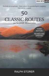
FOLLOWING ON FROM50 Best Routes on Scottish Mountains, 50 More Routes on Scottish Mountains and 50 Best Routes on Skye and Raasay, 50 Classic Routes on Scottish Mountains completes a selection of 200 routes that represents the best of Scottish hillwalking.
The four volumes were originally published as four hardbacks, which are no longer available. In paperback form, 50 Best Routes and 50 More Routes have been combined into 100 Best Routes on Scottish Mountains, published by Warner Books. The second paperback edition of 50 Best Routes on Skye and Raasay is published by Birlinn. This Luath Press publication is the third paperback edition of 50 Classic Routes on Scottish Mountains.
50 Classic contains a selection of outstanding walking and scrambling routes that were prevented by lack of space from inclusion in earlier volumes in the series. These routes again range across the Highlands to provide a cross-section of route types and locations, with tedious and tiresome ascent routes avoided in favour of more rewarding ways up. Hence ‘Best’. As well as descriptions of popular routes up popular mountains you’ll also find here descriptions of interesting ways up less well-known mountains that will be a revelation even to many experienced Scottish hillwalkers.
The temptation to revisit favourite mountains from earlier volumes in order to describe other ascent routes has been resisted. All routes in this volume are brand new, with a greater concentration than before on the more accessible southern half of the country. Further route possibilities remain, of course, but given the number of mountains in Scotland, a worthwhile continuation of the series would require a change to the route criteria. For instance, there are many fine routes on hills that do not meet the 600m/2,000ft height criterion cited in the Introduction, notably in the Hebrides.
This Luath Press third edition follows the 1998 first edition and 2005 second edition and is completely updated. If you think mountain routes wouldn’t change much in such a period of time, think again. Lower down, there are new paths, new vehicle tracks, new car parks with new starting points, new access arrangements (owing, for example, to increased afforestation or changes in land ownership)… Higher up, paths can either become worn, overgrown or dangerous, or be upgraded and made easier by path renovation schemes.
Here are some examples of changes that have occurred in recent years. Inverpolly lost its National Nature Reserve status in 2004 (Route 41). The Land Rover track from Dalmunzie Hotel to Glenlochsie Farm has been paved (Route 43). There’s now a café at Auchtertyre Farm on the recommended route up Ben Challum (Route 6). The road to Achallader Farm now has a new car park and path (Route 7).
A bulldozed Land Rover track has obliterated the fine old path up Glen Ure (Route 13). The path up Beinn Dubhchraig is now so eroded that it could do with being obliterated (Route 5). The original path described for the ascent of Sgor Gaoith is now so overgrown that it has necessitated a new approach route (Route 45). The original route to Beinn a’ Chaorainn is also overgrown and requires a new approach (Route 21).
Among other changes, the Ordnance Survey has opted to Gaelicise some of its place-names. Examples in this book include changing Loch Einich to Loch Eanaich and Loch Quoich to Loch Cuaich (though Glen Quoich remains unaltered). Yet more annoyingly for guidebook writers, even the height of many mountains has changed, owing to improved surveying methods (including by satellite). All these changes have been reflected in this third edition’s text and sketch maps.
Another major development since the first two editions has been a reappraisal of access to Scotland’s countryside, not only in terms of statutory rights but also in terms of the willingness of landowners to countenance the presence of hillwalkers on their land. See Access notes in the Introduction.
It’s also worth noting that more and more car parks at the start of routes are becoming pay-and-display, eg Glen Muick (Route 44) and Linn of Dee (Route 46), so keep a few £1 coins handy.
The at-a-glance difficulty grids I pioneered in 50 Best Routes on Scottish Mountains are now commonplace in guidebooks. In this edition they have been updated to reflect current conditions and they have also been improved slightly. Where a route has two (or more) optional lines of differing difficulty, eg up a crag or around it, the grid now reflects this with more than one box infilled.
Finally, may the routes presented herein continue to bring you as much joy as they do the author.
Introduction
The Scottish Highlands
THE SCOTTISH HIGHLANDS are characterised by a patchwork of mountains separated by deep glens, the result of glacial erosion in the distant past. On a global scale the mountains reach an insignificant height, topping out at 1,344m/4,409ft on Ben Nevis. But in form they hold their own against any range in the world, many rising bold and beautiful from sea-level. For hillwalkers they have distinct advantages over higher mountain ranges: their height is ideal for day walks and glens give easy road access.
Moreover, the variety of mountain forms and landscapes is arguably greater than in any mountainous area of equivalent size. This is due to many factors, notably differing regional geology, the sculpting influence of glaciation and the proximity of the sea.
There are no less than 282 mountains, called ‘Munros’, that are over 3,000ft/914m high. If they were much higher or more remote, mountain walking in Scotland would be an entirely different pursuit, requiring more time, more effort and more skill to climb the highest peaks, as is the case in the European Alps and American Rockies. We’re lucky to have so many accessible mountains.
The 3,000ft peaks are named Munros after Sir Hugh Munro (1856–1919), the third President of the Scottish Mountaineering Club, who first listed them in the 1891 edition of the Scottish Mountaineering Club Journal. In a country with a highpoint of 4,409ft the choice of 3,000ft as a cut-off point is aesthetically justifiable and gives a satisfying number of mountains. Despite metrication of measurement in the 1970s, a metric cut-off point of 1,000m (3,280ft), giving a more humble 137 Mountains, has never captured the hillgoing public’s imagination.
The original list, soon known as Munro’s Tables, was a substantial achievement in an age when mapping of the Highlands was still rudimentary. In the years since, various developments have conspired to prompt amendments to the Tables, including metrication, improved surveying methods (most recently by satellite), and a desire on the part of each succeeding generation of Tables’ editors to reduce what they have regarded as ‘anomalies.’ For example, the ‘mountain range in miniature’ of Beinn Eighe was awarded a second Munro in 1997 to redress the balance with similar but over-endowed multi-topped ridges such as the seven-Munro South Glen Shiel Ridge.
The original list contained 283 Munros. By 1981 that number had been reduced to 276, but in the latest Tables published by the SMC in 1997 there were 284. Even that number had since changed, with satellite re-measurement causing Sgurr nan Ceannaichean (2009) and Beinn a’ Chlaidheimh (2012) to lose their status.
And that’s not all. Part of the problem in devising the Tables is deciding when a summit is a separate mountain rather than the subsidiary top of a nearby higher mountain. Consider, for example, the problem of differentiating between separate mountains, subsidiary tops and other highpoints on the Cairngorm plateaus, where every knoll surpasses 3,000ft. Cue pub discussion on distance and height differentials. Suffice to say that, as well as 282 Munros, there are also currently 226 further highpoints, known as ‘Tops’, that are over 3,000ft high but are not regarded as separate mountains in their own right.
And that’s not all. There are many fine mountains, especially in the north and on the islands, that don’t reach the magic 3,000ft mark. To cater for these, the 1921 edition of the Tables also included J. Rooke Corbett’s list of mountains with heights between 2,500ft/762m and 3,000ft/914m. These are now known as Corbetts and there are currently 222 of them.
And that’s not all either, as there are some fine ‘mountains in miniature’ that don’t even reach the 2,500ft mark, such as Stac Pollaidh in the Northern Highlands. Other mountain classification systems exist to include these, but Munros and Corbetts are the traditional lists and give some idea of the wealth of adventure that awaits the mountain walker in Scotland. 50 Classic Routes includes Munros, Corbetts and others, judging mountain routes by quality rather than height climbed.
Routes
To give some order to the country’s geographical complexity, the Highlands are traditionally divided into six regions for hillwalking purposes: Southern Highlands, Central Highlands, Cairngorms, Western Highlands, Northern Highlands and Islands. These regions feature a great variety of scenery, but you’ll find amazing mountains to climb everywhere.
The volumes in the Best Routes series contain a personal choice of the best walking and scrambling routes in this mountain playground, from short afternoon rambles to day-long expeditions, from roadside summits to remote mountain sanctuaries, from gentle paths to kneebreakingly-steep hillsides, from hands-inpockets-whistle-while-you-walk strolls to thrilling scrambles.
Any book of this nature begs the question ‘What constitutes best?’, for beauty lies in the eye of the beholder. Some walkers may prefer the vast windswept plateaus of the Cairngorms in winter, others the sharp peaks of Skye on a long summer gloaming. For the purposes of this series, the routes chosen are those I have found to be most enjoyable, would most want to repeat and would most recommend to newcomers, given the following criteria:
1 A route must ascend a mountain over 2,000ft/600m. Although many of the finest mountains are Munros, this book does not neglect some superb smaller ones. Of the 50 routes described in this volume, 14 are on mountains under 3,000ft/914m.
2 A route must contain no rock climbing, ie terrain on which a rope would normally be required for security. This does not exclude some scrambles on which walkers of a nervous disposition would never venture – even with a safety net.
3 For ease of access, a route must start from a place that can be reached by motorised transport (including a ferry if necessary on the west coast and islands) and end at the same place.
4 A route must be able to be completed by walkers of reasonable fitness in a single day. No backpacking is required. This does not exclude some routes whose completion may be impracticable in daylight in winter.
Although the 50 classic routes in this guidebook represent a cross-section of the six mountain regions of the Highlands, most are intentionally located in the Southern and Central Highlands and the Cairngorms, which are more accessible from the south of the country.
Within each region routes are listed in approximately south-tonorth, west-to-east order.
As with Munro’s Tables and Corbett’s List, the list of recommended routes has already provoked many hours of heated debate among colleagues, and may it continue to do so among readers. Yet amongst those who know and love the Highlands the amount of agreement is surprising. May the following pages help you explore and enjoy the Scottish mountains and, when you’re not on the hill, while away many an hour in planning, anticipation and reflection.
Route Grid
The overall difficulty of each route is shown in the form of an at-aglance route grid. Many accidents in the Scottish hills are caused by walkers attempting routes outside their capabilities and the grid is intended to enable a more realistic route appraisal.
Each route’s grid indicates its overall difficulty, where difficulty consists not only of grade (ie technical difficulty) but also type of terrain (irrespective of grade), difficulty of navigation with a compass in adverse weather and seriousness (ie difficulty of escape in case of curtailment of route for one reason or another, based on criteria of length and restricted line of escape).
These factors vary over the duration of the route and should not be taken as absolute, but they provide a useful general guide and enable comparisons to be made between routes. Each category is graded 1 (easiest) to 5 (hardest). New to this third edition, the presence of more than one infilled Grade box indicates optional lines of differing difficulty, eg up a crag or around it.
Grade
1 Mostly good going
Mainly on good paths or good terrain. There may be occasional steep or rough sections, but not for long.
2 Appreciable awkward going
Notably rough or steep terrain, perhaps prolonged, but not involving handwork on rock.
3 Minor handwork required
Use of hands required on rock, e.g. for balance or a step-up, but not difficult or prolonged enough to constitute scrambling.
4 Easy scramble
Includes one or more sections that require movement on rock with good holds.
5 Hard scramble
One grade below a rock climb for which a rope would normally be required. Compared to G4, holds are often smaller and exposure is often greater.
Note: Some guidebooks misleadingly include roped rock climbs as ‘scrambles’. This guidebook does not.
Terrain
1 Excellent, often on paths
2 Good
3 Reasonable
4 Rough
5 Tough
Navigation
1 Straightforward
2 Reasonably straightforward
3 Appreciable accuracy required
4 Hard
5 Extremely hard
Seriousness
1 Straightforward escape
2 Reasonably straightforward escape
3 Appreciable seriousness
4 Serious
5 Very serious
Route Assessment
A brief Assessment is provided for each route to give an indication of what to expect during summer conditions. Under snow, Scottish mountains become much more serious propositions.
Seasons and Weather
From a hillwalking perspective, the Highland year has two seasons: the snow season and the no-snow season. The length of these seasons varies from year to year and from place to place.
From May to September, snow is rarely a problem. Historically, May and June have the greatest number of sunny days, with the air at its clearest. July and August are the hottest months but are also more prone to rain and haze, not to mention that blight on the landscape, the Highland midge. The biting season begins in mid to late June and lasts until the first chills of late September. By October it is colder, the hills get their first dusting of winter snow and good days are few and far between.
The months from November to April, though sometimes earlier and later, are characterised by short days, cold and snow. March and April are transition months, with little or lots of snow. In some years, snow can last into early summer and be a nuisance on some routes. If you are unequipped for it, turn back. Snow is more treacherous to descend than ascend, and spring snow often has a crystalline quality that makes it behave like ball-bearings.
In a normal winter (whatever that is, these days), conditions vary from British to Alpine to Arctic. An easy summer route can be made life-threatening by icy conditions and severe winter weather. Paths are obliterated, grassy hillsides become treacherous slopes, ridges become corniced, stone shoots become snow gullies, walking becomes more difficult and tiring, terrain becomes featureless in adverse weather, and white-outs and spindrift reduce visibility to zero.


