10,99 €
Mehr erfahren.
- Herausgeber: Books on Demand
- Kategorie: Lebensstil
- Sprache: Englisch
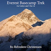
This book on the very popular Everest Trek via Gokyo and the Cho La pas is an image based narrative by mountain climber and guide Bo Belvedere Christensen. It's is based on a trek that he led during an autumn trip and the experiences that met him and his group during this beautiful trek through one of The Worlds most amazing mountain regions. The descriptions are based on the authors extensive experience with the area since arriving here first time in 1988 to climb Ama Dablam, and since spending several years in total in the Everest region.
Das E-Book können Sie in Legimi-Apps oder einer beliebigen App lesen, die das folgende Format unterstützen:
Seitenzahl: 25
Veröffentlichungsjahr: 2020
Ähnliche

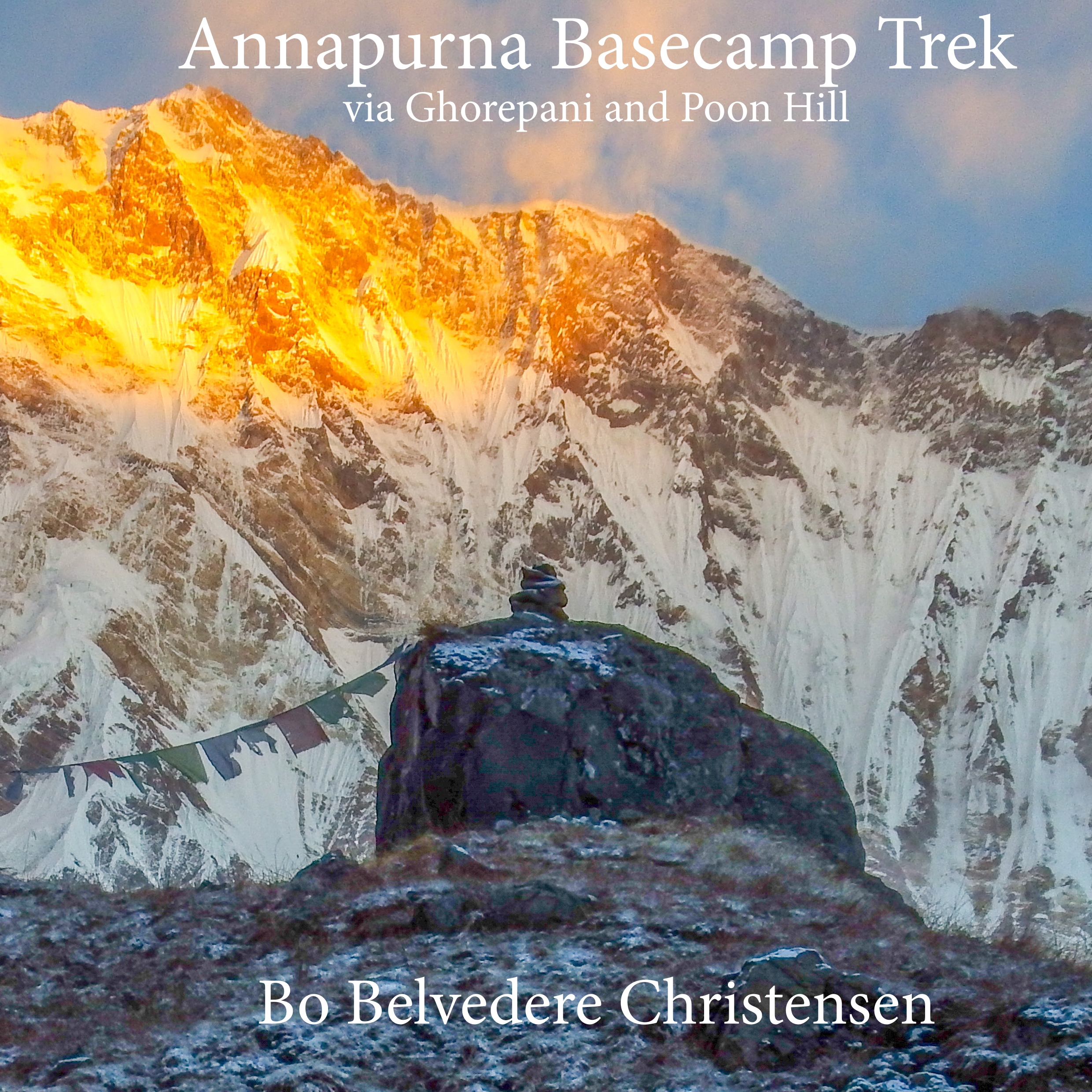


Table of Contents
Route diagram
Lukla airport
Monjo, a village on the way to Namche Bazar
Prayer stones at Monjo
Crossing the bridge to the ”Namche Hill”
First sight of Mt. Everest
Namche Bazar
Towards Thame
Thame Gompa
Khumjung stupa
Ama Dablam
The Gokyo Valley
The Gokyo Valley
Going up Gokyo Ri
Gokyo Ri
Cairn at Gokyo Ri
Gokyo Valley details
Towards Cho La
Cho La glacier
Resting on Cho La glacier
Towards Khumbu Valley
Ama Dablam
Sherpani at Dzongla
Khumbu Valley views
Going up Kala Patar
Kala Patar
Everest Basecamp
Changtse - Everest North
Memorial site
Old sherpani
Thyangboche
Kathmandu
Kathmandu market
Kathmandu people
The day of the dog
Boudnath stupa
Swayambhunath
Pashupatinath
Places visited and slept
Camera equipment
Route diagram
This is the images and stories from a trekking trep to Everest Basecamp.
The route we used took us to from the airstrip at Lukla to Namche Bazar. From here up to Thame for acclimatization and afterwards up through the Gokyo valley, during this climbing to several small high points for further acclimatization.
This made us ready for the long day passing the Cho La and descending down into the Khumbu valley and in the end to Everest Basecamp.
After basecamp the route followed the traditional route to Everest BC passing Pheriche and Tengboche before returning to Namche Bazar further on to Lukla before finally flying back to Kathmandu.
The route is detailed in the map on the next page though other side treks that we didn’t do are also marked.
In the back of the book you will find a day by day listing of the places visited and where we slept together with an altitude diagram.
Lukla airport
Coming to Kathmandu there is a lot to see but as we had some days at the end of the trip in the Capital of Nepal, we skipped most of the sightseeing to the end of our trip.
Therefore, we flew to the small airstrip at Lukla as soon as possible, which wasn’t at all sure to be. Heavy cloud cover in the mountains almost prevented us coming to Lukla on the first possible day. But a short improvement in the weather conditions allowed us to reach into the mountains.
From here I usually take a relatively short trekking day to one of the small villages of Mungo or Phakding. Landing in Lukla early in the afternoon doesn’t allow for a longer trip. And another preventing factor is, that you already have to think about your acclimatization. Going to far the first day could mean higher risc of running into altitude problems later.


