10,99 €
Mehr erfahren.
- Herausgeber: Books on Demand
- Kategorie: Lebensstil
- Sprache: Englisch
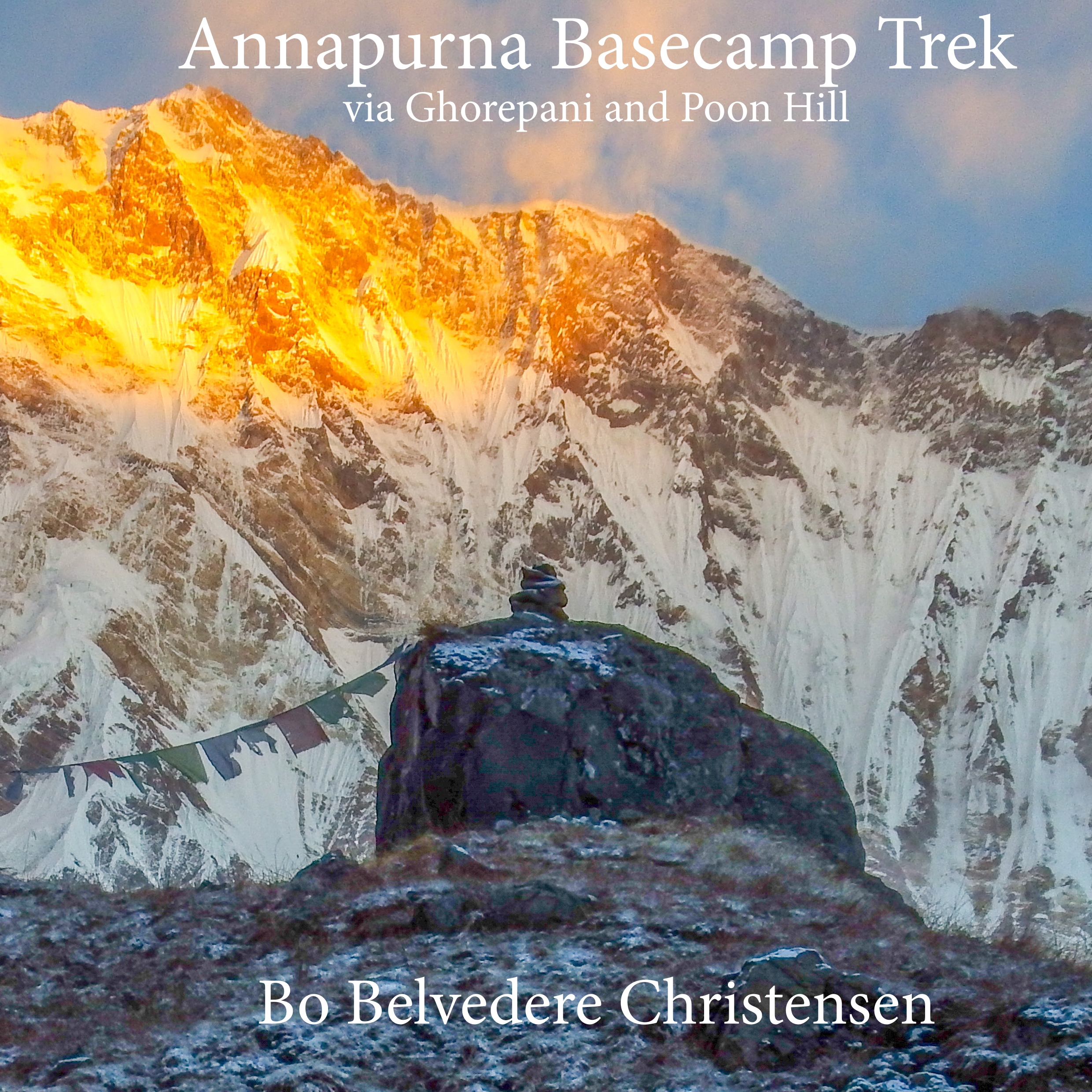
This book on the very popular Annapurna Basecamp trek via the famous viewpoint Poon Hill is an image based narrative by mountain climber and guide Bo Belvedere Christensen. It's based on several treks done in both spring and autumn and documents the experiences that met him and his groups during this beautiful trek through one of the most amazing mountain regions of The World. The descriptions are based on the authors extensive experience with the area since visiting here the first time in 1991 on route to climb Dhaulagiri, and since doing several treks and expeditions in the Annapurna region.
Das E-Book können Sie in Legimi-Apps oder einer beliebigen App lesen, die das folgende Format unterstützen:
Seitenzahl: 25
Veröffentlichungsjahr: 2020
Ähnliche


Contents
Route diagram
Nayapul
Local porters
Tikhedunga
Towards Ghorepani
Early up Poon Hill
Poon Hill / Pun Danda
View of Machapuchare
Views from the forest
Towards Tadapani
Working the fields
The Annapurna gorge
Wildlife
Modi Khola
Temperamental weather
Towards Annapurna BC
Annapurna basecamp
Annapurna South Face
Impressive mountains
The Annapurna glacier
Small things
Starting down
Conditions on the BC
Into the forest again
Steep stairs and terrace fields
Jinhu Danda
Jinhu Danda
Old and young at work
Villager and village
Pokhara
Phewa lake and temple
Last view of Dhaulagiri
Boudnath stupa
Religious traditions
Pashupatinath
Places to stay and sleep
Camera equipment
Copyright
Route diagram
This is the images and stories from the trekking trip to Annapurna Basecamp on the south side of the mountain.
The route described will take you from the the city of Pokhara via Nyapul to Ghorepani. From here you visit the awesome viewing point on Poon Hill and afterwards trek via Tadapani to Chomrong before starting the actual ascent towards Machapuchare and Annapurna Basecamps.
The route follows well developed trekking trails with lots of stairs going both up and down.
After basecamp the route descents following the same trail until Chomrong from where it takes a direct line towards Phedi.
The route is detailed in the map on the next page with altitudes that not quite correspond to the altitudes I have recorded with GPS during several occasions on this trek.
Travel possibilities to the starting point are either by road or flying to Pokhara and from there by road to Nyapul. On the return after you reach Phedi, you go by road back to Pokhara.
In the back of the book you will find a day by day listing of the places where I have slept on my visits, an outline of the daily distance together with an altitude diagram.
The image below shows the author and Machapuchare in the background.
Nayapul
It is a long trip driving from Kathmandu, but you can actually go by a fast car from the capital of Nepal early in the morning and arrive at Nayapul before noon to start your trek.
If you want a more relaxed and cultural start to your trip spend, a day driving by a local bus from Kathmandu to Pokhara. Next day it’s only a short trip to the start of the trek.
Nayapul is not a place to linger for long. As many small towns along the road it’s not a very pleasant site due to amounts of rubbish strewn all over the place.
But that is soon over as you wander into the wonderful landscape towards Ulleri and Tikhedunga.
At the beginning it’s very much a farmed landscape, but the surroundings change as you get further.
Camera: Fujifilm Finepix S1
Lens: Built in at 12.6mm
Settings: 1/160 sek, aperture 3.9, ISO 100


