80,99 €
Mehr erfahren.
- Herausgeber: John Wiley & Sons
- Kategorie: Wissenschaft und neue Technologien
- Sprache: Englisch
An integrated approach that combines essential GIS background with a practical workbook on applying the principles in ArcGIS 10.0 and 10.1
Introducing Geographic Information Systems with ArcGISintegrates a broad introduction to GIS with a software-specific workbook for Esri's ArcGIS. Where most courses make do using two separate texts, one covering GIS and another the software, this book enables students and instructors to use a single text with an integrated approach covering both in one volume with a common vocabulary and instructional style.
This revised edition focuses on the latest software updates—ArcGIS 10.0 and 10.1. In addition to its already successful coverage, the book allows students to experience publishing maps on the Internet through new exercises, and introduces the idea of programming in the language Esri has chosen for applications (i.e., Python). A DVD is packaged with the book, as in prior editions, containing data for working out all of the exercises.
This complete, user-friendly coursebook:
- Is updated for the latest ArcGIS releases—ArcGIS 10.0 and 10.1
- Introduces the central concepts of GIS and topics needed to understand spatial information analysis
- Provides a considerable ability to operate important tools in ArcGIS
- Demonstrates new capabilities of ArcGIS 10.0 and 10.1
- Provides a basis for the advanced study of GIS and the study of the newly emerging field of GIScience
Introducing Geographic Information Systems with ArcGIS, Third Edition is the ideal guide for undergraduate students taking courses such as Introduction to GIS, Fundamentals of GIS, and Introduction to ArcGIS Desktop. It is also an important guide for professionals looking to update their skills for ArcGIS 10.0 and 10.1.
Sie lesen das E-Book in den Legimi-Apps auf:
Seitenzahl: 1191
Veröffentlichungsjahr: 2013
Ähnliche


Contents
Foreword
Preface
Preface to First Edition
Introduction
Part I: Basic Concepts of GIS
Chapter 1: Some Concepts That Underpin GIS
You Ask: “What Is GIS About?”
And So You Ask Again: “What Is GIS About?”
More of What GIS Is About
Next Steps: Seemingly Independent Things You Need to Know
Determining Where Something Is: Coordinate Systems
Determining Where Something Is: Latitude and Longitude
Geodesy, Coordinate Systems, Geographic Projections, and Scale
Projected Coordinate Systems
Geographic vs. Projected Coordinates: A Comparison
Two Projected Coordinate Systems: UTM and State Plane
Physical Dimensionality
Global Positioning Systems
Remote Sensing
Relational Databases
Searching (and Indexing) in General
Another Definition of GIS
Computer Software: In General
Step-by-Step
Understanding the File Structure for the Exercises
Anatomy of the ArcCatalog Window
Setting Some Options
The Catalog Tree
Connecting to a Folder
The Toolbars and the Status Bar
An Optional Step
Exploring Basic GIS Data Storage Models
Copying Data over to Your Personal Folder
Examining the Table
Deriving Information from the Table
Sorting the Records
Finding Values in a Table
Identifying Geographic Features and Coordinates
Looking at GeoGraphics
A First Look at Metadata
Using ArcCatalog to Place Data in ArcMap
Using the Area on the Disk for Your Own Work
Copying Data over to Your Personal IGIS Folder
Searching for GIS Data
Exploring Soils
But Something Is Missing
Is the Newly Found Data Applicable?
Making a Personal Geodatabase Feature Class from a Coverage
Looking at the Landcover Personal Geodatabase Feature Class
Further Examining the Wildcat Boat Facility Area Data Sets
Seeing the Results of the Join
A Button for Instant Help: What’s This? (for ArcGIS Desktop version 10.0 only)
Getting Instant Help for a Tool or Command (for ArcGIS Desktop version 10.1)
The Help System and Documentation
ArcGIS Help across the Internet
What’s Next?
Chapter 2: Characteristics and Examples of Spatial Data
The Original Form of Spatial Data: Maps
Moving Spatial Data from Maps to Computers: Forces for Change
Spatial Data
Limiting the Scope
Spatial Data for Decision Making
Sets of Spatial Data: The Database
Spatial Databases: Inherent Difficulties
Information Systems
Uses for a Geographic Information System
Step-by-Step
The Basic Difference between ArcCatalog and ArcMap
Exploring Data from the NAVSTAR Global Positioning System (GPS)
Preliminaries
Seeing the GPS File in ArcMap
Looking at the GPS Track in the Context of a Variety of GIS Data
A Potpourri of Types of Geographic Data
Displaying Layers from Vector-Based Datasets
Housekeeping: Saving and Restoring a Map
Selecting: Both Map Data and Attribute Data
Using the Measure Tool and the Identify Tool
County Boundaries and Polygons
TIGER/Line Files
The Table of Contents: Display vs. Source vs. Selection
Digital Raster Graphics and Cell-Based Files
A Look (Optional) at How DRG Color Values Are Put Together
Experimenting with Different Ways of Seeing Data
Digital Orthophotos
More TIGER/Line Files
Another Tie between Attributes and Geographics
More Housekeeping: Shutting Down and Restarting ArcMap
Digital Elevation Model Files
Comparing the DEM and the DRG
Contour Line Files
TINs are Three-Dimensional Datasets
Elevation Based on Massive Sets of Data: The Esri Terrain
The Summarizing Procedure
Some Geological Data
Rasters of Land Cover Data
You Are Not Alone (Assuming you have an Internet connection)
Next Steps on Your Own
The Next Chapter
Chapter 3: Products of a GIS: Maps and Other Information
GIS and Cartography—Compatibility?
Products of a Geographic Information System
Overall Requirements for Utility
Classification of GIS Products
Documenting Products
Thoughts on Different Types of Products
Don’t Ignore Character-Based Information
Don’t Hesitate to Sort Information
Consider Hard Copy
Consider Balance in Product Content
Elements of Product Design
Units, Projection, and Scale
Thoughts on Resolution and Scale
Making Sure There Is a Base Map
Measure of Quality Assurance
The Decision Maker–Product Interface
In Summary
Step-by-Step
The Data View and the Layout View
Controlling Your View of the Map: Zooming
Understanding the Panning and Other Controls
Adding Other Map Elements
Adding Data to Data Frames
A Summary of the Graphic Indicators
Tinkering with the Map—Scale Bars
Legends
Layer Files
Layer Packages
Styles
Adding and Using a Style
Reports
Charts and Graphs
Graphics
Making Graphics out of Geographic Features
Chapter 4: Structures for Storing Geographic Data
Why Is Spatial Data Analysis So Hard?
How the Computer Aids Analyzing Spatial Data
Complexity of Spatial Data
Structures for Spatial Data
Storage Paradigms for Areal Data
Fundamental Bases of Geographic Data Mode
The Raster Data Model
Vector Data Model
A Multiplicity of “Storadigms”
Vector-Based Geographic Datasets—Logical Construction
Zero-Dimensional Entities in a Two-Dimensional Field: Points
One-Dimensional Entities in a Two-Dimensional Field: Lines
Two-Dimensional Entities in a Two-Dimensional Field: Polygons
Three-Dimensional Entities in a Three-Dimensional Field: Triangles and Multipatches
Specific Esri Spatial Vector Data Storage Mechanisms
The Geodatabase Data Structure
Geodatabase Software
Polygons within Polygons—Perimeter and Area Calculations
Geodatabases—Layout in the Computer
Geodatabases—Logical Construction
Geodatabases—Feature Shape
Nested Polygons in Geodatabases
Geodatabases and Attributes
Objects—First Acquaintance
The Shapefile Data Structure
Shapefiles—Layout in the Computer
Summarizing Vector Dataset Features
Summary of Logical Structures of Vector-Based GIS Datasets
Raster-Based Geographic Data Sets—Logical Construction
Raster-Based Geographic Data Sets—Layout in the Computer
TINs
TIN-Based Geographic Data Sets—Layout in the Computer
Spatial Reference
Step-by-Step
More Help
Specification of your Input Text File for the “Create Features from Text File” Tool
Labeling Features
Making Polygons from Lines
Areas and Perimeters Examined
Labeling Features with Selected Attributes
Computers and Inexact Computation
Creating a New Topology
Specifying Which Feature Moves When Features Are Adjusted: Rank
Topology Rules
Validating Topology
A Warning: Changes Made through Topology Are Permanent
Chapter 5: Geographic and Attribute Data: Selection, Input, and Editing
Concerns about Finding and Collecting Data
Looking for Data on the Internet
Steps in Developing the Database
GPS and GIS
Anatomy of the Acronym: GPS
What Time Is It?
Step-by-Step
Looking at Reference Systems
Looking at Coordinate Systems
Using the Reference System to Discover the Boundary Coordinates of a State Plane Zone
Primary Lesson
A Plan for Digitizing and Transforming
Getting Started
Loading an Image File as a Layer in ArcMap
Loading the New, Blank Shapefile into ArcMap
Adding Line Features to a Shapefile by Using the Editing Facility in ArcMap
Converting a Shapefile to a Geodatabse Feature Class and Giving It Real-World Coordinates
Converting the Shapefile to a Geodatabase Feature Class
Moving the Foozit Court Feature Class into the Real World
Preliminaries
Making the Feature Class That Will Be the Object of the Digitization
Georeferencing
Moving the Sketch to UTM Zone
Digitizing the Line Boundaries of the Islands
Making Polygons of the Digitized Lines
Making Multipart Polygons
Five islands divided by county and agency
Merging Multipart Polygons
Making Copies of the Feature Class
Using “Clip” to Remove Overlaps from the Feature Class
Using Topology to Remove Overlaps from the Feature Class
The Concept of the Edit Sketch
Making Sketches with Snapping
Experimenting with Editing Polygons
Experimenting with Editor’s Union
Experimenting with the Editor’s Intersect
Experimenting with the Editor’s Buffer Capabilities
Using Undo, Redo, Copy, and Cut
Working with Line Editing Again
Creating a 3-D Feature
Organization
Environment and Measurement (Spatial Data)
Measurements (Non-spatial Data)
Recording Data
Team Assignments
Undertaking the Data Entry Process
Making a Table That Contains the Coordinate Data
Making a Table That Contains the Student Data
Populating the Student_Info Table with Data
Joining the Two Tables to Make a Single Table
Seeing the Results of the Join
Part II: Spatial Analysis and Synthesis with Gis
Chapter 6: Analysis of GIS Data by Simple Examination
Information
Computer Hardware—What a Computer Does
Continuous and Discrete Phenomena
Some Implications of Discrete Representation for GIS
Scientific Notation, Numerical Significance, Accuracy, and Precision
Precision vs. Accuracy
Basic Statistics
Putting Values into Classes
Measurement Scales
Step-by-Step
Examining the Toolbars
Pointing at Records
Two Windows Are Available for Selecting
Selecting Records (and, Thereby, Features)
Looking at the Other Capabilities of the Options Menu
Selecting Features (and, Thereby, Records)
Quick Selection of Features
Selecting by Location
Reviewing and Understanding Actions on the Table of Contents
Layers and the Data Frames
Changing Layer Properties
Thinking about Maps Again
Classification (or Categorization) and Symbolization
User Selection of Classes
A More Careful Look at Equal Intervals
Defined Interval
Quantiles
Standard Deviation
Natural Breaks
Normalization
Using Charts and Graphs
Making a Layout
Obtaining Data from the U.S. Bureau of the Census
Converting the Census Data Spreadsheet to dBASEIV Format
Using TIGER-Based Street and Block Shapefiles from Esri
Assessing What We Have and What We Need to Solve the Problem
Converting the Relevant Files to Cartesian Coordinates
Finally
Chapter 7: Creating Spatial Feature Classes Based on Proximity, Overlay, and Attributes
Generating Features Based on Proximity: Buffering
Generating Features by Overlaying
Overlaying with Line and Point Feature Classes
Spatial Joins in General
Deriving Feature Classes by Selecting Attributes: Extraction
Step-by-Step
Using ArcToolbox to Make Buffer Zones around the Roads
Variable-Width Buffers
Make a New Feature Class from a Subset of Polygons: Extract
More Complex Queries—And’s and Or’s
Other Polygon Spatial Joins: Intersect and Identity
The Getrich Saga
Deriving Information by Combining Tables
Overlaying the Feature Classes
Create a Python Script from the Gold Model
Modify the Python Script from the Gold Model
Execute the Python Script
Understanding Dissolve
Making New Sites that Including the COST_HA Field
Considering the Site Eccentricity Criterion
Making a Model of the Wildcat Boat Solution
Chapter 8: Spatial Analysis Based on Raster Data Processing
A Really Different Processing Paradigm
Facts about Rasters
Coordinate Space
Rasters with Integer Cell Values
Rasters with Floating-Point Values
What Is Raster Storage and Processing Good For?
Rasters and Features
Rasters: Input, Computation, and Output
Where Raster Processing Shines: Cost Incurred Traveling over a Distance
Proximity Calculation with Rasters
Human Activity, Cost, and Distance
Euclidean Distances on the Raster
Euclidean Distance and the Spatial Analyst
Proving Pythagoras Right
Finding the Closest of Multiple Source Cells
Excluding Distances beyond a Certain Threshold
Other Factors That Influence Cost
The Cost Distance Mechanism
The Cost Distance Calculation
Path Calculation in Euclidean Distance and Cost Distance
Understanding How Total Costs Are Calculated
Getting More Information: Paths and Allocations
Direction and Allocation Rasters for Euclidean Distance
Direction and Allocation Rasters for Cost Distance
A Major Application of Raster Processing: Hydrology
Basic Surface Hydrology
Basic Surface Hydrology Concepts
Calculating Flow Direction
The Ultimate Destination of Water Is Off the Raster Area
Flow Accumulation: Drainage Delineation and Rainfall Volume
Nonuniform Rainfall
Calculating the Length of a Potential Linear Water Body
Assigning Identities to Streams
Vector vs. Raster Representation
Assigning Orders to Stream Links
Watersheds and Pour Points
Step-by-Step
The Raster Calculator—Integer Rasters
Arithmetic Calculation
Boolean Operations
Floating-Point Rasters
Setting the General and Raster Environment
Converting Features to Rasters
Creating Rasters with Linear Features
Buffering with Spatial Analyst (Maybe)
Buffering—Plan B
Reclassifying the Data
Adding the Rasters with the Raster Calculator
Converting Zones to Regions to Find Individual Sites
Points and Density
Thiessen, Dirichlet, Voronoi (and, of course, Decartes)
Making a Raster Showing Straight-Line Distances to a Single Place
Examining Many Source Cells and the Capping Distance
Developing a Raster with Cost Distance
Creating Direction and Allocation Rasters
Using Cost Distance to Make Direction and Allocation Rasters
Calculating a Least-Cost Path from “A” to “B”
Setting Things Up
Preparing to Create a Cost Surface
Building a Cost Surface
Improving the Understandability of the Map
Examining the Surface with Various Spatial Analyst and 3D Tools
Determining the Stream Channels
Calculating Stream Order
Numbering Each Stream Individually
Identifying Basins
Finding Pollution Culprits
Chapter 9: Other Dimensions, Other Tools, Other Solutions
Two Different Third Dimensions: The Temporal and the Vertical Spatial
The Third Spatial Dimension
3-D: 2-D (Spatial) Plus 1-D (Spatial)
ArcScene
ArcGlobe
The Third Spatial Dimension
An (Almost) New Software Package: ArcScene
ArcScene
What’s 3-D and What’s Not
Viewing 3-D Data with Animation
Making a TIN and Other 3-D Representations of Elevation
Creating DEM files with Kriging
Creating a Map of Contour Lines
Two-and-a-Half Dimensions (2.5-D): Calculating Volumes
Calculating a Volume with ArcGIS
Other Neat Stuff You Can Do with 3D Analyst: Viewshed and Hillshade
A Closer Look at ArcGlobe and Adding Data to It
Making a Terrain
The Time Dimension: OVERVIEW
3-D: 2-D (Spatial) Plus 1-D (Temporal)
The Time Dimension: STEP-BY-STEP
Sliding through Time—Seeing Changes in Features at Intervals
Address Geocoding: OVERVIEW
A Second Fundamental Way of Defining Location
TIGER/Line Files
Precision of the Geographic Coordinates in TIGER Files
Address Locators
Address Geocoding: STEP-BY-STEP
Finding the Geographic Position of an Address “Manually”
Making an Address Locator
Finding the Geographic Position of an Address “Automatically”
TIGER Files and ZIP Codes
More to Know—More Information Available
Analysis of Networks: Overview
Analysis of Networks: Step-by-step
Finding the Shortest Route to a Facility
Allocating Territories to Facilities
Linear Referencing: Overview
Linear Referencing: STEP-BY-STEP
Intersecting Route Events
What’s Not Covered Here
Afterword: From Systems to Science by Michael Goodchild
Index
Notes
Download CD/DVD Content
About the Cover
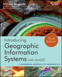
The cover shows six images of the same geographic area, demonstrating various GIS data formats, depicting both natural and human-made features. The scene is a river flowing through a canyon. North of the river is a water filtration plant. The top scene is a TIN (Triangulated Irregular Network) indicating the elevation of the surface. Across the bottom of the cover, left to right, the first two images are portions of (a) a DRG (Digital Raster Graphics) file digitized from a US Geological Survey 7.5 minute quadrangle and (b) a DEM (Digital Elevation Model). The last two images, left to right are (d) a raster-based (cell-based, grid-based) depiction of different types of land cover and (e) a DOQ (Digital Ortho Quadrangle), which is an aerial photograph that has been rectified so it can be used as a map. In the center at the bottom is (c) a three-dimensional view in which ArcGIS software was used to “drape” a DOQ over an elevation model. The red dots along the river depict points collected by a GPS (Global Positioning System) receiver on a boat moving along the river.
Cover image: Courtesy of Michael Kennedy
Cover design: John Wiley & Sons, Inc.
This book is printed on acid-free paper.
Copyright © 2013 by John Wiley & Sons, Inc. All rights reserved
Published by John Wiley & Sons, Inc., Hoboken, New Jersey
Published simultaneously in Canada
No part of this publication may be reproduced, stored in a retrieval system, or transmitted in any form or by any means, electronic, mechanical, photocopying, recording, scanning, or otherwise, except as permitted under Section 107 or 108 of the 1976 United States Copyright Act, without either the prior written permission of the Publisher, or authorization through payment of the appropriate per-copy fee to the Copyright Clearance Center, 222 Rosewood Drive, Danvers, MA 01923, (978) 750-8400, fax (978) 646-8600, or on the web at www.copyright.com. Requests to the Publisher for permission should be addressed to the Permissions Department, John Wiley & Sons, Inc., 111 River Street, Hoboken, NJ 07030, (201) 748-6011, fax (201) 748-6008, or online at www.wiley.com/go/permissions.
Limit of Liability/Disclaimer of Warranty: While the publisher and author have used their best efforts in preparing this book, they make no representations or warranties with the respect to the accuracy or completeness of the contents of this book and specifically disclaim any implied warranties of merchantability or fitness for a particular purpose. No warranty may be created or extended by sales representatives or written sales materials. The advice and strategies contained herein may not be suitable for your situation. You should consult with a professional where appropriate. Neither the publisher nor the author shall be liable for damages arising herefrom.
For general information about our other products and services, please contact our Customer Care Department within the United States at (800) 762-2974, outside the United States at (317) 572-3993 or fax (317) 572-4002.
Wiley publishes in a variety of print and electronic formats and by print-on-demand. Some material included with standard print versions of this book may not be included in e-books or in print-on-demand. If this book refers to media such as a CD or DVD that is not included in the version you purchased, you may download this material at http://booksupport.wiley.com. For more information about Wiley products, visit www.wiley.com.
ISBN 978-1-118-15980-4; ISBN 978-1-118-33034-0 (ebk); ISBN 978-1-118-33103-3 (ebk);
ISBN 978-1-118-33318-1 (ebk); ISBN 978-1-118-51050-6 (ebk); ISBN 978-1-118-51056-8 (ebk)
To the memory of Evan Kennedy, who had every gift but that of years
Foreword
by Jack Dangermond
Introducing Geographic Information Systems with ArcGIS offers a unique approach to GIS instruction. In it, Michael Kennedy re-creates his time-tested methods of teaching GIS in the classroom in a step-by-step guidebook to GIS. Students on a journey to learn GIS with Professor Kennedy may feel like he is taking the journey with them, offering them his sage advice each step of the way. Professor Kennedy cares deeply for his students, and the detail of this care and years of teaching GIS come through in this book. In it, he walks students through the multitude of questions that come up daily in the classroom. His goal is to help students understand GIS concepts and learn GIS skills. It takes a master teacher to map GIS knowledge, making it clear to students and enabling them to gain confidence in their growing skills.
Once GIS students have learned the basics, the next step is to learn how to analyze spatial data and identify problems and create solutions. Learning to analyze spatial data moves students beyond exploration, beyond locating places on maps, and helps them create maps that guide better decisions.
All of us learn GIS skills in different ways. Some people are visual learners, some are auditory learners, and some need a hands-on approach. As the learning styles of students in general vary, so do the learning needs of students of GIS. Some students will need classroom study, with conversations and time to process information about GIS concepts, spatial data, geodatabases, map projections, attribute tables, feature classes, datasets, and building maps, while others need only a guidebook with clear graphic illustrations. So, a variety of approaches to teaching GIS will help ensure that the increasing number of students worldwide have opportunities to gain GIS skills in ways that best suit their needs.
GIS is becoming part and parcel of the daily work lives of most people in many fields, from architects to zoologists, from academia to the business world, from city planning to national and international spatial data portals. Teachers are now taking on the essential task of opening the door for students to learn GIS. In Introducing Geographic Information Systems with ArcGIS, Professor Kennedy opens such a doorway for students to learn the skills basic to understanding GIS and to prepare students to make our communities better places.
Preface1
It turns out to be hard, for me anyway, to write the preface for a third edition. As I tried to compose this I put a lot of electrons in the recycle bin. Most of what I have to say was said in the prefaces to previous editions. And who wants to want to wade through eleven pages of those in addition to this one!
So what I will do is just to tell you about the new material in the text and then just abstract and reference earlier information and ideas. I’m eliminating the Preface to the Second Edition. If you haven’t used the book before, you probably should read the Preface to the First edition, included after this one.
First, of course, is that the material is oriented to ArcGIS Desktop versions 10.0 and 10.1. Where there are differences between these two, and there are several, I have usually pointed them out. However, those using 10.0 will occasionally have to adapt the Step-by-Step instructions, which favor version 10.1. I recommend using 10.1 if it is available and you are familiar with it. (To indicate the extent of the changes, we can start with the fact that the functionality level names have changed from those in version 10.0 and before. In 10.1 ArcView is Basic, ArcEditor is Standard, and ArcInfo is Advanced.)
The CD-ROM used in earlier editions has been replaced by a DVD, because the data sets are more extensive and all the figures in the book are available.
Since the first edition, sections and exercises have been added on the topics of:
Publishing maps on the Internet, using
ArcGIS.com
.
Using the Esri online data service to add basemaps to the student’s map.
The terrain data structure, made possible by the emergence of LIDAR as a remarkable method of very dense data collection, is covered both in theory and by exercise.
Layer packages – a welcome invention which facilitates the transfer of feature classes of all formats from one computer to another, without worries like relative path names and separate data transfers.
Since this book is primarily aimed at preparing professionals for using GIS to do analysis and synthesis (topics separate from display and mapmaking, which, for completeness, is covered in considerable detail in Chapter 3), topology plays an important role. A number of exercises, therefore, emphasize the use of the topology capabilities of geodatabases, which is considerably different from those of coverages and completely absent from the shapefile format.
Changes from the Previous Editions
Use of and information about coverages has been demoted to an optional exercise on converting an Esri coverage to a geodatabase.
2
All references to ArcInfo Workstation have been removed, since its functions have been taken over by ArcToolbox, and Workstation has been “depreciated” (although many of us “appreciated” it a lot in times past!).
A couple of the more arduous exercises (making feature classes by key entry and digitizing) have been improved so that the student or reader understands the concepts without having to experience the all-too-real tedium of data entry. Other exercises have input data provided for them on the DVD to cut down on digitizing and typing.
More flexibility has been built into the text. I suggest exercises that might be omitted in the interest of compressing the learning of essential GIS material into a shorter time span.
3
All the figures in the book are reproduced, many in color, on the DVD that accompanies the text. At the beginning of each Step-by-Step section, I encourage students to open both the Color Figures file and their Fast Facts File (both to access reference information and to add new material). The Fast Facts File, into which the students write the information they consider relevant, thus making their own reference guides to ArcGIS Desktop, is emphasized. The past several years have convinced me that the Fast Facts File is an important tool for long-term learning of the material – as the software grows in facility and complexity.
In previous editions, students were asked to write, in their textbook, the names of some menus and tabs. The third edition has no blanks for this. Instead students are encouraged to record the name of tabs and menu items in their Fast Facts Files – and to think about what each item might mean. Since there is no way to cover all of ArcGIS (except perhaps in an intensive, year-long, full time course), having a list that at least hints at the capabilities of the software that are not covered in the text (represented by these tabs and menus) is beneficial. Further, the lists in the student’s Fast Facts File can be updated as ArcGIS evolves in the years to come.
The purpose and structure of the book remains essentially the same. (Please see the Preface to the First edition). Chapters are divided into (a) Overviews (a top-down look at GIS theory and other relevant information) and (b) Step-by-Step (sequential) exercises. All the data needed for the exercises is provided on the included DVD. (The DVD does not include ArcGIS software. I assume that the several mechanisms that Esri provides (e.g., site licenses, student one-year licenses, and so on) for access to ArcGIS will be in place.)
This third edition is meant to educate a wider group than the first edition. The subtitle—A Workbook Approach to Learning GIS—is intended to convey that the book has been specifically revamped for community college and technical institute courses, where almost all students can become proficient with many ArcGIS software abilities in a single semester.
The combination theory-workbook approach is designed to bring the reader from GIS neophyte to well-informed GIS user—from both a general knowledge and practical viewpoint—in a single semester or, used by an individual outside of class, in about 60 hours of self-study.
It is appropriate to repeat some ideas and warnings from the First Edition Preface:
Do not use any of the sample databases on the DVD for anything other than tutorial purposes. Many of the data sets are not current. Many have been modified for instructional purposes. Some of it is totally bogus.
Exercise 5–8 is a cooperative exercise for eight to twenty-four students. Preparation and management on the part of the instructor is a really good idea. Information on the book’s companion website at
www.wiley.com/go/kennedygis
can help.
If you, as an instructor, are quite sure that your students will not need more than the most basic knowledge about coverages and shapefiles, you can have them skip considerable portions of Chapter 4. You should perhaps read those sections and, if needed, supplement the student’s knowledge of the concepts that apply to geodatabases.
If you serve ArcGIS, or even just its license manager, over a network, you should thoroughly test the process. Also, in Chapter 8, the unsupported CellTool is used. Students may not be able to install it, so someone from network services may have to be involved.
Students learn the software at their own pace, pretty much regardless of what the instructor does. They learn by doing, and paying attention to and recording what they are doing. As the text proceeds, the sophistication required to operate the software increases. For students who aren’t paying attention, the exercises will get harder and harder because it is expected that they will learn (or be able to quickly find in their Fast Facts Files (see next paragraph) how to perform operations that they have performed before. Careful explanation of basic procedures (e.g., finding the properties of something), which is extensive at the beginning of the book, is reduced gradually but considerably as the text unfolds. Warn your students about this: The handholding diminishes as the chapter numbers increase.
Students are asked to develop a Fast Facts File in which they record what it is they have learned about the software. This is a computer file that they keep open during their work sessions, both for adding new material and ascertaining how to do a particular procedure that they have used previously but cannot remember. They periodically revise and augment this file. Then, at the end of the course, they have their own reference manual for the software. I have used this technique for some years now, and it pays dividends. Some students who have graduated and now work in the GIS field tell me they take their Fast Facts File with them and maintain it in their new positions. One failure of other workbooks and web-based courses is that, while students can go through the exercises and even pass a test at the end, they simply cannot operate the software when handed a new exercise. Now with twelve-plus years of teaching GIS with the Overview-Step method behind me, insisting that students make a Fast Facts File to provide themselves a guide through the very complex GIS software, I’m convinced that the not-always-popular-with-the-students Fast Facts File is more than worth the trouble.
One way this book has been used is in a two-semester course sequence for advanced students with an intensive theory text (e.g., Longley, Goodchild, Maguire, Rhind) using
Introducing Geographic Information Systems with ArcGIS
—A
Workbook Approach
providing the needed practical experience.
I don’t know if it’s me, the students of today, the multi-media culture, or something else, but I find the traditional lecture to be less and less useful. Lately I have confined my lectures, which I keep short, to those topics that seem to give some students trouble conceptually. My teaching environment has not been an easy one; it has usually involved a mixture of civil engineering graduate students, geography sophomores, and students from other departments (29 such departments as of this writing.) Given the varied computer experience and maturity of students in such a diverse group, I find that an environment in which students work from the text at their own pace, with reasonable deadlines and the opportunity to ask questions individually, seems to work best.
Instructors who want answers to exercises: please write to me on school, college, or university letterhead and just ask.
Michael KennedyDepartment of GeographyPatterson Office Tower 817University of KentuckyLexington, KY 40506-0027
Or obtain the answers from the Instructor Companion website at www.wiley.com/go/kennedygis
For those who want to provide comments, criticisms, corrections (many thanks), or complaints: email me at [email protected].
Acknowledgments for the Third Edition
For both the second and third editions, I must foremost thank my son, Alexander Kennedy, who edited the manuscript and worked all the exercises twice, using ArcGIS Desktop 10.0. No less a contribution was made by my daughter, Heather Kennedy, who also contributed to the editing and who developed the images on the cover from figures in the book itself.
I want again to thank
Folks with the Esri Support and Customer Service teams:
Gretchen Gallegos, with the Lawrence Livermore National Laboratory, who fought her way through an early version of the third edition, both to help me and to become more proficient with GIS.
The Lexington Herald Leader for the photograph of the water filtration facility on the Kentucky River.
And finally, Bob Argentieri and Dan Magers—my editors at John Wiley and Sons—who had to put up with a number issues beyond the normal problems in dealing with authors, and were assisted therein by Bob Hilbert, who managed production, and David Riedy who put the cover together with images from the book, after several iterations and challenges created by yours truly.
Acknowledgments for the Second Edition
Great thanks are due to Mr. Mike Richie, Owner and President of Photo Science (which is among the most comprehensive aerial remote sensing firms in the United States, www.photoscience.com) for the special effort in providing the LIDAR data for the second edition of the book.
The author is indebted (for help with the second edition) to Ms. Ryan Bowe, who read the text and worked all the exercises twice. She is a remarkably good editor, and her detailed knowledge of ArcGIS was invaluable.
Much appreciation is owed to staff and teaching assistants at the University of Kentucky:
Chris Blackden, Sarah McCormack, Amanda Corder, Priyanka Ghosh, and Tim Guenther
Thanks also go to several people who taught with previous editions of the text in their classes and provided feedback: Brad Baldwin, Lee De Cola, James W. Craine, Charla Gaskins, Richard A. Lent, Mark MacKenzie, Jack Mills, Emmanuel U. Nzewi, Thomas Orf, Jim Pimpernell, Brian Scully, Anne Stearns, Fred Sunderman, Raymond Tubby, and Christopher Urban.
1 If this text is used in a classroom/laboratory setting, this preface is for the instructor and may be skipped by students. If you are using the book to learn GIS on your own you should probably read it.
2 Some coverages are still used as data as part of exercises, but primarily to let the student know that such objects still exist and that a lot of data still resides in them.
3 I want to emphasize, however, that everyone should take the time to read the Afterword by Dr. Michael Goodchild on GIScience at the end of the book, which will be critical for the effective use of GIS in the coming years.
Preface
to the First Edition1
The purpose of Introducing Geographic Information Systems with ArcGIS is threefold.
Introducing Geographic Information Systems with ArcGIS is meant to serve as a text book for a standard one-semester course. It is suitable for a university, college, technical school, or advanced high school course, meeting for three hours per week. Between two and five additional hours per week are required for laboratory work, depending on the capabilities and computer experience of the students. The text may also be used for self-study.
The book, and any course taught from it, depend on having ESRI’s ArcGIS Desktop and Workstation software, version 9.0, 9.1, or higher, available. The assumption is that the students will have access to full the ArcInfo package offered to colleges and universities under the generous site license agreement that ESRI offers to educational institutions. For more information about this program, point your browser at: http://www.esri.com/industries/university/education/faqs.html. However, if ArcInfo is not available, many of the exercises can be done with the ArcView level of ArcGIS, available to students with a free, one-year license.
Lesen Sie weiter in der vollständigen Ausgabe!
Lesen Sie weiter in der vollständigen Ausgabe!
Lesen Sie weiter in der vollständigen Ausgabe!
Lesen Sie weiter in der vollständigen Ausgabe!
Lesen Sie weiter in der vollständigen Ausgabe!
Lesen Sie weiter in der vollständigen Ausgabe!
Lesen Sie weiter in der vollständigen Ausgabe!
Lesen Sie weiter in der vollständigen Ausgabe!
Lesen Sie weiter in der vollständigen Ausgabe!
Lesen Sie weiter in der vollständigen Ausgabe!
Lesen Sie weiter in der vollständigen Ausgabe!
Lesen Sie weiter in der vollständigen Ausgabe!
Lesen Sie weiter in der vollständigen Ausgabe!
Lesen Sie weiter in der vollständigen Ausgabe!
Lesen Sie weiter in der vollständigen Ausgabe!
Lesen Sie weiter in der vollständigen Ausgabe!
Lesen Sie weiter in der vollständigen Ausgabe!
Lesen Sie weiter in der vollständigen Ausgabe!
Lesen Sie weiter in der vollständigen Ausgabe!
Lesen Sie weiter in der vollständigen Ausgabe!
Lesen Sie weiter in der vollständigen Ausgabe!
Lesen Sie weiter in der vollständigen Ausgabe!
Lesen Sie weiter in der vollständigen Ausgabe!
Lesen Sie weiter in der vollständigen Ausgabe!
Lesen Sie weiter in der vollständigen Ausgabe!
Lesen Sie weiter in der vollständigen Ausgabe!
Lesen Sie weiter in der vollständigen Ausgabe!
Lesen Sie weiter in der vollständigen Ausgabe!
Lesen Sie weiter in der vollständigen Ausgabe!
Lesen Sie weiter in der vollständigen Ausgabe!
Lesen Sie weiter in der vollständigen Ausgabe!
Lesen Sie weiter in der vollständigen Ausgabe!
Lesen Sie weiter in der vollständigen Ausgabe!
Lesen Sie weiter in der vollständigen Ausgabe!


