16,31 €
Mehr erfahren.
- Herausgeber: Fernhurst Books Limited
- Kategorie: Lebensstil
- Serie: Skipper's Library
- Sprache: Englisch
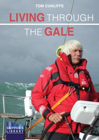
Heavy weather is a lurking spectre that most of us hope and plan to avoid, but not even internet forecasting can make it go away. Anyone intent on crossing oceans must be ready to deal with it if it comes, as well it may. Even well-informed inshore and continental-shelf sailors will inevitably be caught out sooner or later. The object of this slim, quickly absorbed volume is to give everyone, whatever their passage-making aspirations, a sound brief so that whether they find themselves at the wrong end of a force-six blow along the coast, or confronting serious waves far out at sea, they are fully aware of their options for taking it in their stride.Heavy weather is a lurking spectre that most of us hope and plan to avoid, but not even internet forecasting can make it go away. Anyone intent on crossing oceans must be ready to deal with it if it comes, as well it may. Even well-informed inshore and continental-shelf sailors will inevitably be caught out sooner or later. The object of this slim, quickly absorbed volume is to give everyone, whatever their passage-making aspirations, a sound brief so that whether they find themselves at the wrong end of a force-six blow along the coast, or confronting serious waves far out at sea, they are fully aware of their options for taking it in their stride.
Das E-Book können Sie in Legimi-Apps oder einer beliebigen App lesen, die das folgende Format unterstützen:
Seitenzahl: 250
Veröffentlichungsjahr: 2022
Ähnliche


CONTENTS
TOM CUNLIFFE
INTRODUCTION
1 WIND & WAVE
2 FIT FOR SEA: THE BOAT
3 THE CREW
4 HANDLING THE BOAT
5 NAVIGATION
6 STRATEGY, TACTICS & THE WEATHER
7 BOAT PERFORMANCE
8 RIDING OUT A GALE AT SEA
9 SHELTER FROM THE STORM
10 EMERGENCIES
11 THE LIFERAFT – THE FINAL RESORT
12 OUTSIDE ASSISTANCE
TOM CUNLIFFE
Tom Cunliffe is Britain’s leading sailing writer. A worldwide authority on cruising instruction and an expert on traditional sailing craft, he learnt his sextant skills during numerous ocean passages, many in simple boats without engines or electronics, voyaging from Brazil to Greenland and from the Caribbean to Russia. He is a consultant for US Sailing and author of numerous maritime textbooks.
Tom’s nautical career has seen him serve as mate on a merchant ship, captain on gentleman’s yachts and skipper of racing craft. He has owned a series of traditional gaff-rigged vessels that have taken him and his family on countless adventures from tropical rainforests to frozen fjords, but he now sails a modern classic 44-foot cutter which he keeps in Scandinavia.
Tom has been a Yachtmaster Examiner since 1978 and has a gift for sharing his knowledge with good humour and an endless supply of tales of the sea.
He has monthly columns in Sailing Today, Classic Boat, Yachting World and SAIL (US) magazines. He wrote and presented the BBC TV series The Boats That Built Britain and the popular Boatyard series. His YouTube channel (search ‘Tom Cunliffe Yachts and Yarns’) has a global audience.
Tom Cunliffe - Yachts and Yarns - YouTube
During the Covid lockdown he set up an online club for sailors worldwide. This has proved very popular with a monthly Zoom Q&A forum, articles and videos by Tom, an audiobook and book recommendations. All for just £15 a year. To join go to: www.tomcunliffe.com where you will also find information about his various lectures, etc.
Tom has written 7 other books for Fernhurst Books:
200 Skipper’s Tips
Boat Handling Under Sail & Power
Celestial Navigation
Coastal & Offshore Navigation
Expert Sailing Skills
Inshore Navigation
Sailing, Yachts & Yarns
INTRODUCTION
Nobody but the most extreme enthusiast wants to be at sea in heavy weather, but it’s out there nonetheless. Anyone planning on crossing an ocean must be ready to meet it if it comes, as well it may. Inshore and continental-shelf sailors can still be caught out despite today’s remarkable weather forecasting. The object of this slim, quickly absorbed volume is to give all sailors, whatever their passage-making aspirations, a sound brief so that whether they find themselves at the wrong end of a force-six blow along the coast, or confronting serious waves far out at sea, they are fully aware of their options for taking it in their stride.
Every sailor is fascinated by the subject of heavy weather. There are probably more strongly held opinions about how to cope with it than any other question related to seafaring, but if you try to define it you soon discover that, like happiness, hard going is different things to different people. An experienced crew in a 50-foot cutter sailing on a broad reach in 25 knots of wind ought to be thoroughly enjoying themselves. In the same conditions, a family group who have been working to windward for 24 hours in a 20-foot bilge keeler could well be near snapping point.
Heavy weather could be characterised as any combination of wind and sea of sufficient severity to cause the crew of a particular boat to consider altering their plans. But weather at sea is capable of worsening far beyond that marginal situation, and sooner or later any boat may meet circumstances in which she can do little more than drift helplessly into mortal danger. The art of skippering is to handle yourself, your crew and your boat so that you steer clear of that final truth for a whole lifetime. The list of essential equipment to achieve this is short. It consists of a well-found yacht, a sound knowledge of the options available and a positive, self-reliant approach.
The strong message throughout this book is one of self-help. It’s about making the most of your own resources to keep clear of trouble if you can, and dealing with it if you can’t. For all these fine intentions, however, the sea very occasionally brings our own efforts to nothing, so the chapters on Emergencies, The Liferaft and Outside Assistance consider the sort of situation that can arise one day for any of us who stay out there long enough. However carefully we prepare, there always remains the possibility that the weather and other circumstances will combine against us and leave us at the end of our tether. These chapters discuss how to approach the question of outside assistance, when it may realistically be needed and how to handle oneself in connection with it.
Sailing in heavy weather is an inevitable part of life on the water. It can be a nightmare, or it may provide that spice of real action which many sailors secretly – or not so secretly – desire. Coming through a blow undamaged and without fuss pulls a crew together. They’ll talk about it years later and the satisfaction they feel with their boat and one another is something special. The means of achieving this result are latent in all of us. The following pages will help you to identify and draw on them at sea when the wind blows hard.
As an afterthought, in these times of inclusivity I have endeavoured throughout the book to avoid personal pronouns implying gender. Without apology, however, I have maintained the ancient tradition of the sea by referring to ships and boats as ‘she’. No offence is intended or implied.
Tom Cunliffe
March 2023
1
WIND & WAVE
WIND
Wind is what sailing is all about. Wind powers the rig which drives the boat along; wind heels the boat over; wind direction decides whether we beat or sail free; wind strength and direction are the weather predictions in which we are most interested. Wind also stirs up the surface of the sea and makes waves, and in the last analysis it is waves which are most likely to spoil our day.
THE BEAUFORT SCALE IN PERSPECTIVE
If you listen to broadside folk ballads of the eighteenth century you will hear some strange weather reports. We are advised that when General Wolfe’s men set sail, ‘the wind it blew a pleasant gale’. This sort of muddy concept of weather conditions became obsolete when Admiral Beaufort produced his famous scale of wind forces.
Originally designed for use in Royal Navy ships it related wind speed to the sails a standard frigate or ship of the line would choose to set, all things being equal. His wind forces ran from 0-12 and so successful were his efforts that to this day many maritime nations still refer to wind strength on the Beaufort Scale.
The table above is a yachtsman’s Beaufort Scale. The wind and sea states are related to three typical modern yachts. One is a 22-foot cruising sloop with twin bilge keels. She is roomy, but not very powerful; she has an inboard diesel engine. The second is a typical 36-foot cruiser with a fin keel and a spade rudder. She will have a flat amidships section and will perform well in flat water. Going upwind in a seaway she may well slam. The last is a serious deep-water cruising yacht, designed and built to take rough weather in her stride. For convenience, each is assumed to have a good suit of sails, with a three-slab reefing mainsail and a roller genoa. The shortcomings of the reefed genoa are shown in the table and some alternatives are offered. These are available to any boat, but are not usually ‘plug and play’. They may require some modifications to a standard vessel. All the boats are sailing to windward in open water. Below the heavy line each will experience considerable problems and, while all is not lost, progress to windward may prove ineffective without power assistance. Ultimately, it becomes impossible.
Moving on in time from the days when Nelson’s captains were deciding whether or not to double-reef their topsails, more recent versions of the scale describe the sea conditions found in typical wind strengths. These are surprisingly useful and, until masthead anemometers became standard equipment for seagoing yachts, knowing that in force 7, foam becomes organised into long streaks behind wave crests was a big help.
Nowadays, wind force is accurately quantified by onboard instruments and internet weather sites, most giving predictions in knots or metres per second. In a sense, however, nothing has changed. Regardless of what the numbers are on the dial, the main concern of a yacht skipper is about the question of shortening sail rather than whether the apparent wind is blowing at 17 knots or 8mps.
WIND PRESSURE
As wind speed increases, the pressure exerted by the flowing air rises at a dramatic rate. At 15 knots (force 4), it is 0.8 pounds per square foot. At 30 knots (force 7) it has quadrupled to 3.1 pounds per square foot, and by the time the heady figure of 60 knots comes along in a full hurricane-force blow, we are up to around 12.3 pounds.
Wind pressure increases dramatically with wind speed
The units of measurement are unimportant in practice, so if you think in kilograms and square metres with wind strength defined in metres per second, it matters not. In this context at least, it’s the proportions that count and they don’t change.
A ghastly shock awaits the inexperienced mariner who is under the impression that force 8 is twice as windy as force 4. Five times as bad is nearer the mark and, of course, that’s only the wind. The real enemy is the sea.
GUSTS
Forecast wind strengths were traditionally given as mean wind speeds. Some still are, but wind predictions published on the internet will typically give a mean wind and what is described as a ‘gust speed’. Very often, the gust will be double the mean, leaving the user to make the judgement call while covering the forecasters against contingencies.
The fact is that a strong breeze officially described as being force 6 (22-27 knots) may, in fact, vary from 20 knots in the lulls to some evil gusts blasting up to 30. Twenty knots is force 5 on the Beaufort Scale, comfortably within the windward capacity of a small cruiser. Thirty knots is well into force 7, which is double the real wind force, and is quite capable of giving such a boat a very unpleasant afternoon.
Recognising this, forecasts are now usually given with a mean wind and a gust speed.
In open water, different types of air mass will lead to more or less gusty conditions. The unstable polar maritime air that comes swishing down behind a cold front in temperate latitudes is high on the gustiness list whereas a stable ‘tropical maritime’ south-westerly breeze at 50º North is likely to be a lot steadier.
SQUALLS
A squall is a local disturbance in the airstream which, in one form or another, produces conditions more violent than those currently being experienced.
You can usually see a squall coming because its presence is given away by a cloud effect. Squall clouds come in various shapes and sizes and will be discussed in Chapter 4. For now it is enough to understand that a bad squall can turn fifteen minutes of a fresh, windy day into a temporary horror show.
You can usually see a squall coming
LOCAL EFFECTS ON A STEADY WIND
A given surface wind blows more strongly over the sea than it does over land because water offers less frictional resistance to its passing. The presence of land also tends to break up the steady flow of air. These two factors mean that close to leeward of a coastline there is often a zone where the wind is lighter than it is offshore. However, certain types of land mass can cause accelerated wind speeds or eccentric wind directions.
Air funnelling down a valley to windward will frequently create a local increase in wind speed, while immediately to windward of a high land mass or a steep cliff there may be a zone of light or turbulent wind.
Air blowing through a gap in the hills on a nearby coast will often cause a local increase in wind speed over the sea to leeward
If the high land is the right shape, the wind may well be accelerated down the lee side, causing considerably increased gusting. In locations where particularly steep mountains coincide with narrow sea leads, such as the fjords of western Norway, some fearsome conditions of this type may be experienced. The Norwegians call this a ‘falling wind’; as the author discovered to his cost. Such terrible winds have a measurable downward component, and are no fun at all.
High land can have dramatic effects on local wind conditions with turbulence to windward and occasional ‘falling winds’ to leeward
So don’t assume you’ll get a lee from land to weather of you. It may help the sea state, but its effect on the wind will be less predictable.
Breezy corners may occur at the end of a continental landmass such as Cape Finisterre (top) or on a projecting headland (bottom)
TRUE & APPARENT WIND
An understanding of the difference between true and apparent wind is of particular importance in bad weather. True wind is the airstream experienced passively by a boat that is stationary. Once that boat starts moving through the water she moves through the air as well, and this has a direct effect on the wind blowing across her deck.
If a boat motors at six knots in still air, she receives a six-knot headwind. This is obviously apparent wind. Conversely if she motors downwind at six knots in a six-knot breeze, she would feel no wind at all: an apparent lack of wind. If she now turns and motors dead to windward at six knots in the same six-knot breeze, the wind at her masthead transducer will appear to blow at 12 knots.
There is, therefore, a 12-knot difference in the wind the boat actually experiences (the apparent wind) if she is travelling upwind or downwind.
When the true wind is averaging 28 knots (the bottom end of force 7) a boat running before it at six knots will be enjoying a fine sailing breeze of 22 knots (force 5 or 6). Close-hauled upwind, her apparent wind will increase to something approaching force 8, a whole gale. The pressure of the wind on a given sail area will double, and instead of running comfortably with the sea the boat will have to smash her way through every wave. She is in an entirely different world.
Apparent wind is a combination of the true wind speed and the boat’s speed; both the strength and direction of the apparent wind are affected
WAVES
At sea in hard weather the three primary sources of danger are wind, sea state and poor visibility. Unless it rises to extremes, wind alone is rarely a problem for a well-found vessel. A good navigator, whether electronically assisted or not, can handle a lack of visibility effectively. Waves, however, are a different story.
Waves shake and wring a boat like a terrier with a rat, and sometimes they explode against her like a sledgehammer. They test her sternly every time she makes a passage and should she be found wanting in any of her many departments, we have problems.
Waves cause skipper and crew to get wet and, in consequence, cold. They make many of us seasick and can, by this means, reduce a capable hand to a human liability for the duration of a rough passage. Even if we are not sick, waves still make the yacht jump about like a crazy thing, rendering such niceties as cooking and navigation near-impossible sophistications.
Waves can also overwhelm us, roll us over and, in the end, drown us.
We need to give them some serious thought.
THEORETICAL WAVES IN DEEP WATER
In theory, waves in deep, open water should assume a regular sine-wave profile; in practice the effects of wind and tide cause considerable variation
When a breeze blows across mirror-calm water it causes the formation of perfectly shaped waves an even distance apart. At lower wind speeds these waves approximate to the regular shape of a sine wave (see diagram). The distance between the wave crests is called the wavelength and, if this is long enough, the waves will have a gentle enough gradient to cause no trouble to a small boat.
As wind velocities increase towards gale and storm force, wave shape tends to change, becoming steeper until finally the wave can no longer support itself and the strength of the wind blowing across the top helps it to break.
Wave height is measured from trough to crest (see diagram). If wave development is unimpeded, the height of the waves caused by a steady wind in open water will go on increasing until they achieve the ‘probable wave height’ for that strength of wind (see the Beaufort Scale).
Wave height depends upon fetch, which is the distance that the wind has blown uninterrupted over open water. For example, the probable wave height developed in theory by a force 8 wind is given as around 5.5 metres, but with a fetch of even 50 miles it is unlikely to exceed three metres.
In a steady wind the height of the waves will increase as you travel further from the windward shore; this distance is known as the fetch
The length of time the wind has been blowing is also a factor in wave size. It takes many hours to build up to the theoretical mean wave height for a given wind force. So in waters not open to the wide ocean it is unusual for these heights to be achieved during the average summer blow.
Wave speeds generally end up as about 60 percent of the mean wind speed if it blows long enough for things to settle down to any degree of regularity.
The effect of all this is that a breaking wave in a moderate force 8 gale is likely to be 18 feet high (5.5m) with a maximum of 25 feet (7.5m), steep-sided and travelling at up to 30 knots or so. Not a pretty proposition, even though it is only the crest that is breaking.
Beam-on to a breaking wave in a gale
WAVES IN PRACTICE
An ideal series of waves never normally appears at sea. This is because the wind varies, not only in strength, but also in direction. In any case, there is nearly always an old sea left over or another one coming from somewhere else, or both, or worse, such as when tide or current runs contrary to the flowing air.
In real life, because of variations in wind velocity, all the waves in a given series do not travel at exactly the same speed, so from time to time one catches up with another. When this happens the two can combine to produce a wave half as big again as the regular wave height being experienced. These are not the ‘freak waves’ beloved of the media. They are predictable and appear in wave height tables as ‘probable maximum wave height’ (see Beaufort Scale).
WINDSHIFTS
The vast majority of gales and good solid blows will, at some stage of their lives, give their victims the benefit of a substantial windshift.
I have waited eagerly for many a cold front to mark the beginning of the end of a gale out in the North Atlantic, only to discover that as the scudding cloud breaks up and the wind veers to the northwest the sea gets a whole lot worse before it gets any better.
It stands to reason that if you have an established army of contented 25-foot seas marching uniformly out of the west and you suddenly remove their motive force to replace it with a new one from a different direction, the waves are going to get confused. Unfortunately, when they are subjected to this indignity, they don’t all suddenly execute a right wheel and stride away before the new wind. Instead, they maintain their progress towards the east while a new bunch begins marching over the top of them. The results are evil. Mostly the combatants sidle around one another with less fuss than one might expect, but when two big ones meet in confrontation they either rear up in a tower of breaking water and collapse in chaos on the spot, or they get together in a sort of lethal truce and go thundering away like a salt-water avalanche, very dangerously if you happen to be in the way.
The sea can get very confused with wind from different directions
THE ‘SMOOTH’
Every so often the wave pattern (or lack of it) in a rough sea produces a short period when an area of water is relatively calm. These events are known as ‘smooths’.
If you plan on carrying out a manoeuvre such as tacking or gybing it is well worth waiting for a smooth. A smooth may last half a minute or more, or it may be merely a gap of a few seconds before the next big wave arrives. You may never get one, but if there is a smooth coming your way it is a lot easier to wait for it than to tack your ship in the face of a series of steep waves.
Try to identify a smooth to carry out a manoeuvre
TIDE & CURRENT
If you take a normal wave pattern and impose a weather-going current upon it, the seas will heap up in what can appear to be personal spite. The waves become shorter and steeper and break much more readily in consequence. In heavy conditions a bad sea may become dangerous as the tide turns to windward.
A nasty sea created by wind against tide
On the ocean you can often observe when you have run into an adverse current by looking at the sea, in even moderate weather. Telltale streaks of foam running down the backs of the waves as the current carries them to windward is the sign to look for.
In tidal waters the steepening effect on the waves as wind-with-tide changes through slack water to wind-against-tide is dramatic. Indeed, you can judge the turn on the tide on a windy day more accurately by observation than by referring to the tide tables. In the mid-English Channel, for example, where tides can run at three knots or more out of sight of land, the turn of the tide is obvious in bad weather by virtue of the change in sea state.
It’s worth remembering that a turning tide can also have a dramatic effect on apparent wind. If the wind is blowing in the same directional vector as the tide, a three-knot stream reversing makes a 6-knot difference to wind blowing across the water, transforming a 24-knot force 6 into a force 7 near gale.
Wind against tide: the same wind strength blowing with the tide (top) and against the tide (bottom)
RACES & RIPS
In some places the nature of the seabed or the shape of a headland will cause the formation of tide-induced waves.
An uneven bottom can incite the running tide to upwell in whirlpools or stopper waves just as individual bottom variations do in a white-water river.
A tidal stream upwelling over a rocky seabed will often create a patch of angry, turbulent water
Tidal overfalls in the Solent
Certain headlands and passages produce rough water, regardless of wind conditions. In the illustration the eddy running westward along the south side of the headland meets the main stream in a mass of broken water that you enter at your peril. A notorious example of this is found at Portland Bill in the English Channel. Another one that can be equally nasty is the Raz de Barfleur on the French side. These places are always far worse at spring tides than at neaps, and if you spice things up with an onshore gale as well, the combination can be literally lethal.
An innocent-looking headland may conspire with the tide to create a race of blood-curdling ferocity; this is exactly what happens at places like Portland: extremely nasty on a calm day, death-traps in heavy weather
Sail into a bad tide-race on such a day and you may join the ghostly fleets of those who did not emerge to tell the tale.
Portland Bill with the notorious overfalls in the distance
It doesn’t always take a gale to whip things up either. I will never forget sailing into what should have been a modest tide rip off St Alban’s Head – also in the English Channel. The experience came soon after I’d come through two full-blown autumn storms in the North Atlantic. St Alban’s doesn’t have a particularly ugly reputation, and the weather was positively benign, but the place was on top form that day with what could only be described as ‘wall-to-wall breakers’. My boat was spun round and round. Steering was impossible. We gybed, came aback, square waves leapt aboard and filled the cockpit as we were set onwards by the roaring tide.
Ten minutes later, the same tide spat us out into calm water once more. We survived, shaken, but mercifully without damage. It’s not an experience I’d care to repeat. Had we not seen what was coming in time, battened down and clipped on we would have been swamped and could well have had someone thrown overboard. I realised later that I’d been caught out by a big swell left over from a mid-Atlantic storm. This came sweeping in against the spring tide which I’d caught in full spate. Sometimes, it pays to think beyond the next forecast.
Treat tide races with great care!
SHALLOW WATER EFFECTS
Theoretical mean and maximum wave heights hold good only so long as the sea is deep enough to support them. Here is what happens when a series of waves enters shoaling water.
In a fresh to strong breeze the wave condition on a lee shore, even if fully formed, is unaffected until the water shoals to about 40 metres. From this point on the waves begin to ease a little, growing shorter and somewhat smaller. As the bottom comes closer, the waves gradually become shorter still and take on a steeper shape. They are unwilling to break, however, until the depth has shoaled to between one and a half and two times the height of the wave, after which they cannot survive and break heavily.
In shoaling water the waves get shorter and steeper, and will often break over the harbour bar
If you are sailing anywhere near a lee shore in a blow you need to be aware of how the waves will react, particularly if you have to cross the bar of a river. Add an ebbing tide to seas which are approaching their natural breaking point and you have another situation not to be tolerated.
Countless well-found vessels have completed their voyage only to be dumped terminally on the harbour bar at their destination – very likely by the first breaker of the falling tide. There has to be a first. Always bear in mind, if in doubt, that it may be waiting just for you.
Notorious estuary bar in north Cornwall on a calm day; when it’s rough, it lives up to it’s name: Doom Bar
The bar at Salcombe harbour in southwest England is another famous for dangerous seas on the ebb in an onshore gale.
Many harbour mouths on the Atlantic coast of Portugal can become untenable when a big swell is running in from the ocean. Sailing five miles offshore you notice nothing untoward, but as you approach the breakwaters, you realise that a huge swell is developing, getting steeper and steeper until you almost literally surf in through the entrance, grateful to have been spared. In hard weather such places are not to be countenanced. Read the pilot book and take notice of what it says. For further confirmation of how dangerous this sort of thing can be, Google ‘Nazaré surf YouTube’ and marvel at what you see.
Off-lying banks are also subject to these effects. Sometimes they are marked as dangerous on the chart (‘breaks in westerly gales’ or ‘breaks heavily’), but not always. If you are unsure, consult your pilot book but be ever wary in gale conditions, particularly if the tide is pouring into the eye of the wind.
CLIFFS & BREAKWATERS
When a sea runs squarely up to a wall it bounces straight back out again like a squash ball. It matters not whether the wall was put there by God as a cliff face or by man in the form of a harbour wall.
In heavy weather the effects of this can be grim, so you should anticipate some severe wave activity if you find you are approaching a harbour with a breakwater that forms a lee shore with sea breaking against it.
Such a refuge would be a dubious option anyway, but waves bouncing back and running into one another add directly to each other’s height and break with the ferocity of a tide rip in full cry. A small vessel caught in a sea like this is liable to lose control of her steering and she would be lucky indeed if the wind saw fit to squirt her in through the harbour entrance. The alternatives are to scrape clear with a bruised ego or be overwhelmed and wrecked.
The conditions such situations produce in a whole gale need to be experienced to be believed. Better by far to go elsewhere or remain offshore where the big seas roll by more benevolently. Except in the most extreme circumstances, the sea alone is rarely the ultimate enemy. Real danger occurs at the interface between sea and land.
When waves meet the land, the effects can be grim


