97,99 €
Mehr erfahren.
- Herausgeber: John Wiley & Sons
- Kategorie: Wissenschaft und neue Technologien
- Sprache: Englisch
Hydrology is vital to human civilisations as well as to natural ecosystems, yet it has only emerged as a distinct scientific discipline during the last 50 years or so. This book reviews the development of modern hydrology primarily through the experiences of the multidisciplinary team of scientists and engineers at Wallingford, near Oxford, who have been at the forefront of many of the developments in UK hydrological research. These topics include:
• The development of basic understanding through the collection of data with specialised instrumentation in experimental basins
• The study of extreme flows – both floods and droughts
• The role moisture in the soil
• Studies of the processes controlling evaporation
• Water resource studies
• Modelling and prediction of the extremes of flow improved
• Understanding of water quality issues
• A widening recognition of the importance of an ecosystem approach
• Meeting the challenges of climate change,
• Data handling
• Future developments in hydrology and the pressures which generate them.
Readership: hydrologists in both academia and a wide range of applied fields such as civil engineering, meteorology, geography and physics, as well as advanced students in earth science, environmental science and physical geography programmes worldwide.
Sie lesen das E-Book in den Legimi-Apps auf:
Seitenzahl: 1143
Veröffentlichungsjahr: 2015
Ähnliche


Table of Contents
Cover
Title Page
Copyright
Dedication
List of Contributors
Chapter Reviewers
Foreword
Preface
Acknowledgements
Acronyms
Chapter 1: Introduction
1.1 Starting Point
1.2 Setting the Scene
1.3 Early Days at Wallingford
1.4 NERC's Role in Promoting Hydrological Research
1.5 Countering Water Problems
1.6 The Beginnings of Experimental Hydrology
1.7 Fighting Floods
1.8 Gaining International Recognition
1.9 Governmental Turbulence
1.10 An Expanding Role
1.11 Extending Hydrological Research into the Eighties
1.12 Into the Nineties
1.13 Moving into the New Millennium
1.14 Looking Ahead
1.15 References
Chapter 2: Basin Studies and Instrumentation
2.1 Introduction
2.2 Part 1. Basin Studies
2.3 Part 2. Instruments
2.4 Acknowledgements
2.5 References
Chapter 3: Risks and Extremes
3.1 Overview
3.2 The UK Flood Studies Report (FSR)
3.3 Post FSR Developments
3.4 The Flood Estimation Handbook (FEH)
3.5 Post-FEH developments
3.6 Future challenges and opportunities
3.7 Looking to the future: flood protection investment in a highly variable climate
3.8 References
Chapter 4: Terrestrial Hydrological Processes
4.1 Introduction
4.2 Soil Water Under Different Land Covers
4.3 Unsaturated Zone Water Balances
4.4 Role of Macropores
4.5 Hillslope-Streamflow Linkages
4.6 Looking to the Future
4.7 End Piece
4.8 References
Chapter 5: The Physics of Atmospheric Interaction
5.1 Introduction
5.2 Creating New Measurement Methods and Understanding
5.3 Regional and Global Hydrometeorology Studies
5.4 Eco-Hydrology Studies
5.5 Arctic Studies
5.6 Reflections on Contributions to Research
5.7 Acknowledgments
5.8 References
Chapter 6: Water Resources Security
6.1 Introduction
6.2 Low Flow Studies 1974–1987
6.3 Low Flow Studies 1988–2000: Capitalizing on Digital Cartography
6.4 Low Flows 2000 to 2015: Delivering UK and EU Policy Requirements
6.5 International Co-operation in Low Flow Studies
6.6 Applied Overseas Studies
6.7 Conclusions
6.8 References
Chapter 7: Hydrological Modelling
7.1 Introduction
7.2 Different Types of Models
7.3 Uncertainty in Modelling
7.4 Discussion and Conclusions
7.5 References
Chapter 8: Water Quality
8.1 Background
8.2 The Chemistry of the Uplands
8.3 Plynlimon
8.4 Lowland River Water Quality
8.5 Nutrients: Nitrogen and Phosphorus
8.6 Steroid Oestrogens
8.7 Pesticides
8.8 Water quality modelling
8.9 Future Challenges and Opportunities
8.10 References
Chapter 9: Ecohydrology
9.1 Introduction
9.2 Water Requirements of River Ecosystems
9.3 Wetlands
9.4 Lakes
9.5 References
Chapter 10: Climate Change and Hydrology
10.1 Introduction to Climate Change: Changes in Twentieth Century and Expected Impact of Increasing GHG on Global Water Cycle
10.2 Introduction to GCMs: From 1970s Onwards
10.3 The Development of Land Surface Models Within Climate Models: Short History
10.4 Targets for Benchmarking
10.5 Studies in Land/Atmosphere Interaction
10.6 Impacts of Climate Change on River Flows and Water Resources
10.7 Conclusion
10.8 References
Chapter 11: Hydrological Data Acquisition and Exploitation
11.1 Introduction
11.2 The Need for Water Data
11.3 Evolution of the UK Hydrometric Network
11.4 Acquisition and Archiving of UK River Flow Data
11.5 Getting to Grips with Extreme Flows
11.6 Towards Integrated Data Management: The Water Data Unit
11.7 Managing the National Hydrological Archives at Wallingford
11.8 River Networks and Spatial Data
11.9 Exploiting the New Catchment and Regime Descriptors
11.10 A Holistic Approach to Managing Water Information
11.11 Regional and Global Collaborations
11.12 Hydrometric Network Evolution: Capitalising on Regionalisation Techniques
11.13 Strategic UK Gauging Station Networks
11.14 Exploring the Past
11.15 Maximising the utility of hydrological data
11.16 Integration of Databases and Models
11.17 Capturing Hydrological Change
11.18 Conclusion
11.19 References
Chapter 12: Looking Towards the Future
12.1 Introduction
12.2 Concern for the State of the Environment
12.3 Interactive Water
12.4 Outreach
12.5 Community Research Programmes
12.6 Contributions from Space Science
12.7 Future Modelling and Future Management
12.8 Opportunities Ahead
12.9 References
Index
End User License Agreement
Pages
ix
x
xi
xiii
xv
xvi
xvii
xviii
xix
xxi
xxii
xxiii
xxiv
1
2
3
4
5
6
7
8
9
10
11
12
13
14
15
16
17
18
19
20
21
22
23
24
25
26
27
28
29
30
31
32
33
34
35
36
37
38
39
40
41
42
43
44
45
46
47
48
49
50
51
52
53
54
55
56
57
58
59
60
61
62
63
64
65
66
67
68
69
70
71
72
73
74
75
76
77
78
79
80
81
82
83
84
85
86
87
88
89
90
91
92
93
94
95
96
97
98
99
100
101
102
103
104
105
106
107
108
109
110
111
112
113
114
115
116
117
118
119
120
121
122
123
124
125
126
127
128
129
130
131
132
133
134
135
136
137
138
139
140
141
142
143
144
145
146
147
148
149
150
151
152
153
154
155
156
157
158
159
160
161
162
163
164
165
166
167
168
169
170
171
172
173
174
175
176
177
178
179
180
181
182
183
184
185
186
187
188
189
190
191
192
193
194
195
196
197
198
199
200
201
202
203
204
205
206
207
208
209
210
211
212
213
214
215
216
217
218
219
220
221
222
223
224
225
226
227
228
229
230
231
232
233
234
235
236
237
238
239
240
241
242
243
244
245
246
247
248
249
250
251
252
253
254
255
256
257
258
259
260
261
262
263
264
265
266
267
268
269
270
271
272
273
274
275
276
277
278
279
280
281
282
283
284
285
286
287
288
289
290
291
292
293
294
295
296
297
298
299
300
301
302
303
304
305
306
307
308
309
310
311
312
313
314
315
316
317
318
319
320
321
322
323
324
325
326
327
328
329
330
331
332
333
334
335
336
337
338
339
340
341
342
343
344
345
346
347
348
349
350
351
352
353
354
355
356
357
358
359
360
361
362
363
364
365
366
367
368
369
370
371
372
373
374
375
376
377
379
380
381
382
383
384
Guide
Cover
Table of Contents
Preface
Begin Reading
List of Illustrations
Chapter 1: Introduction
Fig. 1.1 The First HRU Annual Report in 1966. (Source: Reproduced with permission of CEH.)
Fig. 1.2 The Flood Studies Team in the 1970s. (Source: Reproduced with permission of CEH.)
Fig. 1.3 The Workshops at Wallingford were essential in the development of novel hydrological instruments. (Source: Reproduced with permission of CEH.)
Fig. 1.4 One of the Chemistry Laboratories for rapid the in-house analyses of water samples. (Source: Reproduced with permission of CEH.)
Fig. 1.5 The library. (Source: Reproduced with permission of CEH.)
Fig. 1.6 Staff picture Institute of Hydrology in the 1990s. (Source: Reproduced with permission of CEH.)
Fig. 1.7 BHS twenty-first birthday celebrations in 2004. (Source: Reproduced with permission of BHS.)
Chapter 2: Basin Studies and Instrumentation
Fig. 2.1 Plynlimon catchments, comparing the mostly forested Severn and the grassland Wye. (Source: Reproduced with permission of CEH.)
Fig. 2.2 Plynlimon overview of results, showing (a) Changing water use of forest relative to grassland, (b) Soil water under forest and grass, (c) Peak flows from forest, (d) Greater winds speeds in the uplands, (e) Reducing frost days over time, (f) Sediment loss from forest and grassland, (g) Changes in stream nitrate loss with tree felling. (a–f). (Robinson
et al
. 2013. Reproduced with permission of John Wiley & Sons.)
Fig. 2.3 East African catchments. (Source: Edwards & Blackie 1981. Reproduced with permission of John Wiley & Sons.)
Fig. 2.4 A typical traditional Met Site.
From left to right:
Campbell-Stokes Sunshine recorder, Stevenson screen containing thermometers for recording maximum and minimum air temperature and ‘wet and dry bulb’ thermometers for measuring relative humidity, with a five inch manual raingauge. In right photo are the wind direction and windspeed sensors. (Source: Reproduced with permission of Ian Strangeways.)
Fig. 2.5 Two different data loggers.
Top
: Microdata logger used in the 1970s with data stored on compact cassettes.
Bottom
: A modern solid-state logger. (Source: Reproduced with permission of Ian Strangeways.)
Fig. 2.6 The UK standard five-inch manual raingauge. (Source: Reproduced with permission of Ian Strangeways.)
Fig. 2.7 Ground-level raingauge (pit gauge). (Source: Reproduced with permission of Ian Strangeways.)
Fig. 2.8 Wind effects on catch can be reduced by surrounding a raingauge with a wind shield:
From left to right
– Nipher, Alter and Tretyakov wind shields. (Source: Reproduced with permission of Ian Strangeways.)
Fig. 2.9 Aerodynamic raingauge. (Source: Reproduced with permission of Ian Strangeways.)
Fig. 2.10 Wind effects are even more severe for snowfall, and the The World Meteorological Organisation (WMO) recommends a double-fence snow shield. (Source: Reproduced with permission of Ian Strangeways.)
Fig. 2.11 Five inch funnel gauge over forest canopy. (Source: Reproduced with permission of CEH.)
Fig. 2.12 Tipping bucket raingauge (showing the interior). (Source: Reproduced with permission of Ian Strangeways.)
Fig. 2.13 Automatic Weather Stations:
Left
: Early prototype developed at IH in the late 1960s. One of the first modern AWSs.
Right
: Didcot Instruments production model – still in use. (Source: Reproduced with permission of Ian Strangeways.)
Fig. 2.14
Top left
: UK Evaporation pan sunk in the ground.
Top tight
: ‘Class A’ evaporation pan, normally exposed above the ground.
Bottom left
: A lysimeter.
Bottom right
: Drawing of a lysimeter components. (Source: Reproduced with permission of Ian Strangeways.)
Fig. 2.15 Potentiometer river level sensor developed at IH to replace chart-recording instruments. (Source: Reproduced with permission of Ian Strangeways.)
Fig. 2.16 Compound Crump weir in the Wye. (Source: Reproduced with permission of CEH.)
Fig. 2.17 Steep stream flume at Plynlimon. (Source: Reproduced with permission of CEH.)
Fig. 2.18 Neutron probe 1 the Danbridge equipment showing scaler and transport shield. (Source: Reproduced with permission of CEH.)
Fig. 2.19 Neutron probe. (Source: Reproduced with permission of CEH.)
Fig. 2.20 Manually read tensiometers. (Source: Reproduced with permission of CEH.)
Fig. 2.21 Borehole tensiometer. (Source: Reproduced with permission of CEH.)
Fig. 2.22 Data collection platform satellite telemetry station (left). Data collection platform which processed the measurements (right). (Source: Reproduced with permission of Ian Strangeways.)
Fig. 2.23 Cold regions AWS at Faraday. (Source: Reproduced with permission of Ian Strangeways.)
Fig. 2.24 IH undertook the development of a telemetry network for the Pantanal (Brazil). (Source: Reproduced with permission of Ian Strangeways.)
Chapter 3: Risks and Extremes
Fig. 3.1 Estimation of the design flood (from FSR Vol. I.). (Source: Reproduced with permission of CEH.)
Fig. 3.2 A flooded gauging station. (Source: Reproduced with permission of Hydro-GIS Ltd.)
Fig. 3.3 Flood Studies Report regional growth curves. (Source: Reproduced with permission of CEH.)
Fig. 3.4 Examples of correlation maps (from FSR I.). (Source: Reproduced with permission of CEH.)
Fig. 3.5 Historical flood marks at Shillingford Wharfe. (Source: Reproduced with permission of Hydro-GIS Ltd.)
Fig. 3.6 Effect of eliminating lake catchments on regression coefficients (FSR I.). (Source: Reproduced with permission of CEH.)
Fig. 3.7 Comparison of adjacent regions: (a) divided basic regions. (b) basic regions (from FSR I.). (Source: Reproduced with permission of CEH.)
Fig. 3.8 Summary of hydrograph analysis (FSR I.). (Source: Reproduced with permission of CEH.)
Fig. 3.9 HOST class for each kilometre square. (Source: Reproduced with permission of CEH.)
Fig. 3.10 FEH CD-ROM screen shot showing the IHDTM derived river network. (Source: Reproduced with permission of CEH.)
Fig. 3.11 Screenshot from the WINFAP-FEH software. (Source: Reproduced with permission of CEH.)
Fig. 3.12 Flood estimation using the FSR rainfall–runoff method. (Source: Reproduced with permission of CEH.)
Fig. 3.13 One day Rmed map (mm). (Source: Reproduced with permission of CEH.)
Fig. 3.14 Networks of daily gauges focused on Leicester (from FEH Vol. 2.). (Source: Reproduced with permission of CEH.)
Fig. 3.15 The Revitalised Flood Hydrograph (ReFH) model. (Source: Reproduced with permission of CEH.)
Fig. 3.16 Screen shot of the spreadsheet based ReFH software. (Source: Reproduced with permission of CEH.)
Fig. 3.17 Top down flood protection scheme. (Source: Reproduced with permission of P E O'Connell.)
Chapter 4: Terrestrial Hydrological Processes
Fig. 4.1 Manaus: Pasture (top) profile storage in top 2 m. Forest (bottom) profile storage in top 2 m and 2–3.6 m depth. (Source: Hodnett
et al.
, 1996. Reproduced with permission of CEH.)
Fig. 4.2 Marabá: Pasture (top) profile storage in 0–2 and 2.0–3.6 m layers. Forest (bottom) profile storage in 0–2 and 2.0–3.6 m layers. (Source: Hodnett
et al.
, 1996. Reproduced with permission of CEH.)
Fig. 4.3 Ji-Paraná: Pasture (top) profile storage in 0–2 and 2.0–3.6 m layers. Forest (bottom) profile storage in 0–2 and 2.0–3.6 m layers. (Source: Hodnett
et al.
, 1996. Reproduced with permission of CEH.)
Fig. 4.4 Photo of each array before crop emergence – sugar cane can be seen in the distance. (Source: Reproduced with permission of CEH.)
Fig. 4.5 2-D distribution of soil water potentials (kPa) beneath a drip irrigated row crop, based on tensiometer profiles at A–F. across the dripline (•). (Source: Reproduced with permission of CEH.)
Fig. 4.6 Location of the soil moisture databank sites. (Source: Gardner 1981a. Reproduced with permission of CEH.)
Fig. 4.7 Comparison of MORECS SMD estimates (- – -) and measured SMDs (—) for four sites on different soils with grass vegetation for: (a) sandy soil in Staffordshire, RSMD 13.4, bias −5; (b) loam in Gloucestershire, RMS 38.5, bias −32.5; (c) clay in Gloucestershire, RSMD 27.0, bias −17.8 and (d) chalk in Lincolnshire, RSMD 18.4, −1.3. Deficits estimated by MORECS were compared against the measured deficits for four sites on different soils. (Source: Gardner & Field 1983. Reproduced with permission of Elsevier.)
Fig. 4.8 Principle of the ZFP method, showing water flux, hydraulic potential and water content changes as a function of depth. (Source: Reproduced with permission of CEH.)
Fig. 4.9 Cumulative components of the water balance for a stand of Scots Pine in Thetford Forest during the very dry year, 1976 (Cooper, 1980). Total evaporation (transpiration plus evaporation of intercepted water) was predicted well by the Gash and Stewart (1977) model until about Day 155, after which increasing water stress limited transpiration. Note the large contribution of interception (the difference between total evaporation and transpiration) to the overall evaporation. (Source: Cooper 1980. Reproduced with permission of CEH.)
Fig. 4.10 In situ measurements of soil water characteristics for four depths at Bridget's Farm, Hampshire, showing a transition from typical soil behaviour at shallow depth to undisturbed Chalk at deeper depths. Published soil water characteristic curves for Chalk samples determined in the laboratory by other workers are shown for comparison in the lower graph. (Source: Wellings & Bell 1980. Reproduced with permission of Elsevier.)
Fig. 4.11 Unsaturated hydraulic conductivity at four Chalk sites covered by thin soils. Except for Fleam Dyke, all measurements are for a depth of 2.1 m. (Source: Cooper, Gardner & Mackenzie 1990. Reproduced with permission of John Wiley & Sons.)
Fig. 4.12 Cumulative drainage at 3 m depth at four sites on Chalk during 1980 (Wellings and Cooper, 1983). The Stud Farm site in Cambridgeshire was beneath a deep soil, whereas the other three were under shallow soils. The Golf Course and Fleam Dyke sites were close to and had similar rainfall to the Stud Farm, whereas Bridget's Farm is in Hampshire and had higher rainfall. The period marked ZFP shows when a zero flux plane was observed at the Golf Course site. (Source: Wellings & Cooper 1983. Reproduced with permission of Elsevier.)
Fig. 4.13 Grendon drainage study. (Source: Reproduced with permission of CEH.)
Fig. 4.14 COSMOS data processed and calibrated for Chimney Meadows. (Source: Reproduced with permission of CEH.)
Chapter 5: The Physics of Atmospheric Interaction
Fig. 5.1 The three tallest towers with the TIS machines on the middle tower. (Source: Reproduced with permission of CEH.)
Fig. 5.2 The Thetford Data Acquisition System with the HP 2116B computer on the right. (Source: Reproduced with permission of CEH.)
Fig. 5.3 Two TIS Systems to account for all wind directions. (Source: Reproduced with permission of CEH.)
Fig. 5.4 The Evaporation Flux Studies group circa 1978. Clockwise from top left: David McNeil, Colin Lloyd, Jim Shuttleworth, Chris Moore, John Gash and Howard Oliver (to depart to join the VAI section). (Source: Reproduced with permission of Colin Lloyd.)
Fig. 5.5 The Mk1 HYDRA. (Source: Reproduced with permission of John Gash.)
Fig. 5.6 The Berners Heath–forest interface experiment showing two of the eight Mk1 HYDRAs on a transect between the heath and the forest. (Source: Reproduced with permission of CEH.)
Fig. 5.7 The tower-carrying truck with Jim Shuttleworth and John Roberts wondering what to do next. (Source: Reproduced with permission of John Gash.)
Fig. 5.8 The 52 m Manaus tower emerges over the extensive Amazonian rainforest. (Source: Reproduced with permission of CEH.)
Fig. 5.9 Partitioning of energy at the Reserva Ducke site for eight days in September 1983. (Source: Reproduced with permission of Colin Lloyd.)
Fig. 5.10 Colour modified Landsat satellite image of the herringbone pattern forest clearance (in pink) as areas are cleared to either side of roads. (Source: NASA Open Source.)
Fig. 5.11 One of the ABRACOS experimental sites at the Dimona cattle ranch, 100 km north of Manaus. (Source: Reproduced with permission of CEH.)
Fig. 5.12 The Mk2 HYDRA eddy correlation instrument. (Source: Reproduced with permission of John Gash.)
Fig. 5.13 One of our tower section carrying canoes on the Ji-Parana river near our field site at Jaru, Rondonia. (Source: Reproduced with permission of John Gash.)
Fig. 5.14 The Mk2 HYDRA at the Leirhagen site near Ny-Alesund, Svalbard in early May 1995. (Source: Reproduced with permission of Colin Lloyd.)
Fig. 5.15 An aerial view of the LAPP mire site at Kevo, northern Finland. (Source: Reproduced with permission of Colin Lloyd.)
Fig. 5.16 Getting the equipment to the Plotnikovo wetland site in May 1999. (Source: Reproduced with permission of Colin Lloyd.)
Fig. 5.17 The field site at Tadham Moor during the flooded phase of Tier 3 management – January 23, 2003. (Source: Reproduced with permission of Colin Lloyd.)
Fig. 5.18 Mk4 and Solent R3/Licor 7500 flux systems, wind generators and horizontal solar panels at the upland tundra site near Abisko, northern Sweden. (Source: Reproduced with permission of Colin Lloyd.)
Fig. 5.19 The combined AWS/flux system at the desert margin site at Bamba. (Source: Reproduced with permission of Colin Lloyd.)
Chapter 6: Water Resources Security
Fig. 6.1 Base flow separations for contrasting flow regimes: River Beult (upper); impermeable catchment, BFI = 0.23 and River Lambourn (lower); permeable catchment, BFI = 0.97. (Source: Reproduced with permission of WHS.)
Fig. 6.2 Dimensionless FDCs for contrasting flow regimes: River Beult (green); impermeable catchment, River Lambourn (blue); permeable catchment. (Source: Reproduced with permission of WHS.)
Fig. 6.3 Low Flow HOST groups. (Source: Reproduced with permission of CEH.)
Fig. 6.4 FDCs for natural and influenced flow regimes obtained from the LowFlows 2000 software. (Source: Reproduced with permission of WHS.)
Fig. 6.5 FRIEND regional groups. (Source: Reproduced with permission of UNESCO.)
Fig. 6.6 The FDC in hydropower design. (Source: Reproduced with permission of CEH.)
Fig. 6.7 Power potential report. (Source: Hydra software – Gwyn Rees. Reproduced with permission of CEH.)
Fig. 6.8 Percentage change in 1961–1990 modelled mean flow for the Indus basin over a 100-year period assuming an average annual temperature increase of 1°C per decade. (Source: Reproduced with permission of CEH.)
Fig. 6.9 Botswana: Deficient volume analysis. (Source: Parks and Gustard 1982. Reproduced with permission of IAHS.)
Fig. 6.10 Historical water levels of Lake Victoria measured at Jinja in Uganda. (Source: Water Resource Associates. Reproduced with permission of WHS.)
Fig. 6.11 Lake Victoria basin showing the single outlet to the White Nile at Jinja (with schematic of the two hydropower stations shows as an inset). (Source: Water Resource Associates. Reproduced with permission of WHS.)
Chapter 7: Hydrological Modelling
Fig. 7.1 IHACRES schematic: the basic model structure. (Source: Littlewood et al. 1997. Reproduced with permission of CEH.)
Fig. 7.2 The lumped IH Conceptual model structure. (Source: Blackie & Eeles 1985. Reproduced with permission of John Wiley & Sons.)
Fig. 7.3 The original schematic representation of the SHE. (Source: Abbott et al. 1986a. Reproduced with permission of Elsevier.)
Chapter 8: Water Quality
Fig. 8.1 Locations of catchments in UK that have been the focus of water quality research carried out at Wallingford. (Source: Reproduced with permission of CEH.)
Fig. 8.2 Prediction of combined steroid oestrogen concentrations (estradiol equivalents, E2_eqv) in the Thames catchment originating from the human population and their sewage treatment plants for the month of August. Note concentrations above 1 ng/L suggest some level of endocrine disruption with more significant disruption occurring over 5 ng/L. Thin blue lines denote the river network not impacted by significant discharges. (Source: Reproduced with permission of CEH.)
Fig. 8.3 Reconstruction of past pH at Scoat Tarn in the Lake District together with predictions for various sulphur reductions – plus (in red) the observed pH from the Acid Waters Monitoring Network at CEH. (Source: Reproduced with permission of CEH.)
Chapter 9: Ecohydrology
Fig. 9.1 River discharge
v
Weighted Usable Area of habitat (lower curve) compared with the total wetted area of river bed (upper curve) that defines a maximum. (Source: Reproduced with permission of CEH.)
Fig. 9.2 Rapid assessment of flow
v
habitat curves from PHABSIM (black-solid) and RAPHSA (green-dashed). (Source: Reproduced with permission of CEH.)
Fig. 9.3 Basic elements of flow regime required to deliver components of the river ecosystem (after Acreman
et al
., 2009a, 2009b). (Source: Adapted from Acreman
et al
. 2009.)
Fig. 9.4 Risk of river ecosystem change in European rivers by 2050. (Source: Adapted from Laizé et al. 2014. Reproduced with permission of John Wiley & Sons.)
Fig. 9.5 (a) Natural river channel with complex channel geometry and dense bank vegetation. (Source: Photograph by Mike Acreman.) (b) Highly modified river channel with straight, reinforced banks and sparse vegetation. (Source: Photograph by Mike Acreman.)
Fig. 9.6 Variations in flow–river ecosystem relationships with channel alteration (annotated as % modification from natural). (Source: Reproduced with permission of CEH.)
Fig. 9.7 River Lambourn Observatory, Boxford, UK. (Source: Photograph by Mike Acreman.)
Fig. 9.8 Flood hydrographs at Oxford for April 1998 with and without (embanked) floodplain storage upstream (after Acreman
et al
., 2003.) (Source: Reproduced with permission of CEH.)
Fig. 9.9 Water-regime requirements of MG13 wetland plant community (Wheeler
et al
., 2004). (Source: Wheeler
et al
. 2004. Reproduced with permission of CEH.)
Fig. 9.10 Time series of water table elevations in restored and drained plots at Tadham Moor, from July 1997 to July 2000. (Source: Reproduced with permission of CEH.)
Fig. 9.11 Tadham Moor wet grassland Somerset. (Source: Photograph by Mike Acreman.)
Fig. 9.12 Monthly mean water table levels (
m
) for the rain-fed wetland type, superimposed on the M16 wet heath water level requirements zone graphs, at the six sample sites across GB. The solid lines represent baseline (1961–1990) climate, the dashed lines show the projected values for the 2080s (2071–2100) using UKCIP02 (Hulme
et al.
, 2002) climate change data for the 'Medium–High' emissions scenario. (Source: Reproduced with permission of CEH.)
Fig. 9.13 'Wetland Tool for Climate Change' example output showing the potential impact of climate change on wetlands for the 2050s under the 'Medium' emissions scenario – Gross mean annual water balance for a rain-fed M16 wet heath in East Anglia. (Source: Reproduced with permission of the Environment Agency.)
Fig. 9.14 Haweswater, Cumbria, UK, August 1995, showing exposed shoreline after exceptionally dry conditions. (Source: Photograph by Ian J. Winfield, CEH.)
Fig. 9.15 Hypothetical change in water temperature with depth in a lake during stratification and lake zones associated with this process. (Source: Reproduced with permission of CEH.)
Fig. 9.16 Spatial variations in subsurface water temperature and
Daphnia
population densities in the north basin of Windermere, English Lake District, on 20th June 2001. (Source: Adapted from Thackeray
et al
. 2004. Reproduced with permission of John Wiley & Sons.)
Fig. 9.17 Wind-induced disturbance along the shoreline of Loch Girlsta, Scotland. (Source: Photograph by Ian J. Winfield, CEH.)
Fig. 9.18 Esthwaite Water (
a
) average maximum wave mixed depth (
m
) for 2005–2009 and (b) wave affected area based on this wave mixed depth. (Source: Adapted from Mackay
et al
., 2012. Reproduced with permission of John Wiley & Sons.)
Fig. 9.19 Annual average percentage of sediment surface estimated to have been disturbed by wave induced mixing in Loch Leven, Scotland, 1979–2005 (upper left); seasonal variation in 30-year average, modelled, wave mixed depth across six sites in the lake (upper right and lower left) between 1979 and 2005. (Source: Spears & Jones 2010. Reproduced with permission of Springer Science and Business Media.)
Chapter 10: Climate Change and Hydrology
Fig. 10.1 Schematic of main energy flows in the atmosphere and greenhouse effect. (Source: Reproduced with permission of CEH.)
Fig. 10.2 Time series from the Wallingford Meteorological site of (a) mean air temperature and (b) annual rainfall. (Source: Reproduced with permission of CEH.)
Fig. 10.3 Cloud developing over the Le Landes forest. (Source: NOAA – National Oceanic and Atmospheric Administration.)
Fig. 10.4 Example impacts on river flows in the UK. (a) Change in mean monthly river flows in the 2050s, with UKCIP02 and other scenarios. (Source: Arnell 2004. Reproduced with permission of John Wiley & Sons.) (b) Change in seasonal runoff in the 2050s, under the 11 UKCP09 regional climate model scenarios (Prudhomme
et al.
, 2012b. Reproduced with permission of John Wiley & Sons.). (c) Flood frequency curves under the current climate (dashed line) and in the 2080s, under the 11 UKCP09 regional climate model scenarios. (Source: Bell
et al.
2012. Reproduced with permission of Elsevier.) The dotted lines show the uncertainty range for the current frequency distribution. (d) Response surfaces for percentage change in the 20-year return period flood, against magnitude of annual rainfall change (vertical axis) and change in seasonal variation in rainfall (horizontal axis). (Source: Prudhomme
et al.
2010. Reproduced with permission of Elsevier.) Left: Endrick catchment, North East Scotland and right: Roding catchment, South East England.
Fig. 10.5 Components of water fluxes and storages for global terrestrial land surface and four major basins representing different climate regimes (1985–1999). The numbers represent simulation results of 11 models participating in WaterMIP (Haddeland
et al.
, 2011). (Source: Reproduced with permission of CEH.)
Chapter 11: Hydrological Data Acquisition and Exploitation
Fig. 11.1 Components of a national hydrometric data management system. (Source: Reproduced with permission of CEH.)
Fig. 11.2 Contrasting river flow patterns in neighbouring Chalk (black trace) and Clay (grey trace) catchments in central southern England. (Source: Reproduced with permission of CEH.) (Source: Reproduced with permission of CEH.)
Fig. 11.3 Growth of the UK gauging station network. (Source: Reproduced with permission of CEH.)
Fig. 11.4 Digitising a river level hydrograph. (Photo NRFA.) (Source: Reproduced with permission of CEH.)
Fig. 11.5 Examples of publications in the National Hydrological Monitoring Programme series. (Source: Reproduced with permission of CEH.)
Fig. 11.6 Spatial characterisations for a selected region, from top: target area, soil type, land use and topography. (Source: Reproduced with permission of CEH.)
Fig. 11.7 The Water Information System cube. (Source: Reproduced with permission of CEH.)
Fig. 11.8 Distribution of gauging stations for which flow records are held in the European Water Archive. (Source: Reproduced by permission of Global Data Runoff Centre.)
Fig. 11.9 Large capacity flume at Rhos-y-Pentref in central Wales (Photo: NRFA.) (Source: Reproduced with permission of CEH.)
Fig. 11.10 Trends in high flow duration (number of days above q10 threshold) at gauging stations in the UK Benchmark Network. (Source: Reproduced with permission of CEH.)
Fig. 11.11 Components used in the Service Level Agreement to identify and rectify errors in river flows. (Source: Reproduced with permission of CEH.)
Fig. 11.12 Acoustic Doppler Current Profiler (ADCP) being deployed on the River Thames (Source: Reproduced with permission of CEH.)
Fig. 11.13 Susceptibility to groundwater flooding in the upper Pang valley, Berkshire. (Source: Reproduced with permission of British Geological Survey.)
Fig. 11.14 Annual Q
95
outflows: Scotland (black), England (dark grey) and Wales (light grey). (Source: Reproduced with permission of CEH.)
List of Tables
Chapter 3: Risks and Extremes
Table 3.1 The Flood Estimation Handbook, an indication of structure
Chapter 6: Water Resources Security
Table 6.1 Summary of low flow regime measures
Table 6.2 International coverage of regional FRIEND groups in 2010
Chapter 11: Hydrological Data Acquisition and Exploitation
Table 11.1 Objectives of the UK National Hydrological Monitoring Programme
Teddington Weir: This is the lowest gauging station on the Thames and provides the longest continuous record of flow in the UK, and one of the longest flow records in the world. Systematic flow measurement began in 1883 and there is a wealth of documentary evidence relating to historical floods. Prior to the twentieth century, snowmelt-aggravated flood events were more common; extreme examples include 1809, when a number of bridges across the Thames were destroyed. Urbanisation and agricultural intensification have influenced flood flows to the river system, and river engineering works particularly following the disastrous 1947 flood have increased the capacity of the Thames. Thus, while peak flows exhibit little trend, peak river levels – the primary cause of overbank flooding – decreased appreciably through the twentieth century. (Source: Reproduced by permission of Environment Agency.)
Progress in Modern Hydrology: Past, Present and Future
Edited By
John C. Rodda and Mark Robinson
Honorary Fellows at the Centre for Ecology and Hydrology, Maclean Building, Crowmarsh Gifford, Wallingford, Oxfordshire, OX10 8BB, UK
This edition first published 2015 © 2015 by John Wiley & Sons Ltd
Registered office: John Wiley & Sons, Ltd, The Atrium, Southern Gate, Chichester, West Sussex, PO19 8SQ, UK
Editorial offices: 9600 Garsington Road, Oxford, OX4 2DQ, UK
The Atrium, Southern Gate, Chichester, West Sussex, PO19 8SQ, UK
111 River Street, Hoboken, NJ 07030-5774, USA
For details of our global editorial offices, for customer services and for information about how to apply for permission to reuse the copyright material in this book please see our website at www.wiley.com/wiley-blackwell.
The right of the author to be identified as the author of this work has been asserted in accordance with the UK Copyright, Designs and Patents Act 1988.
All rights reserved. No part of this publication may be reproduced, stored in a retrieval system, or transmitted, in any form or by any means, electronic, mechanical, photocopying, recording or otherwise, except as permitted by the UK Copyright, Designs and Patents Act 1988, without the prior permission of the publisher.
Designations used by companies to distinguish their products are often claimed as trademarks. All brand names and product names used in this book are trade names, service marks, trademarks or registered trademarks of their respective owners. The publisher is not associated with any product or vendor mentioned in this book.
Limit of Liability/Disclaimer of Warranty: While the publisher and author(s) have used their best efforts in preparing this book, they make no representations or warranties with respect to the accuracy or completeness of the contents of this book and specifically disclaim any implied warranties of merchantability or fitness for a particular purpose. It is sold on the understanding that the publisher is not engaged in rendering professional services and neither the publisher nor the author shall be liable for damages arising herefrom. If professional advice or other expert assistance is required, the services of a competent professional should be sought.
Library of Congress Cataloging-in-Publication Data
Progress in modern hydrology : past, present and future / edited by John Rodda and Mark Robinson.
pages cm
Includes bibliographical references and index.
ISBN 978-1-119-07427-4 (cloth)
1. Institute of Hydrology (Great Britain)–Research. 2. Centre for Ecology and Hydrology
(Great Britain)–Research. 3. Hydrology–Research. I. Rodda, J. C., editor. II. Robinson, M. (Mark), 1953- editor.
GB658.8.G7P76 2015
551.48–dc23
2015018213
A catalogue record for this book is available from the British Library.
Wiley also publishes its books in a variety of electronic formats. Some content that appears in print may not be available in electronic books.
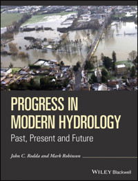
Cover image: Flooding of the River Thames at Wallingford, Oxfordshire taken by RAF Benson on 7th January 2003, several days after the peak which was the highest since 1947 in many reaches of the Thames. The Centre for Hydrology and Ecology is situated above the flood waters at the top left hand corner of the photograph. (Source: Crown Copyright 2003, Reproduced under Open Government Licence v2).
Progress in Modern Hydrology is dedicated to the memory of Dr Jim McCulloch who passed away while the book was being prepared. Jim will be remembered for his distinguished leadership of the Institute of Hydrology and his tireless promotion of the science during a long career.
This volume was prepared to mark the 50th anniversary of the founding of the Natural Environment Research Council in 1965 and to highlight in excess of 50~years of hydrological research at Wallingford; first at the Hydraulics Research Station, then at the Hydrological Research Unit and the Institute of Hydrology and currently at the Centre for Ecology and Hydrology.
List of Contributors
MIKE C. ACREMAN
Centre for Ecology and Hydrology, Wallingford, Oxfordshire, UK
NIGEL ARNELL
Walker Institute for Climate Research, University of Reading, UK
JAMES BATHURST
Dept Civil Engineering & Geoscience, University of Newcastle upon Tyne, UK
JOHN BELL
Ex-Institute of Hydrology, Wallingford, UK
MAX BERAN
Ex-Institute of Hydrology, Wallingford, UK
KEITH BEVEN
Lancaster Environment Centre, University of Lancaster, Lancaster, UK
JIM BLACKIE
Ex-Institute of Hydrology
JAMES R. BLAKE
Centre for Ecology and Hydrology, Wallingford, Oxfordshire, UK
ELEANOR BLYTH
Centre for Ecology and Hydrology, Wallingford, Oxfordshire, UK
MIKE BOWES
Centre for Ecology and Hydrology, Wallingford, Oxfordshire, UK
JOHN BROMLEY
School of Geography & Environment, University of Oxford, Oxford, UK
DAVID J. COOPER
Ex-Centre for Ecology and Hydrology, Wallingford, UK
LAURENCE R. CARVALHO
Centre for Ecology and Hydrology, Edinburgh, Midlothian, UK
HARRY DIXON
Centre for Ecology and Hydrology, Wallingford, Oxfordshire, UK
MIKE J. DUNBAR
Centre for Ecology and Hydrology, Wallingford, Oxfordshire, UK
JON EVANS
Centre for Ecology and Hydrology, Wallingford, Oxfordshire, UK
FRANK FARQUHARSON
Water Resource Associates, Henley on Thames, UK
DUNCAN FAULKNER
JBA Consulting, Skipton, UK
KEVIN GILMAN
Ex-Institute of Hydrology, Wallingford, UK
IAIN D. M. GUNN
Centre for Ecology and Hydrology, Edinburgh, Midlothian, UK
ALAN GUSTARD
Ex-Institute of Hydrology
CATE GARDNER
IAHS Press, Wallingford, Oxfordshire, UK
JAMIE HANNAFORD
Centre for Ecology and Hydrology, Wallingford, Oxfordshire, UK
ATUL HARIA
Ex-Centre for Ecology and Hydrology, Wallingford, UK
RICHARD HARDING
Centre for Ecology and Hydrology, Wallingford, Oxfordshire, UK
MARTIN HODNETT
Ex-Centre for Ecology and Hydrology, Wallingford, UK
HELEN HOUGHTON-CARR
Centre for Ecology and Hydrology, Wallingford, Oxfordshire, UK
JIM HUDSON
Ex-Centre for Ecology and Hydrology, Wallingford, UK
HELEN JARVIE
Centre for Ecology and Hydrology, Wallingford, Oxfordshire, UK
ALAN JENKINS
Centre for Ecology and Hydrology, Wallingford, Oxfordshire, UK
ANDREW JOHNSON
Centre for Ecology and Hydrology, Wallingford, Oxfordshire, UK
IAN D. JONES
Centre for Ecology and Hydrology, Bailrigg, Lancaster, UK
CELIA KIRBY
British Hydrological Society, UK
THOMAS KJELDSEN
Department of Architecture and Civil Engineering,
University of Bath, Bath, UK
CEDRIC LAIZÉ
Centre for Ecology and Hydrology, Wallingford, Oxfordshire, UK
GRAHAM LEEKS
Centre for Ecology and Hydrology, Wallingford, Oxfordshire, UK
MELINDA LEWIS
British Geological Survey, Wallingford, Oxfordshire, UK
IAN LITTLEWOOD
British Hydrological Society, UK
DAVID JONES
Ex-Centre for Ecology and Hydrology, Wallingford, UK
COLIN LLOYD
Centre for Ecology and Hydrology, Wallingford, Oxfordshire, UK
STEPHEN C. MABERLY
Centre for Ecology and Hydrology, Bailrigg, Lancaster, UK
ELEANOR B. MACKAY
Centre for Ecology and Hydrology, Bailrigg, Lancaster, UK
TERRY MARSH
Centre for Ecology and Hydrology, Wallingford, Oxfordshire, UK
LINDA MAY
Centre for Ecology and Hydrology, Edinburgh, Midlothian, UK
JIM MCCULLOCH
Ex-Institute of Hydrology, Wallingford, UK
CHRISTINE MCCULLOCH
School of Geography and Environment, University of Oxford, Oxford, UK
ROGER MOORE
British Geological Survey, Wallingford, Oxfordshire, UK
OWEN MOUNTFORD
Centre for Ecology and Hydrology, Wallingford, Oxfordshire, UK
COLIN NEAL
Centre for Ecology and Hydrology, Wallingford, Oxfordshire, UK
MALCOLM NEWSON
Tyne Rivers Trust, Corbridge, Northumberland, UK
ENDA O'CONNELL
Dept. Civil Engineering & Geoscience, University of Newcastle upon Tyne, Newcastle upon Tyne, UK
HOWARD OLIVER
Ex-Institute of Hydrology
SYLVIA OLIVER
Ex-Institute of Hydrology
CHRISTEL PRUDHOMME
Centre for Ecology and Hydrology, Wallingford, Oxfordshire, UK
GWYN REES
Centre for Ecology and Hydrology, Wallingford, Oxfordshire, UK
NICK REYNARD
Centre for Ecology and Hydrology, Wallingford, Oxfordshire, UK
MARK ROBINSON
Centre for Ecology and Hydrology, Wallingford, Oxfordshire, UK
JOHN C. RODDA
Centre for Ecology and Hydrology, Wallingford, Oxfordshire, UK
ANDRAS SZOLLOSI-NAGY
UNESCO-IHE Institute for Water Education, Delft, The Netherlands
BRYAN M. SPEARS
Centre for Ecology and Hydrology, Edinburgh, Midlothian, UK
LISA STEWART
Centre for Ecology and Hydrology, Wallingford, Oxfordshire, UK
IAN STRANGEWAYS
Terradata, Wallingford, UK
CHARLIE J. STRATFORD
Centre for Ecology and Hydrology, Wallingford, Oxfordshire, UK
JOHN SUTCLIFFE
Ex-Institute of Hydrology, Wallingford, UK
CHRIS TAYLOR
Centre for Ecology and Hydrology, Wallingford, Oxfordshire, UK
STEPHEN J. THACKERAY
Centre for Ecology and Hydrology, Wallingford, Oxfordshire, UK
HELEN WARD
Department of Meteorology, University of Reading, Reading, UK
PAUL WHITEHEAD
School of Geography and the Environment, University of Oxford, Oxford, UK
RICHARD WILLIAMS
Centre for Ecology and Hydrology, Wallingford, Oxfordshire, UK
IAN J. WINFIELD
Centre for Ecology and Hydrology, Bailrigg, Lancaster, UK
ANDY YOUNG
Wallingford HydroSolutions Ltd., Wallingford, Oxfordshire, UK
Chapter Reviewers
ROBIN CLARKE
Institute of Hydraulic Research, Federal University of Rio Grande do Sul, Porto Alegre, Brazil
CLAUDE COSANDEY
Centre National de la Recherche Scientifique (CNRS), Paris, France
CON CUNNANE
Department of Civil Engineering, University College, Galway, Ireland
ROBERT GURNEY
Department of Earth Observation Science, University of Reading, Reading, UK
ZBYSZEK KUNDZEWICZ
Institute for Agricultural and Forest Environment, Polish Academy of Sciences, Poznan, Poland
FRANK LAW
Ex-Institute of Hydrology
LARS ANDREAS ROALD
Norwegian Water Resources and Energy Directorate (NVE) Oslo, Norway
JULIAN THOMPSON
Wetland Research Unit, Department of Geography, University College, London, UK
JIM SHUTTLEWORTH
Department of Hydrology and Water Resources, University of Arizona, Tucson, USA
ANNE VERHOEF
Department of Geography and Environmental Science, University of Reading, Reading, UK
ANDREW WADE
Department of Geography and Environmental Science, University of Reading, Reading, UK
ROY WARD
Ex-Geography, Environment and Earth Sciences Department, University of Hull, Hull, UK
ERIC WOOD
Department of Civil and Environmental Engineering, Princeton University, Princeton, USA
Lesen Sie weiter in der vollständigen Ausgabe!
Lesen Sie weiter in der vollständigen Ausgabe!
Lesen Sie weiter in der vollständigen Ausgabe!
Lesen Sie weiter in der vollständigen Ausgabe!
Lesen Sie weiter in der vollständigen Ausgabe!
Lesen Sie weiter in der vollständigen Ausgabe!
Lesen Sie weiter in der vollständigen Ausgabe!
Lesen Sie weiter in der vollständigen Ausgabe!
Lesen Sie weiter in der vollständigen Ausgabe!
Lesen Sie weiter in der vollständigen Ausgabe!
Lesen Sie weiter in der vollständigen Ausgabe!
Lesen Sie weiter in der vollständigen Ausgabe!
Lesen Sie weiter in der vollständigen Ausgabe!
Lesen Sie weiter in der vollständigen Ausgabe!
Lesen Sie weiter in der vollständigen Ausgabe!
Lesen Sie weiter in der vollständigen Ausgabe!
Lesen Sie weiter in der vollständigen Ausgabe!
Lesen Sie weiter in der vollständigen Ausgabe!


