87,99 €
Mehr erfahren.
- Herausgeber: John Wiley & Sons
- Kategorie: Wissenschaft und neue Technologien
- Serie: Analytical Methods in Earth and Environmental Science
- Sprache: Englisch
Structure from Motion with Multi View Stereo provides hyperscale landform models using images acquired from standard compact cameras and a network of ground control points. The technique is not limited in temporal frequency and can provide point cloud data comparable in density and accuracy to those generated by terrestrial and airborne laser scanning at a fraction of the cost. It therefore offers exciting opportunities to characterise surface topography in unprecedented detail and, with multi-temporal data, to detect elevation, position and volumetric changes that are symptomatic of earth surface processes. This book firstly places Structure from Motion in the context of other digital surveying methods and details the Structure from Motion workflow including available software packages and assessments of uncertainty and accuracy. It then critically reviews current usage of Structure from Motion in the geosciences, provides a synthesis of recent validation studies and looks to the future by highlighting opportunities arising from developments in allied disciplines. This book will appeal to academics, students and industry professionals because it balances technical knowledge of the Structure from Motion workflow with practical guidelines for image acquisition, image processing and data quality assessment and includes case studies that have been contributed by experts from around the world.
Sie lesen das E-Book in den Legimi-Apps auf:
Seitenzahl: 383
Veröffentlichungsjahr: 2016
Ähnliche


New Analytical Methods in Earth and Environmental Science
Introducing New Analytical Methods in Earth and Environmental Science, a new series providing accessible introductions to important new techniques, lab and field protocols, suggestions for data handling and interpretation, and useful case studies.
This series represents an invaluable and trusted source of information for researchers, advanced students, and applied earth scientists wishing to familiarise themselves with emerging techniques in their field.
All titles in this series are available in a variety of full-colour, searchable e-book formats. Titles are also available in an enhanced e-book edition which may include additional features such as DOI linking and high-resolution graphics and video.
Ground-Penetrating Radar for Geoarchaeologyby Lawrence B. Conyers
Rock Magnetic Cyclostratigraphyby Kenneth P. Kodama and Linda A. Hinnov
Techniques for Virtual Palaeontologyby Mark Sutton, Imran Rahman, and Russell Garwood
STRUCTURE FROM MOTION IN THE GEOSCIENCES
JONATHAN L. CARRIVICKMARK W. SMITHDUNCAN J. QUINCEY
This edition first published 2016 © 2016 by John Wiley & Sons, Ltd
Registered OfficeJohn Wiley & Sons, Ltd, The Atrium, Southern Gate, Chichester, West Sussex, PO19 8SQ, UK
Editorial Offices9600 Garsington Road, Oxford, OX4 2DQ, UKThe Atrium, Southern Gate, Chichester, West Sussex, PO19 8SQ, UK1606 Golden Aspen Drive, Suites 103 and 104, Ames, Iowa 50010, USA
For details of our global editorial offices, for customer services and for information about how to apply for permission to reuse the copyright material in this book please see our website at www.wiley.com/wiley-blackwell.
The right of the author to be identified as the author of this work has been asserted in accordance with the UK Copyright, Designs and Patents Act 1988.
All rights reserved. No part of this publication may be reproduced, stored in a retrieval system, or transmitted, in any form or by any means, electronic, mechanical, photocopying, recording or otherwise, except as permitted by the UK Copyright, Designs and Patents Act 1988, without the prior permission of the publisher.
Designations used by companies to distinguish their products are often claimed as trademarks. All brand names and product names used in this book are trade names, service marks, trademarks or registered trademarks of their respective owners. The publisher is not associated with any product or vendor mentioned in this book. It is sold on the understanding that the publisher is not engaged in rendering professional services. If professional advice or other expert assistance is required, the services of a competent professional should be sought.
The contents of this work are intended to further general scientific research, understanding, and discussion only and are not intended and should not be relied upon as recommending or promoting a specific method, diagnosis, or treatment by health science practitioners for any particular patient. The publisher and the author make no representations or warranties with respect to the accuracy or completeness of the contents of this work and specifically disclaim all warranties, including without limitation any implied warranties of fitness for a particular purpose. In view of ongoing research, equipment modifications, changes in governmental regulations, and the constant flow of information relating to the use of medicines, equipment, and devices, the reader is urged to review and evaluate the information provided in the package insert or instructions for each medicine, equipment, or device for, among other things, any changes in the instructions or indication of usage and for added warnings and precautions. Readers should consult with a specialist where appropriate. The fact that an organization or Website is referred to in this work as a citation and/or a potential source of further information does not mean that the author or the publisher endorses the information the organization or Website may provide or recommendations it may make. Further, readers should be aware that Internet Websites listed in this work may have changed or disappeared between when this work was written and when it is read. No warranty may be created or extended by any promotional statements for this work. Neither the publisher nor the author shall be liable for any damages arising herefrom.
Library of Congress Cataloging-in-Publication data applied for
ISBN: 9781118895849
A catalogue record for this book is available from the British Library.
Wiley also publishes its books in a variety of electronic formats. Some content that appears in print may not be available in electronic books.
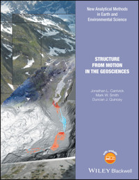
Cover image: Illustration of SfM -MVS workflow which progresses from multiple overlapping images to point cloud generation and usually then to differenced elevation model: in this case for detecting and analysing erosion and deposition in an alpine river © Jonathan Carrivick
Abbreviations
ALS
airborne laser scanning
DEM
digital elevation model
dGPS
differential Global Positioning System
DoD
DEM of difference
DSLR
digital single-lens reflex camera
EXIF
exchangeable image file format
Gb
gigabyte
LiDAR
light detection and ranging
MAE
mean absolute error
Mb
megabyte
NRSfM
non-rigid Structure from Motion
PMVS
patch-based multi-view stereo
RAM
random access memory
RANSAC
random sample consensus
RGB
red–green–blue
RMSE
root-mean-square error
SfM-MVS
Structure from Motion–Multi-View Stereo
Tb
terrabyte
TLS
terrestrial laser scanning
TS
total station
UAV
unmanned aerial vehicle
About the Companion Website
This book is accompanied by a companion website:
www.wiley.com/go/carrivick/structuremotiongeosciences
The website includes the following:
Videos
Figures and tables from the book for downloading
Interactive figures
1Introduction to Structure from Motion in the Geosciences
Abstract
Structure from Motion (SfM) is a topographic survey technique that has emerged from advances in computer vision and traditional photogrammetry. It can produce high-quality, dense, three-dimensional (3D) point clouds of a landform for minimal financial cost. As a topographic survey technique, SfM has only been applied to the geosciences relatively recently. Its flexibility, particularly in terms of the range of scales it can be applied to, makes it well suited to a field as diverse as the geosciences. This book is designed to act as a primer for scientists and environmental consultants working within the geosciences who are interested in using SfM or are seeking to understand more about the technique and its limitations. The early chapters consider SfM as a method within the context of other digital surveying techniques, and detail the SfM workflow, from both theoretical and practical standpoints. Later chapters focus on data quality and how to measure it using independent validation before looking in depth at the range of studies that have used SfM for geoscience applications to date. This book concludes with an outward look towards where the greatest areas of potential development are for SfM, summarising the main outstanding areas of research.
Keywords
geosciences; Structure from Motion; multi view stereo; GIS; landform
1.1 The Geosciences and Related Disciplines
Geoscience is a term that encompasses many disciplines of research and industry, particularly environmental consultancy. It is an umbrella term for climate, water and biogeochemical cycles, and planetary tectonics, which are the three basic processes that shape the Earth’s surface. These are complex natural systems in space and time. For example, process responses and interactions occur on spatial scales spanning hundreds of kilometres to microns, such as river catchments and abrasion marks on fluvially-transported grains, respectively. Process responses and interactions occur on timescales ranging from picoseconds for chemical reactions to millions of years for plate tectonics and biological evolution, respectively.
Whether academic or applied, whether large scale or small scale, the geosciences seek to understand the forces and factors that shape our world and the environments in which we live. Reasons for requiring understanding of these forces and factors span many remits: exploitation for the hydrocarbon and renewable energy sectors, managing natural hazards, managing a resource-consuming and dynamic society, mitigating effects of climate change, and academic interest and enquiry, for example.
In seeking ever-refined understanding for application to real-world problems, the geosciences now transcend “traditional” earth science disciplines (Fig. 1.1). The multidisciplinary nature of the geosciences is partly due to it having become particularly adept at pursuing interactions between the biological, chemical, and physical sciences. Analysis across these traditional boundaries is critical to understanding systems in an integrated and holistic manner.
Figure 1.1 A word cloud of geoscience sub-disciplines. The font size of each word does not indicate anything.
Furthermore, the geosciences are now established as being notable for embracing emerging and novel technologies and innovations. Indeed the revolution brought about by spatial analysis software such as geographical information systems (GIS) has been argued as a new paradigm in the discipline. Many technologies in the geosciences have been adapted from the military, from the petroleum industries, and more recently from computer science.
No matter what particular specialism to which they affiliate themselves, many geoscience disciplines will generally recognise three key tasks:
Recognition of spatial patterns
Documentation of transient landforms
Linking processes to products
Here it is important to note that in this book we use the term landform independent of any scale; the term as used in this book is considered to encompass landscape, terrain, feature, surface, and texture, for example.
A common requirement for each of these three key tasks is for the geosciences to have topographic information. The primary function of topographic information in digital format is to quantify landform variability and more specifically three-dimensional (3D) structure.
Topographic information can be used to identify landforms and landform properties. Landforms can include natural and artificial features and thus form part of the description of a specific place. When landforms are observed to change, the processes causing those changes are often inferred conceptually, and perhaps also tested by numerical models. New methods of acquiring topographic data with a fine spatial resolution are to be welcomed because they expose greater detail about landform morphology. They also provide an opportunity to match the scale of topographic data with the spatiotemporal scale of the landform or processes under investigation.
On the basis of the multidisciplinary nature of the geosciences and of the widespread academic and applied need for topographic survey data, we consider that this book, which will focus specifically on one specific method for generating topographic data, has relevance for all the geosciences (Fig. 1.1) and for related disciplines. Related disciplines requiring topographic information include architecture, archaeology, civil engineering and subdisciplines associated with built structures, objects, and artefacts, and biology and medicine where concerns range from vegetation to anatomical surveys.
1.2 Aim and Scope of this Book
The aim of this book is to describe an emerging survey method and workflow that is better established in related disciplines such as archaeology (e.g. De Reu et al. 2013) and cultural heritage (Koutsoudis et al. 2014) and is now finding widespread uptake in the geosciences, namely, “Structure from Motion” (SfM). This book is designed to act as a primer for geoscientists who are interested in using SfM or are seeking to understand more about the technique and its limitations.
This book is designed to appeal to students, professional academics, and industry practitioners, particularly environmental consultants. Whilst existing texts dealing with SfM are often heavily mathematical, originating commonly from computer vision literature, this book is designed to be fully accessible by an interested geoscience audience that may not necessarily be fully conversant in complex mathematical operations involved in SfM. Thus, the workflow of SfM is described in a predominantly qualitative manner, and the reader is referred elsewhere for further technical details. Important terms are in bold at first use, a list of abbreviations is provided, and emphases of particularly important properties are in italics. This book is designed to balance the conceptual discussion of application, theory, and technical details of analytical methods. Thereby this book serves as a synoptic reference to both inform and educate. In educating, we emphasise the discussion and development of a critical understanding of the application of SfM in the geosciences to date. In terms of informing, we build on this critical understanding to stimulate ideas for carefully considered future developments of the SfM workflow by the geosciences.
1.3 The Time and the Place
This book is timely and of immediate relevance because of (i) the emergence of an affordable, user-friendly software; (ii) rapid developments in unmanned aerial vehicles (UAVs) or drones and other potential SfM survey platforms; and (iii) a dearth of textbooks on SfM in the geosciences. Notwithstanding that, of course, the pace of technological change in hardware and software is incredibly rapid, and for that reason the forward-looking chapters of this book do not dwell on specific hypothetical applications but rather on major themes and concepts.
At present, the use of SfM can only really be evaluated in academic literature since technical and industry reports tend not to be listed on public databases. A search in the academic publications database Web of Knowledge for Structure from Motion (made in April 2015) delivered approximately 1000 records since the early 1980s (Fig. 1.2). Computer science was the category with the most counts of that phrase. Engineering was ranked 2nd and geosciences was ranked 9th. Notably, the geosciences have only started producing publications incorporating SfM in the past decade (Fig. 1.2).
Figure 1.2 Count of citations to “Structure from Motion” in the academic literature.
The impact of SfM is arguably going to be greater than that associated with the advent of airborne laser scanning (ALS) or airborne light detection and ranging (LiDAR), not least because SfM workflows democratise data collection and the development of fine-resolution 3D models at all scales of landscapes, landforms, surfaces, and textures. Moreover, to produce such advanced data products, very little input data are required: as little as a photograph set from an uncalibrated, compact (and therefore often cheap) camera. In a similar vein to airborne LiDAR surveys and terrestrial laser scanning (TLS) 15 and 10 years ago, respectively, the past couple of years have seen a raft of sessions at major international conferences describing work using SfM. This book places these developments in context, outlines the analytical framework and key issues, and presents 10 detailed case studies contributed by SfM practitioners.
This book fills a niche where there is a current dearth of textbooks on SfM for the geosciences. Although existing photogrammetry-orientated and computer vision-oriented texts will describe in depth many of the algorithms and procedures that SfM utilises, albeit in a modified or improved form to handle the input of dozens or hundreds of images, these texts are often extremely technical and may be largely inaccessible to the “average” geoscientist. The Wiley-published book series “New Analytical Methods in Earth and Environmental Science” has two other titles in that series that may be complementary to this book: Techniques for Virtual Palaeontology (Sutton et al. 2014) and a proposed Digital Outcrop Modelling. Both of these certainly fall within the geosciences domain and illustrate that geoscience usage of SfM is not just about terrain models.
1.4 What Is Structure from Motion?
Structure from Motion (also known as Structure-and-Motion) has developed since the 1980s into a valuable tool for generating 3D models from 2D imagery, not least with the development of software with graphical user interfaces (GUIs). Full details of the SfM workflow are provided in Chapter 3 but are summarised briefly here. In contrast to traditional photogrammetry, SfM uses algorithms to identify matching features in a collection of overlapping digital images and calculates camera location and orientation from the differential positions of multiple matched features. Based on these calculations overlapping imagery can be used to reconstruct a “sparse” or “coarse” 3D point cloud model of the photographed object or surface or scene. This 3D model from the SfM method is usually refined to a much finer resolution using Multi-View Stereo (MVS) methods, thereby completing the full SfM-MVS workflow. Whilst there is prevailing practice in the geosciences literature to abbreviate this workflow simply to SfM


