Terrestrial Water Cycle and Climate Change E-Book
149,99 €
Mehr erfahren.
- Herausgeber: John Wiley & Sons
- Kategorie: Wissenschaft und neue Technologien
- Serie: Geophysical Monograph Series
- Sprache: Englisch
The Terrestrial Water Cycle: Natural and Human-Induced Changes is a comprehensive volume that investigates the changes in the terrestrial water cycle and the natural and anthropogenic factors that cause these changes. This volume brings together recent progress and achievements in large-scale hydrological observations and numerical simulations, specifically in areas such as in situ measurement network, satellite remote sensing and hydrological modeling. Our goal is to extend and deepen our understanding of the changes in the terrestrial water cycle and to shed light on the mechanisms of the changes and their consequences in water resources and human well-being in the context of global change. Volume highlights include: * Overview of the changes in the terrestrial water cycle * Human alterations of the terrestrial water cycle * Recent advances in hydrological measurement and observation * Integrated modeling of the terrestrial water cycle The Terrestrial Water Cycle: Natural and Human-Induced Changes will be a valuable resource for students and professionals in the fields of hydrology, water resources, climate change, ecology, geophysics, and geographic sciences. The book will also be attractive to those who have general interests in the terrestrial water cycle, including how and why the cycle changes.
Sie lesen das E-Book in den Legimi-Apps auf:
Seitenzahl: 700
Veröffentlichungsjahr: 2016
Ähnliche


Table of Contents
Cover
Title Page
CONTRIBUTORS
PREFACE
ACKNOWLEDGMENTS
Part I: Overview of the Changes in the Terrestrial Water Cycle
1 Macroscale Hydrological Modeling and Global Water Balance
1.1. INTRODUCTION
1.2. COMPONENTS OF TERRESTRIAL HYDROLOGICAL CYCLES
1.3. GLOBAL WATER BALANCE IN EARLY ERA
1.4. MACROSCALE MODELING FOR WATER CYCLE IN NATURE
1.5. CLIMATE CHANGE AND HUMAN IMPACT
1.6. INTERNATIONAL COLLABORATION AND CAPACITY BUILDING
1.7. PROSPECTS FOR GLOBAL HYDROLOGY AND MODEL DEVELOPMENT
REFERENCES
2 Historical and Future Changes in Streamflow and Continental Runoff
2.1. INTRODUCTION
2.2. STREAMFLOW AND RUNOFF DATA
2.3. HISTORICAL CHANGES IN STREAMFLOW AND RUNOFF
2.4. MODEL‐PROJECTED FUTURE CHANGES IN RUNOFF AND STREAMFLOW
2.5. SUMMARY
ACKNOWLEDGMENTS
REFERENCES
3 Changes in the Global Terrestrial Water Cycle
3.1. INTRODUCTION
3.2. DEVELOPMENT OF LONG‐TERM RETROSPECTIVE WATER BUDGET DATA SET
3.3. ASSESSMENTS OF THE RETROSPECTIVE WATER BUDGET
3.4. CONCLUSIONS AND DISCUSSIONS
ACKNOWLEDGMENTS
REFERENCES
Part II: Human Alterations of the Terrestrial Water Cycle
4 Human‐Induced Changes in the Global Water Cycle
4.1. INTRODUCTION
4.2. MACROSCALE WATER MANAGEMENT MODELS AND INTERCOMPARISONS
4.3. GLOBAL CONSUMPTIVE USE OF WATER
4.4. RESERVOIR CONTRIBUTIONS TO GLOBAL LAND SURFACE WATER STORAGE VARIATIONS
4.5. CONCLUSIONS
ACKNOWLEDGMENTS
REFERENCES
5 Impacts of Groundwater Pumping on Regional and Global Water Resources
5.1. INTRODUCTION
5.2. HUMAN WATER USE AND GROUNDWATER PUMPING
5.3. DIRECT AND INDIRECT CLIMATE IMPACTS ON GROUNDWATER RESOURCES
5.4. GLOBAL AND REGIONAL ESTIMATES OF GROUNDWATER DEPLETION
5.5. GROUNDWATER DEPLETION AND SEA‐LEVEL RISE
5.6. FUTURE PROJECTIONS OF GROUNDWATER DEPLETION AND THE SUSTAINABILITY OF HUMAN WATER USE
5.7. A WAY FORWARD
REFERENCES
6 Land Use/Cover Change Impacts on Hydrology in Large River Basins
6.1. INTRODUCTION
6.2. EXAMINED VARIABLES
6.3. APPROACHES
6.4. LAND COVER CHANGE IMPACTS
6.5. OUTSTANDING ISSUES
6.6. CONCLUSIONS
ACKNOWLEDGMENTS
REFERENCES
Part III: Recent Advances in Hydrological Measurement and Observation
7 GRACE‐Based Estimates of Global Groundwater Depletion
7.1. INTRODUCTION
7.2. GLOBAL GROUNDWATER CHANGES
7.3. SUMMARY
7.4. DISCUSSION
ACKNOWLEDGMENTS
REFERENCES
8 Regional‐Scale Combined Land‐Atmosphere Water Balance Based on Daily Observations in Illinois
8.1. INTRODUCTION
8.2. DATA
8.3. THEORY AND METHODOLOGY
8.4. RESULTS
8.5. CONCLUSIONS
REFERENCES
Part IV: Integrated Modeling of the Terrestrial Water Cycle
9 Drivers of Change in Managed Water Resources
9.1. INTRODUCTION
9.2. MODELING FRAMEWORK
9.3. REGIONAL APPLICATION: DOMAIN, FORCING, AND EXPERIMENTAL APPROACH
9.4. APPLICATION IN THE CONTEXT OF GLOBAL CHANGE
9.5. DISCUSSION AND CONCLUSION
ACKNOWLEDGMENTS
REFERENCES
10 Modeling the Role of Vegetation in Hydrological Responses to Climate Change
10.1. INTRODUCTION
10.2. ADVANCES IN HYDROLOGICAL MODELING
10.3. MODEL EXPERIMENT
10.4. HYDROLOGICAL MODELING RESULTS
10.5. DISCUSSION AND CONCLUSIONS
ACKNOWLEDGMENTS
REFERENCES
11 Estimating Virtual Water Contents Using a Global Hydrological Model
11.1. INTRODUCTION
11.2. BASIS
11.3. APPLICATIONS: OBJECTIVE AND METHODS
11.4. RESULTS AND DISCUSSION
11.5. CONCLUSIONS
ACKNOWLEDGMENTS
REFERENCES
Index
End User License Agreement
List of Tables
Chapter 01
Table 1.1 Global Water Balance in mm yr
–1
by Different Studies
Chapter 04
Table 4.1 Parameterization of Human Impacts in the Hydrologic Models
Table 4.2 Comparisons of Previous Estimates (km
3
) about Irrigation Withdrawal, Irrigation Consumption, Total Withdrawal, and Total Consumption
Chapter 05
Table 5.1 Global Estimates of Groundwater Pumping (km
3
yr
–1
)
Table 5.2 Total and Nonrenewable Groundwater Abstraction (km
3
yr
–1
) over Major Groundwater Users for 1960, 2010, and 2099
Table 5.3 Comparison of Estimated Sectoral Water Use (Withdrawal and Consumption) to Other Estimates (km
3
yr
‐1
)
Chapter 06
Table 6.1 LUCC Impact Studies Reviewed and the Changes of Streamflow Metrics after LUCC
Chapter 07
Table 7.1 A Summary of the Amount of Groundwater Depletion for 10 Regions
Chapter 08
Table 8.1 The 10‐Year (2004–2013) Long‐Term Average of Precipitation, Soil Moisture (SM) at Top 175 cm, and GW Depth at the 12 ICN Stations
Table 8.2 The 10‐Year (2004–2013) Mean Annual Cycles and Interannual Variability of Precipitation, Evaporation, Runoff, Atmospheric Vapor Convergence, SM (0–175 cm), GW depth, and Precipitable Water
Chapter 09
Table 9.1 Correlation Coefficients between GCAM and USGS Based on State‐Level Water Demand Estimates by Sector
Table 9.2 Percent Change in Annual Discharge of the Simulated Regulated Flow with Respect to the Simulated Natural Discharge
Table 9.3 Relative Supply Deficit over the Three Regions of Interest and Future Periods
Table 9.4 Covariances of Supply Deficit with Inflow and Water Demand
Table 9.5 The Sensitivity Analysis of Water Resources with Respect to Changes in Natural Flow Demand
Chapter 11
Table 11.1 Major Countries Producing Four Crops in 2000
Table 11.2 List of Commodities and Their Yield Ratio, Price Ratio, and Content Ratio
Table 11.3 The Mean, Standard Deviation, and Slope of Precipitation and Potential and Actual Evapotranspiration for Four Crops
Table 11.4 The Mean, Standard Deviation, and Slope of Total, Green, and Blue Water Consumption for Four Crops
Table 11.5 The Mean, Standard Deviation, and Slope of Time Series of Crop Yield for Four Crops for the Globe and United States
Table 11.6 The Mean, Standard Deviation, and Slope of the Time Series of Virtual Water Contents for Four Crops
Table 11.7 Regions
List of Illustrations
Chapter 01
Figure 1.1 Global hydrological fluxes (1000 km
3
yr
–1
) and storages (1000 km
3
) with natural and anthropogenic cycles are synthesized from various sources. Vertical arrows show annual precipitation and evapotranspiration over ocean and land with major landscapes (1000 km
3
yr
–1
). Parentheses indicate the area (million km
2
)
Figure 1.2 Global distribution of long‐term (1979–2013) annual mean of (a) precipitation (mm yr
–1
) from the GPCC [
Schneider et al
., 2014], (b) evapotranspiration (mm yr
–1
), (c) runoff (mm yr
–1
), (d) river discharge (m
3
yr
–1
), (e) groundwater recharge (mm yr
–1
), and (f) soil wetness (‐) from off‐line hydrological simulations by Ensemble Land Surface Estimator (ELSE)
Figure 1.3 Global water balance and partitioning between the components of evapotranspiration (E
transp
: transpiration, E
canop
: interception‐loss, and E
soil
: evaporation from bare soil) and runoff (R
surf
: surface runoff, R
sub
: base flow) based on the estimation by
Kim and Oki
[2014].
Figure 1.4 Schematic diagram for (a) terrestrial water balance, (b) atmospheric water balance, and (c) combined atmosphere–land surface water balance corresponding to equations (1.1), (1.2), and (1.3), respectively
Figure 1.5 Atmospheric water balance approach using (a) annual vapor‐flux convergence (mm yr
–1
) from European Centre for Medium‐Range Weather Forecast (ECMWF) global analysis [
Hoskins
, 1989] based on
Oki et al
. [1995] to estimate (b) annual mean evapotranspiration (mm yr
–1
) for 1989–1992 as a residual of (a) and precipitation corresponding to the period.
Figure 1.6 Basinwise validation for a macroscale hydrological simulation using the gauged Global Runoff Data Center (GRDC) discharge and the observed TWSA by GRACE. It shows (a) seasonal variations of GRDC discharge (black solid line), simulated discharge (red solid line), and runoff without routing (gray dashed line); (b) seasonal variations of GRACE observed TWSA (black solid line), simulated TWSA with river storage (red solid line), simulated TWSA without river storage (gray dashed line), and the major water storage components in TWS; and (c) interannual variations of relative TWS: the GRACE observation (black dot), simulation with river storage (red solid line), and simulation without river storage (gray dashed line). Gray crosses and shade, green circles and shade, and blue triangles and shade in (b) and (c) represent the individual storage component of snow water, soil moisture, and river storage, respectively
Figure 1.7 (a) The ratio of blue water to the total evapotranspiration during a cropping period from irrigated cropland (the total of green and blue water). The ratios of (b) streamflow, (c) medium‐size reservoirs, and (d) nonrenewable and nonlocal blue‐water withdrawals to blue water
Chapter 02
Figure 2.1 Distributions of the 9009 GRDC stations with monthly streamflow data. Colors indicate the record ending years in (a) and the record length in years in (b)
Figure 2.2 Global runoff data base, temporal distribution of river discharge data. Time series of number stations with river discharge data included in the GRDC data base as of December 2013
Figure 2.3 Distribution of the farthest downstream gauge stations (dots) with varying length of record of streamflow available during 1948–2013 for world’s 925 largest rivers included in
Dai et al
. [2009].
Figure 2.4 Time series of yearly (October–September) mean streamflow rate (in km
3
yr
–1
) from observations (thick solid line) and estimated using basin‐mean PDSI or precipitation (thin solid line) at the farthest downstream station for world's first six largest rivers, with the river name (station name) shown on top of each panel. Also shown (dashed line) is the basin‐averaged precipitation anomaly (right ordinate, normalized by its standard deviation). The correlation
r
(D,P) between the thick solid and dashed lines is also shown.
Figure 2.5 Same as Figure 2.4, but for world's next largest rivers. Time series of yearly (October–September) mean streamflow rate (in km
3
yr
–1
) from observations (thick solid line) and estimated using basin‐mean PDSI or precipitation (thin solid line) at the farthest downstream station for world's second six largest rivers, with the river name (station name) shown on top of each panel. Also shown (dashed line) is the basin‐averaged precipitation anomaly (right ordinate, normalized by its standard deviation). The correlation
r
(D,P) between the thick solid and dashed lines is also shown.
Figure 2.6 Linear trends of yearly (October–September) streamflow during 1948–2012 for world's largest 200 rivers plotted as a function of the 1948–2012 mean flow rate of the corresponding river. The trend is expressed in percentage of the mean per decade, with the statistically significant trends (at 5% level) denoted by stars and insignificant ones by open circles. Only 55 of the 200 rivers show significant trends, with 26 of them being positive and 29 being negative.
Figure 2.7 (a) Long‐term (1949–2012) trends (in 0.1 mm/day per 50 years) of October–September mean runoff inferred from records of downstream river flow rates. Blank areas do not have runoff into the oceans or do not have enough observations. (b) Long‐term (1950–2012) trends (in 0.1mm/day per 50 years) of annual precipitation from rain gauge observations.
Figure 2.8 (a) Yearly time series of October–September mean total continental discharge (in Sv or 1 × 10
6
m
3
s
–1
, excluding that from Greenland and Antarctica) for 1949–2004 (thick solid line) estimated based on streamflow observations from 925 world's largest rivers [from
Dai et al
., 2009], and for 2005–2012 (thin solid line) estimated based on updated streamflow data for 264 of world's largest rivers and a linear regression with the think solid line. The dashed line is the October–September mean precipitation averaged over global (60
°
S–75
°
N) land areas. (b) Same as (a) except the dashed line is the Nino3.4 (170
°
W–120
°
W, 5
°
S–5
°
N) SST index.
Figure 2.9 Multimodel mean long‐term percentage changes from 1970–1999 to 2070–2099 (under a moderate RCP4.5 scenario) over land in annual (a) precipitation, (b) soil moisture content in the top 10 cm layer, (c) surface evapotranspiration, and (d) total runoff from 31–33 CMIP5 models. The stippling indicates at least 80% of the models agree on the sign of change. The change patterns are similar to those shown by
Collins et al
. [2013].
Figure 2.10 Multimodel ensemble averaged long‐term changes from 1970–1999 to 2070–2099 (under the moderate RCP4.5 scenario) over land in annual (a) sc_PDSI_pm, (b) potential evapotranspiration (PET) based on the Penman‐Monteith equation, (c) precipitation (P) vs. PET ratio (×100), and (d) runoff ratio (×100) estimated using data from the 14 CMIP5 models (12 for panel d). For reference, a sc_PDSI_pm value below –1 is considered drought and below –3 is considered severe to extreme drought for current climate [
Palmer
, 1965]. The sc_PDSI_pm and PET were computed for each model run and then averaged over the 14 models
Figure 2.11 Time series of the changes (in percentage of the 1950–1979 mean) in globally (60°S–75°N) averaged land annual precipitation (P, black line), total runoff (R, blue), evapotranspiration (ET, magenta), and runoff ratio (R/P, red). The 1950–1979 mean for the global land P, R, ET, and R/P are 2.340, 0.709, 1.690, and 0.303, respectively
Figure 2.12 Relative change (difference of future [2071–2100] and past [1971–2000], divided by past) in percentage of multimodel means of (a) long‐term mean stream flow (Qm), (b) high flow (Q5), and (c) low flow (Q95) under the RCP8.5 scenario. The flow rates were simulated by a high‐resolution river routing model forced by the daily runoff fields from 11 CMIP5 models, and the simulated flow rates were then averaged to derive the multimodel mean shown here
Chapter 04
Figure 4.1 Percentage of area equipped for irrigation
Figure 4.2 Estimated mean annual potential irrigation water consumption (km3 year–1), 1985–1999
Figure 4.3 (a) Mean annual (1985–1999) potential irrigation water consumption for the five models, and (b) coefficient of variation of the model means
Figure 4.4 Monthly mean global potential irrigation water consumption, 1985–1999
Figure 4.5 Ensemble mean monthly streamflow and evapotranspiration for naturalized and human impact simulations in the (a, b) Indus River basin and (c, d) Colorado River basin. Simulation results represent the control period (1971–2000), and the period representing a +2K global temperature rise compared to preindustrialized levels
Figure 4.6 Location of river basins and 166 simulated reservoirs (blue dots give reservoir capacities in km3)
Figure 4.7 Reservoir storage and variation range comparisons between model‐simulated and satellite‐estimated results for 23 global reservoirs
Figure 4.8 Simulated seasonal variation of reservoir storage compared with combined SWE and soil‐moisture storage variation for 32 major river basins.
Figure 4.9 Mean seasonal reservoir storage variations compared with seasonal SWE and soil moisture in five continents (a–e) and Northern (f) and Southern (g) Hemisphere.
Chapter 05
Figure 5.1 Conceptual representation of climate, groundwater, and pumping
Figure 5.2 Historical trends of global human water use and groundwater abstraction (1900–2010).
Figure 5.3 Present global human water use intensity (year 2010).
Figure 5.4 Present global groundwater abstraction rate (year 2010).
Figure 5.5 Global diffuse groundwater recharge from (a)
Döll and Fiedler
[2008] and (b)
Wada et al
. [2010], and the difference (a)–(b).
Figure 5.6 Global irrigation return flow to groundwater system.
Figure 5.7 Global groundwater depletion for the year 1960 and 2010.
Figure 5.8 Historical and future trends of global groundwater depletion rates.
Figure 5.9 Historical and future trends of the contribution of global groundwater depletion to sea‐level rise.
Figure 5.10 Global average nonsustainable water use (BlWSI) (dimensionless) for (a) surface water, (b) groundwater, and (c) the total at a subbasin scale (except Antarctica and Greenland; 1960–2010).
Figure 5.11 (a) Future global human water use intensity (year 2099) (million m
3
yr
‐1
) and (b) the relative change (%) from the present (2010) (Fig. 5.3) to the future (a).
Figure 5.12 Future trends of global human water use and groundwater abstraction.
Figure 5.13 Global average nonsustainable water use (BlWSI) (dimensionless) for (a) surface water, (b) groundwater, and (c) the total at a subbasin scale (except Antarctica and Greenland) (2069–2099).
Figure 5.14 Estimated trends of consumptive blue water use, surface water overabstraction, nonrenewable groundwater abstraction (km
3
yr
‐1
) (left y‐coordinate), and Blue Water Sustainability Indicator (BlWSI) (dimensionless) (right y‐coordinate) over the period 1960–2099.
Chapter 06
Figure 6.1 Scatter plots between (a) deforested coverage and relative annual streamflow change, (b) afforested coverage and relative annual streamflow change, (c) converted agricultural coverage and relative annual streamflow change, and (d) urbanized coverage and relative peak flow change.
Chapter 07
Figure 7.1 Eight aquifers reviewed in this study. (a) GRACE total water storage changes averaged from three data‐processing centers (The Center for Space Research [CSR], GeoForschungsZentrum [GFZ], and Jet Propulsion Laboratory [JPL]) with 24 months running average from 2003 to 2013; (b) sum of snow, soil moisture, and canopy water from four GLDAS models (including CLM, Mosaic, VIC, and Noah) simulations; (c) groundwater changes (GRACE minus GLDAS). The shaded colors indicate the one standard deviation uncertainty from three GRACE datasets and four GLDAS model outputs. Modified from
Famiglietti
[2014].
Chapter 08
Figure 8.1 (a) Location of 19 Illinois Climate Network (ICN) stations (circles); 12 of them used in this study with complete data coverage are marked in green. The 11 USGS streamflow stations are marked in black squares. (http://www.isws.illinois.edu/warm/weather/). (b) Time series of daily soil moisture (Sm) at top 175 cm and groundwater (GW) depth at 12 ICN stations and their state averages from 2004 to 2013.
Figure 8.2 The 2004–2013 daily time series of state‐average SM content at six depths with the blue solid lines denoting the corresponding long‐term (2004–2013) average.
Figure 8.3 The 2004–2013 monthly time series of state‐average convergence, precipitation, streamflow, SM at top 175 cm and GW depth with the blue solid lines denoting the corresponding long‐term (2004–2013) average.
Figure 8.4 GRACE‐derived land water storage variations in Illinois (2003–2013), the unit is mm/month. Comparisons between applying DDK filter versus applying 340 km Gaussian filter (GF) and P3M10 decorrelation (P3M10) for the data from four processing centers: CSR, GFZ, GRGS, and JPL. See the text for details.
Figure 8.5 Averaging kernels used in this study to obtain Illinois regional‐averaged total land water storage variations.
Figure 8.6 The comparison between the land water storage (TWS) using different soil depths in (a) monthly timescale, (b) annual mean, and (c) annual time series.
Figure 8.7 Monthly time series of the correction term for double counting in TWS derivation and GW depth (
H
). The 1.75 m level is denoted by the red solid line.
Figure 8.8 The comparison between the 10 yr (2004–2013) TWS from GRACE, derived TWS without correction for double counting, corrected TWS and TWS averaged among the 12 ICN stations (local) in (a) monthly timescale and (b) annual mean. The 1:1 relationship between corrected
TWS
and from GRACE is shown in (c).
Figure 8.9 The comparison between the land water storage change (
d
(
TWS
)/
dt)
, derived from GRACE and from
TWS
averaged among the 12 ICN stations (local) in (a) monthly timescale, (b) annual mean, and (c) annual time series.
Figure 8.10 The 10 yr (2004–2013) mean annual cycles and interannual variability of land water balance components (
P
: precipitation;
R
: runoff;
E
: evaporation;
d
(
TWS
)/
dt
: monthly change of
TWS
;
d
(
TWS
sm
)/
dt
: monthly change in SM storage; and
d
(
TWS
gm
)/
dt
: monthly change in GW storage).
Figure 8.11 The 10 yr (2004–2013) mean annual cycles and interannual variability of atmospheric water balance components (
P
: precipitation;
C
: convergence;
E
: evaporation;
dW
a
/
dt
: monthly change of precipitable water).
Figure 8.12 The 10 yr (2004–2013) mean annual cycles and interannual variability of combined water balance components (
C
: convergence;
R
: total runoff;
d
(
TWS
)/
dt
: monthly change of land water storage; and
dW
a
/
dt
: monthly change of precipitable water).
Figure 8.13 The comparison between the 10 yr (2004–2013)
C
reanalysis data (
C
raw
) and that derived from LWB approach using GRACE and in situ data in monthly timescale, annual mean cycle, and annual time series.
Figure 8.14 The comparison of different monthly
d
(
TWS
)/
dt
estimates: from LWB approach using GRACE and in situ data and from AWB approach using
C
reanalysis data in monthly timescale, annual mean cycle, and annual time series.
Figure 8.15 The comparison between the land water storage change,
d
(
TWS
)/
dt
, derived from daily and monthly averaged SM and
H
, using forward and backward differencing.
Figure 8.16 The comparison of different evaporation (
E
) estimates: from LWB approach using GRACE and in situ data and from AWB approach using convergence data in monthly timescale, annual mean cycle, and annual time series.
Figure 8.17 Plots of different evaporation (
E
) estimates: from LWB approach versus AWB approach and between LWB approach using GRACE and in situ data. The solid line is the 1:1 line and the dashed line denotes the best fit line by linear regression.
Chapter 09
Figure 9.1 Schematic of the system. The paper describes and evaluates the coupling of the water demand model with the water resources model (red). Publicly available datasets processed for the experiments are in grey. Models are in blue
Figure 9.2 Flow chart of the water resources model
Figure 9.3 GRanD reservoir database by type of operating rules over the three regions of the Midwest: Missouri, upper Mississippi, and Ohio. Flow is validated at the outlet of the three regions: Missouri at Hermann (06934500), upper Mississippi at Grafton (05587450), and Ohio at Metropolis (03611500)
Figure 9.4 Simulated natural (dashed) and regulated (solid) flow (left column) and relative change in flow due to regulation (right column) over the three midwestern regions: Missouri, upper Mississippi, and Ohio for the historical (1984–1999)
Figure 9.5 Time series of simulated historical and future (B1) mean annual regulated and natural flow for the outlets of the Missouri, upper Mississippi, and Ohio river basins
Figure 9.6 Average relative change in the future periods relative to the historical period for multiple variables for the Missouri, upper Mississippi, and Ohio river basins and the entire Midwest. Values for regulated flow, demand, and supply are indicated by the
y
‐axis on the left, and values for supply deficit are indicated by the
y
‐axis on the right.
Figure 9.7 Annual total water demand (left) and actual water supply (center) in cubic meters, and fractional water supply deficit for the historical and future periods for the B1 scenario
Figure 9.8 Covariances between supply deficit and natural flow (blue) and demand (red) for all three regions for different time periods and emission scenarios. Filled markers represent value statistically significant at 0.1 level. Actual values are presented in Table 9.4.
Figure 9.9 Elasticities of supply, supply deficit, and regulated flow with respect to changes in natural flow and demand, for 2030s, 2050s, and 2080s and A2 and B1 emissions scenarios, for the three regions and the Midwest.
Chapter 10
Figure 10.1 Evolution of hydrological model. (a) First generation: empirical and lumped models; (b) second generation: distributed hydrological models; (c) third generation: distributed biosphere‐hydrological model.
Figure 10.2 The GEO‐3 regions and the selected eight global basins.
Figure 10.3 Comparison of DBH monthly runoff and UNH/GRDC observations at selected global major basins during 1986–1995. Grey areas denote the standard deviation for each month during the period.
Figure 10.4 Differences of runoff between EXP1 and EXP2 (EXP2‐EXP1) for seasons and annual. MAM: spring, JJA: summer, SON: autumn, DJF: winter.
Figure 10.5 Differences (EXP2‐EXP1) of relative global runoff changes (%) in EXP1 and EXP2 versus increment of atmospheric CO
2
concentration during 2020–2050 compared to present day. Grey area denotes the ranges of the 25th and 75th values of relative runoff changes in global grids.
Figure 10.6 (a) Projected mean relative discharge changes during 2020–2050 with constant atmosphere CO
2
concentration (EXP1), and (b) the differences of annual mean discharge between the two experiments (EXP2‐EXP1).
Chapter 11
Figure 11.1 Annual precipitation (thick line), and potential and actual evapotranspiration (dotted and thin lines) that come in or go out from cropland of wheat, maize, rice, and soy for three major producing countries. (a)–(d) show the global average. (e)–(p) show the individual countries with the largest production.
Figure 11.2 Total (thick line), green (dotted line), and blue (thin line) water consumption for wheat, maize, rice, and soy for the globe and three major countries.
Figure 11.3 The crop yield of wheat, maize, rice, and soy for the globe and three major producing countries. Thick, dotted, and thin lines show GDHY [
Iizumi et al
., 2013], GDHY‐det, and H08 simulation, respectively. The numbers indicate the correlation coefficient of H08 with GDHY and GDHY‐det, respectively.
Figure 11.4 Virtual water contents of four crops for the globe and major producing countries. Thick, dotted, and thin lines show total, green, and blue VWC, respectively.
Figure 11.5 Spatial distributions of virtual water contents of total (green + blue) water for (a) maize, (b) rice, (c) soybean, and (d) wheat. The United States and China are subdivided into states and provinces, respectively.
Figure 11.6 Spatial distributions of virtual water contents of green water for (a) maize, (b) rice, (c) soybean, and (d) wheat.
Figure 11.7 Spatial distributions of virtual water contents of blue water for (a) maize, (b) rice, (c) soybean, and (d) wheat.
Figure 11.8 Global total trade flows among regions. The numbers shown on the arc are regions listed in Table 11.6. The beam indicates the flow; the beams on the right‐hand side of each arc indicate export (the beams are connected to the arc), and those on the left‐hand side are import (note the gap between the end of the beams and the arc). The area of the circle reflects the total volume of flows.
Figure 11.9 Global total virtual water flows among regions. See Figure 11.8 for details.
Figure 11.10 Global blue virtual water flows among regions. See Figure 11.8 for details.
Guide
Cover
Table of Contents
Begin Reading
Pages
ii
iii
iv
vii
viii
ix
xi
1
3
4
5
6
7
8
9
10
11
12
13
14
15
16
17
18
19
20
21
22
23
24
25
26
27
28
29
30
31
32
33
34
35
36
37
39
40
41
42
43
44
45
46
47
48
49
50
51
52
53
54
55
57
58
59
60
61
62
63
64
65
66
67
68
69
71
72
73
74
75
76
77
78
79
80
81
82
83
84
85
86
87
88
89
90
91
92
93
94
95
96
97
98
99
100
101
103
104
105
106
107
108
109
110
111
112
113
114
115
116
117
118
119
120
121
122
123
124
125
126
127
128
129
130
131
132
133
134
135
137
138
139
140
141
142
143
144
145
146
147
148
149
150
151
152
153
154
155
156
157
158
159
160
161
162
163
164
165
167
169
170
171
172
173
174
175
176
177
178
179
180
181
182
183
184
185
186
187
188
189
190
191
193
194
195
196
197
198
199
200
201
202
203
204
205
206
207
208
209
210
211
212
213
214
215
216
217
218
219
220
221
222
223
224
225
226
227
228
229
230
231
232
233
234
235
236
237
238
Geophysical Monograph Series
175 A Continental Plate Boundary: Tectonics at South Island, New Zealand
David Okaya, Tim Stem, and Fred Davey (Eds.)
176 Exploring Venus as a Terrestrial Planet
Larry W. Esposito, Ellen R. Stofan, and Thomas E. Cravens (Eds.)
177 Ocean Modeling in an Eddying Regime
Matthew Hecht and Hiroyasu Hasumi (Eds.)
178 Magma to Microbe: Modeling Hydrothermal Processes at Oceanic Spreading Centers
Robert P. Lowell, Jeffrey S. Seewald, Anna Metaxas, and Michael R. Perfit (Eds.)
179 Active Tectonics and Seismic Potential of Alaska
Jeffrey T. Freymueller, Peter J. Haeussler, Robert L. Wesson, and Göran Ekström (Eds.)
180 Arctic Sea Ice Decline: Observations, Projections, Mechanisms, and Implications
Eric T. DeWeaver, Cecilia M. Bitz, and L.‐Bruno Tremblay (Eds.)
181 Midlatitude Ionospheric Dynamics and Disturbances
Paul M. Kintner, Jr., Anthea J. Coster, Tim Fuller‐Rowell, Anthony J. Mannucci, Michael Mendillo, and Roderick Heelis (Eds.)
182 The Stromboli Volcano: An Integrated Study of the 2002–2003 Eruption
Sonia Calvari, Salvatore Inguaggiato, Giuseppe Puglisi, Maurizio Ripepe, and Mauro Rosi (Eds.)
183 Carbon Sequestration and Its Role in the Global Carbon Cycle
Brian J. McPherson and Eric T. Sundquist (Eds.)
184 Carbon Cycling in Northern Peatlands
Andrew J. Baird, Lisa R. Belyea, Xavier Comas, A. S. Reeve, and Lee D. Slater (Eds.)
185 Indian Ocean Biogeochemical Processes and Ecological Variability
Jerry D. Wiggert, Raleigh R. Hood, S. Wajih A. Naqvi, Kenneth H. Brink, and Sharon L. Smith (Eds.)
186 Amazonia and Global Change
Michael Keller, Mercedes Bustamante, John Gash, and Pedro Silva Dias (Eds.)
187 Surface Ocean–Lower Atmosphere Processes
Corinne Le Quèrè and Eric S. Saltzman (Eds.)
188 Diversity of Hydrothermal Systems on Slow Spreading Ocean Ridges
Peter A. Rona, Colin W. Devey, Jérôme Dyment, and Bramley J. Murton (Eds.)
189 Climate Dynamics: Why Does Climate Vary?
De‐Zheng Sun and Frank Bryan (Eds.)
190 The Stratosphere: Dynamics, Transport, and Chemistry
L. M. Polvani, A. H. Sobel, and D. W. Waugh (Eds.)
191 Rainfall: State of the Science
Firat Y. Testik and Mekonnen Gebremichael (Eds.)
192 Antarctic Subglacial Aquatic Environments
Martin J. Siegert, Mahlon C. Kennicut II, and Robert A. Bindschadler
193 Abrupt Climate Change: Mechanisms, Patterns, and Impacts
Harunur Rashid, Leonid Polyak, and Ellen Mosley‐Thompson (Eds.)
194 Stream Restoration in Dynamic Fluvial Systems: Scientific Approaches, Analyses, and Tools
Andrew Simon, Sean J. Bennett, and Janine M. Castro (Eds.)
195 Monitoring and Modeling the Deepwater Horizon Oil Spill: A Record‐Breaking Enterprise
Yonggang Liu, Amy MacFadyen, Zhen‐Gang Ji, and Robert H. Weisberg (Eds.)
196 Extreme Events and Natural Hazards: The Complexity Perspective
A. Surjalal Sharma, Armin Bunde, Vijay P. Dimri, and Daniel N. Baker (Eds.)
197 Auroral Phenomenology and Magnetospheric Processes: Earth and Other Planets
Andreas Keiling, Eric Donovan, Fran Bagenal, and Tomas Karlsson (Eds.)
198 Climates, Landscapes, and Civilizations
Liviu Giosan, Dorian Q. Fuller, Kathleen Nicoll, Rowan K. Flad, and Peter D. Clift (Eds.)
199 Dynamics of the Earth’s Radiation Belts and Inner Magnetosphere
Danny Summers, Ian R. Mann, Daniel N. Baker, and Michael Schulz (Eds.)
200 Lagrangian Modeling of the Atmosphere
John Lin (Ed.)
201 Modeling the Ionosphere‐Thermosphere
Jospeh D. Huba, Robert W. Schunk, and George V Khazanov (Eds.)
202 The Mediterranean Sea: Temporal Variability and Spatial Patterns
Gian Luca Eusebi Borzelli, Miroslav Gacic, Piero Lionello, and Paola Malanotte‐Rizzoli (Eds.)
203 Future Earth ‐ Advancing Civic Understanding of the Anthropocene
Diana Dalbotten, Gillian Roehrig, and Patrick Hamilton (Eds.)
204 The Galápagos: A Natural Laboratory for the Earth Sciences
Karen S. Harpp, Eric Mittelstaedt, Noémi d’Ozouville, and David W. Graham (Eds.)
205 Modeling Atmospheric and Oceanic Flows: Insightsfrom Laboratory Experiments and Numerical Simulations
Thomas von Larcher and Paul D. Williams (Eds.)
206 Remote Sensing of the Terrestrial Water Cycle
Venkat Lakshmi (Eds.)
207 Magnetotails in the Solar System
Andreas Keiling, Caitríona Jackman, and Peter Delamere (Eds.)
208 Hawaiian Volcanoes: From Source to Surface
Rebecca Carey, Valerie Cayol, Michael Poland, and Dominique Weis (Eds.)
209 Sea Ice: Physics, Mechanics, and Remote Sensing
Mohammed Shokr and Nirmal Sinha (Eds.)
210 Fluid Dynamics in Complex Fractured‐Porous Systems
Boris Faybishenko, Sally M. Benson, and John E. Gale (Eds.)
211 Subduction Dynamics: From Mantle Flow to Mega Disasters
Gabriele Morra, David A. Yuen, Scott King, Sang Mook Lee, and Seth Stein (Eds.)
212 The Early Earth: Accretion and Differentiation
James Badro and Michael Walter (Eds.)
213 Global Vegetation Dynamics: Concepts and Applications in the MC1 Model
Dominique Bachelet and David Turner (Eds.)
214 Extreme Events: Observations, Modeling and Economics
Mario Chavez, Michael Ghil, and Jaime Urrutia‐Fucugauchi (Eds.)
215 Auroral Dynamics and Space Weather
Yongliang Zhang and Larry Paxton (Eds.)
216 Low‐Frequency Waves in Space Plasmas
Andreas Keiling, Dong‐Hun Lee, and Valery Nakariakov (Eds.)
217 Deep Earth: Physics and Chemistry of the Lower Mantle and Core
Hidenori Terasaki and Rebecca A. Fischer (Eds.)
218 Integrated Imaging of the Earth: Theory and Applications
Max Moorkamp, Peter G. Lelievre, Niklas Linde, and Amir Khan (Eds.)
219 Plate Boundaries and Natural Hazards
Joao Duarte and Wouter Schellart (Eds.)
220 Ionospheric Space Weather: Longitude and Hemispheric Dependences and Lower Atmosphere Forcing
Timothy Fuller‐Rowell, Endawoke Yizengaw, Patricia H. Doherty, and Sunanda Basu (Eds.)
Geophysical Monograph 221
Terrestrial Water Cycle and Climate Change
Natural and Human‐Induced Impacts
Qiuhong Tang
Taikan Oki
Editors
This Work is a copublication of the American Geophysical Union and John Wiley and Sons, Inc.
This Work is a copublication of the American Geophysical Union and John Wiley & Sons, Inc.
Published under the aegis of the AGU Publications Committee
Brooks Hanson, Director of PublicationsRobert van der Hilst, Chair, Publications Committee
© 2016 by the American Geophysical Union, 2000 Florida Avenue, N.W., Washington, D.C. 20009For details about the American Geophysical Union, see www.agu.org.
Published by John Wiley & Sons, Inc., Hoboken, New JerseyPublished simultaneously in Canada
No part of this publication may be reproduced, stored in a retrieval system, or transmitted in any form or by any means, electronic, mechanical, photocopying, recording, scanning, or otherwise, except as permitted under Section 107 or 108 of the 1976 United States Copyright Act, without either the prior written permission of the Publisher, or authorization through payment of the appropriate per‐copy fee to the Copyright Clearance Center, Inc., 222 Rosewood Drive, Danvers, MA 01923, (978) 750‐8400, fax (978) 750‐4470, or on the web at www.copyright.com. Requests to the Publisher for permission should be addressed to the Permissions Department, John Wiley & Sons, Inc., 111 River Street, Hoboken, NJ 07030, (201) 748‐6011, fax (201) 748‐6008, or online at http://www.wiley.com/go/permissions.
Limit of Liability/Disclaimer of Warranty: While the publisher and author have used their best efforts in preparing this book, they make no representations or warranties with respect to the accuracy or completeness of the contents of this book and specifically disclaim any implied warranties of merchantability or fitness for a particular purpose. No warranty may be created or extended by sales representatives or written sales materials. The advice and strategies contained herein may not be suitable for your situation. You should consult with a professional where appropriate. Neither the publisher nor author shall be liable for any loss of profit or any other commercial damages, including but not limited to special, incidental, consequential, or other damages.
For general information on our other products and services or for technical support, please contact our Customer Care Department within the United States at (800) 762‐2974, outside the United States at (317) 572‐3993 or fax (317) 572‐4002.
Wiley also publishes its books in a variety of electronic formats. Some content that appears in print may not be available in electronic formats. For more information about Wiley products, visit our web site at www.wiley.com.
Library of Congress Cataloging‐in‐Publication data is available.
ISBN: 978‐1‐118‐97176‐5
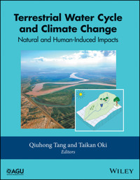
Cover images: The main image shows the irrigation area of Jungar Banner along the Yellow River, as photographed by Genwan Li. The inset image gives the schematic figure of the Distributed Biosphere‐Hydrological (DBH) model. More details on the DBH model are given in Chapter 10.
CONTRIBUTORS
Lan CuoCenter for Excellence in Tibetan Plateau Earth SciencesKey Laboratory of Tibetan Environment Changes and Land Surface ProcessesInstitute of Tibetan Plateau Research, Chinese Academy of SciencesBeijing, China
Aiguo DaiDepartment of Atmospheric and Environmental Sciences, University at Albany, SUNYAlbany, New York, USA; andNational Center for Atmospheric Research (NCAR),Boulder, Colorado, USA
James S. FamigliettiNASA Jet Propulsion Laboratory, California Institute of TechnologyPasadena, California, USA; andDepartment of Earth System Science, Department of Civil and Environmental Engineering University of CaliforniaIrvine, California, USA
Ingjerd HaddelandDepartment of HydrologyNorwegian Water Resources and Energy DirectorateOslo, Norway
Naota HanasakiNational Institute for Environmental StudiesTsukuba, Japan
Mohamad I. HejaziJoint Global Change Research Institute, Pacific Northwest National Laboratory, andUniversity of Maryland, College Park, Maryland, USA
Hyungjun KimInstitute of Industrial Science, The University of TokyoTokyo, Japan
Guoyong LengKey Laboratory of Water Cycle and Related Land Surface ProcessesInstitute of Geographical Sciences and Natural Resources ResearchChinese Academy of SciencesBeijing, China
Dennis P. LettenmaierDepartment of Geography, University of CaliforniaLos Angeles, California, USA
Lai‐Yung R. LeungPacific Northwest National LaboratoryRichland, Washington, USA
Xingcai LiuKey Laboratory of Water Cycle and Related Land Surface ProcessesInstitute of Geographical Sciences and Natural Resources ResearchChinese Academy of SciencesBeijing, China
Min‐Hui LoDepartment of Atmospheric Sciences, National Taiwan UniversityTaipei, Taiwan
Bart NijssenDepartment of Civil and Environmental EngineeringUniversity of WashingtonSeattle, Washington, USA
Taikan OkiInstitute of Industrial Science, The University of TokyoTokyo, Japan
Ming PanDepartment of Civil and Environmental EngineeringPrinceton UniversityPrinceton, New Jersey, USA
John T. ReagerNASA Jet Propulsion Laboratory, California Institute of TechnologyPasadena, California, USA
Matthew RodellHydrological Sciences Laboratory, NASA Goddard Space Flight CenterGreenbelt, Maryland, USA
Sean SwensonClimate and Global Dynamics Laboratory, National Center for Atmospheric ResearchBoulder, Colorado, USA
Qiuhong TangKey Laboratory of Water Cycle and Related Land Surface ProcessesInstitute of Geographical Sciences and Natural Resources ResearchChinese Academy of SciencesBeijing, China
Nathalie VoisinPacific Northwest National LaboratoryRichland, Washington, USA
Yoshihide WadaNASA Goddard Institute for Space StudiesNew York, USA;Center for Climate Systems Research, Columbia University, New York, USA;Department of Physical GeographyFaculty of Geosciences, Utrecht UniversityUtrecht, The Netherlands; andInternational Institute for Applied Systems AnalysisLaxenburg, Austria
Wen‐Ying WuDepartment of Atmospheric Sciences National Taiwan UniversityTaipei, Taiwan
Pat J.‐F. YehDepartment of Civil and Environmental EngineeringNational University of Singapore (NUS)Singapore
Xuejun ZhangKey Laboratory of Water Cycle and Related Land Surface ProcessesInstitute of Geographical Sciences and Natural Resources ResearchChinese Academy of Sciences; andUniversity of Chinese Academy of SciencesBeijing, China
Tian ZhouDepartment of Civil and Environmental EngineeringUniversity of WashingtonSeattle, Washington, USA; Now at Pacific Northwest National LaboratoryRichland, Washington, USA
PREFACE
Water is a vital resource for human well‐being and ecosystem functioning. The water cycle describes the storage and movement of water on, above, and below the surface of the Earth. Through countless interactions within the Earth system, the water cycle plays a crucial role in the physical, biological, and chemical processes of the planet. The terrestrial water cycle is of paramount importance because it continuously renews water supply for societal and ecological well‐being.
Over the past few decades, the terrestrial water cycle has experienced an unprecedented degree of change. Many of the rivers at the middle latitudes have dried up, whereas river discharge across the Eurasian pan‐Arctic has significantly increased and changed in the seasonality. In the managed river basins, regulated stream flow has become the new normal: a shift with profound implications for our water supply. The complex change is driven by factors such as the internal variability in the climate system, anthropogenic climate change, and widespread human disturbances.
A better understanding of the change in the terrestrial water cycle is crucial for humans to adapt to the changing environment, and is essential for improved water management to meet society’s needs. In the era of the Anthropocene, when human activities are changing the atmospheric and hydrological processes, there is an urgent need for scientists to study not only the natural terrestrial water cycle, but also how humans are increasingly changing it. Investigating the human‐altered terrestrial water cycle and assessing the implications of the change in the cycle for society are a major focus of research in hydrology, water resources, climate change, sustainability, and development.
Several advances have made the study that focuses on the change in the terrestrial water cycle possible. The technological advances in Earth observation produce fairly long‐term water‐related data needed for characterizing the change in the terrestrial water cycle with unprecedented spatial coverage. The advances in land surface hydrological modeling started to build dynamic connections between hydrology and other components of the Earth system. The models with explicit representation of anthropogenic manipulations can simulate the terrestrial water cycle more realistically. The emerging hydrological data and tools have been used to quantify the water cycle change, identify the impact factors of the change, predict future change, and assess the implications of the change in water management and hazard mitigation. These advances not only deepen our understanding of the terrestrial water cycle, but also contribute to the development of sustainable adaptation strategies for water management.
The objectives of the book are to extend and deepen our understanding of the change in the terrestrial water cycle, and to shed light on the mechanisms of the change and the consequences of the change in water resources and human well‐being in the context of global change. This book provides a comprehensive overview and presents the state‐of‐the‐art technology and sciences developed and acquired in the study of the terrestrial water cycle change and the natural and human‐induced impacts. The book brings together recent progress and achievements in large‐scale hydrological observations and numerical simulations, specifically in areas such as in situ measurement network, satellite remote sensing, and hydrological modeling.
The book contains four parts. Part I presents an overview of the changes in the terrestrial water cycle. It illustrates the global picture of the past and current changes and potential future change under the global warming. Part II covers the human alterations of the terrestrial water cycle. The human influence is highlighted by focusing on various kinds of human activities such as water impoundment, withdrawals, groundwater pumping, and land use/cover change. Part III demonstrates the recent advances in hydrological measurement and observation. Examples from regional and global studies are chosen to show how to apply the advanced satellite remote sensing and ground observation network to quantify hydrological changes. Part IV addresses new achievements in the integrated modeling of the terrestrial water cycle. These modeling efforts integrate knowledge from various aspects in the Earth system to expand and deepen our understanding in the nexus of water, climate, and society.
I hope this book will give the reader clear pictures of the large‐scale changes in the terrestrial water cycle, and of the data and tools that are being used to study the natural and human‐induced impacts on the cycle. I further hope that the attribution of the change will be an open source of inspirations for study on human, water, and climate interactions.
Qiuhong Tang
ACKNOWLEDGMENTS
Dr. Tang would like to thank the reviewers who donated their time to review the chapters and Dr. Oki who agreed to co‐edit this book. Thanks also to the Natural Science Foundation of China (NSFC) that funded him to write, edit, and engage with the various authors to make this book a reality (Grant No. 41425002). He also extends his thanks to Rituparna Bose and Mary Grace Hammond at John Wiley & Sons, Inc., for smoothly and professionally handling all aspects of the book production process.
Part IOverview of the Changes in the Terrestrial Water Cycle
1Macroscale Hydrological Modeling and Global Water Balance
Taikan Oki and Hyungjun Kim
Institute of Industrial Science, The University of Tokyo, Tokyo, Japan
ABSTRACT
An overview of the global hydrological cycle, and recent achievements in macroscale modeling are given. Major components of fluxes and storages in the global hydrological cycle are described and quantitatively illustrated based on an off‐line simulation framework. Methodologies for estimating fluxes and storage changes are presented from the simple water balance concept to the state‐of‐the‐art numerical models that are capable of incorporating anthropogenic impacts. Efforts made by international research communities on global‐scale hydrologic modeling are introduced. Current situations of modeling, research opportunities, and gaps in global hydrology are also identified.
1.1. INTRODUCTION
“Blue Planet” is a frequently used term to describe the Earth, as approximately 70% of its surface is covered by water. Although the water mass constitutes only 0.02% of the total mass of the planet (5.974 × 1024 kg), it is a critical matter for all organisms including humans in their survival [Oki et al., 2004]. Also, its availability has largely affected civilizations in both culture and economy in human history. Therefore, to ensure adequate fresh water supply is essential for human well‐being.
The Earth's surface is dominated by various forms of water. The total volume of water on the Earth is estimated to be approximately 1.4 × 10¹⁸ m3, which corresponds to a mass of 1.4 × 10²¹ kg. The global hydrologic cycle always includes the oceanic circulation. The proportion of water in the ocean is large (96.5%). Oceanic circulations carry large amounts of energy and water. The surface ocean currents are driven by surface wind stresses, and the atmosphere itself is sensitive to the sea surface temperature. Temperature and salinity together determine the density of ocean water, and both factors contribute to the overturning and the ocean general circulation. Some terrestrial areas are covered by freshwater (lakes and rivers), solid water (ice and snow), and vegetations (which imply the existence of water). Even though the water content of the atmosphere is relatively small (approximately 0.3% by mass and 0.5% by volume), 0.68 (±0.03)% of the area above the Earth is always covered by clouds when considering clouds with optical depth > 0.1 [Stubenrauch et al., 2013].
Water on the Earth is stored in various reservoirs, and water flows from one to another. Water flow per unit time is also called water flux. To understand the global water cycle, the quantification of fluxes and storages with the associated processes is necessary. Figure 1.1 schematically illustrates various water storages and fluxes in the global hydrologic system [revised from Oki and Kanae, 2006].
Figure 1.1 Global hydrological fluxes (1000 km3 yr–1) and storages (1000 km3) with natural and anthropogenic cycles are synthesized from various sources. Vertical arrows show annual precipitation and evapotranspiration over ocean and land with major landscapes (1000 km3 yr–1). Parentheses indicate the area (million km2)
[from Oki and Kanae, 2006].
The objective of this chapter is to give a brief overview of research approaches for global water‐balance estimation. To provide basic background of the water cycle, in Section 1.2, major components of terrestrial hydrologic processes are briefly explained with quantitative estimations using a global off‐line simulation. From Section 1.3 to Section 1.5, the major methodologies for water‐balance estimations are described. An early estimation that used reanalysis data set and a simple water‐balance equation is introduced, and the development of the model‐based macroscale land simulation framework and recent achievements to consider the human impact are covered. Section 1.6 introduces how the science communities have organized international collaborative frameworks. As the last part, prospects for macroscale hydrologic model development in the near future are given in Section 1.7.
1.2. COMPONENTS OF TERRESTRIAL HYDROLOGICAL CYCLES
Precipitation is the water flux from the atmosphere to the land or the ocean surface. It drives the hydrological cycle over the land surface and also changes the ocean surface physical properties (i.e., salinity and temperature), which affect its thermohaline circulation. It is intercepted by vegetation canopy, and the amount exceeding the interception storage reaches the land surface as throughfall. Compared to the other major hydrological fluxes, precipitation behaves in a more variable, intermittent, and concentrated way in time and space. Despite dense gauge station networks, such a highly inhomogeneous spatiotemporal variability makes the observation of precipitation and the aggregation of the process complicated and challenging. In a hybrid product, such as Global Precipitation Climatology Project (GPCP) [Huffman et al., 1997], satellite‐based estimates are merged with in situ observational data to fill the observational gaps. Global distribution of precipitation is presented in Figure 1.2a.
Figure 1.2 Global distribution of long‐term (1979–2013) annual mean of (a) precipitation (mm yr–1) from the GPCC [Schneider et al., 2014], (b) evapotranspiration (mm yr–1), (c) runoff (mm yr–1), (d) river discharge (m3 yr–1), (e) groundwater recharge (mm yr–1), and (f) soil wetness (‐) from off‐line hydrological simulations by Ensemble Land Surface Estimator (ELSE)
[Kim and Oki, 2014].
Snow has special characteristics compared to rain which refers to the liquid phase of precipitation. When snow accumulates, the surface temperature keeps 0 °C or below until the completion of snow melt. The albedo of new snow can be as high as cloud albedo, and it varies between 0.6 and 0.9 in the aging process (covered with dust). Consequently, the existence of snow significantly changes the surface budget of energy and water. A snow surface typically reduces the aerodynamic roughness, so that it may also have a dynamic effect on the atmospheric circulation and associated local and remote hydrologic cycles.
Evapotranspiration, consisting of evaporation and transpiration, is the flow of water and latent heat energy returning from the surface to the atmosphere. The amount of evaporation is determined by both atmospheric and hydrological conditions. Wetness at the surface influences the partition between latent and sensible heat significantly. The ratio of actual evaporation to potential evaporation is reduced due to drying stress near the surface. The stress is sometimes formulated as a resistance under which evaporation is classified as hydrology‐driven (soil‐controlled). If the land surface is wet enough compared to available energy for evaporation, the condition is classified as radiation driven (atmosphere controlled).
Transpiration is the release of water vapor from the stomata of leaves. It is distinguished from evaporation from soil surfaces in two aspects. One is that the resistance of stomata does not relate only to the soil dryness but also to the physiological conditions of vegetation through the opening and closing of stomata. The other is that roots can transfer water from deeper soil layers in contrast to evaporation over bare soil. Vegetation also modifies the balance of surface energy and water by altering surface albedo and by intercepting and evaporating a part of precipitation. The global distribution of total evapotranspiration is shown in Figure 1.2b.
Runoff (Fig. 1.2c) carries water back to the ocean from the land. Without rivers, global hydrologic cycles on the Earth are not closed. Runoff into the ocean also plays a role in the freshwater balance and the salinity of the ocean. Rivers carry not only water but also sediments, chemicals, and various nutrient materials from continents to seas. Runoff at the hillslope scale is a nonlinear and complex process. Surface runoff can be generated when the intensity of rainfall or snowmelt exceeds the infiltration capacity of the soil (Hortonian runoff), or when rain falls on the saturated land surface (Dunne runoff).
Saturation at the land surface mostly occurs along the hill slopes according to the topographic concentration mechanism. Infiltrated water in the upper part of the hill slope flows down the slope and discharges at the bottom of the hill. Because of the high heterogeneity of topography, soil properties (such as hydraulic conductivity and porosity), and precipitation, basic equations such as Richard’s equation, which can be valid fairly well at a point scale or hillslope scale, cannot be directly applied in the macroscale using the mean quantities because of the nonlinearity involved. The river discharge accumulates total runoff generated in upstream watershed. The global distributions of runoff and river discharge are illustrated in Figure 1.2c and d.
Groundwater is the subsurface water in the saturated zone. It contributes to the runoff in the low‐flow regime between storm events, that is, during a dry spell. Deep groundwater may also reflect the long‐term climatological condition. The groundwater quantity in Figure 1.1 considers both gravitational and capillary water, but groundwater in Antarctica (roughly estimated as 2 × 10⁶ km3) is excluded. Gravitational water is the water in the unsaturated zone (vadose zone), which moves downward by gravity. Capillary water is the water that moves upward due to capillary diffusion. Implementing macroscale groundwater dynamics, Koirala [2010] estimated groundwater recharge flux as 31,789 km3 yr–1, which is close to the flux of subsurface runoff in Figure 1.1 (30,200 km3 yr–1). The global distribution of model‐simulated groundwater recharge is illustrated in Figure 1.2e.
The global distribution of soil wetness is shown in Figure 1.2f. Soil moisture is the water being held above the groundwater table. It influences the energy balance at the land surface by affecting evapotranspiration (which consists of soil evaporation, plant transpiration, and interception loss) and changing surface albedo. Soil moisture also alters the fraction of precipitation partitioned into direct runoff and infiltration. When the temperature of the soil column keeps at or below 0 °C for more than two consecutive years, the condition is called permafrost. During the summer season, the upper part of the soil column thaws and the melting water infiltrates downward, but the permafrost layer is still impermeable like a bedrock. Figure 1.3 indicates the global estimation of evapotranspiration and runoff. Approximately one third of precipitation turns to runoff and one third of the runoff is estimated to be surface runoff. The shares of transpiration, canopy infiltration, and bare soil evaporation are close on global average.
Figure 1.3 Global water balance and partitioning between the components of evapotranspiration (Etransp: transpiration, Ecanop: interception‐loss, and Esoil: evaporation from bare soil) and runoff (Rsurf: surface runoff, Rsub: base flow) based on the estimation by Kim and Oki [2014].
Major reserves other than the ocean are solid waters on the continent, including glaciers and permanent snow cover. Glaciers are ice accumulations originated from the atmosphere, and they move slowly on land over a long time period. Glaciers form U‐shaped valleys over land and leave moraine deposits when they retreat. If a glacier “flows” into an ocean, it often turns into an iceberg. Glaciers evolve in a relatively longer timescale in comparison to climatic change. They can also induce isostatic responses of continental‐scale upheavals or subsidence in even longer timescales. Even though it was believed that the thermal expansion of oceanic water dominated the anticipated sea level rise due to global warming, glaciers over land are also a major concern as the cause of sea level rise associated with global warming in the coming decades.
1.3. GLOBAL WATER BALANCE IN EARLY ERA
The 1980s was the dawn of four‐dimensional data assimilation (4DDA) of the global atmosphere. Oki et al. [1995] were one of the first to demonstrate the potential capability of 4DDA data to estimate terrestrial water balances using global precipitation observations and large basin river discharges based on the atmospheric water balance (AWB) method. Water balance over land and combined water balance are schematically illustrated in Figure 1.4.
Figure 1.4 Schematic diagram for (a) terrestrial water balance, (b) atmospheric water balance, and (c) combined atmosphere–land surface water balance corresponding to equations (1.1), (1.2), and (1.3), respectively
[Oki et al., 1995].
The water balance over land is described as equation (1.1) where P, E, R, and S are precipitation, evapotranspiration, runoff, and terrestrial water storage, respectively, within an arbitrary boundary as illustrated in Figure 1.4a:
Atmospheric water vapor flux convergence contains water balance information in addition to the traditional hydrological elements such as precipitation, evapotranspiration, and discharge. The basic concepts as well as the application of atmospheric data to estimate terrestrial water balance were first presented by Starr and Peixöto [1958]. The atmospheric water balance for a column of atmosphere from the bottom at land surface to the top of the atmosphere is described by the equation,
where W represents the precipitable water (i.e., column integrated water vapor), and Q is the water vapor flux convergence in the atmosphere (Fig. 1.5a); all fluxes given in the unit volume of per time step). Since the atmospheric water content in both solid and liquid phases is generally small, only the water vapor is considered in equation (1.2). Figure 1.4b shows that the water storage in an atmospheric column is increased by the lateral convergence of water vapor and evapotranspiration from the bottom of the column (i.e., land surface), and decreases due to the precipitation falling from the bottom of the atmosphere column to the land.
Figure 1.5 Atmospheric water balance approach using (a) annual vapor‐flux convergence (mm yr–1) from European Centre for Medium‐Range Weather Forecast (ECMWF) global analysis [Hoskins, 1989] based on Oki et al. [1995] to estimate (b) annual mean evapotranspiration (mm yr–1) for 1989–1992 as a residual of (a) and precipitation corresponding to the period.
Since there are common terms in equations (1.1) and (1.2), they can be combined into:
Figure 1.4c illustrates the balance in this equation. The difference of precipitation and evapotranspiration is equal to the sum of the decrease of atmospheric water vapor storage and lateral (horizontal) convergence, and is also equal to the sum of the increase of water storage over the land and runoff. Theoretically, equation (1.3) can be applied for any control volume of the land area combined with the atmosphere above, however, the practical applicability depends on the accuracy and availability of atmospheric and hydrologic information. The global distribution of total evapotranspiration is shown in Figure 1.5b, which is estimated using the atmospheric water balance. Trenberth et al. [2007] used 40 yr ECMWF Re‐Analysis [ERA‐40; Uppala et al., 2005] to compute the atmospheric moisture budget (i.e., E–P) and calculated global evapotranspiration as a residual of the precipitation and runoff (i.e., P–E) using gauged streamflow data of the largest 921 rivers in the world. This approach has been extended combining terrestrial water storage variability (obtained from remote sensing data by Gravity Recovery and Climate Experiment, GRACE; Tapley et al., 2004) and satellite altimetry‐based ocean mass change observation to estimate basin‐scale evapotranspiration [Rodell et al., 2004], global terrestrial discharges [Syed et al., 2010], and discharges in continents and large river basins [Syed et al., 2009].
1.4. MACROSCALE MODELING FOR WATER CYCLE IN NATURE
Macroscale hydrological models have been developed in response to societal expectations for solving current and future world water issues. There is an increasing demand for information on water resources and the prediction of their future changes. Conventionally, available freshwater resources are commonly defined as annual runoff estimated by historical river discharge data or water‐balance calculation [Baumgartner and Reichel, 1975; Korzun


