Erhalten Sie Zugang zu diesem und mehr als 300000 Büchern ab EUR 5,99 monatlich.
- Herausgeber: The History Press
- Kategorie: Geisteswissenschaft
- Serie: Little Book of
- Sprache: Englisch
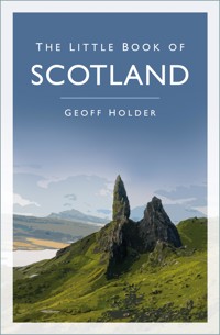
Did you know? - One of the biggest battles between the Scots and the English was fought in France. - The success of his first book of poems saved Robert Burns from working on a slave plantation. - Six craters on Mars are named after places in Scotland. The Little Book of Scotland is a funny, fast-paced, fact-packed compendium of the sort of frivolous, fantastic or simply strange information that no one will want to be without. Discover the most unusual crimes and punishments, eccentric inhabitants, famous sons and daughters and literally hundreds of other wacky facts. A reliable reference and quirky guide, this book can be dipped into time and tagain to reveal something you never knew.
Sie lesen das E-Book in den Legimi-Apps auf:
Seitenzahl: 260
Veröffentlichungsjahr: 2014
Das E-Book (TTS) können Sie hören im Abo „Legimi Premium” in Legimi-Apps auf:
Ähnliche


To Glastonbury Coromandel
CONTENTS
Title
Dedication
Illustrations
Introduction
1.
Places – Here & Now, Then & There
2.
Scottish People
3.
From Lochs & Rivers to Ships & the Sea
4.
Wars, Battles & Rebellions
5.
Transports of Delight: From Horse to Hovercraft
6.
Food & Drink
7.
Culture
8.
The Natural World
9.
Scotland at Work
10.
Sports & Games
Bibliography
Copyright
ILLUSTRATIONS
The illustrations are taken from the following publications:
A History of Scotland for Schools by P. Hume Brown (1907)
An Account of the Bell Rock Light-House by Robert Stevenson (1824)
Boy’s Own Annual(1905)
Chatterbox(1914)
The History of Scotland by James Mackenzie (1894)
The Humorist(1923)
Larousse Petit Encyclopédie Illustrée (1906)
London Opinion(1920)
The National Burns (1879)
Punch(1882–1919)
Sir Walter Scott by W.S. Crockett & J. L. Caw (1903)
As ever, many thanks to Ségolène Dupuy.
INTRODUCTION
Oh, ye’ll take the high road,
and I’ll take the low road,
And I’ll be in Scotland afore ye.
You probably know these lines – they’re from the famous traditional Scottish song ‘The Bonnie Banks o’ Loch Lomond’. So well known is the song that it gave its name to Take the High Road, a Scottish daytime soap opera that ran from 1980 to 2003. The series was filmed on Loch Lomond – the very place celebrated in the song’s lyrics: ‘For me and my true love will never meet again, On the bonnie, bonnie banks of Loch Lomond.’
Nobody really knows how old the song is, nor what the lyrics mean. The song has usually been interpreted as a lament related to one of the Jacobite rebellions. Other people think it may have something to do with a criminal due to hang in England, or perhaps a tale of the supernatural – is the ‘low road’ the land of the dead? All these interpretations, however, may be wide of the mark. Quite simply, this beautiful, emotional and universally known ballad is a complete mystery.
That, to me, sums up Scotland. A country of worldwide fame, with a distinctive culture and a strong heart, it is nevertheless something of an enigma.
Some parts of Scotland’s story are universally celebrated or championed, while other aspects have been neglected, even obscured. It is widely perceived as a romantic land of castles and mountains, and yet the vast majority of its people live in modern cities. A simplistic view of continual tension with its southern neighbour clouds a much more complex history of shifting allegiances and enmities within Scotland itself, often reflected in the fundamental geographical and cultural difference between the Highlands and the Lowlands. Even the elements that commonly define Scottish identity – the kilt, the bagpipes, tartan – have changed their meaning so much that a visitor from, say, just two centuries ago, would struggle to understand how it is they mean so much to modern Scots.
And so here you will find many surprising, hidden and quirky aspects of Scotland, from history to hovercrafts, from whisky to wine, and from extreme food (haggis, anyone?) to some extremely odd sports.
Welcome to a Scotland that is strange, marvellous, madcap, dark, glorious, peculiar, and spectacular – often all at the same time.
Take the high road.
1
PLACES – HERE & NOW, THEN & THERE
PREHISTORIC DAYS
The oldest calendar in the world was constructed by nomadic hunter-gatherers in Aberdeenshire 10,000 years ago. Twelve wooden posts set up at Warren Field near Crathes Castle mimicked the phases of the moon and recorded the lunar months, allowing the seasons to be followed. The Mesolithic device is almost 5,000 years older than the first recognised formal calendars known from ancient Mesopotamia.
Aberdeenshire contains approximately 10 per cent of all the 900 stone circles in Britain.
The Ring of Brodgar on the mainland of Orkney is the third largest stone circle in the world. The numerous prehistoric monuments in the area are collectively listed as a World Heritage Site known as the Heart of Neolithic Orkney.
Callanish on Lewis in the Western Isles is one of the most elaborate prehistoric sites in Britain. Featuring a stone circle with a cross-shaped series of stone rows, the complex is focused on the 18.6-year cycle of the moon across the heavens.
Lewis also has the tallest standing stone in Scotland. The Clach an Trushal monolith is over 19ft in height.
One of the most spectacular prehistoric sites is at Machrie Moor on Arran, where seven stone circles stand in close proximity to each other.
A prehistoric monument unique to Scotland is the broch, a cylindrical stone defensive/residential proto-castle that looks like a scaled-down power station cooling tower. Double-skinned, the walls were honeycombed with internal stairs and chambers. Brochs survive to a reasonable height in Lochalsh, Skye and the Western Isles. The best is at Mousa in Shetland.
The mysterious stone monuments of the Neolithic and Bronze Ages were still regarded with awe into the modern age. Many burial mounds were thought to be the home of fairies or spirits. Women visited various stones thought to promote conception and/or a safe childbirth at Darvel (East Ayrshire), Pitreavie (Fife), Dingwall (Ross & Cromarty, Highland) and Clach-na-bhan (Aberdeenshire). Such visits continued until at least the mid-nineteenth century.
WHAT DID THE ROMANS EVER DO FOR US?
Hadrian’s Wall did not mark the limit of the Roman Empire. There are two (far less well-known) Roman frontiers further up Scotland: the Antonine Wall (AD 142–144), parts of which can still be seen on the narrow neck of land between Glasgow and the River Forth; and the Gask Ridge, a true ‘Wild West’ frontier of forts and watchtowers running from Camelon in Falkirk District north-east through Stirling District and Perth & Kinross to Stracathro in Angus.
Having been built between AD 70 and AD 80, forty-two years before the start of building works on Hadrian’s Wall, the Gask Ridge is the earliest fortified land frontier in the Roman Empire. It effectively separated the fertile plains and important harbours of the Lowlands from the less valuable (and more difficult to control) Highlands – perhaps the first political recognition of the fact that Scotland has two distinct geographies. The tensions and differences between the Highlands and the Lowlands have remained a factor of Scottish life ever since.
In the first century AD the Roman army briefly penetrated even further north, reaching Aberdeenshire, Moray and as far as present-day Inverness.
The idea that everyone in Iron Age Scotland painted themselves with blue woad, lived a wild but free life and hated the Romans is a myth that has its roots in misguided nineteenth-century romantic patriotism. Some Lowland Caledonian tribes were more than happy to take bribes of silver and luxury Mediterranean goods (like wine) in exchange for not disturbing the Pax Romana. And a number of Lowland farmers did very nicely selling grain and other agricultural products to the hungry Roman troops. Even Hadrian’s Wall wasn’t the military exclusion barrier it has been portrayed as – many of its gates were open most of the time to allow the passage of goods and animals for market – goods and animals, that is, sold by the local tribes.
Roman influence in Scotland ebbed and flowed, depending largely on what was happening elsewhere in the Empire. After AD 211, with a few exceptions, the Romans largely withdrew to Hadrian’s Wall.
In 1772 the pioneering traveller Thomas Pennant was given a Roman coin which had been found on the shore at Greshinish on Skye. The Romans never reached the area, leaving us to wonder how a denarius bearing the image of the Emperor Trajan (AD 98–117) reached this remote spot.
The belief that an entire Roman legion was annihilated in AD 117 somewhere in Scotland has inspired a number of works of fiction, notably Rosemary Sutcliff’s 1954 novel The Eagle of the Ninth and the films The Last Legion (2007), Centurion (2010) and The Eagle (2011). The story, however, is nothing more than a modern myth: the supposedly vanished Ninth Legion was still in existence after the alleged Scottish battle, and it disappears from the records only after a later, unknown, conflict in the eastern part of the Roman Empire.
WHAT’S IN A NAME?
You would think the name Scotland means ‘the land of the Scots’, the Scots of course being the indigenous people of the country that lies north of England. Nothing, however, is ever that simple.
To the Romans, the area north of Hadrian’s Wall was called Caledonia, and at least some of the people who lived there in later times were known as the Picts. The Scots, meanwhile, were actually a tribe from Ireland, the Dal Riàta, who didn’t arrive until the sixth century, long after the Romans left. Initially the Gaelic-speaking Scots only controlled the western seaboard of their new country, while most people still called the place Pictland. Had they not won their generations-long conflict with their Pictish neighbours, the Scots may well have disappeared from history and the national anthem would today be ‘Pictland the Brave’.
But never mind the Scots coming from Ireland; Dark Age Scotland was nothing like the Scotland of our times. The south-west was part of the Kingdom of Strathclyde, stretching from north-west England as far as Glasgow, and home to a Brythonic (Celtic British) people who spoke Old Welsh. The south-east – including Edinburgh – was meanwhile occupied by the Angles of Bernicia (whose Anglo-Saxon language became the basis for the modern Scots variant of English). And the Northern and Western Isles were the stamping ground of the Vikings, who introduced numerous Norse-speaking settlements. With various ethnic peoples speaking Welsh, proto-English, Gaelic, Pictish or Norse, the idea of ‘Scotland’ as a unitary nation in the seventh and eighth centuries was ludicrous.
The Scots eventually became the dominant people in much of the central part of the country, creating a kingdom known as Alba. Pictish as a language and a cultural identity disappeared, replaced by the Gaelic culture and language of the new overlords. Over time, Alba of the Scots became referred to as Scotia, and by the early eleventh century there was finally a country which almost everybody called Scotland.
CASTLES
Conflict creates castles. If there are men with sharp pointy things coming to kill you, then it makes sense to defend yourself in the best way possible. There are records of perhaps 2,000 castles in Scotland, of which around 1,200 still exist today. Some ‘castles’ are really nineteenth-century luxury houses with twiddly bits, while others are the full-on medieval real deal.
The most common Scottish castle is not the vast, hugely expensive royal fortress such as those found at Edinburgh or Stirling, but the family stronghold, a relatively modest tower house designed to protect a small number of kinsmen from marauders.
Castles first make their appearance in the eleventh century, with the earliest stone-built castles dating from about 1200. This means that Macbeth (king from 1040 to 1057), for example, would have never walked a stone battlement or entered a great hall made from anything other than earth and wood. Filmmakers, take note.
The most visited castle in Scotland is Edinburgh Castle, which receives more than 1.3 million visitors a year.
Even if a castle is in ruins, there is usually one feature that survives: the garderobe, or toilet, which typically projects outward from the wall – and is often placed directly above the moat. You can imagine the consequences.
The most northerly castle is the sixteenth-century Muness Castle on the island of Unst in Shetland. Like most Scottish castles, it is modest in size, and its history is stained with blood.
Castles, of course, attract legends. When visiting ruined Duntulm Castle on Skye, for example, you might be told that the castle was abandoned because a nursemaid accidentally dropped the heir to the MacDonald chiefdom onto the jagged rocks below. You might even be informed that the window where the accident took place still exists, and that any young woman who looks through it will be cursed with a barren womb. Before swallowing this story hook, line and sinker, it might be worth knowing that exactly the same story is told of at least six other castles throughout Scotland.
Scottish castles are also famous for being haunted, and guides tend to get a bit fed up of being asked, ‘Where are the ghosts?’ Whisper it quietly, but some castles have been known to keep visitors happy by inventing the odd ghost or two …
THE MARCH OF TIME – LOST COUNTIES
There are three certainties in life: death, taxes, and changes to local government boundaries. In Scotland, the many variations inflicted on the various county councils mean that names that were once part of the landscape and culture are now largely lost, and what used to be one place is now an entirely different place – which is confusing if you’re trying to find the modern map location for somewhere mentioned in family history research, a historic document, or a Walter Scott novel.
To be fair, the situation before the reforms of 1890 was at times baffling and bizarre. There were thirty-four counties, some of which, curiously, had ‘offshoots’ in other counties, leading to all kinds of administrative craziness when it came to registering births and deaths, or paying taxes. The northern county of Cromartyshire, for example, was actually nine separate enclaves entirely surrounded (and separated) by the much larger Ross-shire. Nairnshire had colonies in both Inverness-shire and Ross-shire. Lewis was governed by distant Ross-shire, while Harris – part of the same island – was the responsibility of Inverness-shire. In the Borders, a tiny part of Selkirkshire nestled inside neighbouring Roxburghshire. And in the heartland, Clackmannanshire cut both Perthshire and Stirlingshire into two parts each, while Stirlingshire itself sliced Dumbartonshire in half. It was, frankly, a right pig’s ear of a system.
The situation after 1890 became a little more sensible, but there were still some name changes to come. Haddingtonshire became East Lothian, while Linlithgowshire transformed into West Lothian. Forfarshire was now Angus, and Dumbartonshire changed one letter to become Dunbartonshire. Zetland, meanwhile, became Shetland.
In 1975 the thirty-three former county councils were reorganised into just twelve regions: Borders, Central, Dumfries & Galloway, Fife, Grampian, Highland, Lothian, Orkney, Shetland, Strathclyde, Tayside and the Western Isles. Some of the regions were ungainly, clumsy creations – Strathclyde Region, for example, stretched from the metropolis of Glasgow to the remote islands of Coll and Tiree, whose combined population would barely fill a Partick tenement. In 1996, when the regions were abolished in the most recent shake-up, Strathclyde Region was broken up into no less than twelve councils.
Although the regions were little loved as administrative units, their names (and catchment areas) are retained in official bodies such as Strathclyde Partnership for Transport or Tayside Fire & Rescue.
Several counties disappeared in the 1996 reforms. In the south-west, the names Dumfriesshire, Kirkcudbrightshire and Wigtownshire vanished, as did the Borders counties of Peebles-shire, Selkirkshire, Berwickshire and Roxburghshire, plus Nairnshire in the north. Banffshire and Kincardineshire became subsumed in greater Aberdeenshire. A large part of Perthshire was shifted into Stirling District, and then Perthshire was married to Kinross-shire to become Perth & Kinross. In practice, most people still use the original names – even the tourist board prefers ‘Perthshire’ to ‘Perth & Kinross’.
There are currently thirty-three council areas in Scotland, and these are the ones referred to when indicating locations in this book.
In the south and south-west:
Dumfries & Galloway
South Ayrshire
Scottish Borders
East Ayrshire
North Ayrshire
South Lanarkshire
In the Central Belt (the most populous area):
Inverclyde
North Lanarkshire
Renfrewshire
Falkirk District
West Dunbartonshire
West Lothian
East Dunbartonshire
City of Edinburgh
City of Glasgow
Midlothian
East Renfrewshire
East Lothian
In the Heartland:
Clackmannanshire
Perth & Kinross
Stirling District
City of Dundee
Fife
Angus
In the north-east:
Aberdeenshire
Moray
City of Aberdeen
And in the north and west:
Argyll & Bute
Orkney Islands
The Western Isles
Shetland Islands
Highland
The smallest county on the mainland is Clackmannanshire, where around 50,000 people live in just 60 square miles: hence the nickname, ‘the Wee County’. The largest county by far is the Highland Council area – which is bigger than four of the next largest counties put together – so often a subsidiary, more usefully local name is appended, such as Caithness, Sutherland, Wester Ross, Cromarty, Skye, Lochalsh or Strathspey.
Just to muddle matters further, the administrative county known as ‘Highland’ does not include all of the geographical area known as ‘the Highlands’. So you can be in the Highlands but not be in Highland. Yes, it’s confusing – but that’s local government for you.
I suspect that more local government changes of name and boundary await us in the future.
THE MARCH OF TIME – CHANGING FORTUNES
It wasn’t until 1437 that Edinburgh became the capital. In fact, the city was not even in Scotland at all until the year 1020.
The Borders county of Berwickshire disappeared in the administrative shake-up of 1996. But it had lost its county town long before. After a great deal of to-ing and fro-ing in the wars with England, Berwick-upon-Tweed had been finally taken by the English in 1482, and to this day remains just south of the border. In 1596 the much smaller Greenlaw was designated as the new county town of Berwickshire. In 1661 the nearby town of Duns snatched the title. As being the county town had all kinds of advantages, not least financial, Greenlaw took it back in 1696. Duns and Greenlaw then argued about the matter for hundreds of years, and it was not until 1903 that Greenlaw finally lost its status as county town.
PLACE NAME PECULIARITIES
The longest place name in Scotland is the eighteen-letter Coignafeuinternich, which is an abandoned village in the Monadhliath Mountains west of Aviemore (Highland). The name is Gaelic, a language which cleaves to long words. Norse, in contrast, tends to be terse, and gives us the shortest village name in Scotland – Ae in Dumfries & Galloway – as well as uninhabited places like Aa and Ve (Shetland) and Oa (Islay).
You can have a Brawl in Caithness (Highland), meet Mavis Grind in Shetland, and walk through Muck (Inner Hebrides). Take care, however, when dealing with Hen Poo (Scottish Borders), Rotten Bottom (Dumfries & Galloway) or Tongue of Gangsta (Orkney).
The village of Dull in Perth & Kinross is paired with the Oregon town of Boring.
If you are in Aberdeenshire you could get some Blankets, call someone Fattiehead or Tarty, watch out for your Backside in case of Brokenwind – and then get Lost.
Other names to please or vex the tongue are Maggieknockater (Moray), Brainjohn, Easter Auquhorthies and Yondertown of Knock (Aberdeenshire), Slackend (West Lothian) and Puddledub (Fife).
With Zetland becoming Shetland in 1890, there are now only two places in Scotland beginning with the letter ‘Z’, and they’re both called Zoar: one is in Forfar in Angus, and the other is a farmstead west of Hillswick on Shetland.
There are no places in Scotland beginning with X.
Balfron in Stirling District is occasionally visited by Star Wars fans seeking a connection with the fictional planet of the same name.
Should you wish to go overseas without leaving Scotland, you could head for New Orleans in Argyll or Moscow in East Ayrshire.
Beware pronunciation: Milngavie in Glasgow is pronounced ‘Mulguy’; Findochty in Moray is ‘Finechty’; Friockheim in Angus is ‘Free-come’; Strathaven in South Lanarkshire is ‘Straven’; Garioch in Aberdeenshire gets warped into ‘Geerie’; Footdee in Aberdeen is ‘Fittie’; Hawick (Scottish Borders) becomes the throat-clearing ‘Hoyck’; Wemyss in Fife is ‘Weems,’ while nearby Kirkcaldy is rendered as ‘Kir-cawdie’; and Kirkcudbright in Dumfries & Galloway trips off the tongue as ‘Kir-coo-brie’. Why? Just because.
The abandoned coastal village of Fishtown of Usan in Angus was once known as Ulysseshaven.
Deep inside the Cairngorm range is a mountain called The Devil’s Point. The original Gaelic name, however, is Bod an Deamhain, or ‘The Penis of the Demon’. According to Cameron McNeish’s 1998 book The Munros: Scotland’s Highest Mountains, the name was changed when Queen Victoria asked what the mountain was called. Her guide, the famous John Brown, was too embarrassed to use the real translation, and so the euphemism has remained as the English name ever since.
Close to Campbeltown in Argyll is a small mountain some 617ft high. Its official name is The Bastard, although no one seems to know why it is thus called.
The northern half of the Aberdeenshire village of St Combs was once known by the name of Sodom – and the inhabitants were hence referred to as Sodomites.
SCOTLANDS AROUND THE WORLD
For centuries Scots have left their native land as soldiers of fortune, as political or religious refugees, as prisoners, economic migrants, forced labourers, and as the unwilling victims of the Highland Clearances. As a consequence, the number of places around the world named after a location in Scotland, or a Scottish person, is so great that the list would fill an entire book. Here are just a few examples.
In the United States, there are Scotlands in Connecticut, Georgia, Indiana, Maryland, Ohio, South Dakota and Virginia. In New York state, New Scotland is joined by Scotchtown, Scotchhill, Scotch Church and, slightly bizarrely, Scotch Bush. A Scotland County can be found in each of the states of Missouri, Maryland and North Carolina. Maryland also has Scotland Beach and Scots Fancy, while Iowa gives us Scots Grove and Scotch Glen. Scotlandville is part of Baton Rouge in Louisiana. North Carolina has its Scottish Hills and Nashville its Scottish Highlands, while Scotland Run is in New Jersey, which also claims Scotch Plains and the slightly unusual Scotch Bonnet.
To give one example of Scottish influence in America, take the case of the state of Pennsylvania. As well as possessing a Scotland, a Scotch Hill, a Scotch Valley and a Scotch Hollow, Pennsylvania has approximately 580 other places named after Scottish locations or people. In fact, every one of the state’s sixty-seven counties has at least one place name of Scottish origin.
As well as naming part of the American continent, Scots may have been among the very first Europeans in the New World. According to the ‘Saga of Thorfinn Karlsefne’, an Icelandic saga first written down in the thirteenth century, Thorfinn, who headed the second Viking expedition to America around 1007, had with him two fast-running Scottish slaves named (in Norse) Haki and Hekja. Thorfinn put them ashore first, largely as bait. After three days the slaves had not been attacked by any natives, so the Vikings deemed it safe to come ashore and camp. The saga, sadly, makes no further mention of what happened to Haki and Hekja.
There are three New Scotlands in Canada, two of them being in the province of Ontario, and the third in the Maritime province of New Brunswick. Nova Scotia (Latin for ‘New Scotland’) is another of Canada’s east coast Maritime provinces.
British Colombia, Canada’s westernmost province, was originally called New Caledonia. Caledonia was the Roman name for Scotland, and gained popularity with Scottish writers and poets in the nineteenth century (Sir Walter Scott famously coined the phrase ‘O Caledonia! stern and wild’).
Caledonia was the name of the doomed colony established by the Scots in Panama in the 1690s. The ‘Darien Disaster’, as it came to be known, almost ruined the Scottish economy.
New Caledonia, a large tropical island in the Pacific with a population of around 250,000, is a territory of France (the official name is Nouvelle-Calédonie).
Johannesburg in South Africa has the world’s largest cluster of suburbs named after Scottish locations, with twenty-four names across some 6 miles of city, including Morningside, Glen Atholl, Heriotdale, Birnam and Balmoral.
New Zealand and Australia both have major concentrations of Scottish place names, and the river in the former’s city of Dunedin – Gaelic for Edinburgh – is even named after the Scottish capital’s Water of Leith.
Within the Antarctic Circle you can find the South Orkney Islands and the South Shetland Islands, while the Falkland Islands are, via the Viscount of Falkland, named after the palace in Fife. Antarctica also has a Dundee Island and its own Firth of Tay.
These days ‘Scotland Yard’ is synonymous with London’s Metropolitan Police. The Met’s original nineteenth-century headquarters had its public entrance on a street called Great Scotland Yard, which may have got its name when diplomats from still-independent Scotland lived there in the sixteenth and seventeenth centuries.
The Pacific island nation of Vanuatu was once known as the New Hebrides. Hong Kong has Aberdeen Harbour, Java hosts Glenmore, and you can find Macduff, Iona and Glasgow in Sri Lanka. There’s a Bannockburn in Zimbabwe, a Glencoe in Trinidad and, in Jamaica, Culloden.
There are in fact hundreds of Scottish place names scattered across Jamaica, and many Jamaicans bear Scottish surnames such as Campbell, Douglas, Farquharson, Ferguson, Frazer, Gordon, Graham, Grant, Lamont, Lewis, McDonald, McFarlane, McKenzie, Reid, Robinson, Russell, Scott and Stewart. Both place names and personal names are the legacy of Scotland’s massive involvement in the slave trade. In 1800 some 300,000 slaves on the island were administered by a handful of Englishmen – and 10,000 Scots, for whom Jamaica was the place to make their fortune. Many Scottish slave masters became millionaires. Slave-grown sugar and tobacco powered the eighteenth-century Scottish economy and led directly to the growth of Glasgow, Greenock and other cities.
SCOTLAND IN SPACE
Six craters on Mars are named after Scottish places – Ayr (Scottish location: South Ayrshire); Balvicar (Argyll & Bute); Banff and Echt (both in Aberdeenshire); Darvel (East Ayrshire); and Doon (a loch and river in South Ayrshire).
The Dorsa Geikie, a tectonic ridge system on the moon, is named after Edinburgh-born Sir Archibald Geikie, one of the pioneers of nineteenth-century geology. In 1882 Aberdonian astronomer Sir David Gill took the first successful photograph of a comet. Gill Crater on the moon and its namesake on Mars are named after him.
When Neil Armstrong took his ‘one small step for man, one giant leap for mankind’ in 1969, and became the first human being to walk on the moon, he was carrying with him a tiny scrap of Armstrong tartan.
Two asteroids in the asteroid belt have craters with Scottish place names: 253 Mathilde is home to Clackmannan Crater, while 243 Ida boasts Fingal Crater, named after Fingal’s Cave on the isle of Staffa.
Europa, one of the larger of Jupiter’s sixty-seven moons, has a linear feature named after the prehistoric stone rows at Tormsdale in Caithness, plus a ‘large ring feature’ caused by the impact of a meteorite or other space debris, which takes its name, appropriately, from the amazing stone circle of Callanish in the Western Isles. Europa also has a region of ‘chaotic terrain’ which has been given the fantastic, science fiction-sounding name of ‘the Arran Chaos’.
NAE LIMITS
Many people – including VisitScotland – claim that the most northerly place on mainland Britain is the small village of John O’Groats. This is not true. Dunnet Head, 11 miles to the north-west, is a little over 2 miles further north, and there are several small populated places with a latitude above John O’Groats – the northernmost settlement on the mainland is actually the tiny hamlet of Scarfskerry.
The actual claim to fame for John O’Groats is that it is one end of the longest distance between two inhabited points on mainland Britain (the other being Land’s End in Cornwall).
The southernmost point in Scotland is the Mull of Galloway, which is further south than Carlisle in England.
Falkirk’s Tolbooth Street used to hold the title of the shortest street in Britain, although its crown has recently been usurped by Ebenezer Place in Wick (Caithness/Highland), which is all of 6ft 9ins long. To qualify as a street a thoroughfare needs to have a doorway opening out onto it.
The highest pub in Scotland is not in the Highlands but in the Southern Uplands of Dumfries & Galloway. Wanlockhead, home to the Wanlockhead Inn, is Scotland’s highest village, standing at 1,531ft above sea level.
The most remote pub in mainland Britain, however, can be found in Inverie, in Knoydart (Lochaber/Highland). The Old Forge can only be reached by ferry from Mallaig, or by walking over the hills from Loch Hourn to the north. Tiny Kinloch Hourn, at the head of Loch Hourn, may be the loneliest mainland settlement connected by a public road: the winding, steep and little-used single-track road from Glen Garry runs for 22 miles of emptiness, with not a single building for the last 12 miles. This must be one of the most spectacular car journeys in Britain.
In 1943 the Ordnance Survey commenced the process of resurveying and remapping the whole of Britain. The last place to be mapped was Durisdeer in Dumfries & Galloway, where a completion ceremony took place on 25 May 1982 – thirty-nine years after the project started.
ISLANDS
There are 790 islands in Scotland, of which 130 are inhabited.
Only about 2 per cent of the islands are found on the east coast. The major groups are the Shetland and Orkney Islands to the north, and to the west, the Outer Hebrides, the Inner Hebrides and the islands in and beyond the Firth of Clyde.
In line with recent renamings of places around the world, the Outer Hebrides are now officially referred to (far less evocatively) as the Western Isles, possibly because the original name suggested an unwelcome remoteness. In practice, both names are used.
The largest Scottish island is in the Western Isles – the combined island of Lewis and Harris.
The most northerly island – and hence the most northerly point in the UK – is Out Stack, just off the larger Shetlandic island of Unst. If travelling directly north from Out Stack, the next stop is the North Pole.
Skaw on Unst is the most northerly settlement in the UK. Bruray, on the Out Skerries archipelago (Shetland), is Britain’s most easterly settlement. The sea-girt islet of Rockall, far to the west of the Western Islands, is the most westerly point of the UK.
Rockall is actually disputed territory. Ireland, Denmark and Iceland all claim that it belongs to them.
The islands of Shetland and Orkney only became part of the Kingdom of Scotland in 1471. Formerly belonging to Norway, the Scandinavian influence on the islands remains strong.
Lerwick, the capital of Shetland, is over 300 miles from Edinburgh. By contrast, Bergen in Norway is only 230 miles away.
The Isle of Man was part of Scotland from 1266 until 1334.
In the Middle Ages, the kings of Scotland, being bound to the mainland, always had great difficulty with their cantankerous subjects in the distant Hebrides. It took centuries before the ‘Lords of the Isles’ finally acknowledged the authority of the Edinburgh-based monarchy.
The Black Isle in Ross & Cromarty (Highland) is not an island. Neither is the Isle of Whithorn in Dumfries & Galloway.
The fantastically named Gulf of Corryvreckan, between the islands of Jura and Scarba, is home to the third-largest whirlpool in the world.
There are seven islands in the Slate Island group of the Inner Hebrides, but there used to be eight. The slate quarry on Eilean-a-beithich was hollowed out to well below sea level – and in 1881 the sea breached the quarry wall. Now the only sign that there was once an island here is the outer rim of the flooded quarry, looking for all the world like a miniature caldera of a sea-swamped volcano.


