13,99 €
Mehr erfahren.
- Herausgeber: Crowood
- Kategorie: Lebensstil
- Sprache: Englisch
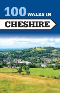
Cheshire is a walker's paradise with its industrial heritage and outstanding natural beauty. The collection of 100 walks of up to 12 miles will help you explore the best of this diverse county. The Crowood Walking Guides give detailed and accurate route descriptions of the 100 walks. Full-colour mapping is included which is sourced from the Ordnance Survey. Details of where to park and where to eat and drink are included and also places of interest to see along the way.
Das E-Book können Sie in Legimi-Apps oder einer beliebigen App lesen, die das folgende Format unterstützen:
Seitenzahl: 247
Veröffentlichungsjahr: 2016
Ähnliche


100 WALKS IN CHESHIRE
THE CROWOOD PRESS
First published in 2016 by
The Crowood Press Ltd
Ramsbury, Marlborough
Wiltshire SN8 2HR
www.crowood.com
This e-book first published in 2016
© The Crowood Press 2016
All rights reserved. No part of this publication may be reproduced or transmitted in any form or by any means, electronic or mechanical, including photocopy, recording, or any information storage and retrieval system, without permission in writing from the publishers.
British Library Cataloguing-in-Publication Data
A catalogue record for this book is available from the British Library.
ISBN 978 1 78500 182 6
Front cover: Shutterstock
Mapping in this book is sourced from the following products: OS Explorer 257; 266; 267; 268; 276
© Crown copyright 2016 Ordnance Survey. Licence number 100038003
Every effort has been made to ensure the accuracy of this book. However, changes can occur during the lifetime of an edition. The Publishers cannot be held responsible for any errors or omissions or for the consequences of any reliance on the information given in this book, but should be very grateful if walkers could let us know of any inaccuracies by writing to us at the address above or via the website.
As with any outdoor activity, accidents and injury can occur. We strongly advise readers to check the local weather forecast before setting out and to take an OS map. The Publishers accept no responsibility for any injuries which may occur in relation to following the walk descriptions contained within this book.
Contents
How to Use this Book
Walks Locator
WALK 1
Chester City Walls
2½ miles (4 km)
WALK 2 & 3
Marbury Country Park
2½ miles (4km) or 4 miles (6.5km)
WALK 4
Northwich
2½ miles (4km)
WALK 5
Rowton Moor
2½ miles (4km)
WALK 6
Alderley Edge & Hough
3 miles (5km)
WALK 7
Hale Village & the Mersey Shore
3 miles (5km)
WALK 8 & 9
The Macclesfield Canal
3 miles (5km) or 5 miles (8km)
WALK 10
Maiden Castle
3 miles (5km)
WALK 11 & 12
Nantwich & the River Weaver
3 miles (5km) or 4 miles (6.5km)
WALK 13 & 14
Raw Head
3 miles (5km) or 5¾ miles (9km)
WALK 15
Walton
3 miles (5km)
WALK 16
Farndon & the River Dee
3¼ miles (5km)
WALK 17
Adlington
3½ miles (5.5km)
WALK 18
Alvanley & Helsby
3½ miles (5.5km)
WALK 19 & 20
Around Church Minshull
3½ miles (5.5 km) or 4½ miles (7km)
WALK 21
The Bollin & Morley
3½ miles (5.5km)
WALK 22
Eccleston & Eaton Hall
3½ miles (5.5km)
WALK 23
Frodsham
3½ miles (5.5 km)
WALK 24
Moore Nature Reserve
3½ miles (5.5km)
WALK 25
Styal & Quarry Bank Mill
3½ miles (5.5km)
WALK 26
Tarporley & Wharton’s Lock
3½ miles (5.5km)
WALK 27
Vale Royal
3½ miles (5.5km)
WALK 28
Whitchurch & Wirswall
3½ miles (5.5km)
WALK 29
Wybunbury Moss
3½ miles (5.5km)
WALK 30
Acton to Swanley
4 miles (6.5km)
WALK 31
Ashley
4 miles (6.5km)
WALK 32
Barthomley & Englesea Brook
4 miles (6.5km)
WALK 33
Daresbury
4 miles (6.5km)
WALK 34
Glazebury & Hitchfield Wood
4 miles (6.5km)
WALK 35
Heswall Village to Parkgate
4 miles (6.5km)
WALK 36
The Manchester Ship Canal
4 miles (6.5km)
WALK 37
North Rode
4 miles (6.5km)
WALK 38
Ollerton
4 miles (6.5km)
WALK 39
Plumley & Holford Hall
4 miles (6.5km)
WALK 40
Prestbury
4 miles (6.5km)
WALK 41
Rode Mill & Little Moreton Hall
4 miles (6.5km)
WALK 42
Willaston & the Wirral Way
4 miles (6.5km)
WALK 43
Alsager & the Merelake
Way 4½ miles (7km)
WALK 44
Astbury (including Astbury Lake)
4½ miles (7km)
WALK 45
Bollington & Berristall Dale
4½ miles (7km)
WALK 46
Chester Meadows
4½ miles (7km)
WALK 47
Culcheth & Croft
4½ miles (7km)
WALK 48
Gawsworth Hall
4½ miles (7km)
WALK 49 & 50
Redesmere
4½ miles (7km) or 7½ miles (12km)
WALK 51
Tegg’s Nose
4½ miles (7km)
WALK 52
Bosley Cloud
5 miles (8km)
WALK 53
Brereton Green
5 miles (8km)
WALK 54
Burtonwood & the Sankey Valley
5 miles (8km)
WALK 55
Great Barrow
5 miles (8km)
WALK 56
Guilden Sutton & Christleton
5 miles (8km)
WALK 57 & 58
Knutsford & Tatton Park
5 miles (8km) or 6 miles (9.5km)
WALK 59
Little Leigh & Barnton
5 miles (8km)
WALK 60
Mottram & Broadbottom
5 miles (8km)
WALK 61
Stretton Mill
5 miles (8km)
WALK 62
Timbersbrook & The Cloud
5 miles (8km)
WALK 63 & 64
Wincle & Sutton Common
5 miles (8km) or 10 miles (16km)
WALK 65
Wybunbury & Hatherton
5 miles (8km)
WALK 66
Bunbury & Bunbury Locks
5¼ miles (8.5km)
WALK 67
Nantwich, Hurlstone & Acton
5¼ miles (8.5km)
WALK 68
Ackers Crossing & Mow Cop
5½ miles (9km)
WALK 69
Aston Juxta Mondrum & Barbridge
5½ miles (9km)
WALK 70
Delamere Forest, Flaxmere & Hatchmere
5½ miles (9km)
WALK 71
Grappenhall & the Lumb Brook Valley
5½ miles (9km)
WALK 72
Great Barrow
5½ miles (9km)
WALK 73
Harrow
5½ miles (9km)
WALK 74
Timbersbrook & Ravensclough
5½ miles (9km)
WALK 75
Walton & Hill Cliffe
5½ miles (9km)
WALK 76
Winterley
5½ miles (9km)
WALK 77 & 78
Circuit of Shutlingsloe
6 miles (9.5km) or 12 miles (19km)
WALK 79
Darnhall & Wettenhall
6 miles (9.5km)
WALK 80
Foxwist Green & Petty Pool
6 miles (9.5km)
WALK 81
Hankelow & Broomhall
6 miles (9.5km)
WALK 82
Wildboarclough to Three Shires Head
6 miles (9.5km)
WALK 83
Dunham Park
6 miles (9.5km)
WALK 84 & 85
Adlington
6½ miles (10km) or 7½ miles (12km)
WALK 86
Around Wrenbury
6½ miles (10km)
WALK 87
Higher & Lower Wych & Malpas
6½ miles (10km)
WALK 88
Lower Peover & Peover Hall
6½ miles (10km)
WALK 89
Wheelock & Moston
6½ miles (10km)
WALK 90
Jenkin Chapel & Windgather Rocks
7 miles (11km)
WALK 91
Macclesfield Forest
7¼ miles (11.5km)
WALK 92
Holmes Chapel & Bradwall
8 miles (13km)
WALK 93
Chester Canal & Llangollen Canal
8½ miles (13.5km)
WALK 94
Lyme Park
8½ miles (13.5km)
WALK 95
Shining Tor from Derbyshire Bridge
8¾ miles (14km)
WALK 96
Hanging Gate & the Gritstone Trail
8¾ miles (14km)
WALK 97
Little Moreton Hall
9 miles (14.5km)
WALK 98
Little Budworth
9½ miles (15km)
WALK 99
Delamere Forest & Beacon Hill
11½ miles (18.5km)
WALK 100
Around Bridgemere
12 miles (19km)
How to Use this Book
The walks in the book are ordered by distance, starting with the shortest. An information panel for each walk shows the distance, start point (see below), a summary of route terrain and level of difficulty (Easy/Moderate/Difficult), OS map(s) required, and suggested pubs/cafés at the start/end of walk or en route.
MAPS
There are 89 maps covering the 100 walks. Some of the walks are extensions of existing routes and the information panel for these walks will tell you the distance of the short and long versions of the walk.
The routes marked on the maps are punctuated by a series of numbered waypoints. These relate to the same numbers shown in the walk description.
Start Points
The start of each walk is given as a postcode and also a six-figure grid reference number prefixed by two letters (which indicates the relevant square on the National Grid). More information on grid references is found on Ordnance Survey maps.
Parking
Many of the car parks suggested are public, but for some walks you will have to park on the roadside or in a lay-by. Please be considerate when leaving your car and do not block access roads or gates. Also, if parking in a pub car park for the duration of the walk, please try to avoid busy times.
COUNTRYSIDE CODE
Consider the local community and other people enjoying the outdoors
Leave gates and property as you find them and follow paths
Leave no trace of your visit and take litter home
Keep dogs under effective control
Plan ahead and be prepared
Follow advice and local signs
Walks Locator
WALK
1
Chester City Walls
START King Charles Tower, Chester, CH1 3EH, GR SJ406 667
DISTANCE 2½ miles (4km)
MAPS OS Landranger 117 Chester & Wrexham; OS Explorer 266 Wirral & Chester
WHERE TO EAT AND DRINK There are many outlets to suit all tastes in Chester
A walk around one of England’s most complete walled towns.
The walk around the old town walls of Chester is one of the highlights not only of a visit to the city itself, but also of a visit to Cheshire. The route directions are minimal as the walk merely follows the wall top, but are given for completeness.
1 King Charles Tower stands close to the Shropshire Union Canal, which threads its way through the city. Go up the steps onto the wall and turn right. On this first section of wall you will pass the city’s Cathedral to the right. Continue to Eastgate, the most picturesque of the gates that pierce the walls. Next, the walk takes you over Newgate.
2 To the left here is the Roman amphitheatre. Continue to the corner overlooking the River Dee. Turn right, with the wall, to reach Bridgegate.
3 At the next corner, the Castle is to the right, while to the left is the Roodee, Chester racecourse.
4 Now walk to Watergate and continue to the final corner and the linked Bonewoldsthorne and Water Towers. Turn right and cross St Martin’s Gate and Northgate to return to the start point.
Points of interest
King Charles Tower: the name derives from an old legend that King Charles stood here on 24 September 1645 and watched his army being defeated at the battle of Rowton Moor.
Chester Cathedral: This is the old abbey church for a Benedictine monastery founded in 1092 by Hugh Lupes, the Norman Earl of Chester. Only after the Dissolution did it become the city’s cathedral. Inside there is some superbly carved woodwork, particularly on the fourteenth-century choir stalls.
Roman amphitheatre: During the first century AD the Romans occupied the site on the banks of the River Dee known as Deva. Soon it became an important military base, the headquarters for one of three British legions. The Romans fortified Deva, and two sections of that wall can still be seen between Northgate and King Charles Tower. The amphitheatre is the largest so far discovered in Britain. When completed, it was of stone and measured 315 by 285ft. The gladiatorial area measured 190 by 160ft. The best of the excavated Roman remains are to be found in the Grosvenor Museum in Grosvenor St.
Chester Castle: The first known castle on the site was built in 1070 by William the Conqueror. This motte and bailey structure was later consolidated, the thirteenth-century stone castle being an important centre during Edward’s campaigns in Wales. However, from the fifteenth century the castle fell into disrepair. Today, only the square Agricola Tower and Flag Tower remain of the medieval building, the rest having been built in the late eighteenth century.
Watergate: In medieval times, when boats were smaller and the River Dee a more navigable waterway, Chester was an important port, the Watergate giving access to the dock area, which was protected by the Water Tower. At that time it is likely that the Water Tower actually stood in water. However, changes in drainage patterns caused the Dee to silt up. Chester declined as a port and the river retreated from both Watergate and the Water Tower.
WALKS
2
Marbury Country Park
3
START Marbury Country Park car park, CW9 6AT, GR SJ652 763
DISTANCE 2½ miles (4km); 4 miles (6.5km) with extension
MAPS OS Explorer 267 Northwich & Delamere Forest
WHERE TO EAT AND DRINK Stanley Arms, Anderton (close by the Anderton Boat Lift), T01606 75059
An easy walk in both instances, with the short walk going around the edges of the Park and the extension taking in the Anderton Boat Lift.
Route 2
1 Leave the car park by the north-east exit path and shortly turn left. Follow this track past the toilet and information centre until facing Budworth Mere. Go forwards until a path to the left is visible. Turn right and follow the footpath for about 250yds and take the left fork back into the Park (Marbury La). Follow this road for about 1,200yds to a canal bridge and cross over it.
2 Drop down to the canal and go east to the next bridge in about 200yds. Cross over it, then follow the path to the right for about 800yds, then take the right fork down to the edge of Budworth Mere for a further 600yds to the boathouse. In a further 200yds at the bird hides turn left and up steps.
Route 3
1 For the extension, turn right and go about 70yds before crossing the road to a concrete bus shelter. Just beyond the shelter turn left through a kissing gate into fields. Go into the left-hand field, keeping close to the hedge on the right. At the end of the field go into the woodland section and cross the footbridge and up the bank to exit in another field. Follow the path through two fields and cross Cogshall La into another field. Follow the hedge line to the right across two fields and turn left into Hough La. Go down the hill for about 550yds and across the canal bridge. Turn left and shortly take a short path to the right down and turn right onto the canal towpath.
2 Follow the towpath for 400yds to the Anderton Boat Lift. Then go along the towpath for about 1 mile to the Marbury Lane Bridge. Follow the short route from this point back to the car park.
Points of interest
Anderton Boat Lift: ‘The Cathedral of the Canals’ is a unique Victorian piece of cast iron engineering. Built in 1875, it was used to transfer barges from the Trent and Mersey Canal to the River Weaver – a drop of 50ft. It has a visitors’ centre, where boat trips can be booked.
Marbury Country Park: Set by Budworth Mere, the Park offers a wide range of activities including fishing, swimming in the open air pool, exploring the garden centre and an arboretum.
Budworth Mere: Used for sailing, fishing (club only), birdwatching and openwater swimming (club only).
WALK
4
Northwich
START The Weaver Hall Museum and Workhouse car park, CW9 8AB, GR SJ658 732
DISTANCE 2½ miles (4km)
MAPS OS Landranger 118 Stoke-on-Trent & Macclesfield; OS Explorer 267 Northwich & Delamere Forest
WHERE TO EAT AND DRINK There are numerous possibilities in Northwich
A short but fascinating town walk.
1 Leave the car park and turn left, passing under the viaduct and turning immediately left, walking beside the arches of the viaduct to the River Weaver. Turn left again and walk beside the river, continuing along until you reach the first footbridge, which is a swing bridge. Cross this and the Hunt’s Locks beyond (the locks are on another arm of the River Weaver) and walk to a path junction. Continue ahead, bearing left at first and then swinging right just before steps to go under the railway viaduct again. Continue to reach a road.
2 Turn right along the road (Spencer St, which leads into Navigation Rd), as far as a T–junction. Turn right into Chester Way, go over the bridge over the River Weaver and then drop down left to follow a path beside the river at Hayhurst Quay. You soon cross another bridge; turn right, crossing over the road and following the river to reach a road. Cross straight over to rejoin the path and continue along it.
3 Soon the path is sandwiched between the railway viaduct and the river. Follow the line of the viaduct, crossing the river and continuing to reach London Rd (the main A533), and walking beneath the viaduct back to the start at the museum car park.
Points of interest
Railway viaduct: The superb viaduct took the Cheshire railway over the rivers and canals of Northwich. Its 48 arches are over ½ mile long and took the railway 40ft above the water. It is now a Grade II-listed structure.
Swing bridge: This elegant footbridge is also Grade II-listed. It can be swung to allow boats to traverse this older course of the River Weaver.
Bridge: This is the Hayhurst Bridge, built in 1898. It is also a swing bridge, though only tall boats would require it to do so. Hayhurst is widely believed to have been the first electrically driven swing bridge in Britain.
The Weaver Hall Museum and Workhouse: Interesting displays and tales of the history and industry of west Cheshire housed within the old Northwich Union Workhouse building.
WALK
5
Rowton Moor
START Christleton church, CH3 7AP, GR SJ441 657
DISTANCE 2½ miles (4km)
MAPS OS Landranger 117 Chester & Wrexham; OS Explorer 266 Wirral & Chester
WHERE TO EAT AND DRINK The Ring O’ Bells Inn, Christleton, T01244 335422
A walk along the Shropshire Union Canal and by an ancient battlefield.
1 From the church in Christleton, walk to the triangular village green (an unusual feature, village greens being uncommon in Cheshire), on which the old pump house and pump still stand, and head south past the Ring O’ Bells Inn, continuing along the road past a school to a road junction. Walk down Rowton Bridge Rd, going over the Shropshire Union Canal to reach the A41. Cross, with great care, and follow the road opposite. This soon passes the site of the battle of Rowton Moor. Continue along the road through Rowton village to reach a T–junction and turn left, continuing until you reach the A41 again.
2 Cross over and follow the road opposite, called Moor La. This soon goes right. Ignore all side turnings to reach a crossroads in Waverton; now turn left. At the canal bridge turn left down onto the towpath and follow it back to the bridge that was crossed at Rowton Bridge Rd. Turn right up onto the road and reverse the outward route through Christleton to return to the start.
Points of interest
Shropshire Union Canal: The Union of the name was the amalgamation of several companies into a single company, creating a web-like system that reached as far as Llangollen and Wolverhampton, as well as linking into the Trent and Mersey on the Cheshire Ring. The network formed a powerful commercial highway, and is still one of the best canal systems in Britain.
Rowton Moor: During the Civil War, Chester was a Royalist stronghold and by late 1644 was under a state of siege. The siege was long and hard, and, in an effort to lift it and, in part, to link up with the Royalist army of the Marquis of Montrose to the north in Lancashire, the King marched north in September 1645. On 24 September, the King’s cavalry met the Parliamentary army of Major General Poyntz here at Rowton Moor and was heavily defeated. The battle was one of the last set-piece actions of the first Civil War.
Christleton: This village was mentioned in the Domesday Book, and almost six centuries later the Old Hall, the oldest village house, was the headquarters of the Parliamentarians besieging Chester.
WALK
6
Alderley Edge & Hough
START National Trust car park on the B5087, GR SJ859 773
DISTANCE 3 miles (5km)
MAPS OS Landranger 118 Stoke-on-Trent & Macclesfield; OS Explorer 268 Wilmslow, Macclesfield & Congleton
WHERE TO EAT AND DRINK The Wizard, Alderley Edge (tea room at the back open at weekends, children welcome, dogs allowed in outside area only), T01625 584 000; there are many cafés, pubs and a supermarket in Alderley Edge
An easy walk, not strenuous, but on the Edge beware as route-finding can be confusing and difficult.
1 From the car park head towards the information board and along to a gate. Turn right and go down a track a short distance before turning left in front of The Bungalow and along a well-maintained track. When you enter a clearing ahead, passing by ‘Engine Vein’ mine works, go straight across it to join a path which bears to the left. Continue ahead over cross tracks and at the next cross track, just before a stone wall, bear right and uphill towards the remains of the Armada Beacon.
From the Beacon turn your back to the wall and go down a short distance to meet a track and turn to the right on a main path that will take you to an open, rocky viewpoint at Alderley Edge. The views from here extend from the Welsh hills to the west to the Derbyshire Peak District to the east on a clear day. You will also find some caves here, but take care if you do go into them, particularly if you have children with you.
With the view in front of you, turn left to walk through woods following a yellow marker post. Following this path to a dip, you veer to the right over a small rise before dropping steeply down the hillside. This path emerges at a barbed wire fence and a field; turn left here and follow the path to the road. Turn left, then right across the road to follow a public footpath sign to Saddlebole Farm.
2 At the end of the drive go left over a stile to enter a field. Keep the hedge on your right and pass through a metal gate, keeping right to cross a field to another road. At the road turn right and after 550yds turn right again down a footpath signposted ‘Mottram’, which lies opposite the entrance of Brook Farm. Walk across the large field, keeping the hedge to your left, until you reach a stile. Over the stile is a small pool on your left; you turn to the right. Cross a stile ahead and turn right again, following a sign for ‘The Edge’.
Cross a footbridge and a stile and go left diagonally, keeping the hedge on your left, to go over two more stiles, up a path (can be muddy in parts) and onto the road. Over the road is an upward path in a sunken lane, and where this enters a wood take any of the paths going up, as they should all lead back near to the open rocky outcrop. From here follow the green NT waymarkers back to the car park.
Points of interest
The Caves: These date back to the early eighteenth century, when mainly copper ore was mined here. Engine Vein (now filled in) had fine examples of copper on a fault plane, with cobalt blue azurite nodules to be found.
Alderley Edge: 600ft high, with excellent views of the Cheshire Plain. There was once a Neolithic settlement here. Bronze Age pottery and tools have been discovered in the area.
WALK
7
Hale Village & the Mersey Shore
START The car park in front of a row of shops in Hale, L24 4AX, GR SJ469 825
DISTANCE 3 miles (5km)
MAPS OS Landranger 108 Liverpool, Southport & Wigan; OS Explorer 275 Liverpool, St Helens, Widnes & Runcorn
WHERE TO EAT AND DRINK The Childe of Hale, T0151 425 2954
An easy walk on good surfaced footpaths from an interesting village and beside the Mersey Estuary.
1 Turn right from the car park and walk for 100yds before turning left as the road forks to a traffic island with a stone cross on it. Go down the lane for another 100yds to the Childe of Hale Inn, a favourite with walkers who enjoy a ‘log fire’ atmosphere.
2 Beyond the Childe of Hale the road splits into two. Take the right-hand fork into Church End, past the thatched cottages. After 200yds take Church Rd and follow it to St Mary’s church on your left. Pass the church and continue for a further ½ mile through a landscape of agricultural farmland.
3 On reaching a gateway pass through and take a footpath, the Mersey Way, to Hale lighthouse about 600yds away.
At the lighthouse a right of way signpost directs you to Within, which you follow for the next ¾ mile. The footpath follows the contours of the Mersey Estuary and stands high on a bank above areas of saltmarsh, rich in wildlife. At the gate turn left and walk inland back onto Within Way and follow the lane for the next mile back into the village of Hale. It emerges in Church Rd, opposite the large Manor House where the poet John Betjeman stayed and wrote ‘The Manor House, Hale’. Turning right into Church Rd, retrace your steps for a short while back to the start.
Points of interest
St Mary’s church: This ancient church is famed as the last resting place of John Middleton (the Childe of Hale), who reputedly was a 9ft 3in giant who lived in Hale during the late fifteenth century. His gravestone can be visited on the south side of the church. The church interior has some fine examples of eighteenth-century architecture.
Hale lighthouse: Hale lighthouse stands at the tip of Hale Head, the southernmost point of the north Mersey shore. It was from here that Prince Rupert crossed the Mersey with his soldiers. The lighthouse is no longer functional.
WALKS
8
The Macclesfield Canal
9
START Nelson Pit car park, Higher Poynton, SK12 1TH, GR SJ944 834
DISTANCE 3 miles (5km) or 5 miles (8km)
MAPS OS Landranger 109 Manchester, Bolton & Warrington and OS Landranger 118 Stoke-on-Trent & Macclesfield; OS Explorer 268 Wilmslow, Macclesfield & Congleton
WHERE TO EAT AND DRINK Lyme Breeze at bridge 18 of the Macclesfield Canal, T01625 871120; Bailey’s Trading Post at bridge 15 of the canal, T01625 872277; The Miners Arms, Adlington, T01625 872731, just off the route; The Boar’s Head, T01625 876676, close to the start
An old canal and an old railway.
1 From the car park start at Nelson Pit, walk through towards the back of the car park directly onto the Macclesfield Canal towpath and turn right, walking under bridges 15, 16 and 17, past the marina to bridge 18. The short walk goes up onto the road here. Turn right, soon crossing a bridge over the old railway. Refreshments are available by continuing to the crossroads and turning right to reach the Miners Arms. The walk rejoins the longer route by dropping down onto the railway track bed, which is used by the Middlewood Way.
2 The longer route continues along the towpath. Go under bridge 19, leading to Woodend Farm, where power lines cross the canal. Continue along the towpath to reach road bridge 21. Go up to the road and turn left, travelling over a bridge but dropping immediately down onto the Middlewood Way. Follow the trackbed to reach the shorter route near Wood Lanes. To reach the Miners Arms leave the trackbed at the road and follow the directions above.
From Wood Lanes continue along the Middlewood Way, passing the Poynton Coppice car park and picnic area to the left. At road bridge 15 leave the trackbed and climb to the road. The car park is at the bridge top. The Boar’s Head Inn can be seen on the other side of the bridge.
Points of interest
Macclesfield Canal: Construction began in 1826, after the enabling Act of Parliament, and took 5 years. The canal is 28 miles long, linking the Peak Forest Canal at Marple to the Trent and Mersey at Hardings Wood Junction. It is, therefore, part of the system known as the Cheshire Ring. After years of decline, restoration began in the 1960s.
Middlewood Way: The local industries – silk, coal and stone as well as the more famous cotton mills – were served by the Canal until the coming of the railways. This line, the Macclesfield, Bollington and Marple, was just 10 miles long, and spent its life on an economic knife-edge. It was closed in 1970. The local councils that border the line have restored it as a walk and cycle track (and, for part of its length, a bridleway) all the way from Macclesfield to Marple.


