Erhalten Sie Zugang zu diesem und mehr als 300000 Büchern ab EUR 5,99 monatlich.
- Herausgeber: The History Press
- Kategorie: Lebensstil
- Sprache: Englisch
The first edition of British Canals was published in 1950 and was much admired as a pioneering work in transport history. Joseph Boughey, with the advice of Charles Hadfield, has previously revised and updated the perennially popular material to reflect more recent changes. For this ninth edition, Joseph Boughey discusses the many new discoveries and advances in the world of canals around Britain, inevitably focussing on the twentieth century to a far greater extent than in any previous edition of this book, while still within the context of Hadfield's original work.
Sie lesen das E-Book in den Legimi-Apps auf:
Seitenzahl: 611
Veröffentlichungsjahr: 2012
Das E-Book (TTS) können Sie hören im Abo „Legimi Premium” in Legimi-Apps auf:
Ähnliche


BRITISH CANALS
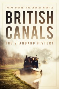
Cover illustrations from front: A narrow boat on a beautiful, misty morning. (Matthew Troke/Shutterstock.com); Pontcysyllte Aqueduct, which carries the Llangollen Canal 121ft above the River Dee in north-east Wales.
First published 1950 by Phoenix House
This paperback edition published 2022
The History Press
97 St George’s Place, Cheltenham,
Gloucestershire, GL50 3QB
www.thehistorypress.co.uk
© Joseph Boughey and the estate of Charles Hadfield, 1994, 2008, 2022
The right of Joseph Boughey and Charles Hadfield to be identified as the Authors of this work has been asserted in accordance with the Copyright, Designs and Patents Act 1988.
All rights reserved. No part of this book may be reprinted or reproduced or utilised in any form or by any electronic, mechanical or other means, now known or hereafter invented, including photocopying and recording, or in any information storage or retrieval system, without the permission in writing from the Publishers.
British Library Cataloguing in Publication Data.
A catalogue record for this book is available from the British Library.
ISBN 978 0 7524 8711 3
Typesetting and origination by The History Press
Printed and bound in Great Britain by TJ Books Limited, Padstow, Cornwall.
eBook converted by Geethik Technologies
Contents
List of Maps
Preface to the Paperback Edition
Introduction to the Paperback Edition
Note and Acknowledgements
1. Origins
2. Building the Canals
3. Early Life on the Canals
4. The Arteries of the Revolution
5. The Canal Mania and the Wars
6. Canals, Seas and Ports
7. The Golden Years
8. The Rivers during the Canal Age
9. War with the Railways
10. The Years of Decline
11. Time of Hope
12. Towards Nationalization
13. Between Transport and Amenity
14. Into the Second Canal Age
Notes
Further Reading
About the Authors
List of Maps
The main navigable rivers of England and Wales, indicating navigation improvements up to 1727
The canals of the Birmingham area as completed by the end of the canal age
The main inland waterways of Lancashire and Yorkshire
The waterways of southern England
The waterways system of England and Wales, 1789
The canals of the South Wales valleys
The main waterways of south-west England
The main waterways of Scotland
The waterways of Kent and East Anglia
The waterways of the West and East Midlands
The line from London completed by the Portsmouth & Arundel Canal, and the system centred on Southampton
The shortening of part of the Oxford Canal
The waterway system in Ireland
The Norwich & Lowestoft Navigation
The waterways associated with the Severn and border England
The main waterways of the Fens
The contraction of the main waterways system in England and Wales between 1906 and 1947
The classifications produced by the Board of Survey in 1955
Preface to the Paperback Edition
My interest in inland waterways began in the summer of 1963, when my father hired Kingfisher from Ernest Thomas at Gailey, in Staffordshire, for a slow fortnight’s journey to Ellesmere and back. This journey was repeated in the following summer, towards the end of which my father and I viewed the two lowest locks of the Hatherton branch of the Staffordshire & Worcestershire Canal. Although this had closed in 1955, these were reasonably intact and looked as if they could be used with heroic effort and will. I was curious to know what the canal was like beyond the locks, and from that time, I determined to learn more about the waterways that had so far formed a mere backdrop to a family holiday.
Over the following ten years of family holidays, we explored various less-used and derelict waterways, by boat, and sometimes by road or rail, until I began to explore by road on my own in the mid-1970s. This was driven by my enthusiasms perhaps more than they should, as the youngest family member, although the others took a moderate interest. I encountered a world, much of which, sadly, has long since receded into the past; we saw many vernacular waterside buildings, working narrow boats, and small plywood and fibreglass pleasure boats that no longer exist.
An early encounter was with Charles Hadfield’s British Canals; I still have a somewhat battered copy of the 1962 edition, which I received on my 10th birthday. This was a good time to begin a lifelong interest in waterways history; David & Charles’ The Canals of the British Isles regional series, to which British Canals formed (and still forms) an introduction, was well under way, with many histories of individual waterways building on their foundations. As I would discover, the “Charles” in David & Charles was Charles Hadfield, leading research and writing in this field, and encouraging publications. He also had a significant role in shaping the progress of history. For instance, he co-founded the Inland Waterways Association (1946), the Railway & Canal Historical Society (1954) and the Inland Shipping Group (1970/1), and was a key member of the first British Waterways Board (1963/6). I would meet Charles in his later years, and would write Canal Man and More about his waterways-related work, life and influence. In some ways, we live in a world of waterways that he influenced.
I began as an enthusiast, but later became an academic, carrying out postgraduate research into the built environment until 1984, and as a lecturer between 1989 and 2010. Transport history has a bad name in academic circles, with the term ‘anorak’ never far away, and I have discovered that many enthusiasts fear that academics look down on their work. In Canal Man and More, I presented evidence that this even applied to Charles Hadfield’s meticulous work. I later spent several years teaching environmental management, a field in which enthusiasts, professionals and academics often mix with mutual respect, and I hope that transport history will enjoy a similar position one day.
While many assisted me with the 8th and 9th editions, I would detail specific and diverse debts here. My late parents, Joan and Joseph, encouraged me to explore waterways history, although they had many other life interests and could have wished for a very different future for me. My (sadly late) sister Hilarie and surviving sister Christine also provided encouragement in their way. Charles Hadfield placed confidence in me to take over his old book, ‘to be completely and radically revised by a fresh mind and a younger head’, as he put it. We have now been without him for over 25 years, and I hope that he would be content with a book that is, indeed, so radically revised.
In 1994, I somewhat amusedly described Brenda Heath, my first wife, as bearing ‘canal widowhood’, little realising the devastation that ‘actual widowhood’ would bring when she died in 2002. She shared some visits, like that shown in the view of Standedge Tunnel on Page 130, but mostly her love and support helped me to work on writings that could well have awaited a later period, perhaps retirement. A continuing regret is the time spent on writing and a frustrating and unrewarding employment - time that we could have spent together. Finally, my second wife, Sara Richards, has brought new hope and love, but also much practical support, as a stern critic of both Charles’ and my words. Our shared interest in historic environments and landscapes, along with the love that has developed despite our major losses, has brought renewed inspiration. I should apologise for such personal comments in a Preface to a book about transport history, in place of the usual British male reticence about feelings but - not on this occasion.
Many people helped both Charles and myself with queries, over the last 75 years. I would commend the assistance and dedication of both reference librarians and (later) archivists, keepers of knowledge whose contribution deserves to be better known. Charles’ own interest in waterways had begun nearly hundred years ago, when the family solicitor encouraged him to study documents about his local canal, the Grand Western in Devon. He began British Canals with almost no regular public access to archives, yet now there are extensive archives, from digitised newspapers to local record offices, The National Archives, and the Waterways Archive at Ellesmere Port (which now includes many of his own records). Thanks largely to Charles’ work in writing and publishing, interest in waterways history now has firm foundations. This does not mean that it is, in any sense, completed. There has been an explosion in sources, online, written and audiovisual, and there is much to be found and further explored, in depth, detail and breadth. At the same time, sources like oral recollections and evidence from engineering and other structures are disappearing, lending urgency to much research. I hope that much more will be written and published, and that this book will provide a useful background.
Introduction to the Paperback Edition
The text from the hardback edition has been left as matters stood in 2008, with minor corrections, but this new edition provides an opportunity to sketch changes over the last 14 years.
The administration of British canals changed markedly in 2012. Ownership of the former British Waterways navigations in England and Wales was formally transferred to a new Waterways Infrastructure Trust, with strategic and everyday management awarded to the new Canal & River Trust. The Trust has moved from an emphasis on powered pleasure boating towards a much broader and general focus on well-being, with a much heavier involvement on the role of volunteers. The Inland Waterways Advisory Council, set up under the Transport Act 1968 to advise government, was abolished in 2011. Relations with government were now very different, while many campaigning groups felt that cooperation rather than confrontation was appropriate.
One intention was for CRT to assume the navigation responsibilities for the Environment Agency waterways, but this failed to take place. The Waterways Trust was absorbed into the Canal & River Trust, including the museums at Stoke Bruerne, Gloucester and Ellesmere Port. British Waterways’ Scottish navigations were left with British Waterways, employing a new name of Scottish Canals. The main development was the improvement of the eastern end of the Forth & Clyde, improving access to the Carron and Forth estuary. This new line, which opened in 2015, ran through the Kelpies, two huge horse sculptures.
Effective subsidies continued, with income from government that represented the functions that could not be the subject of charges or other direct payments. For the Canal & River Trust, by the end of 2022, negotiations should determine the renewed level of payments.
From 2010 the separate Trusts for the Lower and Upper Avons, from the Severn at Tewkesbury, to Alveston Weir above Stratford, were amalgamated under a single Avon Navigation Trust, the first unified management since 1717!
Most waterways in Ireland remained devolved to Waterways Ireland. This completed the restoration of the Royal Canal in 2010, and has led the long-term plans to restore the Ulster Canal. The Ulster’s first phase of restoration will focus on the section between Lough Erne and Clones; the restoration of an isolated section west of Clones (all within the Republic), costing 12 million euros, was finally announced in 2021.
Restoration completions have been much more limited during this period, in contrast to those completed around the Millennium. Perhaps the most significant completion was that of the Droitwich Canals, in 2011, after which administration was transferred to the Canal & River Trust. The gradual restoration of the Stroudwater Canal and Thames & Severn Canal over the last 50 years accelerated after 2006, using Lottery funding. While British Waterways withdrew promised funding in 2008, support from Stroud District Council secured reopening from Stroud downstream to Ocean, with much progress elsewhere, despite infilling and low road crossings. Further Lottery funding may well see the canal reconnected to the canal network at Saul by 2024.
Some restoration plans were effectively abandoned during this period. This included the Upper Severn and Higher Avon, over which environmental provisions prevailed, as they had on the Yorkshire Derwent, on which there was no progress, with the restored Sutton Lock becoming inoperable in 2015. The Barnsley Dearne & Dove Canals Trust had involved ambitious rebuilding proposals that would have involved extensive new construction. This Trust was wound up in 2020, spurred by the failure of planning protection for the line of the canal within Barnsley, exacerbated by falling membership. Despite greater volunteer involvement in work for the Canal & River Trust, there has been a decline in voluntary organisations. The ageing demographic of key voluntary enthusiasts, and unwillingness to commit to administrative work, provide a partial explanation. This did not just affect canal restoration. The Towpath Action Group also suspended activities in the 2010s, as did the Waterways Craft Guild.
Some smaller-scale restoration works continued, to provide modest extensions to sections of the navigable system. One notable longstanding scheme was the line to Newtown, known as the Montgomery. Progress was gradual and volunteer-led; the line was extended south from Maesbury, reopening to Gronwen. Reconnection to the navigable length at Llanmynech was in sight in 2022, and the final bridge crossing reconstruction under way. South of Llanmynech, much of the section to Arddleen (but not the low A483 crossings at Maerdy and Arddleen, or the Vyrnwy aqueduct) is to be restored under the 2019 UK Government’s Community Renewal Fund. In East Yorkshire, while part of the Derwent is now inaccessible, a further navigable two miles was added to the connected Pocklington Canal, upon which full restoration may be achieved in the 2020s.
The restoration of isolated sections in Ireland included the clearance and partial regating of locks on the Newry Canal, in local authority ownership. In the Republic, clearance works on the Boyne, owned by An Taisce, began in 2007. The lowest lock was reopened in 2012, with two more locks completing navigation to Newgrange by 2021, while further works were proceeding on isolated sections upstream.
Schemes of more modest scope have developed outside England. In Scotland, while much of the Monkland Canal has been destroyed, a local Friends group began to clear the towpath and water on a remaining length in 2020. Earlier, the Pontypridd Canal Conservation Group was formed in 2010; this has restored structures on one of the few surviving sections of the Glamorganshire Canal.
The restoration of the Wey & Arun Junction Canal may suggest how future restoration schemes will progress. Most of those schemes that have been completed either did not present major engineering problems, or were able to obtain significant funding around the Millennium, from sources that are much more difficult to access. A campaign for restoration of the Wey & Arun, last used in 1872, had begun just under a hundred years later, with clearance work in the 1970s and 1980s. As much of the line had been sold off and long sections destroyed, works proceeded only when finance and agreements with landowners was obtained. By 2022 a three-mile section north of Drungewick Lock had been made navigable, with reconstructed canal structures and new road crossings, and with short lengths further north navigable by small boats. This may well provide one model for large restoration schemes like the Herefordshire & Gloucestershire, Wilts & Berks, Thames & Severn, Lichfield & Hatherton: gradual environmental improvements, navigation on short but expanding lengths, and perhaps the completion of restoration by the later part of the the present century. Smaller-scale restorations may involve shorter timescales, but this may be disappointingly long-term.
The decline of freight traffics over English waterways continued. For instance, the aggregate traffics between Besthorpe on the Trent to Lafarge at Whitwood, on the Wakefield line of the Aire & Calder, ended in 2013 when Lafarge merged with Tarmac, and closed Whitwood wharf. This left very limited traffic on the CRT Yorkshire waterways - an oil traffic between Goole and Rotherham - as grain and general merchandise had ceased. Plans for a Port Leeds resulted in a new wharf at Knostrop, with a larger scheme in progress, taking renewed aggregate traffic to Leeds, which began in 2019. Elsewhere, traffics remained scattered and minimal, although much potential remains. Among pressure groups, the Inland Waterway Freight Group became dormant in the 2010s, although the Commercial Boat Operators Association, now open to enthusiasts and campaigners as well as operators, has taken up much of its role. Traffic continues to tidal ports, especially in the Thames area; of those East Coast ports listed in the hardback edition, Mistley, Wisbech and Boston are still operational, although Fosdyke Bridge is now a yacht haven. Most of the hoped-for traffic associated with the London Olympics in 2012 did not develop, although this did involve the restoration for leisure use of the Bow Back Rivers.
The Manchester Ship Canal, which had been mooted for closure in 1987, has remained open under Peel Ports, with traffics continuing to Irlam, and grain, cement, and scrap for export, upstream of Barton. It has formed the centre of major proposals by Peel, under the umbrella of Ocean Gateway, which includes a new Port Salford, served by rail. However, the proposed canal to the Trafford Centre did not materialise.
In Scotland, no new traffics have developed on the restored Forth & Clyde Canal (although this had been considered), while Ireland’s only inland traffic, in sand mined from Lough Neagh to the Lower Bann, has continued only in the face of major environmental objections that may well lead to its withdrawal.
Local and specialist independent museums, developed strongly from the 1970s, were beginning to decline by the 2020s. For example, the Yorkshire Waterways Museum at Goole, in financial difficulties, closed in 2019. The Canal Museum at Dewsbury and the Canal Exhibition Centre at Llangollen were among smaller attractions that have closed, partly due to changes in the patterns of leisure and tourism and the costs involved. The voluntary organisation that had set up what became the National Waterways Museum, latterly the Waterways Museum Society, was dissolved in 2020. In Ireland, the former Robertstown Canal Hotel remains vacant, although the small museum on the Newry, at Moneypenny’s Lock, is still open.
The position with the waterways of the British Isles in 2022 is thus a mixed one. The commercial transport role has become limited, despite the potential for new development, although the latter would require public subsidy. Subsidy is also required to ensure that the majority of waterways that have been retained for leisure boating continue to provide a different form of transport. There are further non-transport purposes, which have developed greatly since the 1960s: to seek the conservation of historic environments, species and habitats, to contribute to landscapes and to informal recreation and amenity. If this is sufficiently recognised and financed, the future of many historic waterways will be secured.
Joseph Boughey
January 2022
Note and Acknowledgements
Some waterways have been through so many changes of ownership and name that it has been difficult to describe them exactly. I have, therefore, tended to retain within the text the contemporary names used at each historical period, while deferring towards more modern names in the illustrations. I have diverged from names recognisable in modern times only in the case of the entirely unhistorical ‘Montgomery Canal’.
In the later chapters I have tended towards abbreviations for recurring titles and names: ‘BTC’ is much more readable than ‘Docks and Inland Waterways Board of Management of the British Transport Commission’, which was the controlling body for many British waterways between 1953 and 1955!
I have converted pre-1971 British currency to post-1971 equivalents; of course, inflation has removed any real comparability from these. I have resisted the temptation to metricate measurements, since this is largely a work of history; the only exception to this is the reproduction of statistics of tonnages which are now recorded in metric tonnes. In the interests of uniformity, I have used converted statistics which do not treat a multiple chambered lock in Ireland as a single lock; thus the 41 locks on the Grand Canal represent thirty-six sites with changes of level.
For the maps, I would again thank Mr Paul Hodgkinson and Mr Richard Dean. Most of the historical photographs came from four sources: the then Department of the Environment for Northern Ireland (which held the McCutcheon Collection), British Waterways at Gloucester, the then Boat Museum at Ellesmere Port (now the National Waterways Museum) and the Guinness Museum. I would repeat my thanks to various officers who assisted with the supply of these illustrations. For permission to use other illustrations I would like to thank the late L.A. Edwards, Dr Ian Bath, the National Library of Ireland and the Office of Public Works.
Many people have helped with information and comment and I would repeat my thanks for the exceptional assistance of Mrs Ruth Heard, Ireland’s principal canal historian, whose help enabled the enlarged coverage of Irish waterways for the eighth edition, which is continued here. For specific assistance with the ninth edition, I must thank Mr Mike Clarke, who always encourages scholarly research, and Mr Ken Fairhurst of the MMBC. As ever, all views expressed in this work, and all errors, are entirely my own.
CHAPTER ONE
Origins
The first edition of this book, which was written largely in 1948, depicted the scene at Boulter’s Lock on the Thames, on which boating for pleasure had then been significant for over 60 years. A contrast was then drawn with the river that earlier generations would have experienced, as primarily a means of transport. On artificial canals elsewhere in Britain in 1948, very few pleasure boats could be seen, as what will be termed the Second Canal Age was then only embryonic. On those canals, most boats that could be seen were engaged in carrying the surviving traffics over routes that had been constructed largely during the First Canal Age. To those who now use those routes, for boating, walking, or angling, or who benefit from their less obvious roles in water supply, drainage or nature conservation, their past use for transport may well not be apparent, leaving the reasons for their construction unclear.
This book aims to explain the promotion and construction of canals in the British Isles and their survival into the Second Canal Age. The use of inland waterways for transport long predates the First Canal Age, before which coastal transport and transport by road were supplemented by the extensive use of rivers. Rivers were often used for food, power generation, drainage and water supply and, sometimes, adapted for transport. Then, as now, these purposes could be in conflict, especially under pressure from economic development.
Freshwater fish remain significant in many parts of the world for food as well as for recreational angling, and, before transport developments improved meat distribution, many inland areas relied on freshwater fish for food. In the mediaeval period, fish were often harvested through fish weirs. These comprised dams of wooden stakes with nets, stretched across rivers, to trap migrating fish like eels. Similar examples from the Saxon period have been found in intertidal coastal areas. Weirs were largely created by major landowners, and presented such major barriers to navigation that Magna Carta in 1215 provided specifically that: ‘All fish-weirs shall be removed from the Thames, the Medway and throughout the whole of England, except on the sea coast.’1 Most coastal weirs had ceased to be used after the fourteenth century, but many inland ones long continued to impede navigation of rivers. Some still survive, such as those in Durham.
Rivers often provided a major source of hydropower, especially where they were tidal or fast-flowing. Wherever a sufficient fall of water could be exploited, waterwheels could grind corn mills and industrial processes like driving the hammers of ironworks could be powered. Often weirs, mill races and ponds were built to raise river levels and enable a sufficiently large and controllable flow through the wheel. This raising of levels could assist navigation on larger rivers, but both the fall, and the need to maintain levels, provided barriers to navigation. The earliest means in the world by which such barriers were overcome used rough ramps, later known as inclined planes, over which boats were dragged in the dry. Later, opening wooden sections in weirs enabled boats to pass through once levels on either side were equalised. These were known as flash-locks or staunches, early examples being developed on the Thames in the thirteenth century. These had a very limited fall, and provided a ‘flash’ of water so that a boat could be pulled upstream over a shallow section. At half-locks, or watergates, ‘the weir was built of masonry and was equipped with a gate, swinging on rides and equipped with movable paddles, which could be opened against the flow of the river by means of a winch on the bank.’2
The larger rivers, like the Thames, featured some such flash-locks until the 1930s, while the last navigable watergate, at Pershore on the Warwickshire Avon, was removed only in 1956. The remains of earlier staunches may still be found on the Little Ouse and Bottisham Lode, in Eastern England.
Few rivers had towing-paths, and it remains unclear which had them, or when the use of animal haulage began. The Warwickshire Avon had no horse path in the 1630s when William Sandys improved it, while the Wey Navigation had paths both for men and horses from 1652. When barges could not rely on sails, they were pulled by gangs of men, known as bow hauliers, who could scramble through obstructions and ford side-streams more easily than could horses or donkeys. Sometimes they would damage property or steal ‘Hennes, Geese, Duckes, Piggs, Swannes, Eggs, Woode and all such other Commodytyes’3 en route. Rivers were rarely dredged or maintained, and barges going upstream would often ground, with the water in each level reach held back to protect the power supplies to each mill. Bargaining with the miller controlling the reach above would be needed in order to release a ‘flash’ – sufficient water to enable the barge to be floated off. Further bargaining would be required at each weir to allow levels to equalise sufficiently to allow the boat to be pulled through, often with a winch, and sometimes, going downstream, to release enough water for the barge to float over shallow sections. It was reported of the River Lea in 1760 that:
The natural inconveniences of the River [are] made much worse by the practice of those who own the Mills, for tho Flashes from the Mill be in some places necessary, for which the Bargemen pay…for the most part the Millers by deepening and enlarging their bye streams that bring water to the Mill, draw off from the main river very much more than they need, that so they may sell the same water to the bargemen again and help those for money whom they have first themselves disabled. It is certain that some of the Mills do command the streams, that they can lay a whole fleet of Barges on ground upon the adjoining sharps and help them off again upon Composition, and one turnpike there is that lays the whole River dry.4
It was written later, that this ‘brings on a considerable charge to the Barge-Owner; renders his arrival at any given Place uncertain; and gives the Land Carriage the greatest advantage over that of the River Navigation.’5
The records are full of disputes between these interests, over excessive charges, refusals to give a flash, fights and stratagems. The medieval period involved similar efforts to remove fish weirs.
Any economic expansion requires improvements in transport and power, without which progress in agriculture, industry and distribution will be inhibited. Similarly, innovations in transport and power provide opportunities for industry, agriculture and distribution, which may consolidate progress if they are taken, or retard it if they are not. The process known as the Industrial Revolution was characterised in Britain by the mechanization of cotton manufacture, allied to a growing population and colonial surpluses, although the seeds were sown in the sixteenth century. The expansion of industrial production required improved transport and improved means of power generation. The population of England grew from 4 million in 1600 to over 7 million by 1750, and the size of the industrial labour force would almost double between 1780 and 1820. Industry and mining slowly grew in output and variety, as did the range of consumer goods, but before the locomotive railway, their products could only be moved in three ways, by land, sea or inland water.
Land transport has always existed, of course, but, before road engineers emerged in the eighteenth century, roads were often so bad that waggons could not always be used, and much was carried on the backs of horses and mules. For instance, in the early eighteenth century clay coal and flints to the Staffordshire Potteries, and the distribution of finished goods, largely relied on packhorses. The cost of road transport was prohibitively expensive: one horse could draw around 2 tons on a level road but from 50-100 tons on a good larger waterway. Road transport was therefore often limited to short-distance carriage, for instance the transport of coal for a few miles around a colliery, or of goods to and from a river or the sea. It was mainly used over long distances only where perishable or valuable goods were involved, where water transport would damage established interests, or the cost and unreliability of water transit were increased by monopolies or delays. Waggon services in England and Wales eventually grew with the expansion of trade before and during the canal age, with many roads being turnpiked between 1751 and 1772, and further developed to reflect urban and industrial growth, before the railways took much passenger and freight traffic. Some early river navigations were ineffective or expensive; thus various roads in West Yorkshire were turnpiked under Acts of 1741, to bypass the Aire & Calder Navigation that had opened in 1699.
Around the coasts, especially those of England and Wales, ships of the coastal trade moved goods that would be later moved by rail or road. Vessels passed up estuaries to minor inland ports on the smaller rivers of (for instance) East Anglia, or to the larger seaports such as London, Bristol and Kings Lynn. At seaports goods were transhipped to smaller craft – keels, trows or Western barges – in which they were transported to smaller ports, such as Bewdley and Bridgnorth, on the Severn.
A somewhat fanciful drawing of a packhorse train. Over the terrain depicted, of course, only horses could be used prior to the development of motorised road transport. This and other drawings from Samuel Smiles’s Lives of the Engineers tend to overemphasise the advances made by civil engineers in the Industrial Revolution.
Other waterways were adapted for navigation merely by the construction of landing-places. In some cases goods carried in larger vessels were unloaded to small boats and then onto the waterside. Estuaries and lakes often presented a barrier that had to be crossed by ferries where there were no bridges or fords. For lakes such as Windermere and Coniston in the Lake District, Llyn Padarn in North Wales, or Lough Corrib in the west of Ireland, the water was used as a means of transport rather than a barrier. Estuarial tidal waterways were often used without recourse to the sea; thus, barges carried lead up the River Dee from Flintshire mines to the leadworks at Chester. In other cases, the river itself was the source of raw materials, such as sand and gravel dredged from its bed, which was then landed nearby.
The River Severn was the main water route to the west side of midland England. Much traffic was carried upstream from the port of Bristol, along with that originating from industries along its length such as the saltworks of Droitwich. Large quantities of coal passed along it from the Shropshire collieries of Broseley, Benthall and Barr. Of around 2–300,000 tons of coal carried on English rivers at the end of the seventeenth century, 100,000 passed along the Severn to Shrewsbury, Bridgnorth, Bewdley, Worcester, Tewkesbury and Gloucester. From Bewdley’s warehouses goods landed from Severn trows were distributed by packhorse and waggon into the countryside of Worcestershire, Staffordshire and Shropshire. A return flow, in goods like Midlands ironware, was sent down river to the seaports and the West Country.
Sand dredged from the estuary of the River Taw at Crow Point being landed on the Yeo at Barnstaple in summer 1993. This was a traffic that had been continuous since at least the sixteenth century, before the canal age. Small creeks like the Yeo (which once served Rawle Gammon & Baker, in the background) carried large quantities of local and seagoing traffic before and during the canal age. This traffic finally ceased in the late 1990s when temporary planning permission expired.
On the other side of England, the Thames was also a distributing and trading river, connecting towns such as Windsor, Reading and Oxford, and forwarding goods from the port of London. Cambridge had long been significant for the distribution of goods by water from Kings Lynn, sending corn and other produce downstream. The nearby Stourbridge fair, which Defoe described in 1724 as the largest in the world, was sustained by water transport, much of it to and from East Coast ports.
The Fens waterways had a special position, as the main highways in parts of Eastern England. They carried goods from overseas and coastal ports up the Great Ouse, Nene, Welland and Witham, sending back countryside produce. They were used to move passengers and goods round their water-dominated district, where roads were few. Stone was brought by water from the Barnack quarries in Northamptonshire to build the Crowland and Ramsey abbeys, and the Lincoln, Ely and Peterborough cathedrals. The fourteenth-century records of Ely show:
…the sacrist and his fellows using the fenland waterways as their normal means of transport; whether it was to synods at Barnwell, or to buy cloth wax, tallow, lead and other necessaries at Lynn and Boston, or merely to conduct their ordinary business at Shippea, Quaveney, Littleport and elsewhere among the fens.6
In much of Scotland, Wales and coastal Ireland, rivers tended to be fast-flowing, and not readily adapted for navigation, although in Scotland the deepened Clyde would play its part in the growth of Glasgow, and several tidal rivers around the Welsh coast were navigated upstream.
Before the reign of Elizabeth I most legislation sought to maintain or restore navigation upon naturally navigable rivers, but after her reign there were many more attempts to make new navigable rivers. Beginning with the Lea in 1424, the Thames, Yorkshire Ouse, Kentish Stour and others (but not the Severn) had been put under the care of corporations or other bodies charged with maintaining navigation. Meanwhile Acts authorised the removal of fisheries and other obstructions from the largest rivers, such as the Wye and Medway, the latter without success. Improvement schemes needed bodies which had powers to set aside the rights of private property in the public interest. These were usually corporations in cities like London, Gloucester and York, or Commissioners of Sewers. The latter bodies, set up under a 1531 Act, comprised local landowners with rating powers whose principal concern was land drainage and flood protection rather than navigation.
When rivers were to be made navigable for the first time, the usual practice was to grant letters patent to one or more people who undertook to make the navigation. Thus Thomas Skipwith was empowered in 1634 to make the Soar navigable. In other cases trustees were appointed or powers were given to a company. Those involved were permitted to collect tolls from all who used the improved navigation, and sometimes the exclusive right to carry goods on it. Improvements and operations conferred uneven benefits, and thus attracted variations in support from landowners and merchants.
In the second part of the sixteenth century, the pound-lock, in use since the previous century in Italy, Germany and the Netherlands, was introduced into England. Despite its cost, this invention made it possible to improve river navigation far beyond the level achieved merely by dredging and the removal of obstructions. A Victorian civil engineer described the pound-lock as:
… a chamber, placed at the junction of two reaches, in which the water can be raised or lowered so as to be on a level with either the upper or lower reach. The lock-chamber is usually closed by a pair of gates at each end; it is filled by letting in water from the upper pool through sluices in the upper gates or side walls, and emptied by letting it out through similar sluices at the lower end.7
If pound-locks were used to pass boats from one level to another, weirs no longer needed a central moveable portion, and could be made continuous. This created such an increased economy in water use that compromises with milling interests became possible. Pound-locks only needed a lockful of water, but a flash given to a barge might have meant lowering the whole stretch of river up to the next weir.
The first known examples of pound-locks in Britain were not on a river but on a short canal. John Trew of Glamorgan, an otherwise unknown engineer, built three on the Exeter Canal between 1564 and 1566. These were very wide basins, with very limited falls; soon replaced, this design does not seem to have been emulated elsewhere. Pound-locks began also to be built on rivers – seemingly one on the Lea and one on the Trent, both in 1576. In the seventeenth century they were constructed on the Thames between Iffley and Abingdon, the Warwickshire Avon, the Wey and elsewhere. Pound-locks were now included in improvement schemes, as with the six ‘sluices’ built on the pioneering Great Ouse between 1618 and 1625, alongside the older ‘staunches’ (flash-locks), which continued to be used at lower toll charges.
Opposition to navigation improvements came from many quarters. Those interested in road transport disliked a cheaper competitor. Landowners perceived increased risks of flooding from the raising of water levels for pound-locks, or conversely that improved flood-control would prevent their water-meadows from being flooded. Farmers feared that improved transport would open up wider areas of trade and cause prices to fall, since produce could be obtained from further away. The most sustained opposition to specific schemes came from local authorities in towns that might lose their role as distributing centres for goods. For instance, Nottingham, high up the Trent, bitterly opposed the attempts by Derby citizens to make the Derwent navigable, so that goods would come up the Trent without transshipment at Nottingham. Reading opposed the Kennet Navigation to Newbury, and Liverpool the Mersey & Irwell to Manchester. Parliamentary Bills for navigation improvements thus involved many petitions and compromises with opponents.
When major attempts to drain the Fens were made in the early seventeenth century, towns like Cambridge were concerned that this might damage their navigations. In 1630, an agreement, the Lynn Law, was made with the Duke of Bedford, the chief promoter of the drainage, to preserve the navigation of the ‘Ouse, Grant, Nean, Welland amd Glean’8 and the port of King’s Lynn.
While drainage engineers usually sought to keep watercourses as empty as practicable to increase capacity during floods, this often conflicted with regulations to retain a minimum depth for navigation purposes. Despite many disputes, the rights of navigation were preserved in all legislation for the better drainage of the Fens. There were major arguments over Denver Sluice, which was thought to cause the silting up of the channel below it until it collapsed early in the eighteenth century.
Thereafter there were three main periods of activity in the making of river navigations. Before the first, England had about 685 miles of river navigation, including the Thames, Severn, Trent, Yorkshire Ouse and Great Ouse. Several Acts passed between 1662 and 1665, including important provisions to improve the Worcestershire Stour and Salwarpe, the Wye and Lugg, Medway, Hampshire Avon and Itchen. On 2 March 1665 the Speaker of the House of Commons told the Lords:
The main navigable rivers of England and Wales, indicating navigation improvements up to 1727. The main coasting ports are also shown. Early editions of British Canals reproduced two maps from T.S. Willan’s River Navigation in England, indicating districts which were more than 15 miles from navigable waterway. This map attempts to replace the earlier maps, indicating a much more modest advance than the Willan maps suggested. Some navigations were short lived (such as the Lugg), while others varied in their condition and usefulness. It is noteworthy that it was the industrial centres in the English Midlands which were not served by water transport.
Cosmographers do agree that this Island is incomparably furnished with pleasant rivers, like Veins in the Natural Body…Therefore we have prepared some Bills for making small Rivers navigable; a Thing that in other Countries hath been more experienced, and hath been found very advantageous; it easeth the People of the great Charge of Land Carriages; preserves the Highways, which are daily worn out with Waggons carrying excessive Burdens; it breeds up a Nursery of Waterman, which, upon Occasion, will prove good Seamen; and with much Facility, maintain Intercourse and Communion between Cities and Countries.9
Schemes to build canals emerged during the seventeenth century. In 1641, for instance, there was a proposal to make navigable the Wey and Arun rivers, and to join their upper reaches by a canal two miles long, while the Restoration period included unsuccessful Bills to join the Thames to the Severn via the Bristol Avon. These would have used very short artificial canals to join rivers at points where they were extremely narrow and shallow. Andrew Yarranton, a Worcestershire ironmaster and later the author of England’s Improvement by Sea and Land (1677), advocated the construction of such links in the 1660s, and began work on part of the Severn-Trent route, by canalising part of the Stour.
In the second period of activity, from 1697 to 1700, Acts included the Tone, Aire & Calder, upper Trent, Lark, and Yorkshire Derwent. In the third, between 1719 and 1721, river navigation schemes reflected the boom associated with the South Sea Bubble, including Acts for the Derbyshire Derwent, Douglas, Weaver, Mersey & Irwell, and Bristol Avon. By 1724 there were 1,160 miles of river navigation, although some navigation works were short-lived or ineffective. Most of lowland England then lay within 15 miles of a navigable river, and goods moved more freely, often in new patterns and at lower costs. Before the Aire & Calder was made navigable to Leeds and Wakefield in 1699, wool for manufacturing came from east coast ports or from Lincolnshire or Leicestershire, by road; cloth from Leeds or Wakefield also went by road to the nearest points on navigable rivers, like Selby on the Ouse or Knottingley on the Aire. Most coal to York came, not from the West Riding mines only 20 miles away by road, but from Newcastle, by keel down the Tyne, ship to the Humber, and up the Ouse in lighters – a distance of 200 miles.
Often three or four groups of undertakers would at different times try to make the same river navigable, often defeated by opposition, or by destruction through flooding, as with the Worcestershire Stour to Stourbridge in 1667, and the newly built locks on the Calder & Hebble in 1767 and 1768. Many plans failed because of the lack of engineering knowledge at the time. As will be stressed in Chapter two, it was the building of canals that largely created the profession of civil engineer by producing sufficient demand to foster the development of specialisms, and levels of capital investment that necessitated the reliable and accurate estimating of costs, design, and the supervision of works. However, even after well-known engineers with much practical experience were available, it remained more difficult to make rivers navigable rather than to construct canals, as there were more forces outside the engineers’ control. Rivers like the Severn and Trent were not made properly navigable until after the canal age; others, like the Swale, never were.
Poor institutional management and organised opposition sometimes meant that new navigations were less successful. The Kennet, for instance, was to be made navigable to Newbury, but the 1708 Bill was opposed by both the town of Reading, which anticipated the loss of transhipment trade, and by one Finch, a pensioner of the Reading turnpike. Finch presumably feared that the turnpike trust would no longer be able to pay his pension if the navigation was successful. The Act was passed in 1715, making seven partners the proprietors. After a disastrously inexperienced engineer had been dismissed, John Hore was appointed in 1718. He built 21 locks and made 11 miles of artificial cuts to join the 7 miles of river, which, apart from the towpath, was ready in 1723. The navigation had only been completed, however, with many disputes over mills and water left unsettled, deep hostility (sometimes with threats of violence) from parties in Reading, and a severe shortage of money, such that by 1734 the works were in poor order. The original seven partners had soon dwindled to one, and no profit had been made. By 1761 the proprietors asserted that:
The undertaking has been ruin’d by Idle Servants Extravagant Wages Imbezelments & Loss of materials & by a superfluous & unnecessary number of Hands all of which Evils must be remedy’d by Industry, Frugality great care & application…10
Among rivers that had successfully been made navigable were the Mersey and the Irwell. From Liverpool the River Mersey ran past Runcorn and Warrington to Irlam, where the Irwell took up the line to Manchester. By 1697 fish-weirs had been cleared to make the Mersey navigable to Warrington, but in 1721 a company of undertakers was authorised to make the rivers navigable to Manchester, which:
… will be very beneficial to Trade, advantageous to the Poor, and convenient for the Carriage of Coals, Cannel, Stone, Timber, and other Goods, Wares and Merchandises, to and from the Towns and Parts adjacent, and will very much tend to the Imploying and Increase of Watermen and Seamen, and be a Means to preserve the Highways.11
By 1734 the navigation was open, with eight locks between Warrington and Manchester taking flats, sailed if possible, otherwise towed. However, Manchester needed not only improved trade with Liverpool, but also coal supplies, and in 1737 the company obtained an Act to make the Worsley Brook navigable, to carry coal from mines near Worsley to the Irwell, and so to Manchester. Although this scheme was never carried out, it had significant consequences for the first canal age.
After the invasion in AD 43, the Romans made use of the Fossdyke from the Witham at Lincoln to the Trent at Torksey as a navigation. They may also have used other waterways (the Bycarrsdike and Turnbridgedike) to form a water route towards York. The gradient of surviving remains of the Caerdyke (or Carrdike), running south from Lincoln to the Nene at Peterborough, suggests that its northern part merely served a drainage function and was never fully navigable. However, the section between Peterborough and the Cam at Waterbeach in Cambridgeshire was navigable, and this and the Fossdyke can be said to be the oldest canals in the British Isles. The Fossdyke was partly supplied by tidal water (land and water levels have since greatly changed), but silted up after the Romans left. It was dredged out by 1121, but was unnavigable during most of the thirteenth century. After partial clearance by Bishop Atwater in 1519–21, it declined into decrepitude with only occasional use, until full clearance and a pound-lock at Torksey were provided in 1741.
A new waterway, termed a canal but largely an enlargement of the tidal River Clwyd for three miles under a master Fossator, enabled the construction and later supply of Rhuddlan Castle after 1277, as part of works to unify Wales with England. In the twelfth or thirteenth century two short canals were built to carry stone to Rievaulx Abbey in Yorkshire, although, like the Fossdyke, these partly used the former course of a river. Around 1490 Sir Andrew Wood, a retired admiral, appears to have constructed a short private canal at Largo, Fife, for use by his pleasure boat.
The Exeter Canal, effectively bypassing part of the Exe estuary blocked by weirs, was built between 1564 and 1566, at the behest of the local authority in Exeter. Engineered by John Trew, this was a very small canal, 3ft deep, 16ft wide and 1¾ miles long. While Trew had promised to build a canal accessible at all states of the tide, this was not achieved, and the canal was none too successful at first. The canal was rebuilt in 1581, extended downstream by 1677, and then enlarged between 1698 and 1701 to a depth of 10ft and breadth of 50ft, dimensions sufficient for coasting craft and small ships.
The ‘Titchfield Canal’, built in 1611 in the lower Meon valley in Hampshire, apparently included a sea-lock at its tidal end, but it is unclear whether it was used for navigation. The Wey Navigation of 1651–3 included 12 pound-locks and some 9 miles of cuts in its 15-mile length, including the ‘Long Reach’ above Weybridge. The navigation began operations amid financial chaos, with unpaid bills and the treasurer heading for the debtors’ prison. By 1677 its condition was ruinous, but trade improved after 1680.
The longest improvement to a river line, however, was in rural Lincolnshire. The Stamford Canal extended the navigation of the Welland upstream over 9 miles from Market Deeping to Stamford. After water mills rendered the Welland no longer navigable, an Act to restore the navigation was obtained in 1571 by Stamford Corporation. While no action resulted, it was empowered by a Charter of 1621 to ‘make a river or new cut of such breadth and depth as they should see fit for the passage of boats, lighters and other vessels’. This was financed by tolls at each of the 10 canal and 2 river locks, over a 9-mile navigation, the upper section of which comprised 6 miles of canal, with an independent water supply. Construction was delayed by the English Civil War, but was completed by 1673. Using 7-14 ton lighters, the main traffic was seaborne coal, although by 1706 increased taxation had severely reduced it; some traffic lasted until 1863.
However, perhaps the first true artificial canal to be built in the British Isles was in the north of Ireland, to link Lough Neagh and the Tyrone coalfield with the port of Newry.
Ireland’s lakes, linked to rivers like the Bann, Erne and Shannon, were used for transport by small boats in the mediaeval period. As early as 1178, navigation along the south end of Lough Corrib was reputedly improved by the construction of Friars Cut by the friars of Claregalway Abbey. This improved access to the port of Galway, and in 1498 a canal was proposed to link the lake westwards through Lough Athalia to the sea.
From the early seventeenth century there were schemes to link the main rivers in Ireland, but it was only after the overthrow of James II in 1688–91 that moves began to promote inland navigations to foster economic development. The Irish Parliament considered several Bills between 1697 and 1700 for river improvements and for a new canal to link Newry and Lough Neagh. None succeeded, but in 1715 an Act was passed to develop the inland counties of Ireland through drainage works and by making ‘navigable and communicable passages for vessels of burthen to pass through’.11 This and later Acts provided for local commissioners who would appoint undertakers to construct works and to levy tolls. Proposals foreshadowed the later Grand Canal from Dublin to the Shannon.
All that resulted was some work on the River Maigue and a disastrous attempt to canalise a fast-flowing part of the Liffey. An Act of 1729 provided for a more centralised control of developments, which led directly to the start of work on the Newry Canal in 1731.
While Dublin was expanding rapidly at that time, it relied on imported coal. Dublin merchants were keen to develop coalfields in east Tyrone, which could be served by way of a coastal route to Dublin, reaching Lough Neagh, through a new canal to Newry. Its form was influenced by Richard Castle (or Cassels), a French Huguenot refugee who had studied waterway engineering in Continental Europe, and arrived in Ireland in 1728. He worked for Edward Lovett Pearce, a Dublin architect responsible for many country houses, who was appointed Surveyor-General in 1730.
Engineered at first by Pearce until his death in 1733, then Castle until his dismissal in 1736, and finally by Thomas Steers of Liverpool, the Newry Canal was opened in March 1742, when it was reported from Dublin that ‘the Cope of Loughneaghe, William Semple (commander), came into this harbour laden with coals and being the first vessel that has come through the new canal.’12
Lock 11 at Poyntzpass on the Newry Canal in the mid-1960s. While many of the structures on this canal were rebuilt after 1810, this gives an impression of the earliest major canal in the British Isles. (McCutcheon collection)
The Newry Canal was 18 miles long, some 45ft wide and over 5ft deep, with 14 wide locks, with brick chambers, timber floors and sizeable falls of between 12ft and 13½ft. These locks included a staircase pair at the summit at Terryhoogan, and three which made use of ground paddles, which had first been developed in 1561 on the Brussels Canal. Its summit was supplied by a feeder from Lough Shark (now Acton Lake), some 78ft above sea level. Vessels were towed by horses along the Canal itself, but sailed across Lough Neagh and by sea from Newry, although lighterage into seagoing vessels soon replaced the latter stage.
This had critical elements of later canals: locks with solid chambers (some earlier versions, as on the Kennet, had been turf-sided), mitred gates and ground paddles, a towing path for horses, opening bridges in Newry, and a summit reservoir. Castle (Cassels) and Steers may well have been influenced by knowledge of waterways in France. These included the Canal de Briare, opened in 1642 which was the first to cross watersheds, and to have staircase locks, and the Canal du Midi, opened in 1681, which had a summit level, independent water supplies and a short tunnel. By 1750, however, problems with construction and maintenance had limited the Newry Canal’s usefulness, and it would be extended downstream of Newry in the 1750s and rebuilt in the early nineteenth century.
Steers had been born around 1672. After a military career in the Low Countries, he became engineer for Liverpool’s Old Dock, the first commercial wet dock in Britain, in 1710; from 1717 he was Dockmaster, and Mayor of Liverpool in 1739. He had been approached first to be Newry Canal engineer in 1729, and was later involved in plans for the Douglas Navigation and Mersey & Irwell Navigation.
The first modern canal in England, the Sankey Navigation (later called the St Helens Canal), involved Steers’ pupil Henry Berry, who succeeded him as Liverpool dock engineer after Steers died in 1750, and William Taylor. Only the making navigable of the little Sankey Brook from near St Helens to the Mersey was authorised by the Act of 1755, which, in contrast to most waterway proposals, met with no Parliamentary opposition. Berry had probably decided to build a canal instead of a river navigation, and agreed with the principal shareholder, John Ashton of Liverpool, that ‘the work should commence on 5 September 1755, but the project was carefully concealed from the other proprietors, it being apprehended that so novel an undertaking would have met with their opposition’12. Most of the canal was opened in 1757, with a further length in 1759. It was 8 miles long with 10 locks, including a staircase pair, using water supplies from the Sankey Brook. The line relied on the use of sailing barges that could transit the Mersey, with opening bridges rather than overbridges.
Worsley on the Duke of Bridgewater’s Canal, showing entrances to the underground colliery canals, which operated until about 1887. The boats are ‘starvationers’. This drawing from Smiles is generally accurate, and the site can be recognised today.
While Henry Berry and John Ashton should receive their tribute, the credit for beginning the development of the English connected canal system must go to the Duke of Bridgewater and his advisers, John and Thomas Gilbert, and James Brindley. The first short length of the Duke’s Canal that opened in 1761 demonstrated the engineering practicality of building artificial canals and the economic success that could be generated. Above all, the publicity involved inspired much public support and encouraged investment.
The Sankey Navigation Canal between Bradley and Hey Locks, one of the few lengths of the 1757 canal to have survived with anything like its original appearance. This length was in regular use until the sugar traffic ended in 1959 and was closed in 1963. Some clearing works were carried out in the 1970s, but the bridge does not open, and much of the canal above Bradley Lock has been destroyed.
The Duke of Bridgewater had inherited coal mines in Worsley, to which the canalization of the Worsley Brook had been authorised in 1737. Although the number of cotton mills, powered by water, had greatly increased in north west England, domestic coal was not readily available in the growing Manchester area. The sea coal that was available, via the Tyne and the coasts, to towns on the eastern side of England could not reach Manchester, which relied on coal brought expensively from local collieries on horseback or wagons. The Duke had travelled to the Continent on the Grand Tour in 1754 and must have seen the Canal du Midi and other canals there. His land agent, John Gilbert, proposed the line for a canal from the collieries towards Manchester in 1757. The duke agreed, and obtained an Act in 1759 to build two lines to the Mersey & Irwell Navigation. John Gilbert had already been involved in plans to build a canal from the Potteries to the Trent, which had faced financial barriers. The Duke’s wealth, which the exploitation of his mines was expected to increase greatly, enabled him to finance the whole undertaking, partly by mortgaging his estates. His political influence and lobbying enabled the Act to pass despite opposition from landowners.
A further Act of 1760 amended the canal’s line to one that would cross the Irwell, to join a proposed level line from Manchester to Runcorn. As this presented Gilbert with too much work, he introduced James Brindley to the scheme. Brindley would later be considered to be the most important engineer of the early canals, although he was a millwright by training. He had been born in the High Peak, and practiced as a millwright in Leek. His expertise lay with the use of water, including early experiments with a steam engine, and harnessing water power to drain the Wet Earth colliery near Salford. This had led to his survey of the Potteries-Trent canal in 1758. Brindley surveyed the line to Manchester and gave evidence to Parliament, helping to defeat the Mersey & Irwell opposition, although it was Gilbert who designed the Barton Aqueduct to cross the Mersey & Irwell.
When this canal was being built, in contrast to earlier ones, it attracted great interest. One writer said that ‘it will be the most extraordinary thing in the kingdom, if not in Europe. The boats in some places are to go underground, and in another place over a navigable river, without communicating with its waters…’14 A year later, in 1761, the canal was open to the outskirts of Manchester, and barges were passing over the 200 foot long aqueduct, 38ft above the Irwell. At Worsley a basin was built at the foot of a sandstone cliff, from which tunnels ran into the mine so that coal could be loaded directly into small boats, ‘starvationers’, possible ancestors of the later narrow boat. Eventually 46 miles of underground canals, on four levels, would be tunnelled, as the Duke’s prosperity increased. A further Act, of 1762, much opposed by Cheshire landowners, would extend the line to the Mersey at Runcorn.


