11,49 €
Mehr erfahren.
- Herausgeber: Crowood
- Kategorie: Lebensstil
- Sprache: Englisch
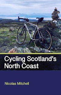
This cycling guidebook follows the course of a new cycling route around the North Coast of Scotland, described as Scotland's own Route 66. Since its launch in 2015 this route - branded as 'North Coast 500' (NC500) - has proved to be a resounding success, with motorists, motorcyclists and cyclists flocking to Inverness to put rubber to the road, driving and riding through some of the most spectacular scenery in the United Kingdom. This guidebook is aimed specifically at cyclists, describing the entire coastal route over seven stages. A sketch plan, elevation graphs and turn-by-turn directions are given to each stage; points of interest are highlighted, and in many cases illustrated; helpful sections on travel to Inverness, nutrition, navigation and emergency cycle repairs; alternative route is offered to the busy and challenging A9 section south of Wick and finally, a full list of accommodation providers to suit all budgets.
Das E-Book können Sie in Legimi-Apps oder einer beliebigen App lesen, die das folgende Format unterstützen:
Veröffentlichungsjahr: 2018
Ähnliche


Cycling Scotland’sNorth Coast
Nicolas Mitchell
The Crowood Press
First published in 2018 by
The Crowood Press Ltd
Ramsbury, Marlborough
Wiltshire SN8 2HR
www.crowood.com
This e-book first published in 2018
© Nicolas Mitchell 2018
All rights reserved. This e-book is copyright material and must not be copied, reproduced, transferred, distributed, leased, licensed or publicly performed or used in any way except as specifically permitted in writing by the publishers, as allowed under the terms and conditions under which it was purchased or as strictly permitted by applicable copyright law. Any unauthorised distribution or use of thistext may be a direct infringement of the author’s and publisher’s rights, and those responsible may be liable in law accordingly.
British Library Cataloguing-in-Publication Data
A catalogue record for this book is available from the British Library.
ISBN 978 1 78500 472 8
CONTENTS
INTRODUCTION
CHALLENGES OF CYCLING THE NORTH COAST OF SCOTLAND
NAVIGATION
TECHNOLOGY
NUTRITION AND FITNESS
WHAT GEAR TO TAKE
TRAVEL
EMERGENCY CYCLE REPAIRS
STAGE 1 INVERNESS CASTLE TO LOCHCARRON 64.7 MILES
STAGE 2 LOCHCARRON TO GAIRLOCH 79.9 MILES 38
STAGE 3 GAIRLOCH TO LEDMORE (ALTNACEALGACH MOTEL) 74.6 MILES 50
STAGE 4 LEDMORE (ALTNACEALGACH MOTEL) TO RHICONICH 75.3 MILES
STAGE 5 RHICONICH TO THURSO RAILWAY STATION 85.4 MILES
STAGE 6 THURSO TO HELMSDALE 72.6 MILES (INCLUDES 19 MILES CYCLING ON THE A9)
STAGE 7 HELMSDALE TO INVERNESS 78.3 MILES (INCLUDES 54 MILES CYCLING ON THE A9)
ALTERNATIVE STAGE 6A THURSO TO ALTNAHARRA (AVOIDING THE A9) 64.1 MILES
ALTERNATIVE STAGE 7A ALTNAHARRA TO INVERNESS CASTLE (AVOIDING THE A9) 73.3 MILES
RESOURCES
ACCOMMODATION PROVIDERS
CYCLE REPAIR SERVICES
BIKE HIRE
LUGGAGE TRANSFER AND CYCLE TOURS
TOURIST INFORMATION
CYCLING FITNESS BOOKS AND WEBSITES
CYCLING NUTRITION BOOKS AND WEBSITES
CYCLE REPAIR BOOKS AND WEBSITES
TEN OF THE BEST CYCLING BOOKS
INTRODUCTION
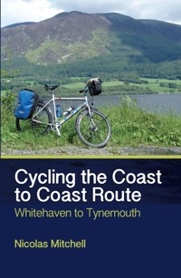
This guidebook describes a cycling road trip of over 500 miles in seven stages around the northern coastline of Scotland, starting and finishing in Inverness. At the end of Stage 5, the reader is given the choice of following one of two routes back to Inverness. Our attention was initially drawn to cycling in the Northern Highlands of Scotland by articles in the press and online about Mark Beaumont, the record-breaking round-the-world cyclist and documentary film-maker, who rode 500 miles of the northern coastline of Scotland in under 40 hours. We discovered that the coastal public roads used by Beaumont had been packaged, branded and protected under trademark as the NORTH COAST 500 (NC500). Launched in 2015, it is essentially an economic initiative based around an iconic road trip, designed to bring car drivers, motorcyclists and cyclists from all over the world to the Northern Highlands of Scotland to spend their money and energize the local economy; it is a Scottish Route 66, swapping California for Caledonia. Through a mixture of strong branding, slick marketing and the natural attraction of Scotland as a tourist destination, the road trip, especially for car drivers and motorcyclists, has proved to be a roaring success.
We initially planned a guide to cycling the route based solely on Beaumont’s coastal odyssey. However, when we looked in more detail at the route he had ridden, it raised one important issue: the danger of cycling on the A9, a road with a fearsome reputation. Taking into account the difficulties of the A9, we believe that we have covered all bases by researching and describing two routes. Stages 1 to 5 are common to both and should appeal to cyclists of all stripes, from beginner to experienced club rider. Thurso presents a fork in the road. If you are set on hugging the coastline back to Inverness, sticking to the branded road trip, then you should follow the route from Thurso described in Stages 6 and 7. If you want to enjoy a quieter ride back to Inverness, without the stress of cycling on one of Scotland’s most dangerous roads, then follow Stages 6A and 7A, which will allow you to return to Inverness via a less busy inland route.
Every stage of the tour is fully described, with directions, distances, daily ascent and descent and the maximum elevation for every stage, as well as a sketch plan and an elevation chart. Annotated maps derived from OpenStreetMap (openstreetmap.org) are included as well as various points of interest. There are short sections on fitness, nutrition, navigation, what gear to take, travel and emergency cycle repairs. At the back of the guidebook you will find a full list of accommodation providers, cycle repair services and tourist information offices, as well as suggested further reading.
The total mileage for Stages 1–7 is 530.8 miles, with 10,079 metres of ascent. The highest point on the cycle tour is Bealach na Bà, at 600 metres (1,968 feet), which you will encounter on Stage 2, Lochcarron to Gairloch. The alternative route, utilizing Stages 6A and 7A, is slightly shorter at 517.3 miles. It is physically a little more challenging, but has significantly less traffic and is far more relaxing.
This cycle tour of the northern coastline of Scotland offers mile upon mile of gorgeous scenery, from the early stages, which present stunning views of the Isles of Raasay and Skye from Applecross, to the later stages, where you will revel in the big skies of the Flow Country. Rivers, lochs and the sea will be your constant companions. The hills are numerous. Some are relentless, but they fit every description: rolling, long and steep, short and very steep, exceptionally steep. On the Bealach na Bà you will experience hairpin bends, a rare phenomenon in the UK. Cycling between Applecross and Shieldaig on a blustery day, with winds from the north or north-east, and clear blue skies trading places with rain showers every half hour, will test the legs of even the strongest cyclist.
The ruggedness and sheer drama of the landscape of the North-West Highlands are unsurpassed anywhere in the UK. The mountains especially make this amazing cycle tour unforgettable. They are mainly comprised from a combination of three types of rock: Lewisian gneiss, Torridonian sandstone and Cambrian quartzite, embodying 2.5 million years of the Earth’s geological history. As you pedal from north of Ullapool to Laxford you will be riding amongst exposed Lewisian gneiss, a bedrock that is in the region of 1.75 billion years old, almost half as old as planet Earth itself. Around 1.2 billion years ago, gigantic rivers and streams transported massive quantities of sand, rock, mud and boulders, which covered the existing bedrock in a layer of detritus 3 miles thick. This hardened to become what we now call Torridonian sandstone, a reddish-brown ancient material that you will see near Applecross. Some 530 million years ago, pure sand from a shallow sea was deposited. Over time, this crystallized to become Cambrian quartzite, which now reflects mirror-like in bright sunlight. The best places to see Cambrian quartzite are on the upper slopes of the peaks of Liathach mountain as you ride through Glen Torridon and on Foinaven as you cycle from Rhiconich to Durness.
It is easy to think of Scotland’s geographical position in the world today as timeless, and to imagine that it has always resided in its northerly latitude. This is not the case, however. About 600 million years ago, the land lay close to the South Pole on the fringe of Laurentia, an ancient continent that included Greenland and North America. Over millions of years, Laurentia slowly moved north, powered by convection currents that shifted the Earth’s tectonic plates. Around 400 million years ago, the ancient Lapetus Ocean that had once separated Laurentia from Avalonia (what we know today as England and Wales) and Baltica (now Scandinavia) finally closed and disappeared, causing these ancient continents to collide. The tumult of the collision triggered volcanic eruptions. The ancient deposits that had been laid down over millions of years were altered through intense heat and pressure; huge terranes of rock were shifted upwards and younger rocks were pushed over older rocks. The violence of the event created a mountain landscape of epic proportions, believed to have been comparable in size at one time with the Himalayas of today. Over millions of years, the combined actions of ice, wind, rain and snow slowly eroded the once-mighty mountain chain to a tiny remnant. This is the North-West Highlands of Scotland – a place where a cyclist putting rubber to the road will encounter some of the most breathtaking cycling terrain in the UK.
That feeling of freedom.
Cambrian quartzite on the upper slopes of Foinaven 911m. © Graham Lewis
CHALLENGES OF CYCLING THE NORTH COAST OF SCOTLAND
There are two important issues that any cyclist should be aware of when cycling the north coast of Scotland. The first is presented by the weather. Even at the height of summer the weather can be cold, rainy, windy or a combination of all three. Temperatures in Scotland are generally lower than in the rest of the UK and it is the windiest country in Europe. The Scottish Highlands are also one of the wettest places in the UK. It is imperative that you check the weather forecast before cycling each day and that you are prepared to ride in, or carry, appropriate clothing. That means waterproofs, fleece, over-shoes and so on. If the weather forecast is really bad, with heavy rain, fog, ice, sleet, snow and/or strong winds (in excess of 18 miles per hour) predicted, then do not ride that day. It is also worth preparing a daily ‘bail-out’ strategy, researching local taxi companies who can collect you should the weather turn particularly bad, and finding out about alternative accommodation providers in case you have to curtail a day’s ride through inclement weather. Before you leave on the ride each morning it is good practice to adopt a ‘phone-in’ procedure with a family member or friend, giving them an approximate time when you will contact them later in the day to confirm you have arrived at your destination safely.
The second challenge comes from other road users. You are likely to encounter groups of motorcyclists riding high-powered machines, and it is not unusual to be overtaken by twenty motorcyclists riding in convoy. Owners of supercars are also flocking to drive the northern coastline of Scotland. The branded coastal road trip ‘NC500’ was launched in March 2015, and over the next year there were nine deaths and twenty-three serious accidents on the main roads that comprise the route, an increase of 45 per cent on 2014 (sundaypost.com). With these statistics in mind, it is essential that you wear bright, high-visibility clothing, have working lights on your bike and ride with the utmost care and attention. It is not advisable to wear earphones and listen to music or podcasts whilst riding this route; you will often hear a group of cars or motorcycles long before you see them.
Stages 6 and 7 follow the coastline and have a total of 73 miles cycling on the A9, which starts at Latheron (ND 199 335), 16.8 miles south of Wick, and finishes at Ardullie Lodge (NH 587 622), 3.4 miles north-east of Dingwall. This is the most challenging stretch of road on the tour. If you are not confident riding amongst fast moving traffic on a trunk road, we strongly recommend cycling as far as Thurso and returning to Inverness via the much quieter and safer route through Strath Halladale and Strathnaver. With safety in mind, Cyclecraft by John Franklin (The Stationary Office, 2014) is a very useful book and gives sound advice. You will also find safety advice specific to the NC500 on their website (northcoast500.com).
Father and son loving the ride to Lochcarron.
NAVIGATION
We are confident that the contents of this guidebook in terms of the route description and map panels will provide all the information required for a successful cycle tour of the north coast of Scotland. On any long-distance cycle tour that traverses remote and exposed places, it is essential to know your exact location at all times. You may have an accident, come across an incident or need rescuing in the case of extreme weather. In these circumstances, you should be able to give the emergency services a six-figure grid reference and this is why we recommend carrying the appropriate Ordnance Survey (OS) Landranger maps for this route. Throughout this guidebook you will find numerous six-figure grid references, which are derived from OS maps. Two grid letters precede each of the six-character grid references. For example, the Cairn to the north-west of the Bealach na Bà can be found on OS Landranger Sheet 24 and is referenced as NG 774 426; the first two grid letters, in this instance NG, can be found on any of the four corners of Sheet 24 and form the first part of the grid reference.
The important letters forming the first part of a six-figure grid reference.


