8,39 €
Mehr erfahren.
- Herausgeber: Batsford
- Kategorie: Lebensstil
- Sprache: Englisch
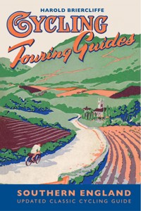
The revised edition of the classic cycling guide by Harold Briercliffe of 1950. Used as the inspiration for the Britain by Bike television series and a vital part of the award-winning Britain by Bike book by Jane Eastoe, the original book is reproduced along with suggested cycling routes in the Central England region for today's cyclists. Harold Briercliffe was the Alfred Wainwright of cycling and his books provide great insight into cycling in various parts of the UK in the 1940s. Harold's fascinating description of the towns, villages and roads of Britain at the time is a joy for all those who love these isles and especially for cyclists looking for inspiration. Many roads have changed over the decades and are now too busy for enjoyable cycling, so Mark Jarman, along with Sustrans, have made suggestions for alternative routes in the region for today's cyclists. The book includes the original photographs taken by Harold Briercliffe and the original illustrations. The Cycling Touring Guide: Southern England covers cycle routes in the Thames Valley and the Cotswolds, The Isle of Wight, The New Forest, between London and the South Coast, and routes along the South Coast. The cycle routes vary in length from half day and day-long trips to weekend and week-long tours.
Das E-Book können Sie in Legimi-Apps oder einer beliebigen App lesen, die das folgende Format unterstützen:
Seitenzahl: 207
Veröffentlichungsjahr: 2012
Ähnliche


ACKNOWLEDGMENTS
Thanks to Sam Howard at Sustrans for providing details of the latest Sustrans routes, and to Ruth Briercliffe for her assistance.
First Published 1950 (under the title Cycling Touring Guide: Southern England)
Revised edition published 2012 by
Batsford 10 Southcombe Street London W14 0RA
An imprint of Anova Books Company Ltd
Volume © Batsford, 2012 First ebook publication 2012 Additions by Mark Jarman and Sustrans
The moral rights of the author have been asserted.
All rights reserved. No part of this publication may be reproduced, stored in a retrieval system, or transmitted in any form or by any means electronic, mechanical, photocopying, recording or otherwise, without the prior written permission of the copyright owner.
ebook ISBN: 9781849940665
A CIP catalogue record for this book is available from the British Library.
20 19 18 17 16 15 14 13 12 10 9 8 7 6 5 4 3 2 1 First ebook publication 2012
Also available in paperback ISBN-13: 9781849940399
Neither the publisher nor the author can accept responsibility for any changes, errors or omissions in this guide, or for any loss or injury incurred during the use of any of the cycling routes.
CONTENTS
Introduction by Mark Jarman
Preface by Harold Briercliffe
Chapter I–THE THAMES VALLEY AND THE COTSWOLDS
Introduction
Approaches
Tour of the Thames Valley and the Cotswolds
Brief Gazeteer
Nearby Touring Districts
Cycling in the Thames Valley and Cotswolds today
Chapter II–THE ISLE OF WIGHT
Approaches
Three-day Tour
Round the Island
Across the Isle to Carisbrooke Castle
Over the Downs
Cycling in the Isle of Wight today
Chapter III–THE NEW FOREST
Approaches
In the New Forest
Cycling in the New Forest today
Chapter IV–BETWEEN LONDON AND THE SOUTH COAST
To Portsmouth
To Chichester
To Chichester (and Portsmouth) by Petworth
To Arundel (for Bognor or Littlehampton)
To Worthing
To Brighton (via Horsham)
To Brighton
To Eastbourne
To Brighton (via New Chapel)
To Lewes, Newhaven and Seaford
London to Eastbourne (by Tunbridge Wells)
To Battle and Hastings
To Rye
To Folkestone
To Canterbury, Dover and the Isle of Thanet
To Margate and Ramsgate
Cycling between London and the South Coast today
Chapter V–THE SOUTH COAST
Approaches
Tour of the Southern Counties
Day and Week-end Runs into Kent
Cycling on the South Coast today
Appendix
Index
LIST OF LINE ILLUSTRATIONS
London to the Coast
Fairford
The “Devil’s Den”, Dolmen on Marlborough Downs
Shanklin Chine
Chale
Godshill
The Knightswood Oak, the largest tree in the new Forest
Lewes
The Arun, Near Amberley
Stopham Bridge
The Cuckmere Valley, Sussex
The Barbican, Sandwich
The scenic illustrations are taken from drawings by Frank Patterson.
LIST OF PLATES
Typical Thames-side scenery where the Chilterns meet the river
Looking down the picturesque High Street of Burford, Oxfordshire
Godshill village in the Isle of Wight
The Rufus Stone, in a New Forest clearing
At Friday Street, a favourite resort near Leith Hill, Surrey
The Long Man of Wilmington, a hillside carving on the South Downs
The picturesque harbour at Rye, Sussex
The ancient bridge over the River Medway at Aylesford, Kent
INTRODUCTION
The Britain by Bike TV series was based on a collection of old and largely forgotten cycling guides written by Harold Briercliffe over 60 years ago in the late 1940s. Such was the interest in the TV series and associated book that the guides quickly went from almost unknown on the second-hand market to being highly prized and almost impossible to obtain. Perhaps the main reason for the renewed interest in the guides is that they take you back to a time many now see as cycling’s golden era. They are so much more than slightly dated books with directions to help you find your way from A to B. Indeed anyone who sought out the original Southern England guide in the belief that it would provide accurate and reliable information about the best cycle routes around Southern England will be rather disappointed. Clearly, as a 21st century cycling guide, Harold Briercliffe’s writings are no longer as helpful as they once were as so many aspects that impact upon cycling conditions have changed dramatically since the 1940s. For this reason, in this revised reissue the end of each chapter includes details of current recommended Sustrans routes that can be used to help explore the places that Briercliffe visited on his cycle journeys. The real joy of Harold’s original books is their insight into Britain in an earlier age, and a reminder of a gentler pace of life and the attractions of cycle touring around Britain.
The starting point for understanding and appreciating the guides is to look at the context in which they were written. In the post-war years, Harold Briercliffe was a writer for Cycling magazine, then the UK’s main cycling publication. The guides were assembled from the feature articles written in the magazine, with each issue covering an area of the UK that later formed the basis of a chapter within the regional guides. The first guide was published in 1947 and covered the Northern England region. Over the next few years a further five were produced ending with the Southern England guide, which was published in 1950.
The post-war Britain that Briercliffe encountered on his cycling journeys was a place in the midst of austerity, where rationing strictly controlled the availability of essentials, including food, clothes and fuel. It is worth remembering that at the end of the 1940s only 1 in 7 households had access to a car. If you were one of the few that did have a car your family’s vehicle was likely to have little in common with today’s air-conditioned people carriers and 4 x 4s. The most popular cars of the day were rather uncomfortable and modestly sized by modern standards with the Morris Minor and the Austin A30 being two of the most popular 1950s models. For most people, the main methods of mechanised transportation were rail, bus and, of course, the bicycle. With the average workers’ holiday being only one or two weeks a year, the bicycle was seen as a key form of transport, offering cheap and easy access to the UK’s places of interest (alongside bus and rail travel). During this period, the UK’s cycling industry output was moving towards its peak. There were numerous manufacturers producing bicycles not only for the domestic market but for export all over the world. Notable companies from that era include Phillips, Dawes, BSA, Holdsworth, Royal Enfield, Elswick, Sunbeam, Evans, Claud Butler, Bates and Hetchins. But it was Raleigh that became established as the leading bicycle manufacturer of the day with the company’s bicycle production reaching a peak of over a million in 1951. This increase in demand and supply was accompanied by advances in design so that bicycles became much more suited to longer distance touring. The use of lightweight 531 tubing to build the classic diamond- shaped frame (including randonneur handlebars), and the introduction of the simplex derailleur gear system and cantilever brakes, meant that the bicycles available in the early 1950s looked remarkably like modern touring bikes (although today’s bicycles benefit from more sophisticated alloys of steel and aluminium as well as a much greater range of gears).
For those who might have been slightly less enthusiastic about spending their leisure time on a bike, there was relatively little to encourage them to stay indoors. This was a world without games consoles, personal stereos, home computers or wide-screen TVs. By the beginning of the 1950s only 8% of households in the UK had a TV. For the few television owners, there was only one station (ITV did not join the BBC until 1955) and the broadcasting hours were very limited. So for the vast majority, the radio “wireless” provided the main source of family entertainment within the home. Cinema was the only other boom area for entertainment.
Against this background of ongoing rationing and limited forms of entertainment, it is perhaps easier to understand the reasons why Harold Briercliffe (approaching 40) embarked on the monumental task of covering the whole of the UK by bike. Following production of the Northern England guide in 1947, Briercliffe’s articles in Cycling magazine were gradually used to form a series of regional guides covering the Scottish Highlands, Wales, South West England, and The Midlands before finishing with Southern England.
The Southern England guide covered what Briercliffe described as a triangular area within the corner points provided by Banbury to the north, Margate to the southeast and Poole to the southwest. This area of Britain has experienced perhaps the greatest changes over the last 60 years, particularly in terms of housing and traffic growth. As far as traffic conditions are concerned it is revealing to see Briercliffe suggest the use of what are now very busy ‘A’ roads to cycle out of main urban areas. In the case of the Southern England guide the most obvious example of this is Briercliffe’s suggestion to use the A4 Great West Road to cycle to Reading or starting from London Bridge to get to Kent, and Hyde Park Corner to head off to Sussex. His description of these routes does not refer to avoiding the M25 or the wider motorway network because in 1950 Britain’s motorway network was still very much on the drawing board.
This gradual increase in Britain’s highway capacity coincided with the growth in car ownership and use. The Department for Transport has recorded levels of use of the various types of transport (in annual billion vehicle kms) every year since 1949. Cycling has declined rapidly since the 1950s from a high of 24 billion vehicle kms in 1949 to around 5 billion vehicle kms in 2010. In the same 61-year period, car usage has risen from just over 20 billion vehicle kms in 1949 to almost 400 billion vehicle kms by 2010. Against this backdrop, it is little wonder that the road conditions Briercliffe describes at the end of the 1940s seem to bear so little relationship to what would be found if you tried cycle touring on Britain’s trunk road network today.
In addition to this massive increase in highway capacity and traffic levels, Britain experienced significant house building in the post-war years leading to the expansion of major urban conurbations as well as some of our smaller towns and cities. There are many reminders of the obvious changes that have occurred since the 1940s in Briercliffe’s description of the places he visits on his journeys. Briercliffe’s route towards Reading involves passing through Bracknell, which he states “is likely to see great changes in the coming years”. Great changes indeed! Bracknell was one of the 14 new towns designated by the Government in the New Towns Act of 1946. In the case of Bracknell its new-town status resulted in the transformation from what Briercliffe referred to as a small “townlet” (less than 5,000 inhabitants) to a major urban area with a population of over 60,000. The 1946 Act resulted in similar levels of development in a ring of New Towns around London, with places such as Stevenage, Crawley, Hemel Hempstead, Basildon and Harlow all growing rapidly. A second wave of new-town building followed in the 1960s, including towns such as Runcorn, Telford and Washington, with the grandest project being Milton Keynes, which was designated in January 1967.
You might wonder whether in the face of so much housing development, road building and traffic growth since 1950, if any of the UK that Briercliffe discovered on his journeys still exists. It is therefore reassuring to find that so much of the distinctive character of Briercliffe’s Britain can still be discovered by the cycle tourist. An obvious starting point within the Southern England guide is to visit Oxford. The central area of this city has changed very little since the 1940s, and was left largely unscathed from World War II. So in the post-war years there was no need to undertake any significant rebuilding of the city centre. And due to the enlightened ‘no road building’ policies of the City and County Councils, there has been no need for significant demolition of old housing areas to make way for new roads. The benefit of all this is immediately apparent to the visiting cyclist travelling through the centre of the city. Today’s cycle tourist will be surrounded by thousands of other people on their bikes in Oxford and will see a wonderful array of outstanding buildings including the Sheldonian Theatre, Bodleian Library, Bridge of Sighs and the Radcliffe Camera. No doubt Briercliffe would still find Oxford “a most interesting and picturesque town”.
Moving beyond the confines of Oxford, many of the routes that Briercliffe identifies in his journeys around the Thames Valley and the Cotswolds are still perfectly suitable for the keen touring cyclist. The network of roads and lanes around the Barringtons, Sherborne, Farmington and Northleach continue to provide ideal cycling country as do some of the roads linking villages in the Coln Valley. Towns such as Broadway, Chipping Camden, Chipping Norton and Stow remain wonderfully preserved examples of the best that the Cotswolds has to offer. And if Briercliffe was to return to Great Tew, his favourite Cotswold village, it is doubtful whether he would notice too many differences. But it is important to realise that some of the countryside routes suggested by Briercliffe have become so heavily trafficked that they are no longer suitable for leisure cycling. Examples include his suggested route from Enstone to Woodstock, using what has now become the A44 (an alternative Sustrans option, NCR 5, now exists). Similarly, the idea of using the A424 to cycle to Stow-on-the-Wold would perhaps be better avoided.
Moving beyond the Cotswolds and Thames Valley area, there are many other parts of Southern England where much of 1950s Britain still remains. The most notable example of this can probably be found on the Isle of Wight. Certainly Briercliffe is a big fan of the Island, commenting “The tourist who wishes to choose a small neat region for exploration from a single centre could hardly do better, in southern England, than the delightful Isle of Wight.” The island has seen relatively little development in the last 60 years. As far as road building is concerned, most of the roads remain as they have been since the war and there is only one small stretch of dual carriageway on the island. There are currently over 200 miles of picturesque countryside and coastal cycle routes within a compact area of just 147 square miles. This explains why, in recent years, cycling has become a prime tourism feature on the Island to the extent that it now hosts an annual cycling festival.
Similarly, the New Forest has remained relatively unscathed by the passage of time since Briercliffe’s visits in the 1940s. Places such as Lyndhurst, Brockenhurst and Lymington retain much of their old charm, albeit with increased traffic pressures. Interestingly, proposals for new road schemes within the Forest have not progressed. This passage of time seems insignificant in comparison to the lifespan of one the New Forest landmarks mentioned by Briercliffe. The Knightwood Oak remains a popular attraction today and is estimated to be over 500 years old, having been one of the Forest’s well-known tourist magnets even in Victorian times.
One important feature that has changed in the New Forest, as elsewhere throughout Britain, is the availability of youth hostel accommodation. Briercliffe mentions the suitability of Norleywood Youth Hostel as a base for exploring the area. This hostel, along with many others mentioned throughout Briercliffe’s guides, was one of the casualties of the hostel closure programme. This would not have been anticipated by Briercliffe back in the late 1940s when membership of the Youth Hostel Association was heading towards its peak. At the start of the 1950s there were 303 youth hostels and over 200,000 YHA members. Increased availability of holidays abroad and changes in the level of walking and hiking resulted in a gradual fall in demand for YHA accommodation. This led to closures and a modernisation programme with the emphasis on providing better youth-hostel facilities in towns and cities. The net result of this programme was that around 100 of the hostels (particularly those in more remote rural areas) were closed. So today’s touring cyclists planning a holiday along the south coast will find the availability of YHA accommodation much diminished.
In terms of how to get to the south coast from the London area, Briercliffe’s guide mentions a number of route options. He is particularly keen on the main route from Central London to Portsmouth, stating that the “72 miles of the Portsmouth Road are perhaps the finest scenically of any main road between London and the South Coast.” Users of the main road, now the busy A3, will realise that it no longer provides an ideal cycling environment. Instead, there are now a number of options for less busy routes developed by Sustrans, which are described at the end of chapters 4 and 5 (see pages 110 and 139). Many of the places Briercliffe mentions are still of great interest. For example, Guildford’s High Street is described by Briercliffe as one of the most picturesque in the country. It remains a worthwhile stopping point with its “projecting clock” dating from 1682 outside the town hall. Also interesting to note is Briercliffe’s reference to another well-known Guildford landmark: the construction of the modern cathedral building started in 1936 and by 1949 Briercliffe noted that it was well on the way to completion.
Leaving Guildford and looking at potential routes for getting to the south coast there is one option that was not available to Briercliffe. The infamous “Beeching Axe” which fell in the 1960s resulted in more than 4,000 miles of railway branch lines and 3,000 stations being closed. One unintended benefit from so many railway lines falling out of use was that in more recent years some of these routes have been converted to form excellent paths for cyclists and pedestrians. As cycle routes they have become a much-valued facility, free from the hazards of fast-moving motor vehicles and are generally very flat, not exceeding a gradient of more than 1 in 20. The network of available old railway paths can now be studied on the Sustrans mapping (see also page 141). One such path known as “The Downs Link Route” provides a 35-mile connection between Guildford and the south coast and is one of the longest converted railway path cycle routes in the country.
Moving on to the closing chapter of the Southern England guide, Briercliffe offers his ideas for a tour of the southern counties. What becomes increasingly apparent by this point is that much of the essential character of Southern England’s towns has remained intact over the course of the last 60 years. It is noticeable that the routes between towns and cities seem to have changed more than the description of the towns themselves. In places such as Tunbridge Wells, Battle and Rye, much of the historic core remains. Chichester and Arundel still retain the wonderful buildings and architecture that Briercliffe mentions, including the Cathedral at Chichester and the castle at Arundel. You would however, no longer want to cycle between the two places via the A27. North of Arundel and the busy A27, the pleasant cycling that Briercliffe describes still exists in quintessential English villages such as Bury and Bignor. The towns along the south coast have, of course, been subject to much more development. For today’s cyclist, travelling towards Kent new routes now exist (Sustrans NCR 2) to help cyclists visit the towns along the English Channel, such as Eastbourne, Bexhill, Hastings, Winchelsea and Rye before heading on to Folkestone and Dover. Interestingly, back in 1947, Briercliffe makes reference to the exploratory shafts for the “often-proposed Channel Tunnel”. It took almost another half a century for the commencement of the construction in earnest and for the tunnel to open finally for business. Who knows where Harold Briercliffe’s journeys would have ended if there had been such an easy option for travelling in to France!
Mark Jarman 2012
PREFACE
The scope of this guide to Southern England is a wide one. It takes in all the area—perhaps even a little more—that is enclosed within a triangle which has its apexes at Banbury, Margate and Poole. Thus it deals mostly with Londoners’ country. Nevertheless, cyclists from the industrial Midlands and the North, living in a grimmer environment altogether than that south of the Warwickshire Avon, look upon “the South”, as they call it, as one big garden.
Indeed, that part of the district which lies in Kent, Sussex and Hampshire, apart from a few blots, is singularly free from industrialism. Moreover, the weather is kinder for the greater part of the year than it is farther north.
The scenery of the district is pleasing rather than noble, soothing rather than inspiring. It has few hills higher than 900 feet, its coastline is nearly all spoilt by building and except for the Thames it has few impressive rivers.
Yet its own characteristics are striking enough. Throughout there are splendid examples of ecclesiastical, military and domestic building. There are great stretches of open moorland and down, plenty of woodlands and many pleasant, twisting, valleys.
Kent was for long the most advanced in the arts and sciences of all early English settlements and the power of the Kingdom of Wessex was so great that it extended far to the north—even into the confines of Midland Mercia, just as this guide to Southern England does.
The four main tours in this book cover, respectively:—
1. WThe Thames Valley and the Cotswolds;
2. Isle of Wight;
3. The New Forest; and
4. Kent, Surrey and Sussex.
There is necessarily some overlapping with two previous volumes in this series: South-west England and the Midlands. Where there appear to be omissions, the reader is directed to the appropriate companion volume.
HAROLD BRIERCLIFFE.
Letchworth, Herts.
December, 1949.
CHAPTER I
THE THAMES VALLEY AND THE COTSWOLDS
INTRODUCTION
IN the westerly and north-westerly directions, suburban London extends for 30 or 40 miles. Inside the arc Maidenhead—Berkhampstead there is a good deal of quiet and unspoilt scenery, but it is more worthy of the attention of the day rider or the week-ender rather than the man on a holiday. Beyond the 40-mile radius there lies a stretch of rural England which is lovely and varied and has very few marks of industrialism, if Reading and Swindon are avoided.
For a few miles above Reading goes perhaps the finest reach of the River Thames, and after a stretch of less attractive country comes Oxford. North and west of the university city undulate the Cotswolds consisting mostly of bare uplands, not greatly appealing in themselves but holding in their folds exquisite valleys and much splendid domestic architecture. This was all rich wool country in the Middle Ages and the stone houses and churches testify to its wealth and greatness.
The Cotswolds end at the imposing scarp which overlooks to the west the Severn Estuary, and in this vicinity are the richest woods of the district, at Cranham. On this western fringe, too, are some of the most charming of the deep valleys in the Cotswolds.
There are plenty of viewpoints in the Cotswolds, notably Cleeve Hill and Birdlip Hill (near Cheltenham), Fish Hill (above Broadway) and Edge Hill (between Banbury and Stratford-on-Avon). There is, too, a network of lanes, but an exception must be noted in the Thames Valley. It is not easy to follow the Thames closely by road, and glimpses of the river must be gained along the few reaches favoured with a riverside road or at selected viewpoints, mostly close to bridges and villages.
The district is, even now, fairly well supplied with bed and breakfast places. There are also plenty of youth hostels, although the inexperienced hosteller needs the usual warning that at week-ends hostels within 40 miles of the big cities are often uncomfortably full. Camping sites, especially in the remoter corners, are easily obtained.
Road surfaces, even on the minor highways, are quite good and once the Chilterns are pierced there are few of the flinty top-dressings which can damage so severely modern bicycle tyres with thin walls.
Nearly everyone who visits the Cotswolds comes home with a favourite village—the “most beautiful” is a typical superlative. I am as prejudiced as anyone else in this matter and I have my own ideas. Broadway is too sophisticated for me. Burford I would call a wonderful old townlet instead of a village. Perhaps I rate the highest of all, Great Tew (see page 40), which the purist might retort is not in the Cotswolds at all!


