Erhalten Sie Zugang zu diesem und mehr als 300000 Büchern ab EUR 5,99 monatlich.
- Herausgeber: Luath Press
- Kategorie: Lebensstil
- Sprache: Englisch
Spending seven months in Orkney during 2015 and 2016 in order to delve into the secrets of the islands, Richard Clubley was keen to get as many local views as possible. He gathered interviews with lighthouse keepers, farmers, archaeologists and climbers – and many others! On dreich afternoons during the short days of winter, Richard ate home bakes with locals and recorded their memories. It was at one such hearth that someone said, 'You know about so-and-so of course, you come to Orkney all the time, so how could you not know?'. Richard didn't know. While there are still a lot of unearthed stories hidden in Orkney, Richard has collected a fair few in this beautifully illustrated book. Richard Clubley loves Scotland's islands, but it is Orkney that has stolen his heart. In this book, he portrays the northern Scottish islands fairly and honestly, with stories that even Orkney locals may not have heard before. Travellers from elsewhere will be charmed by Richard's descriptions of the Orkney landscape and way of life.
Sie lesen das E-Book in den Legimi-Apps auf:
Seitenzahl: 385
Veröffentlichungsjahr: 2017
Das E-Book (TTS) können Sie hören im Abo „Legimi Premium” in Legimi-Apps auf:
Ähnliche


RICHARD CLUBLEY lives in Derbyshire, which is not the most convenient place to stay if you love Scottish islands, so this year – 2017 – he is moving with his wife Beverly to Orkney. They are building a house in Orphir on Mainland with views over Scapa Flow. Although the phrase is a cliché it will be ‘a dream come true’.
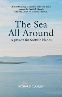
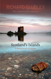
Richard has found Scottish islands endlessly fascinating since his very first one – Arran – at the age of eight. He has visited around 70 of them to date and they form the content of his first book Scotland’s Islands – A Special Kind of Freedom, published by Luath Press in 2014.
As a schoolteacher Richard took several parties of children to uninhabited islands to share the unique experiences with a new generation. He knows of one or two from those early trips in the 1980s that are still hooked on island hopping.
Richard is a regular contributor to Scottish Islands Explorer magazine and the online magazine Orkney.com. Writing this book and moving to Orkney do not presage an end to the infatuation but rather less flirting and a deeper love.
LIZ THOMSON trained as a teacher before taking up her brush and pencils and graduated from Sheffield School of Art in 1979. Her work is regularly exhibited both locally – in Sheffield, where she still lives – and nationally. Liz won a major prize for landscape in the 2001 Laing competition and was a regional finalist in the 2005 competition for Channel 5. Her work hangs in private collections in the USA, Holland, Austria and France, as well as here in the UK.
He has a beautiful written style that allows him to convey his enthusiasm in a truly inspiring way.UNDISCOVERED SCOTLAND
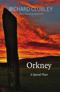
Orkney
A Special Place
RICHARD CLUBLEY
with illustrations by LIZ THOMSON
Luath Press Limited
EDINBURGH
www.luath.co.uk
First published 2017
ISBN: 978-1-910745-95-3
eISBN: 978-1-912387-00-7
Illustrations and maps by Liz Thomson
The author’s right to be identified as author of this work under the
Copyright, Designs and Patents Act 1988 has been asserted.
© Richard Clubley 2017
To Beverly and Catherine, with whom the discovery and exploration of Orkney have provided some of my happiest memories.
Contents
MAP1: Scotland with all her islandsMAP2: Map of OrkneyMAP3: Orkney Mainland
AcknowledgementsForeword by Howie FirthPrefaceIntroduction
ORKNEY HISTORY
CHAPTER 1: A Brief History of OrkneyCHAPTER 2: Neolithic Orkney from the airCHAPTER 3: The Kitchener MemorialCHAPTER 4: LighthousesCHAPTER 5: The Ring of Brodgar
ORKNEY PEOPLE
CHAPTER 6: Dr John RaeCHAPTER 7: The Island GamesCHAPTER 8: Orkney FurnitureCHAPTER 9: Young PeopleCHAPTER 10: The Owld Men’s Hut – The Pier Head ParliamentCHAPTER 11: Traditional Music – Hanging by a ThreadCHAPTER 12: Old Men of HoyCHAPTER 13: Islands in Winter
ORKNEY’S OUTER ISLANDS
CHAPTER 14: Hunda – Small and mysteriousCHAPTER 15: Cava – A couple of Robinsons Crusoe and a whaleCHAPTER 16: Rousay – The ClearancesCHAPTER 17: Papa WestrayCHAPTER 18: Westray – A place of safety
ORKNEY’S WILDLIFE
CHAPTER 19: Birds in WinterCHAPTER 20: Stoats
ORKNEY’S FAVOURITE BUILDINGS
CHAPTER 21: Favourite Buildings 1 – SchoolsCHAPTER 22: Favourite Buildings 2 – ChurchesCHAPTER 23: Favourite Buildings 3 – Saint Magnus CathedralCHAPTER 24: Favourite Buildings 4 – The Bothy at Swanbister
TOURISM IN ORKNEY
CHAPTER 25: Cruise LinersCHAPTER 26: Orkney Produce
ORKNEY’S FUTURE
CHAPTER 27: Green EnergyCHAPTER 28: Heading North – The journey to Orkney is all part of the experienceCHAPTER 29: New Hospital – The future’s bright
Epilogue
Map 1 – Scotland with all her islands.
Map 2 – Map of Orkney archipelago
Map 3 – Map of Orkney Mainland
Acknowledgements
My first thanks must go to the people of Orkney for making me welcome and being so open and honest about their islands. The tea and home bakes as people told me their stories have not helped the diet, however.
Another big thank you to Liz Thomson for more of her super drawings. Her enthusiasm for both illustration and meeting deadlines is highly valued.
Thanks to NorthLink Ferries, Orkney Marketing Scheme, Dave Flanagan and Loganair for all the travel assistance and thanks, too, to The Pickaquoy Centre for a comfy tent pitch (with electricity hook-up!).
The use of Cliff and Nikki Bichan’s bothy at Swanbister was much appreciated, especially in the winter months when it shut out the noise of the wind so effectively.
Thanks, once again, to Gavin MacDougall and everyone at Luath Press for their continued support.
Thanks to John Humphries, editor of Scottish Islands Explorer magazine, for publishing some of my stories in advance of the book and for giving it a good plug.
In spite of all the help, the responsibility for any and all errors is entirely mine. I’ve tried to have everything up to date at publication but with Orkney forging ahead the way it does some things will be out of date in a matter of days.
Huge thanks to Captain Davie Miller, Jackie Delaney and everyone at Loganair for the flight described in chapter two. Thanks also to Craig Taylor at The Orcadian and archaeologists Caroline Wickham-Jones (lecturer in archaeology, University of Aberdeen) and Dan Lee (Orkney Research Centre for Archaeology) who gave up their Saturday morning to fly with me.
Last, but not least, much love and thanks to Bev, for unwavering support and encouragement throughout and for letting me go off island hopping and for always being here when I get back – so far.
Richard Clubley 2017
Foreword by Howie Firth
RICHARD CLUBLEY loves islands. His previous book took him round a range of Scotland’s islands, and he sailed and he walked and he kayaked and he swam, and the chapters paint pictures of land and sea and people.
There is something in his childhood that called him onto a lifelong island quest. Born at Withernsea on Yorkshire’s east coast, he remembers vividly his father pointing out a ruined wartime fort on a tidal island, and the longing on summer days for the sea to go far enough out to let him cross to it.
He never managed to make that crossing but all his life he’s been making up for it, and not simply setting foot on islands but talking to the people and gathering their stories. There is something in him that makes him a natural inquirer. Maybe it’s his science background, with a degree in applied biology and a master’s in pharmacology. Maybe it’s his career in teaching. Or maybe it’s an independent approach to life, which led him to change careers after 30 years and set up as a plumber.
Now in retirement from day-to-day work, he gives himself fully to the island quest and here he takes us on a journey around the islands of Orkney, with affection and enjoyment and a freshness of approach.
He has an ability which is becoming increasingly rare today – to be a good listener – and he finds as a result a wealth of stories and descriptions which give the book a further dimension of enjoyment. It has a wealth of island voices, with a rich and varied picture of life in Orkney today.
And all the time he is travelling and seeking and sharing insights. ‘Every journey to an island begins with a quickening of the pulse,’ he says. ‘Each time I look out of my window in March and see the light sparkling on the water, or feel the strength returning to the sun, I know it is time to start checking the ferry schedules.’
With Liz Thomson’s illustrations capturing the mood so well, we can sit back with pleasure and enjoy the journey.
Preface
GLENDA JACKSON, actor and politician, once said she had a trick for dealing with interviewers. When she first sat down with them she would say ‘Before you start, let me tell you I can’t act and my looks are nothing to shout about, now, what was it you wanted to ask me?’ After that, of course, it was very difficult to criticise her.
An Orkney resident and friend read a first draft of this book and said ‘It reads a bit like a love affair with Orkney. I know it is meant to be but you should also tell people that Orkney is not perfect, it has internal politics, grumbles and fallings out, just like everywhere else.’ So, as Glenda Jackson might say, the weather in Orkney is terrible and it is not the crime-free idyll you might think.
I picked a court report, at random, from the local paper – The Orcadian – and this is what it said: ‘Man denies supply of drugs; man assaults woman; benefit cheat claims £30,000; man sets dog on police; man fined for having defective exhaust, pensioner fined £4,200 for theft of wild birds’ eggs.’ And finally ‘Man squeezes man’s testicles and throws a clothes dryer at him.’
The council was severely censured for over-spending on wheelie bins. Beaches are polluted with plastic and have to be cleaned every spring, people fall out over access to uninhabited islands. There’s a shortage of firefighting volunteers and there are empty retail premises in the street.
People complain about wind turbines, cruise liners, winter closures of the Churchill Barriers, the inadequacy of the electricity cable to the mainland and the lack of a roll-on-roll-off service to North Ronaldsay.
The list goes on but you get the idea. I’m sure there are more serious issues, too, but I will not go further. I think any visitor or prospective resident would be foolish to expect anything other. Utopia probably doesn’t exist but, if it does, it certainly isn’t Orkney. Nevertheless, as a visitor to the islands, I have been in love with them for 30 years and that is what I have written about. Now, let me tell you why I love them and how I hope you’ll come to love them too.
In any event, we are having a house built in Orkney and will move to live there in 2017. For the present I am marooned – as far from the sea as it is possible to get in the UK – in Derbyshire.
Introduction
ORKNEY IS A special place. I can think of nowhere else in Scotland with so much fabulous diversity in just under 400 square miles of land. If we count the sea as well there are about 3,500 square miles. This might seem a lot when you look at the map, but I have drawn my box to include Suleskerry and Sulestack, two tiny rocks about 40 miles west of Orkney Mainland that belong to Orkney and are full of puffins and gannets and home to a lighthouse.
Jane Glue, one of several brilliant artists working in Orkney today told me ‘I wouldn’t have a business if it were not for the puffins.’ They are everywhere, on tea towels, cards, fridge magnets, prints and paintings, woolly hats and jumpers. Orkney actually has about 121,000 but, as about 120,000 live on Sule Skerry, you don’t see one every day.
I make no apology for including the sea. Those seemingly empty spaces on the map are where Orcadians have fished and travelled since the Ice Age. For much of the islands’ history the sea was the main highway, rather than the barrier it often appears to us today. Apart from the inter-island, 8-seater air service to many of the outer islands, the sea is still the main highway. Hoy, the second largest of the Orkney islands has a population of around 270 but no bridge, causeway or air link. It depends entirely on its two sea routes to Mainland (Mainland, by the way, is the name of Orkney’s main island. Newcomers often confuse this with mainland Britain. For future reference all land between John O’Groats and Land’s End is referred to as ‘South’)
Now we love the sea for the wildlife living there – the orcas, seabirds, seals and otters. The magnificence of the Orkney landscape is sharpened and delineated by the sea. Orkney is a group of islands. To exclude the sea from its description would be to deny its island character.
Everywhere you go in Orkney there is a feeling of optimism, energy and forward looking. Orkney has been described as ‘The Energy Islands’ but I’m never quite sure whether this refers to the practice of farmers being up ladders, painting sheds, at 11.00pm in the endless summer daylight, or the recent arrival of new energy technology – both probably.
I love to see the tide rips and roosts that tear through the narrow sounds at places like Eynhallow, Swona and Copinsay. Now engineers are harnessing this power to generate electricity. On the Orkney Ferries trip from Kirkwall to Stronsay, a tidally driven turbine can be seen operating in the water off Eday.
Orkney describes itself as the ‘Energy Capital of the World’, and not without justification. In August 2014 there were 15 working wave or tidal generators in the sea worldwide. Ten of them were in Orkney. All the elements required for wind and marine energy research come together in this tiny county. First, there is plenty of wind, wave and tidal energy. Orkney is exposed to Atlantic gales, big tides and lots of narrow gaps between islands to force the water through. Secondly, there is a maritime culture. The population of around 21,000 have the sea in their blood and are well able to provide the expertise and labour to operate in the environment. A considerable investment is being made in the provision of infrastructure and support for companies wanting to use test beds in Orkney waters. There are people here who can give you tidal information in minute detail, tell you what the likely impact on the crab population is and provide a skilled workforce. The installations look massive when viewed on dry land, but tiny in the water. There is room to develop this technology in Orkney – so long as the place isn’t swamped.
Orcadians have always used the sea. They arrived after the Ice Age, perhaps 10,000 years ago. The first wave were Mesolithic hunter-gatherers but they haven’t left much evidence behind for us to study.
The really exciting story begins in the Neolithic. Orkney has some of the most fabulous Stone Age treasures to be found anywhere. Probably the most famous is the village at Skara Brae which was exposed from where it had been entombed for 5,000 years, at the seaside on West Mainland, when a storm blew away tons of sand.
Ten beautiful stone houses, with inter-linking passageways, were found built into midden heaps – piles of shell detritus built up from an earlier settlement at the site. Building in midden gives an almost subterranean feel to the house and provides them with effective insulation and shelter from the Atlantic storms.
Ten miles east of Skara Brae, on a narrow strip of land between two lochs, stands a Neolithic stone circle known as the Ring of Brodgar. Visitors often liken it to Stonehenge but it is, in fact, several hundred years older than its English cousin. For most of Orkney’s history the Ring of Brodgar has been thought of as a grand ceremonial centre at which people from Skara Brae – and villages like it – will have congregated for, perhaps, worship, courtship, trade, socialising, politics and whatever else people have gathered for down the ages. In 2002, however, some geophysical investigation in a field nearby pointed to the existence of much more. Now Ness of Brodgar, as it has become known, is shaking British archaeology to its foundations. The Ring may only have been the gateway to a fantastic ‘temple’ complex at the Ness.
Whatever Ring of Brodgar may have been used for it is a fabulous place to spend time today. Sunsets are spectacular and there are always a few amateur photographers on fine evenings. No matter how many times you see it the light is always different – the stones silhouetted when you look in one direction, or with the last of the sun turning their faces golden in another.
Sarah Sankey, Head of RSPB Orkney, told me Ring of Brodgar was her favourite birding spot in the islands. ‘Get up there at dawn or dusk in spring,’ she said ‘and you won’t be able to hear yourself think for oystercatchers, curlew and lapwing calling round.’ I did, and it’s true. It reminded me of my first, ever, visit to Orkney in 1988. My daughter, Catherine (then aged eight) and I would walk out on the cliffs at Rose Ness, in East Mainland, every evening after tea. The sound of the birds was just as it still is. ‘I thought we’d come to Orkney for peace and quiet.’ Catherine said.
The birdlife is still special in Orkney but, like birds everywhere, it is under pressure. The usual suspects have all been pointed to but it seems that changes in agricultural practices, often referred to as ‘improvements’, plus a shortage of sand eels for the seabirds are mainly to blame for the decline in numbers.
On that first trip I had a Dire Straits cassette in my car, including Theme from Local Hero, playing endlessly. It just seemed to fit my mood, and the surroundings, although I had not yet seen the film and hadn’t a clue what it was about. I just couldn’t stop looking at the colours. Orkney is green, white and blue in alternating bands. From a good vantage there’s a green field in front of you then, as you lift your gaze, the blue of a loch cutting across, then green again on the far bank then blue sky and sometimes white cloud. There can even be two bands of water, if you get your position just right. It can be a distracting place in which to drive a car.
On overcast days the vista goes flat, everything is grey and drab but even then you start to notice that not all the greys are the same – 50 shades, at least, I should think – and the greens are infinite and subtle – different crops blending and patch-working with the ripening ones. ‘Keep Orkney Green and Active –,’ the banner protesting against the threat of uranium mining read during the 1980s, ‘Not White and Radioactive.’
The houses are mostly grey, too, with harled walls. The slate roofs are speckled with lichen in the clean air. Shetland has started introducing some striking developments of Scandinavian houses with the vibrant blue, green and ochre walls, which I think look very well, but Orkney is resisting, preferring to stick with tradition. There is one house I pass regularly with a bright, red tiled roof and it does stick out a bit like a sore thumb. I’m not really sure how they got away with it. A few locals are clamouring for change however. ‘Ach let’s have a bit o’ colour in the hooses,’ they say. But for now at least, grey holds sway.
In those early visits I tried to photograph everything – the colours, the lichen encrusted walls and crow-stepped gables, the twisting, flag-stoned streets and the red boats in the harbour. I gave up with the camera after a time, realising that time spent squinting into the viewfinder and agonising over the view and the angle was, actually, time lost from just soaking it all up. In any case you can’t photograph the air, the light and the sheer specialness.
Now when I look at Orkney I know I can’t put it in a bottle, or on a digital memory card, to take home with me, so I mostly just enjoy the moments. Actually, I have started snapping again, with a better camera and a bit more patience. Recently I set my tripod up in St Magnus Cathedral and took a shot, with a slow shutter but no flash, down one of the aisles. I have it now as wallpaper on my computer and it makes me smile every time I log on. The depth of field is perfect, the interior lights from various angles make the red and yellow sandstone glow with such a warmth. The cathedral draws me in, just as the Ring of Brodgar and all the other special Orkney places do.
The pillars in St Magnus are immense, the afternoon light through the stained glass on the local stone is fabulous. The building actually leans a bit at one end, you can see it and feel it as you walk down the nave to the main door. It is as if the weight of history is, literally, pressing down on you and you can touch the stone in the pillar where St Magnus himself was interred almost a thousand years ago. Rows of chairs intrude into my picture and give a human dimension to this very people-friendly place. St Magnus is owned by the people of Orkney and they are always in there, arranging flowers, playing music or just sitting quietly. Sit there long enough and you’ll see every Orcadian you know walk through.
After a contemplative sit in the cathedral I like to cross the road to Judith Glue’s (sister of Jane) gift shop and café. There are tables in the shop where I can sit with my coffee and look at the cards, prints, ceramics and woolly puffins to my heart’s content. They are made for the cruise ship and tourist market, of course. We serious travellers are not supposed to be interested in them, but I am. I love them. They are like supra-normal stimuli. The intense blues and greens of the Orkney scenery, and the red of the puffin beaks crowd in from all sides. They are not fakes, the colours are real and the actual views they depict are all just a few miles away for verification. It’s great to pop in there at the start of a visit, but I am always desperate and frustrated on the last day, trying to store up the memories until next time.
Kirkwall is the UK premier cruise ship destination. The harbour is in the town so passengers can wander down the street from the quay. The scale of Orkney is such that all the major places of interest on Mainland can be reached easily by coach during a port call. Mostly the passengers mingle with locals and other visitors and the street resembles no more than a busy Saturday. On a few days in the season, however, two or three mega-liners tie up together and the population of Kirkwall doubles. People in the know make a note of scheduled arrivals and go to the allotment, or out of town, on such days. One only has to step a few yards off the tourist trail and the islands are quiet again.
‘You should come in the winter,’ say the locals with monotonous regularity. Whenever the sun shines in June, and I remark on how pleasant it all is, I am challenged to come and sit out a few gales. So I did. I’d wanted to see the Ba’ on New Year’s Day so I booked a cottage for January and took up the challenge. I loved it.
Orkney has a huge military history. In both world wars the massive expanse of sheltered water at Scapa Flow was used to harbour the British fleet. Its strategic position allowed warships to reach both the North Sea and Atlantic equally quickly. In 1939 a German submarine – U47 – squeezed in, between the tiny island of Lamb Holm and the village of St Mary’s in East Mainland.
Most ships had been dispersed to west coast ports but the battleship Royal Oak was at anchor off Scapa beach. Six torpedoes were fired at the great ship, with three scoring direct hits. She rolled over and sank in a few minutes and 834 men and boys lost their lives, from a crew of about 1,200. Most of the dead are interred forever with their ship, which was declared a war grave at the time. Only about 24 bodies were found and their graves are in the beautifully kept and tranquil naval cemetery at Lyness on Hoy, just across Scapa Flow.
The sinking of HMSRoyal Oak was one of the biggest single disasters in British military history. It has never been far from the consciousness of people in Orkney for 75 years. The ships bell was recovered by divers and hangs today in St Magnus Cathedral, along with an ensign and a book showing the roll call of the dead. Whenever night falls, anyone looking out from a beach or cliff on the eastern side of Scapa Flow can see the green light winking on the buoy that marks the final resting place of Royal Oak.
The marker is like no other – no matter how many times you see it, it will never be just another aid to shipping. It is so clear, not hidden away. Even a cemetery requires you to open the gate and walk in, but this light is speaking to you as it flashes. No one can, or should, forget Royal Oak. Every year Royal Navy divers visit the wreck and fix a new ensign to it, to flutter, first one way then the other, in the endless tide streaming past. Veterans place poppies on the surface nearby and the old flag is carefully dried and folded then handed to one of the dwindling few who remain.
There are other reminders of war in Orkney – concrete batteries on headlands, the beautiful chapel built by Italian POWs, sunken block ships and remains of cinemas for entertaining troops. It is as if the islands have taken responsibility for remembrance. In this open, treeless landscape everything is seen and nothing is forgotten.
All this for a population of around 21,000 people. No wonder Orkney is reckoned to be one of the very best places to live in Scotland. The town in which I live has 21,000 people but doesn’t have a fraction of what Orkney has – it’s just a dormitory town. That’s the thing about islands though, they have to provide everything for themselves. Orkney is a microcosm.
Orcadians have collected around them all the things they have prioritised to make a comfy place to live: hospital, schools, cafes, bars, churches, shops, theatre, cinema, swimming pools, sports pitches and the rest, all in the most fabulous setting. It is a world in miniature. The Orkney Islands Council has to deal with all the issues of the big cities, but on a smaller scale. There is a transport infrastructure of roads, planes, buses and ferries that keep commerce on the move.
My favourite bit of council jargon is Orkney Council’s ‘commitment to peripherality’. Just as the government in Holyrood has to listen to petitions for consideration from (say) Inverness, Kirkwall has to consider plans for a causeway between Westray and Eday; a new ferry for Stronsay or more pencils for the school on Papa Westray.
These commitments that councillors in the town make to the outer islands are vital if small communities there are to continue. Much as the 65 people on Papay love their away-from-it-allness, they would find it difficult without a school, a boat and a daily air service.
Three quarters of Orkney’s population live on Mainland. There is a competition for resources between the 8,500 people of Kirkwall and the 50 of Rousay. There may be a view that money can have more cost effectiveness when more people share whatever it buys, but Orcadians are island people. There is a commitment to peripherality. People in Kirkwall mind full well that to lose one of the smaller communities, in the way that Swona, Switha and others have been lost in living memory, would diminish them all.
History
The Standing Stones of Stenness
CHAPTER ONE
A Brief History of Orkney
WHENEVER I MEET geologists it’s never long before they start waving their arms in the air and shaping their hands to illustrate some three dimensional theory or other. Common features they ask you to accept are sea beds on mountain tops, continents floating around and bumping into each other and some countries not being where they used to be. Little wonder that McDuff felt compelled to enquire, in Shakespeare’s Macbeth, ‘Stands Scotland where it did?’ Methinks he must have known a few pioneers in Earth science.
I like to give credit where it is due but I won’t name either of the very well qualified geologists I consulted for this chapter because I’m certain I will have misunderstood what they told me and I do not wish them to take any of the blame. (If either of you read this, you know who you are, so thanks, and sorry.)
Here goes.
Three hundred and eighty million years ago, in the period called the Devonian, rift valleys were forming in an area south of the equator. Two continents had recently collided, pushing up mountains and there followed a period of tension in which lands pulled apart leading to rifts forming. Land slipped, leaving a low lying plain between high cliffs (like the Grand Canyon looks today).
Rivers flowed down from the mountains on either side, partially filling the valley with rubble and then water. The resulting lake, or rather chain of small lakes, was called Lake Orcadie (do you see where we’re going with this?). The geologists say we can still see traces of two rivers that once flowed across Orkney during its formative time – one from the south-west and one from the north-west.
Both collided continents, with Lake Orcadie on board, then set off to drift north at about the same rate as your thumb nail grows. The original rift was about 200–300 km wide and 2,000–3,000 km long.
It drifted until it arrived at present day Spitzbergen, Greenland, Orkney, part of Holland and Scotland down as far as the Moray Firth. Well, of course, it was all those places. Perhaps I should have said: Spitzbergen, Greenland, Orkney, part of Holland and Scotland down to the Moray Firth drifted north until they arrived where they are today.
Orkney was formed. It didn’t change much after that. It got covered in ice a few times, sea level rose and fell but the rocks were pretty much set in stone. My geology informer showed me a superb computer animation of ice sheets waxing and waning – 40,000 years speeded up into a couple of minutes. The gist of it is that Orkney was covered with ice 37,000 years ago; ice free 27,000 years ago; covered 23,000 years ago; just about clear 17,000 years ago; slightly covered 12,000 years ago (a phenomenon called the Loch Lomond Ice Age) and clear since 11,000 years ago. All of which is a roundabout way of saying the last Ice Age ended about 11,000 years ago.
It is not certain how humans came to be in Scotland. One of the earliest traces consists of some charred hazelnut shells found on the shore opposite Cramond Island, in The Firth of Forth, just outside Edinburgh. They have been carbon dated to about 9,000 years old. Humans – hunter-gatherers – passed by that way and stopped for a meal. There is a nice pub there now and it’s still a good spot for lunch. People could have spread north on foot or by coastal navigation.
There is a possibility that people were already in Orkney, living a sort of Inuit lifestyle on top of the ice. If not, then Mesolithic, hunter-gatherer settlers moved in after the ice left and conditions ameliorated to prepare the way for them. They would have had to wait until food plants and quarry species were sufficient to make it worth their while, possible even.
If there were Inuit-style people in Orkney before the ice finally retreated, then they could have walked here over the ice. At other times, what we now call the North Sea was shallower and there were land bridges from continental Europe across Doggerland, which remains as Dogger Bank today. Of course, earlier settlers could have come in wooden boats but there is, as yet, no evidence for this in the form of boat remains.
There is uncertainty over sea levels in prehistoric times. Caroline Wickham-Jones believes the seas around Orkney could have been 30m below their present level when the last Ice Age ended. That being the case the distance from Mainland Scotland to Orkney would have been less than now and a relatively easy crossing for Mesolithic seafarers. Scapa Flow had a single entrance, to the west of South Ronaldsay, and small boats would have been carried in by the tide.
Archaeologist Naomi Woodward was walking over a ploughed field in Stronsay, Orkney (archaeologists do this all the time – it’s a remarkably effective way of finding traces) when she found what turned out to be remains of human activity. Naomi’s finds were subsequently radio carbon dated to 6900 BC. These are, so far, the earliest known human traces in Orkney.
The period of human history for which Orkney is famous is the Stone Age or Neolithic. The stone houses at Skara Brae, for example, were built about 5,000 years ago. The Neolithic was a time characterised by the advent of farming of cereal crops and the domestication of animals. The hunter-gatherer lifestyle of the Mesolithic was abandoned. Sure, everyone likes a free meal, so nuts and berries will still have been gathered by Neolithic folk but they had adopted a settled existence with permanent houses in a home territory – much as we enjoy today.
At around the same time the Neolithic people built the burial chamber at Maes Howe and the standing stones of Stenness and the Ring of Brodgar. Until quite recently it was believed these two stone structures, at either end of a narrow strip of land between Lochs Harray and Stenness, were all there was to see in the area. Since 2003, however, extensive archaeological digging between the two sets of stones, at Ness of Brodgar, has revealed a significant collection of buildings to rival anything found in Britain so far. There is the largest non-funery building ever found from the period and the whole assemblage is surrounded by a ten foot thick wall.
Whatever the true purpose of Ness of Brodgar was it seems clear it was a very important centre for the whole of Orkney. Ceremony, government, religious and social activities may all have taken place there. Incidentally, the population of Orkney at that time may have been as high as 10,000 to 15,000 people – not vastly lower than today’s figure of just over 20,000.
The Neolithic gave way to the Bronze Age. I was a little disappointed to learn that Orkney was not littered with bronze knives and axes as I might have hoped. It seems the new metal technology was slow to reach Orkney, perhaps because of its cost, or maybe the Orcadians were a conservative lot. Metal goods from the Bronze Age are rare in Orkney and it is difficult to establish their use. Copper (the key ingredient of bronze) is present but very limited so homemade bronze would not have been easy.
The Neolithic had been such a rich time for Orcadians that Bronze Age people (they were descended from Neolithic farmers don’t forget – there was no invasion) probably carried on using stone building technology for some time. There is evidence of Bronze Age wooden round houses in Orkney but, of course, wood does not survive in the record so well. Bronze Age pottery is probably a better indicator of that period in Orkney. Burial practices also change in the Bronze Age, with the increasing use of cist burials and cremation prior to burial. For all that, it may be the population was restricted to a few, isolated communities, and that may reflect a poorer climate for much of the time. Peat growth occurred then.
Orkney seems to have returned to the main stream of life somewhat during the Iron Age. Some 200 Iron Age brochs or defensive towers were built, often overlooking sea routes. One suggestion is that as a result of improved ship technology Orkney fell more on the trade route between Ireland, western Britain and Scandinavia. Some archaeologists suggest there are similarities of scale and measurement between brochs and Neolithic structures – hinting that maybe one evolved from the other by natural descent. It may be, however, that some ‘broch people’ came from elsewhere. Or there may have been a combination of the two. The descendants of the Bronze Age, and even the Neolithic, were not wiped out or displaced by Iron Age people, they simply did things more efficiently using the iron technology.
The first Christian missionaries came to Orkney around the seventh century AD. This was around the time of the shadowy folk known as the Picts. It is not clear whether the Pictish communities were absorbed into new arrivals or displaced by them, but they left very little trace other than some elaborate carved stones. Interestingly, however, many of the early Orcadian churches are sited close to remains of Pictish brochs – as though one belief system gave way to another. Orkney was actually attacked by Pictish King Bridei II in 681.
The first Viking raids came at the end of the eighth century and the most famous evidence of their passing is perhaps the graffiti they left when sheltering in the Neolithic burial chamber of Maes Howe: ‘Ingigerth is the most beautiful of women’ and ‘Thorni bedded, Helgi carved,’ being two such examples. They also hinted at great treasure hidden to the north-west. It has never been found but I live in hope.
The Vikings had, more or less, had their day by 1066. William the Conqueror arrived in the south and there followed a great expansion of Norman influence which eventually reached Orkney in the form of St Magnus Cathedral – a superb example of Norman / Romanesque architecture, the style of which was hugely influenced by the slightly earlier Durham Cathedral and Dunfermline Abbey.
In 1117 Earl Magnus was murdered on the island of Egilsay by his cousin and joint ruler – Earl Hakon. It seems Orkney wasn’t considered big enough for the both of ’em. Earl Rognvald, Magnus’s nephew who governed after Hakon, established the cathedral to house the bones of Magnus (now Saint Magnus). He had been temporarily buried in Birsay Church but was now to be interred in a pillar of the new cathedral in Kirkwall. His bones were re-discovered there during 20th century renovations and duly replaced. A plaque now marks the spot. Rognvald was also canonised and his bones are in the opposite pillar.
Until the middle of the 15th century Orkney belonged to Norway, in spite of increasing links to Scotland. In 1468 Margaret, daughter of King Christian I of Norway and Denmark was betrothed to James III of Scotland. The Scandinavian king had promised 50,000 florins to James by way of dowry but, as he was hard up, he had to pay by handing over some land. The land in question was Orkney and Shetland. The marriage, and the land transfer, took place in 1469. In 1486 James III gave a charter assigning St Magnus Cathedral to the people of Kirkwall.
Even as late as 1749 Denmark was still hoping the transfer might be reversed, the pawned goods redeemed in effect, by a suitable cash payment. In reality Orkney had become ‘Scottish’ and there was no going back. Shetland has always retained a stronger Scandinavian affinity however. In 2014, in advance of the Scottish independence referendum, I could still find people in Shetland willing to say ‘We’re not going off with Scotland – we’ll stay with England, or we might just go back to Norway if we have to.’
In September 2014 Scotland voted by 55 to 45 to reject the proposal that she be an independent country and break from the UK. Orkney returned the biggest majority of any constituency by voting 2:1 against the split.
Voting no to independence did not mean Orcadians are against the idea of greater self-determination. In the run up to the referendum the three councils of Orkney, Shetland and The Western Isles met in Orkney to confer and frame a document that would give them greater autonomy, whatever the outcome of the vote. The resulting paper: ‘Our Islands, Our Future’ had plenty to say about how the islands should be run.
Modern day visitors to Scotland’s islands often remark on their ‘remoteness’. This can be a dangerous opinion to express to locals who are very much at home in the islands and do not feel remote at all. Edinburgh is as remote to them as they are to it. Nevertheless, Orkney is a long way from the large centres of population so goods and services have often been slow in coming to the islands.
The first steamship service, from Leith to Kirkwall, began in 1833. There had been various ad hoc services before this. Folk in the islands were used to cadging lifts with fishing boats and whomever was passing. An old fisherman on one of the outer islands once told me he always had someone wanting a lift to the Kirkwall shops, or back, whenever he went out.
The 149-ton Velocity on the Leith-Aberdeen-Wick route extended the service to Kirkwall. At first this was just during August, so that cattle could be shipped south for the winter. Later, the 378-ton paddle-steamer Sovereign started a weekly service. Ships became larger and more frequent and the expansion of sea routes to Orkney has continued up to 2015.
At the time of writing NorthLink Ferries operate MVHjaltland and MVHrossey on a daily roll-on-roll-off service from Aberdeen to Kirkwall and Lerwick for people, cars and the largest articulated lorries and coaches. The crossing takes about seven hours. NorthLink also offer a 90-minute crossing from Scrabster to Stromness, with MVHamnavoe, two or three times a day. Pentland Ferries go from Caithness to St Margaret’s Hope in an hour several times a day and are currently planning to re-develop the Burrick pier on South Ronaldsay, enabling the crossing to be made in just 30 minutes. There is even talk of a tunnel from the Scottish mainland, via Stroma to Orkney. Romantics, like me, believe one should arrive at an island standing on the prow of a ship, pitching and rolling a bit. Locals, however, need to guarantee their deliveries. Insularity needs protecting, but so does trade if island communities are to thrive.
Scapa Flow, the body of seawater enclosed by the southern islands of Orkney, is about 20km east to west and 15km north to south. It is one of the largest natural harbours in the world. During World War One it formed an ideal base for the British fleet. After the conflict the German fleet was interned there and, in 1919, famously scuttled by the German crews to prevent the British having them. Today some of the ships provide recreational dive sites.
In World War II the harbour was used again. The most notorious event of that era was that the German submarine, U47, managed to squeeze through an almost impossibly narrow gap, between Orkney Mainland and Lamb Holm, to attack and sink the British battleship HMSRoyal Oak with the loss of 834 men and boys. Winston Churchill ordered the construction of barriers to prevent further attack.
In 1966 Chris Bonington, Rusty Baille and Tom Patey climbed the Old Man of Hoy for the first time. In 1967 Bonington and Patey repeated the feat for the benefit of television. It was a triumph of outside broadcasting for the BBC, who had to assemble tons of equipment, dragged across Hoy by a fleet of trucks. (When Sir Chris Bonington repeated the climb aged 80 in 2014 – and with Leo Houlding this time – it could be filmed and transmitted with little more than a hand held camera and a satellite dish.) Read about a conversation I had with Sir Chris in the chapter on Hoy.


