Erhalten Sie Zugang zu diesem und mehr als 300000 Büchern ab EUR 5,99 monatlich.
- Herausgeber: BoD - Books on Demand
- Kategorie: Sachliteratur, Reportagen, Biografien
- Sprache: Englisch
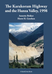
Annette Bräker and Horst H. Geerken take us with them on a more than 3000-kilometre journey from Pakistan through the Hunza Valley to Kashgar in Xinjiang and back to Pakistan. The book deals with the history, culture and peoples of the Hunza Valley and Xinjiang. As well as with historical facts the book is larded with amusing anecdotes about their experiences. It is an amusing and humorous, but also informative read.
Sie lesen das E-Book in den Legimi-Apps auf:
Seitenzahl: 355
Veröffentlichungsjahr: 2025
Das E-Book (TTS) können Sie hören im Abo „Legimi Premium” in Legimi-Apps auf:
Ähnliche


In memory of Annette’s and my parents,
wonderful people, who always supported
and encouraged our travels to the Orient,
even in our youth. They awakened our love
for travel and other cultures,
for which we thank them.
(Horst H. Geerken)
Contents
1. Foreword Horst H. Geerken, 2016
2. Foreword Annette Bräker, 1998
3. Arrival in Islamabad
4. From Islamabad to Gilgit on the Karakoram Highway
5. Into the Hunza Valley from Gilgit to Karimabad
6. The Hopar Valley
7. From Karimabad to Gulmit
8. From Gulmit to Sust
9. From Sust over the Khunjerab Pass to Kashgar
10. Xinjiang
11. The Kashgar Oasis
12. The Return Journey to the Hunza Valley
13. The First Westerners to Visit the Hunza Valley
14. To Islamabad and Lahore
15. Back to Germany
16. The Karakoram Highway and the Hunza Valley 2015/2016
17. Thanks
18. Literature
19. Index of Persons
20. Subject Index
Ill. 1: Our route
1. Foreword Horst H. Geerken
The Hunza Valley and its secondary valleys lie in an extremely inaccessible area of the Hindu Kush. It is a high valley – between 2,500 and 3,500 metres high between the Karakoram and Hindu Kush ranges –, surrounded by 7,000-metre peaks, of which Rakaposhi is the highest at around 7,800 metres.
Herodotus (about 450 B.C.) was the first author to mention this region, bordering on Kashmir and close to Afghanistan.1 Dr Gottlieb2 Wilhelm Leitner, an orientalist and linguist who was born in Hungary3 in 1840 and died in 1899 in Bonn, was the first scientist to visit the Hunza Valley, among other regions in the Hindu Kush, in the 1860s and 1880s. His books about the history, languages, religions, customs, legends and songs of the region are interesting and important works of reference even today.
The paths along the steep mountainsides in the impassable terrain along the river Hunza and the simple suspended bridges were so narrow, that goods could only be carried by porters on most stretches of the way. As the Hunzakuts4 say, a rider here has to carry his horse!
The main language spoken in the Hunza Valley is the isolated Burushaski. The influence of Greece resulting from Alexander the Great’s invasion around 325 B.C. is still evident today in sculptures and the genetic (European and Aryan) characteristics of the Hunzakut. You often see blond hair or blue eyes, which are not typical of Pakistan. The inhabitants of the Hunza Valley regard themselves as descendants of the warrior king Alexander the Great and his army. Many of Alexander’s warriors did not wish to undertake the difficult return journey to their homeland and exchanged the sword for the ploughshare. Alexander founded villages and towns in the Indus and Hunza Valleys and settled his Greek and Macedonian veterans there. He encouraged marriage with the local women. The language, music and dances resemble those of Macedonia and Albania even today. In the almost inaccessible Hunza region it was possible for the genetic and cultural characteristics of the invaders to survive almost undiluted. According to legend, the King of Hunza is said to be a direct descendant of Alexander the Great. The founder of the dynasty was called King Alexander Iskandar Shah. Outside the Hunza Valley Alexander’s soldiers also founded city states, but these resulted in more mixed cultures.
Because of its isolated position, it was easy to defend the Hunza Valley against invaders, which is why the Hunzakuts managed to live there largely independent and free of foreign influence for about 1,000 years. In 1889 Britain attempted to conquer the Hunza Valley, only finally succeeding in 1892. Mir5 Safdar Ali, the King of the Hunzakuts, had fled shortly before to China. As Durand writes in his book6, the British treated the Mir very badly. They took his kingdom away from him without giving him any chance to negotiate, in spite of several attempts on his part. He died impoverished in exile in Xinjiang in 1930.7
From 1892 to 1947 the Hunza Valley was administered by the British as part of British India. Just as India and Pakistan took over the British mandate in Hunza after the Second World War, Britain took over the Chinese mandate in 1892.
When the British withdrew from the Hunza Valley in 1947 – after independence and the partition of the former British colony of India into Hindu India and Muslim Pakistan –, it aroused India’s covetousness. India tried to retain control of Gilgit and Hunza and began an inexcusable war. The mountain people of the Hunza Valley fought the aggressors off successfully and prevented their annexation. In the great park in Gilgit stands a monument, the “Minaret of the Martyrs”, a memorial to this war, which remained totally unknown in the West.
In 1947 the kingdom was abolished by the British. The former ruler and his descendants were allowed to retain the title of “Mir” as a symbol of respect, as well as the red number plates with ‘Hunza 1’ and ‘Hunza 2’ on their cars in gold lettering. In the years that followed, foreign visitors were not allowed to enter the area. Only in 1974 was the Hunza Valley incorporated into the Gilgit-Baltistan region under the Pakistani central government, and visits by foreigners to the lower part of the valley were permitted.
Until 1950 the children of the Hunzakuts had not seen a bicycle or a motor vehicle. All goods, like tools, cooking utensils, oil lamps, mirrors and other glassware, nails and building materials – in fact, nearly everything needed for everyday life – had to be carried into the valley on the backs of porters.
The mountainous terrain has only a few level areas which can be used for agricultural purposes such as growing corn, apricots and grapes. Pastoral farming is restricted to goats and poultry – mainly ducks. The indigenous population’s diet is almost entirely meatless. Even dairy products such as milk, butter and cheese are not consumed very often. The legendary longevity and good health of the Hunzakuts is mainly attributed to the glacier water, its milky appearance due to the rich admixture of minerals and noble metals, and to their diet of mainly wholemeal foods. Men well over 100 years of age, who still farm their own fields or play polo, are no rarity. For this reason the Hunza Valley, which is often considered to be the lost kingdom of Shangri La8, is also called the “Oasis of Eternal Youth”.
The women in the Hunza Valley, with their brightly coloured caps under a white veil, are self-confident and totally free. Their faces are open, and they are always prepared to smile. Unlike the surrounding Islamic areas, monogamy is the rule here, and both partners have to agree to enter a marriage. No distinction is made between men and women. Even on her wedding night, a woman can refuse her husband, and she has the right to be divorced. Today, in 2016, the Hunza Valley has about 90,000 inhabitants. At the time of our trip there were considerably fewer.
For many years the Hunza Valley was a forbidden realm for foreigners. In the south, it borders on Pakistan, in the north east on the Chinese autonomous province of Xinjiang, and in the north west on Afghanistan. It was only in 1974 that the news that “the Hunza Valley is now open” rang out to the world. But why were foreigners forbidden to visit the little kingdom of Hunza until then?
There was a treaty between Pakistan and China guaranteeing the security of Hunza by China. Since the Chinese intended to invest heavily in the Karakoram Highway, they did not want foreigners to be able to see their cards. China was particularly sensitive about Xinjiang at the time, even though the uncertain border between Pakistan and China in the northern Hunza Valley had been corrected and firmly established in 1963. After the mandate was transferred from Britain to Pakistan, China was prepared to accept that Hunza – which had previously long been a Chinese mandated territory – became Pakistani. China saw that it was in their interests to have a safe buffer state between themselves and their southern neighbour.
Hunza was a country without criminality, without police, without prisons and without an administration. There were no hotels, no newspapers, and no banks – and also no motor vehicles or petrol stations. Electricity was unknown. Since the Hunzakuts were a robustly healthy people, there were no doctors or chemists either. No one had to pay any tax.
In the mountains surrounding the Hunza Valley many foreign travellers, mainly climbers, had vanished without trace. The Pakistani Prime Minister would have had to accept responsibility for every traveller who entered the valley. And even for the Pakistani government the kingdom was still somewhat alien and mysterious: Hunza was markedly different from the rest of Pakistan, and so the valley was closed to foreigners for a long time.
For my brother Hartmut, the news that the Hunza Valley was open was the signal that he should immediately fly from Kabul to Gilgit via Rawalpindi. He and his son Olaf, then six years old, were among the first foreign visitors in May 1974.9 At the time, my brother was head of the Goethe Institute in Kabul, Afghanistan. His son Olaf was probably the youngest foreign visitor ever to travel to the Hunza Valley. In Gilgit, and especially at the border with the Hunza Valley, they were greeted with bouquets of flowers. Visitors from the West were still seen as something special and a great rarity.
To enter the state of Hunza, it was necessary at that time to get the permission of the Pakistani government and to go through border controls. On the road between Gilgit and Karimabad there was a table, about a metre and a half long, set diagonally across the narrow path, with one person incorporating both the customs and immigration officers. He was dressed in typical Hunza costume, with a long, wide-sleeved, brown, felt-like woollen coat and the native Hunza cap, the farshin, with its characteristic rolled edge. The women, on the other hand, are always brightly dressed and wear brightly embroidered caps.
The passport was stamped, and the first question from the immigration officer was, “Would you like a drink of wine?” Wine in strictly Islamic Pakistan? The Hunza Valley has a special status, since its inhabitants are tolerant Ismailites, whose religious leader is the Aga Khan. The official produced a full bottle, sealed with clay, and opened it carefully so that none of the clay could crumble into the wine. It was a brownish, naturally cloudy wine, but according to my brother it was quite drinkable.
Ill. 2: Hunza stamp in my brother Hartmut’s passport, dated May 27th, 1974
The Chinese were still hard at work constructing the Karakoram Highway (KKH). Near Gilgit there was the first Chinese workers’ settlement, housing thousands of Chinese workers. It was a typical Chinese camp with temporary huts and tents. It was possible to buy Chinese goods, there was a canteen, a bakery and a large vegetable garden. It was a hive of activity. The Hunzakuts called the camp the “Camp of Smiles” and it was totally self-sufficient. All the signs were in Chinese script, including those on the pathways between the huts and tents. Foreigners were forbidden to enter the camp. The gateway to the Hunza Valley lay beyond the camp. The Chinese workers in their bright blue overalls and baker-boy caps were shovelling and hacking along the breathtakingly steep cliffs. It was reminiscent of a disturbed nest of blue ants.
The way up to the Hunza Valley was still very difficult. In those days you could go no further than Karimabad and Baltit. During their entire stay in the valley Hartmut and Olaf were looked after by Mr German, the chief secretary of the last Mir of the Hunzakuts. They were his guests, because at that time there were no restaurants anywhere in the entire Hunza Valley. He housed them first in Mir Muhammad Jamal Khan’s guest house in Karimabad, and then in an apartment – there were no hotels then, either. In honour of Hartmut and Olaf a sheep was slaughtered and there was a great feast attended by all the dignitaries of Karimabad.
At the time when my brother was in the Hunza Valley with his son, the Mir of Hunza was in Germany for medical treatment. It was quite a strange coincidence that the place where the Mir was being treated by a Professor Stuhlinger was in Starnberg, close to my brother’s home. While the Mir was being treated in Germany, the moon in the Hunza Valley had an unusually large corona, which the Hunzakuts interpreted as a good and positive sign that things would go well for the Mir in far-off Germany, and that he would soon recover.
Only two years later, in March 1976, Mir Muhammad Jamal Khan died in Karimabad. Many years before his shaman had prophesied his death on exactly that day. After the death of the Mir, who was so loved by his people, the shaman refused to look into the future anymore.
Mr German requested Hartmut in the name of the Mir to stay in the Hunza Valley and work as a teacher of German, English and French. The Mir was very concerned to improve the education of his people, although the illiteracy rate was even at that time less than four percent. The best rate in Pakistan! All children in the Hunza Valley receive compulsory education down to this day. All the schools are heavily supported financially by the Aga Khan Foundation.
As a teacher, Hartmut would be given the finest house in the Hunza Valley for himself and his family, but after serious consideration, he decided to carry on in the Goethe Institute. After about a week in Karimabad Mr German placed the Mir’s Jeep, with its Hunza 2 number plate, at Hartmut’s disposal for his return journey to Gilgit.
Only two years after my brother, Annette’s father, the orientalist Professor Hans Bräker, visited the Hunza Valley in 1976 in the company of Professor Hans-Joachim Klimkeit. Bräker taught at the University of Trier and was the founder and Director in Chief of the Federal Institute for Asiatic and International Studies in Cologne. Klimkeit worked in comparative religion and Indology, which he had studied with the renowned Professor Helmuth von Glasenapp in Tübingen. At the time of the trip Klimkeit held the Chair of Comparative Religion at the University of Bonn. They only had a week, and wished to explore the Hunza Valley by bicycle. For reasons of time they were unable to reach Karimabad because of the very bad road conditions.
Later Klimkeit was the boss of the co-author of this book, Annette Bräker, at the University of Bonn. The stories told by her father and her boss about their experiences in the Hunza Valley gave Annette an intense desire to visit the region, which was also known to me because of my brother’s visit. My old Pakistani fellow-student, Mohiuddin Biyabani, kept me sporadically informed about the progress of the work on the KKH, and so I developed a plan to surprise Annette by suggesting a trip to the Hunza Valley, thus fulfilling a dream we both shared.
Ill. 3: The orientalist Professor Hans Bräker in conversation with the author
Kashgar was intended to be the final destination of our journey. It is in western China in the province of Xinjiang,10 which has a population of about 22 million, a surface area of over 17 percent of the Republic of China and is bordered by India, Pakistan, Afghanistan, Tajikistan, Kirgizstan, Kazakhstan, Russia, Tibet and Mongolia. With so many nations on its borders, it is not surprising that this area, called the Pamir Knot, gave rise to acquisitive desires on the part of the Western powers in both world wars on account of its outstanding strategic position. The diplomatic conflicts connected with the area, particularly between Britain and Russia, were called with some cynicism by the British “The Great Game”.
In this book there is no space to deal with the Great Game except in a superficial manner. However, there are countless works dealing with the subject, especially in British literature, though the reports contained in the latter about the political game and the military encounters are of course depicted from a British viewpoint. In this book we wish to focus on cultural matters and the early exploration of the region.
Our journey from Gilgit through the Hunza Valley and Xinjiang to Kashgar was a unique – and at times quite adventurous – experience in a region of great interest in terms of both history and landscape. A journey like this is always unforgettable.
Horst H. Geerken
Autumn/Winter 2016/17
Ill. 4: “The Great Game”: a native is threatened by the Russian bear and the British lion.11
1 Herodotus, III. p. 102-105 und IV. p. 13-27
2 In many British publications also called Georg
3 Many British publications also give Austria as his birthplace, since the area belonged to Austria-Hungary at the time
4 or Hunza people
5 “Mir” was the ruler’s title.
6 Algernon George Arnold Durand, The Making of a Frontier: Five Years of Experiences and Adventures in Gilgit, Hunza, Nagar, Chitral and the Eastern Hindu-Kush, 1900
7 Historically East Turkestan or Chinese Turkestan
8 James Hilton, The Lost Horizon, ISBN 978-00-62113726
9 The porcelain manufacturer and mountaineer Philip Rosenthal from Selb visited the Hunza Valley and Nanga Parbat as early as the 1960s. How was it possible for him to enter the forbidden territory at that time? He had invited his guide, Sarbaz Khan from Aliabad, to Germany. Within a single year the latter learned German and also the production of simple porcelain, which he took back to Hunza. Sarbaz Khan was certainly at that time the only Hunzakut who could speak German. In 1998 we, however, met several Hunzakuts who could speak some German, probably as a result of the tourist industry. The guides on the Fairy Meadow near Nanga Parbat told us that Philip Rosenthal set up a flag made of Rosenthal porcelain on a peak neighbouring Nanga Parbat. At first we could not believe it, but in Gulmit it was confirmed to us by Abdullah Baig, the owner of the Hunza Marco Polo Inn Hotel. I wonder if the porcelain flag is still flying up there on one of the high peaks.
10 Historically East Turkestan or Chinese Turkestan
11 Cartoon from Punch, November 30th 1878, Wikipedia Public Domain
2. Foreword Annette Bräker
This journey was a long-cherished wish, which came to fulfillment for us in 1998. Long before I heard of the Kingdom of Hunza, I was fascinated by the name Gilgit and the political controversies between the colonial powers of Britain and Russia connected with it – and also China – in what was called the “Great Game”! I absolutely had to go there, and began to take an interest in it. I quickly came across the legendary Kingdom of Hunza and its role in that “Great Game” – as the British said – as well as the Karakoram Highway, the road that was built with the sacrifice of countless human lives, and leads from Islamabad in Pakistan to Kashgar in western China. The wish – now extended to include driving the length of the Karakoram Highway – would certainly have remained a dream if Horst had not had the same dream for even longer than I. Now he surprised me with his plan, which gradually took clearer shape. We met Hanne and Tonny Rosiny, who had lived in Pakistan a long time and had already made the journey. Tonny Rosiny was a diplomat and author, and had already published some books about Pakistan.12 The Rosinys gave us valuable tips and addresses, which were to prove very useful on the spot.
Finally, at the end of April 1998, the dream came true. We packed and unpacked until we had reduced our baggage to such an extent that each of us had only a relatively modest rucksack, weighing – including books – less than ten kilograms. As usual I suffered from a kind of travel fever: I became more and more nervous every day and would in the end have preferred to cancel the trip. But all that was forgotten when we finally took off on a British Airways flight from Manchester to Islamabad on the 30th of April 1998.
We have compiled this record of our journey together from the letters and other reports we wrote on our travels. The sections written by Horst are printed in italics.
Annette Bräker
Summer 1998
12Pakistan. Drei Hochkulturen am Indus: Harappa, Gandhara, die Moguln; Pakistan. Kunst; Pakistan. DuMont Reiseführer
3. Arrival in Islamabad
We took off from Frankfurt only slightly late, and an hour and a half later we were in Manchester. On arriving there we immediately sought out a quiet spot near an out-of-the-way loo – after all, we had six hours to kill before our connecting flight. We stretched out on two benches and immediately sank into a deep sleep, but only after emptying two of the little bottles of wine that we had brought from the plane. The food on British Airways was admittedly quite Spartan, but they were all the more generous with the wine, which they served in 20 centilitre bottles – and so copiously that you could cram your pockets full of them. And so we went to sleep straight away in our quiet corner. We slept for three of our six hours in Manchester, and so the time “just flew past”. When it was time to board our connecting flight to Islamabad, we waited until almost the last, because we had heard in Frankfurt that the flight was not fully booked. This meant that we could see which seats were unoccupied, and then we each spread out over a whole row of seats so that we would have a comfortable place to sleep. A couple, who were obviously German, clearly found this behaviour outrageous and shot sideways glares at us the whole time, which didn’t bother us a bit as we lay comfortably stretched out.
95 percent of the passengers were Pakistanis, and that’s what it looked like towards the end of the flight. Chaos, confusion, dirt, the toilets overflowing – and no one was worried. A gigantic, picturesque Afghan armed with a kind of St Peter’s staff walked up and down the aisle every now and again, making the whole flight even more oriental. We spent the entire flight lying down relaxed and slept another four hours. By the end of the flight we had a good supply of forks and spoons in our baggage. You have to be ready for anything!
During the steward’s announcement that importing alcohol into Pakistan was strictly prohibited, Horst had calmly stuffed several more bottles of the generously distributed wine into his hand luggage to join our bottle of whisky and another of Fernet Branca. And so we landed in Islamabad at six o’clock in the morning just as the muezzin just began to sound – well-rested and with our own private bar in our luggage. I was still a bit nervous, however, because of the alcohol content of our hand luggage.
From the outside, the airport looked as if it was in the process of being pulled down, while the inside was small, shabby and totally chaotic. But in spite of this impression everything then went very smoothly. In spite of long queues, we were through passport control in five minutes, and while Horst fished our luggage out of the equally chaotic seeming crowd of people around the conveyor belt, I looked around to see where we could most easily smuggle the demon drink into the country past the customs control. And I did find a place where there wasn’t really an exit, but where people with not much luggage were constantly being let through. Horst thought we should hold up our passports in our hands to make a good impression. And then we should, without looking to either right or left, simply march through. And that’s what happened: one minute later we had left it all behind us without meeting a single customs officer. Impudence had triumphed once again! The whole process had lasted 15 minutes in all.
We exchanged a little money and then we were sitting in the taxi – with me jammed between our rucksacks – on the way to the Ambassador Hotel. After what my mother and Rosiny had said, we were not expecting a great deal of the hotel, but we were pleasantly surprised. We’re staying in what is presumably the same corner room where my parents stayed in 1983. The room is tidy and clean, like the whole hotel, at whose door stands a picturesquely costumed – or rather uniformed – doorman with a big rifle, who always pulls the door open devotedly, even when you don’t want to go out.
Ill. 5: The doorman
Although we had enthused to each other, after arriving here in Islamabad, about how pleasant it was to arrive at our destination rested, because we had been able to lie down on the plane and get sufficient sleep, we could hardly keep our eyes open after 10 o’clock in the morning, and every time between our “organisational trips” – travel agency, lunch, car hire, then travel agency again – we came even close to a bed, we simply fell in and fell into a deep sleep.
In the meantime we have slept another four hours here in the Ambassador Hotel, but in the active phases in between we’ve also sorted out everything necessary for our onward journey. Tomorrow morning at seven a hire car will pick us up here and drive us the two day journey along the Indus Valley to Gilgit. It was actually Horst who arranged everything – I just sat there modestly with a scarf over my hair like a good little girl, as is fitting in an Islamic country! As a reward, the man who was renting us the car told me that we would feel at home in his car because the driver could speak good English and wore a uniform. I immediately put on a happy expression, so that he could be certain that we had a uniformed chauffeur at home too. You have to keep up appearances! So tomorrow is the big day. It’s really lovely to be back in the Orient.
As always, when a dream comes to fruition, one you have been viewing from a great distance for years, and are on the point of fulfilling – and in our case that means being at the starting point of our journey, now on the 1st of May 1998 in Islamabad – you can hardly believe that everything is real and that you are the same person. But it is true! We are really sitting in the lovely garden of the Ambassador Hotel and are feeling great.
4. From Islamabad to Gilgit on the Karakoram Highway
Today it’s already Sunday May 3rd. We only arrived here in Pakistan two days ago, and I really don’t know where to begin telling my story. At the moment I’m sitting in Gilgit on the terrace outside our room.
We set out from Islamabad at seven o’clock yesterday morning. I’ve already mentioned that we’d rented a car with a driver. That was on the afternoon of the 1st of May. That evening, as we were waiting for our dinner in the garden of the Ambassador Hotel, the brother of the owner of the car rental firm suddenly appeared, accompanied by a Mister Nissar, the manager, with whom we’d negotiated and signed the rental contract that afternoon. They sat down at the table with us and started to talk to one another excitedly. All we understood were place names like Gilgit, Chilas, Dasu and others. With some effort, we worked out that they obviously wished to persuade us to travel to Gilgit in a single day. Of course we did not want that, because we could have flown for a fraction of the price! And above all, we wanted to see a lot of things and make a lot of stops. When they saw that we were not going to be persuaded, the owner of the car rental company was sent for in person. Now he was also sitting at our table, in the middle of our dinner – we didn’t let him spoil it –, knocking his knees nervously together the whole time, while his brother kept holding his mobile fervently to his ear, even though nobody called and he didn’t call anybody either. They didn’t actually tell us exactly what they wanted, but they kept behaving as if they only had our best interests at heart.
When they realised that we were not to be deterred, everything finally returned to square one. The only thing was that we were warned not to make excessive demands on the driver, and not to ask him to stop too often. The five-year-old son of the car rental man, who was there as well and had been staring wide-eyed at our meal, was made to shake everyone’s hand, and finally they assured us that they had only come to ensure that everything was to our satisfaction.
At the word ‘satisfaction’ Horst suddenly thought of something very important: he asked if the hired car had air-conditioning. But in true Pakistani fashion the car-hire man, never at a loss for an answer, said that ‘Air Condition’ didn’t start until the 15th of May.
At this very moment, all the muezzins in Gilgit are starting to call the faithful to prayer – and strangely enough, all the goats are starting to bleat at the very same moment!
Horst is just coming with our last little British Airways bottle of Bordeaux, and we’ll drink it now overlooking the view of the Gilgit River.
After downing the wine it was too dark to write, because the electricity here is not very good. The lamps provide very little light and there are constant power cuts. [Only next morning was it possible to take up our text again.]
From Islamabad we set off – as I’ve already said – for Gilgit at 7:15 in the morning. Our driver’s ‘uniform’ admittedly consisted only of dark blue trousers and a white shirt and his English was less than mediocre, but he made up for that by his calm and careful driving style, which we learned to value, especially when we reached the Karakoram Highway, the KKH.
It was only when we left Islamabad that we really got the feeling of being in Pakistan. Even if the airport itself is very Pakistani, Islamabad itself strikes you as extremely modern. But a few kilometres out of Islamabad things became very oriental: cows, goats, people, carts, cars, heavily laden, brightly painted, hooting lorries, dirt and stench, total confusion. As far as Taxila we were still on the Grand Trunk Road, and then the KKH began. At first there was still a terrible amount of traffic, but after Manshera, a long ribbon-developed village, the road became so empty that for quite a while we thought the driver had got lost – we felt sure this was so because he had hesitated at one junction as if uncertain which road to take. Since all the signposts and town signs were exclusively in Arabic script it took about an hour and a half for us to realise that we were actually on the right road.
The junction in Manshera led to an unmetalled track over the 4,173 metre high Babusar Pass through the mountains: Nanga Parbat is only 50 kilometres away. The track over the pass joins the KKH again at Chilas. Since from the middle of July to the end of September this stretch is only passable with a four-wheeldrive vehicle, our driver naturally chose the better road along the Indus Valley. In the past, before the KKH was built, the track over the Babusar Pass was an important trade route to the south.
After the junction the landscape became ever wilder and more mountainous, and even the people in the villages seemed more untamed and unapproachable. The people’s faces became serious, impenetrable or even forbidding. The further we travelled along the KKH, the more women we saw who were totally veiled, ultimately more than half of them.
Ill. 6 and 7: Top-heavy, overloaded lorries
Ill. 8: From Rawalpindi to Pishora
After Dasu, where we spent the night, we saw hardly any women in the streets. We arrived here in Gilgit yesterday afternoon, and between then and this afternoon we have only caught sight of five women.
From Thakot onwards the KKH winds along the right bank of the Indus, rising all the time. Gloomy grey-black, bare mountains tower on both sides of the river. The Indus rages down towards the Indian Ocean: in Besham its loud roar drowns out the sound of your own voice.
Ill. 9: On the KKH
Ill. 10: Crumbling bridges on our route
Ill. 11: From Pishora to Shatial
Hundreds of inscriptions and images carved in the cliffs and large rocks along the Indus are like a guest book of the Silk Road. In many languages, the vicissitudes of the relationship between China and the Indus valley are recorded here. In the past, exotic goods streamed out of the Indus Valley to the rest of the world.
Just beyond Besham is the famous milestone at the edge of the KKH: still 975 kilometres to Kashgar! We’ve covered a quarter of the distance.
Ill. 12: Still 975 kilometres from Kashgar!
Ill. 13: Suspension bridge over the Indus
But back to our journey from when the road reached the Indus. From that point on it really became unimaginably adventurous and dangerous. You have to have seen it! A wildly threatening mountain landscape, the road not stable, falling steeply away on one side – up to 150 metres deep – down to the river, and on the other side of the river equally steeply rising cliffs up to the snow covered peaks. Again and again we came to places where the road had been covered by a landslide and a new road had been created by simply shovelling a way over the landslide, which, of course, could slide further at any moment. Every time we had to drive over one of those bits, I sent up a hurried prayer. And rock falls everywhere – though the rocks that fall in those parts are more like minor cliffs. One of them, about the size of my living room, must have crashed down on the road just before we got there. Fortunately it had fallen at an angle that meant that we could just squeeze past in the car.
Ill. 14: Obstacles on the KKH
Ill. 15: Occasionally you had to guess where the road was.
Again and again we had to cross both large and small streams which simply flowed over the road in great floods: every time we feared we’d be washed off into the depths below. Twice we even drove through waterfalls.
The rock falls made our driver particularly nervous. He literally hung over the steering wheel for the whole journey so that he could look up at the mountains above to see if anything was threatening to crash down on us. Presumably rock falls were the greatest danger on this journey. At any rate, it seemed miraculous to us that we weren’t hit by anything.
We passed Abottabad, a town at an altitude of 1,200 metres, during the morning. The people in the relatively infrequent settlements were beginning by now to look as if they came from the Old Testament. In Dasu, which we reached in the late afternoon, we intended initially to stay in the government guesthouse, the CW-Guesthouse just above Dasu, which we had chosen from Horst’s guidebook. The food was supposed to be excellent, cooked by a Kohistani chef. But the guesthouse seemed totally deserted, and the manager was down in the village – nobody knew exactly when he might return. So we decided to take a room down in Dasu village – which is, by the way, the district capital of Kohistan, so that a Kohistani chef is unlikely to be a rarity there – in the Arafat Hotel right on the bank of the Indus. The room had a splendid view over the river, was clean but musty – and there was electricity only in the evening. But I suppose if cars only have air-conditioning after the 15th of May, it’s only fair that there should be no current in hotel rooms until the evening! The chef in the hotel was Kashmiri, which seemed more remarkable to me than a Kohistani. He cooked us an excellent meal, but afterwards we needed a double Fernet Branca and a Whisky because of the excessively fatty food. We’d already eaten a meal in a very indigenous guesthouse in the little village of Besham. Our systems are not used to such quantities of fat in dhal, vegetables and rice – they never make white rice, but only a kind of greasy pilaf. It all tasted good, but afterwards we felt as if we had a large lump of fat in our stomachs.
Ill. 16: Dasu is a dull grey city
Ill. 17: Dasu, Arafat Hotel
Horst had great difficulty getting to sleep that night in Dasu. Firstly, there was a lorry going crazy on the bridge over the Indus near the hotel. The driver was hooting continuously; then there was a great palaver in the restaurant beneath us when two people set about each other. When the outside world finally came to rest, I was snoring! I didn’t hear any of the night’s events. The last I heard was the rushing of the Indus und the thundering of the great rocks that kept on falling from the mountains into the valley below: apart from that, I slept extremely well the whole night. Horst, however, had wild dreams during the night of the 2nd to the 3rd of May.
It rained heavily throughout that night, as it had done on the previous day as we drove through the mountains. My first words the next morning were, “Anita had a healthy boy last night,” and I told Annette about my dream: my niece Anita was pacing up and down in the room with a very swollen belly, carrying a glass in her hand, from which she kept on drinking. Finally she disappeared into her bedroom. Shortly afterwards she came back smiling with her little boy in her arms and showed him to me.
The dream was so realistic that I immediately sent a postcard to Anita, and on the 21st of May we received a birth announcement in Gulmit: Anita had given birth to her son that very night!
The next morning shortly after 8 o’clock we continued our journey. As far as Chilas the road was said to be in great danger of rock falls – and we saw them everywhere. Here in the Karakoram mountains the Eurasian and Asiatic plates collide, and that’s why the earth is so unsettled in this area. It is a great experience to drive through this landscape on this precipitous road, but I felt uneasy the whole time – especially when we had to cross a landslide or a temporary bridge where the original had been ripped away, or squeeze past giant blocks of stone on the road.
Chilas used to be a dangerous den of robbers, but now it’s a popular trading centre at the crossing of several routes. This is where the track over the Babusar Pass rejoins the KKH. Beyond Chilas the valley widened and we felt more relaxed – especially our driver. The landscape is desolate and inhospitable: it was only where there were settlements that we saw lush patches of green. They are oases irrigated by water brought to the villages from the glaciers by channels. And you only find human dwellings where irrigation is possible.
Shortly after leaving Chilas the Nanga Parbat Massif suddenly hove into view in all its grandeur and majesty, gleaming in the morning sun. The weather had brightened and the sun had finally shown itself. What a gigantic view – we couldn’t take our eyes off the mountain. The previous days we had been subjected to a continuous downpour, which did nothing to make the journey less scary.
We came to a junction with a signpost: “Fairy Meadows”. We had to see this famous sight, and asked our driver to drive up the gravel track – which he did, albeit somewhat reluctantly. The Fairy Meadows lie high up in the Rakhiot Valley at an altitude of about 3,500 metres. When you arrive there from the desert-like Indus Valley, the blooming alpine meadows are quite a surprise. This is where the many German Nanga Parbat expeditions started out. The base camp was only a little higher up, but could only be reached on foot.
Nanga Parbat – the Naked Mountain – is, at an altitude of 8,125 metres, one of the ten highest mountains in the world. The mountain face to the south – 4,500 metres high – is the steepest and highest in the world. Alpinists consider Nanga Parbat to be the most difficult mountain to climb, and many mountaineers and native porters have lost their lives there. Temperatures are often far below zero and constant gusts of wind at speeds of some 100 kilometres per hour make the climb almost impossible. The freezing temperatures are the least of their problems.
Mountaineering became fashionable in Britain towards the end of the 19th century and the first Alpine Club in the world was founded in London. In 1885 a Briton, Alfred Mummery, was the first mountaineer to attempt to conquer Nanga Parbat. In August he set out with two bearers. All three were buried by a huge avalanche. They were never found.
From July 1932 there were several attempts to be the first to climb the mountain by German alpinists. They all ended in tragedy. The experienced German mountaineer and expedition leader Willy Merkel lost his life in a snowstorm. In 1934 four German climbers and six native Sherpas died on the mountain. The greatest height reached was just over 7,000 metres.


