Erhalten Sie Zugang zu diesem und mehr als 300000 Büchern ab EUR 5,99 monatlich.
- Herausgeber: The History Press
- Kategorie: Sachliteratur, Reportagen, Biografien
- Serie: Little History of
- Sprache: Englisch
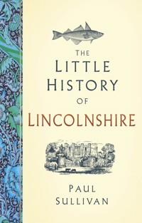
From civil wars to cod wars, Lincolnshire is no stranger to historical upheaval. The stories in this book follow the pre-Roman, Roman, Anglo-Saxon, Danish, Norman and Dutch people who carved a manageable landscape from a wild county of wetlands and wolds. The Little Book of Lincolnshire recounts the events that made Lincolnshire the jewel in England's agricultural crown, relating how a colourful procession of pirates, monarchs, artists, engineers and hucksters brought wealth and despair in equal measure. The story begins with Neolithic burial mounds and ends with the Humber Bridge, even tackling the vexed question of why Lincolnshire people are called Yellowbellies along the way.
Sie lesen das E-Book in den Legimi-Apps auf:
Seitenzahl: 247
Veröffentlichungsjahr: 2025
Das E-Book (TTS) können Sie hören im Abo „Legimi Premium” in Legimi-Apps auf:
Ähnliche


For my parents, Marlene and Terry Sullivan
First published 2025
The History Press
97 St George’s Place, Cheltenham,
Gloucestershire, GL50 3QB
www.thehistorypress.co.uk
© Paul Sullivan, 2025
The right of Paul Sullivan to be identified as the Author of this work has been asserted in accordance with the Copyright, Designs and Patents Act 1988.
All rights reserved. No part of this book may be reprinted or reproduced or utilised in any form or by any electronic, mechanical or other means, now known or hereafter invented, including photocopying and recording, or in any information storage or retrieval system, without the permission in writing from the Publishers.
British Library Cataloguing in Publication Data.
A catalogue record for this book is available from the British Library.
ISBN 978 1 80399 900 5
Typesetting and origination by The History Press.
Printed and bound in Great Britain by TJ Books Limited, Padstow, Cornwall.
eBook converted by Geethik Technologies
CONTENTS
Preface
Introduction
1 From Prehistory to the Romans
2 Anglo-Danish Lincolnshire
3 The Normans: From Conquest to Anarchy
4 The Thirteenth and Fourteenth Centuries: Wool and Guilds
5 The Plantagenets at War
6 Tudor Lincolnshire: Religious Turmoil
7 The Stuarts: War, Poverty and Puritans
8 The Eighteenth Century: Jacobites and Georgians
9 The Nineteenth Century: Feasts, Farms and Ferries
10 The Twentieth Century: War and Change
Bibliography
PREFACE
In the late 1830s, historian Roger Quaint was nosing through the shelves of a small library over the south porch of St Botolph’s Church in Boston when he noticed a Franciscan friar with long auburn hair. The friar began speaking in Latin, and Quaint realised it was a ghost. The helpful spirit handed over a book and, switching to English, said, ‘Take this volume, it contains all the information you require’, adding a cryptic ‘Bene vale, nostri memor!’ [farewell our memories]. Quaint took the book, and sure enough, it included everything he needed for his magnum opus, A Series of Legends and Tales, Illustrative of the History and Antiquities of Boston and its Neighbourhood.
The discovery of a ‘magic volume’ (Quaint’s own words) that provides the key to wisdom is nothing new. Geoffrey of Monmouth, Britain’s first and most imaginative historian, claimed to have based his History of the Kings of Britain on a mysterious Welsh tome recording the exploits of Britain’s Trojan founders and their heirs, culminating in the golden age of King Arthur. Among many other whoppers, Geoffrey reveals how the River Humber was named after Humber the Hun, who drowned there following his defeat by the first British king, Brutus.
But in Roger Quaint’s case, perhaps he was just responding to his publisher’s request to come up with some Unique Selling Points. That haunting question, ‘Why would anyone buy your book?’ keeps the more faint-hearted author awake at night. Being accosted in Latin by a red-headed Franciscan ghost is a pretty good USP.
In my case, USP stands for Unique Selling Phantom. My research for this short history of Lincolnshire, my home county, was enhanced and disrupted in equal measure by a poltergeist, which is why I’m drawn to Quaint’s yarn. In addition to the customary knocking – often on the bedroom door or external windows in the small hours – the poltergeist took delight in interrupting the wi-fi by pulling the plugs, and on two occasions there was a power outage that killed my Mac before I had a chance to press the ‘save’ button.
Now, if this were a volume about Lincolnshire ghosts and folklore, this would have been a perfect preface. However, it’s a book about Lincolnshire history, so my ghosts are red herrings. Unlike Roger Quaint, I used non-imaginary books from libraries and databases and put it all together in a small village in the Czech Republic (home of the poltergeist), York, Waltham and Grimsby, my hometown, where I am even now enjoying a post-manuscript cup of Yorkshire Tea (wrong county, sorry).
Having got all that off my chest, in addition to the poltergeist, I would like to thank my mother and late father, Marlene and Terry Sullivan, for allowing me to lodge with them in Waltham and plunder their bookshelves; Jan Sullivan, Jay Sullivan and Amy Bullard for keeping me entertained in York during my working visit; and Magda and Theo Sullivan, who kept the home fires burning and listened patiently to my ghost stories.
INTRODUCTION
Many authors have attempted thumbnail sketches of Lincolnshire. Here are a couple.
Lincolnshire is a maritime county of England, bounded on the north by the river Humber, which separates it from Yorkshire, on the east by the German Ocean, on the south by Cambridgeshire and Northamptonshire, and on the west by the counties of Rutland, Leicester, Nottingham, and York. It is in length 77 miles, and in breadth about 48. Mr. Arthur Young [1741–1820, English writer, traveller and agricultural expert] states the area of this county at 2,888 square miles, or 1,848,320 acres, of which, he says, the wolds contain 234,880; the heath 118,400; lowland 976,960; and miscellaneous soils 718,080 … Lincolnshire consists of three great divisions, Holland, Kesteven, and Lindsey; which are subdivided into thirty-two hundreds, wapentakes, and sokes; containing in the whole one city, thirty-one market towns, and six hundred and fifty-seven villages.
(Mary Saunders, Lincolnshire in 1836: Engravings with Accompanying Descriptions, 1836)
The Fens are the rich flat corn lands, once perpetually flooded, but now drained and tilled; the divisions between field and field being mostly ditches, small or big, and all full of water. The soil is deep vegetable mould, fine, and free from stones, hardly to be excelled for both corn and roots; while the Marsh is nearly all pasture land, stiffer in nature, and producing such rich grass that the beasts can grow fat upon it without other food. Here, too, the fields are divided by ditches or ‘dykes’ and the sea wind blows over them with untiring energy, for the Marsh is all next the coast, being a belt averaging seven or eight miles in width, and reaching from the Wash to the Humber.
(Willingham Franklin Rawnsley, Highways and Byways of Lincolnshire, 1914)
As summaries go, these score highly on geography and maths, but they say nothing about Lincolnshire people, their achievements, struggles and celebrations, or the unique character of the region. But in many ways, the appeal of the county is a difficult one to sell. Lincolnshire is a subtle beauty. It doesn’t come at you with mountains and lakes, cliff-lined coasts or a Middle England haze of thatched cottages and four-by-fours. It tugs at your heartstrings with bird- and seal-haunted beaches and mudflats, vast expanses of former fen and marsh that seem 90 per cent sky, chalk wolds undulating like the world’s gentlest roller coaster, architectural beauties such as Lincoln and Stamford, fabulous churches like the ones at Grantham, Boston and Louth, gritty ports such as Grimsby, Immingham and Barton, and charismatic Victorian pleasure islands, including Cleethorpes, Skegness and Mablethorpe. The county has played a crucial role in many strands of the nation’s history and culture, including civil wars, religion, science, sea trade, heavy industry, the RAF, farming, literature and music.
My aim in this book is to capture the spirit of Lincolnshire through the people, politics and landscape of this unique county. The following pages take a brief sprint through 2,000 years of extraordinary Yellowbelly history. Given the limits of space, this can be no more than a thumbnail sketch, but hopefully one with enough good stories and quirks and sufficient narrative continuity to be read from beginning to end without trivia fatigue.
Oh, and did I mention the poltergeist …?
Paul Sullivan, Grimsby, February 2025
1
FROM PREHISTORY TO THE ROMANS
Lincolnshire has been plagued by floods throughout the centuries, notably in the vast area of fen and marsh around the Wash, but also in the floodplains of the Humber and its tributaries. Relatively high ground in the fens, such as Crowland and Holbeach, were once islands in a flooded landscape.
This inherent sogginess has been the lay of the land for at least 4,000 years. Prior to this, in the 6,000 years between the end of the last Ice Age and the flooding, the Lincolnshire lowlands were covered with forest, as evidenced in the many ‘bog oaks’ hauled from the damp earth around the Wash during centuries of land reclamation. Most of these drowned trees turned out to be yews rather than oaks. In November 2023, carbon dating showed that the local forests disappeared around 4,200 years ago due to a rapid rise in sea levels and the consequent inundation of the land with saltwater.
For obvious reasons, there were no permanent settlements in the frequently water-inundated parts of the county until some mad genius began applying basic drainage and water-control techniques in the Roman era. However, the Lincolnshire Wolds are littered with evidence of prehistoric people. The earliest litter includes flint axes and scrapers, the oldest dating from 800,000 years ago. People settled here during interglacial spells in the icy Palaeolithic and in the Mesolithic period that followed the receding of the ice.
BARROW AND HENGE
Around sixty Neolithic long barrows and over 350 Bronze Age round barrows, dating from about 5,500 and 4,000 years ago respectively, pepper the landscape. Many of these, and doubtless many more undiscovered sites, have been destroyed by centuries of extensive and intensive agriculture. Some of the burial sites have yielded grave goods, largely pottery. It’s not all down to the dedicated work of archaeologists, though – in 1960, heavy rain unearthed a mug and beaker from a sandpit in South Willingham.
Giants Hill at Skendleby is one of the prime examples of long barrows. Made of chalk, it was the final resting place of seven adults and a child. Their remains were discovered on chalk slabs at the site.
Legend claims that seventh-century Anglo-Saxon Saint Guthlac built his hermitage at Crowland’s Anchor Church Field on a prehistoric henge – a bank and ditch enclosure-cum-settlement. This remained the stuff of legend until 2023, when a team from Sheffield University, searching for Guthlac’s hermitage, discovered a henge dating back to the late Neolithic or early Bronze Age. The circular earthwork was the largest ever found in eastern England.
Given its size and location on a prominent piece of relatively high ground jutting into the Fens, the henge must have been a significant site 4,000–5,000 years ago. The earthworks would still have been a central feature of the wet landscape in Guthlac’s day, although by then the site would have been abandoned for centuries. The archaeologists found seventh-century pottery, bone combs and high-status drinking vessel fragments, hinting that the Anglo-Saxons were latecomers to a much older henge party.
FROM BRONZE TO IRON
Surviving Bronze Age sites in the county include barrows at Tallington, Thoresway, Broughton, Cleethorpes, Willoughby and Stroxton. Archaeological discoveries from the era include a hoard of swords and spearheads at Appleby, a gold torc at Low Burnham and a gold armlet at Cuxwold.
The later Bronze Age – a period spanning 1300 to 600 BC – has bequeathed a wooden trackway and a wooden boat believed to be a proto-ferry near Brigg, and dugout canoes in the valleys of the Welland, Nene, Trent, Ancholme and Witham.
The Brigg Boat – a Bronze Age ferry. (William Andrews, Bygone Lincolnshire, 1891)
The Iron Age ushered in a new era for Lincolnshire around 500 BC. Evidence from the early stages of the pan-European Celtic La Tène culture that marked this period is scarce but significant. It includes a bronze brooch unearthed at Scunthorpe, a scabbard dredged up over the Cambridgeshire border near Wisbech complete with one of the earliest decorated Celtic swords found in Britain, and a beaten bronze shield recovered from the River Witham, one of the finest pieces of La Tène art in Europe.
The Ancaster–Sleaford region and the northern Wolds have the county’s highest concentration of Iron Age settlements. Sites include Kirmington, Dragonby and South Ferriby. The most extensive Iron Age settlement discovered in the county is at Sleaford, at a crossing of the River Slea (hence the town’s name). More than 3,500 coin-mould fragments have been found here, hinting at the site’s role as a tribal centre. A distinctive South Ferriby coin template emerged as the dominant template in the pre-Roman East Midlands, featuring a stylised horse motif and abstract symbols.
The pre-Roman inhabitants of Lincolnshire, and the minters of the Sleaford and South Ferriby coins, belonged to the Coritani (or Corieltauvi) tribe. Roman writer Ptolemy (born around AD 100) identified the Coritani’s main settlements as Lindum (Lincoln) and Ratae (Leicester). Trade, crafts and society seemed to have been thriving in this gentle, rich-soiled breadbasket of the island when the Romans arrived in AD 43, spearheaded by the Ninth Legion and drawing a line under the Iron Age and that vast period we think of vaguely as ‘prehistory’.
WHAT DID THE ROMANS EVER DO FOR LINCOLNSHIRE?
The Romans established a major settlement at Lindum – Lincoln – as one of their nine main bases on the island. The city was plonked on an Iron Age settlement established on the banks of the Witham and Brayford Pool at the foot of the hill whose summit later became the site of Lincoln Cathedral and Lincoln Castle. The name ‘Lindum’ comes from the town’s Brythonic name Lindon, linked to the modern Welsh word Llyn, meaning a lake or pool (i.e., Brayford Pool).
The Roman settlement evolved from a Ninth Legion fort established around AD 50 as the Romans pushed north through England. When the Legion moved its main base to York, Lindum became a Colonia, a city run by the families of ex-officers and soldiers of the Ninth Legion. Emperor Diocletian made the city a provincial capital in the late third century.
The various inhabitants of Lincolnshire over the centuries have had to address the problem of flooding, and it was the Romans who first tried to do something about it. They made major engineering inroads into the problem by constructing dykes, including Foss Dyke, which connects the Rivers Witham and Trent, and building rudimentary sea defences.
The main Roman road in these parts is Ermine Street, which runs from London to York, bisecting Lincolnshire from Stamford to Winteringham on the Humber. Ermine Street lives on in spirit today, and the Romans’ famous love of straight lines is evident in the A15 that follows the old road’s course between Lincoln and Brigg, continuing to Winterton as a minor road from the point where the M180 crosses the A15. The old road is also followed on the B6403 between Colsterworth and Ancaster. Lincoln’s High Street was part of Ermine Street. As for that memorable name, it has nothing to do with stoats in their winter coats – the tag is from the Old English Earninga Straet, referencing an Anglo-Saxon tribe called the Earningas, who presumably loved getting from A to B in a straight line.
Ermine Street is joined at Lincoln by the Fosse Way, which continues via Leicester and Bath to Exeter. The A46 follows the route of the Fosse Way south-west to Newark and Leicester.
The Romans were also canal builders. Foss Dyke served as a link between Lincoln and the Rivers Trent and Humber, providing access to the North Sea for trading purposes. The canal meets the Trent at Torksey Lock.
Car Dyke ran from the River Witham near Lincoln to the River Cam near Cambridge. It served drainage and transportation purposes alike.
LINCOLNSHIRE ROMANS
A milestone dedicated to Emperor Marcus Piavonius Victorinus, who ruled Rome’s north-western lands from AD 268 to 270, was unearthed in 1879 on the stretch of Ermine Street in Lincoln. Victorinus was based in Gaul, a high-ranking officer in the Praetorian Guard. His boss, Marcus Cassianius Latinius Postumus, was the first ruler of the splinter state known to historians as the Gallic Empire (covering modern England, Wales, France, Belgium, the Netherlands and parts of Germany). He was murdered by his own troops, who installed Emperor Marius in his place. Victorinus murdered Marius and seized the Emperor title, only to be murdered by the husband of a woman he had seduced. His mother Vitruvia ruled briefly after him and managed to get her son deified. If you think politics is a den of thieves and chancers today, be thankful you didn’t have to endure life in the third-century Roman Empire.
Lincoln has folkloric ties with another Gallic Emperor, Marcus Aurelius Mausaeus Carausius, who took his turn on the murder express twenty years after Victorinus while Emperor Diocletian was supposedly in charge in Rome. Carausius is said to have resided in Lincoln, although there is no solid evidence of this. Coins bearing his name and image are relatively common finds, not just in Lincolnshire but in all parts of England.
A native of Belgic Gaul from the Menapian tribe, Carausius seized control of Britain and northern Gaul in AD 286, an event known as the Carausian Revolt. Calling himself ‘Emperor of the North’, his reign lasted seven years. He was assassinated by his finance minister, Allectus. Those who live by the sword, etc.
LINCOLN’S ROMAN REMAINS
Newport Arch is a surviving Roman gateway into Lindum Colonia, and it still has a constant stream of city traffic passing through it. It was the North Gate of the Upper Town, Lincoln being divided into Upper and Lower sections, the dividing line between them being Steep Hill. Newport Arch is the oldest arch still used by traffic in Britain. Three lorries have managed to get wedged under it in the last sixty years, most recently in 2017, when the guilty truck had to deflate its tyres and reverse. Romans 1, Haulage 0.
A further section of Roman wall (Mint Wall) survives behind the Castle Hotel on West Bight. This was part of a Roman basilica. Lincoln’s Bailgate area once housed a sprawling forum, the central hub of public life. While the forum itself is no longer standing, there are markers showing the spot where its colonnade once stood. The base of the north tower of the Roman East Gate and parts of the adjacent city wall of the upper city can be seen in Lincoln Hotel’s forecourt.
Roman remains can also be seen in Ancaster. Across the road from St Martin’s Church, the outline of the town wall and ditch is still visible. Next to the church lychgate sits a replica of a Roman sculpture of three goddesses unearthed in the churchyard in 1831, and the church has a small display of Roman sculpture fragments.
There are traces of Roman Wall in Horncastle, too, which is thought to have been the otherwise lost Roman town of Banovallum (although some think this was Sleaford). There is also a Roman station at Navenby on Ermine Street, midway between Lincoln and Ancaster. Caistor, a Roman fort built on an Iron Age settlement, has a section of original Roman wall visible to the south of the church of St Peter and St Paul.
Lincoln’s Newport Arch (M. Saunders, Lincolnshire in 1836)
In June 2023, a copper alloy Roman dodecahedron – a twelve-sided hollow object, with each face measuring 8cm in diameter – was found at Norton Disney, a few miles south-west of Lincoln. This was the thirty-third of these mysterious artefacts to be found in England and the first one unearthed in the Midlands.
The object features multiple round holes framed by knobs, and its purpose is unknown. Various theories have been proposed, from religious and divination objects to knitting and measuring tools, or perhaps executive toys or stress balls. It is tempting to link them to the Greek Dodecatheon, the twelve Olympian gods who symbolised and oversaw all aspects of human life and were adopted and adapted by the Romans. In this case, the dodecahedron may have functioned as a simplified pack of tarot cards.
Alternatively, the mysterious objects might simply have been a way for metalworkers to showcase their skills. There is no mention of them in Roman art or literature, and they are never found with other objects that might shed light on their purpose, which merely adds to the enigma.
ROMANS ROAM OUT
All good things come to an end. Around AD 407, Constantine III, the latest in a long line of local usurpers, left Britain and headed to Rome, taking the army with him and setting in motion a process of rapid anarchy and urban decay. Lincoln, Ancaster, Horncastle and all the other Roman settlements were largely deserted, and the Roman roads and waterways fell into decline. By the end of the fifth century, much of Lincoln had been abandoned.
However, the church of St Paul continued to serve as a place of worship until at least AD 450, and its churchyard remained in use well into the following century, suggesting a continued Romano-British presence in the area. When Saint Paulinus visited Lincoln in AD 629, he was surprised to encounter a civic leader named Blecca who held the Roman title Praefectus Civitatis. The spirit of the Romans had managed to survive the otherwise complete Anglo-Saxonisation of the region.
2
ANGLO-DANISH LINCOLNSHIRE
The Anglo-Saxon era is disparagingly labelled the Dark Ages, but it was the century between the departure of the Romans in AD 409 and the consolidation of the proto-English kingdoms that wins the Dark Age title. This is the era of King Arthur and conjecture. Details of the early Anglo-Saxon settlers of Lincolnshire and their tussles with the Brythonic-speaking Coritani and the remnants of the region’s Romano-British population in Lincoln and elsewhere are missing from the historical record.
The traditional narrative is of Germanic tribes forcing the native Britons out with sword and spear. The reality was probably more about waves of armed agriculturalists seizing land and submitting the Britons to cultural assimilation. Genetically, the Britons never disappeared from the east of the island – they just became Anglo-Saxon through language, customs and manners.
According to folklore, the Anglo-Saxons’ first foray into Britain occurred in AD 449, culminating in a battle at Stamford. The natives, armed with long swords, defeated the proto-English. The British king, Vortigern, responsible for inviting the first Anglo-Saxons to the island as mercenaries, was said to have died in Lindcoit, a post-Roman town in the northern part of modern Lincoln.
Despite the unpromising start at Stamford, the Germanic invaders soon triumphed. The years after AD 449 are associated with the semi-mythological invasions of Hengest and Horsa and their eventual subjugation of their sponsor, Vortigern. Whether or not the Stamford battle took place, the first mention of the town does not occur until AD 922, when the Anglo-Saxon Chronicle mentions King Edward the Elder arriving in ‘Steanford’ and ordering the extension of the town south of the River Welland, part of his policy of building and consolidating towns in anticipation of Viking-fuelled battles to come. The name Steanford comes from the original ‘stony ford’ that crossed the river at this point. The town was known as Stanford well into the eighteenth century.
THE KINGDOM OF LINDSEY
The original kingdom in Lincolnshire was Lindsey, one of whose early kings, Winta, has his name immortalised in Winteringham. The kingdom was bounded by the sea, the Humber, the Wash, the Rivers Trent and Witham and the Roman-created Foss Dyke. There were smaller tribal groups in pre-Lincolnshire, including the Spaldas around Spalding and the Gyrwas in the Fens bordering the Wash. These minor states were part of Middle Anglia and were eventually absorbed by Mercia as it expanded in the early seventh century.
Lindsey only lost full independence around AD 800 – one of the last of the smaller kingdoms to succumb to the three-way push and pull of Mercia, Northumbria and Wessex. Its name means ‘the island of Lincoln’, reflecting its water-bound geography. It was established early in the sixth century by Anglian settlers who called themselves the Lindisfaras. By AD 679, Lindsey was already subservient to the much larger Mercia. In this year, Northumbria, led by King Ecgfrith, clashed with the Mercians under King Ethelred at an unknown location in Lindsey at the Battle of the Trent. The Northumbrians won, scooping Lindsey as their prize. Victory was short-lived, however, as Lindsey was back under Mercian semi-control by AD 701.
During the Battle of the Trent, a wounded Northumbrian thegn – an Anglo-Saxon nobleman – called Imma was captured by the Mercians. He proved too much of a handful as a hostage, as no ropes could tie him. This pre-Houdini was sold to a Frisian merchant, who was also unable to tie him up. Aware of the man’s aristocratic roots, the merchant ransomed him to King Hlothhere of Kent. The deal was that Imma should visit the Kentish court and then return with the ransom money, which, honest to a fault, he did. This tale was recounted by the Venerable Bede in AD 731 as an example of a pious and honest man with a divinely inspired method of untying himself. The man’s relevance to these pages is that he is said to be the Imma after whom Immingham is named, but that’s probably as folkloric as Bede’s Houdinisms.
The years between AD 600 and 870 were a time of immense change for Lincolnshire, shaping its future course. The political dominance of Mercia slowly eclipsed Lindsey, although the kingdom remained an almost semi-independent Mercian vassal until the Danes invaded and conquered in the ninth century. Its last known king, in the AD 790s, was Aldfrith.
The rise of Mercia was accompanied by the rise of Christianity, returning to the island for the first time since the retreat of the Romans. In AD 625, Paulinus, Bishop of York, came to Lincoln, where he erected a stone church and baptised converts in the River Trent, following the pattern he had established in the River Swale near Richmond, Yorkshire. His Lincoln church served as the venue for the consecration of Honorius as Archbishop of Canterbury in AD 627, solidifying the ecclesiastical hierarchy in Anglo-Saxon England.
According to the Venerable Bede:
Paulinus … preached the Word to the province of Lindsey, which is the first on the south side of the river Humber, stretching as far as the sea; and he first converted to the Lord the reeve of the city of Lincoln, whose name was Blaecca, with his whole house. He likewise built, in that city, a stone church of beautiful workmanship; the roof of which has either fallen through long neglect, or been thrown down by enemies, but the walls are still to be seen standing, and every year miraculous cures are wrought in that place, for the benefit of those who have faith to seek them. In that church, when Justus had departed to Christ, Paulinus consecrated Honorius bishop in his stead.
Partney used to have an abbey, an offshoot or cell of Bardney Abbey. One of its first abbots was Deda, who took the job in AD 730. Deda recorded that he had talked to an old man who had been one of a large crowd baptised by Bishop Paulinus in the presence of King Edwin – a snapshot of the conversion of the pagan Anglo-Saxons of Lindsey.
THE FONABY SACK STONE
Folklore claims that Bishop Paulinus, on his Lincolnshire missionary travels, encountered a farmer sowing corn from a sack at Fonaby near Caistor. When the saddle-sore saint asked for grain for his hungry ass, the uncharitable farmer replied that the sack contained stones, not grain. Unimpressed at this lack of generosity, Paulinus declared, ‘Then stone it shall be!’, and the sack was instantly fossilised.
A century or two later, a farmer removed the so-called Sack Stone from his field, although it took a team of four struggling horses to drag it away. After suffering a series of misfortunes, the farmer got the message and replaced the stone. This time, a single horse was able to haul it back with ease.
The Sack Stone was actually three lumps of ironstone, probably plonked on the Fonaby chalkland by retreating glaciers 10,000 years ago, piled on top of each other to form a 3ft tall market cross-type structure. Over the centuries, the Sack Stone was carefully moved from the field during ploughing and replaced afterwards, before being abandoned at the side of the field in 1917. It may or may not still be in a hedgerow at Fonaby Top. I have tried in vain to locate it.
THE FIRST MONASTERIES
King Wulfhere (AD 640–75), the first Christian King of Mercia, was baptised by a monk from Lastingham in Yorkshire called Ceadda or Chad. Wulfhere granted Chad land at Barrow-on-Humber to build a monastery. The town still has a street called St Chad. This most successful of early career evangelists became Bishop of Northumbria, Mercia and Lindsey.
Crowland (M. Saunders, Lincolnshire in 1836)
The other great religious foundation of the mid-Saxon period was Crowland, a Benedictine monastery established on a site first founded as a religious hermitage by St Guthlac. Legend mentions the evil spirits that haunted the waterlogged neighbourhood around Crowland. Their shrieks were not sufficient to deter Guthlac, who probably played up the story while recognising the sounds for what they were – the calls of curlews, plovers and other wetland birds. The site had formerly been a prehistoric henge – a bank and ditch structure of the type seen across the country (and named, rather confusingly, after Stonehenge). Henges are thought to have had religious significance, so it appears that Guthlac was establishing his community on an already sacred site.
Arriving on what was then an island in the Fens at the age of 26 on St Bartholomew’s Day (24 August) 699, Guthlac was ordained by Bishop Haedda in AD


