Erhalten Sie Zugang zu diesem und mehr als 300000 Büchern ab EUR 5,99 monatlich.
- Herausgeber: The History Press
- Kategorie: Lebensstil
- Sprache: Englisch
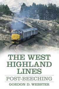
The railway lines of the West Highlands of Scotland are famous the world over for their illustrious history and unparalleled scenic beauty. Linking Glasgow with Oban, Fort William and Mallaig, the lines managed to survive the axe of Dr Beeching, whose infamous report forced the closure of almost a third of Britain's railways in the 1960s. With a detailed look at the routes, their workings and rolling stock since then, Webster examines how the West Highland network has gone on to prosper to the present day. Despite Beeching, British Rail's rationalisation, privatisation, fluctuating freight traffic levels and economic downturn, the network retained its unique infrastructure in the modern age. Today the use of modern traction, together with the return of steam-hauled trains, has added yet another dimension to this wonderful scenic route.
Sie lesen das E-Book in den Legimi-Apps auf:
Seitenzahl: 279
Veröffentlichungsjahr: 2014
Das E-Book (TTS) können Sie hören im Abo „Legimi Premium” in Legimi-Apps auf:
Ähnliche


Contents
Title
Acknowledgements
Introduction
1 The West Highland Lines: A Background
2 Early History and Beeching
3 The British Rail Era
4 From British Rail to First ScotRail
5 Traction
6 Steam Renaissance
7 Passenger Traffic
8 Freight Traffic
9 Buildings and Infrastructure
10 Signalling
11 The Lines Today
Gradient Profiles
Bibliography
Plates
Copyright
Acknowledgements
I am particularly indebted to the many people who work for the railway (and those now retired) who have given up their time to help me and provide me with information for this book. Particular thanks goes to John Yellowlees, External Relations Manager of ScotRail, who opened many doors for me with his enthusiasm and support. Another big thank you to Mr Yellowlees, as well as to the staff at ScotRail, who arranged for my cab ride to Fort William. I would also like to thank the following people, who have helped in many different ways with the production of the book. Without your help, what you see in the following pages would simply not have been possible:
Graham Atkins, John Barnes (Glenfinnan Station Museum), Doug Carmichael and the rest of the Friends of the West Highland Lines; John Baker; John Hanlon, Diane MacDonald, Joe Mansfield and Martin Wyber of ScotRail; Angus MacDonald; Florence MacLean and James Shuttleworth of West Coast Railways; Nick Meskell of Videoscene; Mick Parker and the Class 37 Locomotive Group; Michael Pearson; Malcolm Poole (Mallaig Heritage Centre); Andy Ross of GBRf; Peter Walker (West Coast Railways). A special mention too for those who kindly gave me not only information, but also the use of their superb photographs: Bob Avery; Jules Hathaway; Tom Noble; Allan Trotter of Eastbank Model Railway Club; and my father, David Webster, who allowed me complete control of his entire photographic collection. Last but not least, thanks to Chrissy McMorris and The History Press for their continued guidance.
Introduction
The West Highland railway has been the key link between a very large but remote area of north-west Scotland and the bustling city of Glasgow ever since the late-nineteenth century. The lines to Oban, Fort William and Mallaig have long been renowned for their miles upon miles of breathtaking scenery and extraordinary feats of engineering, meaning a trip up there is always one of the most sought-after railway journeys in Britain.
There are many people for whom the lines have played a big part in their lives throughout the years and who will forever remember some of the classic everyday scenes: the numerous fish trains that departed throughout the day from the busy harbour at Mallaig; heavy passenger trains of compartment coaches, with double-headed steam locomotives blasting their way up the torturous gradients; or the stop at Crianlarich Upper, where passengers would descend upon the station tea room as the two locomotives took water at the end of the platform.
By the time I started visiting the West Highlands regularly in the early 1990s, things were quite different from how they were a few decades before, during the period that most railway aficionados would acknowledge as the real glory days. Gone were the steam locomotives and their associated branch lines and paddle steamers they used to connect with. And many superb scenic views gradually became diminished by line-side vegetation. The mid 1980s saw further drastic change,s with the loss of mechanical signalling and most stations becoming unstaffed. And of course, most locomotive-hauled trains were replaced by diesel multiple units.
Yet despite these changes the West Highland lines have retained most of their charisma. For me personally, it was always down to that enchanting atmosphere they had – the tiny stations up on the hillside with their Swiss chalet-style buildings, approached via a subway under the island platform, and those long periods of silence between trains. And if you were travelling by road, there was the marvellous spectacle of seeing the train racing alongside you on the mountainside. I can recount numerous occasions of seeing one up ahead in the distance winding its way around the base of Ben Dorain near Bridge of Orchy, then overtaking it as it changed its course around the famous Horseshoe Curve.
There are no doubt lots of other people, each with their own special memories, who have been left with a similar lasting impression of the West Highland lines. The proverbial ‘magic’ of the area has been well-documented in not only the railway press but the mainstream press – so much so that the Fort William–Mallaig route was voted the ‘Greatest Railway Journey in the World’ by readers of travel magazine Wanderlust for three years in a row from 2009–11. Interestingly, the magazine abolished its railway journey category for 2012 – probably knowing that it would be a no-contest once again! It was no surprise either that the line was specially chosen for filming the train scenes in the Harry Potter films – another accolade that has helped the West Highland railways to gain their celebrity status.
It is important to mention the main reasoning behind the exact title I have chosen for this book. For the first part, I use the name The West Highland Lines in its plural form, as the book deals with all three of the lines which make up the West Highland rail network today. Not only is there the main route from Glasgow–Fort William but also the Fort William–Mallaig and Crianlarich–Oban routes. The ‘West Highland Line’ is the traditional name given to the Glasgow–Fort William section, with the other two parts being generally known as the ‘West Highland Extension’ and the ‘Oban line’ respectively. Despite this, all three are often seen being referred to collectively as the ‘West Highland Line’ – which is not strictly correct! This matters little really, but it is important that people recognise the importance of all three routes in this study of the lines and their respective individual characteristics.
In terms of the second part of the title, I have used the term ‘Post-Beeching’, as I wanted to write a book which studies the West Highland lines in more modern times. The infamous report The Reshaping of British Railways was published fifty-one years ago, in 1963, by the then new chairman of British Railways (BR), Dr Richard Beeching. This resulted in the closure of around 6,000 miles of railway along the entire BR network. Targeting mostly rural secondary routes and branch lines, around 2,300 stations would be subsequently shut and the withdrawal of steam traction accelerated further. The ‘Beeching Axe’ – as the process became known – would eventually reach the West Highlands, just as it reached everywhere else. By the late-1960s, its effect was there for all to see, with the biggest casualty being the closure of the ‘Callander & Oban’ main line, which was the main artery for traffic between Oban and Glasgow. The branch lines to Killin and Ballachulish were also lost for good, along with several wayside stations in the Highlands.
This book will examine the West Highland lines in the period following the ‘Beeching Cuts’, from the mid-1960s right up until the present day. It has been an interesting last few decades, with plenty of changes having occurred as modernisation continues to advance steadily. While the 1970s saw the dust settle after the cutbacks of the previous decade, the 1980s brought the aforementioned rationalisation of signalling and massive changes in rolling stock; changes which would ultimately be necessary to see the West Highland lines survive into the twenty-first century. And survive they have, undoubtedly helped by the summer steam-hauled service between Fort-William and Mallaig – now in its thirty-first consecutive year.
Over and above that, it is pleasing to report that we still have a railway linking Glasgow to Oban, Fort William and Mallaig. These famous scenic routes could quite easily have fallen victim to the Beeching Axe in the same way as the Edinburgh–Carlisle ‘Waverley Route’. Or indeed the old route to Oban via Callander. Certainly in the case of the former we saw a route closed simply on the basis that it was unprofitable, despite its huge importance as an Anglo-Scottish main line and a vital artery to a large part of the country. Other important cross-country main lines have fallen in a similar way, so it may be seen as something of a miracle that those in the West Highlands did not suffer a similar fate.
At Tulloch on 13 August 1987, 37409 Loch Awe waits with the 0540 Glasgow–Fort William as an unnamed 37422 approaches on the 0830 Fort William–Glasgow. Happily, both ‘37/4s’ are still in traffic today with DRS, with 37409 returning to the mainline in 2010 after an entire decade in store. (Jules Hathaway)
A train journey to the West Highlands today still brings me the same excitement that it always did. It truly is a line for all seasons, with its scenery and feats of engineering looking just as stunning on a cold winter’s day as in the height of summer. Even after a heavy rainstorm the scenery is splendid, with the line-side waterfalls and streams foaming.
I do hope that this book helps to capture some of the magical atmosphere of the West Highland lines. At the same time, I want to show the routes in what is my own personal favourite era: the diesel era. I have tried my best over the following pages to give a good account of the numerous types of locomotives and trains which have plied the lines in the past few decades. At first glance, one would be forgiven for thinking that it was always just a steady diet of Class 27s, 37s and 156 DMUs (Diesel Multiple Units), but it was actually far from it. After digging for information, I was quite surprised with some of what I came across in this respect. Preserved steam has also played a big part on the lines in recent years and I have naturally made an effort to cover this in detail too.
Another real benefit from conducting my research for this book was being able to meet some of the railway personnel who have worked on the West Highland lines, past and present. I soon realised just how insignificant somebody like myself really was next to the people who have really been there, and done that! Not only did they have some fantastic stories to tell, but it was very interesting to hear some first-hand knowledge about operations on the lines allowing me to discover a lot of interesting facts I didn’t know about the railway. You think you know it all … think again!
Gordon D. Webster
1
The West Highland Lines: A Background
The railway network that exists in the West Highlands today consists of 141 miles of track and is largely the same railway that has existed from the very beginning. Yet, like most places in the United Kingdom, the network used to be even bigger. Not only was there the renowned Callander & Oban route from Crianlarich to Dunblane, but several branch lines and industrial railways to boot. All of these gradually fell victim to rationalisation – or more specifically, in many cases, to what became known as the ‘Beeching Axe’.
Today, the West Highland railway network is best described in three parts. Firstly, the Glasgow–Fort William route – most commonly referred to simply as the ‘West Highland Line’. Secondly, the Fort William–Mallaig route, known as the ‘West Highland Extension’ or ‘Mallaig Extension’. And lastly, the Crianlarich–Oban route – colloquially known as the ‘Oban line’. By looking at the three principal routes individually, it is clear that they all have quite different characteristics; contrasting not only geographically but in terms of infrastructure as well.
One would be forgiven for thinking that the Oban line has always existed in the form it does today – that of a route which diverges from the West Highland main line at Crianlarich. However, for its first eighty-five years of existence, the railway to Oban was part of a completely separate main line which started in the Scottish Lowlands at Dunblane Junction near Stirling. The ‘Callander & Oban line’, as it was known, passed beneath the Glasgow–Fort William route at Crianlarich, with a connecting spur at Crianlarich Lower Junction. Services on both routes also operated out of separate terminus stations in Glasgow. Services for Fort William/Mallaig used Glasgow Queen Street while Oban trains used Glasgow Buchanan Street.
In 1965, the line between Crianlarich Lower Junction and Dunblane was closed and the spur joining the West Highland Line was retained, resulting in the route that we have today.
The West Highland Line (Glasgow–Fort William)
The typical West Highland Line adventure begins at Glasgow Queen Street station. But it is not until Craigendoran Junction, near Helensburgh, that the actual West Highland Line starts; with trains running for the first 23 miles of the journey along the electrified North Clyde line via Dumbarton. Nowadays, of course, the majority of West Highland service trains run as a single service from Glasgow Queen Street before splitting in two at Crianlarich – one portion going to Oban and one going to Fort William and Mallaig. The Fort William/Mallaig services have always run out of Queen Street, unlike the Oban trains, which formerly used Glasgow Buchanan Street station, before the closure of the Callander & Oban line in September 1965.
After departing from Queen Street up the 1 in 41 Cowlairs incline and emerging from Cowlairs tunnel, we pass the famous Eastfield depot, which is now used for servicing much of the ScotRail DMU fleet. Eastfield was responsible for the maintenance of the West Highland Line’s locomotive fleet before it was closed in 1992 (it subsequently reopened in 2004).
Travelling through the northern and western suburbs of Glasgow, West Highland trains join the electrified North Clyde line at Westerton, where the line runs alongside the Forth & Clyde canal and the branch to Milngavie diverges. All daytime service trains on the West Highland Line now run non-stop as far as Dalmuir, with the exception of the London Euston–Fort William sleeper, which calls at Westerton in both directions. Drumchapel, Drumry and Singer follow before Dalmuir station and its triangular layout, where we join the former Glasgow, Yoker and Clydebank Railway line via Jordanhill.
Leaving the city behind, the railway runs alongside the River Clyde estuary. At Bowling, the Forth & Clyde canal, which runs alongside the railway virtually the whole way westwards from Maryhill, enters the Clyde. After this all-too-brief countryside interlude we are back into the urban sprawl at Dumbarton. Dumbarton Central station provides another stop for West Highland services, allowing connections to Balloch – the route of which diverges from the main line at Dalreoch a quarter of a mile to the north. Dumbarton Central still retains its full canopies and buildings, incorporating three platforms. With large overgrown areas around the station which used to hold extensive sidings, it is evident that Dumbarton was once a very busy railway community.
Trains cross the River Leven on a girder bridge on the approach to Dalreoch station before the Balloch route parts company. The main road between Glasgow and Fort William – the A82 – takes a more direct route up to the Highlands past Balloch and the southern shores of Loch Lomond. Meanwhile, the main railway heads for the coast again, skirting past Cardross and the headland of Ardmore Point.
Craigendoran Junction is where the West Highland main line really begins, as we leave the electrified line to Helensburgh Central. The rationalisation of the railway is very much in evidence here nowadays, with Craigendoran station having been reduced to just one platform on the Helensburgh line only. It was once a busy station, with separate platforms serving both the West Highland and Helensburgh lines, and trains running right on to the pier to connect with Clyde steamers. The pier is now a ruin and Craigendoran is little more than a residential area on the outskirts of Helensburgh.
The first of many a steep gradient on the Glasgow–Fort William route is on the climb up the hill to Helensburgh Upper station. Although not immediately obvious, Helensburgh Upper was once an island platform with one of the ‘Swiss chalet’-style station buildings that characterise the West Highland Line. It is now merely an un-staffed halt. The line continues to climb leaving the station and begins its path along the hillside, high above the Gare Loch; a landscape already vastly different to that on the electrified line to the south.
There are views of Faslane naval base on the loch, which was once connected via a short branch line which ran down the hill. Wartime traffic used to be heavy over this southernmost part of the West Highland Line, though the branch was used little after the war and closed finally in the 1980s. The site of Faslane was chosen as a naval base on account of its quiet, secluded surroundings and deep water – ideal for testing ships’ compasses. Nowadays it is of course the headquarters of the United Kingdom’s nuclear defence system.
Garelochhead station lies high above the village it serves at the head of the loch, and displays the typical West Highland station layout of an island platform and ‘Swiss chalet’ buildings. It is also the first passing place for trains on the line. A turntable was once provided at the northern end of the station, the remains of which can still be seen to this day. As trains depart northbound, climbing once again, the head of the Gare Loch disappears from view.
Only a short strip of land, past the site of the closed station at Whistlefield, separates it from another sea loch: Loch Long. Climbing along the hillside once again, the first real summit of the West Highland Line is reached at Glen Douglas, 564ft above sea level. This isolated passing loop once had its own station, with a short island platform and signal box. It is now the site of a large, high-security Ministry of Defence depot; hidden from passing trains behind large plantations of fir trees but still rail-connected.
Dropping downhill again, there are views across Loch Long of the series of mountains known as the ‘Arrochar Alps’. Reaching the head of Loch Long and with the line traversing a narrow glen, we reach Arrochar & Tarbet station – often shortened to just ‘Arrochar’. It is situated on the hillside at a point right between the two villages it serves – Arrochar being on the head of Loch Long, and Tarbet on the banks of Loch Lomond 2 miles to the east. Travellers will start to notice a very familiar pattern with most of the stations on the line; Arrochar, like Garelochhead, has a compact layout with an island platform, reached via a subway.
A driver’s-eye view of the West Highland main line in winter. Views of Glen Falloch Viaduct (right) and County March Summit (below). (Author, taken during a cab ride with permission of ScotRail)
Upon leaving Arrochar, the West Highland Line begins winding its way along the side of Loch Lomond, which is 23 miles long and the largest loch in Scotland. Meanwhile, Ben Lomond can be seen towering across the opposite side of the water – 3,192ft above sea level and Scotland’s most southerly ‘Munro’ (one of a number of mountains over 3,000ft, listed by, and named after, Sir Hugh Munro). The views of such landmarks today are rather limited due to line-side vegetation, though the railway is at least a much safer bet than the adjoining A82 – which takes a decidedly treacherous course, bending sharply along the very edge of the loch as far as Ardlui.
At Inveruglas, the line crosses over four large pipes which run down the hillside, connecting to an adjoining turbine house as part of the Loch Sloy hydroelectric power scheme: the largest of its kind in the UK. It was built immediately after the Second World War and whilst not being the most aesthetically pleasing structure, makes for an impressive sight nevertheless. The railway then proceeds to cross the eight-arch Creag an Ardain Viaduct – the only arched viaduct on the whole route between Craigendoran and Fort William. The structure was reportedly built this way to minimise the railway’s intrusion on the beautiful landscape alongside Loch Lomond. Its castellated parapets are especially worthy of note. The adjoining Creag an Ardain Tunnel – 47yd long – is one of only two on the route to Fort William.
Ardlui is the point at which Loch Lomond comes to an end. Its island platform is another one unfortunately bereft of its station building, though there are still remnants of the former goods yard. It serves as a base for both hillwalkers and the adjoining marina on the loch, which can be glimpsed through the trees before northbound trains begin their 15-mile ascent of Glen Falloch. Glen Falloch Viaduct carries the line high over the Dubh Eas Gorge and with its centre span towering 144ft above the ground, it reaches a height only 7ft less than that of the Forth Bridge. Remains of the ancient Caledonian Pine Forest can also be seen from the train window just before the line reaches the top of the glen.
At Crianlarich, the famous station tea room on the platform makes use of the main building, while further activity ensues when today’s Sprinter trains are split and combined here – with respective portions for Oban and Fort William. The station was formerly known as Crianlarich Upper, with the other station down the hill on the Callander & Oban line known as Crianlarich Lower. The Lower closed in September 1965 and ever since then the Oban trains have taken the route of the West Highland, diverging from Crianlarich Upper on the former linking spur at the north end of the island platform. While the Oban line curves sharply to the west, the West Highland Line strikes northwards over two more viaducts, before itself taking a sharp ninety-degree curve to reach the opposite side of the Fillan valley.
Class 37 No 37404 Ben Cruachan tackles the final quarter of a mile towards County March Summit with the 1810 Fort William–Glasgow Queen Street, on the bright summer’s evening of Saturday 4 June 1988. From Sundays through to Fridays, this 1810 departure formed the overnight sleeper service to London Euston. (David Webster)
From here, views open up to passengers of the Oban line threading its way along in the same direction as far as Tyndrum, accompanied by the River Fillan. With most of today’s services joining or splitting at Crianlarich, the resultant timetabling allows for the Oban portion to often be seen making its way across the valley at the same time as the Fort William one on the opposite side. The latter line skirts the mountainside, crossing two more lofty viaducts along the way. These viaducts follow the same design as most of the others on the route: that of lattice steel trusses and built over concrete piers, in a style unique to the West Highland Railway.
Tyndrum Upper is another station on the line which has had its name altered. The introduction of radio signalling in 1988 saw its name reversed to become Upper Tyndrum, so as to avoid it becoming confused in radio messages with Tyndrum Lower station on the Oban line. It once had goods sidings located on a lower level, along with camping coaches for many years. What is still apparent today is a real lack of any civilisation in the station vicinity, as Upper Tyndrum lies high up on the hillside, a good distance from the village on the valley floor.
The Oban line now disappears into the distance behind the mountains as the West Highland route climbs at a gradient of 1 in 60 towards County March Summit, 1,024ft above sea level. These days it marks the boundary between the districts of Stirlingshire to the south and Argyll & Bute to the north, with the road, railway and the West Highland Way running close and parallel, before the railway winds its way around the famous Horseshoe Curve under the flanks of Ben Odhar and Ben Dorain. This stretch of line is best seen from the train window, with the curving track and its intervening viaducts seen up ahead in the distance before it traverses the bend, then once again from behind as the train reaches the opposite side of the glen.
It is a desolate landscape north of Tyndrum, interrupted only briefly by the hamlet of Bridge of Orchy – another hillside station and our next passing place on the line. Northbound trains face another climb out of here, with the railway continuing to cling to the hillside before the terrain flattens out over Rannoch Moor. The A82 road, and for that matter the West Highland Way, head off in a different direction, past Loch Tulla and the distant mountain range known as the Black Mount. We will not meet the A82 again until the outskirts of Fort William, as it takes a route through the mountains of Glen Coe.
The section of line over Rannoch Moor was the most difficult to build on the entire line. The ancient Caledonian pine forest used to cover the entire moor, but this was swept away, leaving only a bare expanse: 50sq. miles of heather, rivers and peat bogs. The land here was so waterlogged in fact that the navvies had to float the railway across the moor on a mattress of brushwood and tree roots, added to thousands of tons of ash and soil, the latter obtained from cuttings on the line. It is also an area rich with wildlife – grouse and red deer are often visible from the train.
There is a crossing loop on the middle of the moor at Gorton, which used to be essentially a private halt not featured in the public timetable. There was never any real community here except for a few scattered cottages occupied by railwaymen and shepherds, whose children attended a makeshift school made out of an ex-Great North of Scotland Railway coach body on the station platform. Being an extremely remote place with no linking road, any supplies for the locals had to be dropped off by passing engine drivers!
Rannoch station, with Class 156 Sprinter No 156492 calling on 8 October 2004. (Author)
In its BR guise as No 62005, the NELPG’s K1 mogul performs a run-past on a private photographer’s charter near Corrour Summit, October 2004. (Bob Avery)
The line descends for a few miles after Gorton, before another uphill climb ensues on the approach to Rannoch station. Rannoch marks the end point for the B846 single-track road to Pitlochry, while a pathway on its western side leads to Loch Laidon. The well-maintained station still retains its West Highland Railway signal cabin and main building, the latter of which was formerly used on alternate Sundays for religious services, the minister travelling in from Bridge of Gaur, 6 miles away. A couple of sidings survive in regular use by the Permanent Way Department. The platform offers a good view of the railway as it heads north across Rannoch Viaduct – 584ft in length and the longest on the line.
The surrounding snow fences on the moor are an indication of just how bad the winters can be in this part of the world, especially at the Cruach Rock cutting near Rannoch. During the first few winters after the line’s opening, the cutting became blocked by drifting snow on several occasions. As a result, a snow shed was placed here to protect the line and is still in situ today – the only one of its type in the UK. The track then climbs further to reach Corrour – the highest station on the entire British railway network. It is also one of the most remote, though very much a popular destination with the hillwalking fraternity, with a trail leading to the nearby Loch Ossian youth hostel and shooting lodge. The station, despite its isolation on the moor, boasts a popular restaurant and bunkhouse, though the nearest road is 17 miles away. The highest point on the line – Corrour Summit – lies immediately to the north of the station, at 1,350ft above sea level.
Now dropping down the gradient towards Loch Treig, the railway enjoys another change of scenery as Rannoch Moor is left behind. The railway takes a course along the hillside high above the loch, similar to earlier parts of the journey, before reaching the second of the two tunnels on the route at Fersit. The tunnel was actually built in 1932, due to the track being realigned over a short section here as part of the Lochaber hydroelectric power scheme, which saw Loch Treig’s water level raised by over 30ft. Originally the line ran lower down on the loch side, with the old trackbed nowadays usually underwater. The hydroelectric scheme was built to provide power for the Lochaber aluminium works, which also had its own narrow gauge railway running from a terminus on the shores of the loch. It climbed for 19 miles over the mountains to Fort William, where it met another short line running to the shores of Loch Linnhe. After the smelter was built in 1929, the railway was used for maintaining the huge 15-mile-long pipeline that runs from Loch Treig to the factory. The line was eventually closed in 1977.
Tulloch station was originally named ‘Inverlair’ when the West Highland Line first opened in 1894. That same year, the West Highland Railway proposed to build a 32-mile branch line from here to Kingussie on the Highland Main Line from Perth to Inverness. The Highland Railway thwarted the plans, but the West Highland still had the audacity to erect nameboards at the newly renamed Tulloch station that read ‘Tulloch for Kingussie’. Perhaps as a result of its hoped-for junction status, Tulloch has the standard station layout of two platforms that is more common to the Oban and Mallaig routes. It still boasts a sizeable ‘Swiss chalet’ station building and former signal cabin, with the former superbly preserved and in use as a bunkhouse. Typical of many rural stations, the two platforms are linked via a barrow crossing, not a footbridge.
Beyond Tulloch, the line takes a westerly direction through Glen Spean to reach Fort William, with the wooded valley and meandering river contrasting sharply to the vast wastelands of Rannoch Moor not long left behind. A most spectacular feature along this stretch of line is where the A86 road, railway and River Spean come together to squeeze through the narrow Monessie Gorge. Spectacular views open up from the train window as the railway eases along the edge of the river on a steep retaining wall, with the waterfalls gushing down below. Wild rainstorms in the past have seen the Spean flood up to rail level here.
Only 3 miles separate the final two stops on the line, the first of which is Roy Bridge – another which formerly boasted the twin-platformed layout and crossing loop but is now reduced to a single platform and bus stop-style waiting shelter. Spean Bridge retains both its platforms and crossing loop, together with an immaculate station building now used as a restaurant. It was from here that a 24-mile branch line ran northwards to Fort Augustus. Built with the most lavish infrastructure, it was the intention that this branch would eventually run all the way up the Great Glen to Inverness, linking Fort William with the Highland capital. This never happened and the line as far as Fort Augustus did not generate much at all in the way of revenue, resulting in its closure to passengers in 1933 and to freight in 1946.
As we draw towards the end of our journey, the landscape is dominated by the peak of Ben Nevis: the tallest mountain in the British Isles at 4,406ft above sea level. Another quite striking landmark is the huge aluminium smelter on the outskirts of Fort William, today operated by Rio Tinto Alcan and served by the railway on a daily basis. It was a prime target for German bombing raids during the Second World War – a fake smelter was even built at nearby Torlundy to fool the enemy into thinking they had found the real thing. One failed raid saw a German bomb dropped near Morar, with the pilot thought to have mistaken a hillside fire for the factory.
Fort William Junction (formerly named Mallaig Junction) sees the line from Mallaig join the single track for the final mile into Fort William station. The town of Fort William is the second largest settlement in the Highlands behind Inverness and takes its name from King William of Orange, who occupied the original military fort here on the shores of Loch Linnhe. Originally built in 1654, the fort was largely knocked down to make way for the railway when its construction began, with the old steam locomotive depot occupying the site. Ironically, there are still remains of the fort today while the steam shed was swept away many years ago. These days, Fort William is the outdoor capital of the UK, being at the foot of the country’s highest mountain and the end point for the West Highland Way. For many train travellers, it is journey’s end on one of the world’s most scenic routes. Though for many the best is yet to come, for Mallaig and the Sound of Sleat still lie some 40 miles ahead.
Sprinters 156476/499 pass Fort William Junction signal box on 3 April 2013 with the 1605 Mallaig–Glasgow, after reversal at Fort William station. The box was refurbished in 2000, when it was repainted, with new windows and outside steps. It is the last remaining mechanical box in the West Highlands. (Author)
EARLY HISTORY


