11,49 €
Mehr erfahren.
- Herausgeber: Crowood
- Kategorie: Lebensstil
- Sprache: Englisch
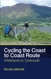
The 137-mile Coast to Coast Route (C2C) was the first national cycle route in Britain and has grown to become the most popular long-distance cycle ride in the country. Tackling the route over five days is a marvellous mini-adventure that should appeal to all sorts of cyclists. Every stage of the route, from Whitehaven on the west coast of Cumbria to Tynemouth in the east, is described by author Nicolas Mitchell, including fascinating accounts of its rich industrial heritage and details of the many opportunities to explore its glorious natural history. The guide includes route maps and elevation charts indicating the ascent and descent; full-colour and archive photographs of all the sights along the way; details listings of accommodation, places to eat and drink and local bike shops and finally, advice on how to prepare yourself and your bike for the trip. Fully illustrated with 75 colour photographs, 6 route maps and 6 elevation graphs.
Das E-Book können Sie in Legimi-Apps oder einer beliebigen App lesen, die das folgende Format unterstützen:
Seitenzahl: 125
Veröffentlichungsjahr: 2015
Ähnliche


Frontispiece: Fig. 01: The iconic C2C marker at Whitehaven. (Photo: Chris Brammall)
Cycling the Coast to Coast Route
Whitehaven to Tynemouth
Nicolas Mitchell
First published in 2015 byThe Crowood Press LtdRamsbury, MarlboroughWiltshire SN8 2HR
www.crowood.com
This e-book published 2015
Text copyright © 2015 Nicolas MitchellAll photographs are by the author, unless specified otherwise
Nicolas Mitchell hereby asserts and gives notice of his right to be identified under Sections 77 and 78 of the Copyright, Designs and Patents Act 1988, as the author of this work.
All rights reserved. No part of this publication may be reproduced or transmitted in any form or by any means, electronic or mechanical, including photocopy, recording, or any information storage and retrieval system, without permission in writing from the publishers.
British Library Cataloguing-in-Publication DataA catalogue record for this book is available from the British Library.
ISBN 978 1 84797 982 7
CONTENTS
INTRODUCTION
HIGHLIGHTS
HOW IT WORKS
SIGNS AND MAPPING
ESSENTIALS
FITNESS AND NUTRITION
WHEN TO GO AND WHAT BICYCLE TO TAKE
WHAT GEAR TO TAKE
ESSENTIAL MAINTENANCE
TRAVEL
STAGE 1: WHITEHAVEN TO KESWICK
STAGE 2: KESWICK TO PENRITH
STAGE 3: PENRITH TO NENTHEAD
STAGE 4: NENTHEAD TO CONSETT
STAGE 5: CONSETT TO TYNEMOUTH
CONCLUSION
RESOURCES
About the Author
Nick Mitchell is a keen cycle tourist. He has thousands of miles to his credit and is a veteran of numerous long-distance rides. Nick undertook his National Standards Cycling Instructor training in 2009 and his comprehensive knowledge of the Sea to Sea (C2C) is to be found in this, his third, cycling publication. When he isn’t in the office writing up cycling routes, Nick can be found out on the road guiding long-distance cycle tours.
Fig. 02: The author, Nick Mitchell.
Advice to Readers
While every effort is made to ensure the accuracy of this book, changes can occur during the lifetime of an edition. We advise readers to check such things as accommodation and transport before setting out to cycle the C2C. As with any adventurous activity, accidents and injury can occur. We accept absolutely no responsibility for any accident or injury which may occur in relation to using or following the route described, or for the information contained within this guidebook.
INTRODUCTION
This guidebook explores the C2C cycle route between Whitehaven and Tynemouth and is designed to assist riders in planning a leisurely five-day west to east cycle tour. This time-frame should ensure that it is well within the reach of those new to cycling as well as families with children aged twelve and over.
A significant part of this route is off-road, using the track-beds of disused railway lines, making gradients relatively gentle and on these particular stretches there is no interaction with motor vehicles.You will find off-road sections through parts of Whitehaven, Workington, Keswick, on the Waskerley Way, through the Derwent Valley and on the approach to and through Newcastle-upon-Tyne, as well as out to the finish at Tynemouth. The 137-mile C2C cycle route was the first national cycle route in Britain, inaugurated in 1994. It has grown to be the most popular long-distance cycle ride in the country. This guidebook outlines a multi-day cycle tour where the average daily mileage is a very relaxed 27½ miles. We have designed the C2C in five stages, as listed below:
Stage 1: Whitehaven to Keswick: 32 miles (ascent 628 metres, descent 548 metres)
Stage 2: Keswick to Penrith: 23 miles (ascent 432 metres, descent 379 metres)
Stage 3: Penrith to Nenthead: 27 miles (ascent 1,015 metres, descent 718 metres)
Stage 4: Nenthead to Consett: 29 miles (ascent 637 metres, descent 875 metres)
Stage 5: Consett to Tynemouth: 26 miles (ascent 165 metres, descent 358 metres)
For those riders looking for a quicker cycle tour, the five stages can be condensed into three: Whitehaven to Keswick (32 miles), Keswick to Nenthead (50 miles) and Nenthead to Tynemouth (55 miles).
Fig. 03: Mum and son on the C2C. (Photo: Saddle Skedaddle Cycling Holidays)
HIGHLIGHTS
The C2C is a tremendous cycle route comprising a mixture of lanes and off-road cycle paths, short sharp hills, long steep hills, freewheeling descents, dales, moorland and urban riding. Through careful design, the C2C cyclist is only in contact with motorized traffic on quiet B roads and unclassified lanes and because the route is ridden by thousands of riders each year local motorists expect to see cyclists and usually drive with courtesy. The C2C provides numerous highlights from the first mile to the last and a relaxed multi-day journey means that you have the chance to enjoy all that the C2C has to offer.
The scenery, especially through the Lake District, is exceptional, and the short ride through Wythop Woods near Keswick is some of the most peaceful and beautiful forest cycling to be found anywhere in the country. The ride out of Keswick is a spectacular part of the route, using the track-bed of the former Cockermouth, Keswick and Penrith Railway; it is a traffic-free and gentle ascent towards Mungrisdale under the towering presence of Blencathra (Saddleback) Mountain (868m). Further along into the journey there is the lush Eden Valley, a gorgeous patchwork of fields and meadows before the brutal climb up to Hartside Café. From the isolated café, manned by a crew of raucous and friendly local women, you will be pushing onwards, cycling through the grandeur of the North Pennines Area of Outstanding Natural Beauty (AONB), where you may sight some rare birds such as the hen harrier or black grouse.
A descent to Rookhope and a gnarly ascent to Parkhead Café signify the start of the Waskerley Way, which is a rollicking freewheel towards Consett. As you bowl downhill with the wind on your cheeks, the only sound will be the rhythmic whirr of your wheels on gravel, with a reservoir to the right, the dun-coloured moorland framing the former steel town away in the distance. From Consett the terrain flattens and the approach to Newcastle-upon-Tyne is on another track-bed of a former railway line.
At Rowlands Gill the countryside relinquishes her grip, giving way to the suburbs, while the C2C clings to the bank of the River Derwent before it converges to meet the River Tyne. With a westerly wind the ride into Newcastle is swift and exciting: the numerous bridges over the river provide a feast of architectural engineering, while lunch at the BALTIC is always a memorable stop before the final miles to Tynemouth.
HOW IT WORKS
This book is divided into a number of short sections, featuring signs and mapping, fitness and nutrition, when to go and what gear to take, a comprehensive kit list, essential maintenance and a section on travel. This should be useful when planning your arrival at the start point and your departure after successfully completing the ride. Within the main section of the book each of the five stages are fully described, including a strip map highlighting the towns and villages that will be encountered during the day as well as an elevation chart indicating the ascent and descent. You will also find a number of vignettes that identify historical places of interest as well as species of plants, birds and mammals that you may encounter en route. At the rear of the book you will find a comprehensive list of accommodation to suit all budgets, including hotels, bed and breakfasts, campsites and youth hostels. There is a list of cycle repair shops, train operators, taxi companies operating from Tynemouth as well as tourist information offices and a list of other resources relating to bike repairs, fitness and nutrition.To make the text a little easier on the eye websites are identified by the final part of the domain name rather than the full web address.
Fig. 04: Taking a breather. Riders from the Ocean Youth Trust completing a sponsored ride on the C2C. (Photo: Ocean Youth Trust and Grace Metcalfe)
SIGNS AND MAPPING
One of the outstanding features of the C2C is that the route is extensively signed from start to finish. The signs are well designed, clear and numerous, and it is quite possible to cycle the entire 137 miles relying entirely on the National Cycle Network (NCN) and C2C signposts that you will see on the route.
Nevertheless, we strongly recommend that, in addition to this guidebook, riders carry appropriate hard copy maps at all times and, for those riders who enjoy detailed planning and navigating, mapping will be an important aspect of your tour preparations. We believe that the most suitable maps for cycle touring are the Ordnance Survey Landranger series 1:50 000, 2cm to 1km, 1¼ inches to 1 mile.This scale fits perfectly with the rhythm of long-distance cycling, at a steady pace of anything from six to twelve miles per hour. They include just enough detail but not too much. You will need seven Ordnance Survey Landranger maps to complete the C2C. An alternative is to use the excellent NCN Challenge Sea-to-Sea map published by Sustrans. Full details of the maps required are listed below. If you are on a budget you should be able to save money by borrowing the Ordnance Survey maps from your local library. Alternatively you may find second-hand copies on eBay for a pound or two.
Fig. 05: National Cycle Network signs for the C2C.
Maps Required
Ordnance Survey Landranger Sheet 89: West Cumbria(ISBN 0-319-22689-1)
Ordnance Survey Landranger Sheet 90: Penrith & Keswick(ISBN 978-0-319-23151-7)
Ordnance Survey Landranger Sheet 91: Appleby-in-Westmorland(ISBN 0-319-22691-3)
Ordnance Survey Landranger Sheet 86: Haltwhistle(ISBN 0-319-22086-9)
Ordnance Survey Landranger Sheet 87: Hexham, Haltwhistle(ISBN 0-319-22087-7)
Ordnance Survey Landranger Sheet 92: Barnard Castle & Richmond(ISBN 0-319-22692-1)
Ordnance Survey Landranger Sheet 88: Newcastle-upon-Tyne(ISBN 978-0-319-22998-9)
NCN Challenge Sea to Sea (C2C) Cycle Route Map, Sustrans(ISBN 978-1-901389-65-4)
Navigating with a physical map on your handlebars is great fun and very rewarding. For those riders who enjoy this aspect of touring we have included every significant turning and junction as a grid reference throughout the body of the book. These references are denoted by two letters followed by six digits, for example NY 971 453, NZ 002 431, etc. A full list of these grid references and a comprehensive list of villages and towns are listed at the rear of the book. It should be a simple matter to transfer the grid references from this book and plot the route onto the Ordnance Survey Landranger maps before beginning the ride. Additionally, grid references are used to mark the location of hotels, bed and breakfast accommodation, cycle repair shops and youth hostels; this information can be found at the back of the book. If you are unsure about how to plot a grid reference onto a Landranger map, Robert B. Matkin’s book Map Reading (ISBN 978-1855680968), published by Dalesman 2008, is a very user-friendly introduction, and Ordnance Survey also produce a free map-reading guide entitled Map Reading: from the beginner to the advanced map reader (ISBN 978-0-319-08785-5).
With the revolution in information technology, many riders will choose to navigate the C2C using a Global Positioning System (GPS), smartphone or tablet rather than a traditional paper map. To do this you will need an open source mapping application.There are some excellent resources on the internet and we believe that two of the best are Google Maps (maps.google.com) and Open Cycle Map (opencyclemap.org). In addition, there is also an iPhone app (apple.com) for Google Maps, whilst Open Street Map (openstreetmap.org), Garmin Basecamp (garmin.com), Ordnance Survey OS Open Data (ordnancesurvey.co.uk) are all tremendous resources. You may also find the National Cycle Network app from Sustrans (sustrans.org) and their online mapping of the National Cycle Network very helpful. Many cyclists who have already completed the C2C have uploaded their routes and maps to the cycling website Map My Ride (mapmyride.com) and it is quite easy to download the GPX files from this resource directly to your computer, GPS, smartphone, etc. Finally the website nearby.org.uk will convert a grid reference (as used throughout this book) or postcode into a physical location onto a host of open source mapping resources such as emapsite.com, streetmap.co.uk, multi-map.net, or magic.gov.uk. This should prove invaluable when searching for a bed and breakfast, youth hostel or cycle repair shop.
ESSENTIALS
FITNESS AND NUTRITION
You do not need to be super-fit to complete the C2C, nor will you need to prepare for weeks with a specially designed diet, but giving some general thought to your fitness and what you eat before, during and after each day on the bicycle will make the whole C2C experience more enjoyable. In this section of the book we want to try and help our readers with nutrition and fitness. It hardly needs saying that you will need to be in good health before attempting the C2C. Although not the toughest ride in the pantheon of long-distance cycle tours, the C2C can still deliver a surprise, especially on the climb to Hartside Café. With this in mind we recommend that you visit your GP for a health check-up before undertaking the ride.
Fig. 06: A Sustrans Millennium Milepost on the C2C, works of art in their own right.
With regard to fitness, there are some excellent resources on the internet, which will help you personalize your training plan. One of the best is Do It For Charity (doitforcharity.com), where you will find a section on the website dedicated to cycling fitness. The British Heart Foundation (bhf.org.uk) has also produced a clear and concise beginners’ fitness programme. We believe that there is no substitute for being out and about on your bicycle. If possible, make it your preferred mode of transport and use it for commuting or going to the shops; you will soon build up some cycling fitness. Around two weeks before the start of the C2C try and do two consecutive days of around twenty to thirty miles in the saddle. If you have never undertaken a long-distance ride before, this is a good way of assessing your general condition whilst giving you a little extra time to get a final few miles under your belt. We have listed the best cycling fitness books we could find at the rear of this book.


