8,39 €
Mehr erfahren.
- Herausgeber: Batsford
- Kategorie: Lebensstil
- Sprache: Englisch
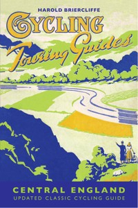
The revised edition of the classic cycling guide by Harold Briercliffe of 1949. Used as the inspiration for the Britain by Bike television series and a vital part of the award-winning Britain by Bike book by Jane Eastoe, the original book is reproduced along with suggested cycling routes in the Central England region for today's cyclists. Harold Briercliffe was the Alfred Wainwright of cycling and his books provide great insight into cycling in various parts of the UK in the 1940s. Harold's fascinating description of the towns, villages and roads of Britain at the time is a joy for all those who love these isles and especially for cyclists looking for inspiration. Many roads have changed over the decades and are now too busy for enjoyable cycling, so Mark Jarman, along with Sustrans, have made suggestions for alternative routes in the region for today's cyclists. The book includes the original photographs taken by Harold Briercliffe and the original illustrations. The Cycling Touring Guide: Central England covers cycle routes in the Peak District, Cheshire and north Shropshire, East of the Pennines, the Midlands, the Malverns, the Wye Valley, the Forest of Dean and various routes north of London. The cycle routes vary in length from half day and day-long trips to weekend and week-long tours.
Das E-Book können Sie in Legimi-Apps oder einer beliebigen App lesen, die das folgende Format unterstützen:
Seitenzahl: 250
Veröffentlichungsjahr: 2012
Ähnliche


ACKNOWLEDGMENTS
Thanks to Sam Howard at Sustrans for providing details of the latest Sustrans routes, and to Ruth Briercliffe for her assistance.
First Published 1949 (under the title Cycling Touring Guides: The Midlands)
Revised edition published 2012 by
Batsford 10 Southcombe Street London W14 0RA
An imprint of Anova Books Company Ltd
Volume © Batsford, 2012 First ebook publication 2012 Additions by Mark Jarman and Sustrans
The moral rights of the author have been asserted.
All rights reserved. No part of this publication may be reproduced, stored in a retrieval system, or transmitted in any form or by any means electronic, mechanical, photocopying, recording or otherwise, without the prior written permission of the copyright owner.
ebook ISBN: 9781849940641
A CIP catalogue record for this book is available from the British Library.
20 19 18 17 16 15 14 13 12 10 9 8 7 6 5 4 3 2 1
Also available in paperback ISBN-13: 9781849940405
Neither the publisher nor the author can accept responsibility for any changes, errors or omissions in this guide, or for any loss or injury incurred during the use of any of the cycling routes.
CONTENTS
Introduction by Mark Jarman
Preface by Harold Briercliffe
Chapter I—THE PEAK DISTRICT
Introduction
Approaches
Round of the Peak District
Gazetteer
Cycling in the Peak District today
Chapter II—PEAK DISTRICT “ROUGH STUFF”
Peakland Crossings
Rough Trails in the Peak District today
Chapter III—CHESHIRE AND NORTH SHROPSHIRE
The Wirral
Delamere Forest
Dee-side, Peckforton and Beeston Castle
Barton Bridge to Frodsham
Barton Bridge to Shrewsbury
Manchester to Wellington
Alderley to Newcastle-under-Lyme
East Cheshire
Cycling in Cheshire and North Shropshire today.
Chapter IV—EAST OF THE PENNINES
The Dukeries
Cycling East of the Pennines today.
Chapter V—THE WEST-CENTRAL MIDLANDS
Newcastle-under-Lyme to Coventry (for London)
Newcastle-under-Lyme to Gloucester
Shrewsbury to Hereford
Wellington to Ludlow
Halesowen to Bridgnorth and Atcham
West of the Severn
Cycling in the West-Central Midlands today
Chapter VI—THE EAST-CENTRAL MIDLANDS
Charnwood Forest
Southwell
Rutlandshire
Rockingham Forest and the Northants Uplands
Cycling in the East-Central Midlands today
Chapter VII—THE MALVERNS, WYE VALLEY AND FOREST OF DEAN
Approaches
A Six-Day Tour
The Severn Bore
Crossing the River Severn
Gazetteer
Cycling in the Malverns, Wye Valley and Forest of Dean today
Chapter VIII—NORTHWARDS FROM LONDON
The Great North Road
The Old North Road
Fast By-roads North from London
By-road Alternative to A1
By-roads to Ashwell
To East Lincolnshire, and the Norfolk Coast
Missing Luton
Alternative to A5
Towcester to Warwick
Cycling North of London
Appendix —Mapping your route today
Index
LIST OF LINE ILLUSTRATIONS
Approaches to the Peak District
Dewpond Under Thorpe Cloud
Chrome Hill
Peak Cavern, Castleton
High Tor
Buildwas Abbey
The Butter Cross, Oakham
Obelisk at Naseby
LIST OF PLATES
The Winnats Pass, West of Castleton, Derbyshire
Gawsworth Church, between Macclesfield and Congleton, Cheshire
The Fortified Gateway on Monnow Bridge, Monmouth
The View from Symonds Yat, Looking Over the River Wye
Welbeck Park, near Worksop
A Glimpse of Ledbury, Herefordshire
INTRODUCTION
The Britain by Bike TV series was based on a collection of old and largely forgotten cycling guides written by Harold Briercliffe over 60 years ago in the late 1940s. Such was the interest in the TV series and associated book that the guides quickly went from almost unknown on the second-hand market to much sought after and almost impossible to obtain. Perhaps the main reason for the renewed interest in the guides is that they take you back to a time many now see as cycling’s golden era. They are so much more than slightly dated books with directions to help you find your way from A to B. Indeed anyone who sought out the original The Midlands guide in the belief that it would provide accurate and reliable information about the best cycle routes around Central England will be rather disappointed. Clearly, as a 21st-century cycling guide, Harold Briercliffe’s writings are no longer as helpful as they once were as so many aspects that impact upon cycling conditions have changed dramatically since the 1940s. For this reason, in this revised reissue the end of each chapter includes details of current recommended Sustrans routes that can be used to help explore the places that Briercliffe visited on his cycle journeys. The real joy of Harold’s original books is their insight into Britain in an earlier age and a reminder of a gentler pace of life and the attractions of cycle touring around Britain.
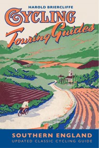
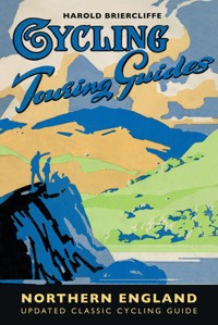
The starting point for understanding and appreciating the guides is to look at the context in which they were written. In the post-war years, Harold Briercliffe was a writer for Cycling magazine, then the UK’s main cycling publication. The guides were assembled from the feature articles written in the magazine, with each issue covering an area of the UK that later formed the basis of a chapter within the regional guides. The first guide was published in 1947 and covered the Northern England region. Over the next few years a further five were produced ending with the Southern England guide, which was published in 1950.
The post-war Britain that Briercliffe encountered on his cycling journeys was a place in the midst of austerity, where rationing strictly controlled the availability of essentials, including food, clothes and fuel. It is worth remembering that at the end of the 1940s only 1 in 7 households had access to a car. If you were one of the few that did have a car your family’s vehicle was likely to have little in common with today’s air-conditioned people carriers and 4 x 4s. The most popular cars of the day were rather uncomfortable and modestly sized by modern standards with the Morris Minor and the Austin A30 being two of the most popular 1950s models. For most people, the main methods of mechanised transportation were rail, bus and, of course, the bicycle. With the average workers’ holiday being only one or two weeks a year, the bicycle was seen as a key form of transport, offering cheap and easy access to the UK’s places of interest (alongside bus and rail travel). During this period, the UK’s cycling industry output was moving towards its peak. There were numerous manufacturers producing bicycles not only for the domestic market but for export all over the world. Notable companies from that era include Phillips, Dawes, BSA, Holdsworth, Royal Enfield, Elswick, Sunbeam, Evans, Claud Butler, Bates and Hetchins. But it was Raleigh that became established as the leading bicycle manufacturer of the day with the company’s bicycle production reaching a peak of over a million in 1951. This increase in demand and supply was accompanied by advances in design so that bicycles became much more suited to longer distance touring. The use of lightweight 531 tubing to build the classic diamond-shaped frame (including randonneur handlebars), and the introduction of the simplex derailleur gear system and cantilever brakes, meant that the bicycles available in the early 1950s looked remarkably like modern touring bikes (although today’s bicycles benefit from more sophisticated alloys of steel and aluminium as well as a much greater range of gears and better pedals).
For those who might have been slightly less enthusiastic about spending their leisure time on a bike, there was relatively little to encourage them to stay indoors. This was a world without games consoles, personal stereos, home computers or wide-screen TVs. By the beginning of the 1950s only 8% of households in the UK had a TV. For the few television owners, there was only one station (ITV did not join the BBC until 1955) and the broadcasting hours were very limited. So for the vast majority, the radio ‘wireless’ provided the main source of family entertainment within the home. Cinema was the only other boom area for entertainment.
Against this background of ongoing rationing and limited forms of entertainment, it is perhaps easier to understand the reasons why Harold Briercliffe (approaching 40) embarked on the monumental task of covering the whole of the UK by bike. Following production of the Northern England guide in 1947, Briercliffe’s articles in Cycling magazine were gradually used to form a series of regional guides covering the Scottish Highlands, Wales, South West England, and The Midlands before finishing with Southern England.
The Midlands guide, which in this revised edition we have renamed Central England, covered an enormous area of the UK that went well beyond the confines of more standard definitions of that region. He defined it as starting at the northern edge of the Cotswolds and continuing as far north as the River Mersey. The western boundary of the region was rather imprecise but considered to be a rough line joining Chester, Hereford and Newport. And the eastern boundary of the region seemed to use the Great North Road linking Doncaster down towards Newark and Grantham, eventually joining Huntingdon and Ware before going all the way to the Thames at London Bridge. As Briercliffe accepted ‘The Midlands then, for the purposes of this guide, constitutes a far-flung region.’
Many parts of this central area of Britain have experienced significant changes over the last 60 years, particularly in terms of housing and traffic growth. Briercliffe suggests the use of what are now very busy ‘A’ roads to cycle out of main urban areas. In the case of The Midlands guide the most obvious example of this is Briercliffe’s suggestion to use the Great North Road and sections of the A1, A5 and A10 to cycle north out of London towards the Midlands. He makes no mention of the unsuitability of these roads for the cyclist because of the volume of traffic or even the need to avoid the M25 (or the M5, M6 and M42 motorway network around Birmingham) because in 1950 Britain’s motorway network was still very much on the drawing board. In 1946 the first map was published showing the planned motorway system, including lines that became the M1, M4, M5, M6, M62 and M18 (there was also a circle around London that would eventually become the M25). In the same year, the Government also announced an 80% expansion of the trunk-road system, adding an extra 3,500 miles to the network. A series of trunk-road improvements took place throughout the 1950s, a decade which ended with the opening of the M1 in November 1959.
This gradual increase in Britain’s highway capacity coincided with the growth in car ownership and use. The Department for Transport has recorded levels of use of the various types of transport (in annual billion vehicle kms) every year since 1949. Cycling has declined rapidly since the 1950s from a high of 24 billion vehicle kms in 1949 to around 5 billion vehicle kms in 2010. In the same 61-year period, car usage has risen from just over 20 billion vehicle kms in 1949 to almost 400 billion vehicle kms by 2010. Against this backdrop, it is little wonder that the road conditions Briercliffe describes at the end of the 1940s seem to bear so little relationship to what would be found if you tried cycle touring on Britain’s trunk-road network today.
In addition to this massive increase in highway capacity and traffic levels, Britain experienced significant house building in the post-war years, leading to the expansion of major urban conurbations as well as some of our smaller towns and cities. There are many reminders of the obvious changes that have occurred since the 1940s in Briercliffe’s description of the places he visited on his journeys. Briercliffe’s route from London towards the Midlands involved passing through Stevenage, which was designated a New Town by the government in the 1946 New Towns Act. The town was transformed, swelling from around 6,000 inhabitants to a population of over 80,000. The 1946 New Towns Act resulted in similar levels of development in such places as Bracknell, Crawley, Hemel Hempstead, Basildon and Harlow. A second wave of new-town building followed in the 1960s, including more towns situated within the area defined by Briercliffe as the ‘Midlands’ region, the most significant of these being at Runcorn and Telford, with the grandest project at Milton Keynes, which was designated in January 1967.
You might wonder whether, in the face of so much housing development, road building and traffic growth since 1950, if any of the UK that Briercliffe discovered on his journeys still exists. It is therefore reassuring to find that so much of the distinctive character of Briercliffe’s Britain can still be discovered by the cycle tourist. An obvious example of this within the Central England guide is the wonderful cycling that can be found in the Peak District. This area is one of the 10 National Parks that were designated by Government in 1949. In the period since this legislation, strict planning controls have limited the amount of development so that much of the varied landscape described by Briercliffe remains as it was in the 1940s. The last sixty years represents a mere blink of an eye in comparison to the millions of years over which the ‘geological foundation’ of the Peak District was formed. The underlying limestone and millstone grit rock which dominates the area has created a landscape that has changed very little since Briercliffe’s time. The rock types have a significant impact on the ecology of the area and these variations can still be viewed when cycling in areas such as the Upper Derwent Valley. It includes the series of reservoirs along the valley, only two of which (Howden and Derwent) were built by the time Harold wrote his guide book. The Derwent Reservoir, completed in 1916, had been used during World War II as the Dambusters Squadron prepared for their dramatic raids on German dams. Today, the series of reservoirs and their surrounds have been developed for tranquil recreational uses, including fishing as well as a network of paths for walking and cycling.
The network of such paths is now quite extensive throughout the Peak District. While many of the on-road routes that Briercliffe mentions have become much more trafficked and unsuitable for cyclists, quieter segregated cycle paths are now more available than they were in the 1940s. Much use has been made of the unused old railway lines. Some 4,000 miles of railway branch line was shut during ‘Beeching’s Axe’ of the 1960s. In the last few decades some of these old railway routes have been converted to form excellent paths for cyclists and pedestrians. As cycle routes they have become a much-valued facility, free from the hazards of fast-moving motor vehicles and are generally very flat, not exceeding a gradient of more than about 1 in 20. So while Briercliffe might have recommended using sections of what have become busy A roads (such as the A6 to leave Bakewell) today’s reader would be well advised to check the alternative modern-day Sustrans routes (identified at the end of each chapter). A good example of such a route is the very popular Tissington Trail, which follows the line of the old railway tracks between Ashbourne and Buxton. There are similar converted railway paths throughout the Peak District, including the Sett Valley Trail, Monsal Trail, Manifold and Hamps Trail, Longendale Trail and the High Peak Trail.
Another major change in the Peak District, and elsewhere in Britain, is the availability of Youth Hostel accommodation. Briercliffe mentions the suitability of Whitemeadows, Langsett and Rudyard Lake Youth Hostels as providing a base for exploring the area. However, these hostels (along with many others mentioned throughout Briercliffe’s guides) were among the casualties of the hostel-closure programme. This would not have been anticipated by Briercliffe back in the late 1940s when membership of the Youth Hostel Association (YHA) was heading towards its peak. At the start of the 1950s there were 303 youth hostels and over 200,000 YHA members. Increased availability of holidays abroad and changes in the level of walking and hiking resulted in a gradual fall in demand for YHA accommodation. This led to closures and a modernisation programme with the emphasis on providing better youth-hostel facilities in towns and cities. Around 100 of the hostels (particularly those in more remote rural areas) were closed. Thankfully, some of the hostels mentioned by Briercliffe remain open. These include the impressive Ilam Hall Youth Hostel (page 22), which continues to provide an excellent base for exploring the area.
Moving beyond the confines of the Peak District, many of the routes that Briercliffe identifies in his journeys around Central England are still perfectly suitable for the keen touring cyclist. Much of the landscape between the west side of the Birmingham conurbation and the Welsh borders retains something of the quiet remoteness that Briercliffe was so keen to praise. This is particularly the case in the area to the west of the Wyre Forest, crossing back and forth between the counties of Herefordshire and Shropshire and around Wenclock Edge and Corvedale. Further to the north, the landscape between Wolverhampton and Shrewsbury has changed much more dramatically since the 1960s with the introduction of the M54 motorway and the rapid development of Telford. The area to the south west, through the Welsh Marches, seems to have been a particular favourite of Briercliffe’s. He describes the cycle route from Shrewsbury to Hereford as benefiting from ‘one of the finest and fastest main roads in the country.’ He identifies Church Stretton and Ludlow as particular highlights along the route and is keen to emphasise the wonderful scenery that can be viewed from locations such as Dinmore Hill near Leominster. Sixty years on, Ludlow is still dominated by its Castle, dating back to Norman times and Church Stretton still retains its charm created by the backdrop of the Stretton Hills and Long Mynd. Unfortunately, the A49 between Shrewsbury and Hereford is no longer the attractive cycling route that Briercliffe once described, undergoing a series of upgrades that now present sections of dual carriageway and much higher flows of fast-moving traffic. Travelling further south towards Monmouth, Briercliffe continues to emphasise the beauty of the scenery along the route. His description of the views of Symonds Yat is very much in keeping with today’s accounts of this popular spot. Certainly this remains an attractive location for cyclists and can now best be experienced using the recommended Sustrans route.
A vast area was covered by Briercliffe in what he called his ‘Midlands’ guide. He describes routes out of London, heading north and east towards Lincolnshire and even to the Norfolk coast. He also sets out an extensive network of routes across the core of Central England, linking places with historic interest such as Stratford-upon-Avon, Worcester and Malvern. It is noticeable that the roads between towns and cities seem to have changed more than the description of the towns themselves. The latest designated Sustrans routes described at the end of each chapter are therefore an invaluable tool in helping today’s cyclist to rediscover the extent to which the essential character of these towns and the wider countryside has remained intact over the course of the last 60 years.
Mark Jarman 2012
PREFACE
FOR the first time in this series of guides I deal in this book with an area which lacks the attraction of a coast. The guides dealing with Northern England, Wales, the Scottish Highlands and South-West England all featured long stretches of seashore, and in them there was constant reference to the sea.
In the Midlands there are no adequate topographical compensations for the absence of the ocean. This book is comprehensive enough to reveal the interest of the Severn Estuary and of the estuaries of the River Dee and River Mersey, but their glories are milder than those of, say, the Mawddach or Loch Torridon.
Nevertheless, the Midlands have their attractions in plenty for the tourist. But before I go any farther, I had better define the area—and it is a big one—covered by this guide.
“Northern England” reached down as far as the River Mersey and the course of its tributary, the Etherow, at Woodhead, and took in the district north of the Barnsley-Doncaster road. All south of that line, right down to the northern edge of the Cotswolds, comes into this volume.
“Wales” took in all the country—including a large slice of England—west of the line Chester-Whitchurch-Ludlow-Hereford-Monmouth-Newport. There lies the westerly boundary of this book. On the east, the course of the Great North Road southwards forms the boundary from Doncaster, past Bawtry, Retford, Newark, Grantham, Stamford, Norman Cross, Alconbury Hill, and then along the old North Road by Huntingdon, Royston, Ware and Hoddesdon to the Thames again at London Bridge.
“The Midlands,” then, for the purposes of this guide, constitutes a far-flung region. Classification of a series of guides which will eventually cover the entire British Isles is not easy, and because of the relatively restricted areas covering adjacent touring districts, “the Midlands” have been extended in size and importance.
I must admit at once that for the cyclist and walker Central England has a smaller appeal than the Lake District, the Yorkshire Dales and Coast, North and Mid Wales and the Scottish Highlands. It is primarily given over by the cyclist to day trips, weekends and short holidays such as Easter, Whitsun and Christmas.
Only the Peak District, duly extended to bring in East Cheshire and North Staffordshire, provides sufficient interest for a week or a fortnight’s tour. But the cyclist who cares to link up—as he can very easily—short tours of Shakespeare’s Country, the Malverns, the lower Wye Valley and the Forest of Dean, as given in their respective chapters, will find that he has presented himself with one of the most varied and unusual holidays that he will find south of the Scottish Border, east of Wales and north of Bridgwater.
Finally, I should like to thank my cycling friends who have helped me with their advice on the Midlands, notably E. R. Forscutt, of Kettering, and Charles Fearnley, the health expert. Their knowledge of a few obscure corners was freely offered and gratefully accepted.
HAROLD BRIERCLIFFE.
Letchworth, Herts.
December, 1948.
CHAPTER I
THE PEAK DISTRICT
INTRODUCTION
THE Peak District is not large and it is not remote. Moreover, it is hemmed in by a ring of manufacturing towns and cities. The cyclist who goes there should not expect to find himself amidst the solitudes that are to be found in the more northerly parts of the Pennine Chain.
It follows, therefore, that the Peak District calls for leisurely and patient exploration. Any rider who goes in for mile-eating will quickly find himself in Clay Cross or in Hanley or Ancoats—hardly halts for the tourist.
Because of its geological foundation, the Peak—here signifying North Derbyshire, East Cheshire, East Staffordshire, and even part of Lancashire and Yorkshire—has great variety within a limited compass. The core of the district, from Chapel-en-le-Frith and Castleton southwards to near Ashbourne, is chiefly limestone, that fantastic rock which gives deep gorges—old caverns with their roofs fallen in; weird, isolated hills, as near Longnor; and miles of dull, uninspiring upland.
This limestone core is flanked by millstone grit, a harder, more durable, relative of sandstone. The grit is warmer altogether, and makes for impressive “edges” and more romantic scenery. The upper Derwent Valley, near Grindleford Bridge, forms part of the dividing line between the two rocks. It is a stimulating experience to stand on the hills north of Eyam and look westward across the limestone upland, undulating in smooth, stone-walled surges, and then to turn eastwards and gaze across the trough formed by the Derwent and the steep castellations of the gritstone on the far side of the valley.
The Midland gritstone does not achieve its most outstanding scenic phase in Derbyshire at all. This honour is reserved for the steep little gorges and their plunging streams that abound on and around the River Dane, near Swithamley. The river thereabouts separates Cheshire from Staffordshire. In this district, too, are the remarkable pieces of natural statuary formed by The Roaches and Hen Cloud. These eroded rock shapes lie just west of the Leek-Buxton road.
“The Peak,” or Kinder Scout, consists of a plateau over 2,000 ft. high, and of irregular shape. It is about 1½ miles by 4½ miles, and in composition is sterile bog overlaying millstone grit. The plateau is scored in all directions by deep and treacherous watercourses, each one like its neighbour, all full of pitfalls to the unwary, and literally deadly in mist or fog. There are few acknowledged footpaths across Kinder Scout, and grouse and keepers have the wilderness nearly to themselves. From time to time daring parties and individuals have braved the bogs, the weather and the keepers and have been up the hill. In the 1930s a “mass trespass” took place which led to arrests and to imprisonment.
The most impressive features of Kinder Scout, however, are the edges which buttress the summit bogs. These are steep gritstone faces reaching down boldly from the plateau towards the valleys. One striking face of this kind is Fairbrook Naze, noticeable from the public footpath along Ashop Clough, between Hayfield and the Snake Inn. The grandest piece of scenery on Kinder Scout, however, is Kinder Downfall. This is a mere trickle in summer and autumn, but in winter the stream feeding the fall becomes a torrent, spreading out in a fan across the gritstone and falling hundreds of feet into the valley below.
Perhaps no county in England has so much to show in natural phenomena as Derbyshire. Castleton has a glut of caverns and two impressive limestone gorges in The Winnats and Cave Dale. In the nearby limestone, too, there are the “bottomless” Eldon Hole and the Bagshaw Cavern at Bradshaw. Mam Tor, or the “Shivering Mountain,” dominates the head of the Hope Valley, west of Castleton, and its shaley face does “shiver” in the right conditions.
There are other caves, too, at Buxton, while at Matlock there are more commercialized “wonders.”
Accommodation in the Peak District is now getting back slowly towards the standards which prevailed before the war. More and more of the farms and smaller houses are offering bed and breakfast and meals.
The Youth Hostels Association has covered the Peak District with some 25 hostels. These vary in capacity and in kind—there is quite a difference between the large hostels, such as Hartington Hall or Ilam Hall, and the more modest Windgather.
The camper who shuns the larger sites in the vicinity of such places as Hayfield, Castleton and Baslow and takes himself to the hill farms will find that Derbyshire has plenty to offer in the way of rural surroundings, sheltered pitches and ample water supply and dairy produce.
The main roads of the Peak District are consistently good. Tarred limestone makes a hard, durable and non-skid surface, although the untarred limestone by-roads can be quite “tacky” after rain. Gritstone by-roads dry quickly and in rain are firm and non-skid.
APPROACHES
Unlike the more distant touring grounds, the central situation of the Peak District enables the cyclist from most of the large cities and towns south of the line Preston-Hull to reach at least the fringes of the district in a day’s riding. Derby, for instance, is only 126 miles from London by the direct route through Leicester. A strong rider could do this distance fairly comfortably in a long day.
Some of the alternative road routes between London and the Midlands are given in the chapter headed “Northwards from London.” The handiest direct way runs through Barnet, Hatfield, Welwyn, Codicote, Hitchin, Bedford, Rushden, Kettering, Market Harborough, Leicester and so into Derby.
The following tour starts and finishes at Derby because of that town’s situation on the south side of the Peak District. It is, therefore, closest to London and to Birmingham. Derby has little to detain the tourist.
The Manchester cyclist may join the round at Glossop, which he can reach by way of the indifferent road through Denton, Hyde and Mottram Cutting.
From Liverpool the handiest route lies through Warrington, Knutsford, Macclesfield and Sutton, joining the tour at Danebridge.
For the Potteries rider, the junction with the tour can be best made by going through Leek to Upper Hulme, at the foot of the Roaches.
A sporting entry into the Peak District for riders from Leeds and Bradford lies across the moors to the Flouch Inn, where the roads from Manchester to Barnsley and from Huddersfield to Sheffield cross. Southwards from Langsett (itself south-east of the Flouch Inn) a moorland lane rambles and falls, tips and dips, past Upper Midhope, Ewden and the Strines Inn to the Sheffield-Manchester road above the Ashopton Reservoir. By going right and descending to the Reservoir, the main route can be joined. There are convenient youth hostels close to this picturesque entrance to Peakland, at Fulshaw Cross (not far from Langsett) and at Ewden village, east of the route from the Flouch Inn.
From Sheffield, nearest of all cities to the Peak District, the route can be joined at the Ashopton Reservoir and continued southward from there.
Railway routes to the Peak District are varied. From London, Bristol and the south-west and from Birmingham, the obvious jumping-off point is Derby, served by excellent express services.
Derby is also served by expresses from Bradford, Leeds, Edinburgh and Glasgow. These trains are either direct or nearly so. Similarly, Sheffield is on main lines from these northern cities.


