13,99 €
Mehr erfahren.
- Herausgeber: Parkstone International
- Kategorie: Geisteswissenschaft
- Sprache: Englisch
In the Middle Ages, navigation relied upon a delicate balance between art and science. Whilst respecting the customs and the precautions of their forbearers, sailors had to count on their knowledge of the stars, the winds, the currents, and even of migratory flights. They also used hand-painted maps, which, although certainly summary, were marvellously well-drawn. In following the saga of old sailors, from Eric Le Rouge to Robert Peary, Donald Wigal leads us in discovering the New World. This magnificent overview of maps dating from the 10th to the 18th centuries, often ‘primitive’ and sometimes difficult to understand, retraces the progress of cartography and shows the incredible courage of men who endeavoured to conquer the seas with tools whose geographical accuracy often left much to be desired.
Das E-Book können Sie in Legimi-Apps oder einer beliebigen App lesen, die das folgende Format unterstützen:
Seitenzahl: 77
Veröffentlichungsjahr: 2022
Ähnliche


Donald Wigal
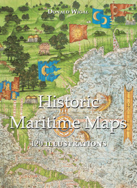
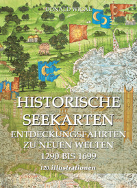
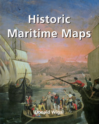
HISTORIC
MARITIME MAPS
120 illustrations
© 2014, Confidential Concepts, Worldwide, USA
© 2014, Parkstone Press USA, New York
© Image-Barwww.image-bar.com
All rights reserved. No part of this may be reproduced or adapted without the permission of the copyright holder, throughout the world.
Unless otherwise specified, copyright on the works reproduced lies with the respective photographers. Despite intensive research, it has not always been possible to establish copyright ownership. Where this is the case, we would appreciate notification.
ISBN: 978-1-78160-855-5
Contents
Chronology
The Beginnings of Exploration: 300 BC – 1000 AD
Coming out of the Dark: 1000-1400
Portolani During this Period
Discovering New Worlds, West and East: 1400-1500
Portolani during this period
Beyond the New World: 1500-1550
Portolani During This Period
Bridging the Oceans: 1550-1600
Portolani During This Period
The Renaissance of Discovery: 1600-1700
Portolani During This Period
Sailing Towards the Modern World: 1700-1900
Modern Explorers: American Explorers
List of Illustrations
Map of the most principal maritime explorations
God said, “Let the waters under heaven come together into a single mass, and let dry land appear”. And so it was.
Chronology
About 981:
The Viking, Eric the Red, discovers Greenland.
About 1000:
Leif Ericsson, nephew of Eric the Red, discovers Vinland, later to be known as North America.
1271-95:
Journeys of the Venetian, Marco Polo, in China.
1434:
Gil Eanes, from Portugal, crosses Cape Bojador (The North West Coast of Africa, just south of the Canary Islands).
1427:
The Portuguese discover the Azores.
1489:
Bartholomeu Dias, from Portugal, becomes the first European to cross the Cape of Good Hope successfully.
1492:
Christopher Columbus, from Spain, discovers America.
1497:
Jean Cabot, from Italy, lands on the coast of North America, in a place that will be later called the New Land.
1497:
Vasco da Gama, from Portugal, returns to India by sea, passing by the Cape of Good Hope.
1513:
(17th September) Vasco de Balboa, from Spain, becomes the first European to see the Pacific Ocean while leaving America.
1520-22:
Fernand de Magellan, from Portugal, crosses through, what will later be known as the Straits of Magellan and carries out the first circumnavigation of the world.
1535:
(10th August, St Lawrence Day) Jacques Cartier, from France, reaches Canada.
1610-11:
Henry Hudson, from England, while searching for the North West passage toward the Pacific Ocean discovers Hudson's Bay.
1642:
Abel Janszoon Tamsan, from Holland, famous for the discovery of the Island of Tasmania, discovers New Zealand, Tonga and the Islands of Fiji.
1728:
Vetus Bering, from Denmark, crosses the Strait that separates the countries, later named Eastern Siberia and Alaska.
1768-71, 1772-73 and 1776-79:
James Cook, from England, explores the Islands of the Southern Oceans three times.
1829-33:
John Ross, from England, and his nephew James discover the magnetic North Pole on the Island of Somerset.
1820:
The American, Nathaniel Palmer, becomes the first European to have seen the Antarctic.
1838:
The American, Charles Wilkes, discovers Wilkes Land.
1886:
The American, Robert Peary, explores the ice sheet of Greenland.
1906:
Roald Amundsen, from Norway, becomes the first man to reach the South Pole.
1908:
The American, Vilhjalmur Stefansson explores the Canadian Arctic.
1909:
The American, Matthew Henson, plants the American flag near the North Pole.
1914:
The American, Robert Bartlett, reaches Siberia.
1956:
Final expedition of the American Richard Byrd in the Arctic.
The Artist’s Studio
Johannes Vermeer van Delft (1632-1675), c. 1665. Oil on canvas, 120 x 100 cm. Kunsthistorisches Museum, Vienna
Maps, even those dating from centuries ago, constantly influence our daily lives. They are one of the things which are part of our daily environment. Throughout history, besides having a utilitarian function, every single map symbolizes the period of time in which it was created. We are often reminded of the romance of antique maritime maps as we see them displayed in museums, or reproductions of them framed on the walls of private houses or institutions. In a Vermeer painting a map may be seen telling a story-within-a-story. In plays and films maps typically set the period.
In fiction they may be called on to remind the reader of a world beyond the story’s setting (in Herman Melville’s Moby Dick, for example). Each map is, therefore, a priceless snapshot in the on-going album of humankind. This is especially true with antique maps where we can see the world through the eyes of our forebears.
While the map maker’s vision might later prove to be inadequate, or even incorrect, the unique truth is that his map expresses a story that might not be revealed in any other way. It may well be said that each map maker has effectively traveled in his mind vicariously not only to the envisioned places, but also to the future.
One such visionary monk was the 15th century map maker, Fra Mauro. He was certainly responsible for bringing to light the work of several other map makers. In doing so he helped make the transition from the Dark Ages to the beginning of the modern era (c. 1450). Mauro was part of the generation that was at work during the very focus of these significant times, over thirty years before the famous voyage of Christopher Columbus to the New World in 1492.
Mauro probably went largely unnoticed in his monastery on an island within the Laguna Veneta (the lagoon that surrounds Venice). But his new map was destined to demand attention. It was large and round – which was unusual – almost two metres (six feet) in diameter, yet still very definitely a map and not a global representation. Most of all, he no longer showed Jerusalem as the center of the world.
For the Asian part of the map Mauro took his data from the writings of Marco Polo. The rest was based on Ptolemy, or his own contemporary sea-faring charts. Mauro’s extraordinary work was completed in 1459.
Also in transition was the Earth itself, as after all, its surface was being ‘discovered’. Its face was also becoming more clearly defined with each new exploration and subsequent map revision.
Just twenty years before Mauro’s map – as if anticipating the need to get such priceless information to the world – Gutenberg (1400-1468) developed his revolutionary printing press. The first printed map in 1477 followed the first printed Bible in 1440. Both were documents that would support, in very distinct ways, the emergence of international humanism.
Arab map featuring Arabia as the centre of the world Al-Istakhri
10th century. National Library, Cairo
World Map
after 1262. In Psalter Map Manuscript, London, Ms-Add 28681, British Library, London
The Pisana map
Unknown Artist, 1290. Parchment, 50 x 105 cm. Bibliothèque nationale de France, Paris
The Beginnings of Exploration: 300 BC – 1000 AD
Alexander the Great
During Alexander’s triumphant thirteen-year campaign of territorial expansion which began in 336 BC, he extended his empire from Macedonia to India and along the Mediterranean coast southward to Egypt. Although his route of conquest was predominantly by land, he did assign a fleet of ships under his officer, Nearchus, to scout the northern coast of the Indian Ocean towards the Persian/Arabian Gulf.
Nearchus’coastal exploration, while limited, most likely contributed data that would eventually be used in the preparation of the coastal maps of the area.
Alexander was a military genius who used every opportunity to expand his territory by conquering everything in his path and his western expansion undoubtedly spread Greek culture into Asia. It prepared that part of the world for the concept of obedience to a single King of a universal kingdom on which the Romans would build for political gain.
Erik the Red (c. 950-1007)
A thousand years ago, the Scandinavian explorers known as the Vikings undertook many journeys and some came to North America to escape the political unrest in Norway. Erik the Red, a descendant of Viking chieftains, established the first European settlement in North America.
Around 981, he and his fleet of twenty five ships discovered the land he named Greenland. About twenty years later, Leif Eriksson (Erik’s son), most notable of all the Vikings, discovered Vinland, later to be recognized as North America.
Leif Eriksson (c. 970-1020)
In his Saga of Erik the Red, Ericsson records the contemporary accounts of the grandson of one of the earliest colonists of Greenland. The description of the coastline may well constitute the beginning of the first portolano of North America. A collection of sagas known as The Hauksbók and a section of another called The Flateyjarbók are cited as additional evidence, but it has to be admitted that these resources are mixtures of fact and fiction.
We see a similar mixture again in the writings of Marco Polo, Columbus, and other explorers whose enthusiasm often influenced their documentation. Such imagination influenced their maps in general. For example, there are some unicorn-like figures indicating imaginatively weird native animals in a map within the portolano of the St Lawrence Bay area between 1536 and 1542 by Pierre Desceliers.
Atlas (Black Sea)
Petrus Vesconte, 1313. Parchment, 48 x 40 cm. Bibliothèque nationale de France, Paris
Atlas (Central Mediterranean Sea)
Petrus Vesconte, 1313. Parchment, 48 x 40 cm. Bibliothèque nationale de France, Paris
Atlas (Aegean Sea and Crete)


