16,99 €
Mehr erfahren.
- Herausgeber: Parkstone International
- Kategorie: Geisteswissenschaft
- Sprache: Englisch
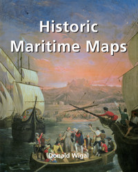
This book presents a selection of oceanic charts dating from the 13th to the 17th century. Though to us they may appear rudimentary, they bear excellent witness to the achievements of the early European navigators, and to their determination to explore the very ends of the Earth. What the charts may lack in geographical accuracy they undoubtedly make up for in charm. And of course they are priceless historical records. Recounting the epic voyages of maritime exploration, from Erik the Red to Robert Peary, author Donald Wigal leads us on an exciting journey from Terra Incognita to the World As We Know It.
Das E-Book können Sie in Legimi-Apps oder einer beliebigen App lesen, die das folgende Format unterstützen:
Seitenzahl: 182
Veröffentlichungsjahr: 2022
Ähnliche


Donald Wigal
HISTORIC
Author: Donald Wigal
Layout:
Baseline Co. Ltd,
7/1 Thanh Thai
4th Floor
District 10, Ho Chi Minh City
Vietnam
© 2021 Confidential Concepts, worldwide, USA
© 2021 Parkstone Press International, New York, USA
Image-Barwww.image-bar.com
All rights reserved.
No parts of this publication may be reproduced or adapted without the permission of the copyright holder, throughout the world. Unless otherwise specified, copyright on the works reproduced lies with the respective photographers. Despite intensive research, it has not always been possible to establish copyright ownership. Where this is the case, we would appreciate notification.
ISBN: 978-1-68325-100-2
CONTENTS
Chapter I Maps And Exploring
The Portolani: Old Nautical Sea-Charts
Breaking With Traditional Church Mapping
From Ice To Iron: Prehistory To 300 B.C.
Exploring Begins: 300 B.C. – 1000 A.D.
Coming Out Of The Dark: 1000–1400
Portolani During This Period
Chapter II Discovering New Worlds, West And East: 1400 – 1500
Sailing Over The Edge
Portolani During This Period
Chapter III Beyond The New World: 1500 – 1550
Vasco De Balboa
Francisco Pizarro
Ferdinand Magellan
Charles I, King Of Spain
Hernan Cortes
Jacques Cartier
Portolani During This Period
Chapter IV Bridging The Oceans: 1550 – 1600
Francis Drake
Martin Frobisher
Samuel De Champlain
Portolani During This Period
Chapter V The Renaissance Of Discovery: 1600 – 1700
Henry Hudson
Abel Janszoon Tasman
Portolani During This Period
Chapter VI Sailing Towards The Modern World: 1700 – 1900
James Cook
Jean-François De La Perouse
John And James Ross
John Franklin
James Knight
William Edward Parry
Robert Peary
Roald Amundsen
Conclusion
Index
Glossary
Further Reference
The History Of Early Naval Architecture
List Of Illustrations
Notes
The Artist’s Studio, c. 1665. Johannes Vermeer (1632-1675). Oil on canvas, 120 x 100 cm. Kunsthistorisches Museum, Vienna.
CHAPTER I MAPS AND EXPLORING
THE PORTOLANI: OLD NAUTICAL SEA-CHARTS
Maps, even those dating from centuries ago, influence our daily lives. They are one of the things that are part of our daily environment. Throughout history, besides its utilitarian function, every single map symbolises the period of time in which it was created. We are often reminded of the romance of antique maritime maps as we see them displayed in museums, or reproductions of them framed on the walls of private houses or institutions.
In a Vermeer painting a map may be seen telling a story-within-a-story (seeillustration). In plays and films maps typically set the period. In fiction they may be called on to remind the reader of a world beyond the story’s setting. In Herman Melville’s Moby Dick, for example:
Had you followed Captain Ahab down into his cabin… you would have seen him go to a locker in the transom, and bringing out a large wrinkled roll of yellowish sea charts, spread them before him on his screwed-down table. Then seating himself before it, you would have seen him intently study the various lines and shading which there met his eye; and with slow but steady pencil trace additional courses over spaces that before were blank. At intervals, he would refer to piles of old logbooks beside him, wherein were set down the seasons and places in which, on various former voyages of various ships, Sperm Whales had been captured or seen.[1]
A map indicates not only the location of places, it can also help us see the world as did the people of its day. Each map is therefore a priceless snapshot in the on-going album of humankind. This is especially true with antique maps, by which we can see the world through the eyes of our forebears.
While the map-maker’s vision might later prove to be inadequate, maybe even incorrect, the unique truth it expresses tells a story that might not be revealed in any other way (seeillustration).
It may well be said that each map-maker effectively traveled in his mind vicariously not only to the envisioned places but also to the future. Each was sure, along with the aging Pimen in the play Boris Godunov, that
A day will come when some laborious monk will bring to light my zealous, nameless toil, kindle, as I, his lamp, and from the parchment shaking the dust of ages, will transcribe my chronicles.[2]
One such laborious monk was the fifteenth-century mapmaker Fra Mauro. He was certainly responsible for bringing to light the work of several other map-makers. By doing so he helped make the transition from the Dark Ages to the beginning of the modern era (c. 1450).
Mauro was part of the the generation that was at work during the very focus of these significant times, over thirty years before the famous voyage of Christopher Columbus to the New World in 1492.
BREAKING WITH TRADITIONAL CHURCH MAPPING
Mauro probably went largely unnoticed in his monastery on an island within the Laguna Veneta (the lagoon that surrounds Venice). But his new map was destined to demand attention. It was large and round – which was unusual – almost 2 metres (6 feet) in diameter, yet still very definitely a map and not a global representation. It also included exceptional detail.
For the Asian part of the map Mauro took his data from the writings of Marco Polo. The rest was based on Ptolemy or his own contemporary sea-faring charts.
Mauro’s extraordinary work was completed in 1459. That was the time when the plainchant sung in his monastery – like the plainchant sung in many contemporary monasteries – might well have been changing to the more harmonic presentations of such innovating musicians as Guillaume Dufay (c.1400–1474).
Soon polyphonic masses began to anticipate the elaborate styles of the High Renaissance of 1500. In that innovative environment, Mauro may have wondered that if the singing of even the sacred texts of the liturgy were being freed of their over-simplicity, whether the Church’s representations of the Earth might likewise be given a new and meaningful dimension.
Mauro’s map did just that. By orienting his map to the south, rather than to the east, he broke with the Church’s tradition. He no longer showed Jerusalem as the center of the world (seeillustration). Cartographer Alan G. Hodgkiss observes that ‘Indeed, Fra Mauro’s map can be said to mark the end of theologically-based map-making and the beginning of an era of scientific cartography.’[3]
Only sixty years after Mauro’s map was completed, Martin Luther stood his ground against Rome. And in turn that was seventy years before Copernicus published his Revolution of the Heavenly Bodies.
More than a century and a half later Galileo would confront the Church with the shattering news that the Earth was not the center of the universe.
This was a restless time for the Roman Catholic Church that liked to retain control and preserve tradition. Also in transition was the Earth itself, as after all its surface was being “discovered”. Its face was also becoming more clearly defined with each new exploration and subsequent map revision.
Just twenty years before Mauro’s map – as if anticipating the need to get such forth-coming information to the world – Gutenberg (1400–1468) developed his revolutionary printing press. The first printed map in 1477 followed the first printed Bible in 1440. Both were documents that would support, in very distinct ways, the emergence of international humanism. As if to link early Church teaching to the Age of Exploration, Mauro’s large circular map was completed at about the same time that elsewhere Leonardo da Vinci (1452–1519) was born. Also born at about that time were the future navigators John Cabot (1451–1498) and Christopher Columbus (1451–1506), and the future explorer Vasco da Gama (1460–1524).
Mauro could not have foreseen that these young men would in a few years be the great explorers who would indeed bring to light the ‘zealous, nameless toil’ of his and other pioneering map-makers.
Ten years after Mauro came to the end of his work, Machiavelli (1469–1527) was born: it was he who would eventually encourage the kind of creative effort in art and politics that Mauro and other innovators prefigured. His was the individualism soon to be personified in the great explorers.
The Pisana Map, 1290. Unknown artist. Parchment, 50 x 105 cm. Bibliothèque nationale de France, Paris. (Map 1)
Arab Map Featuring Arabia as the Centre of the World, 10th century. Al-Istakhri. National Library, Cairo.
World Map, after 1262. In Psalter Map Manuscript, London, Ms-Add 28681. The British Library, London.
FROM ICE TO IRON: PREHISTORY TO 300 B.C.
Before launching into the choppy sea of knowledge that is the on-going discovery of our planet, let us briefly apply the theme of exploration first to the historical origins of humankind. The first thing to note is that in many discplines scientists once thought the epoch in which our earliest ancestors appeared was the Pleistocene or Ice Age.
In the late 1960s it was determined that the Pleistocene epoch began ‘only’ about 1.8 million years ago. For at least a century prior to that it was thought that the ‘Ice Age’ began several million years earlier. The academic juries may be out – as they nearly always are about such things – on how more modern studies will yet change the majority opinion.
Enter Humankind
We know that it was during the Ice Age that the extinction of certain mammals began – but at the same time humankind first appeared some 500,000 years ago. Also, with remarkable speed and thoroughness humankind evidently migrated to the American continents, undoubtedly at times traveling one way or another by sea as well as by land.
Meanwhile, elsewhere on Earth other human cultures were evolving. As we skip forward 497 millennia – more or less – we see distinctive civilisations arise, such as prehistoric Greece in the Neolithic Age.
By the early Iron Age (c. 800 BC to c. 500 BC) migrations by the Celts extended the use of iron into central and western Europe. We might again presume that the transition involved some sea travel, if not yet trans-oceanic voyages. Iron would of course play a vital part in the making of tools, nails, and equipment needed to build the ships that would spread the more technically advanced civilisations around the world.
By the fifth and fourth centuries before Christ we see not only distinctive groups but also influential individuals, along with their works, who become known beyond their immediate circle of influence.
In Greece, for example, great leaders arose who would significantly influence all aspects of subsequent generations. Among the many great thinkers of the era were Socrates, Plato, and Aristotle.
A pupil of Aristotle was later to become one of history’s greatest military leaders, the king of Macedonia, Alexander III. Although he would live for only thirty-three years, he was one of the few kings – along with Herod, the Roman-appointed king of Judea at the time of the birth of Jesus – to be called ‘the Great’.
Atlas (Black Sea), 1313. Petrus Vesconte. Parchment, 48 x 40 cm. Bibliothèque nationale de France, Paris. (Map 2)
Atlas (Central Mediterranean Sea), 1313. Petrus Vesconte. Parchment, 48 x 40 cm. Bibliothèque nationale de France, Paris. (Map 3)
Atlas (Aegean Sea and Crete), 1313. Petrus Vesconte. Parchment, 48 x 40 cm. Bibliothèque nationale de France, Paris. (Map 4)
ALGEBRA MAKES THE WORLD SMALLER
For centuries, map-making, shipbuilding and navigation used only simple mathematics (whole numbers and fractions) for the calculations required.
The ancient Egyptians did not use symbols in their math, other than for real numbers; they did not use the abstract properties of numbers. However, problems such as we see in today’s introductory algebra textbooks were nonetheless posed as far back as 2000 years before Christ by the Babylonians and, indeed, by the Egyptians. The Greeks, through their use of geometry, discovered and used irrational numbers five centuries before Christ – irrational numbers are real numbers that have a nonrepeating decimal expansion.
While they surely used mathematical principles, Ptolemy's twenty-six pioneering portolani were published eighty years before the appearance of the first book of algebra in around the year 250. Even four centuries before that, Chinese ships were built that were able to reach India, with or without maps.
Obviously, exploration could achieve a great deal without a knowledge of advanced mathematics, but much more would be accomplished as greater mastery of time and space through mathematics evolved.
Meanwhile, the development of algebra in terms of negative numbers took centuries. Hindu mathematicians first developed negative numbers in the sixth century. While complex numbers were not actually used before the late eighteenth century, the Italian Rafael Bombelli developed them in the sixteenth century, though it was to take another century before the theories were applied.
Calculus, discovered about 1665, applies differential equations to many practical challenges – in mechanics, for example. These complex numbers would prove to be essential in engineering and physics, and by extension certainly in shipbuilding and navigation, as well as in sophisticated map-making.
Nicolas Kratzer, 1528. Hans Holbein the Younger (1497-1543). Oil on canvas, 83 x 67 cm. Musée du Louvre, Paris.
Atlas (French, English and Irish Coasts), c. 1321. Petrus Vesconte. Parchment stuck onto wood, 14.3 x 29.2 cm. Bibliothèque municipale, Lyon. (Map 6)
EXPLORING BEGINS: 300 B.C. – 1000 A.D.
Alexander the Great
During Alexander’s triumphant thirteen-year campaign of territorial expansion that began in 336 BC, he extended his empire from Macedonia to India, and along the Mediterranean coast southward including Egypt.
Because Alexander was a student of Homer and was fascinated by the figures of mythology, on his return from India he marched his army west through the desert of southern Iran towards Babylon – just as he thought great heroes of the past had done. He pressed on to Babylon and it was there that he died in 323 B.C.
Alexander was a military genius who used every opportunity to expand his territory by conquering everything in his path. Although his route of conquest was predominantly by land, he did assign a fleet of ships under his officer Nearchus to scout the northern coast of the Indian Ocean towards the Persian/Arabian Gulf. Nearchus’ coastal exploration, while limited, most likely contributed data that would eventually be used in the preparation of the coastal maps of the area.
Alexander’s western expansion undoubtedly spread Greek culture into Asia. It prepared that part of the world for the concept of obedience to a single King of a universal kingdom, which the Romans would build on for political gain, and later Christianity would accommodate to its aggressive apostolic purposes.
Erik the Red
A thousand years ago, the Scandinavian explorers known as the Vikings undertook journeys and left artefacts that remind the world of the contribution to civilisation made by these important pioneers (see illustration). Some came to North America to escape the political unrest in Norway, living for over two centuries in peace and eventually establishing the world’s oldest national assembly in around 1030.
Erik the Red, a descendant of Viking chieftains, established the first European settlement in North America. Around 981, he and his fleet of twenty-five ships discovered the land he named Greenland. He spent three years exploring the area. About twenty years later, Leif Eriksson (precisely, Erik’s son), most notable of all the Vikings, discovered Vinland, later to be recognised as North America – although there is continued dispute about exactly where the initial landing or first settlement was.
In around the thirteenth century, as Iceland became a Norwegian colony, many of the greatest Scandinavian sagas were written in the Viking language, which is still spoken in Iceland.
Leif Eriksson
In his Saga of Erik the Red, Eriksson records the contemporary accounts of the grandson of one of the earliest colonists of Greenland. ‘Our voyage must be regarded as foolhardy,’ the writer admits, ‘seeing that not one of us has ever been in the Greenland Sea’.
‘Nevertheless,’ Eriksson comments, ‘they put out to sea when they were equipped for the voyage, and sailed for three days, until the land was hidden by the water. Then the fair wind died out, and north winds arose, and fogs, and they knew not whither they were drifting and thus it lasted for [a long period of time]. Then they saw the sun again, and were able to determine the quarters of the heavens; they hoisted sail, and sailed that [period of time] through before they saw land. They discussed among themselves what land it could be, and [one of them] said that he did not believe that it could be Greenland. He asked whether it was desirable to sail to this land or not. It is my counsel (said he) to sail close to the land.’
The description of the coastline that is then described may well constitute the beginning of the first portolano of North America.[4]
In 1962, archaeologists unearthed the first hard evidence of a Norse presence in north-eastern Canada. L’Anse au Meadow at the very northern tip of Newfoundland was definitely a Norse settlement. A Norse coin dating from around 1070 was afterward unearthed at an American-Indian site in Maine. Moreover, ‘recent scholarship suggests that Vinland may have been off Passamaquoddy Bay, between Maine and New Brunswick. Wherever it was, it was the birthplace of Snorri, the first European child born in America.’[5]
The widow of one of the sons of Erik the Red married the Scandinavian explorer Thorfinn Karlsefni, a Scandinavian explorer born around 980. At the start of the second millennium, with three ships and 160 men, he attempted to establish a colony in North America, probably in about 1002, in what was thereafter called Newfoundland.
A collection of sagas known as Hauksbók and a section of another called the Flateyjarbók are cited as additional evidence, but it has to be admitted that these resources are mixtures of fact and fiction. We see a similar mixture again in the writings of Marco Polo, Columbus, and other explorers whose enthusiasm often influenced their documentation. Such imagination influenced their maps in general. For example, there are some unicorn-like figures indicating imaginedly weird native animals in a map within the portolano of the St Lawrence Bay area of between 1536 and 1542 by Pierre Desceliers.
Atlas (Spanish Coasts), c. 1321. Petrus Vesconte. Parchment stuck onto wood, 14.3 x 29.2 cm. Bibliothèque municipale, Lyon. (Map 5)
Viking Nave and Marine Monster, 12th century. Miniature. Bibliothèque nationale de France, Paris.
Oseberg Ship, c. 817. Oak and pine wood, 22 x 5 m. Found in 1903 in a burial mound next to Oseberg. Norsk Sjøfartsmuseum, Oslo.
COMING OUT OF THE DARK: 1000–1400
Marco Polo
Every textbook of world history mentions the Venetian Marco Polo and his amazing fourteenth-century travels in China. It is quite possible, however, that he never visited Asia at all. The accounts of his travels attributed to him may be simply very clever fiction. But it is more likely that when he was seventeen Polo did indeed accompany his grandfather and uncle, successful jewel-merchants, on their second trading journey to China during the last quarter of the thirteenth-century (see illustration).
Either way, the descriptions of Polo’s seventeen years of journeys are told in The Book of Ser Marco Polo – which for centuries was one of the most influential literary works in Europe. It could even be said to have laid the foundation for the Age of Discovery. Two centuries after its first publication, a printed copy was owned and studied by Columbus. In fact, Columbus made specific attempts to identify some of the islands he visited in the Caribbean as locations described by Polo.
While in prison, Polo apparently related the details of his journeys to a fellow prisoner, who conveniently happened to be a popular writer of romantic fiction. It may be that Polo merely heard these tales while sojourning in Constantinople or in the ports around the Black Sea – the episodes are not unlike typical ‘fishing stories’, openly exaggerated in order to entertain. Appropriate musical accompaniment to listen to while reading about his travels might perhaps be Rimsky-Korsakov’s Scheherazade (see illustration).
In a university dissertation on the literary styles exhibited in the works of Marco Polo, Enrico Vincentini (University of Toronto, 1991) notes that Polo’s account of his travels can be considered a ‘lost’ book, a book of which modern editions are no more than ‘conjectural reconstructions’ of the original corrupt manuscripts.
In any edition (or ‘reconstruction’) of Marco Polo’s book, the descriptions are always exaggerated. Whatever he was counting, there were never less than thousands and even hundreds of thousands. Moreover, nearly every time hyperbole is used, the writer introduces it with such expressions as ‘I give you my word …’ or ‘I assure you …’ which is distinctly similar to the style of storytellers passing on obvious myths and legends. It is a literary device that was not uncommon to the non-fiction of the day, and of course had already been discernible for centuries in the scriptures of various religions.
How much of the Marco Polo work was the product of the writer’s imagination – or the writer’s enthusiasm – may never be known. What we do know is that the work inspired adventurous people for hundreds of years thereafter. Even map-makers, whom we might expect to be scientific as much as artistic, incorporated imaginary figures into their work, as seen in several maps here reproduced. These maps often exhibit truly vivid imaginations together with genuine data from scientific exploration. A serious study of them requires a specialised glossary and a knowledge of the history of their time (as, for example, displayed in Ellen Bremner’s university dissertation on the subject: University of Illinois at Urbana-Champaign, 1961).
The first journey east by the Polos was the also the first purely trading venture by Europeans in China. Previous visitors from Europe had been Papal representatives and religious missionaries who were taking literally the gospel passage ‘the Good News must first be proclaimed to all nations’ (Mark 13:10).
The Mongols, with their history of violent behavior, were deemed to be in special need of Christianity, even if it required similar violence to effect their conversion.


