Erhalten Sie Zugang zu diesem und mehr als 300000 Büchern ab EUR 5,99 monatlich.
- Herausgeber: The History Press
- Kategorie: Lebensstil
- Sprache: Englisch
The ship that will not obey the helm must obey the rocks. Trevose Head, the land mass jutting out into the Atlantic from North Cornwall's shore, has been called the Lizard of the North Coast. This beautiful but inhospitable coast has seen many disasters over the centuries, from ocean-going sailing ships blown off course to coastal vessels bound for Wales and the Bristol Channel foundering and colliding, and colliers blowing up. Both world wars also saw intense activity off Trevose as German U-boats attempted to prevent supplies from reaching the UK. The torpedoing of HMS Warwick in February 1944 deeply affected the whole community. This illustrated history reveals the many shipwrecks to plague the notorious Trevose Head and considers the development of safety at sea, starting with the erection of Trevose Lighthouse in 1857, a project strenuously opposed by most seafarers at the time as it was believed that lighthouses attracted pirates like moths to a flame. A must for all shipwreck and local historians and those with a love of the Cornish coastline.
Sie lesen das E-Book in den Legimi-Apps auf:
Seitenzahl: 115
Veröffentlichungsjahr: 2011
Das E-Book (TTS) können Sie hören im Abo „Legimi Premium” in Legimi-Apps auf:
Ähnliche


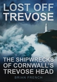
LOST OFF TREVOSE
LOST OFF TREVOSE
THE SHIPWRECKS OF CORNWALL’S TREVOSE HEAD
BRIAN FRENCH
To the Watchkeepers of NCI Stepper Point
First published 2011
The History Press
The Mill, Brimscombe Port
Stroud, Gloucestershire, GL5 2QG
www.thehistorypress.co.uk
This ebook edition first published in 2013
All rights reserved
©Brian French, 2011, 2013
The right of Brian French to be identified as the Author of this work has been asserted in accordance with the Copyright, Designs and Patents Act 1988.
This ebook is copyright material and must not be copied, reproduced, transferred, distributed, leased, licensed or publicly performed or used in any way except as specifically permitted in writing by the publishers, as allowed under the terms and conditions under which it was purchased or as strictly permitted by applicable copyright law. Any unauthorised distribution or use of this text may be a direct infringement of the author’s and publisher’s rights, and those responsible may be liable in law accordingly.
EPUB ISBN 978 0 7509 5346 7
Original typesetting by The History Press
CONTENTS
Acknowledgements
Terms of Reference
Preface
1.
The Iron Shore and the Lighthouse
2.
Ship Losses 1700–1914
3.
1914–18: the U-Boat Menace
4.
Ship Losses 1918 to the Present
Epilogue
Bibliography
Tables of Losses
ACKNOWLEDGEMENTS
I would like to acknowledge the help and advice received in producing this book from the following:
Derek Lindsey, NCI Stepper Point and former Station Manager
John Buckingham and George Barnes of the Padstow Museum
The Libraries at Bodmin and Truro
Kim Cooper and staff at the Cornish Studies Centre, Redruth
John Puddicombe of the HMS Warwick Association
Ness Towndrow for her spectacular cover photo
Moira Gill of St Merryn for her HMS Warwick input
I have acknowledged the sources of photographs in the text. Unacknowledged photographs, sketches and maps are the author’s own work.
And, of course, to my editors, Amy Rigg and Emily Locke of The History Press.
TERMS OF REFERENCE
In order to give some reasonable boundaries to this account I have followed roughly the work of Noall & Farr (1964) and Larne (1995) and taken for my geographical parameters the area between latitude 50.30.00N and 50.51.00N and longitude 05.00W and 05.38W. On the coast this covers the shore from Park Head in the south, round Trevose Head to Harlyn Bay in the east. Even with these arbitrary boundaries there are many losses to record and in the maps I have tried to plot each vessel’s last location as near to the given point as possible.
The narrative will be supported by detailed tables listing vessel, date lost, location, crew saved/lost, tonnage, cargo, captain and maps showing the last known position of all vessels. Photographs, sketches and diagrams will illustrate the text. Where a vessel was positioned outside this ‘rectangle’ I have included it where historical significance or interest demanded.
The scope of this book.
PREFACE
The book Wrecks and Rescues around Padstow’s Doom Bar (2007) focussed predominantly on maritime activity within Padstow harbour limits. This second book now takes Trevose Head, the ‘Lizard’ of the north coast, as its focal point and tells the stories not only of those better-known ships wrecked on Trevose Head itself, but also those recorded as simply ‘lost off Trevose’. This inhospitable coast has seen many disasters over the centuries, from ocean-going sailing ships blown off course or badly navigated, to coastal vessels bound for Wales and the Bristol Channel foundering, colliding, and ‘colliers’ blowing up. Both world wars saw intense activity off Trevose as German U-boats attempted to prevent supplies from reaching the UK and Europe. This book tells the story of these disparate events all linked by the location; Trevose Head.
In addition, the narrative attempts to come to terms with the question, ‘Why did these disasters happen – at least the peacetime ones?’ As a landsman, this author was initially baffled by the number of collisions occurring in these waters. Wasn’t the sea big enough for everybody? This question leads us to the development of safety at sea, starting with the erection of Trevose lighthouse in 1857, a project strenuously opposed by most seafarers, and covering improvements in navigation (the discovery of longitude), International Sailing Law (‘rules of the road’) and the prevention of the overloading of cargo (Plimsoll Line).
CHAPTER 1
THE IRON SHORE AND THE LIGHTHOUSE
The ship that will not obey the helm must obey the rocks.
Old Cornish Proverb
The north coast of Cornwall is famed today for its tourist potential with wide sandy beaches and excellent conditions for the relatively recent sport of surfing. Holidaymakers flock to the region throughout the year to take part in or watch this ever-growing pastime. This industry is flourishing on the pounding Atlantic waves which race into land unchecked after a journey of some 2,000 miles, these selfsame waves that in years before pounded ships to matchwood on Trevose’s lee shore.
Ships on these waters are now monitored constantly by sophisticated radio, radar and computer systems operated by the Maritime and Coastguard Agency’s regional headquarters at Falmouth, which is also the International Distress Centre. Immediate protection is afforded by the RNLI’s latest and most powerful lifeboat, Spirit of Padstow, operating from its state-of-the-art boathouse on Trevose Head. The entire coast is signalled by a succession of lights and daymarks all the way from the Longships lighthouse off Land’s End to Hartland Point light in the north. The newest recruit to sea safety is the National Coastwatch Institution, which has re-established visual watch stations in north Cornwall at Boscastle, Padstow, St Agnes and St Ives.
Yet even today the Nautical Almanac gives fairly bleak advice to the sailor:
The N coast of Cornwall and the SW approaches to the Bristol Channel are very exposed. Yachts need to be sturdy and well equipped since if bad weather develops, no shelter may be at hand … Bude dries and is not approachable in W winds… Boscastle is a tiny harbour (dries) … Padstow is a refuge but in strong NW winds the sea breaks on the Bar and prevents entry … Off Trevose Head beware the Quies Rocks… Newquay dries and is uncomfortable in N winds … off Godrevey Light are the Stones, a drying rocky shoal extending 1.5 m offshore … St Ives to Land’s End is rugged and exposed…
From our relatively safe (and sane) vantage point of the twenty-first century it is astonishing to read that when in 1619 Sir John Killegrew of Arwenack, Governor of Pendennis Castle, petitioned the King that a lighthouse be built at the Lizard Point, Trinity House, the present controller of our lighthouses, opposed the erection, stating ‘It is not necessary or convenient to erect a lighthouse there, but per contra, inconvenient having regard to pirates and enemies whom it would direct to a safe place of landing’. Killegrew himself added the telling comment: ‘They (the locals) have been so long used to reap profit by the calamity of the ruin of shipping that they claim it (the wreck) as hereditary.’
There is no doubt that the mindset at the time was that well-built vessels would have no need of help or refuge as they could sail well off the coast and ride out any gales. In fact any move towards increasing the safety of vessels, both in those early days of sail and well into the nineteenth century, was looked on as unwarranted interference by Government in the ship owners’ domain. It is perhaps a salient point that anyone can, even in today’s safety-conscious society, put a boat onto water without any check on their competence or the suitability of the vessel. This freedom of operation has unfortunately led to inevitable tragedies in these waters.
Richard Larne goes further:
What is remarkable and scarcely credible, is that no emphasis whatsoever was placed upon the need for a light at Land’s End. At the very south-west ‘toe’ of England, ship’s masters required sight of this headland, a landfall if possible, before continuing up the English or Bristol Channels or across the Atlantic or Bay of Biscay. Attempting to round Land’s End at night carrying coal from North Wales must have been a nightmare.
The RNLI Spirit of Padstow at her dedication ceremony, July 2006.
The new Padstow RNLI Station at Mother Ivey’s Bay.
Ever watchful at NCI Stepper Point, Padstow.
Killegrew did get his wish however, and was allowed to display a light at Land’s End provided, as Trinity House decreed, ‘that it should be extinguished at the approach of the enemy’. More consternation was to follow when James I allowed Killegrew, now running low on funds, to set a fee of one halfpenny per ton on all vessels passing his light. Uproar ensued, Killegrew’s patent was revoked, the light was extinguished (permanently) and the lighthouse demolished. It was not to be rebuilt until 1752.
Perhaps at this point the opposition of Trinity House should be explored further. As ever, political and financial issues were to the fore. In order to retain their near monopoly on local (Thames) navigation by the provision of pilots, a guild of mariners petitioned Henry VIII in 1513 for a Royal Charter as ‘it would be dangerous to allow foreigners, including the Scots, Flemmings and the French, to learn the secrets of the King’s streams’. This was granted and in 1514 the guild became known as the Brotherhood of Trinity House and Deptford Strond. Based at the Royal Dockyard at Deptford, the Brethren of Trinity House were to collect all the dues of pilotage on the Thames. So initially Trinity House was in the business of selling its expertise to protect vessels on the Thames, not in the fostering of private lighthouses, which just might afford vessels a different type of protection, which might catch on – to the Brethren’s financial disadvantage. No less a personage than Samuel Pepys, Master of the Brotherhood in 1607, approved the decision of the Elder Brethren to refuse to allow a light to be established on the Goodwin Sands as it would result in shipmasters not paying for pilotage. He considered lighthouses to be a burden on trade.
Charles II, on the restoration of the monarchy, saw the building of lighthouses as a good way of rewarding his supporters and granted patents to private individuals who, in consultation with Trinity House, were to establish private lights, and of course take levies. For the next two centuries this policy of decentralisation continued with Trinity House sanctioning the building of all lighthouses on any part of the British coast. It was only in 1836, following complaints by ship owners of exorbitant dues, and lighthouses that were not fit for purpose, that ‘private lights’ were abolished by Act of Parliament. Trinity House was empowered to buy up all the existing lighthouses and given full responsibility for lighthouse construction and development in England, Wales, Gibraltar and the Channel Islands.
This Act only increased the burden placed on Trinity House. At the time of the Act there were few men on the Board with the scientific knowledge to develop lighthouse technology. The English tried-and-trusted approach was simple: build a big tower, put a lot of lamps in it (126 oil lamps at Lowestoft) and use reflectors (4,000 mirrors at Lowestoft) to generate the beam. This approach was completely out of date. While the Brethren of Trinity House had been plodding on in years of complacency, those crafty Frenchmen had developed a revolutionary approach based on optical science. Reflectors actually dissipated and attenuated the light source. The French, guided by the pioneering work of Fresnel, were using refracting lenses to concentrate the beam and their scientists were well funded by the French government (how unfair). Business and manufacturing were also involved and in short the French were, one could say, light years ahead. As we will see, the building and development of Trevose Head lighthouse was part of the fightback.
The tower of St Eval church.
On the north Cornwall coast in those earlier times, the only ‘mark’ for early mariners was the St Eval church tower which collapsed in 1727 Its importance can be gauged by the fact that the merchants of Bristol and ship owners contributed half the cost of its restoration. In 1829, the Padstow Harbour Association for the Preservation of Life from Shipwreck caused to be built the first coastal ‘mark’. The daymark, situated at Stepper Point to mark the entrance to the estuary, and still standing today, is 254ft above sea level, visible from 24 miles out at sea. (The work of the Harbour Association is fully detailed in Wrecks and Rescues around Padstow’s Doom Bar by this author.)
One man who would not have welcomed the lighthouse – or any other aid to shipping – was the legendary ‘wrecker of Trevose’, Tom Parsons. His cottage still stands on Booby’s Bay and looks down on the rusting remains of the Karl of Hamburg, a 1,993-ton steel ship, believed to be a former German minelayer, which broke tow and beached on Constantine on 17 October 1918. Its spectacular skeleton is still visible after certain scouring tides, a tribute to her makers, Ribson & Co. of Maryport (1893). The story goes that a local wrecker (Tom’s grandson perhaps?) was seen sneaking on board by a vigilant coastguard. The coastguard clambered up the side of the ship and jumped over the bulwarks only to land on top of the crouching felon who stood up and catapulted the officer overboard. True or false, it is a good tale. It is perhaps ironic, but a sign of the times, that Tom’s Cottage is now a holiday let.
The Karl as she is today; an added attraction for holidaymakers.
Parsons was also credited with luring ships onto the rocks by the use of ‘false lights’, tying a lantern to his donkey’s tail. But in truth all the wrecker had to do was wait for the gale to bring home the booty. On 21 November 1808, the Integrity


