4,79 €
Mehr erfahren.
- Herausgeber: Luath Press
- Kategorie: Geisteswissenschaft
- Sprache: Englisch
The Slate Islands lie off the west coast of Argyll. Slate has been taken from these shores from their earliest recorded history and the richness and quality of the deposits meant that in the eighteenth and nineteenth centuries slate quarrying was one of the most important industries in Scotland. The Breadalbane family owned the land of Easdale and its surrounds for over 400 years and of course roofed their own buildings in slate as well as many important buildings, including Cawdor Castle in Inverness-Shire and Glasgow Cathedral. The geology, the industry, the people and their way of lie: this is the story of the Slate Islands past, present and future.
Das E-Book können Sie in Legimi-Apps oder einer beliebigen App lesen, die das folgende Format unterstützen:
Seitenzahl: 122
Veröffentlichungsjahr: 2014
Ähnliche


MARY WITHALLspent thirty-five years in Secondary and Further Education, lecturing in Natural Sciences, Nutrition and Health subjects before retiring to the Island of Easdale in Argyll in1988. She became the archivist to the Easdale Island Museum in1989and has been associated with the museum ever since. She is a founder member and trustee of the Slate Islands Heritage Trust which was formed in March2000.
In1995Mary published the first of her trilogy of historical novels based on the history of the Slate Islands:Beacon on the Shore, The Gorse in BloomandWhere the Wild Thyme Grows(published by Hodder & Stoughton in paperback at £5.99.)Since then she has published four further novels,Fields of Heather, The Poppy Orchard, The Flight of the CormorantsandCrisis of Conscience(published Luath Press) together with two non-fiction works,The Villages of Northern ArgyllandThe Easdale Doctor(published by Birlinn).
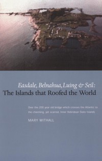
Easdale, Belnahua, Luing & Seil:
The Islands That Roofed the World
MARY WITHALL
LuathPress Limited
EDINBURGH
www.luath.co.uk
First Edition 2001
Reprinted 2003
Reprinted 2006
Reprinted 2007
Reprinted 2008
Reprinted 2010
Reprinted 2011
Revised Edition 2013
Reprinted 2013
eBook 2014
ISBN (Print): 978-1-908373-50-2
ISBN (eBook): 978-1-909912-95-3
The author’s right to be identified as author of this book under the Copyright, Designs and Patents Acts 1988 has been asserted.
© Mary Withall
Contents
Map
Introduction
CHAPTER 1 The Geology of the Slate Islands
CHAPTER 2 The Slate Industry and the Breadalbanes
CHAPTER 3 Winning the Slate
CHAPTER 4 Housing
CHAPTER 5 Public Health
CHAPTER 6 Religion in Netherlorn
CHAPTER 7 Communications
CHAPTER 8 Food, Agriculture and Wildlife
CHAPTER 9 Growing up in the Slate Islands
CHAPTER 10 People and Pastimes
CHAPTER 11 What of the Future?
The Slate Islands Heritage Trust
Bibliography
The Slate Islands of Netherlorn
Introduction
OFF THE WEST COASTof Argyll in the Sound of Lorn, a few miles South of Oban, lie the Slate Islands of Seil, Luing, Belnahua and Easdale. Easdale is less than a mile across in any direction, but is so rich in deposits of slate rock that it became the centre of one of the most important of Scotland’s industries during the18th and19th centuries and gave its name to a band of geological strata stretching in a NE to SW direction right across the Highlands … the Easdale Slate Belt.
From earliest recorded history slate was taken from the shores of Easdale Island. Large slabs of the rock were used to cover buildings and as grave- and hearthstones. Perhaps the Vikings landed here and carried away the slate to their various settlements along the coast. The first recorded account of Easdale slate is in the writings of Dean Munro circa1554. Describing the islands of Lorn, Seill, Seunay and Lunge (probably Luing) he mentions under the heading,Sklaitt, the litle iyle callit in Erische Leid Ellan Sklaitt, quherein ther is abundance of skalzie(slate)to be win.This has been accepted by later historians as referring to Easdale.
Easdale Island
As time went on, men learned to split the laminated rock into thinner and thinner sheets which could then be further divided into roofing slates as we know them today: rectangular pieces of rock which, when laid overlapping one another, form a watertight roof covering.
Many ancient and prestigious buildings in Scotland are roofed with Easdale slate, Ardmaddy Castle in Lorn built in1676, Stalker Castle in Appin built in1631, Cawdor Castle in Invernesshire and Glasgow Cathedral both dating from the 14th century, among them.
The Slate Islands were part of an enormous tract of land 20 miles wide and stretching from Taymouth in the East to the coast of Argyll which formed the estate of the Breadalbane family, cousins of the Dukes of Argyll. By expeditious marriages and an uncanny knack of always being on the right side at the right time, the Breadalbane Campbells acquired this land and held it for more than 400 years.
Naturally enough the Breadalbanes exploited the mineral resources of their own land so that we find many of the buildings they owned are roofed in Easdale slate, and since from the18th century onwards, the title Marquis of Breadalbane carried with it the ownership of Nova Scotia, it is not surprising to discover public buildings in Eastern Canada which also bear roofs of Easdale slate. In the middle years of the19th century, between seven million and19million roofing slates were exported annually as far afield as New Zealand, Australia, the West Indies and the Eastern Seaboard of the United States of America, giving rise to the claim at that time that Easdale was roofing the world!
The Breadalbane estates were broken up early in the20thcentury and the productive land was sold off in parcels mainly for agricultural purposes. Seil and Luing were split up into a few privately owned farms, while the village properties were sold off to indivudual home-owners. Belnahua, abandoned early in the20th century, has remained uninhabited, the island’s owner living on Luing. Easdale Island, having little to offer a developer other than slate, which following the First World War became an uneconomic commodity, remained unsold until the1950s when it was purchased by a local man, Donald Dewer. Under his ownership the island lay fallow, the only inhabitants being a very small population of elderly folk, the remnants of the once great slate quarrying industry. Subsequently the island has been owned by a succession of entrepreneurs each of whom has made some contribution to the island’s economy and population growth. One of these gentlemen, Chris Nicholson, was responsible for the inauguration in1981of the Easdale Island Folk Museum. In celebration of the new millennium a group of local enthusiasts has come together to form the Scottish Slate Islands Heritage Trust whose aims are to identify, record and wherever possible, preserve locations, buildings and artefacts relating to the Scottish slate industry and the social history of the islanders. The Trust’s first major project was the inauguration in the year 2000 of the Slate Islands Heritage Centre and Museum in Ellenabeich village on the Isle of Seil. The Centre exhibits a fine collection of 19th century photographs and artefacts, is a source of genealogical information for descendents of the quarry workers and is a focal point for those wishing to explore and understand the remnants of the slate industry in the islands.
People visit the Slate Islands today for a variety of reasons. Perhaps they are intrigued by the notion that anyone would wish to live on this bleak and rugged coastline, bordering the wild Atlantic Ocean and often in locations accessible only by sea. Maybe they have heard of the slate industry and are genuine seekers after knowledge about Scotland’s industrial past. Some are descendants of the hundreds of sturdy characters who lived and worked on the islands until such time as economic pressures caused the quarries to close and forced the men to seek a life elsewhere.
For whatever reason visitors arrive in the district, they cannot fail to be affected by the unique ambience of the different villages. The population of Easdale Island, for example, is moving into the21st century while living in a village without cars, footpaths, streets or street lighting.
Easdale Today
Visitors are never disappointed by the splendid panorama of sea and islands which can be viewed from the top of Smiddy Brae, nor, when roving in the wild places, can they pass without notice the thickets of grasses and wild flowers which in the course of the past century have endeavoured to heal the scars that Man’s industry has left upon this glorious landscape.
Despite the noise, dust and general chaos created by the operation of an important industry, those who inhabited the Slate Islands a hundred years ago, while the quarries were in operation, were themselves moved by the beauty of their surroundings. Typical of their response is this sonnet, printed in theOban Timesof25March1899, of which the author is identified only by his initials:
Thou Easdale, swept by storms and lashed by foam
Of angry seas, thy memory will last
In all its freshness whereso’ere be cast
My lot in life. Tho’ far from thee I roam
My thoughts are still with thee; no spire or dome
Of mighty city can like thee hold fast
My thoughts; beside thy rocky shores were passed
The happy peaceful days; thou art my home.
The islets gird thee round, and far and nigh
Their rugged forms show clear against the sky;
In calm and sunshine nought can equal thee
But when the winds blow and the waves dash high
In grandeur, like a giant, strong and free
Thou stands’t defiant in thy majesty.E.A.R.W.
The stencil used by Easdale Slate Quarrying Co., 1860s
CHAPTER ONE
The Geology of the Slate Islands
THE BEDROCK OF THE district consists of some of the oldest sedimentary rock exposed in the British Isles. 650 million years ago during the Dalradian Period, two major land masses formed the area now known as Scotland. The mountains and plains of ancient Caledonia were bounded on their southern borders by a shallow sea occupying the area which lies between the Great Glen Fault and the Highland Boundary Fault. The area of this sea included Argyll and the Inner Hebridean Islands of Islay, Jura, Scarba and the islands in the Sound of Lorn. The second landmass covered the area of the Southern Uplands and the Border Country.
In the absence of vegetation and with great extremes of temperature the rock was rapidly broken down into boulders and stones small enough to be carried away by the fast flowing waters shed by the hills. Particulate material, breaking continuously into finer and finer particles as it travelled, was eventually deposited as silt and mud on the bed of the shallow sea.
Approximately440million years ago during the Ordovician period, extensive land movements took place during which great folding of the shallow sea deposits occurred. The concertina effect of this folding created enormous pressure in the layers of mud, compressing and heating the deposits until they were converted into slate rock, hornblende biotite schists and marble.
Easdale Slate is blue-black in colour, bears a ripple on its surface which distinguishes it from other smoother slates from Wales and Cornwall and is identified by the large quantity of iron pyrites it contains. This occurs as cubic crystals of what is often referred to as Fool’s Gold. The crystals may be anything up to15mm across and can be easily seen glistening on the wet slate roofs. They rarely rust and add an extra dimension to the attractive appearance of the slate.
The hornblend biotite schists occur in just a few places on the coast of Seil Island, along the northern edge of Shuna and penetrating in a NE-SW direction, the NE corner of Luing. Deposits of lead and even gold have been found in this rock but never in economically viable quantities.
Marble occurring in one spot only near Ardmaddy Castle was found to be of poor quality and although a quarry was opened up in1745to exploit it, it was quickly abandoned.
During the folding of the slate beds they were tipped over to an angle of between 45 and 47 degrees. The dip of the rocks is clearly seen where slate is exposed in the now abandoned quarries and along the shore of Easdale. Post Dalradian, a long period of denudation resulted in a flat plain being formed across the upended slate beds. Over this, from time to time, there flowed laval outpourings of an andestic and basaltic nature. The rock so formed caps the slate beds and constitutes all the highest ground on the islands, including Dun Mor and the two parallel ridges bisecting Luing.
Fifty five million years ago during the Tertiary Period, extensive volcanic activity centred on the Isle of Mull and resulted in the intrusion of a series of dykes and sills of molten lava which forced their way upwards through the existing strata. The Easdale Slate Beds were at this time crossed in a NW to SE direction by a series of large dykes and hundreds of smaller dykes and sills of Dolerite, a hard basaltic granite known locally as whinstone. Where the intrusions occur, the slate is deformed and crystallisation of minerals has occurred. There are often veins of quartz and greater concentrations of iron pyrites crystals at the junction of slate and Dolerite. At these sites the slate was not worth cutting out and the quarrymen described such areas as bad rock leaving them undisturbed. This accounts for the often jagged outlines of rock surfaces produced by weathering and for the uneven cutting of those quarries, now flooded, where buttresses and platforms can be observed at great depths through the water on a calm day. As a result of the denudation of softer rocks, volcanic plugs of whinstone can be seen about the district sticking up like so many upturned flowerpots.
Exposed Slate
The whinstone was used liberally as a building material on the islands, forming many of the cornerstones of the cottages and the industrial buildings. The early masons must have been particularly skilful in cutting and shaping this rock for even when using modern cutting and drilling equipment it is a difficult material to work. Today the builder’s worst nightmare is to encounter a ‘whin dyke’ while digging out the foundations of a house or excavating for a septic tank!
Easdale ‘cats’
Along the shores rounded pebbles and larger stones may be found in abundance. These are of many different rock types and often bear no relation to the bedrock of the island. These sea-rounded stones are thought to represent glacial moraines carried South Westwards along the Great Glen Fault during the various Ice Ages. Jean Adams, for many years one of Easdale’s several artists in residence, paints lifelike images of cats on these stones. Some of our visitors return year after year to add to their family of Easdale cats.
CHAPTER TWO
The Slate Industry and the Breadalbanes
SINCE THE LATTER


