Erhalten Sie Zugang zu diesem und mehr als 300000 Büchern ab EUR 5,99 monatlich.
- Herausgeber: The Collins Press
- Kategorie: Lebensstil
- Sprache: Englisch
The Kerry Way is Ireland's longest waymarked trail and one of the most popular. Looping around the Iveragh Peninsula, it follows narrow country roads, forest paths, abandoned coach roads and mass paths, national park land and farmland. This clear and lively guide gives the prospective wayfarer enough information to plan and enjoy every step. It offers a detailed description of the trail plus lively asides on geology, history, folklore, settlement, flora and fauna. Above all, this guide will keep the reader from getting lost. The trail description is broken down into sections from the first step out of Killarney, through the high passes in the MacGillycuddy's Reeks, into the splendour of the Ring of Kerry, and back to Killarney. This guidebook is a light, lively guide to this 200km walk, with enough guidance, cultural background and natural history to ensure the user stays on trackto arrive at their car, hostel or B&B. Also available: 'Killarney to Valentia Island – The Iveragh Peninsula: A Walking Guide' and 'The Dingle Peninsula: A Walking Guide'
Sie lesen das E-Book in den Legimi-Apps auf:
Seitenzahl: 144
Veröffentlichungsjahr: 2015
Das E-Book (TTS) können Sie hören im Abo „Legimi Premium” in Legimi-Apps auf:
Ähnliche


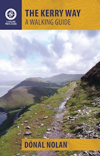
THE KERRY WAY
A WALKING GUIDE
DÓNAL NOLAN is a native of County Kerry where he is a journalist at The Kerryman newspaper. He climbed his first mountain at the age of three (Cruach Mhárthain) and has been slow to come down from the hills since. The Kerry Way is his first book.
Aerial view of Derrynane Bay. VALERIE O’SULLIVAN
Disclaimer
Hillwalking, mountaineering and walking are risk sports. The author and The Collins Press accept no responsibility for any injury, loss or inconvenience sustained by anyone using this guidebook.
Acknowledgements
I would like to thank my wife Sarah for her endless encouragement and patience, as well as for sharing part of the journey, not least that day of incessant rain between Kenmare and Derrycunnihy; photographer Valerie O’Sullivan for her constant help and deep knowledge of the route; Gareth McCormack (www.garethmccormack.com) for photographs; Adrian Hendroff (adrianhendroff.com) for information on access and useful contacts; John Healy for advice on the route; Brian Coakley of Active Me for his invaluable assistance with many questions I had; Bill Cooley, Cormac Ó Dálaigh and Owen Gunning for joining me on a number of treks; my mother Patricia for her love and encouragement and father Don for imparting in me a reverence for our landscape at a formative age as well as for his careful proofing of the guide.
Looking back at the expansive strands at Rossbeigh. VALERIE O’SULLIVAN
On the Kerry Way. Valerie O’Sullivan
Contents
Quick-Reference Route Table
Introduction
Preparing for the Kerry Way
Recommended Route
Day 1:Killarney to The Black Valley
Day 2:The Black Valley to Glencar
Day 3:Glencar to Glenbeigh
Day 4:Glenbeigh to Cahersiveen
Day 5:Cahersiveen to Waterville
Day 6:Coastal: Waterville to Caherdaniel
Day 6:Inland: Waterville to Caherdaniel
Day 7:Caherdaniel to Sneem
Day 8:Sneem to Kenmare
Day 9:Kenmare to Killarney
Select Bibliography
Quick-Reference Route Table
Day
Walk Name
Grade
Distance
Time
Page
1
Killarney to the Black Valley
Easy to moderate
20.5km
6½–7 hours
16
Killarney to Torc
Easy
6km
1–2 hours
16
Torc to Derrycunnihy
Easy to moderate
8.5km
2½ hours
23
Derrycunnihy to Lord Brandon’s Cottage
Easy
3km
40–60 minutes
28
Lord Brandon’s Cottage to the Black Valley
Easy
2.5km
45 minutes
30
2
The Black Valley to Glencar
Moderate to difficult
18km
6–7 hours
32
3
Glencar to Glenbeigh
Moderate, one short climb
12km
3–4 hours
45
via Seefin Circuit
Moderate
15km
4½ hours
50
4
Glenbeigh to Cahersiveen
Easy to moderate
20.5km
5–6 hours
52
Glenbeigh to Cahernaman
Easy to moderate
7km
2 hours
52
Optional excursion to Kells Bay
Easy
2km
30–40 minutes
57
Cahernaman to Cahersiveen
Easy
12km
4–4½ hours
58
5
Cahersiveen to Waterville
Moderate to difficult
24km
7–8 hours
63
6
Waterville to Caherdaniel – Coastal
Easy, with one short climb
11–12km
3–4 hours
72
6
Waterville to Caherdaniel – Inland
Moderate, with one testing climb
23km
6–7 hours
78
7
Caherdaniel to Sneem
Easy to moderate
17km
4–5 hours
85
8
Sneem to Kenmare
Easy, with some gentle climbs
25km
7–8 hours
93
9
Kenmare to Killarney
Easy to moderate
22km
6–7 hours
106
A waymarker in the Bridia Valley. VALERIE O’SULLIVAN
Introduction
Under Ireland’s highest peaks, along some of its finest coastlines, into native forests and through remote valleys, the Kerry Way leads us on a remarkable path. At more than 200km in length, it is one of the longest signed trails in the entire country, looping around one of the most breathtaking peninsulas of all: Iveragh.
It is from this name that the Kerry Way derives its Irish form, Slí Uíbh Ráthach, in a more accurate description of its geography.
Wayfarers might encounter wildlife here seen in few other parts of the island, from the recently reintroduced white-tailed sea eagles to the large herds of red deer that roam Killarney National Park.
Taking the Kerry Way is as much an act of time travel as it is of nature watching, bringing you face-to-face with the enigmatic monuments of the county’s earliest inhabitants in remote landscapes that have barely changed since the ancestors left their mark. Iveragh’s rich Early Christian heritage is just as evident, as is the succession of powers that ruled over it in the many ruined castles and stately homes you will find en route.
The best way to experience the Kerry Way is to follow the route in an anticlockwise direction from Killarney around the entire peninsula and back, through all of Iveragh’s largest communities from Glenbeigh to Sneem and Kenmare. But there is nothing to stop you from going against the grain in a clockwise direction and the signs along the Way helpfully have yellow arrows on either side to direct walkers approaching from either direction.
The Kerry Way can be walked in a fortnight or you can simply use this book as a general guide for day trips here and there. Thanks to the work of the committee charged with its upkeep the Way is well served by the distinctive yellow-on-black signposts and hundreds of handy ladder stiles. These waymarkers are rarely out of view for long, making it difficult to get truly lost. But you will probably lose yourself, in the best sense of the phrase, for hours at a time passing through one sublime landscape after another.
The trail is in good condition for the most part, but this book does point out places where the going can become difficult. It will not take you long to figure out quick, alternative routes to evade the boggiest patches.
This guidebook is intended as a light, lively and anticlockwise guide to the long walk, offering just enough directional, cultural and natural information to keep you on track without getting bogged down in too much detail. But make sure to put down the books, maps and cameras every chance you get simply to soak up the great scenes and silences of this majestic trail.
Preparing for the Kerry Way
Some practicalities
Don’t think about setting foot on these hills and mountains unless that foot and its twin are snug in comfortable, waterproof walking boots. There is a good reason Iveragh’s terrain is boggy and its woodlands and verges are choked with vigorous growth in the summer: it is one of the country’s wettest and warmest regions.
For this reason, good, breathable raingear is recommended. Walking boots with a waterproof Gore-Tex layer and firm ankle-support are best; the latter detail is to minimise the risk of twisting one’s ankle while walking on rocks and boggy tussocks.
Temperatures and conditions can fluctuate rapidly in all seasons. You might find yourself bathed in warm sunlight one moment only for the wind to pick up and rain to start falling the next. You need to ensure you are carrying the right clothes to meet whatever the Atlantic might send inland.
Thankfully, the range of good mountain gear available has never been better so choose a good pair of walking trousers, preferably waterproof, warm, breathable and quick to dry. It will save an inordinate amount of time and energy not to have to continually change into and out of a separate pair of waterproof trousers.
Just as the rain can descend and depart in minutes, so too can temperatures change. One minute you are roasting from the exertion of a steep climb in sunshine, the next it has clouded over and things are getting a little chilly. Carry at least three layers in the summer: a breathable, quick-to-dry T-shirt, a light fleece and a waterproof outer-shell jacket. Having this choice makes it easy to adapt to any changes in the weather. A fleece-lined waterproof jacket would prove too hot and cumbersome in the humid summer.
Protection from the sun is vital so bring a wide-brimmed hat and a sun lotion of at least factor 30 to be safe. Be careful of windburn, too, as the Atlantic can whip winds inland that can burn the skin almost as quickly as direct sunlight.
Pack plenty of food in your bag: more than you think you will need for each day’s walking. All this exercise in the freshest of air can hasten the digestive process and there is nothing worse than feeling those hunger pangs coming on without any food left in the backpack.
Stick to the dictum ‘leave only your footprints’ by taking care not to discard any waste, even inadvertently, along the Kerry Way. Wrapping papers, packaging, tissues and other items are easily forgotten in the rush to get back on the trail after each snacking stop so look around before you leave to ensure the area is exactly as you found it.
It is best to experience the Way with others but if you must go it alone, let your last hosts know your intended route and make sure someone at your destination knows when to expect you. Bring a fully charged mobile phone in case you need to call the rescue team and do not hesitate to do so if you find yourself in a dangerous situation that you cannot get out of by yourself or with the help of companions. Stick to the signed trail and you will be well out of harm’s way far below the trickier higher reaches of the mountains.
One of the great things about this stunning route is its accessibility and suitability for all levels of walker. You don’t have to be super fit to take on any or all of the stages that comprise the trail. And it could not be easier to jump on and off the Kerry Way wherever its suits.
Few parts of it are truly testing, but I have graded the individual sections ‘easy’, ‘moderate’ and ‘difficult’ to give a better sense of what to expect in terms of the effort each part requires:
• Easy sections are those that run on the flat for the most part but with short and gentle inclines in places.
• Moderate parts ask a little bit more of the wayfarer with longer and more testing gradients from time to time.
• Difficult routes are less frequent, but I use the term to describe sections where a good deal of ascent is necessary over steep terrain. It is these routes that generally take us into the highest reaches of the Kerry Way and provide the finest views in exchange for the effort.
The times given for each section are estimates based on a walking speed of 4km per hour. A few parts of the trail are best walked quickly but most sections offer such a dizzying variety of views that you might find yourself dallying just to soak it all in.
Similarly, where you read ‘boggy or rocky’ in the terrain guides for each section you should take it as just a rough guide to the walking track. In a dry period the going can be remarkably pleasant for long distances over firm ground. You are more likely to experience the Kerry Way after or during rain, in which case you should brace yourself for regular boggy patches that require a careful eye to navigate. While keeping an eye on the ground ahead maintain an even closer one on what is immediately underfoot as you pick your way through the mires. Look for the tufts of heather – their roots generally provide firm going – and watch out for moist, mossy areas of a particularly green hue; during wet weather these sometimes comprise little more than a thin layer of growth over depressions that can snare the walker up to the knees or waist.
Derrycunnihy Falls. VALERIE O’SULLIVAN
It is also advisable to bring walking poles for additional support while climbing or treading gingerly through trickier stretches of the Way. Those sold in outdoor shops are best as they are both light and strong. A pole will also give you a greater sense of security approaching barking dogs, of which there are a few along the trail – mainly collies overzealously protecting their sheep flocks.
Access
All land in the Republic of Ireland is owned privately or by the State, with no legal right of entry to the land. When you hear the term ‘commonage’ it implies that the private property is held in common by a number of joint owners.
Access to upland and mountain areas has traditionally been granted out of the goodwill, permission and discretion of landowners. It is normally good practice to strike up a friendly conversation with a farmer or landowner, and if there is any doubt about access, do ask them. If you are asked to leave, please do so politely and without argument or aggravating the situation.
Useful Contacts
Weatherwww.met.ie or LoCall 1550 123850 for a detailed five-day Munster forecast using the Met Éireann Weatherdial service.
Emergencies Dial 999 or 112 for emergency services, including mountain rescue and coastguard.
Tourist Information For tourist information and information, visit www.ringofkerrytourism.com Detailed information on the long distance walking trail of the Kerry Way and other National Waymarked Loops may also be found on www.irishtrails.ie or www.kerryway.com
Killarney National Park For information on the park, its history, landscape and walking trails Tel: +353 (0)64 6631440, www.killarneynationalpark.ie
Transport For intercity train services contact Irish Rail on LoCall 1850 366 222 (or +353 (0)1 8366222 from outside Rep. of Ireland); www.irishrail.ie; For intercity bus services contact Bus Éireann on Tel: +353 (0) 21 4508188 (Cork), +353 (0)64 66 30011 (Killarney), +353 (0)66 7164700 (Tralee), +353 (0)61 474311 (Shannon Airport); www.buseireann.ie; Taxis: Euro Taxis Killarney +353(0)64 6637676, www.eurotaxiskillarney.com; O’Grady’s Cabs (Waterville) +353 (0)87 2230586, www.ogradyswaterville.com
Killarney town with Killarney National Park in the background. GARETH MCCORMACK
DAY 1
Killarney to the Black Valley
Killarney to Torc
Distance: 6km Time: 1–2 hours Grade: Easy
Terrain: On footpath and tarmacked lanes
The Kerry Way starts and ends in Killarney, as do all the best things in life as far as the people of the town are concerned. Who can blame them? Killarney is its own self-contained world, busy with every kind of commercial, cultural and sporting activity all year round and a tourist capital in the summer as thousands of visitors flock in.
Tourism is the lifeblood of the town as the dollars, pounds and euro flow to underpin thousands of jobs. But Killarney repays its visitors well in currencies not listed on any stock exchange: inspiration, rest, joy, peace and myriad other balms for the heart and soul.
It achieves this by bringing two vastly different types of environment to within a hair’s breadth of one another, in the finest examples of each to be found anywhere in Ireland: lowlands of lake and wood and wild, soaring mountainside.
Victorian ghosts are thick in the ether here, and not by accident: Queen Victoria’s visit of 1861 brought fame to Killarney on a scale it had never experienced before. The places she visited then, such as Muckross House and Gardens and Dinis, are still among lowland Killarney’s favourite haunts, along with Lord Brandon’s Cottage and the Demesne. This was the era in which the great Romantic artists tamed the wilds in the public imagination, urging worship for scenery previously seen as tough frontier. Some of the very best of them even drew inspiration from Killarney: Percy Bysshe Shelley, Sir Walter Scott, William Wordsworth and Alfred Lord Tennyson were among its earliest tourists.
Years later, on the shores of Lake Como in Italy, Shelley found himself writing to a friend: ‘The lake [Como] exceeds anything I ever beheld in beauty with the exception of the Arbutus islands of Killarney.’ With endorsements like that, Killarney’s success was assured.
Muckross House. VALERIE O’SULLIVAN
We begin the Kerry Way at the bridge over the River Flesk to the south of the town, leaving Killarney along a wide cycling route past some of its biggest hotels before entering woods about 1.5km further south where the Kerry Way follows a wide track. Muckross Abbey is a ruined monastery that demands an exploratory diversion.
Founded around 1448 by Gaelic chieftain Donal McCarthy Mór, the Franciscan friary was among the most important ecclesiastical power bases of the region and much of it is still standing – not least the great yew tree right in the centre of the cloister. The yew is said to be as old as the friary itself.
Opposite the friary, the Way diverts from the wide path down into the lakeside woods to run south towards Muckross House, but it re-emerges before long onto the wide cycle and jaunting-car track into Muckross. Wherever possible, the Way has been diverted off this wider road into parallel tracks through the trees for reasons that are clear in summertime as cyclists and jaunting cars barrel past.


