Erhalten Sie Zugang zu diesem und mehr als 300000 Büchern ab EUR 5,99 monatlich.
- Herausgeber: The History Press
- Kategorie: Sachliteratur, Reportagen, Biografien
- Sprache: Englisch
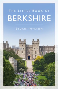
Did you know? - Reading Football Club was founded in 1871, the same year as the FA Cup, and is the oldest football league club south of the River Trent - Newbury Racecourse housed a prisoner-of-war camp during the First World War - The Duke and Duchess of Cambridge's current coat of arms features three acorn sprigs – one for each of the Middleton children, who were born in Berkshire The Little Book of Berkshire is an intriguing, fact-packed compendium of places, people and events in the county, from its earliest origins to the present day. Here you can read about the important contributions Berkshire has made to the history of the nation, and meet some of the great men and women – the eccentrics and the scoundrels – with whom its history is littered. Packaged in an easily readable 'dip-in' format, visitors and locals alike will find something to amuse, surprise and entertain them in this remarkably engaging little book.
Sie lesen das E-Book in den Legimi-Apps auf:
Seitenzahl: 278
Veröffentlichungsjahr: 2014
Das E-Book (TTS) können Sie hören im Abo „Legimi Premium” in Legimi-Apps auf:
Ähnliche


CONTENTS
Title
Introduction and Acknowledgements
1
What is Berkshire?
2
Just Passing Through: Transport in Berkshire’s History
3
Berkshire Murders
4
Sporting Berkshire
5
Berkshire People
6
Berkshire Castles, Abbeys and Stately Homes
7
Ghosts and Ghouls
8
Battlefield Berkshire
9
Why is it Called That?
10
The Thames
11
The Royal Berkshire Regiment
12
Berkshire Takes on Hitler
13
Industrial Berkshire
14
New Berkshire? Slough and Bracknell
15
And Another Thing …
About the Author
Copyright
INTRODUCTION AND ACKNOWLEDGEMENTS
If you are looking for a comprehensive and authoritative history of Berkshire, this is not it. There is a wealth of good books about every aspect of life in the county, and a visit to your local library or bookseller (or, better still, to the comprehensive local history section of Reading Library, where I researched much of this book) will give you the answer to even the most arcane questions about Berkshire. Those of you who know which buttons to press might even risk the Internet!
My brief was more specific. I was asked to produce a book that would be of interest to anyone with links to Berkshire; something that they could dip into, as the mood took them, and where the mainstream history was combined with spicier (or more speculative) fare, such as the area’s most famous ghosts and notorious murderers. As a recipient of one of my previous books in this series put it, ‘the ideal book to keep in your loo’ – but I drew the line at putting ‘now wash your hands’ at the top of each page. Like the remit for the BBC (albeit in a slightly more modest way), I set out to inform, educate and entertain, though not necessarily in that order of priority.
I owe a great debt to the many diligent researchers who have studied Berkshire before me. Having done my full share of trawling through ancient archives for many of my previous books, I can readily appreciate their dedication. Unfortunately, in a book like this, I do not have the space to acknowledge them all, or it would no longer be a little book. But if my efforts encourage you to explore some aspect of our past further through them, I hope my debt will be in part repaid.
Enjoy this little book.
Stuart Hylton, 2014
1
WHAT IS BERKSHIRE?
This is not as daft a question as it may appear, for what passes for Berkshire in 2014 is very different to what has been called ‘Berkshire’ for much of our history. Let’s try and make our way through that history.
The area this book will talk about is based mainly on the Berkshire that was formed by the county boundary of 1831 (but which existed for several centuries before that) and which carried on with only minor changes until the wholesale review of 1974.
Berkshire does not appear to have existed as a recognisable separate unit in Roman times. It was a rural area with no major towns of its own. The main settlements nearby were Silchester (Calleva Atrebatum) in what is now Hampshire, and Dorchester (in modern Oxfordshire). That is not to say that the area was uninhabited. There were traces of small-scale Roman settlement throughout the length of Berkshire and, before that, traces of Celtic civilisation. It is thought that the whole of pre-Roman Berkshire fell within the territory of a tribe called the Atrebates, whose northern capital was at the same Calleva that the Romans later developed. There is also evidence to suggest that when Verica, the last leader of the Atrebates, was driven from his lands (including Berkshire) he may have gone to Rome and appealed to them for help. This, it is suggested, may have encouraged the Roman invasion in AD 43.
Berkshire as a separate entity probably dates from the 840s, when Sunningum (East Berkshire) was united with Ashdown (taking in the Berkshire Downs and, probably, the Kennet Valley). It came into being after a spot of unpleasantness (lasting about 200 years) between the rival kingdoms of Wessex and Mercia.
The River Thames forms much of the northern boundary of the county (as it had previously divided Wessex and Mercia), with the rivers Cole, Enborne, Blackwater and Kennet providing other parts of the new county’s dividing line. Various more or less minor changes took place over the next millennium, ranging from tidying up parish boundaries to coincide with those of the county, to the incorporation of Caversham into Reading (and Berkshire) in 1911. Some of the changes related to truly eccentric divisions from years past, such as parts of Wokingham, Hurst, Shinfield and Swallowfield being classified as detached portions of Wiltshire, until that anomaly was rectified in 1844.
It was in 1974 that Berkshire lost some 260 square miles (36 per cent) of its area and almost 20 per cent of its population, when it gave up all of the area north of the Ridgeway to Oxfordshire, including attractive historic towns such as Wallingford and Abingdon, and received in return Slough, Eton and some other minor parts of Buckinghamshire. I leave you to judge how fair a swap this was, for fear of offending readers in Slough. Since the big shake-up of 1974 there have been further, smaller adjustments. Colnbrook and Poyle joined Berkshire in 1995, as did parts of Mapledurham, and Eye & Dunsden in 1997.
So, to answer my original question, I intend to play fast and loose with the county boundaries – working mainly with the traditional nineteenth-century Berkshire, but incorporating material about the post-1974 county where it seems relevant (or more to the point, interesting), and straying beyond even those boundaries when it seems to me that something worth reporting impinges upon life in modern Berkshire.
2
JUST PASSING THROUGH: TRANSPORT IN BERKSHIRE’S HISTORY
ROADS, ANCIENT AND MODERN
Part of England’s, and possibly Europe’s, oldest road runs through Berkshire. For 5,000 years, or more according to some authorities, the Icknield Way has provided traders with a drier and less forested (and hence safer) route between the Dorset coast and the Wash, in Norfolk. Iron Age forts were built along its length to protect this trade. In later years, its main function was as a drovers’ road, taking large numbers of sheep to market in places like East Ilsley, near Newbury. (East Ilsley was in 1844 the largest sheep market in England, outside Smithfield.) The part of the Icknield Way running across the Berkshire Downs divided into a higher route along the ridge of the Downs, predictably called the Ridgeway, which crossed the Thames at Goring/Streatley, and a parallel lower route, the Icknield Way itself. The Ridgeway was designated a National Trail in 1973.
As we saw, Roman Berkshire was not a recognisable administrative area, and it was not even a significant channel of communication – there are roads out of neighbouring Silchester, heading north in the direction of Dorchester, east to London (which barely scratches the edge of modern Berkshire) and west to Cirencester, but no settlements of any size within the county itself.
Some of the earliest references to transport in Berkshire relate to unwelcome visitors. In AD 869, two Danish Viking armies made for the area, one sailing up the Thames and another marching overland down the Ridgeway. They met at Reading, where the confluence of the Thames and Kennet rivers provided routes to the north, east and west, and where they were able to occupy a former West Saxon fortress at the junction of the two rivers. By AD 871 they were firmly established in their base and, after a number of skirmishes, their army was defeated by that of the West Saxons at the Battle of Ashdown (dealt with in more detail in chapter 8).
In post-Roman times, towns on river crossings became increasingly important in shaping trade routes. Bridges at Abingdon, Wallingford, Henley and Maidenhead became key points in developing more direct westerly routes out of London. Others linked the Cotswolds, and their wool exports, to the channel ports. No less than five new bridges across the Thames were built during the thirteenth century, including Caversham, which dates from 1231, Maidenhead (built prior to 1255), Henley and Marlow. Windsor’s bridge was older still – tolls from it were being collected as early as 1172.
There would tend to be a chapel on some bridges, like the one at St Anne’s at Caversham, or a resident hermit to collect alms (as at the Ock Bridge in Abingdon). Charities or religious institutions might also collect tolls towards the upkeep of the bridges.
In Reading, responsibility for the upkeep of the Thames Bridge was shared between Reading and its neighbouring (but at that time independent) settlement of Caversham. They could never agree about repair works, with the result that it spent centuries in a state of almost continuous disrepair, for a long time in a curious ‘half and half’ structure, partly of wood, partly of stone. In any event, tolls often put bridges beyond the means of the poorest travellers, who had to continue relying on ferries or (where feasible) fording rivers.
Between the bridges, mediaeval highways were rights of passage, rather than structures with fixed routes, and travellers would take whatever route was necessary to make progress. This may help explain why the very earliest maps did not show the roads between towns, given that their alignments were so uncertain.
If the poor condition of the roads was not enough, the misery was compounded by the fear of robbery. This had become so bad by 1285 that Edward I ordered that highways between market towns should be widened so that there would be no ditch, undergrowth or bushes, where anyone could lurk with evil intent, within 200ft on either side of the road.
King Edward I
This only applied to a few major roads, and there were constant disputes as to who was responsible for maintenance of particular roads. In Reading after the dissolution of the Abbey, responsibility for their upkeep passed to the corporation (but not the resources to do anything about it). They fell into worse than usual disrepair, until a 1560 charter from Queen Elizabeth gave them both the responsibility and the means (financial and material – including the gift of 200 loads of stone from the ruins of Reading Abbey) to carry out the repairs.
A grossly inefficient parish-based unpaid labour system for repairing roads was introduced in 1555. It proved utterly inadequate to cope with the increased traffic trying to use them.
Celia Fiennes, in 1690, described the road from Reading to Theale as a ‘sad clay deep way’ and to Newbury was all ‘clay mirey ground’. Wagons could sink axle-deep in mud, and in places the track was not wide enough for two carriages to pass. This road was nonetheless part of the Great Bath Road, probably the most important route in post-Roman Berkshire, forming a spine through the county linking London to the cities of Bath and Bristol.
This was not an ancient or even mediaeval creation, but was developed to carry the increasing traffic from the capital to the fashionable spa and the major port of Bristol. To say it was ‘developed’ may be overstating the case, since it was not even very clearly defined. It would regularly split into several different tracks, with no clear indication as to which was the right way to go (generally the higher route was the safer bet in wet weather). Travellers often even hired local guides; Samuel Pepys did not, and managed to get lost between Newbury and Reading.
Things had not looked up much by the time William Cobbett made his rural rides in 1822. He described the roads in the Windsor area as being mostly ‘upon as bleak, as barren and as villainous a heath as ever man set eyes on’.
Nonetheless, the first stagecoach service through Berkshire was advertised in 1657. The vehicle was unsprung, carried only four people and took three days to complete the journey from London to Bath and Bristol, ‘God willing’ as the advertisement discouragingly put it. By the 1830s there were twenty-five stagecoaches and three Royal Mail coaches in each direction, running along the Bath Road through Maidenhead daily. Slough had twenty-four services, Reading seventeen, Newbury twelve, Hungerford ten, while Windsor got just four, Bracknell three and Wokingham two. In addition, there were cross-country services, for example linking Reading to Brighton, Oxford to Windsor, and Hungerford to Swindon.
The biggest maintenance problems faced those parishes that contained part of a long-distance route, like the Great Bath Road. Some way had to be found of making the long-distance traveller pay towards the wear and tear he caused on the highways. An answer came with the introduction of Turnpike Trusts. Private Acts of Parliament brought into being trusts that would replace the parishes as highway authority on specific routes. They were able to raise loans to fund highway improvements, which they repaid from the tolls paid by the users of the roads.
Turnpiking was a very slow and piecemeal way of upgrading a road, as the improvement of the Berkshire part of the Great Bath Road illustrates. The road from Reading to Theale was one of the first to be turnpiked (in 1714), followed by Twyford to Maidenhead (1718), west and east of Newbury (1726 and 1728), Cranford to Maidenhead (1727) and Twyford to Reading (1736). Other Berkshire roads to be turnpiked at this time included Maidenhead to Henley Bridge (1718), Reading to Basingstoke (1718), Reading to Wallingford (1763), Newbury to Oxford via Abingdon (1770), Hungerford to Wantage and Fyfield (c. 1795) and Windsor to Hurst (1823).
So, by the start of the nineteenth century, a reasonable network of turnpiked roads existed between most significant settlements in the county. Each trust had to justify to Parliament that the turnpike was needed (not so difficult, given the appalling state of so many roads) and that the scale of charges they were proposing was justified by the financial outlay needed to improve and maintain the road. Turnpike proposals were generally hotly contested, since the placing of a tollgate could determine who had to pay to reach a key destination and who did not.
Once established, there was widespread evasion and fraud to contend with. Landowners would conspire with travellers to enable them to circumnavigate the barriers, and all sorts of ingenious ways were found to reduce the tolls for which travellers were liable. The tariffs themselves were exceedingly complex, with different rules applying according to the weight of your load, the shape, height and width of the wagon wheels and the form of motive power (steam road vehicles, once they came along, faced punitive tariffs from some trusts).
The Maidenhead Trust was one of the first to have its own weighing machine for wagons. There were also numerous complicated exemptions to the tariffs – for pedestrians, funerals, churchgoers, horses going to water, members of the Royal Family, etc.
Trusts were also entitled to a share of the unpaid labour that still looked after the non-turnpiked roads in the parish. But this was by no means easily obtained, given that the parishes still struggled to maintain even local routes (since turnpikes never made up more than a fifth of the total road network). Trusts often had to resort to the courts to get their share of the labour. As if all that were not enough, the complex tariffs gave the toll collectors considerable scope for in-house fraud, and their tollhouses were popular targets for highwaymen.
All in all, it is small wonder that turnpike roads – though they made significant improvements – were not a panacea for overland travel in Britain. They were still limited by the speed at which horses could travel, and even the speediest traffic – the mail coaches – were still taking twelve hours between London and Bristol in 1836. Goods carried by wagon or canal barge could take several days – longer, if the canals were closed down by frost or drought. When not bogged down in mud, the roads could also be extremely bumpy. The Marlow Road (the modern A404) was noted as being less rough than the Great Bath Road, and for that reason was favoured by the likes of the Marquis of Salisbury, for being easier on his gout. It became known as the ‘gout track’. As for The Great Bath Road, the Gentlemen’s Magazine for September 1754, after listing a long schedule of the route’s shortcomings, called it ‘… the worst public road in Europe, considering what vast sums have been collected from it.’
The turnpikes were badly hit by the coming of the railways. In 1844 the Windsor Forest Turnpike earned £743 in tolls. In 1850, the year after the railway came to Wokingham, this fell to £414. By 1870 all the turnpike trusts had closed. Further major improvements to the county’s roads would only come with the widespread use of Macadam’s road building technique in the nineteenth century; pressure from the cycling and the motor car lobbies, especially after the county councils took over responsibility for road maintenance from the parishes in 1888; and the discovery of tar as a means of defeating dust early in the twentieth century. As late as the First World War, the Bath Road was still being described as a mess of potholes and loose gravel, with warning signs to alert travellers to the worst hazards, though it was by then being reconstructed.
By the 1920s, the volume of motor traffic had increased to the point of becoming a nuisance, and Twyford and Colnbrook were two of the first settlements in Berkshire to be bypassed. This also had the advantage of creating work for demobbed ex-servicemen.
Having started with Britain’s oldest road, we move on to one of Berkshire’s newest. The need for a ‘South Wales motorway’, as they originally called it, was first identified in the 1930s. At first the authorities thought that a series of bypasses of the major towns along the route, which could then be joined up in some way, would suffice, but it was soon realised that this would not achieve the standard of road or the directness of route required. Consulting engineers were called in, and seven alternative routes were looked at, at one time or another, in the 1950s and 1960s. The southernmost one went south of Reading, Newbury and Hungerford; the northernmost one way to the north of Didcot and Swindon. In finest British tradition the authorities dithered, as the engineers tried to reconcile directness and construction costs with amenity, while comparing routes that variously ploughed through the Thames Valley, the Chilterns, the Berkshire Downs, the Savernake Forest and the Marlborough Uplands, and lobbyists lobbied furiously against the route they were looking to protect.
In 1969 it was announced that the M4 (as it was now called) was about to start construction – by which time it was very sorely needed indeed. East–west through traffic was still having to go through the centre of all the towns en route, and the A4 was carrying somewhere between two and three times the number of vehicles for which it had been designed. At busy times like holiday periods, traffic queues built up for several miles either side of towns like Reading, with motorists taking an hour and a half to reach the other side of town.
The M4 was finally to be opened in December 1971, by a junior minister at the Environment Department – one Michael Heseltine – driving down it in the ministerial Jaguar. A ceremony was held, in which the Bishop of Oxford blessed the road, but the ministerial Jaguar – no doubt feeling unblessed – then refused to start. So Mr Heseltine climbed into the ministerial coach for the trip.
The opening period was not without incident. At one point motorists found themselves mingling on the carriageway with the hounds and huntsmen of the Duke of Beaufort’s hunt, after a fox ignored the ‘no entry’ signs. Debris left on the road by the contractors meant that replacement windscreen suppliers did a roaring trade, and the lack of services anywhere between west London and the Severn Bridge kept breakdown services busy filling empty petrol tanks.
Road schemes generally seem to be like fine wines, in that they cannot be hurried. Even the relatively modest matter of an A4 bypass to Maidenhead was first proposed in 1927. A route was surveyed and work actually began in the 1930s. But it was interrupted by the war, and further delayed by post-war austerity. The scheme was only revived in 1959 and opened in June 1961.
But the most leisurely of all must surely be the third Thames crossing at Reading. A joint committee for the orderly expansion of Greater Reading was convened by authorities in Berkshire and Oxfordshire in 1928. The need for the bridge was raised at that time and the proposal has surfaced at regular intervals ever since, but still remains no more than a fond hope in some hearts (and a nightmare in others).
RIVERS AND CANALS
Given the state of the roads, the nation’s waterways formed important corridors of trade for much of its history. In Berkshire’s case, the River Thames formed much of the county’s northern boundary and provided routes eastwards and northwards, while the River Kennet flowed through the western part of Berkshire. Reading assumed a special importance in two ways: first as a place to tranship goods arriving by road from the surrounding area, for delivery to London via the Thames; and secondly as a place for transferring goods, going up the Kennet to western Berkshire, into shallow- drafted boats, called ‘showtes’. These were the only craft that could navigate the unimproved Kennet. The abbey controlled access to the Kennet by means of a lock, and charged users for it, and a wharf and warehouse were also provided in the twelfth century, near to where the Holy Brook joins the Kennet.
As with most waterways at that time, there were constant disputes between those who wanted to use the river for transport, on the one hand, and fishermen and watermill owners, on the other. The latter in particular would build weirs (or flash locks) across the river, and boatmen would have to pay (and wait) for them to be opened. They would then either be hauled upstream through the opened dam by cables or surf downstream on the rapids. This was not only extremely inefficient but dangerous – the flash lock at Marlow, owned by a man called Thomas Farmer, had a particularly evil reputation for drowning its users.
Successive kings legislated in vain against the damming of rivers. It was only with the development of modern-style pound locks (invented in Holland in 1373, and first used in Britain in 1566) that the two interests could be reconciled.
(As an aside, Jerome K. Jerome reported a similar rivalry between river users in the form of rowers and punters versus steam launches. Oarsmen hated the steamers and would go out of their way to annoy them.)
The idea of linking London and Bristol via the rivers Thames, Kennet and Avon had been around since Elizabethan times. It came close to happening in 1626, but for the untimely death of the man who had surveyed the Kennet and Avon and who had seen the potential. But, before that could happen, the Kennet Navigation Act (1715) was passed, to make the Kennet between Reading and Newbury navigable (despite the fall of 120ft between the two towns).
At Newbury, the building of a canal basin and a wharf involved demolishing a Norman castle. All the towns along the route supported the idea except Reading, who feared that they would lose their pre-eminent trading position. In 1720 this opposition spiralled into violence, when a mob of about 300 people, led by Mayor Robert Blake, attempted to destroy part of the canal works. They were unsuccessful but, thanks to the incompetence of the first engineer employed by the canal company, they were deeply in debt by the time the navigation opened in 1723. They had had to bring a second engineer to put in 11½ miles of cuttings, to make the route direct enough to be competitive. The people of Reading added to their problems by stoning, and making death threats to, bargees passing through the town. The company made almost no profits for the first twenty-five years but, far from bankrupting Reading, the canal ushered in a new era of prosperity for all the towns along it.
The long-awaited link between London and Bristol finally got parliamentary approval in 1794 and opened in 1810. This and other canal developments gave Berkshire excellent trading links with key parts of industrial Britain. But the glory days of the canals were to be short-lived, with the coming of the railways. In the first year of operation of the Great Western Railway, the Kennet and Avon’s takings from lock tolls fell from £51,000 to £41,000. The railway bought out the canal in 1852, starting a predictable period of neglect and decline. As for the Wiltshire and Berkshire Canal (discussed in more detail in chapter 10), by 1870 it was already being described as ‘a muddy trickle’. The Thames Commissioners, heavily in debt, were wound up in 1867 and replaced by the Thames Conservancy.
One piece of canal building that definitely post-dated the railway age was the Slough branch of the Grand Union Canal. This opened in 1882, and was used to transport bricks from the manufacturers in Iver and Langley to their market in London. On the return journey, the barges would bring London’s refuse and night soil, the latter used to fertilise Slough’s many market gardens. No doubt it also helped take locals’ minds off the smells from the town’s brickworks.
The modern British Waterways Board has long-term ambitions to construct a 2-mile link between the Slough arm of the Canal and the River Thames.
THE GREAT WESTERN RAILWAY
As the Liverpool to Manchester Railway opened in 1830, merchants in Bristol looked on enviously. They saw their two rival cities’ economic prospects being transformed by the speed with which goods and people could be transported between them, and they decided to revive an idea which had first seen the light of day in 1824. In 1832 a 27-year-old engineer named Brunel was appointed to design a railway between Bristol and its main market, London. The route would inevitably go through large parts of historic Berkshire.
Like most early railway schemes, the scheme encountered entrenched opposition. Within Berkshire, this included the authorities in Maidenhead, who feared the railway would deny them valuable toll income from their Thames river crossing. (The bridge, built for £19,000 in 1772, had long since been paid for, but they kept charging tolls on it. This only stopped in 1903, after Parliament ruled them illegal and protesters threw the tollgates into the river.)
More substantial opposition to the railway appeared in the form of Eton College, who feared it would carry their pupils off to the fleshpots of the capital. They demanded that a large, guarded fence be erected along the 4 miles of track nearest to the college, and that Slough, the nearest town along the line, be barred from having a station. The fence was provided, but the station issue was easily solved – the railway initially pretended that the station serving Slough would be at Langley, beyond the fenced-off zone. In practice, they hired rooms in a trackside public house in the centre of Slough, which they used as a waiting room from which passengers could decant onto the track itself to board their train. The town then only had to wait until June 1840, when a change in the law allowed a proper station to be built.
In similar vein, the University of Oxford and its chancellor, the Duke of Wellington (who was no fan of railways), refused at first to have a station nearer to Oxford than Steventon, 10 miles south of the city, adding an hour and a half to the journey time between Oxford and London. The Thames Commissioners, fearful of a loss of river-borne trade, instructed their general committee to ‘take all such steps as they shall deem advisable for effectually opposing the progress of this useless and mischievous project’.
Landowners around Reading complained of ‘the destruction of land, the asseverance of enclosures, the inundation of foreign labourers, and the increased poor rate’ and told Parliament that the railway would be ‘injurious to their interests, repugnant to their feelings, and that no case of public utility had been made out to justify such an uncalled for encroachment upon the rights of private property’. A correspondent to the local newspaper doubted whether Reading could benefit from a railway: ‘Here there is no manufacture, nor is it within the range of possibility that any can flourish here; nor can the trade of the place be improved; it now supplies the country around with everything, and more it cannot do.’
Despite the opposition, and the fact that a first, partial scheme was thrown out by Parliament, the Great Western Railway Bill was finally approved in August 1835.
The biggest engineering challenges Brunel faced in the Berkshire part of the Great Western were the Thames crossing at Maidenhead and the Sonning Cutting. The geography of the Maidenhead bridge site was such that Brunel was forced to span the river using the shallowest brick arches ever seen. All the ‘experts’ predicted that it would collapse, but it still stands to this day, carrying far heavier and faster trains than were ever envisaged in his day.
At Sonning, Brunel was faced with making a cutting 2 miles long and up to 60ft deep, all of it dug by men using just picks and shovels. He had up to 1,200 navvies working for more than three years in a sea of mud to complete this mammoth task. At one stage, the contractor ran out of money to pay the workmen; they went on strike and took to hanging around the streets of Reading, so terrifying the locals that the army had to be called out for their protection.
Other great engineering challenges faced Brunel further along his route – notably the Box Tunnel – but the railway opened throughout the length of Berkshire by the end of 1840, and to Bristol in June, 1841.
Once the railway began operating, all but the most die-hard sceptics could see its advantages. Branch lines followed – from Reading to Newbury and Hungerford in 1847, and to Basingstoke in 1848. Even towns that had petitioned against a railway had a change of heart. Abingdon, which was at that time the county town, had twice opposed the railway. But by 1842 they were lobbying the Great Western for the branch line, which was by then being mooted to Oxford, to come closer to them. Negotiations with Abingdon broke down, and it was left to a local company to supply their branch line, in 1856. However, the town remained on the fringes of the rail network, and this is reflected in its subsequent lack of growth.
After much negotiation with Eton College and others, Windsor was finally served by not one, but two, branch lines in 1849. Newbury, not satisfied just with a branch line from Reading, campaigned to extend its line north to Didcot and south to Southampton, and this opened in 1882.
Queen Victoria started her first train ride from Slough in 1842 and a palatial hotel was built opposite the station, to act as her private waiting room for future journeys and to serve the many who would be drawn to Windsor by the royal presence. Its days were numbered from the day the branch lines to Windsor itself got the go-ahead.
The last London to Bristol stagecoach ran in 1843, and with their passing went the businesses of the many coaching inns. But towns like Maidenhead, which had had an important coaching trade, found that its loss was more than compensated for by new coaching business generated by the railways. As we saw, the waterways were much harder hit.
The Sonning cutting was to play an unexpected and macabre part in railway history. On Christmas Eve 1841, heavy rain caused a landslip in the cutting. At about 6.40 a.m. a mixed goods and third-class passenger train entered the cutting and crashed into the debris. The third-class ‘carriages’ were no more than low-sided open wagons and many of the passengers were either thrown from them or crushed by the train of goods wagons behind them. Eight were killed and seventeen injured were taken to the new Royal Berkshire Hospital. The outrage that this accident caused led to William Gladstone’s 1844 Railway Regulations Act – the government’s important first attempt to regulate the conditions under which poorer passengers travelled and the cost of their travel.
The original stations at Slough and Reading had the unusual feature that they were ‘one-sided’ (that is, both the up and down platforms were next to each other, on the same side of the track). The logic of this was that virtually all of the two towns lay on that side of the tracks. However, it made for some complicated and dangerous crossing movements and the experiment was abandoned.


