Erhalten Sie Zugang zu diesem und mehr als 300000 Büchern ab EUR 5,99 monatlich.
- Herausgeber: Fernhurst Books Limited
- Kategorie: Fachliteratur
- Serie: Illustrated Nautical Manuals
- Sprache: Englisch
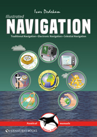
Today, yachts are often equipped with radar, GPS, chart plotters, AIS, etc. This equipment has also become much more reliable, making it possible to make long offshore passages without a great knowledge of navigation. However, such equipment can be set up wrongly, interpreted incorrectly, malfunction or lose power. In these circumstances, knowledge of traditional navigation can become extremely important. This book will teach you how to navigate in the traditional way using compass, log and plotter; and also how to navigate using electronic aids like GPS, radar and chart plotter. In addition, you will learn some basic celestial navigation using the sun and stars to obtain your position using sextant, almanacs, tables and a watch. Each method of navigation is explained alongside detailed illustrations and examples, combining to make a straightforward and easy-to-follow guide. This new version has an improved layout and the eBook's functionality has been improved significantly.
Sie lesen das E-Book in den Legimi-Apps auf:
Seitenzahl: 112
Veröffentlichungsjahr: 2017
Das E-Book (TTS) können Sie hören im Abo „Legimi Premium” in Legimi-Apps auf:
Ähnliche


CONTENTS
TRADITIONAL NAVIGATION
How charts are created
Latitude & longitude
Position
Using charts
Variation & deviation
Steering compass
Log & echosounder
Plotting implements
Leeway & current
Using a handbearing compass
Other navigational aids
Some chart symbols
Sailing at night
IALA buoyage system
Tides
Navigation lights
Summary
ELECTRONIC NAVIGATION
GPS
GPS – how it works
GPS receivers
Waypoints
Chart plotters
Waypoints & routes
Display set-up
Radar
Radar – how it works
Discrimination
Radar operation
Collision avoidance
AIS
CELESTIAL NAVIGATION
The sun’s geographic position
Astronomical model
Principles of celestial navigation
Hour angles
Noon sight
Measuring sun’s altitude
UTC, Zone & Standard time
Working a sight
Taking the Noon sight
Plotting position lines
Finding lat. & long. directly
Corrections
Stars
Polaris (North Star)
Using a calculator
Tables & formulae
The Fernhurst Books’ Knowledge Centre has lots of other information (including videos, book extracts & other resources) on sails & rigging – scan the QR code or visit www.fernhurstbooks.com & click on ‘Knowledge Centre’ to find out more
INTRODUCTION
This book will teach you how to navigate in the traditional way using compass, log and plotter and also how to navigate by means of electronic aids like GPS, radar and chart plotter. In addition you will also learn some basic celestial navigation using the sun and stars to obtain your position using sextant, almanacs, tables and a watch.
Knowledge of traditional navigation is very important, not only when the electronic equipment breaks down but also to reveal incorrect set-ups and malfunctioning equipment.
What distinguishes this book from many others is the short, focussed text backed up by over 120 computer-generated graphics. My aim has been to make it easy to find, understand and remember the information you are looking for. I must also express my thanks to Harald Erik Bjerke for his translation of the original Norwegian text.
To the reader and navigator, I wish you Good Sailing and Good Luck!
Ivar Dedekam
TRADITIONAL NAVIGATION
Traditional coastal navigation entails navigation using paper charts, compass, dividers, plotter, log, echosounder and more.
It is important to have a basic understanding of this type of navigation so that you can spot malfunctioning or incorrect use of any electronic equipment installed.
In the next chapter electronic navigation, incorporating radar, GPS and electronic charts, will be covered.
In the last chapter we will show how you can determine your position with the help of a sextant, tables and the correct time, using celestial navigation.
Because the earth is not a perfect sphere, but slightly compressed at the poles, there are problems in creating accurate charts. Many chart datums or references have been created along the way to describe the not quite spherical earth.
HOW CHARTS ARE CREATED
Through the years different projections have been used to transfer the contours of the planet earth onto paper. Mercator* unfolded the sphere like a cylinder and stretched the curved sections so the meridians became parallel lines.
This caused the land-masses to be stretched the further they were from the equator. The charts were stretched north-south until the land regained the correct proportions. This is the reason the distance between the parallels of latitude increases the further north or south you go on a Mercator chart.
This in turn gives the wrong relationship, size-wise, between the land-masses. Areas far from the equator will seem relatively larger than they actually are.
*Gerardus Mercator (1512-94): Flemish mathematician who projected the earth onto a cylinder, touching the earth at the equator.
The curved portions are smoothed and stretched...
... and the sphere becomes a flat surface.
Areas far from the equator appear stretched wider so the chart is stretched higher to compensate
Different types of projections
LATITUDE & LONGITUDE
Today’s charts use an international reference system consisting of a grid made up of great circles and parallel circles or just parallels.
Parallels
A plane through the centre of the earth will always define a great circle on the earth’s surface. An example of such a great circle is the equator which divides the earth into a northern and southern hemisphere.
If we slice the earth with planes parallel to the equator we get lesser parallel circles usually called little circles.
The equator is a great circle with equal distance to both poles defined as 0° latitude. The other parallels have increasing latitude reaching 90° at the poles.
Latitude is defined as a number of degrees north or south of the equator. 45°N is the parallel halfway between the equator and the north pole.
Meridians
Great circles created by planes at right angles to the equatorial plane which intersect both the north and south poles (and thereby the centre of the earth) make up what we call circles of longitude. These circles are divided at the poles and the semicircles are called meridians.
The meridians are designated 10°, 20°, 30°, etc. east and west of Greenwich. At 180° the east and west meridians meet at a common meridian.
The so-called date line runs mostly along the 180° meridian, although in some places it deviates from it due to practical reasons. When passing the date line, the date must be adjusted.
This is due to the fact that the earth rotates towards the right (east). A total revolution takes 24 hours which means 15° an hour. Even though the sun is stationary, it seems to be moving 15° from east to west every hour. The further east you travel the 'later in the day' it gets.
If you travel far enough to the east you will sooner or later cross the date line and enter 'yesterday'. If you cross the line from east to west, you have to skip a day.
All this is of little importance in coastal navigation, but very important in celestial navigation and when using tide tables and nautical tables.
POSITION
Any point on the surface of the earth can be defined by its latitude and longitude. The latitude is defined by the parallel that intersects the position and the longitude by the meridian that intersects the position.
All places on a parallel circle have the same latitude just as all places on a meridian have the same longitude. But there is only one unique place which is defined by the intersection of the two!
The place where you are is called your position or the vessel’s position. When giving our position we always start with latitude and then longitude.
Boat A in the illustration is found to be at latitude 33°N (latitude 33 degrees north) and longitude 045°W (longitude 45 degrees west). The vessel’s position would be given thus:
33°N 045°W
The sailboat B is in the southern hemisphere. Its latitude is 37°S and longitude 018°E. Its position would be referred to as:
37°S 018°E
Here the position is given in whole degrees. This is too generalised for navigation. As shown on below these positions would at least be given in degrees and minutes:
Boat A’s position would then be 33°23’N 045°11’W or as it also can be presented, N33°23’ W045°11’, but either way the latitude comes first.
Latitude is indicated with 2 digits (0-90° N or S) and longitude with 3 digits (0-180° W or E).
All circles may be divided into 360 degrees. Each degree is divided into 60 minutes which in turn can be divided into 60 seconds. It is now common to use decimals (tenth of a minute) rather than seconds.
Thus:
You have to keep your wits about you when working with minutes, decimals and seconds.
Nautical mile (M)
One nautical mile is defined as 1 minute of arc (or 1/60 of a degree of latitude) measured along a meridian.
From the equator to the north or south pole there are:
The great circle is four times that distance:
This is rounded off:
In the example of Boat A above the position of a vessel was found to be 33°N 045°W. A little more accurately it could be defined as 33°23’N 045°11’W which is read 33 degrees 23 minutes north – 45 degrees 11 minutes west. This is how a position is designated.
You could also include decimals of minutes, for example 33°23.7’N 045°11.3’W, if a more accurate position is required.
USING CHARTS
When navigating you will be using charts with varying scales. The scale defines how much a distance is reduced on the chart. 1:50,000 is a scale found on many charts. 1mm on this chart equals 50m (50,000mm) in the terrain. Other charts like harbour charts and special charts might have a scale of 1:10,000 or 1:25,000. Coastal charts with a scale less than 1:200,000 and passage charts with a very small scale are often used.
NB! 1:10,000 is a larger scale than 1:350,000.
You can determine a position on the chart by drawing a horizontal line from the position to the edge of the chart and reading off the latitude. Draw a vertical line from the position (up or down) and read off the longitude on the scale. However, most people choose to use dividers to measure the distance from the closest horizontal or vertical line and then move the dividers along these lines out to the edges in order to read off latitude and longitude.
There are several ways to define your position, just make sure you read off where lines through your position, parallel with the edges of the chart, intersect the latitude and longitude scales.
You can measure the distance with whatever you please but dividers are most commonly used. Always use the latitude scale on the left or right side level with the area between A and B. This is because the minutes of latitude increase with increased latitude, even if it is hardly noticeable on a 1:50,000 scale chart. Try this on different charts until you are sure you understand the problem.
You will now have found the course from A to B which you can steer the boat by. There are many types of navigational plotter which can be used (see p.16). This is the main principle in traditional navigation – how to sail from one point (A) to another (B). When the course is set, is it just a matter of steering according to the compass and keeping track of your progress on the log?
No! In the real world you have to make corrections for many inaccuracies and discrepancies like compass variation and deviation, current, wind and tide amongst others. This we will deal with further along in the book!
VARIATION & DEVIATION
Variation
The magnetic north pole is situated just outside northern Canada as this is written, but it moves continuously and slowly in these northerly areas.
Variation is the difference in degrees the compass is showing in reference to true north. If the magnetic north pole had coincided with the geographic, the compass needle would always point towards the north pole along the meridian through your position.
The variation may be really high sometimes in some places! Always check the chart and calculate the current variation in the area (Fig.18).
Deviation
The compass is also affected by local disturbances from the boat where it is mounted. Iron and steel on board create magnetic fields. Electrical circuits and loudspeakers create electromagnetic fields which also cause the compass needle to deviate from the magnetic north pole. This is what we call deviation. Deviation alters with course (and heeling), but also over time.
Far too many cruising skippers fail to take deviation into account. This is a practice which could have serious consequences in situations where one is totally reliant on the compass, like in thick fog.
NB! Some of the deviation can be eliminated by adjusting the compass with the built in correction magnets, something which should normally be done by experts.
Take every opportunity to check deviation! Write down a deviation table!
Even if you are not able to set up a complete table, it is necessary to note down the deviation for the main directions so as to give an indication of the inaccuracy of the compass. A quick and easy way to set up a table is given below.
Handbearing compass method
Go out on a day with calm water and position yourself on board in a place with little or no deviation.
This will differ from vessel to vessel, but on a boat with stainless stays (non-magnetic), all the way aft could be a good place. Get the crew to steer the main headings on the main compass while you note the course on the handbearing compass. You could get a table as shown in the illustration. You can also draw up a deviation graph as shown.
Note how the deviation changes in relation to changes in course. The engine often has a large effect. In the figure at the bottom you see how it attracts the compass needle in the simplified situations shown.


