Erhalten Sie Zugang zu diesem und mehr als 300000 Büchern ab EUR 5,99 monatlich.
- Herausgeber: The History Press
- Kategorie: Fachliteratur
- Sprache: Englisch
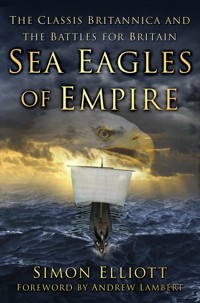
Winner of Military History Monthly's 2017 Book of the Year Award The Classis Britannica was the Roman regional fleet controlling and protecting the waters around the British Isles – in other words, Britain's first-ever navy. For over 200 years it played a key role in the northern frontiers of the Roman Empire: it helped to establish the province of Britannia and assisted in Roman military campaigns, as well as controlling the continental coast through to the Rhine Delta. Outside of war, the Classis Britannica also offered vital support for the civilian infrastructure of Roman Britain, assisting in administration, carrying out major building and engineering projects, and running industry. Later, its mysterious disappearance in the mid-third century ad would contribute to Britain finally leaving the Empire 150 years later. In Sea Eagles of Empire, acclaimed historian Simon Elliott tells its story for the very first time.
Sie lesen das E-Book in den Legimi-Apps auf:
Seitenzahl: 409
Veröffentlichungsjahr: 2016
Das E-Book (TTS) können Sie hören im Abo „Legimi Premium” in Legimi-Apps auf:
Ähnliche


About the Author
Dr Simon Elliott is an award-winning and best-selling historian, archaeologist and broadcaster. He has published fifteen books to date on themes related to the classical world, is widely published in the historical and archaeological media, and frequently appears as a presenter and expert on broadcast media around the world. He is a trustee of the Council for British Archaeology, ambassador for Museum of London Archaeology, guide lecturer for Andante Travels and Hidden History Travel, and president of the Society of Ancients. Simon is also a PRWeek Award-winning, highly experienced communications practitioner who began his career as a defence journalist.
Also by Simon Elliott
Alexander the Great vs Julius Caesar: Who Was the Greatest
Commander in the Ancient World
Ancient Greeks at War
Empire State: How the Roman Military Built an Empire
Julius Caesar: Rome Greatest Warlord
Old Testament Warriors
Pertinax: The Son of a Slave Who Became Roman Emperor
Ragstone to Riches
Roman Britain’s Lost Legion: Whatever Happened to legio IX Hispana
Roman Britain’s Pirate King
Roman Conquests: Britain
Roman Legionaries
Romans at War
Septimius Severus in Scotland
To my mum and dad for encouraging a love of all things Roman, and to Sara, Alex and Lizzie for their love and patience!
Front cover illustrations: Simon Elliott, Martin Latham and iStockphoto.
First published 2016
This paperback edition first published 2022
The History Press
97 St George’s Place, Cheltenham,
Gloucestershire, GL50 3QB
www.thehistorypress.co.uk
© Simon Elliott, 2016, 2022
The right of Simon Elliott to be identified as the Author of this work has been asserted in accordance with the Copyright, Designs and Patents Act 1988.
All rights reserved. No part of this book may be reprinted or reproduced or utilised in any form or by any electronic, mechanical or other means, now known or hereafter invented, including photocopying and recording, or in any information storage or retrieval system, without the permission in writing from the Publishers.
British Library Cataloguing in Publication Data.
A catalogue record for this book is available from the British Library.
ISBN 978 0 75096 931 4
Typesetting and origination by The History Press
Printed and bound in Great Britain by TJ Books Limited, Padstow, Cornwall.
eBook converted by Geethik Technologies
CONTENTS
Foreword by Andrew Lambert
Introduction
1 Background
2 The Roman Navy: History, Technology and Crew
3 The Roman Military in Britain and the Classis Britannica
4 The Military Roles of the Classis Britannica
5 The Civilian Roles of the Classis Britannica
6 The Early Campaigns of the Classis Britannica (AD 43–AD 100)
7 The Campaigns of the Mature Classis Britannica (AD 101–AD 191)
8 The Later Campaigns of the Classis Britannica (AD 192–AD 249)
9 The End of the Classis Britannica
10 Conclusion
Timeline
Bibliography
FOREWORD
For Imperial Rome, the greatest empire of them all, the sea was an essential connecting medium. The grain supply from Egypt and North Africa, the strategic mobility that enabled the legions to deploy quickly to meet new threats and the trade that funded the Universal Monarchy of the Ancient Mediterranean all depended on sea communications. And yet the Romans remained profoundly Continental by culture, so fearful of the sea crossing to Britain that they needed religious sites at both ends of the short passage. Their navies reflected this reality.
Rome won much of the empire with powerful naval forces, focused on combat and control, using great fleets of polyremes to demolish the rival maritime empires of Carthage and the Hellenistic world. Then the Romans abandoned their fleet and left the seas to traders and pirates. A brief resurgence of naval warfare culminating in the decisive victory at Actium saw the establishment of standing fleets, reconfigured for support roles, small cruisers and transports replacing specialised battle galleys. Imperial Roman sea power was responsive, and reflected a Continental world view: naval forces would move, support and sustain the legions, develop large-scale economic activities and secure trade routes.
As the outermost element in Roman power, the force that circumnavigated the British Isles, and helped pacify the Highlands, the Classis Britannica, has long stood in need of a dedicated history. In this book Simon Elliott provides the essential combination of ancient scholarship, archaeology and sea power theory to recover and interpret the First British Navy – extending the reach of Roman power and the antiquity of British maritime exceptionalism.
Andrew LambertLaughton Professor of Naval History and War StudiesKing’s College London2016
INTRODUCTION
The Roman war machine comprised both land and naval forces. In the case of the former one can look to the well-known and famous legions and their auxiliaries, and later in the Empire comitatenses, palatina, limitanei and foederates. Much less understood though are the naval forces, particularly the regional navies that participated actively in most military operations and policed the seas and rivers for much of the history of the Empire. Until the middle of the third century, in a British context this navy was the Classis Britannica, a fighting force in its own right. This book will tell the story of this illustrious naval force in their iron- and bronze-beaked galleys and laden transport ships, and specifically detail their exploits in defeating the Emperor’s enemies while keeping his peace around the islands of Britain.
A reasonable question to ask would be, ‘Why is it relevant now to write a history of Britain’s first navy?’ The answer lies not with classical but with modern history. For the first time in two generations naval power is coming to the fore again in the context of the overall capability of the UK armed forces. After ‘boots on the ground’ deployments in both Iraq and Afghanistan in the 1990s and 2000s, which ultimately lacked public support (though not to the detriment of support for the armed forces), and in an increasingly uncertain world geopolitically, priorities in regard to the UK’s defence and foreign policy have turned full circle. Now, instead of deploying the British Army in major operations abroad, attention is focusing again on the Royal Navy and RAF as the means of executing expeditionary foreign policy. To my mind it is the former that is set to benefit most from this new level of attention, with two new aircraft carriers set to enter service in the next few years, a new fleet of frigates in the same time scale, and a new generation of nuclear-powered submarines to carry the nuclear deterrent on the cards. In short, naval power and thus naval history in the UK are back in vogue, and in that context it seems only right to look at the beginnings of naval power in the islands of Britain.
A second and equally valid question might be, ‘Why is there a need for a new appreciation of the Classis Britannica?’ In the first instance, while there is a plethora of excellent works on the market aimed at both academic and popular audiences regarding Roman military power, such works tend to be dominated by a focus on land-based warfare. Sitting here in my office researching and writing this work surrounded by piles of such publications, I know this first hand! There are, of course, some excellent works on Roman naval military capability, both old and new. Further, in some of the general works on the Roman military, naval warfare is well referenced, though usually as an addition to the much wider appreciation of land forces and with a focus on maritime conflict in the later Republic. Yet even within this limited canon regarding Roman naval power, after extensive research I have yet to find a work specifically focusing on the Classis Britannica. I hope that this book addresses this omission!
With this work I have decided to take a different approach to the usual narrative history format for books of this type, playing to the strengths of my own background. These include being the former naval writer at Jane’s Defence Weekly having a Masters degree in war studies from King’s College London (KCL, where I studied British naval history under Professor Andrew Lambert, and where my dissertation was on post-war British naval power), having a Masters degree in archaeology from the Institute of Archaeology at University College London (UCL, where my dissertation looked at the role of the Classis Britannica in occupied Britain), and now with my PhD at the University of Kent where, again, the Classis Britannica is a major part of my research. This background has allowed me to review the Classis Britannica not just through the eyes of a historian, but also from the perspective of the application of naval power (both in the past and now).
Therefore the flow of this work will feature a background section (examining among other things the various issues that had an impact on the maritime activities of the Classis Britannica around Britain), a review of Roman naval power (including an appreciation of Roman naval activity to the advent of the Principate, an examination of Roman naval technology and a look at the manpower aspects of the Roman navy), an analysis of the Roman military presence in Britain within which the Classis Britannica sat, a review of the military roles of the Classis Britannica (through the prism of the modern academic appreciation of naval power), a similar review of the civilian roles of the Classis Britannica, then three chronologically sequential chapters looking at the early, mid- and late history of this key regional fleet (broadly fitting into the first, second and third centuries AD), they being followed by a discussion of the potential reasons for the end of the Classis Britannica and what followed. The book then finishes with a conclusion reviewing in context the high points of the Classis Britannica’s existence, a chronological timeline covering the major events in occupied Britain and finally a detailed list of references (the latter incorporating the bibliography).
My interpretation of the story of the Classis Britannica set out in this book is based as far as possible on hard data. In the first instance this means the archaeological record that has provided a great deal of insight into the narrative of Britain’s first fleet. Next I have used the historical record to best advantage, including epigraphy from the time of the Roman occupation and wherever possible primary sources, the latter to make my own interpretations on the events of 1,800 years ago (and noting that where the sources used are ambiguous or contradictory I have used common sense to determine what I believe to be the truth). Other data has also been derived from scientific observation, and finally here I have also made extensive use of analogy. To add to these various kinds of data I have also used, where appropriate, anecdote.
In terms of classical and modern names I have been pragmatic in the narrative to ensure that the work is as accessible as possible for the reader. By way of example, where there is a classical version of a modern name for a given city I have used the current name, referencing the occupation-period name at the point of its first use. However, with common and well-understood classical names for a given role, for example legate (general), I use that throughout the work, providing the modern name in brackets at the first point of use as illustrated here.
Where the term province is mentioned in the text, until the Severan-Caracallan reforms of Britain in AD 211–212 (originally planned in AD 197) this references the original single province of Britannia. After the reforms it references either Britannia Superior or Britannia Inferior dependent on the context (for example in the case of the Classis Britannica the former, see Chapter 8 for discussion, and in the case of the northern frontier the latter), or indeed where appropriate both. Following the Diocletianic reformation and the establishment of the diocese with its four and perhaps later five provinces (see Chapter 9 for detail), given the complexity the full name of a given province is detailed for clarity.
In terms of the military activities of the Classis Britannica I have deliberately stripped down my description of the various marine environments in which such activity would have taken place into two, namely the oceanic zone (for blue water naval activity) and the littoral zone (for littoral military combat activity along the coast). There are a number of definitions available for both, particularly the latter, but I have decided yet again to ensure that this work is as accessible as possible to the general reader (while retaining enough specific detail for the specialist). The same goes for all other technical terms – where the option has been available to simplify things, I have done so with the reader in mind.
Finally, I would like to thank all those who have made this work possible. Firstly, Professor Andrew Lambert of the War Studies Department at KCL for his constant encouragement. Secondly, Dr Andrew Gardner at UCL’s Institute of Archaeology for his similar support. Thirdly, Dr Steve Willis at the University of Kent for his guidance regarding my PhD, which features the Classis Britannica so significantly. And, of course, my publisher Chrissy McMorris of The History Press for believing in this work. Others also deserve a specific thank you, for example Dr Paul Wilkinson of the Kent Archaeological Field School, Dr Gustav Milne at UCL, Jeremy Hodgkinson of the Wealden Iron Working Group, Sam Moorhead at the British Museum, Dr Ian Betts at Museum of London Archaeology, Meriel Jeater at the Museum of London, Professor Sir Barry Cunliffe of the School of Archaeology at Oxford University, Professor Martin Millett at the Faculty of Classics, Cambridge University, Ray Chitty of the Medway River Users Association, and lastly here my patient proof reader and lovely wife. All have contributed freely and greatly to my wider research, enabling this work on the Classis Britannica to reach fruition. Finally, of course, I would like to thank my family, in the first instance my mum and dad, Eileen and John Elliott, for instilling a love of all things Roman at an early age, and last but not least my always supportive and tolerant wife, Sara (again!) and children, Alex and Lizzie. Thank you all.
Simon Elliott,August 2016
1
BACKGROUND
The Classis Britannica officially came into being in the Flavian period towards the end of the first century AD, being first mentioned by Tacitus in the context of the Batavian uprising in Germania Inferior in AD 70 (Histories, 4, 79, 3), though the fleet owes its origins to the Claudian invasion of AD 43. It is therefore firmly rooted in the Imperial period of Roman history and, given it is last referenced between AD 244 and AD 249, in the Principate originally established by Augustus.
A major fighting force in its own right, and also a resource used by the province for many other purposes, the Classis Britannica acts as a unique cypher to enable us to view the Roman experience in Britain and elsewhere on multiple levels. In the first instance it was one of the major regional fleets of the Principate, fulfilling a wide variety of military roles around the islands of Britain and along the North Sea Continental coast. It therefore played a major part in all of the great campaigns in Britain through to the mid-third century, while patrolling the littoral around the province and at the same time securing the eastern coastal flank of the limes Germanicus. Thus we can see from the primary sources a Roman fleet (pre-eminent among the regional fleets according to Pitassi in his wide review of Roman naval power, 2012, 50) in action on the open ocean and in the littoral zone, providing insight that is relevant to research not just for occupied Britain but for Roman naval activity across the Empire.
Through these campaigns and the fleet’s regular intelligence gathering and patrolling activities we also get insight into the nature of the province of Britain, the wild west of the Empire with its northern and western borders ever a militarised border zone.
Throughout Britain’s incorporation in the Roman Empire the province had an existentially large military presence. Because of this, and also because it was farthest geographically from Rome in the western part of the Empire, the province was a regular hotbed for usurpations and revolts. In these the Classis Britannica played a major role, again providing insight for the historian and archaeologist, though this involvement may ultimately have cost the fleet its existence.
Finally, in an age before the advent of the modern civil service, state-owned industries or a free market able to facilitate major capital infrastructure projects, those running a Roman province would have used any asset available to provide administration, transport, construction and engineering services, and to run the Imperial estates through which the major industrial enterprises were managed. In Britain, through to its demise, this asset was the Classis Britannica. The regional navy was therefore the very lifeblood by which the province maintained its existence. All of these themes above are discussed in depth in the following work.
This first chapter of our investigation into the British regional fleet is designed to provide all of the background information needed to appreciate the in-depth review of the Classis Britannica that follows. In the first instance I appraise how Britain was perceived in the classical world, before looking more specifically at Britain’s place in the Roman Empire. I then detail specifically the sources of the data used in my research, before finally looking at some of the practicalities that had an impact on those carrying out maritime activities around the islands of Britain and along the north-western Continental coast during the Roman period. These include tidal and weather patterns at the time, the differential in sea level compared to today, and a review of some of the models available to help us understand maritime activity around the islands of Britain during the occupation.
Britain in the Classical World
Even before its separation from the Eurasian landmass around 6,100 BC, Britain’s maritime context was shaping its destiny. Prior to this date it was a promontory stabbing out into the Atlantic at the north-western tip of Europe, and ever since its island nature has shaped its relationship with the rest of the Continent.
Britain was well known prior to the Roman occupation, though as a place of mystery at the very edge of the known world. The earliest reference to its existence appears in the sixth century BC Massaliot Periplus merchants’ handbook, now lost but referenced in the Ora Maritime by fourth-century Roman poet Avienus. Designed for use by those trading along the sea routes to northern Europe, this work shows that even at the earliest dates maritime activity around the islands of Britain was a key focus of regional attention. The original sixth-century work is also the first to attribute a name for the inhabitants of Britain, namely the Albiones for the British and Iverni for the Irish.
Herodotus is the next to reference islands in north-western Europe in the fifth century BC, he describing the Cassiterides in his Histories. These have often been associated with Britain given that the name translates as ‘tin islands’, the metal being a key export from Britain in the prehistoric let alone classical world. More clarity then comes in the form of the fourth-century BC Greek geographer Pytheas. Originating from Marseille (the Greek colony of Massalia, also home of the Massaliot Periplus detailed above), his definitive work is similarly lost to us, but key sections have been preserved by ancient authors including Strabo, Pliny the Elder and Diodorus.
Pytheas was the first person to record a circumnavigation of Britain during his maritime exploration of north-western Europe, which took in a visit to modern Denmark and seemingly an extraordinary visit to Iceland. His reports on the British Isles set a template for most of what followed in the classical world, highlighting their triangular shape and describing Kent, Land’s End in Cornwall and the Orkneys. He also notes for the first time the name from which our current ‘Britain’ is derived, reporting that the natives were called the Pretani (painted ones, referencing the prevalence of tattooing among the natives he encountered). Both Strabo and Pliny made extensive use of Pytheas in their much later descriptions of Britain, the latter going into an immense amount of detail, for instance describing the forty islands of the Orkneys, the seven of the Shetlands, the thirty of the Hebrides and also describing the island of Anglesey. Pytheas’ work is also evident in the physical descriptions of Britain by others, for example Caesar (who of course visited himself twice) and Agrippa.
The definitive classical map of Britain though is derived from Claudius Ptolemy’s mid-second-century Geography. This extensive gazetteer of the peoples and places of the Empire crucially included latitude and longitude, allowing for the first time a representation of the province to be created that appears vaguely recognisable to modern eyes. By the time his work appeared, however, Britain had been part of the Empire for more than a century, the Classis Britannica was in its prime and the islands had long since ceased to be the subject of mystery and awe.
Britain in the Roman Empire
Rome had designs on Britain well before the Claudian invasion in AD 43. Caesar famously made two incursions in 55 BC and 54 BC, though these might best be regarded as armed reconnaissances in the context of his conquest of Gaul (given the assistance provided to his Gallic enemies by some of the tribes of Britain). Augustus himself, founder of the Principate, planned at least three invasions in 34 BC, 27 BC and 25 BC (the first and last cancelled because of issues elsewhere in the ancient world, and the second abandoned after successful diplomacy). These false starts were certainly viewed negatively at the time, with the first century BC poet Horace (Odes, III.v) reflecting that, ‘Augustus will be deemed a God on Earth when the Britons and the deadly Parthians [also targets for Early Imperial Roman expansion] have been added to our Empire.’
Although Augustus’ plans to invade Britain came to naught, naval activity is definitely evident in the North Sea and along the north-western European coast during his reign. For example, in 12 BC his stepson, Drusus, deployed a fleet in the Ems Estuary while campaigning in Germania to subdue the Sicambri, while Drusus’ brother, Tiberius, also used naval forces to protect the North Sea flank of his similar campaigning along the German limes in AD 5. Drusus’ son, Germanicus, also used substantial naval forces while campaigning in Germany in AD 14 and AD 15, including an amphibious operation in the latter campaign to transport several legions.
Next, and bringing the focus back to Britain, in AD 40 Caligula famously abandoned his invasion of Britain from the beaches of northern Gaul (see Chapter 2 for full details), before finally Claudius went ahead with his invasion three years later.
The reality was that, from the moment of Caesar’s conquest of Gaul in the mid-first century BC, let alone the first of his two journeys across the English Channel, the proximity of the new superpower had begun to radically change the political, economic and social nature of Late Iron Age (LIA) society in Britain. This was particularly the case in the south and the east, where a case can be made that there was at the very least a Roman mercantile presence prior to Claudius’ invasion. Closest to Gaul was Kent (pre-Roman Cantion), populated by the Cantiaci. Kent may well have had a unique place in occupied Britain (discussed in depth in Chapter 4) and many have argued it long had a closer association with northern Gaul than it had with its neighbours in Britain, dating from the Mesolithic through to the early Medieval period (post-Roman burials in the county, for example, have a particularly Frankish feel). These neighbours included the Trinovantes to the north, the Catuvellauni to the north-west and the Atrebates and Regnii to the west.
Spreading out around Britain, one then has the Durotriges and Dumnonii along the south coast heading west, the Belgae, Dubonni and Cornovii heading northwards into the Welsh Marches, the Silures, Demetae, Ordovices and Deceangli ranging south to north in Wales proper, the Brigantes and Carvetti in the north country heading into the Scottish Borders, the Parissi north of the Humber, Caritani south of the Humber and Iceni in modern Norfolk. The impact of the presence of Rome prior to the occupation diminished as one headed north and west, and even after the province came into being and began to flourish this division remained in place, with the dividing line being roughly on a line from the Severn running north-eastwards to the Humber. If you lived south of that line during the occupation you were in a fully functioning part of the Empire, with all the economic benefits that this entailed. Caesar (V.135) himself famously describes Britain at the time of his 55 BC sortie as being densely populated and heavily cultivated, and it is clearly the south and the east that he is describing here. If, however, you lived north of the Severn–Humber line, you were in a military border zone where the whole local economy was bent towards maintaining the barrier between the Romanitas of the Empire and the darkness of barbaricum to the north and west beyond.
The Claudian invasion, prompted by opportunities presented when the Catuvellauni displaced the Trinovantes as the leading kingdom in the south-east (see Chapter 6 for full details), marked a huge watershed in the story of the islands of Britain. The most likely landing areas would have been the coast of eastern Kent, with the then shelter of the Wantsum Channel and the broad expanses of beach from Sandwich to Deal being particularly inviting to the invaders, adding to the relatively safe harbourage of Pegwell Bay. The landing place in this part of Kent was later marked in monumental fashion by the construction of a fine quadiphons triumphal 25m-high arch at Richborough that became the official gateway to the new province.
It should be noted here, of course, that despite the success of the Claudian invasion, which survived the significant threat of failure in the early 60s AD with the Boudican Revolt, the whole of mainland Britain was never fully conquered (with no attempt at all evidently being made to conquer modern Ireland). This story will be told in detail in Chapters 6 to 9 through the experiences of the Classis Britannica. For the purposes of this background chapter, however, one should note that it was not until the later first century when a claim could be made that Britain was fully part of the Roman Empire. For the period of activity of the regional navy the border in the north ran either along the Solway Firth–Tyne line (once built, Hadrian’s Wall) or the Clyde–Forth line (the Antonine Wall), except in periods of intense campaigning north of the border during the failed attempts to finally conquer the whole main island. It was this northern border (in either of its locations, by far the most northerly of the entire Empire) that proved so troublesome, with Irish raiding in the west later joining it in problematic intensity to create the militaristic frontier zone described above. Truly, if you were a Roman aristocrat wanting to make your name as a military leader, it was to the wilds of northern Britain that you would come, a fact much reflected in modern fiction!
As to why the whole archipelago were never conquered, James (2011, 144) makes the case that this was the result of a failure of the ‘open hand alongside sword’ strategy that had underwritten much of Rome’s early Imperial growth. He says that this required an elite sophisticated enough in newly conquered territories to buy into the Imperial project once conquest had taken place, adding that despite repeated attempts to conquer the north of the islands, such an elite appears to have been singularly lacking in what is now Scotland. In short, and to be blunt, the conquest of the extreme north and Ireland were simply not economically viable during the Principate, though interestingly contact with Rome in the border zone did create the conditions through which such an elite as described by James did begin to emerge in the later second century among the Maeatae north of Hadrian’s Wall and the Caledonians to the north of them (see Chapters 6 and 7). Such coalescence of power was later to evolve into the Pictish Kingdom, which caused major problems for the dioceses of Britain in the fourth century.
In terms of being a political entity, Britain became the province of Britannia shortly after the Claudian invasion. This lasted from the mid-first century through to the early third century, when the province was divided in two in AD 211–212 by Septimius Severus or his son, Caracalla, the new components being Britannia Superior and Britannia Inferior (Mattingly, 2006, 229). Following Diocletian’s reformation when the Empire was divided into twelve dioceses controlled by a vicarius, the Verona List of AD 303–314 details Britain from that point being comprised of four provinces in the new diocese of Britain, these being Maxima Caesariensis, Flavia Caesariensis, Britannia Prima and Britannia Secunda. The same provinces are listed a century later in the Notitia Dignitatum with the addition of the problematic Valentia. This continued sub-division of occupied Britain should be viewed in the context of the comments regarding Britain being particularly vulnerable to usurpation attempts given the large military presence and distance from Rome. Simply put, smaller political units were expected to present less of a threat (though in reality this actually proved not to be the case given the usurpation attempts actually gathered in pace).
Determining the exact size of the population of Roman Britain is problematic, though both David Mattingly and Martin Millett have usefully attempted such a calculation, breaking down the occupiers into three broad communities as below:
Community Type
Sub-unit
Millett 1990
Mattingly 2nd C
Mattingly 4th C
Military
Army
10,000–20,000
45,000–55,000
20,000–25,000
Garrison settlement (vici and similar)
50,000–200,000
100,000
50,000
Urban
Major towns
183,971–290,057 (both major and small towns)
120,000
100,000
Small towns
25,000
50,000
Rural
Villa dwellers
Mid-point average of 3.3 million, both villa and non-villa.
5,000
60,000
Non-villa settlement
1,700,000
2,215,000
Total
3,665,000
2,000,000
2,500,000
(After Mattingly, 2011, 219.)
Taking Millett’s figure of 3,665,500, this would have been up from a maximum of 2 million in the LIA, it then falling back to below 2 million after the occupation, then beginning a steady climb and reaching up to 8 million before the Black Death in the fourth century (Cunliffe, 2013, 97).
A final note here is with regard to the economy of Roman Britain. Chronologically, the south and east of Britain flourished for much of the early part of the occupation, then suffering as a result of the ‘Crisis of the third century’ (see Chapter 9) before flourishing again in the fourth century when other parts of north-western Europe were suffering further as the western Empire came under increasing pressure from both without and within.
Trade, both national and international, was driven by a number of factors during the period of existence of the Classis Britannica in Britain. The two key factors though were firstly the desire on the part of many elites to attain and display the trappings of Romanitas, this being magnified by the proximity of the south and east to the Continent. Secondly, yet again, was the disproportionately large military presence in occupied Britain. James (2011, 155) says that demand for ‘Roman’ goods would have been particularly strong among the legionaries who saw themselves as Roman and yet lived for the most part distant from Rome, such goods therefore helping them to distinguish themselves from the natives among whom they lived at the periphery of Empire. Similarly auxiliaries, raised elsewhere in the Empire but based in Britain, would have encouraged trade with their own homelands to maintain their own identity.
While this demand for goods from the military clearly benefited the south and east of Britain through which most of the trade would have arrived, the military presence in the north and west where most of the troops were based had a completely different effect. Here, all the data available indicates that the economy was stunted and totally subverted to the needs of the military. It is therefore no surprise that outside some notable examples such as York (Roman Eboracum) and Corbridge (Roman Coria, with even these two examples owing their existence to a military presence), the vast majority of the urban and elite settlement in occupied Britain were a feature of the south and the east of the province, not the north and the west.
Sources and Data
As detailed in the introduction, the data from which the detail of this work has been sourced originates from the archaeological record, the historical record, scientific observation and analogy, together with supporting anecdotal evidence where appropriate.
In terms of the archaeological record there are many examples of vessels of all sizes dating to the occupation period being found and examined across north-western Europe, some of which have a commonality of design that a number of commentators have interpreted as indicating an association with the regional fleets of the time (including in our case the Classis Britannica). These exciting finds are fully detailed in Chapter 2. Additionally, the archaeological record also provides data from the infrastructure that facilitated the operation of the Classis Britannica, for example the forts and harbours that supported the British regional fleet. Such evidence is fully detailed in Chapter 4. Finally, with reference to archaeological data, we have the thousands of tiles and bricks dating to the occupation that have been found on both sides of the English Channel bearing the ‘CLBR’ stamp of the Classis Britannica. These are detailed in Chapters 4 and 8.
Data from the historical record comes in the form of primary sources dating to the classical world, and from epigraphy. Among more than 100 ancient works that mention Britain, a number of authors go into great detail with some specifically highlighting the regional navy in action. The most important for this work are Julius Caesar himself with his Gallic Wars (first century BC but useful to set the scene for pre-conquest Britain), Strabo with his Geography (late first century BC/early first century AD, useful again for pre-conquest context), Cornelius Tacitus with his Annals, Histories and Agricola (late first century AD to early second century, and hugely important for the conquest period), Suetonius with The Twelve Caesars (late first century AD to early second century, and again relevant to the conquest period), Cassius Dio with his Roman History (late second to early third centuries AD, his extensive work covering most of the existence of the Classis Britannica), Herodian with his History of the Empire (late second century AD to mid-third, and particularly important for the campaigns in Britain of Septimius Severus), and Ammianus Marcellinus (fourth century, with his Roman History and useful for analogy). To these authors and their titles we can add the now anonymous Historia Augusta, a collection of biographies of emperors from AD 117 to AD 284 written in the later Empire.
Next we can examine a number of official itineraries and codices that include occupation-period Britain when giving details of the main travel routes across the Empire, crucially including place names for towns and key sites such as fortresses, and the distances between them. Firstly we have the Tabula Peutingeriana, a damaged thirteenth-century AD reproduction of a Roman road map that only includes the south-east corner of Britain (the remainder having been lost). Specifically detailed on the map are the Kentish ports that played a major role in the activities of the Classis Britannica, namely Richborough (Roman Rutupiae, a multi-purpose site featuring a harbour, the monumental arch and later a key Saxon Shore fort), Dover (Roman Dubris) and Lympne (Roman Lemavio). Next we have the Antonine Itinerary, this surviving as a manuscript that details the 225 most important roads in the Empire and the key sites along them. This provides a huge amount of information about occupied Britain, including details of all of the main civic centres and fortresses. Appearing to date from the reign of Caracalla (sole Emperor from AD 211 to AD 217), it therefore overlaps with the period of activity of the Classis Britannica. Next, though not strictly an itinerary, we have the Ravenna Cosmography, an early eighth-century AD list of names of places in the Empire based on earlier sources and thus including 300 locations in Britain (three centuries after the latter had ceased to be part of the crumbling western Empire). To this we can add the Notitia Dignitatum, a late Roman collection of the key officials and military formations in the Empire and their locations. Though outside the period of chronological interest of this book the Notitia is useful by way of analogy. Finally we have the Codex Theodosianus, a compilation of all legal rulings since the time of Constantine I dating to the first half of the fifth century. Again outside the time of interest for our period of study, it is useful by way of analogy.
We now move on to the epigraphy that specifically mentions the Classis Britannica, a number of references surviving in the context of memorials detailing the careers or activities of praefectus classis (fleet admirals), trierarchi (captains) and crew members of the fleet. In the case of the former a good example is provided by an inscription from Ostia naming Q. Baienus Blassianus as the praefectus of the Classis Britannica during the reign of Trajan. Another, closer to home, comes in the form of an altar dedicated to Neptune that was found reused in the walls of the later third century Saxon Shore at Lympne (almost certainly originating from the original Classis Britannica fort on the site). The epigraphy on the altar says it was set up by Admiral of the British fleet Lucius Aufidius Pantera and has been dated to the mid-second century. Further, a Marcus Maenius Agrippa is detailed on an inscription from Camerinum in Umbria that states he commanded the Classis Britannica, again in the mid-second century and with him likely being the successor to Pantera commanding the regional fleet. He is also mentioned on an altar inscription to ‘Jupiter Best and Greatest’ found at Maryport (Roman Alauna) in Cumbria, where he is also listed as being the overall procurator of the whole province, possibly at the same time as being the praefectus classis. Next we have Sextus Flavius Quietus on whose tombstone in Rome is detailed the fact he became the commander of the British fleet, again in the mid-second century. Meanwhile, an inscription from Celeia in Noricum details that one Titus Varius Priscus was also the praefectus of the Classis Britannica, though no date is available here, while finally for admirals we also have an unknown individual who is detailed in a partial inscription from Rome as having commanded four regional fleets – the Classis Britannica, Classis Germanica, Classis Moesic and Classis Pannonica. This latter is particularly interesting as it is not clear if the reference is to consecutive commands or to an unusual combination of all four. One theory is that it refers to the state of affairs after the defeat of usurping British Governor Decimus Clodius Albinus by Septimius Severus in the late second century. In Chapter 7 I make the case that the Classis Britannica would have supported Albinus, and was then ‘reformed’ by the new governor and military commissioners sent to the province after Albinus’ death. It may well be that while the ‘reforms’ were taking place a single commander could have controlled the British, Rhine and Danube fleets.
In terms of references to trierarchus of the Classis Britannica, we have five, the first four on gravestones at the regional fleet’s headquarters in Boulogne. Firstly there is Quintus Arrenius Verecundo, then Tiberius Claudius Seleucus, followed by P. Graecius Tertinus (in the context of his son’s memorial) and B. Domitianus (again in the context of a memorial to his son). Finally we have the North African Saturninus, known to have been a trierarchus of the Classis Britannica from an inscription found at Arles in southern France. This is a particularly important piece of epigraphy as it is dated to between AD 244 and AD 249 and is the last reference known to the Classis Britannica. To conclude the personalised epigraphic evidence we have one Didio, marine of the Classis Britannica, who is known from his gravestone at Boulogne, and finally Demetrius, another marine of the regional fleet also buried at Boulogne where a fragment of his gravestone has been found. The former originated in Thrace, while the latter came from Syria.
Epigraphy regarding the Classis Britannica not specific to an individual is also found in Britain. This includes the well-known inscription on a stone block on Hadrian’s Wall between Birdoswald and Castlesteads referencing a detachment of Pedites Classicorum Britanniorum (marines of the British fleet), and a similar inscription on a stone block in the portico of the granary of the Roman fort at Benwell, also on Hadrian’s Wall, this referencing a Vexillatio Classis Britannicae. Both of these inscriptions have traditionally being interpreted as an indication that the detachments actually built the section of wall or structure rather than them being permanently based there fulfilling a military mission. Additionally, the regional fleet is mentioned in the context of a Cohors 1 Aelia Classica (First Cohort of the Hadrianic Fleet, see Chapter 7) dating to AD 146 on a list of units detailed on a bronze discharge diploma from Chesters fort on Hadrian’s Wall. This appears to be the same unit mentioned in another diploma dated to AD 158 found in three pieces outside the Roman Fort at Ravenglass, and on a lead seal from the same location.
Of the other forms of data, scientific observation is threaded throughout the whole narrative. Analogy is also used extensively, for example in the comparison of the experiences of other regional fleets across the Empire with that of the Classis Britannica. Finally here anecdote too is used extensively, for example when comparing the modern understanding of the academic application of sea power (see the discussion of the military roles of the Classis Britannica in Chapter 4) with what is known of the campaigns and activities of the regional fleet around the islands of Britain and across the North Sea during the occupation. Additionally, anecdote is used in the context of the numerous examples of occupation-period jewellery and graffiti found in Britain that carry enigmatic and stylised images of galleys. These are included here as anecdote rather than as hard archaeological data given the lack of provenance regarding their origins and also because, though resplendent with their maritime imagery, they lack a specific mention of the Classis Britannica. They are particularly important from a phenomenological perspective given they may actually portray such a vessel operating around the islands of Britain during the occupation. Specific examples include an amber intaglio brooch featuring a galley and pharos, and similarly a graffiti on a lead sheet with a galley prominent, both found at Caistor-by-Norwich (Roman Venta Icenorum) and the former now in the collection of Norwich Castle Museum and Art Gallery.
Naval Operations Around Britain in the Classical World
In this final section of the background chapter I discuss the tidal regime around the islands of Britain and across the North Sea that would have had an impact on the operations of the Classis Britannica, the changes of sea level between then and now that certainly impact our understanding of these operations from a phenomenological perspective, the weather patterns across our area of interest during the Roman period, and examine the models that enable us to interpret the patterns of maritime trade in the region during the period of existence of the regional navy.
It is the gravitational attraction of the moon and to a lesser extent sun (the closeness of the former countering the far great mass of the latter) on the rotating earth that create the tides. Then as now they had a major impact on naval operations, and a regional understanding of them was vital to any form of successful maritime activity. In that regard one only has to look at the damage inflicted on Caesar’s invasion fleet in 55 BC by a violent storm associated with a very strong tide off the east Kent coast. Tidal regimes differ around the world, but in Britain today there are usually two high tides (every twelve hours and twenty-five minutes) and two low tides per day, this being called a semi-diurnal regime. In addition to this twice daily rise and fall, the specific positioning of the moon then also provides additional influence such that the highest high tides and lowest low tides are spring tides (with full and new moons), and the lowest high tides and highest low tides are neap tides, this being a fortnightly cycle. Finally, a seasonal cycle also has an impact such that the highest of the spring tides peak during the spring and autumn equinoxes. Thus it is likely that Caesar’s experience above was associated with a very high spring tide (he specifically describes a full moon being present), possibly combined with a storm surge travelling south from the North Sea.
Within this tidal regime the difference between high tide and low tide is known as the tidal range, this additionally differing around the coasts of Britain based on regional littoral and riparian topography, and also water depth (bathymetry). In that regard, at one extreme the Bristol Channel has the third highest global tidal range while Lowestoft on the East Anglian coast one of the lowest. Similarly, for all the same reasons above starting with the twelve hours, twenty-five minutes differential between high tides, the tidal times around Britain also differ within the semi-diurnal regime.
To illustrate the impact that knowledge of the tidal flows around Britain has on maritime operations one only has to look at the English Channel. The principal point of connectivity for the Roman province with the Continent, the tidal regime in this vital waterway changes significantly depending on location. In the eastern part of the crossing, the tidal streams change direction alternately east and west every six and a quarter hours. In the Straits of Dover, however, the tidal alternation is between the north-east and south-west, though again every six and a quarter hours. Matters are further complicated by the fact the same factors that influence the tidal range also impact the speed of the stream in either direction. Therefore local knowledge is essential, which perhaps Caesar was lacking in 55 BC.
Differences in tidal range and times during the occupation compared to today would have been caused by one principal key factor, namely the depth of the sea, which differed then when compared to today (see following comments on weather patterns). Sea levels around Britain have been rising since the Last Glacial Maximum (LGM) as part of the Flandrian Marine Transgression, with the chronological differential being exacerbated by isostatic processes that have seen post-glacial land levels fall in the south of Britain at the same time as they have risen in the north and Scotland. Devoy (1990, 17) has argued that relative sea level (RSL) by the beginning of the occupation would have been between 0.5 and 1m below current levels when looking at mean high water spring tides. Hall and Merrifield (1986, 18) go further, saying that the River Thames was 4m below its current level in the first century AD, while at the extreme end of this argument and in a source quoted by a number of more recent scholars, Briquet (1930, 439) argued there had been a rise in RSL of 5m since the occupation period. Some of this rise in sea levels actually occurred during the occupation, with Waddlelove and Waddlelove (1990, 253) arguing there was a marine transgression spike early in the first millennium AD that caused sea levels to rise significantly higher. Cunliffe (1988, 83) agrees, explaining that the change within the occupation period is readily visible on Romney Marsh where a layer of alluvium up to 2m thick, and dating to the later Roman period, covers settlement from earlier in the occupation. Even given this rise during the occupation, however, sea levels still seem to have been lower at the end of the period of Roman presence in Britain than they are today.
These lower sea levels during the occupation would definitely have seen a moderately different coastline around Britain than the one today, with many inlets as of then now being silted up. Good examples include the Wantsum Channel that then separated Thanet at the north-eastern tip of Kent from the rest of the mainland. During the Roman period this provided a ready channel to enable those travelling from the English Channel to the Thames Estuary to bypass the treacherous Goodwin Sands, and is the reason why the Saxon Shore forts at Reculver and Richborough were built at its northern and southern ends. Similarly, Cunliffe’s Romney Marsh was then open water, semi-enclosed by a spit of land that provided a safe anchorage and the reason for the Saxon Shore fort built there at Lympne (and almost certainly an earlier Classis Britannica fort, see Chapter 4).
One novelty regarding the seas around Britain that emerged following the conquest was for the first time the various oceanus


