18,49 €
Mehr erfahren.
- Herausgeber: The History Press
- Kategorie: Geisteswissenschaft
- Sprache: Englisch
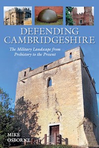
Throughout history, Cambridgeshire (including Huntingdon and Peterborough) has figured in many of the conflicts which have shaped our nation. Doomed Roman legionaries marched from Longthorpe to defeat by Boudicca's Iceni; Saxons and Danes fought over the edges of the Danelaw; the Normans came this way to crush Hereward's Fenland resistance; in the Civil War it provided the defended frontier between Parliamentarian and Royalist; in Napoleonic times French prisoners of war were incarcerated here; and in the twentieth century its flat expanses were home to numerous airfields and missile bases. This book describes the function and purpose of these defensive structures and reveals the evidence which many of these major events left on the ground: the earthworks of hill forts, medieval castles and moats; the masonry of later forts and strong-houses; drill halls and militia barracks; and the lines of anti-invasion defences from 1940.
Das E-Book können Sie in Legimi-Apps oder einer beliebigen App lesen, die das folgende Format unterstützen:
Veröffentlichungsjahr: 2013
Ähnliche


Contents
Title
Acknowledgements
Abbreviations
Introduction
One Prehistoric, Roman and Saxon Cambridgeshire
Two The Early Mediaeval Period in Cambridgeshire 1066–1300
Three The Later Mediaeval and Tudor Periods 1300–1600
Four Stuart and Georgian Cambridgeshire
Five The Victorian Period 1815–1914
Six Cambridgeshire in the First World War
Seven The Interwar Years
Eight The Second World War
Nine The Cold War and Beyond 1946–2012
Appendix 1 Iron Age Forts
Appendix 2 Mediaeval Castles and Other Fortified Sites
Appendix 3 Civil War Sites
Appendix 4 Drill Halls and Other Premises used by Volunteer Forces
Appendix 5 Airfields and other RAF and USAAF Aviation-related Sites
Appendix 6 Designation of Airfields under Taylor Report, 1940
Appendix 7 Air Defence: Bombing Decoys
Appendix 8 Locations used by Home Guard (HG) Units
Appendix 9 Command and Control in the Second World War
Appendix 10 Military Hospitals and Welfare
Appendix 11 Second World War Prisoner-of-War Camps
Bibliography
Copyright
Acknowledgements
Thanks are due to the following:
Colin Alexander; Adrian Armishaw; Tony Baggs; Mike Bardell of East Anglia RFCA; Bob Beales; Paul Bellamy; Guy Bettley-Cooke; Michael Bowyer; Mrs Boyall of Chapel Cottage, Maxey; Barry Britain; Graham Cadman; Wayne Cocroft of English Heritage; Darby Dennis of Walcot Hall for allowing access; Paul Francis of the Airfield Research Group/AiX for Figure 17; John Goldsmith of the Huntingdon Museum for permission to include Figures 3, 4 and 5; Richard Hillier of Peterborough, Chris Jakes of Cambridge and David Hufford and Lesley Akeroyd of Huntingdon local studies libraries; Sir William Proby of Elton Hall for providing photographs; Martyn Smith for information regarding the Huntingdonshire Cyclists; Ray Smith; Keith Ward; Dr William Ward.
All illustrations are the author’s unless otherwise credited.
Abbreviations
NB In several places, especially where RAF buildings are concerned, they are often described by their Drawing Numbers. These consist of a sequential number and a year: thus 343/43 refers to the Watch Office for All Commands, built to the 343rd design to come out of the Air Ministry in 1943. The term ‘tb’ refers to buildings with walls which are a single brick in width and officially known as ‘temporary brick’.
Introduction
This volume, the sixth in a series covering the military landscapes of individual counties, includes all those local authorities which combined as Cambridgeshire in 1974: old Cambridgeshire, the Isle of Ely, Huntingdonshire, Peterborough and the Soke. Over the years continuous boundary changes have led to an eclectic mix of military affiliations. Infantry units representing Cambridgeshire, Suffolk, Northamptonshire, Bedfordshire and Huntingdonshire have been recruited from and based in the county, as have Yeomanry cavalry units from Suffolk, Norfolk, Bedfordshire and Northamptonshire. The Northamptonshire battery of a parent artillery unit based in Hertfordshire, and a specialist engineer unit, nominally from Northamptonshire, have both been closely associated with parts of the county. Successor units, such as the Royal Anglian Regiment, have continued to maintain these territorial connections.
For the almost twenty-five years that I worked in the county, avoidance of the A14 enabled me to drive most of the county’s by-roads and so discover the wealth of heritage often overshadowed by the dominance of Cambridge, Ely and Peterborough. There are sites ranging from the lowest-lying hill-fort in Britain, through to bases devoted to the collection of electronic intelligence. Many of these sites have been re-used over the centuries – Stonea Camp, the Cambridgeshire Dykes and Earith Bulwark all figured in conflicts from ancient times, through the Civil Wars or into the Second World War. It is no coincidence that in those latter two conflicts, the same line was chosen for Cambridge’s inner defensive perimeter.
Whilst giving a talk at Duxford’s Imperial War Museum, I made the mistake of noting the absence of coast defences in land-locked Cambridgeshire forgetting, as was pointed out to me that, not 100 yards away was one of the 9.2-inch turreted guns from Gibraltar, along with all sorts of other exhibits from campaigns near and far, all shown within an almost unique historic setting. Having always been fascinated by castles and forts, it was in Peterborough that my interest in more recent anti-invasion defences was kindled when I came across Barry Allen, of the Soke Military Society. The pillbox in his back garden had prompted him to record such structures across a wide swathe of the north of the county. That was thirty years ago and many which had survived until then have now gone. Demolition on brown-field sites is gathering pace and Oakington, Waterbeach and Alconbury airfields will soon have largely disappeared. This makes the process of recording doubly vital. The confusion between disc barrows and searchlight sites is now a cliché but such mistakes still occur. Humps and bumps on Peterborough’s Stanley recreation-ground, for instance, identified as evidence of mediaeval ridge and furrow, actually represent former air-raid shelters, and unless we note what was once there it will be lost forever. This book seeks to show how rich Cambridgeshire is in its military heritage, but also how quickly the evidence is disappearing. However, new discoveries are still out there waiting for us, and any reader lucky enough to uncover items of interest is asked to observe three principles: to respect private property and privacy; to take appropriate care in potentially hazardous locations; and to report discoveries to local authority Historic Environment Officers or museum staff.
Mike Osborne, 2013
Prehistoric, Roman and Saxon Cambridgeshire
Prehistoric Fortifications
One of the earliest forms of defence work is the causewayed enclosure. That at Haddenham is the largest in England, covering a little over 20 acres (8.5ha) surrounded by a single ditch and palisade. Other examples have been found at Great Wilbraham and Maxey/Etton. At Rectory Farm, Godmanchester, is an enclosure of 16 acres (6.3ha) with an entrance to the north-east and twenty-four massive timber posts spaced around the inside of the perimeter. The Early Iron Age was largely characterised by loose unenclosed villages which had developed from farms set in field systems. Throughout the Iron Age, right up until the Roman invasion and beyond, isolated settlements consisted of round huts within an enclosure. A typical example was found at Werrington, where a single hut lies in a roughly square enclosure of bank and ditch, with sides of around 50 yards.
In the period between the third and the first centuries BC, the so-called Iron Age ‘hillforts’ made their appearance. There is still disagreement amongst historians as to the purpose of these monuments which would have required an enormous investment of materials and labour. It is quite possible that individual examples fulfilled different functions, but it is clear that many were never permanent residential sites. Assuming at least an element of military intention, it is possible to draw distinctions between those in our area. Some, such as Belsars Hill, were of only local importance, whilst others suggest themselves as being of more strategic significance, guarding frontiers. A line of forts, which includes Wandlebury, Arbury and War Ditches, stretched from the Thames to the Fens using the valleys of the Lea, Stort and Cam to separate the Trinovantes to the east from the Catuvellauni, controlling Huntingdonshire and West Cambridgeshire, in the west. Further to the north, the Corieltauvi marked their boundary with the Iceni with the fort at Borough Fen and a series of smaller defended enclosures which extended into Lincolnshire. Borough Fen (1), 4.5 miles (7km) north-north-east of Peterborough, on Peakirk Moor, had been built with a rampart 24 feet (7.5m) wide and reinforced with a revetment and a surrounding ditch, 32 feet (10m) wide and nearly eight feet (2.5m) deep, but these clear defensive features apparently enclosed empty space which was soon put to pasture. Recent Lidar mapping has shown an outer bank and ditch on the west, and emphasised that the fort stands ‘a dizzying 4m’ (13 feet) above sea level. Arbury, too, appears to lack interior structures and it has been suggested that it was an enclosure for migrating stock, but its substantial timber gateway, ramparts and ditches nevertheless suggest a defensive function. There is continuing uncertainty regarding the purpose of many Iron Age forts, and explanations of their use as emergency refuges are perfectly plausible. Arbury’s low-lying position is contrasted by that of Wandlebury, a bi-vallate fort on the Gog Magog hills south of Cambridge. Here there is evidence of settlement, but not necessarily contemporaneous with the defences. A smaller fort at Cherry Hinton, War Ditches is, again, roughly circular, whilst Borough Hill at Sawston, much more extensive than all those mentioned above, appears to anchor its double ditches on natural marshy obstacles. Along with these forts, tribal boundaries were often marked by linear dykes, many of which are traceable through their re-use in Anglo-Saxon times.
It has been suggested that the major Fenland fortress of Stonea Camp, covering nearly 24 acres (9.5ha) and the most extensive such structure in East Anglia, was an important focus for Iceni gatherings. It enjoys the status of oppidum, or tribal centre, putting it on a level with Colchester, St Albans and Leicester. Stonea lies a little to the south-east of March on a ridge that dominates the southern Fens, close to the old courses of the Ouse and the Nene, and at a point where fresh-water met sea-water. The Iron Age fort occupies a site which in Neolithic times accommodated a settlement, a cursus, and burial mounds. The camp dates from the third or second centuries BC, from which time an inner defensive rampart and ditch have been found, entered through staggered entrances, an arrangement commonly found in such forts across the country. There are three distinct lines of banks and ditches, the two inner of them forming D-shapes with outer ones to the north and east (2). The ditches are cut through different ground conditions and this may account for variations in their dimensions and profiles. The excavators have postulated a four-phase construction for the camp, which began with the outer enclosure, and finished with the outer of the two D-shaped enclosures, suggesting a re-modelling towards the end of the Iron Age occupation. Ditches were generally around 16 feet (5m) across and up to 7 feet (2m) deep which, added to the height of the rampart, would have produced an impressive fortification in this low-lying landscape. To the surprise, and apparent disappointment of the excavators, no evidence was discovered for timber gate-defences. This may be explained by the lack of settlement evidence, as it seems likely that Stonea Camp was a site for gatherings and rituals, its defences being more of an insurance policy for emergencies rather than of permanent and continuous usage. The weakness of the defences on the south facing the watery approaches has been cited as a case for dismissing the structure’s defensive integrity but, as at Borough Hill, the marshy nature of the land on that side may have been deemed sufficient defence in itself.
1 BOROUGH FEN CAMP on Peakirk Moor: this circular Iron Age camp may have defended a tribal frontier. In this low-lying landscape the bank and ditch nowadays appear insignificant as fortifications.
2 STONEA CAMP near Wimblington: this Iron Age site may have served as a tribal centre, a refuge and a settlement. Its inner banks and ditches still appear to fulfil a defensive function.
Despite archaeologists’ and historians’ ambivalence over the purpose of these Iron Age forts, it would appear that at least one Cambridgeshire example, War Ditches at Cherry Hinton, may have met a sudden and violent end. Although much of the fort has been destroyed by quarrying, excavators found that the ditch had not filled by natural processes but had been back-filled with the rubble and stone blocks which had formed the rampart, apparently intentionally, rapidly and by human agency. Not only was there charcoal in the ditch indicating the burning of, at the very least, the timber palisade, but there were large numbers of skeletons, both articulated and disjointed, some bearing cut-marks, and constituting possible evidence of injuries received in conflict. All this was dated to the middle of the first century AD, and may relate to the northward progress of the Roman army, or may simply represent the product of an intertribal spat.
Roman Fortifications
Having reconnoitred Britain in the previous century, but penetrated no farther than Hertfordshire, the Romans invaded Britain in AD 43, this time showing every intention of staying. Although the native British tribes had made some collective effort to resist the earlier incursions of the Belgic tribes from France, they were generally not given to co-operation, which gave the Roman troops a clearer run than they might have expected. Having secured London, and especially the major tribal centre of Colchester, their major thrust was towards the Trent and Humber, with the line of the Fosse Way marking a temporary western frontier. The valley of the Great Ouse appears to have provided one approach for the Roman forces who established forts at Godmanchester to secure a ford on the road north from Sandy (Bedfordshire), and at Longthorpe, on the Nene a little to the west of Peterborough, to act as a base for further operations. By AD 48 the Romans felt sufficiently well-established to demand that the British disarm, but powerful tribes such as the Iceni unsurprisingly resisted this demand, and military action, possibly taking place near Stonea Camp, was necessary for the policy to be enforced. Amongst human remains uncovered at Stonea was the skeleton of a child which appeared to carry sword-cuts. Following their subjugation, the Iceni were allowed to retain their own leader, a source of later misunderstandings, but became a subject people under Rome.
At Godmanchester (Durovigutum) the earliest fort, of the usual playing-card shape and oriented east-west, was large enough to hold half a legion. It had a double ditch and a timber rampart revetted in turf. It appears to have had timber interval turrets, the four corner-posts of one having been found on the south side of the fort. At Cambridge, the early settlement on the promontory overlooking the river was surrounded by a ditch outside a bank topped by a palisade. The original fortress at Longthorpe was squarer in plan with double ditches and an earthen rampart, 20 feet (6m) wide, surmounted by a timber palisade with a wall-walk or fighting-platform. The fortress, again designed to accommodate half a legion, covered 27 acres (11ha). It was south-facing on a site on the north bank of the Nene and close to important roads. Its four gates were each defended by flanking timber turrets mounted on six posts, allowing them to project beyond the two gate-passages, which were each 12 feet (3.6m) wide. The interior of the fort held barracks, a headquarters building, stores and granaries. It was in occupation from some time in the mid-AD 40s, but whether or not it pre-dated the initial problem with the Iceni cannot be determined with any certainty. Given that only auxiliaries rather than legionaries were involved in that particular campaign, might suggest that it came after the rebellion had been put down. It had a number of functions which included providing a reserve force behind the Fosse Way and a blocking force to prevent military collusion between the Iceni and their neighbours, the Coritani and Catuvellauni. It was also the nearest garrison to the newly established colonia at Colchester. As well as providing the base for a mobile strike-force, it offered winter quarters for troops on campaign, and a permanent storage facility for grain and equipment. The mobility required by a quick-reaction force would have been provided by the stationing of auxiliary cavalry in the fortress, and one of the buildings, excavated in the 1960s and ’70s, has been interpreted as stabling. The nature, proportions and dimensions of the buildings and the spaces in which they are set, enabled the excavators to infer a garrison of around 1,700 legionaries and 1,000 auxiliaries, including cavalry. About 500 yards to the east, a military depot produced pottery and other wares for the army.
In AD 60 Boudicca led a full-scale revolt of the Iceni against Roman rule. Hearing of the sack of Colchester, Petillius Cerialis, legate of the IXth Legion, led his troops from Longthorpe but was surprised by a vastly greater force of Iceni and defeated. A draft of reinforcements to the legion the next year contained 2,000 legionaries and is likely to represent the scale of losses sustained in the battle. Cerialus escaped back to Longthorpe with his cavalry, and appears to have shrunk the area of the fortress to reflect his reduced defence capability. The new fort, nearer to the typical playing-card shape, covered 11 acres (4.4ha) within the perimeter of the old fortress. The new defences were on a smaller scale to the earlier ones although it is likely that the old timbers, particularly those of the gate-towers (Fig. 1), were re-used. Those buildings which fell within the new enclosure were used as they were, with no visible evidence either of adaptation or rebuilding. The old outer defences were allowed to erode and the now unused buildings were dismantled. After the inevitable defeat of the Iceni, the Roman army shifted its focus northwards once more, and around AD 60 the IXth Legion’s base was established in a new legionary fortress in Lincoln, rendering Longthorpe redundant. Military occupation there appears to peter out after AD 61, although it is not impossible that the fort continued in use for some years after.
Fig. 1 LONGTHORPE: a reconstruction of the gateway of this Roman legionary fortress of the first century AD, based on other examples and archaeological evidence.
Following the shock of the Boudiccan revolt in which three major Roman towns had been razed and their inhabitants slaughtered, the urgent re-establishment of Roman control was essential. Cambridgeshire contained important hubs in the network of roads in the region. From Colchester, a road ran to Braintree and Great Dunmow (Essex) entering the county at Great Chesterford, and continuing on to Cambridge and Godmanchester, finishing up in Leicester. Another road led from Royston to Durobrivae via the river crossing at Godmanchester (Ermine Street) and linked to the Longthorpe fort. The Fen Causeway ran from Whittlesea to Denver (Norfolk), and King Street ran from Durobrivae north along the fen edge to Lincoln. To protect these routes, and the settlements which grew up associated with them, forts were newly built or up-dated. New forts were built along the Fen Causeway, at Grandford near March and at Eldernell. The Grandford fort replaced an earlier one which may have been built around AD 47 at the time of the brush with the Iceni. Its successor, of a size appropriate to the accommodation of 500 auxiliaries, most likely represents the installation of a garrison along the Fen Causeway charged with ensuring that the remnants of the Iceni army caused no further problems. The fort at Eldernell, also located on the Fen Causeway, appears to have been of a similar size. At Cambridge (Durolipons) the defensive site above the river-crossing and track-way junction was enlarged with renewed defences as a military supply base, located near New Hall on the road out of the North Gate to Godmanchester, and in use around the turn of the first century. It was later adapted for domestic use, and by AD 150 the fort had been redeveloped as a town laid out in insulae. The fort at Godmanchester, which had in the meantime become a civilian settlement apparently destroyed during the Boudiccan revolt, was re-built in its aftermath slightly further to the north of its original site. With the winding-down of the legionary base at Longthorpe, it was nevertheless necessary to maintain a military presence in the Nene Valley, and a double-ditched auxiliary fort covering 5 acres (2ha) was established at Water Newton, where Ermine Street crossed the Nene. An industrial settlement, probably supplying the needs of the army, developed outside the fort, and this was most likely the stimulus for the later town of Durobrivae. A further fort at Lynch Farm near Peterborough probably dates from this first century of Roman rule. At Tort Hill, Sawtry, it was once thought that a possible Roman signal station had been built, presumably one in a chain which must have followed the line of Ermine Street. However, subsequent excavation revealed the square earthwork as a Civil War fort. The former presence of a Roman watch-tower at Pilsgate, overlooking Ermine Street, has been recorded in a local history of neighbouring Barnack, along with a marching camp in Burghley Park to its west. To the south of the Coneygeare in St Neots are traces of what has been interpreted as a Roman marching camp, perhaps sited to protect a crossing of the Great Ouse, since signs of a Roman road, entering Eynesbury from the south and aligning with the old Stanestrete to Crosshall and Hail Weston, have been inferred.
The important centre of the Iceni at Stonea was chosen as the site of a Roman town around AD 125. Functioning as an administrative centre, possibly of an Imperial estate under the patronage of Hadrian, exploiting the fertility of the Fenland soil as well as a focus for trade, this town boasted several sophisticated and imposing structures. One of these was a substantial square building, constructed in stone and possibly rising to four storeys, interpreted as either a town hall or a temple. Most of the rest of the town, spread over at least a dozen insulae, were of timber and daub. The settlement flourished until well into the third century when it appears to have shed its official status, and become the nucleus of a farming community. Thus at the time that other similar-sized towns were renewing or acquiring fortifications, Stonea lacked the status, the motivation and the resources.
Durobrivae has been described as a ribbon development straggling along Ermine Street, in essence a definable centre and two suburbs, with plots fronting onto the main road, and lanes going off in all directions behind this frontage. In the late second or early third century, the central part of the town was walled. These walls, in the shape of an irregular hexagon enclosing 44 acres (15ha), consisted of clay banks supporting a stone wall. In common with other such towns, the unrest of the late fourth century led to bastions being added to the walls. Despite a thriving mosaic industry and evidence of wealth as exemplified by the early Christian Water Newton treasure, the town contracted, the suburbs dwindled and the town died with the exodus of the Romans. The nearby settlement of Castor was centred on a high-status villa often described in palatial terms. The owner has never been identified but it has been suggested, possibly somewhat fancifully, that he could have been someone as important as the Count of the Saxon Shore, the Roman commander of the Classis Britannica, responsible for the defence of Britain’s coastline against Saxon raids during the second half of the fourth century.
Godmanchester’s replacement fort was itself subsumed by the town defences following the line of the fort’s walls, and utilising its north gate. These town walls date from just before AD 300, enclose an area of 27 acres (11ha), and consisted of a 10 foot (3m) wide masonry wall built onto a contemporary rampart with a 32 foot (10m) wide ditch, incorporating rectangular external interval towers. The South Gate in Pipers Lane, almost 30 feet (9m) wide, had a pair of projecting towers. The construction of these walls was interrupted by a fire which destroyed the mansio, leaving gaps. A later wall partitioned off the town’s official buildings, and may point to a general contraction of the defended area. A hundred years later the defences were refurbished with stone robbed from the buildings in the town centre, an artillery bastion was added to the south-east corner, and a new 40 foot (12.5m) wide ditch was dug around the perimeter.
In Cambridge, the major part of the town, 25 acres (10ha), was walled in stone (3) late in the fourth century, with gates located on each side. That on the west on Mount Pleasant, at the junction with Albion Row, had been excavated. Only the northern half of the gate could be examined, and this consisted of a rectangular footing measuring 25 feet (7.5m) by 15 feet (4.5m). The roadway between this and its corresponding footing on the south side measured nearly 30 feet (9m). The excavator suggested that this gate-arch would have been flanked by rectangular or D-shaped gate-towers projecting forward from the wall. Since so much of the Roman circuit disappeared under the castle and the later Civil War earthworks, it has not been possible to locate bastions on the course of the wall, if indeed they ever existed.
3 CAMBRIDGE, Mount Pleasant: here Storeys Almshouses stand on the bank which marks the north-west angle of the Roman town defences.
A number of other possible town sites have been identified in the northern Fens. Most appear to have been composed of groups of ditched enclosures containing either circular or rectangular timber huts, temples, barns and evidence of agricultural and associated industrial processes. At Fen Drove, Earith, there are suggestions of defences in the form of a ditch enclosing a roughly rectangular area, measuring about 300 yards by 100 yards, alongside a drove-way, and containing many of the elements of the settlement. Camp Ground at Colne Fen, Earith was a similar settlement estimated to have had a population of up to 120 inhabitants. Covering an area of 17 acres (7ha), its perimeter was marked by double-ditched embankments and ditched trackways. The excavators reckoned that, had these banks been topped with thick thorn hedges, then they would have constituted a viable defence against both casual aggressors and wild beasts.
After a dip which lasted through much of the fourth century, the Fens appear to have experienced a degree of economic recovery marked by new stone buildings, at Stonea and Chatteris for instance. There is evidence that occupation of such sites continued beyond the end of Roman rule in the early 400s.
Saxon and Danish Fortifications
After the Romans left, the inhabitants attempted the continuation of their Romano-British life-style often, but not exclusively, in a rural context. Saxon incomers appeared early in East Anglia and are recorded in the chronicles as having assumed a predominance by the mid-fifth century. There would have been examples of peaceful co-existence in some places, and violent seizure of land and ejection of the native population in others. Evidence for reoccupation at Stonea Grange, where timber halls of Anglo-Saxon date occupied the former administrative quarter, has been found. In Peterborough, Godmanchester and in Cambridge (Grantaceastr north of the river Cam), timber halls, sunken huts and cemeteries have all been uncovered. Clusters of sunken huts have been found all over the county at, among other locations, Maxey, Waterbeach and Willingham. The location of Anglo-Saxon cemeteries in locations such as Haddenham and Witchford airfield may indicate the occupation of strategic sites controlling access to the islands in the Fens, and evidence for the fifth-century reoccupation of the long-abandoned fort at Longthorpe may point to a parallel attempt to control the Nene crossing. At Orton Hall Farm, a Saxon timber hall had been built on the ruins of a Roman house, alongside a group of sunken huts and a granary.
Throughout much of the Anglo-Saxon period, the Cam represented a political boundary between East Anglia and Mercia, and Cambridge was the furthest north it was possible to access the Midlands from East Anglia before the traveller disappeared into the impenetrable Fens. To the east of the river there is a series of defensive dykes of fifth and sixth-century date, apparently positioned to protect East Anglia from hostile approaches from the south-west. The four dykes, south-west to north-east, were Bran Ditch east of Royston; Brent Ditch, between the rivers Granta and Cam; Fleam Dyke/High Ditch between the Cam and the Icknield Way south of Wilbraham; and the Devil’s Dyke between Burwell and the Swaffhams. The latter two, probably earlier than the others, were also more substantial. It has been suggested that having been constructed soon after the Roman withdrawal, they would have figured both in local power struggles, and also against the growing incursions of Anglo-Saxon invaders. It is possible that the origins of these dykes may lie in earlier Iron Age boundary ditches. Devil’s Dyke is the most impressive of these monuments running for a continuous 7.5 miles (11km), its bank 23 feet (7m) wide at its base and its ditch to the west, 16 feet (5m) deep. Excavations have revealed some of the construction techniques and also that the Bran Ditch was preceded by much less impressive double ditches with a timber palisade between them. A succession of re-builds show that construction continued through into the seventh century. Across the border in Suffolk further pairs of similar ditches occur, straddling Roman roads and suggesting that together, all these dykes may represent a co-ordinated attempt to both define and defend territory. It has been suggested on the basis of female dress excavated in sixth-century graves at Edix Hill, that Cambridgeshire failed to develop a regional identity of its own as did, say, Essex, and maybe it was this unsettled life in a buffer state which precluded that.
Mercia only cemented its hold over its easterly area of influence by re-establishing the town of Cambridge late in the eighth century. King Offa picked up on the Danish use of fortified camps by building a network of defensive centres known as burhs. Many of these were well-established towns, previously fortified by the Romans, whilst others were on green-field sites of strategic value. Cambridge, preserving its Roman walls and gates, and representing a gateway to Mercia, became one of Offa’s burhs, Grantabrycge. As well as the fortified core, he also built a bridge across the Cam and encouraged the growth of trade by establishing wharves by the river-side and a market. There may also have been a minster-church on the site later chosen by the Normans for their castle. The king’s reeve or alderman may have had a house within its own ditched and banked enclosure in the north-east corner of the Roman enclosure, referred to as Alderman’s Hill.
Susan Osthuizen has shown how the settlements in the more stable East Anglia have ‘ham’ place-names, whereas the more latterly occupied estates to the west have more ‘tons’. Peterborough had been founded in 655 by Peada, the first Christian king of Mercia, as Medehamstead, with an important monastery and at the centre of extensive land-holdings bestowed by King Wulfhere. Other important monasteries were founded across the county at this time, among them, Thorney, Ely and Ramsey.
The Danes, first appearing off the coast of Britain in 789 on exploratory expeditions, and having previously carried out mainly small-scale raids, stepped up their efforts throughout the ninth century, often over-wintering with up to 300 ships in prepared water-side laagers. In 870, after King Edmund had died attempting to evict the Danish host from East Anglia, attacks increased in ferocity; Peterborough abbey was burnt to the ground, and the abbot and his monks slaughtered. This was but one defeat which heralded a sustained period of Danish dominance, and England was partitioned, with the Danes establishing the Danelaw in the counties to the east of Watling Street under Guthrum. From around 873, outside their heartland of East Anglia, four separate outer territories centred on Bedford, Cambridge, Huntingdon and Northampton were set up, each ruled by an earl with his own standing army. In 875, the Danes built a new burh in Cambridge extending south of the river with St John’s Ditch marking its southern boundary. In 876, Guthrum assembled an army at Cambridge to embark on the subjugation of Wessex, a struggle which finally ended with his defeat by Alfred. The Danes converted to Christianity and retreated into East Anglia, and by 886 Alfred had managed to ally Wessex and Mercia to produce a durable state that might defend against dormant Danish ambitions.
Under peaceful Danish rule, the county saw the growth of up to 250 village communities replacing the scattered farmsteads of earlier times. Members of the Danish aristocracy lived in small defended enclosures known as ‘holds’, examples of which have been identified at Spaldwick and Wistow, with that of the earl himself at Shelford, where his coin was minted. The Danes continued to carry out coastal raiding but they were not the only aggressors. According to the version of the Anglo-Saxon Chronicle written by the monks of Peterborough, in 903 the Danes were lured into breaking the truce giving Edward the excuse to ravage all the land between the Devil’s Dyke, the Fleam Dyke and the Ouse.
By 917, the success of the Danish economy was attracting the covetous attention of Edward the Elder and of Aethelflaed the Lady of Mercia. Having lost Bedford and Northampton, the Danes left their fortified base at Huntingdon and moved to a new camp on the Ouse at Tempsford, seeing it as more convenient for attacks into Mercia. Retiring there, having been repulsed by Edward’s garrison in Bedford, the Danes were overwhelmed by the Mercians and forced back into Essex where they faced further defeats. Edward’s men took Huntingdon, repairing the damage and making it defensible once more. The Danes of Cambridge were particularly keen to accept Edward as their overlord, welcoming his commitment to increase the importance of the town by extending the area south of the river, establishing a mint and awarding them the status of county-town. On the basis of archaeological evidence, RCHM(E) regards the Kings Ditch as being pre-Conquest, being re-cut around 1200, and the church of St Bene’t is dated to between 950 and 1050. There is a theory that stone Saxon church-towers (4) fulfilled defensive and civic functions alongside ecclesiastical ones, and both these monuments point to a developing settlement complementary to the town on the hill. Edward is known to have established burhs across his lands, and it is likely that he was responsible for the Kings Ditch which served as both a drain and a defence. Excavations at St Neots, ideally situated on the Ouse to be a trading hub, have revealed that a flourishing settlement existed by, perhaps, the tenth century, defended by a substantial ditch enclosing nearly 30 acres (12ha). This ditch ran along Cambridge Street and Church Street and may have linked to the Brook to form a secure settlement site on good arable land some way from the river. Within this enclosure were sunken huts and boat-shaped timber halls, one measuring 40 feet by 25 feet (12 x 7.5m), whilst a monastery, founded in 974 by Earl Leofric of Mercia, probably lay outside.
4 CAMBRIDGE, ST BENE’T’S CHURCH: this Saxon tower dating from 950–1050 may have contributed to the defences of the town south of the River Cam.
Under Edward, and then Athelstan, the county enjoyed three generations of peace and prosperity. However, this was to change. After 980 the resumption of Danish raids culminated in a shattering defeat for the combined forces of Wessex and Mercia at Maldon (Essex) in 991. For some twenty years the Danes landed an army virtually every year in order to collect Danegeld, a particularly unsophisticated form of protection racket. In 1010 it was a larger army than normal that landed at Ipswich and marched towards Cambridge. Deserted by most of the East Anglians, the men of Cambridge stood firm but were defeated, losing many of their leaders. The Danes fired Cambridge and Thetford (Norfolk), after which their cavalry ravaged the counties of Buckingham, Oxford and Bedford before meeting up with their ships again at Tempsford. They sailed for home laden with plunder and avoided belated attempts to intercept them. Within a few years the Danish Swein was occupying the throne to be followed by Cnut and, following the blinding of Alfred the Atheling, Aethelred’s son, at Ely in 1036, by Harthacnut. Not until Edward the Confessor, in 1043, was the throne again occupied by an English king.
The monastery of Medehamstede sought to protect itself from the worst of the Danish depredations by building a precinct wall between 992 and 1006. Excavations reported by Don Mackreth appear to have confirmed the local tradition and the assertion in Aelfric’s Life of St Aethelwold, that Abbot Kenulph (992–1005) built a precinct wall around the monastery, thus prompting a name-change to Petreburgh, the fortified place of St Peter, later Peterborough. The base of a stone wall with foundations over 7 feet (25m) thick, was found lying between the cathedral and the later motte on the north side. It may have run across the west front of the present cathedral midway between that and the Outer Gate. On the south side it probably followed the same line as the present wall which follows the course of a stream. On the east it is more difficult to be certain of its course, as it is still unknown how much of the settlement would have lain within this wall. The important Bolhithe Gate, however, gave access on that side to the market and houses of Burgh. In 1997, further excavation, within the present precincts and near the inferred location of the Bolhithe Gate, uncovered the wall, a defensive ditch and two sharpened wooden stakes, thought to be evidence of the Saxon defences.
The Early Mediaeval Period in Cambridgeshire 1066-1300
After William I’s victory over the Saxon army at Hastings, his rapid march on London, and his coronation, there was still much for him to do in the way of consolidation. Not only was there a potentially rebellious Saxon population to subdue, but also the real and constant threat of an invasion by the descendants of Cnut, those whom Harold had recently defeated at Stamford Bridge (Yorkshire) just prior to William’s arrival. One way of securing the country against both these threats was to build castles in the county towns. These, largely novel, structures would fulfil a number of functions. They would provide bases for Norman garrisons; they would act as administrative centres for dispensing justice and collecting taxes; and above all, provide psychological dominance by literally towering over a subject populace. This emphasis on the new Norman rulers as a dominant force was underlined by the ruthless way in which existing dwellings were swept away to provide suitable sites for the imposition of these castles, an act paralleled by the, sometimes violent, substitution of Norman officials for Saxon aldermen and churchmen alike.
The castle as a private fortress was almost unknown in Britain. A few Saxon nobles and some of the Normans at the court of Edward the Confessor had built their own castles in the years prior to the Conquest and a few key defensive sites, such as Dover, appear to have had earthwork and timber forts. However, the concept of the castle as a fortified residence, military garrison and administrative centre, was essentially new to the Saxons. The castles built by the Normans in the first decade after Hastings were of earth and timber and followed two basic patterns: the motte and the ring-work. The motte was a high artificial mound of earth built with the spoil from its surrounding ditch, or else a natural mound, scarped to provide steep sides. Either way, it had a flat top on which was built a timber tower, sometimes on posts which stood on firm ground with the mound piled around them, or sometimes on a stone cellar embedded in the mound. Most mottes were large enough to have a palisade around the rim, often with a timber gate-tower approached by a flying bridge over the moat. The ring-work was an enclosure within a bank and ditch, again surrounded by a palisade which might have interval turrets and a fortified gate-tower. Either model could have one or more outer courtyards known as baileys, which could accommodate a hall, chapel, stables and workshops, as well as living quarters for the garrison, its families and servants. Depending on the castle’s situation, the moats might be wet or dry. Again, depending on the local soil, the motte might need layering with clay, terracing or revetting, particularly if it were intended ultimately to bear the weight of a stone tower. A number of factors influenced the choice of pattern, and each enjoyed both disadvantages and benefits. Mottes provided less accommodation in the most secure part of the fortress, but could be defended by fewer soldiers and had the added benefit of greater two-way visibility – the garrison could see what was going on below them, and the townsfolk were constantly aware of the Norman presence. The ring-work offered more space in the kernel of the fortress but was less obtrusive in the landscape although, as with Iron Age forts, in the low-lying Fens even a modest rampart might appear disproportionately dominant. The choice of pattern might be determined by military considerations or could simply come down to personal taste or even fashion. Across the country the ratio of mottes to ring-works is roughly 4:1. In present-day Cambridgeshire there were ten mottes, four apparent ring-works, seven further early earthwork castles of individual design (mainly rectangular moated platforms) and four vanished ones of form unknown.
The earliest network of Norman castles included two in Cambridgeshire, and these were both mottes. The castle at Cambridge was begun in 1068, when twenty-seven houses were demolished to make way for its construction on the end of the promontory overlooking the river from the north. This had been the location of the Roman town and the earliest Anglo-Saxon settlement and it dominated both the bridge, and the town which had grown up south of the river. At a number of other places, including Cardiff and Chichester, the Normans had placed their mottes within Roman perimeters. The Cambridge motte was 40 feet (12m) high with a diameter of 200 feet (60m) at its base, and was separated from the bailey to the north by a ditch, measured in the early nineteenth century as 16 feet (5m) deep. Allowing for erosion, and even without the tower which stood on the summit, the motte today retains a striking prominence (5). The castle was founded by William himself, on his return from accepting the subjugation of York. On that same journey south, William also established a castle in Huntingdon. The main feature of this, too, was a motte, later radically altered, on the river-bank overlooking the bridge. This motte, along with two baileys, displaced twenty houses, part of a town owned by Earl Waltheof, which formed part of his daughter’s inheritance, and passed into Norman hands on her marriage to Simon de Senlis. It is worth emphasising that the core element of both these early castles was the motte, that very element best-suited to an urban situation where it might daily reinforce the reality of Norman rule.
As well as these strategically placed royal castles, there were a number of private fortresses such as that of Picot, sheriff of Cambridgeshire at Bourn. Recorded in Domesday, this appears to have been built by 1086 as a ring-work, now occupied by Bourn Hall, and a bailey. Aubrey de Vere received the manor of Castle Camps from William in the land share-out which followed the conquest. It consists of a large ring-work with a small bailey, enlarged at a later date prior to the building of the church. It occupies a site on a low spur which is easily defended but not necessarily attractive as a settlement site, suggesting that the castle was sited to satisfy military considerations and that the dependent settlement followed.
5 CAMBRIDGE CASTLE: the eleventh-century motte was built by William the Conqueror as part of his campaign to dominate England’s traditional centres of power and influence.


