Erhalten Sie Zugang zu diesem und mehr als 300000 Büchern ab EUR 5,99 monatlich.
- Herausgeber: Phillimore & Co Ltd
- Kategorie: Sachliteratur, Reportagen, Biografien
- Sprache: Englisch
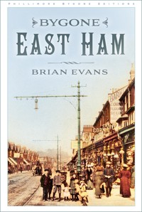
East Ham was sparsely inhabited in the fourteenth century and had not changed much with the advent of the railway in the 1850s. Farmers and market gardeners grew crops for the 'distant' London market, their houses scattered thinly from Wanstead flats in the north to just south of the turnpike road. A phenomenal transformation came in the second half of the nineteenth century as the demands of Britain's growing industries and population led to the use of land for factories and, eventually, to a house-building boom. Fortunately, photos of these amazingly rapid changes have survived to add great impact to this narrative of East Ham's past. Brian Evans captures the rise of East Ham from an area of fields and marshes to a county borough by 1914. Bygone East Ham will fascinate all who know the place whilst adding greatly to our understanding of the making of the present district.
Sie lesen das E-Book in den Legimi-Apps auf:
Seitenzahl: 68
Veröffentlichungsjahr: 2023
Das E-Book (TTS) können Sie hören im Abo „Legimi Premium” in Legimi-Apps auf:
Ähnliche


The Town Hall, 1920s.
To Susan and my friends in local history
First published 1993
This paperback edition published 2023
Phillimore, an imprint of
The History Press
97 St George’s Place, Cheltenham,
Gloucestershire, GL50 3QB
www.thehistorypress.co.uk
© Brian Evans, 1993, 2023
The right of Brian Evans to be identified as the Author of this work has been asserted in accordance with the Copyright, Designs and Patents Act 1988.
All rights reserved. No part of this book may be reprinted or reproduced or utilised in any form or by any electronic, mechanical or other means, now known or hereafter invented, including photocopying and recording, or in any information storage or retrieval system, without the permission in writing from the Publishers.
British Library Cataloguing in Publication Data.
A catalogue record for this book is available from the British Library.
ISBN 978 1 80399 476 5
Typesetting and origination by The History Press
Printed and bound in Great Britain by TJ Books Limited, Padstow, Cornwall.
eBook converted by Geethik Technologies
List of Illustrations
Frontispiece: The Town Hall, 1920s
As Far as the Eye can See
1. 1777 plan of East Ham
2. St Mary Magdalene, plan and views
3. St Mary’s church from the churchyard
4. Porch, lead coffins and Roman sarcophagus
5. Anchorite’s cell
6. Church interior, c.1900
7. Brasses to Neve, Johnson and Heigham
8. 12th-century arches
9. Drawing of the apse, 1903
10. Font, 1639
11. Giles Bream’s almshouses
12. East Ham workhouses
13. Plashet House
14. Plashet cottage, 1910
15. The Limes, White Post Lane
16. Old cottage, High Street South
17. East Ham Post Office, 1872
18. The Clock House
19. The Round House, 1900s
20. East Ham House, 1905
21. Little Ilford church, c.1900
22. Little Ilford manor house, 1910
23. The Three Rabbits, mid-19th century
Civic Pride: Services
24. City of London cemetery, July 1856
25. East Ham fire brigade, 1919–21
26. East Ham fire appliance
27. Advertisement for municipal electricity
28. East Ham Education Office, 1905
29. High Street schools, 1905
30. Shaftesbury Road school
31. Hartley Avenue school, 1913
32. Napier Road school, 1908
33. Kensington Avenue schools, 1905
34. Manor Park school
35. Plashet Lane Football Club, 1925–6
36. East Ham Technical Institute
37. North Woolwich gardens
38. Plashet library
39. Manor Park library, 1912
40. Interior of Central Library
41a. Passmore Edwards Hospital, c.1918
41b. Queen Mary at the Memorial Hospital
42. East Ham carnival
43. Community dust cart
Civic Pride: Transport
44. The Coach and Horses, Romford Road
45. Tollgates
46. The old Duke’s Head and patrons
47. East Ham station, c.1888
48. Steps to the platform, 1890s
49. View of platform buildings and staff, 1890s
50. Station frontage in LMS days
51. Tram tracks being laid at Boleyn Castle
52. Inside a tram depot
53. Trams in the local scene
54. Plashet Lane shops and open-top cars
55. Manor Park terminus
56. New four-wheel covered top car
57. East Ham car at Stratford, 1920s
58. Tramway fares in 1931
59. Tram terminus, Wanstead Flats
60. Wanstead Flats
61. Transport advertisements
62. Ferry approach, North Woolwich, 1913
63. Woolwich ferryboat Hutton, 1911
64. Pedestrian tunnel, Woolwich, 1913
65. East Ham bus route schedule, 1930
66. Open-stairs bus on route 101
67. Traffic waiting at the Docks
The Royals – Docklands Supreme
68. Plan of the Royal Docks
69. Opening of Royal Victoria and Albert Docks, 1880
70. Road to Docks, and shops, Cyprus hamlet
71. Royal Albert dockside, 1904
72. ‘X’ Division police group, 1912
73. In the lock, 1906
74. Transit shed interior, 1926
75. Export berths, post-1945
76. Banner displayed by the unemployed, 1921
77. Lock gates, George V Dock, 1926
78. George V Dock, cross-section
79. Almeda, April 1927
80. Maraunoa, drawing
81. The Royals from the air
82. Tug assistance, 1940s
83. Trolleybus and workers, 1950s
84. King George V Dock, 1960s
85. Barge Channel, King George V, 1960s
Boleyn Castle and the Hammers
86. Green Street House and Boleyn Castle, 1900
87. Boleyn Tower, 1912
88. Boleyn Tower, staircase and roof details
89. Boleyn Ground entrance and Tower
90. West Ham F.C. entrance, c.1919
91. Boleyn Ground, original layout
92. West Ham team, 1905–6
93. West Ham at Wembley, 1923
94. Kay and Brown in heading duel
95. The crowd hug the pitch
96. Moore receives a pass from Ruffell
97. 1923 Cup Final team
98. Men of iron – West Ham characters
99. The original ‘Chicken Run’ stand
Local Hero
100. Boy V.C. John Travers Cornwell in his uniform
101. Jack Cornwell’s Manor Park home
102. Royal Navy Recruiting Office, Manor Park
103. Cornwell standing ready at the gun
104. Alone at the gun
105. Jack’s coffin on the gun carriage
106. Service at the cemetery
107. The firing party
108. A sheet of Cornwell stamps
109. East Ham street memorial
110. A military funeral
111. East Ham War Memorial
Progress with the People: The Street Scene
112. Two hubs of East Ham
113. St Bartholomew’s church
114. Wesleyan Central Hall
115. Two Methodist churches
116. St Stephen’s, Green Street, Upton Park
117. Green Street shopping parade
118. Green Street shops
119. Market scene, Green Street
120. Market stalls and shops
121. Market scene
122. Arrival of the multiple stores
123. High Street North
124. Cull’s Corner, High Street
125. High Street North
126. No. 292 High Street
127. Hellens, High Street South
128. Reliable Clothing Stores, Manor Park
129. Mark Liell’s estate agents
130. Filby Brothers, bakers, Romford Road
131. Clover’s bakery and post office, 1919
132. Louis Chapman, newsagent, High Street North
133. New London Co-op Stores, High Street North
134. Co-op offices, East Ham Burnel Manor
135. The White Horse
136. Cock Hotel advertisement, 1917
137. East Ham ‘Palace’
138. The Electric Cinema
139. The Carlton Cinema
140. Floods at Little Ilford
Progress with the People: Home in East Ham
141. Oak Hall from Wakefield Street
142. Oak Hall, High Street frontage
143. Rear and garden of Oak Hall
144. Housing development, early 20th century
145. Development of High Street South
146. High Street South, 1920
147. Bartle Avenue
148. Thorpe Road
149. Altmore Avenue
150. Ruskin Avenue
151. Plashet Grove
152. Plashet Grove
153. Plashet Grove shops
154. Windsor Road
155. 56 Windsor Road
156. Hilda Road
157. First Avenue
158. Third Avenue
159. Herbert Road
160. Sheringham Avenue
161. Aerial view of Manor Park, 1926
162. Near the Ruskin Arms, Manor Park
163. The Broadway, Manor Park, c.1911
164. Multiple stores, Manor Park
165. Disabled children’s day out, Loughton
War Comes Again
166. City of London cemetery gates
167. East Ham stretcher party, no.23
168. Wartime advertisements
169. Civil defence workers in decontamination suits
170. Weapons in the High Street
Acknowledgements
The author would like to thank the following for all the help they have given with either the text or the illustrations: James Hawes, the Governors and Trustees of the Passmore Edwards Museum, the London Borough of Newham Local History librarian, the London Borough of Redbridge Local History librarian, and the Port of London Authority.
As Far as the Eye Can See: Memories of the 1860s Recorded by J. Charters
In the 1860s East Ham was an era of intensive cultivation, with crops of root vegetables stretching across the horizon as far as the eye could see. Beyond the ancient parish church to the south were marshes which were used for grazing cattle. The marshes stretched from Barking in the east, Plaistow in the west and with the river Thames to the south. The old church and its burial ground stood on the dividing line between marsh and arable land which marked the boundary from time immemorial.
The road southward had always been known as the Manor Way, a narrow winding lane with sluice ditches on both sides, leading right down to the river, a causeway sloping into the water. Only one house stood between the church and the river and that was a humble farm, not quite halfway along the road to North Woolwich. A traveller to Woolwich on a dark and foggy night found his journey on the only possible route a hazardous one, for if he forgot to provide himself with an adequate lantern he would probably stumble into one of the ditches and, likely as not, struggle out the wrong side, finding to his chagrin that in order to restart his journey he must give himself another wetting.
In season, North Woolwich gardens were a favourite pleasure resort for East Londoners who arrived in great numbers to sample to variety of amusements to be found beneath its arbours. One attraction was the largest dancing platform in London. To have paid a visit to these gardens in spring when the buds of the chestnut trees were transformed into young jewel-like leaves was a unique experience. The constantly changing scenes of shipping on the river heightened the joy of such a trip.


