5,99 €
Mehr erfahren.
- Herausgeber: After Midnight Publishing
- Kategorie: Lebensstil
- Sprache: Englisch
Das E-Book können Sie in Legimi-Apps oder einer beliebigen App lesen, die das folgende Format unterstützen:
Veröffentlichungsjahr: 2024
Ähnliche


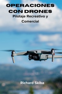
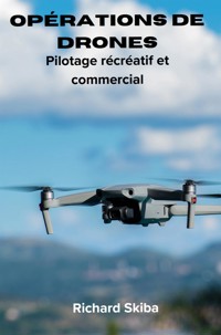


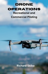
Drone Operations
Recreational and Commercial Piloting
Richard Skiba
Copyright © 2024 by Richard Skiba
All rights reserved.
No portion of this book may be reproduced in any form without written permission from the publisher or author, except as permitted by copyright law.
This publication is designed to provide accurate and authoritative information in regard to the subject matter covered. While the publisher and author have used their best efforts in preparing this book, they make no representations or warranties with respect to the accuracy or completeness of the contents of this book and specifically disclaim any implied warranties of merchantability or fitness for a particular purpose. No warranty may be created or extended by sales representatives or written sales materials. The advice and strategies contained herein may not be suitable for your situation. You should consult with a professional when appropriate. Neither the publisher nor the author shall be liable for any loss of profit or any other commercial damages, including but not limited to special, incidental, consequential, personal, or other damages.
Skiba, Richard (author)
Drone Operations: Recreational and Commercial Piloting
ISBN 978-1-7635353-3-6 (paperback) 978-1-7635353-4-3 (eBook) 978-1-7635353-5-0 (Hardcover)
Non-fiction
Contents
Preface
Adrone, also known as an unmanned aerial vehicle (UAV), is an aircraft that operates without a human pilot onboard. Drones can be remotely controlled by a human operator or can fly autonomously based on pre-programmed flight plans or dynamic inputs from onboard sensors. They come in various sizes and configurations, from small consumer models used for recreational purposes to larger, more sophisticated models used for tasks such as aerial photography, surveillance, agriculture, and even military operations.
Drones are known by various names depending on their specific purpose, design, or function. Here are some common names and terms used to refer to drones:
UAV (Unmanned Aerial Vehicle)
RPAS (Remotely Piloted Aircraft Systems)
UAS (Unmanned Aircraft System)
Quadcopter (a type of drone with four rotors)
Multirotor (a drone with multiple rotors, typically more than four)
Hexacopter (a drone with six rotors)
Octocopter (a drone with eight rotors)
Fixed-wing UAV (a drone with fixed wings, resembling traditional airplanes)
sUAS (Small Unmanned Aircraft System)
Microdrone (very small drones, often used for indoor or close-range operations)
Nano drone (extremely small drones, typically used for surveillance or research)
Aerial drone
Flying robot
Remotely operated aircraft
These are just a few examples, and there may be other specialized terms or names used in specific industries or contexts, and these will be used interchangeably throughout this book.
This book on drone operations offers aims to provide comprehensive knowledge by consolidating information on drone technology, regulations, safety protocols, and best practices. It provides readers with a comprehensive understanding that would otherwise be scattered across various sources. Whether catering to novices or seasoned operators, this book serves as an educational aid, offering valuable insights into drone operation techniques, flight planning strategies, maintenance procedures, and effective troubleshooting methods.
With drone regulations constantly evolving, this book can offer clarity on legal requirements, airspace restrictions, and compliance measures, helping operators navigate the intricate web of regulatory frameworks. A range of specific country regulations are covered within the book.
The book also aims to provide safety awareness relevant to drone operations. Emphasizing safety principles is crucial in drone operations to prevent accidents and mitigate risks. This book underscores the importance of safety protocols, encourages thorough risk assessments, outlines emergency procedures, and promotes responsible flying practices.
Many practical exercises, case studies, and real-world examples are incorporated in this book to enhance operational skills and foster sound decision-making abilities, facilitating the development of proficiency in piloting drones. Further, tailored to specific sectors such as photography, videography, agriculture, surveying, or public safety, this book offers professionals valuable insights into how drones are employed, including advanced techniques and emerging trends within their respective industries.
Overall, this book serves as a comprehensive reference guide, enabling operators to quickly access information on a wide range of topics, from equipment selection and maintenance to flight planning and data analysis. It is intended to provide readers with information and guidance on the operation of drones for recreational and commercial purposes. Before delving into the content of this book, it is important for readers to understand and acknowledge the following disclaimer:
Compliance with Local Laws and Regulations: The operation of drones, whether for recreational or commercial purposes, is subject to a myriad of local laws, regulations, and restrictions. Readers are advised to familiarize themselves with the applicable laws and regulations in their respective jurisdictions before engaging in any drone-related activities. This includes but is not limited to obtaining necessary permits, licenses, and authorizations from relevant authorities.
In the United States, for example, recreational drone operators must adhere to regulations set forth by the Federal Aviation Administration (FAA), including registration requirements for drones weighing over a certain threshold. Additionally, commercial drone operators are subject to Part 107 regulations, which govern the operation of small unmanned aircraft systems (sUAS) for commercial purposes.
Training and Practice are Essential: The safe and effective operation of drones requires proper training and consistent practice. Readers should understand that proficiency in piloting drones, understanding airspace regulations, and handling emergency situations are skills that must be developed over time through dedicated training and practice.
A novice drone pilot should undergo comprehensive training programs offered by reputable organizations or institutions to learn essential skills such as flight manoeuvres, emergency procedures, and airspace navigation. Additionally, regular practice sessions in controlled environments can help pilots improve their proficiency and confidence in operating drones safely.
Assumption of Risk: Engaging in drone operations involves inherent risks, including but not limited to collisions, equipment malfunctions, and regulatory violations. Readers should recognise these risks when participating in drone-related activities and should take appropriate precautions to mitigate them.
While drones offer exciting opportunities for aerial photography and videography, operators must be aware of the risk of collisions with obstacles or other aircraft, especially in congested airspace. Pilots should conduct pre-flight inspections, maintain visual line of sight with their drones, and adhere to altitude and distance limits to minimize the risk of accidents.
Consultation with Professionals: Readers are encouraged to seek guidance and advice from qualified professionals, such as aviation experts, legal advisors, and drone industry professionals, to address specific concerns or questions related to drone operations. Professional consultation can provide valuable insights and ensure compliance with applicable regulations and best practices.
Commercial drone operators may benefit from consulting with aviation attorneys or regulatory experts to navigate complex legal requirements and obtain necessary waivers or exemptions for specialized operations, such as night flights or flights over people.
Introduction
The term "drone" historically originated in the context of military intelligence, surveillance, and reconnaissance missions due to the advantage of not risking a pilot's life in combat zones [1]. While the US Federal Aviation Administration officially adopted the term "unmanned aircraft vehicle/system (UAV/UAS)" in 2005, the term "drone" continues to be preferred in peer-reviewed literature [2]. The historical association of drones with military applications is well-documented, with drones being extensively utilized in various military activities [3].
Over time, the use of drones has expanded beyond military applications to encompass a wide range of civilian uses [4]. Drones are now employed in diverse fields such as healthcare, where they show significant potential for applications like medical surveillance, disaster site monitoring, and epidemiological research [5, 6]. Additionally, drones have found utility in delivering emergency medical supplies like automated external defibrillators to aid in out-of-hospital cardiac arrest situations [7, 8].
The historical evolution of drone technology has seen a shift towards civilian applications, including cultural preservation through the use of drone-based orthophotos for restoring historical buildings [9]. Furthermore, the term "drone" has become the popular and dominant descriptor for unmanned aerial vehicles, reflecting its widespread usage and recognition [10].
A drone, also known as an Unmanned Aerial Vehicle (UAV), refers to an aircraft that operates without a human pilot on board. Drones have gained significant popularity in recent years due to their diverse applications in various fields, including wildlife monitoring, parcel delivery, urban mobility, disaster management, and healthcare supply chain [11-15]. These unmanned aircraft are equipped with sensors, cameras, and other technologies that enable them to perform tasks autonomously or under remote control [16].
The use of drones has expanded beyond military applications to include environmental research, conservation efforts, and even forensic investigations [13, 14]. Drones have been utilized to study wildlife behaviour, monitor ecosystems, and support conservation initiatives [11, 13]. Additionally, drones have been integrated into healthcare systems to transport medical supplies quickly and efficiently, especially in emergency situations like the COVID-19 pandemic [12].
Despite their numerous benefits, drones have raised concerns regarding their impact on wildlife, particularly in terms of disturbance and noise pollution [11, 13, 14]. Studies have shown that drones can affect the behaviour of animals such as kangaroos and sea turtles, highlighting the need to establish ethical operating thresholds when using drones in wildlife monitoring [11, 13]. Furthermore, the noise emissions from drones have been a subject of research, with efforts to understand the effects of drone noise on humans and wildlife [17].
Drone technology has seamlessly woven into the fabric of daily life, thanks to its ever-evolving complexity. Across various sectors, drones serve myriad contemporary applications:
Photography and Videography: Drones have transformed the field of photography, offering photographers unparalleled aerial perspectives. Tailored to specific photography needs, these drones capture stunning vistas of city skylines, coastal landscapes, and architectural wonders. Additionally, they enhance video recording endeavours, enriching sports events, filmmaking projects, and virtual real estate tours with unique angles and immersive visuals.
Delivery Services: Delivery drones have revolutionized logistics by efficiently transporting food, packages, and goods directly to consumers' doorsteps. These "last mile" delivery drones streamline operations for retailers and grocery chains, offering a swift and efficient alternative to traditional delivery methods.
Search and Rescue: Drones play a vital role in rescue operations, particularly in hazardous environments where human intervention is perilous. Autonomous underwater vehicles assist in water-based rescues, while aerial drones aid in locating individuals stranded in avalanches or other emergencies, ensuring swift and effective responses to crises.
Agriculture: In agriculture, drones optimize farm management practices by conducting field surveys, seeding operations, livestock monitoring, and crop yield estimation. These UAVs bolster efficiency, alleviate physical strain on farmers, and economize time in agricultural operations.
Surveillance: Law enforcement agencies and military forces harness the power of drones for enhanced surveillance capabilities. Drones support police in monitoring events, gathering evidence of traffic violations, and reconstructing crime scenes. Similarly, military personnel employ drone technology for reconnaissance missions, target tracking, and strategic planning endeavours.
Personal Use: As costs decline, drones have become accessible to the general public for recreational purposes. Enthusiasts engage in activities such as aerial photography and hobbyist flying. However, recreational drone pilots must adhere to regulations and obtain necessary certifications to ensure safe and responsible operation.
Wildlife Monitoring: Drones offer a cost-effective solution for wildlife conservation efforts. Conservationists utilize drones to monitor wildlife populations, track animal movements, and assess ecosystem health from aerial perspectives, facilitating conservation initiatives and reforestation projects.
3D Modelling: LiDAR-equipped drones conduct landscape surveys and gather data for creating detailed 3D models. These drones provide precise data essential for urban planning, environmental monitoring, and infrastructure development projects.
Military Operations: Modern military drones, equipped with advanced technologies like thermal imaging and laser range finders, play pivotal roles in intelligence gathering, reconnaissance missions, and targeted airstrikes for national defence purposes.
Photography and videography have undergone a remarkable transformation with the advent of drones. These aerial vehicles have revolutionized the way photographers and filmmakers capture images and footage, offering unprecedented perspectives that were previously inaccessible. Tailored to meet the diverse needs of photography enthusiasts and professionals alike, drones are equipped with advanced imaging capabilities that enable them to capture stunning vistas with clarity and precision.
One of the most significant advantages of drone photography is its ability to provide aerial views of landscapes and cityscapes. From towering city skylines to serene coastal vistas, drones offer photographers the opportunity to capture breathtaking scenes from above, revealing patterns, textures, and perspectives that are often overlooked from ground level. This aerial perspective adds a new dimension to photography, allowing photographers to showcase familiar landmarks and landscapes in a fresh and captivating way.
Moreover, drones have become indispensable tools for videographers, enhancing video recording endeavours across various domains. Whether documenting sports events, filming cinematic sequences for movies, or creating virtual real estate tours, drones enable filmmakers to capture dynamic footage from unique angles and perspectives. By manoeuvring effortlessly through the air, drones provide filmmakers with the flexibility to explore creative compositions and perspectives, resulting in videos that are immersive and visually engaging.
Drones have transformed photography and videography by offering photographers and filmmakers unparalleled aerial perspectives. Tailored to meet specific photography needs, drones capture stunning vistas of cityscapes, coastal landscapes, and architectural wonders, while also enhancing video recording endeavours across various domains. With their ability to capture unique angles and perspectives, drones have revolutionized the way images and footage are captured, adding a new dimension to visual storytelling.
Delivery drones represent a groundbreaking innovation in the realm of logistics, fundamentally reshaping the landscape of last-mile delivery services. Traditionally, the final leg of the delivery process, known as the "last mile," has been a bottleneck for retailers and logistics companies, plagued by challenges such as traffic congestion, inefficient routing, and high costs. However, delivery drones offer a transformative solution to these longstanding issues by providing a fast and efficient means of transporting goods directly to consumers' doorsteps.
By leveraging drone technology, retailers and grocery chains can bypass the constraints of traditional delivery methods, delivering packages with unprecedented speed and precision. These unmanned aerial vehicles are equipped with sophisticated navigation systems and autonomous flight capabilities, allowing them to navigate through urban environments and reach destinations quickly and efficiently. As a result, delivery drones offer a viable alternative to conventional delivery vehicles, particularly in densely populated areas where congestion and traffic congestion pose significant challenges to timely delivery.
Furthermore, delivery drones offer unparalleled flexibility and scalability, enabling retailers to adapt to fluctuating demand and respond rapidly to customer needs. With the ability to fly over traffic and obstacles, drones can cover distances more efficiently than ground-based vehicles, making them particularly well-suited for delivering small, time-sensitive items such as groceries, medication, and consumer electronics.
As an example of drone utilisation for delivery, Zipline International Inc. is an American firm specializing in the design, production, and operation of delivery drones. The company maintains distribution hubs across several countries including Rwanda, Ghana, Japan, the United States, Nigeria, Cote d'Ivoire, and Kenya. As of November 2023, Zipline's drones have completed over 800,000 commercial deliveries and flown more than 40 million miles autonomously [18].
Zipline's drones are primarily utilized for transporting essential medical supplies such as whole blood, platelets, frozen plasma, and cryoprecipitate, as well as medical products like vaccines, infusions, and common medical commodities. Notably, in Rwanda, Zipline's drones handle more than 75 percent of blood deliveries outside of the capital city, Kigali. In Ghana, the company began drone deliveries of vaccines, blood, and medicines in April 2019. Additionally, during the COVID-19 pandemic in 2020, Zipline's partner organization, Novant Health, received a Part 107 aviation waiver from the US Federal Aviation Administration (FAA) to use Zipline's drones for delivering medical supplies and personal protective equipment (PPE) to healthcare facilities in North Carolina.
Beyond medical deliveries, Zipline also offers delivery services for non-medical products. This includes partnerships with retail giants like Walmart, initiated in 2021, and with food service provider Sweetgreen, announced in 2023. Zipline's website showcases a range of potential applications for their drone delivery services, including restaurant deliveries, grocery deliveries, convenience shopping, and e-commerce fulfillment.
Moreover, delivery drones have the potential to reduce carbon emissions and environmental impact associated with traditional delivery methods. By operating on electric power and flying directly to their destinations, drones minimize the need for large fleets of delivery trucks and vans, thereby decreasing traffic congestion and air pollution in urban areas.
Overall, delivery drones represent a game-changing innovation in the field of logistics, offering retailers and businesses a cost-effective, efficient, and environmentally friendly solution for last-mile delivery. As technology continues to advance and regulatory frameworks evolve, delivery drones are poised to play an increasingly prominent role in shaping the future of e-commerce and supply chain management.
Search and rescue missions often involve perilous environments where human intervention poses significant risks. In these challenging situations, drones emerge as indispensable tools, playing a pivotal role in facilitating rescue operations. Whether deployed in remote wilderness areas or amidst natural disasters, drones offer unique capabilities that enhance the effectiveness and efficiency of search and rescue efforts.
One area where drones excel is in water-based rescues, where traditional methods may be impractical or unsafe. Autonomous underwater vehicles (AUVs) equipped with specialized sensors and imaging technology can navigate underwater environments with precision, assisting in the search for missing persons or submerged objects. These AUVs can survey large areas of water quickly and efficiently, providing invaluable assistance to search and rescue teams in locating individuals in distress.
Similarly, aerial drones are instrumental in locating and rescuing individuals stranded in hazardous environments such as avalanches or inaccessible terrain. Equipped with high-resolution cameras, thermal imaging sensors, and other advanced technologies, aerial drones can survey vast areas from above, quickly identifying potential hazards and locating individuals in need of assistance. By providing real-time aerial reconnaissance, drones enable search and rescue teams to assess the situation rapidly and deploy resources effectively, ensuring swift and coordinated responses to emergencies.
Overall, drones play a vital role in search and rescue operations by offering unparalleled capabilities for navigating hazardous environments and locating individuals in distress. Whether deployed underwater or in the air, drones enhance the efficiency and effectiveness of rescue efforts, helping to save lives and mitigate the impact of disasters and emergencies.
In the realm of agriculture, drones have emerged as transformative tools, revolutionizing traditional farm management practices. By harnessing the capabilities of unmanned aerial vehicles (UAVs), farmers can optimize various aspects of their operations, leading to increased efficiency and productivity across the agricultural sector.
One of the key applications of drones in agriculture is conducting field surveys. Equipped with advanced sensors and imaging technology, drones can capture high-resolution aerial imagery of farmland, providing farmers with valuable insights into crop health, soil moisture levels, and pest infestations. This aerial data enables farmers to make informed decisions about irrigation, fertilization, and pest control, ultimately improving crop yields and reducing resource wastage.
Moreover, drones play a crucial role in seeding operations, particularly in large-scale farming operations. By deploying drones equipped with precision seeding systems, farmers can accurately distribute seeds across vast tracts of land, ensuring optimal spacing and coverage for maximum crop growth. This automated seeding process not only saves time and labour but also improves planting efficiency and crop uniformity, leading to higher yields and reduced input costs.
In addition to field surveys and seeding operations, drones are also utilized for livestock monitoring in agriculture. With the ability to cover large areas of pastureland quickly and efficiently, drones enable farmers to track the health and behaviour of their livestock, identify sick or injured animals, and detect potential predators or intruders. This real-time monitoring capability allows farmers to respond promptly to livestock-related issues, improving animal welfare and overall farm management practices.
Furthermore, drones are invaluable tools for estimating crop yields and assessing crop health throughout the growing season. By analysing aerial imagery captured by drones, farmers can accurately quantify crop yields, predict harvest times, and identify areas of the field that may require additional attention or intervention. This data-driven approach to crop management enables farmers to optimize their resources, maximize yields, and minimize waste, ultimately enhancing the sustainability and profitability of their operations.
Drones have revolutionized agriculture by optimizing farm management practices and enhancing productivity across the agricultural sector. From conducting field surveys and seeding operations to monitoring livestock and estimating crop yields, drones offer farmers powerful tools for improving efficiency, reducing costs, and achieving sustainable agricultural practices. As technology continues to advance, the role of drones in agriculture is expected to expand further, driving innovation and driving the future of farming.
In both law enforcement and military contexts, drones have become indispensable tools for enhancing surveillance capabilities, offering a range of benefits in monitoring, evidence gathering, and strategic planning.
Law enforcement agencies rely on drones to monitor events and gather evidence, providing a bird's-eye view of activities from above. Drones equipped with high-resolution cameras and live-streaming capabilities enable police to surveil large areas efficiently and discreetly, aiding in crime prevention and response efforts. Additionally, drones are valuable tools for gathering evidence of traffic violations, allowing authorities to monitor roadways and capture footage of speeding vehicles or other infractions. In the event of a crime, drones can also be deployed to reconstruct crime scenes, providing investigators with valuable insights into the sequence of events and the spatial relationships between various elements.
Similarly, military forces leverage drone technology for reconnaissance missions and strategic planning endeavours. Equipped with advanced sensors and imaging systems, military drones can conduct aerial reconnaissance over enemy territory, gathering intelligence on enemy positions, movements, and infrastructure. This real-time surveillance capability enables military commanders to make informed decisions about troop deployments, target prioritization, and operational planning, enhancing the effectiveness and efficiency of military operations. Additionally, drones are used for target tracking, enabling military personnel to monitor and follow high-value targets or potential threats with precision and accuracy.
Overall, drones play a vital role in surveillance operations for both law enforcement and military purposes, providing valuable capabilities for monitoring, evidence gathering, and strategic planning. By offering aerial perspectives and real-time surveillance capabilities, drones enhance situational awareness and decision-making capabilities, ultimately contributing to the safety and security of communities and the success of military missions. As drone technology continues to advance, the role of drones in surveillance is expected to expand further, driving innovation and enhancing capabilities in both civilian and military contexts.
Firefighters utilize drones in various ways to enhance their firefighting efforts and improve overall safety during emergency response operations. Here are some common applications of drones in firefighting:
Aerial Reconnaissance: Drones equipped with cameras and thermal imaging sensors provide firefighters with valuable aerial perspectives of fire scenes. By capturing high-resolution imagery and thermal data from above, drones enable firefighters to assess the extent of the fire, identify hot spots, and detect potential hazards such as structural weaknesses or hazardous materials. This aerial reconnaissance allows firefighters to develop effective firefighting strategies and prioritize resource allocation based on real-time situational awareness.
Search and Rescue: Drones equipped with high-resolution cameras and infrared sensors are valuable tools for search and rescue operations in firefighting scenarios. These drones can quickly scan large areas, including hard-to-reach or hazardous terrain, to locate missing persons or trapped victims. By providing aerial support to ground-based rescue teams, drones help expedite search efforts and improve the chances of locating and rescuing individuals in distress.
Fire Mapping and Monitoring: Drones equipped with GPS technology and mapping software are used to create detailed maps of fire-affected areas, including fire spread patterns and evacuation routes. By monitoring fire behaviour and progression in real-time, drones enable firefighters to anticipate changes in fire conditions, adjust firefighting tactics accordingly, and effectively communicate situational updates to incident commanders and emergency responders.
Hazardous Material Detection: Drones equipped with gas sensors and other environmental monitoring tools can detect hazardous materials or chemical leaks in fire scenes. By conducting aerial surveys of the area, drones help identify potential hazards to firefighter safety and inform decision-making regarding evacuation procedures, containment measures, and appropriate protective equipment.
Post-Fire Assessment: After the fire has been extinguished, drones are used to conduct post-fire assessments and damage inspections. By capturing aerial imagery of the fire-affected area, drones assist firefighters in evaluating structural integrity, assessing damage to buildings and infrastructure, and identifying any remaining hot spots or smouldering debris that may pose a risk of re-ignition.
Overall, drones play a crucial role in enhancing firefighting operations by providing firefighters with valuable aerial perspectives, real-time data, and situational awareness during emergency response scenarios. By leveraging drone technology, firefighters can work more safely and effectively to mitigate fire hazards, protect lives and property, and ultimately save lives.
As the costs of drone technology decrease, it has become increasingly accessible to the general public for personal and recreational use. This accessibility has led to a surge in interest among enthusiasts who are eager to explore the capabilities of drones for various recreational activities. Among these activities, aerial photography stands out as a popular pursuit, allowing hobbyists to capture stunning aerial shots and videos from unique perspectives that were previously inaccessible. Additionally, hobbyist flying, which involves piloting drones for enjoyment and skill development, has gained traction as an engaging pastime for drone enthusiasts of all ages.
However, despite the recreational appeal of drone technology, it is essential for enthusiasts to operate their drones responsibly and in accordance with established regulations. Recreational drone pilots are required to adhere to airspace rules and safety guidelines set forth by aviation authorities to ensure the safety of airspace users and the general public. This includes obtaining necessary certifications or registrations, such as the Federal Aviation Administration's (FAA) Part 107 certification in the United States, which demonstrates competency in drone operation and knowledge of airspace regulations.
Furthermore, responsible drone operation involves a commitment to safety and awareness of potential risks associated with flying drones in different environments. Recreational drone pilots must exercise caution when operating their drones near populated areas, airports, or other restricted zones to avoid potential accidents or conflicts with other airspace users. Additionally, being mindful of privacy concerns and respecting the privacy of others is crucial when capturing aerial footage or images in public spaces.
While drones offer exciting opportunities for recreational use and creative expression, it is essential for enthusiasts to approach drone flying with a sense of responsibility and awareness of regulatory requirements. By adhering to safety guidelines, obtaining necessary certifications, and respecting airspace regulations and privacy considerations, recreational drone pilots can enjoy the benefits of drone technology while minimizing risks and ensuring a positive experience for themselves and others.
In the realm of 3D modelling, drones equipped with Light Detection and Ranging (LiDAR) technology have revolutionized the process of capturing accurate spatial data for various applications. LiDAR-equipped drones conduct aerial surveys of landscapes, gathering detailed information about surface topography, vegetation, and structures with remarkable precision. This data is then used to create highly accurate 3D models of the surveyed area, providing valuable insights for a range of industries and disciplines.
One of the primary applications of LiDAR-equipped drones is in urban planning and development projects. By capturing detailed 3D models of urban environments, including buildings, roads, and infrastructure, drones equipped with LiDAR technology enable urban planners and architects to visualize proposed developments and assess their impact on the surrounding landscape. This data-driven approach to urban planning allows for more informed decision-making and better integration of new developments into existing urban environments.
Furthermore, LiDAR-equipped drones play a crucial role in environmental monitoring and conservation efforts. By conducting aerial surveys of natural landscapes, such as forests, wetlands, and coastal areas, drones can capture detailed data about vegetation density, terrain elevation, and habitat characteristics. This information is essential for monitoring changes in ecosystems over time, identifying areas of ecological significance, and informing conservation strategies aimed at preserving biodiversity and mitigating environmental degradation.
In addition to urban planning and environmental monitoring, LiDAR-equipped drones are also used in infrastructure development projects such as road construction, pipeline monitoring, and utility management. By providing accurate 3D models of terrain and infrastructure assets, drones enable engineers and project managers to plan and execute construction projects more efficiently, minimize environmental impacts, and optimize resource allocation.
LiDAR-equipped drones play a vital role in 3D modelling applications, providing precise spatial data that is essential for urban planning, environmental monitoring, and infrastructure development projects. By leveraging the capabilities of LiDAR technology, drones enable professionals across various industries to make informed decisions, optimize resources, and achieve better outcomes in their respective fields.
Types of Drones
Unmanned Aerial Vehicles (UAVs) can be classified based on various criteria. One common classification is based on the type of UAV, which includes fixed-wing and rotary-wing UAVs [19]. Another classification criterion is based on the propulsion system used, which categorizes UAVs into fuel-based, hybrid fuel-electric, and pure electric propulsion systems [20]. Additionally, UAVs can be classified based on their applications, such as in agriculture, urban vegetation mapping, surveillance, disaster management, and more [21-23].
Furthermore, UAVs can be classified based on their capabilities and features. For instance, UAVs can be classified based on their ability to fly autonomously or be remotely piloted [24]. Moreover, the classification of UAVs can also be related to their detection and identification methods. RF-based techniques have been employed for UAV detection and identification, leading to hierarchical classification approaches for RF-based UAV detection systems [25, 26].
In the context of UAV networks, classifications can be made at different levels, such as cell level, system level, and system of system level, to understand how different components contribute to overall system performance [27]. Moreover, the use of machine learning algorithms has enabled the classification of benign or malicious packets in UAV networks for enhanced security [28].
General Types
Drones come in various types, each designed for specific purposes and applications including:
Fixed-Wing Drones: Fixed-wing drones resemble traditional airplanes and feature wings that generate lift as they move forward. These drones are well-suited for long-distance flights and aerial mapping missions due to their efficient design and extended flight times. Fixed-wing drones are commonly used in agriculture, surveying, and aerial photography.
Multirotor Drones: Multirotor drones, such as quadcopters and hexacopters, feature multiple rotors arranged in a symmetrical configuration. These drones are highly manoeuvrable and capable of hovering in place, making them ideal for tasks that require precise positioning or aerial photography and videography. Multirotor drones are popular among hobbyists, filmmakers, and commercial operators.
Single-Rotor Helicopters: Single-rotor helicopters, also known as rotary-wing drones, feature a single large rotor mounted on top of the aircraft. These drones offer greater lifting capacity and stability compared to multirotor drones, making them suitable for heavy-lift applications such as aerial crane operations or transporting cargo in challenging environments.
Hybrid Drones: Hybrid drones combine features of fixed-wing and multirotor designs, allowing them to take off and land vertically like a multirotor drone while also benefiting from the efficiency of fixed-wing flight for long-distance travel. These drones offer versatility for applications that require both vertical take-off and long-endurance flight, such as surveillance or aerial mapping.
Fixed Wing Drones
Fixed-wing drones utilize aerodynamics to generate lift and remain airborne, similar to traditional aircraft. They are commonly employed for mapping large areas due to their extended autonomy and efficiency. Unlike multi-rotor drones, fixed-wing drones rely on their aerodynamic design for sustained flight, resulting in longer endurance and faster flight speeds.
However, fixed-wing drones tend to be more expensive than multi-rotor drones and require ample space for take-off and landing, akin to airplanes. Some larger models necessitate specialized ground equipment for launching and recovery. Additionally, fixed-wing drones lack the vertical take-off and landing capabilities of multi-rotor drones, limiting their manoeuvrability and suitability for certain applications.
Fixed wing drone used by USGS. Bureau of Land Management Oregon and Washington from Portland, America, Public domain, via Wikimedia Commons.
Despite these limitations, fixed-wing drones offer several advantages. They can cover longer distances, map larger areas, and remain airborne for extended periods, making them ideal for tasks such as aerial mapping, surveying, agriculture, and inspection. Their high altitude capabilities and ability to carry heavier payloads further enhance their utility in various technical applications.
However, operating fixed-wing drones requires training and proficiency due to their unique flight characteristics and landing requirements. Launching and controlling a fixed-wing drone necessitate confidence and skill, as they are always moving forward and typically require a launcher for take-off. Additionally, processing and analysing the vast amount of data captured by fixed-wing drones can be complex and time-consuming, requiring specialized software and expertise.
Overall, fixed-wing drones are valued for their efficiency, range, and endurance, making them indispensable tools for a wide range of technical applications, including aerial mapping, surveying, agriculture, inspection, construction, and security. Despite their challenges, their capabilities make them indispensable assets in various industries.
Multirotor Drones
Multi-rotor drones present an accessible and cost-effective solution for aerial surveillance and photography, offering precise control over positioning and framing. Named for their multiple rotors, these drones commonly come in configurations such as tricopters, quadcopters, hexacopters, and octocopters, with quadcopters being the most prevalent variant. Unlike fixed-wing drones, multi-rotor drones feature multiple vertically rotating motors, enabling them to take off, land, fly, and hover with agility akin to traditional helicopters.
Renowned for their versatility, multi-rotor drones are widely favoured for both recreational and professional applications, particularly in aerial photography. Their compact size and manoeuvrability make them an ideal choice for capturing dynamic shots from various perspectives. Additionally, multi-rotor drones offer the flexibility to mount different types of cameras for diverse tasks, further enhancing their utility.
However, multi-rotor drones are accompanied by limitations, primarily concerning flight autonomy and efficiency. Their reliance on multiple rotors consumes more energy, resulting in shorter flight times compared to fixed-wing counterparts. Typically, multi-rotor drones offer flight durations of less than an hour, necessitating the use of multiple batteries for prolonged operations, thus incurring additional costs.
Advantages of multi-rotor drones include enhanced control during flight, enabling precise movements in various directions, including vertical ascent and descent, lateral motion, and rotation. Their agility allows for close proximity flights to structures and facilitates efficient payload delivery and inspections. Additionally, some designs feature redundant components to ensure continued operation in the event of motor failure.
Despite their advantages, multi-rotor drones are unsuitable for certain tasks requiring extended endurance and high-speed flights, such as large-scale aerial mapping and long-distance inspections. Their inherent inefficiency and reliance on electric motors limit their flight times, typically ranging from 20 to 30 minutes with lightweight payloads. Moreover, the reliance on computer-controlled flight systems renders them vulnerable to failure, necessitating redundancy in components to mitigate risks.
In technical applications, multi-rotor drones find utility in visual inspections, thermal imaging, aerial photography and videography, and 3D scanning. While they excel in tasks requiring precise manoeuvrability and close-quarters operations, their limitations must be considered when selecting the appropriate drone for specific applications.
Single-Rotor Helicopters
Helicopters aren't limited to large, manned aircraft; they also manifest in smaller, unmanned drone forms. These drones come in a range of sizes, from tiny toys to sizable drones equipped with cameras, with prices scaling up accordingly. While some single-rotor drones can be found for as little as $20 in stores, others fetch thousands online.
An interesting feature of professional single-rotor drones is their potential to run on gas instead of electricity, depending on their size. While they boast greater efficiency than multi-rotor drones, they don't match the efficiency of fixed-wing counterparts. Flying a single-rotor drone can be nearly as challenging as piloting a fixed-wing one, requiring a delicate balance.
Although single-rotor drones may not offer as many applications as multi-rotor drones, they excel at carrying heavier payloads. Typically favoured by hobbyists seeking a new challenge, single-rotor drone types are robust and sturdy, resembling actual helicopters in their structure and design. With just one rotor and a tail rotor for stability and control, they offer a blend of multi-rotor agility and single-rotor efficiency.
Single-rotor drones typically utilize gas/petrol engines rather than batteries, resulting in longer flight times. However, their larger size and complexity compared to other UAVs make them pricier and more challenging to operate, with larger blades posing increased safety risks.
Advantages of single-rotor helicopters include their superior efficiency, especially when gas-powered, allowing for extended flight times. Their long blades, resembling spinning wings, contribute to this efficiency, making them suitable for hovering with heavy payloads or achieving a balance between hovering and forward flight.
However, single-rotor drone types have their drawbacks. They are complex, expensive, and less stable than multi-rotor counterparts, requiring meticulous maintenance due to their mechanical intricacy. Additionally, the presence of large spinning blades increases safety risks, especially in the event of component failure.
In technical applications, single-rotor drones find utility in tasks such as aerial LIDAR laser scanning, drone surveying, and carrying heavy payloads. While they offer unique capabilities, their complexity and safety considerations make them a specialized choice for specific operations. In he example shown as Figure 17, the unmanned helicopter is used for spatial dose measurement developed by the Japan Atomic Energy Agency, a national research and development institution. Equipped with a dedicated radiation measurement system on Yamaha Motor's autonomous flying unmanned helicopter RMAX G1, it measures direct gamma rays from the ground and scattered rays from the air.
Hybrid Drones
This innovative category of professional drones melds the extended flight duration characteristic of fixed-wing drones with the vertical take-off and landing capabilities of single-rotor or multi-rotor drones. A notable example of this hybridization is exemplified in the drone developed for Prime Air.
VTOL, an acronym for vertical take-off and landing, serves as the primary rationale behind the creation of this hybrid model. While fixed-wing drones boast significant differences in flight duration compared to other drone types, they encounter challenges with landing. The hybrid model adeptly integrates the strengths of both, despite being a relatively recent concept, it's swiftly gaining traction and recognition.
Hybrid VTOL drones blend the advantages of fixed-wing and rotor-based designs. These drones feature rotors affixed to fixed wings, enabling them to hover, take off, and land vertically. Although currently limited in availability, advancements in technology suggest that this option may witness increased popularity in the years ahead. Notable examples include Amazon's Prime Air delivery drone, showcasing a fixed-wing hybrid VTOL design.
Introduced as the latest frontier in drone technology, fixed-wing hybrid VTOL drones refer to fixed-wing aircraft modified for vertical take-off and landing. They amalgamate the endurance and range of fixed-wing UAVs with the vertical take-off capability of rotary-wing devices, addressing the space constraints inherent in traditional fixed-wing UAV operations. These drones find applications in mapping, power line inspection, surveillance, agriculture, and rescue operations.
However, the complexity of this VTOL drone renders it less suitable for novice operators, and its advanced technology positions it at the upper echelon of the fixed-wing drone market in terms of cost.
Hybrid VTOL drones present several advantages: the autopilot system handles stability, freeing up the pilot to concentrate on navigation, while leveraging the strengths of both fixed-wing and rotor-based designs, excelling in both hovering and forward flight capabilities. However, their availability in the market is currently limited, with only a few models accessible, and the technology supporting these drones is still in the evolutionary stages. In terms of technical applications, they find utility in drone delivery services.
Other variations
Various drone types beyond those previously discussed offer diverse functionalities:
Mini Drones: Designed primarily for recreational purposes, mini drones lack the robustness required for commercial tasks due to their lightweight build, which compromises image stability.
Nano Drones: Despite their diminutive size, nano drones are equipped with micro cameras, exemplified by models like the Black Hornet utilized by the British military. With flight durations of up to 25 minutes and a range of one mile, they enhance reconnaissance capabilities significantly.
Tactical Drones: Combining compact dimensions with agility, tactical drones feature GPS technology and infrared cameras, rendering them well-suited for surveillance missions despite their modest size of 4.5 feet and weight of 4.2 lbs.
Reconnaissance Drones: These drones, measuring approximately 16 feet in length and weighing over 2200 pounds, boast extended flight durations of up to 52 hours at altitudes of 35,000 feet. Known as High Altitude Long Endurance drones (HALE) and Medium Altitude Long Endurance drones (MALE), they facilitate comprehensive reconnaissance operations, launched from the ground.
Large Combat Drones: With lengths averaging around 36 feet, large combat drones are primarily employed for deploying laser-guided bombs or air-to-surface missiles. Featuring ranges exceeding 1000 miles and operational durations of up to 14 hours, they excel in combat scenarios.
Non-Combat Large Drones: Although sizable, non-combat large drones are not intended for combat applications. More advanced than nano drones, they are utilized for large-scale reconnaissance tasks.
Target and Decoy Drones: Serving roles in monitoring and engaging targets, target and decoy drones are tailored in appearance to meet specific mission requirements.
GPS Drones: Establishing connections with satellites via GPS technology, GPS drones accurately plot flight paths, collecting data crucial for informed decision-making.
Photography Drones: Equipped with professional-grade cameras, photography drones, including those with 4K capabilities, capture high-resolution images. Employing automated flight modes and precision stability, they excel in capturing expansive aerial photography.
Uses by Type
In various industries and applications, different types of drones are employed for specific tasks. These tasks range from aerial photography and film production to critical functions such as search and rescue. Multirotor drones are versatile, commonly used for a wide array of activities including roof and solar inspections, real estate photography, mapping, surveying, and power line inspections. They excel in tasks requiring close-range manoeuvrability and precise hovering. Fixed-wing drones, on the other hand, are preferred for tasks involving extensive mapping, surveying, and large-scale inspections due to their longer flight endurance and faster speeds.
Powered lift drones, a newer category, offer a hybrid solution combining the benefits of both multirotor and fixed-wing designs. These drones are suitable for various applications including aerial photography, mapping, surveying, and inspections. They provide the agility and vertical take-off capabilities of multirotors along with the efficiency and endurance of fixed-wing aircraft. Finally, helicopters, though less common in civilian applications, are indispensable for certain tasks such as aerial weed spraying, wildlife tracking, and search and rescue operations due to their vertical take-off and landing capabilities and manoeuvrability in challenging terrain. Each type of drone is tailored to specific needs, ensuring efficient and effective performance across diverse industries and tasks.
Figure 19 shows what aircraft types are in common use for different commercial drone applications.
Drones categorised by weight/size
Drones can be categorized based on their size, ranging from very small nano drones to large drones, although this varies with jurisdictions. Typically, very small drones, also known as nano drones, measure 1 to 50 cm and are used for military surveillance due to their inconspicuous size. Small drones, slightly larger than nano drones, are typically between 50 cm and 2 meters and are utilized for recreational purposes like photography and indoor equipment inspections [29]. Medium drones, exceeding 2 meters in size and weighing up to 200 kilograms, find applications in both professional and amateur photography. Large drones, comparable to smaller aircraft, serve military purposes such as surveillance and combat, as well as civilian applications like drone deliveries and filmmaking [29].
Drones can also be classified based on their payload capacity into four categories: featherweight drones, lightweight drones, middleweight drones, and heavy-lift drones. Featherweight drones, weighing less than 11 grams, are used for military surveillance and can carry payloads ranging from 4 to 100 grams. Lightweight drones, weighing between 200 and 1000 grams, are employed for recreation and photography, with a payload capacity of 150 to 270 grams. Middleweight drones, ranging from 1 to 600 kg, are utilized for professional applications and aerial photography, carrying payloads averaging between 400 and 1460 grams. Finally, heavy-lift drones, weighing more than 160 kg, are primarily used for military purposes and civil applications such as drone deliveries, with payload capacities exceeding 1000 kg [29].
There is not a universal standard for classifying Unmanned Aircraft Systems (UAS), often referred to interchangeably as UAVs in this context. Different entities, such as defense agencies and civilians, have their own distinct criteria for categorizing UAS, with civilians often employing flexible classifications based on factors like size, range, and endurance, akin to the tier system used by the military [30]. The US National Aviation Intelligence Integration Office website offers a comprehensive overview of global UAS classification categories.
Within a US context, For size-based classification, UAS can be further subdivided into the following classes: Very small UAVs, including Micro or Nano UAVs; Small UAVs, including Mini UAVs; Medium UAVs; and Large UAVs [30].
Moreover, UAS can be classified based on their travel range and airborne endurance, utilizing subclasses delineated by the US military, such as Very low-cost close-range UAVs, Close-range UAVs, Short-range UAVs, Mid-range UAVs, and Endurance UAVs.
According to the US Department of Defense, UAVs are categorized into five groups, each distinguished by Size, Maximum Gross Take-off Weight (MGTW) in pounds, Normal Operating Altitude in feet, and Airspeed in knots. Group 1 encompasses Small UAVs weighing between 0-20 lbs, operating at altitudes below 1,200 AGL (Above Ground Level), and achieving speeds below 100 knots, while Group 5 includes the Largest UAVs with a weight exceeding 1320 lbs, capable of operating at altitudes above 18,000 feet and any airspeed. If a UAS possesses characteristics of a higher group, it is classified accordingly [30].
As a further example of jurisdictional variation, in Australia drone weight categories are determined based on the Maximum Take Off Weight (MTOW), which includes the weight of the aircraft, fuel/batteries, and payload. Officially, there are two weight categories, but in practice, there are three [31].
The first category encompasses aircraft weighing less than 25kg. However, the Civil Aviation Safety Authority may impose further restrictions, limiting it to less than 7kg if the Remote Pilot Licence training was conducted on an aircraft weighing less than 7kg. This weight category is not influenced by the manufacturer or payload. Remote Pilot Licence holders can operate any drone within the specified weight range for which they hold a license.
For drones with MTOW exceeding 25kg, licensing is specific to each individual aircraft type. This means that the Remote Pilot Licence is issued for a particular manufacturer and aircraft design, rather than a general category.
The Drone Rules 2021, introduced by the Directorate General of Civil Aviation (DGCA) in India, classify drones based on their total maximum weight, which encompasses both the drone's weight and any payload it carries [32]. These weight categories play a crucial role in determining the applicable regulations and requirements for each drone type.
Outlined in the Drone Rules 2021, the general weight categories include [32]:
Nano Drones: Drones with a total maximum weight of up to 250 grams (approximately).
Micro Drones: Drones with a total maximum weight ranging from 251 grams to 2 kilograms (approximately).
Small Drones: Drones with a total maximum weight ranging from 2.01 kilograms to 25 kilograms (approximately).
Medium Drones: Drones with a total maximum weight ranging from 25.01 kilograms to 150 kilograms (approximately).
Large Drones: Drones with a total maximum weight exceeding 150 kilograms (approximately).
Each weight category is associated with specific regulations and requirements concerning registration, licensing, permissions, and more. For instance, commercial operations involving drones in the "Micro," "Small," "Medium," and "Large" categories often necessitate Remote Pilot Licenses (RPLs) and explicit permissions from the DGCA.
The classification of drones according to AESA regulations introduces six distinct categories based on their Maximum Take-Off Mass (MTOW) or weight, each accompanied by specific criteria to define inclusion within these categories.
Outlined in Regulations (EU) 2019/947 and (EU) 2019/945, the six drone classes, denoted from C0 to C6, have been established. The latest inclusion of the last two classes in Delegated Regulation (EU) 2020/1058 marks their adoption as standard categories for European scenarios.
Class C0 pertains to drones with a MTOW not exceeding 250g, adhering to defined specifications such as maximum speed, design for injury prevention, and inclusion of manufacturer instructions.
Drones categorized as C1 must meet criteria including a weight between 250g and 900g, with features like geo-awareness, remote identification, and safe recovery systems mandated for this class.
Class C2 encompasses drones weighing up to 4kg, requiring additional functionalities such as low-speed operation, interference-protected data links, and lighting systems for night visibility.
Class C3 involves drones with a MTOW limit of 25kg, necessitating features like geo-awareness, flight termination systems, and unique serial numbers for identification.
Drones classified as C4 must be safely controllable, have no automatic flight mode except for stabilization, and be accompanied by manufacturer instruction manuals.
For Class C5, drones with MTOW below 25kg must meet requirements like clear altitude information, low-speed capabilities, and systems for stall recovery and safe landing.
Class C6 drones, also capped at 25kg MTOW, require systems for altitude data management, secure data links, and remote identification, among other specifications.
Drones by Range
Drones can be categorized based on their range into very close range, close range, short range, mid-range, and long range.
Very close-range drones are capable of flying within a radius of 5 km from the controller, maintaining flight for an average duration of 1 hour, primarily utilized for recreational activities [29].
Close-range drones extend their reach up to 50 km from the controller and can sustain flight for 1-6 hours, often deployed in military surveillance operations due to their ability to achieve higher altitudes.
Short-range drones expand the flight radius to up to 150 km, boasting powerful batteries enabling flight durations of 8-12 hours, commonly employed in combat and surveillance missions [29].
Mid-range drones possess impressive capabilities, capable of covering 400 miles (644 km) and maintaining flight at altitudes of 12,000 to 30,000 feet for over 24 hours, typically utilized in combat and surveillance operations [29].
Long-range drones, also known as endurance drones, surpass other categories in terms of flight time and range, with capabilities to travel well over 400 miles (644 km) without signal loss. Primarily employed in military surveillance and espionage, they find applications in tracking weather patterns, geological surveys, and geographic mapping by professionals [29].
Classification by Power Source
Drones rely on various power sources to operate, including batteries, gasoline, hydrogen fuel cells, and solar energy. These different power sources offer distinct advantages and drawbacks, leading to the classification of drones into different types based on their power sources.
Battery-powered drones are favoured for their lightweight construction, ability to store significant energy, and high discharge rates. However, they are limited by their short lifespan, susceptibility to fire if mishandled, and rapid energy consumption [29].
Gasoline-powered drones, typically larger in size, carry highly combustible fuels, posing potential safety risks and emitting more noise compared to battery-operated counterparts. Despite these drawbacks, they offer benefits such as the absence of expensive battery backup and charging stations, quicker refuelling times, higher flight speeds, capacity for heavier payloads, longer flight times, and smoother flight characteristics [29].
Hydrogen fuel cell drones represent a renewable and environmentally friendly option with higher energy density than batteries, resulting in longer flight times and quick refuelling capabilities. However, they generate considerable heat and currently exhibit lower efficiency levels [29].
Solar drones leverage sunlight to charge their batteries, reducing operating costs and extending operating hours. While they are lightweight and environmentally friendly, their flight time is limited to periods when sunlight is available.
The primary power source for most drones is the battery, with common types including lithium polymer (LiPo), nickel-metal hydride (NiMH), and nickel-cadmium (NiCd) batteries. Gasoline/petrol is typically utilized for large-sized drones due to its lightness and affordability. Hydrogen-powered drones offer efficiency benefits at high altitudes but are still evolving in terms of efficiency and heat generation. An example of a hydrogen-powered drone is the CW-25H, capable of carrying payloads up to 4 kg and recognized for its innovation at CES 2022. Solar-powered drones capitalize on sunlight conversion into electricity for prolonged flights [29].
Types of drones according to motors
Based on the motor type, drones can be categorized into brushed motor drones and brushless motor drones [29].
Brushed drone motors are known for their affordability and compact size, making them suitable for various applications. They excel in extreme environments due to their lack of electronics and feature replaceable brushes for extended longevity. With simple two-wire control and no requirement for a speed controller at fixed speeds, they offer straightforward operation. However, they exhibit drawbacks such as uncomplicated wiring, lower energy efficiency, and faster wear of commutators and brushes.
On the other hand, brushless drone motors offer several advantages over brushed motors. Their brushless design requires minimal maintenance and ensures longer durability. They are more efficient, resulting in less energy wasted as heat, and provide better speed and torque due to the absence of brushes. With a wider speed range and superior heat dissipation, they are suitable for high-speed and high-power operations, albeit at a higher cost [29].
Brushed motors are commonly found in recreational drones, offering cost-effectiveness but requiring more maintenance compared to brushless counterparts. While their power remains consistent across models, their size varies, influencing performance. These motors are typically connected to a speed reducer system, reducing strain on the motor and extending its lifespan [29].
In contrast, brushless motors stand out for their maintenance-free operation and higher power output. Their design eliminates brush friction, allowing for more efficient performance and greater speeds. However, each brushless motor requires its own electronic speed controller (ESC) to regulate rotation speed, as they primarily operate with alternating current.
Relevance of Drone Classification to Operations
Understanding drone classifications in your jurisdiction is crucial for several reasons:
Regulatory Compliance: Different jurisdictions have varying regulations regarding the operation, registration, and licensing requirements for drones. Knowing the classifications ensures compliance with local laws and regulations, helping to avoid legal issues and potential penalties.
Safety: Drone classifications often correspond to different operational limitations and requirements, such as altitude restrictions, flight range, and payload capacity. Understanding these classifications helps ensure safe operation, reducing the risk of accidents, collisions, and injury to people or property.
Operational Limitations: Certain classifications may have specific operational limitations or prohibited areas, such as flying near airports, government buildings, or crowded events. Knowing these limitations helps drone operators plan their flights effectively and avoid restricted areas.
Insurance Requirements: Insurance policies for drones may vary based on their classifications. Some insurance providers may offer different coverage options or premiums depending on the type of drone and its intended use. Understanding drone classifications ensures that adequate insurance coverage is obtained to protect against potential liabilities.
Professional Use: For commercial or professional drone operations, knowing the classifications is essential for determining the appropriate licensing, certification, or training requirements. It also helps in selecting the right equipment and understanding the capabilities and limitations of different drone types for specific applications.
Data Privacy: In some jurisdictions, drone classifications may have implications for data privacy and security, particularly when drones are equipped with cameras or sensors. Understanding these classifications helps ensure compliance with privacy laws and regulations governing the collection and use of data obtained through drone operations.
Overall, knowing drone classifications in your jurisdiction is fundamental for operating drones safely, legally, and responsibly, whether for recreational or commercial purposes. It enables drone operators to navigate regulatory requirements, mitigate risks, and uphold standards of professionalism and accountability in their operations.
Drone Regulations
Drone regulations, established by government agencies, serve as comprehensive guidelines governing the operation, registration, and usage of unmanned aerial vehicles (UAVs), more commonly known as drones. The primary objective of these regulations is to ensure safety, privacy, and security within the airspace where drones operate. These regulations encompass several key aspects to achieve these goals.
Firstly, registration requirements are prevalent across many countries, mandating that drones be registered with a government agency before they are allowed to operate. This process aids authorities in tracking drone ownership and holding operators accountable for their actions.
Secondly, licensing and certification are essential for commercial drone operators, necessitating specific permits or qualifications to legally conduct business activities involving drones. These licenses often entail passing exams or completing training programs to demonstrate proficiency in drone operation.
Operational restrictions form another crucial component of drone regulations, delineating the permissible locations, timings, and manner of drone flights. This may include restrictions on flying near airports, over crowds, or in sensitive areas such as government buildings or national parks, with altitude and speed limitations often imposed.
Payload restrictions are also addressed in regulations, particularly concerning the types of payloads drones are permitted to carry. This is especially pertinent for drones equipped with cameras or sensors, where privacy concerns may arise from the collection of images or data.
Additionally, safety features are mandated to minimize the risk of accidents or collisions. These may include fail-safe mechanisms, geo-fencing technology to prevent drones from entering restricted airspace, or lighting systems for visibility during nighttime operations.


