Erhalten Sie Zugang zu diesem und mehr als 300000 Büchern ab EUR 5,99 monatlich.
- Herausgeber: Birlinn
- Kategorie: Sachliteratur, Reportagen, Biografien
- Sprache: Englisch
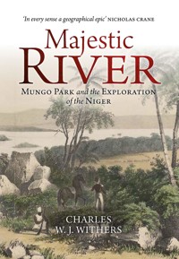
One of the greatest stories of world exploration ever told. By the late eighteenth century, the river Niger was a 2,000-year-old two-part geographical problem. Solving it would advance European knowledge of Africa, provide a route to commercial opportunity and help eradicate the evil of slavery. Mungo Park achieved lasting fame in 1796 by solving the first part of the Niger problem – which way did the river run? Park died in 1806, in circumstances which are still uncertain, in failing to solve the second – where did the Niger end? Numerous expeditions explored the river in the decades following Park's death, but not until 1830 was its final course revealed following in-the-field exploration. By then, however, the Niger problem had been solved by 'armchair geographers' who had never even visited Africa. Majestic River celebrates Mungo Park's achievements and illuminates his rich afterlife – how and why he was commemorated long after his death. It is also the thrilling story of the many expeditions that sought to determine the Niger's course and the facts of Park's disappearance, as well as a biography of the Niger itself as the river slowly took shape in the European imagination. Shortlisted for the Saltire Society History Book of the Year Award
Sie lesen das E-Book in den Legimi-Apps auf:
Seitenzahl: 741
Veröffentlichungsjahr: 2022
Das E-Book (TTS) können Sie hören im Abo „Legimi Premium” in Legimi-Apps auf:
Ähnliche


Contents
List of illustrations
Note on names and spelling
Note on the maps
Preface and acknowledgements
Introduction: ‘Still but a wide extended blank’
1 ‘Its final destination is still unknown’
2 ‘The bustle of life’
3 ‘Geographer enough’
4 ‘The language of truth’
5 ‘The enlargement of our geographical knowledge’
6 ‘Once more saw the Niger rolling’
7 ‘To do justice to Mr Park’s memory’
8 ‘Collect all possible information’
9 ‘Quorra, Quolla, Kowarra, and others similar’
10 ‘The greatest geographical discovery’
11 ‘The river is not correctly laid down’
12 ‘This celebrated African traveller’
13 ‘Cool, impassioned, cowardly, courageous’
Abbreviations
Notes
Bibliography
Index
List of illustrations
Figures
1.1 D’Anville’s 1749 map of Africa
1.2 Boulton’s 1794 map of Africa
1.3 Arrowsmith’s 1802 map of Africa
2.1 Ainslie’s 1773 map of Selkirkshire
2.2 Lizars’ 1787 map of Edinburgh
2.3 Rennell’s 1800 map of Africa according to Herodotus
2.4 Rennell’s 1790 map of Africa
3.1 Ali’s hut at Benowm
4.1 Rennell’s 1798 map of Africa
4.2 Park’s manuscript map
4.3 Park’s manuscript map
4.4 Park’s longitudinal calculations
5.1 Reichard’s 1803 map of Africa
6.1 Mungo Park by Thomas Rowlandson
6.2 Turtle
6.3 Sketch map of the Niger
7.1 Sketch map of the rapids at Bussa
7.2 Riley’s 1817 Niger map
7.3 Mythical mountains
8.1 Bowdich’s 1817 map of the Niger
8.2 Bowdich’s Niger map (detail)
8.3 Barrow’s 1820 Niger map
8.4 Sketch map of Lake Chad
8.5 Sultan Bello’s map of central Africa
8.6 Clapperton’s manuscript map
8.7 Niger hypotheses mapped
9.1 Donkin’s 1829 Niger after Ptolemy
9.2 Donkin’s 1829 Niger and Africa map
9.3 Dupuis’s 1824 Niger map
9.4 Hutton’s 1821 Niger map
9.5 MacQueen’s 1820 map of Africa
9.6 MacQueen’s 1826 map of Africa
10.1 The rapids where Park drowned
10.2 Bussa and the course of the Niger
10.3 Clapperton’s 1829 Niger map
10.4 Banks of the Quorra
10.5 The Niger’s end mapped
10.6 Richard Lander
11.1 The Quorra grounded
11.2 Allen’s 1832–33 Niger map
11.3 Re-naming Africa
11.4 The River Nun branch of the Niger
12.1 Park’s ‘moss moment’
12.2 Park’s memento mori
12.3 Park’s moss
12.4 Park on stage, 1843
12.5 Park on stage, 2016
12.6 1841 monument proposal poster
12.7 Park plaques (Selkirk)
12.8 Park–Lander memorial
12.9 Park plaque (Foulshiels)
12.10 Mungo Park commemorated
12.11 Park plaque (Peebles)
Colour plates (Section 1)
Plate 1 Newark Tower
Plate 2 Sumatran fish
Plate 3 African clematis
Plate 4 Rennell’s manuscript additions to the map of Africa
Plate 5 Park’s travels, 1796–7
Plate 6 Park’s travels, 1805–6
Plate 7 Mungo Park
Colour plates (Section 2)
Plate 8 John Barrow
Plate 9 Playfair’s 1822 map of Africa
Plate 10 Park’s book of logarithms
Plate 11 The steamboats of the 1841 Niger expedition
Plate 12 The explorers of the Central African Expedition
Plate 13 Statue of Mungo Park
Plate 14 Proposed memorial to Park and Lander
Plate 15 Park’s cottage, Foulshiels
Plate 16 Gambia stamps
Plate 17 Mungo Park
Note on names and spelling
Many of the places mentioned by the Niger’s explorers and in Park’s two books no longer exist and for several of those that do, the names have changed in their spelling, or changed entirely, since Park and those who followed him wrote them down. Timbuktu, for example, appears in several different spellings in the sources discussed. Park’s birthplace in the Scottish Borders appears in different forms – ‘Foulshiels’, ‘Fowlshiels’, ‘Fowlsheals’ – the variant spellings sometimes being used even by members of Park’s family. I have kept to the modern form, Foulshiels. Arabic and African personal names are given as they appear in the sources consulted. I have quoted extensively, but always with the reader in mind, so that we can get as close as possible to the conversations, politics, and personal relationships that lie behind Park’s life and the Niger’s exploration. In doing so, I have left intact the original spelling of words and the original form of sentences.
Note on the maps
Maps are important in exploration and to the stories we tell about it. Many of the maps reproduced in this book are large, and so in their original format are either folded, or exist only as fragile manuscripts or were printed, often poorly, in the periodicals of the day. Maps in this period were not all drawn in ‘standard’ ways using modern conventions of scale and orientation. The importance of the many maps included rests less in their specific detail and more because they reveal the slow ‘emergence’ of the Niger in the European geographical imagination – even when the mapped position of the Niger was wholly wrong.
The idea of a great river, rising in the western mountains of Africa and flowing towards the centre of that vast continent; whose course in that direction is ascertained for a considerable distance, beyond which information is silent, and speculation is left at large to indulge in the wildest conjectures – has something of the unbounded and mysterious, which powerfully attracts curiosity and takes a strong hold of the imagination.
J. Whishaw, ‘Account of the Life of Mungo Park’, in M. Park,The Journal of a Mission to the Interior of Africa,in the Year 1805 (1815)
Preface and acknowledgements
Mungo Park and I have been keeping one another company for quite some while. I cannot remember when first I came across him or read his Travels in the Interior Districts of Africa, but I have been researching him, taking notes on the Niger’s exploration, and thinking about Park, his successes, his failures, his still mysterious death, and his varied afterlife, for over twenty years. This book is the result.
Others have turned to Mungo Park before me. In a preliminary note at the start of his 1934 biography of Park, Lewis Grassic Gibbon wrote ‘I think I have read almost everything by or about Mungo Park – everything which still survives in print or manuscript.’ I should hesitate, I know, before making the same claim – but I think it equally true. I can at least say with confidence that I have included much new material on or about Park that has appeared in the nearly ninety years since Grassic Gibbon wrote, especially on Park’s afterlife, including Gibbon’s and other biographers’ views of Park’s achievements.
I have extended Park’s engagement with the Niger to include those who followed him in exploring that river, hoping as they did so not only to solve that part of the Niger problem which Park left unanswered but also to determine how and where he had died. As they did so, geographers of one type or another – ‘in-the-field’ explorers or ‘armchair geographers’ – slowly revealed the course and termination of the river Niger and, equally slowly, reduced Europeans’ ignorance of Africa.
This is, then, a book about Mungo Park and the ‘unbounded and mysterious’ Niger, as Park’s first biographer described it, but it is also about the Niger problem, the Niger’s explorers, and about exploration itself.
All books are collaborative efforts – Park’s 1799 Travels certainly was. I owe much to a great many people for their insight, courtesies, and practical assistance over the years as rough notes and poorly expressed arguments began to coalesce into what I hope is a coherent narrative. Fraser MacDonald, Innes Keighren, Richard Fardon, David McClay, Dane Kennedy, and David Livingstone at various times listened, corresponded, and advised, and I am grateful to them. I acknowledge with thanks the staffs of the British Library, the National Archives, the National Library of Scotland, Cambridge University Library, the Centre for Research Collections in the University of Edinburgh Library, Special Collections in the University of St Andrews Library, the British Museum of Natural History Archives, the Library of Congress Maps Division, Borders Council Archives within Borders Museum and Archive Services, Fran Baker at Chatsworth House Archives, Crispin Powell, archivist to His Grace the Duke of Buccleuch, Margaret Wilkes for assistance with the archives of the Royal Scottish Geographical Society, and Kirsty Archer-Thompson and Claudia Bolling in the Abbotsford Archives. For their assistance with material in the keeping of the Royal Botanic Garden Edinburgh, I am grateful to Graham Hardy, David Long, Lynsey Wilson, and Leonie Paterson. I am grateful to Philip Dodds for drawing to my attention the evidence on Park’s 1799 book in the Bell and Bradfute papers in Edinburgh City Archives. I am grateful to Karina Williamson for her permission to cite as I have from her article on Park with Mark Duffill. I have several times tried to contact Mark Duffill over this article and his biography of Park, but without success, and I hope that this acknowledgement of his fine work will suffice. I am grateful to Raymond Howgego for information on Damberger and the inclusion of elements of Park’s travels within Damberger’s fraudulent narrative of African travels. For assistance with the translations of Park’s Travels, I acknowledge the help of Dan Hopkins over the Danish edition, and Ib Friis for advice on the Swedish edition.
Acknowledgement of permission to reproduce the many illustrations in the book appears alongside the images themselves. It would be a considerable discourtesy, however, not to thank several individuals who were especially helpful in this respect, often in circumstances inconvenient to themselves as they and their institutions faced restrictions upon access to the original material and to their reproduction. It is a pleasure in this respect to acknowledge Eugene Rae and Joy Wheeler in the Royal Geographical Society (with the Institute of British Geographers), Lucinda Lax and Helen Smailes of the National Galleries of Scotland, Laura de Beaté of the Borders Museum and Archives Services, Megan Barford and Beatrice Okoro of the National Maritime Museum, Paul Cox of the National Portrait Gallery London, Paul Johnson of the National Archives, and, in the National Library of Scotland, Chris Fleet in the Map Library and Hazel Stewart in the Library’s Imaging Services. Chris Simmonds was immensely helpful in helping prepare the illustrations for publication.
I am honoured that Nicholas Crane and Dane Kennedy accepted the invitation to write a few words about the book and I thank them for their endorsements, Nick as a best-selling author and TV geographer, Dane as a leading figure in the histories of exploration. Thanks also go to the staff at Birlinn, especially Hugh Andrew for his encouragement over the book, and to Andrew Simmons for his patience and guidance. James Rose was an excellent copy-editor.
My final thanks go to four people without whom this book probably would not have been written in the ways it has, or perhaps at all. Andrew Grout has acted as a research assistant to me, formally and informally, for many years and has, again, proven himself peerless in tracking down unusual and hard-to-find Park material. Henry Noltie, always a patient listener and source of sound advice as well as being a walking companion and a fine writer, drew my attention to the Park material in the Royal Botanic Garden Edinburgh. Years ago, Jim Cameron of the University of Western Australia generously passed to me his notes on Barrow and the Niger’s exploration: I hope I have done his own research justice in the use I have made of it. Last, but always first, I owe so much to my wife Anne. She took several of the photographs that appear in the book and, uncomplainingly, has had to live with me and Mungo Park for quite some while.
Introduction
‘Still but a wide extended blank’
Mungo Park and a 2,000-year-old geographical problem
This is a book about geography, exploration, and death. It is about the life, death, and afterlife of the Scottish explorer Mungo Park who in 1796 solved the first part of a 2,000-year-old geographical puzzle and who, sometime in 1806, died failing to solve the second. It is about the achievements and the failures of those men who, following Park, sought to solve what to Europeans was the world’s greatest geographical puzzle – and who died trying. And it is about those men who did solve that puzzle without leaving home. This is a story of geography, biography, authorship, exploration, and the river Niger.


