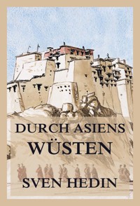
Scientific Results of a Journey in Central Asia 1899 - 1902. Vol. 1: The Tarim River E-Book
Dr. Sven Hedin
12,99 €
Mehr erfahren.
- Herausgeber: Jazzybee Verlag
- Kategorie: Gesellschafts- und Liebesromane
- Sprache: Englisch
Hedin's expedition notes laid the foundations for a precise mapping of Central Asia. He was one of the first European scientific explorers to employ indigenous scientists and research assistants on his expeditions. Although primarily an explorer, he was also the first to unearth the ruins of ancient Buddhist cities in Chinese Central Asia. However, as his main interest in archaeology was finding ancient cities, he had little interest in gathering data thorough scientific excavations. Of small stature, with a bookish, bespectacled appearance, Hedin nevertheless proved himself a determined explorer, surviving several close brushes with death from hostile forces and the elements over his long career. His scientific documentation and popular travelogues, some of them illustrated with his own photographs, watercolor paintings and drawings, his adventure stories for young readers and his lecture tours abroad made him world-famous.
Das E-Book können Sie in Legimi-Apps oder einer beliebigen App lesen, die das folgende Format unterstützen:
Seitenzahl: 1085
Veröffentlichungsjahr: 2023
Ähnliche


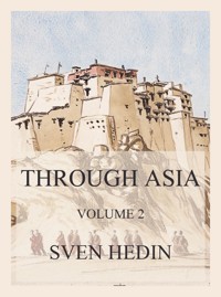


Scientific Results of a Journey in Central Asia 1899 - 1902
Volume 1: The Tarim River
SVEN HEDIN
Scientific Results of a Journey in Central Asia Volume 1, Sven Hedin
Jazzybee Verlag Jürgen Beck
86450 Altenmünster, Loschberg 9
Deutschland
ISBN: 9783849663247
www.jazzybee-verlag.de
CONTENTS:
CHAPTER 1. FROM KASCHGAR TO THE JARKENT-DARJA.1
CHAPTER II. THE JARKENT-DARJA FROM LAJLIK TO KURUK-ASTI.7
CHAPTER III. FROM KURUK-ASTI TO THE CONFLUENCE OF THE KODAJ-DARJA.25
CHAPTER IV. THE KODAJ-DARJA AND THE KASCHGAR-DARJA.53
CHAPTER V. HYDROGRAPHIC RELATIONS OF THE JARKENT-DARJA AND THE AK-SU-DARJA,75
CHAPTER VI. FROM THE CONFLUENCE OF THE AK-SU-DARJA TO INTSCHKÄ.81
CHAPTER VII. FROM INTSCHKÄ TO KORAL-DUNG.97
CHAPTER VIII. THE JUMALAK-DARJA TO TOKUS-KUM.114
CHAPTER IX. FROM THE TOKUS-KUM TO KARAUL.132
CHAPTER X. THE HYDROGRAPHIC RELATIONS OF THE UGEN-DARJA AND THE TARIM.149
CHAPTER XI. FROM KARAUL TO JANGI-KÖL.160
CHAPTER XII. THE STRUGGLE BETWEEN THE RIVER AND THE SAND.169
CHAPTER XIII. THE INTRICATE NETWORK BETWEEN KEPEK-UJ AND AJAGH-ARGHAN.186
CHAPTER XIV. BOLDSCHEMALS, THEIR FORMATION.203
CHAPTER XV. FROM AJAGH-ARGHAN TO JURT-TSCHAPGHAN.216
CHAPTER XVI. RELATIONS BETWEEN MARGINAL LAKES AND DUNES. — BAJIRS AND DUNE-MOVEMENTS.236
CHAPTER XVII. THE TOGHRAKLIK-KÖL AND THE KARAUNELIK-KÖL. MUTUAL RELATIONS OF LAKES AND DUNES.266
CHAPTER XVIII. THE ULLUGH-KÖL AND BEGELIK-KÖL.297
CHAPTER XIX. GENERAL CONCLUSIONS REGARDING THE LAKES.323
CHAPTER XX. THE BAJIRS.336
CHAPTER XXI. BAJIRS WITH KAMISCH –– DESERT SNOWS.355
CHAPTER XXII. ON DUNE-FORMATION AND SANDY THRESHOLDS.376
CHAPTER XXIII. A TRIP TO ANDERE-TEREM.400
CHAPTER XXIV. THE LOWER TSCHERTSCHEN-DARJA.413
CHAPTER XXV. THE ETTEK-TARIM –– TAGH-KUM.432
CHAPTER XXVI. THE RETURN JOURNEY FROM ARGHAN TO JANGI-KÖL.446
CHAPTER XXVII. THE SCHIRGE-TSCHAPGHAN BRANCH AND CANALS.464
CHAPTER XXVIII. AN EXCURSION UP THE EASTERN WATERWAY OF THE TARIM DELTA.483
CHAPTER XXIX. THE ARKA-KÖL, TAJEK-KÖL, KARA-KÖL, ETC.500
CHAPTER XXX. THE KUNTSCHEKISCH-TARIM AND ITS CONNECTIONS WITH THE KONTSCHE-DARJA.516
CHAPTER 1. FROM KASCHGAR TO THE JARKENT-DARJA.
The road which I traversed on 5 — 10th September 1899 between Kaschgar and Lajlik was already known to me in great part from my journey of 1895. But as it is shown on the atlas which accompanies this work, I may say a few words about it, especially as I have some new observations to add. These may be regarded as a sort of text to the first plate of the atlas.
I began my cartographical work immediately I got outside the Kum-darvase gate of Kaschgar. Thence we proceeded along the well-known road southwards, over the three bridges which cross the Kisil-su to Jangi-schahr. The river however now carried a very small quantity of water. Here about three o'clock a storm burst upon us which in violence exceeded anything I had conceived possible in the basin of the Tarim. For an hour and a half the rain literally came down in torrents, making the clay soil soft and slippery; while the thunder crashed deafeningly after every vivid flash. Shortly after leaving on the right the northern wall of Jangi-schahr, we found the road for several kilometers completely under water; in fact, the only guide we had as to where the track ran was the string of huts and gardens which stood beside it. After a while however the ground became drier, showing that the squall, which came from the north-west, had followed a well-defined course, and had not proceeded very far to the south-east; and the night which ensued was perfectly fine. Passing by the big kischlak or winter settlement of Natschuk, we encamped at the village of Musulman-natschuk, also known as Kaltanatschuk (Short Natschuk), a place of some 250 households.
During the whole of the following day both the Tien-schan and the Pamirs stood out with unusual clearness and precision. Owing to the recent rain, the atmosphere was remarkably pure and free from dust, so that the steel-blue flanks of the mountains, and their snow-white crests, wreathed in light fleecy clouds, came out with telling effect. Upon reaching Tschige-tugh, we struck an old riverbed, the course of which was defined with the utmost distinctness. The water it contained, coming direct from Jangi-schahr, was stationary, and consequently quite clear. This old riverbed was called the Kona-darja or Kona-jaman-jar. The road crossed it at the village of Bogha-achun-lengeri, where it was also spanned by an elevated arik (irrigation canal), likewise fed by the Kisil-su. The road here was splendid, hard and dry, and led through an avenue of willows (suget) and poplars (toghrak), bordered on both sides by canals, which kept the vegetation fresh. The country hereabouts was very well cultivated, though not at all thickly inhabited.
On our left we next had the principal channel of the Kona-darja, and on our right a branch of the same. The latter, which in the district of Jajlak was known as the Kelvetschuk-darja, goes as far as Fajs-abad; and as its water is derived from the Kisil-su, it was extremely muddy, and flowed at the bottom of a trench 3 ½ meters below the level of the adjacent country. Its sharp-cut banks were in places steep, but in others shelved gradually down to the water, and were overgrown with meadow-grasses. The volume in this side-arm amounted to about 12 cubic meters in the second. At the little bazaar of Jajlak our road crossed the stream, there called also the Fajs-abad-darjasi, by a handsome, well-made bridge of a single span. It is constructed of stout beams stretching from bank to bank, with planks laid transversely across them, and is provided with a parapet on each side one of the most serviceable bridges I have seen in East Turkestan. At the bridge the stream measured ii m. in breadth and had a mean depth of 11 m. and a velocity of at least 1 m. in the second.
We now had on our left the Fajs-abad-darjasi and on our right the Kisil-bojedarja, which also derives its water from the large deltaic arm on which Jangi-schahr stands. In this way the country is traversed and watered by a system of radiating deltaic arms or canals, all pointing, like fingers or tentacles, towards the east. For a correct understanding of this complicated irrigation system, it is not sufficient to cross over the several arms, but one must follow them first up and then down, until one sees distinctly where they begin and where they terminate. The large canal of Kan-arik, which draws its water from the Ges-darja, lay to the south of our route.
After passing a tract characterized by a few scattered orchards and cultivated fields, we came to more open country, where good pasturage abounded on both sides of the road. As the only bridge across the Kisil-boje consisted of two tree-trunks, we preferred a ford, where the river was 26 m. broad, and had a mean depth of 0.60 m. and a mean velocity of 0.80 m. in the second, and consequently a volume of about 12.5 cub. m. in the second. The bottom consisted of soft, fine mud, into which the camels sank deeply, so that we were obliged to lead them across one by one and use the utmost care in doing so. On the other side of the stream the track continued to be uniformly good, except that it was crossed at intervals by ariks with a soft muddy bottom. The avenues of trees had now for the most part ceased. The horizon all round was generally dotted with groups of trees, though they were at a considerable distance from our line of march. Here are the villages of Il-kitschi-ojle and Dangaltschi. Between the latter and the village of Jangi-arik stands the masar or saints' tomb of Kara-kan-patschim, crowned with the usual cupola. After that we crossed the Kan-arik canal, which near the village of Madscha is called Tukku-su. From it is derived the water which irrigates Jangi-arik. Thus we were now in contact with the system of the Ges-darja. The canal continues to Terem and Moghal and sends off an arm which supplies Jupoga. Higher up this big irrigation artery lie the villages of Bore-kitaj, Urum-basti, Okesch, Janje, and several others. The village af Kan-arik possesses a large and lively bazaar, in which the products of the district, such as cereals (especially maize and wheat), fruits, cotton, and so forth, are bought and sold. The estimates of the population of the place differ widely, and consequently cannot be relied upon. In 1895 I was told that it embraced 1000 households; in 1899 the beks, or begs, of the town asserted that it exceeded double that number. Any way Kaschgar, which is situated in a relatively sterile and badly watered region, derives a large portion of its natural supplies from this fertile district.
At Kan-arik I turned off from my route of 1895, leaving it to the south, and proceeded direct to Jupoga, which I had not visited on the former occasion. The road now traversed a magnificent avenue of willows, mulberry-trees, and poplars, standing so close together as to plunge the track into deep shade. The poplars, which were of the ordinary kind, were here topped, or pollarded, to prevent them from getting too tall; and their branches, all growing straight up, formed a sort of inverted tassel or sheaf. For long stretches the foliage was so dense that the road resembled a tunnel of greenery, through which not a single ray of sunshine was able to pierce — most cool and refreshing on that hot autumn day. From the kischlak of Kan-arik the road runs direct to Fajs-abad.
For a couple of hours after leaving Kan-arik the country is desert, partly flat sand dotted with tussock-grass, partly schor, or moist saliferous ground destitute of vegetation. Then we came to the villages of Jangi-arik och Jek-schambabasar, and beyond them again was the desert. The sand-dunes we here encountered, sporadic outliers of the sandy desert to the south and south-east, were not more than 3 meters high and presented their steep faces towards the east, indicating that at that season of the year the prevailing winds came from the west. Next we passed through the villages of Toktaka and Kalta-jajlak. Between the latter and Kajgulla, a village belonging to the district of Jupoga, were extensive fields of maize. Here we had on our right an arik which shed off from the Kan-arik; it was some 3 meters wide and carried a considerable volume of water. We crossed it just before entering the village of Jupoga, with its houses of adobe or sun-dried bricks, its gardens and orchards, its fields of maize, and reservoirs for holding the overflow-waters of the Kan-arik. The year of our visit the canal was said to carry a less quantity of water than usual; in fact, there was barely sufficient for the needs of the place. Jupoga, with its associated villages, was reputed to embrace 2000 families, each of 4 to 10 members, an estimate which is undoubtedly too high. At any rate Jupoga is not bigger than Kan-arik. Here the usual cereals are grown, except rice, for which there is not sufficient water.
Irrigation is supplied by the Ges-darja, coming via Tasghun and Kan-arik. For twenty days every summer it is continued on from Jupoga to Terem and Moghal, and the time of our visit fell about a month after the supply to these places had been cut off. Whenever there is sufficient water to admit of it, more than a twenty days' supply is allowed. In the autumn however, when Jupoga has fully satisfied all its requirements, the current is allowed to flow on to Terem and Moghal; but it is then of course practically useless for the crops. In years of great scarcity the people are compelled to have recourse to wells.
From Jupoga one road goes due north to Fajs-abad, and another south-southwest to Atschik. According to the native mode of reckoning, it is 50 jol to the former place and 40 jol to the latter, or in our reckoning 32 and 21 kilometers respectively. [1]A third road runs from Jupoga to Moghal, and on through Avat to Mejnet. It was however reported to be difficult for camels by reason of the salt and marshy ground it traverses and the ariks being destitute of bridges; besides, it is longer than the route via Terem. Beyond it on the north stretches a barren and uninhabited desert of flat sand.
On the 9th September we travelled from Jupoga to Terem. Leaving behind us the fields of the first-named, we entered upon the steppe, dotted over with scrubby vegetation. Here we met numbers of countrymen or peasants on their way to the market at Jupoga, transporting their produce on the backs of horses, mules, and oxen. Next came a very thinly inhabited tract called Jildislik, where the clay huts are surrounded by poplars and willows. Across it run several more or less barren sand-dunes, with their steep sides towards the east-south-east. Here and there were patches of maize and cotton, amongst which wound a few wretched ariks, then mostly dry, though one or two were still moist from the last overflow from the Kanarik. Occasionally we saw a flock of sheep. Thereafter we had for some time sand on our left and a tamarisk steppe on our right. Close beside the track, also on the right, stands the masar of Habdan Busrugvar, with its fluttering streamers; and not very far from it was a little köl or pool, surrounded by poplars. Although the region was on the whole barren, nevertheless we came every now and again upon an isolated homestead. When the last narrow belt of sand-dunes was passed, we once more entered the steppe. The road was still good and easy, though painfully dusty. At length it began to narrow, as we came to a part where the regular traffic diminished.
At Sangelik on the outskirts of Terem we again struck the Kan-arik; it was perfectly dry, about 4 m. wide, and had a sandy bottom. The little bridges which spanned it proved however that it did carry water sometimes. The avenue which lines it consists of young trees and is thin and full of gaps; in some places the trees are only planted on one side. The wretched little bazar of Terem was empty and deserted, all the traders and peasants having gone to the market at Jupoga. On the eastern outskirts of the village, which are known as Koselek, we found a köl or reservoir, artificially made and surrounded by a rampart of earth, and not more than 0.6 m. deep. It had been filled thirty days previously, and the water still remaining in it was estimated to last ten days longer. When it gets empty, the people dig a well in its deepest part, and reach fresh water at a depth of 1.7 m.; though a short distance from the reservoir it is necessary to go down 5 m. before water is reached, and even then it is not perfectly fresh. The twenty days' supply from the Kan-arik was nothing like enough for the needs of the village; while of the violent downpour which we had encountered on the 5th September, nothing more than a fine drizzle had reached the vicinity of Terem.
Next day we soon left behind us the last homestead and well and had nothing but the barren desert in front of us. At the same time the extreme arteries of the irrigation-system came to an end, and the outlines of the mountains disappeared in the dust-haze. The vegetation also gradually died away, and the bushes grew smaller and smaller. Here was the well of Kara-kum-kuduk, then perfectly dry, it having been abandoned several years ago. It was said to have been fully 12 m. deep at the time it was in use. Another well however Mahametning-kudughi, did contain water, which, I found, had a temperature of 15.8° C. The surface consisted of sand and dust, and the track was easy to follow. On our left we had low sand dunes overgrown with vegetation; this is called kara-kum or "black sand". On our right the sand is barren; this is called ak-kum or "white sand". Between these two expanses of sand the road ran along a narrow strip of steppe, a sort of continuation of the chain of oases watered by the Kan-arik. At length however vegetation grew more abundant, though it consisted only of tamarisks, dead as well as living, growing on their characteristic conical pedestals, and thinly scattered toghraks or poplars, with short stumpy stems, several of these also in a state of decay. After crossing a belt of sand with continuous and regularly formed sand-dunes, which consistently turned their steep faces towards the east and south-east, we approached the caravanserai of Lenger. This consisted of two small huts, overhung by poplars, a köl or reservoir, and a canal coming from the Jarkent-darja, which is said to leave the left bank of this river about 6 potaj above Lajlik. We formed our camp, which was to be the starting point of our long journey down the river, about half an hour north of the station of Lajlik.
CHAPTER II. THE JARKENT-DARJA FROM LAJLIK TO KURUK-ASTI.
After this short introduction, which has carried us from Kaschgar to the threshold of the region that is to be described in the course of the present volume, I now pass to an account of the Jarkent-darja, or, as the river is called after its confluence with the Ak-su-darja, the Tarim.
My investigations into this river fell in two .separate periods, the first extending from the 17th September to the th December 1899, the second from the 19th May to the 21st June 1900; and they were made from an ordinary ferryboat of the type which is commonly employed in the district of Jarkent for crossing the river on the great caravan routes. It was 11.51 m. long, 2.37 m. broad, and 0.83 m. deep, and was constructed of planks of poplar-wood. As the only means of progression I used was the river, my itinerary was of course entirely determined by the velocity of the stream, which is naturally subject to considerable variation according as it is affected by the inclination of the surface, the accession of tributaries, the volume, the age of the channel traversed, and so forth, in a word, by the various factors of a physical-geographical character which will be all discussed in the following pages. On the other hand, I disregard the effect which the atmospheric and similar conditions have upon the rate of flow of the current. The parallelism, which unquestionably exists in this respect, can be deduced directly from the meteorological tables contained in another volume of this work. I would merely observe here, in this connection, that the volume of the stream depends upon the season, in such a way that high water follows upon the melting of the snows, and is then succeeded by low water; that the maximum volume is found in different sections of the stream at different periods, a consequence of the river's great length; that the formation of the ice and its break-up are dependent upon the temperature of the atmosphere; and that the distribution of the atmospheric pressure, the direction of the prevailing winds, as well as the storms, may to some degree at least exercise a varying effect upon the rate of the current. Nor are these the only external conditions by which the volume is determined. It is also affected by the presence of marginal lakes or lagoons, which, when they are present in considerable numbers, very appreciably retard the period of high water, so that, for example, in the lowermost reaches of the Tarim, this period occurs three or four months later than it does at the confluence of the Ak-su-darja with the Jarkent-darja, and five months later than it does in the Raskan-darja. Yet what relation exists between the volume of this river and the progress or decay of agriculture in the oases of East Turkestan, or how far the one is dependent upon the other, is not easy to say, owing to the absence of trustworthy and sufficient statistics. But that the complicated system of interlacing irrigation canals, which circulate over the greater part of the area of these oases, must of necessity diminish the volume of the river before it reaches its termination at Kara-koschun, does not admit of any doubt.
The task therefore which I have set myself in the following chapters is to present a detailed description of the geography of the Tarim. I shall deal with the riverbed and its varying conformation in different parts of its course, as well as with the changing character of its erosive action upon the surface of the regions it flows through. The bends or sinuosities of the river, its silt-beds, its alluvial deposits, its banks or erosion terraces, and their varying character according as the stream makes its way through forests, steppes and sand-deserts, or washes the foot of detached mountains; the highways, the riparian population and all that concerns them, the irrigation canals, the navigation of the stream, and its fisheries — all these will be successively dealt with as far as my observations, and the information I gleaned about them, will admit. And I shall everywhere give the geographical names which are used in connection with the river itself, or in the immediate vicinity of its banks. Still, the main channel, and the hydrographical relations of its current, will be the principal subjects of consideration throughout. Indeed, considering my means of locomotion, namely that I travelled by boat, and had neither horse nor camel to ride, I cannot very well discuss anything else except the river and the circumstances connected with it. Apart from the actual drift down-stream, I have nothing to record except one or two short trips on foot or in my sailing skiff.
When we have thus the detailed description of the Tarim and its hydrographical phenomena before us, we shall be in a position to gather up the results in a general survey, and draw such conclusions as the data suggest, as well as to consider the relations which exist between the river and the general relief and slope of East Turkestan.
At the point where I began my journey, immediately below the station house of Lajlik, barely one half of the riverbed was on 16th September actually under water; and the current ran close to the right bank. The channel is therefore deeply trenched and overhung by an almost vertical erosion terrace 2 ½ m. high. Immediately under the left bank is a disconnected arm, containing stagnant water; and between this and the active current is a dry mud-bank or silt-bed. Both banks of the river are overgrown with bushes and young forest, frequently thick and tangled like thickets. The road to Maral-baschi runs along the left bank, touching tangentially those loops of the winding river which point to the west.
The actual current had there a breadth of 134.70 m. and a volume of 98.2 cub. m. in the second. The channel was very regular, and by far the greater portion of the current kept, as I have said, to the right bank, that is to say, the concave or peripheral boundary of the loops which project towards the east, and where consequently the erosive power of the stream was most conspicuously manifested.
Dividing the bed of the river into three transverse sections of equal breadth, I found that the one on the right carried a volume of 70.6 cub. m. in the second and had a mean depth of 2.03 m. and a mean velocity of 0.846 m. in the second; that the middle section had 23.915 cub. m., with a mean depth of 0.53 m. and a mean velocity of 0.893 m. in the second, while in the left-hand section the volume amounted to 3.753 cub. m., with a mean depth of 0.34 m. and a mean velocity of 0.24 m. Thus, while the stream was decidedly shallow next the left bank, its maximum depth, under the right bank, amounted to 2.74 m.
With the view of facilitating the use of the map, I intend in my descriptive text to adhere to the diarial form in which my observations were first recorded; each camp where we stopped for the night is indicated by name, with the date attached, on the map itself.
On the 17th September we traversed two fairly sharp loops or curves, with broad alluvial deposits lining the convex or inner bank in each case. The natives, rightly enough, regard these sharp bends, round three sides of which the river winds, as peninsulas. Hence the first name we met with after leaving Lajlik was Araltschi or "the Island-like", from aral, an "island". Here the banks were planted with young forest, low and tangled, and thorny bushes. The banks (kasch or jar) were as much as 3 m. high. These forest tracts generally bear a different name at each bend of the Stream, and these it was of importance to note, as they frequently throw some light upon the local topography. For instance, Arpalik-kaja tells us, that corn is grown in that district; Kakschallik signifies "dry tree"; Tonguslik explains that wild-boar frequents the vicinity, or once did so; and Kalmak-jilghasi perpetuates the traditions of Mongols (Kalmucks) having once dwelt there. Muhammed-Ili-lenger is the name of a caravanserai, standing on the great caravan-route amid a grove of tall, slender poplars. Other names which figure in the forest nomenclature are Ara-koscha and Ghasanglik. The former marks the point of issue of an irrigation canal (arik), which runs west to Avat, though it only carries water in the height of the summer; indeed I think it very doubtful whether the canal really does reach the oases at all. At all events, in the course of an excursion which I made there on horseback in 1895, I remember encountering two dry riverbeds, which the canal would of necessity have to get across.
At Muhammed-Ili-lenger the river had two years before altered its course for a short distance. The channels which the stream thus abandons are known throughout the whole of the Tarim region as Eski-darja or Kona-darja (Old River), while the new channel is called Jangi-darja (New River). At the beginning of this 'old river' there was a pool of water (köl)When it contains water, an old channel of this kind is known as a boldschemal. And these abandoned loops or partes relictae of the river, caused by its seeking a new channel for itself, are very common all the way to Abdal. Every year the stream changes its course somewhere or other, often in several places more or less simultaneously. Hence, strictly speaking, the map which I laid down, and which is reproduced on a reduced scale in the accompanying atlas, cannot claim to represent the actual course of the stream for any great length of time. Some of the loops in the river approximate so closely to a complete circle, that the narrow neck of land remaining would hardly be able to withstand the full flood of the following year. In other localities, where the riverbed is straight, as well as deeper, there is every likelihood of the stream flowing on unchanged for a score of years, or more. Were another map of the river to be constructed twenty years hence, and to be compared with this which I have been enabled to execute, we should be able to perceive to what extent, and in what directions, the stream had altered its course in the interval; and should moreover be in a position to estimate its erosive energy, and measure the mass of its alluvial deposits, as well as to infer the law which from time immemorial has governed its excavating power.
In the region where my journey upon the Tarim commenced, the current flowed at a gentle rate, the fall from Jarkent downwards being inconsiderable. I measured the velocity several times a day. During the first day's journey it amounted to 38.2 m. in the minute; and continued to decrease all the way to the confluence of the Ak-su-darja. It is self-evident, that at the period of high water the velocity is very much greater, and that, had I embarked upon my journey at that season, my progress would have been very appreciably quicker. But the autumn possessed this advantage over the summer, that, large portions of the riverbed being exposed, I was enabled to study its conformation with greater convenience. As a rule the stream drops intermittently in the autumn, the daily decline being but trifling, as we were easily able to see by studying the sharp-cut edges of the miniature banks round the exposed silt-deposits. Although the erosive power of the current diminishes in the autumn, still the evidence of its disintegrating effects upon the 2 to 3 m. high banks was easy to see along those stretches which received the impact of the main body of the water (which of course, moves the fastest) in the not inconsiderable masses of earth which every now and again plunged into the stream, and were swept away, to be deposited elsewhere lower down.
On the 18th September we again navigated two big loops pointing towards the west. In the straight reaches the bed was narrower, the flow more equable, the depth more uniform, and the alluvial formations relatively insignificant. In the first of the two loops just mentioned the channel was, on the other hand, very broad, and the flood had to find its way amongst vast deposits of alluvium and exposed silt-beds. The banks still continued to be set with young forest (toghrak or poplars) and bushy undergrowth. In many places the roots of the trees projected from the vertically scarped banks and trailed in the water below. The stream was too turbid to make fishing a profitable occupation. Flocks of sheep were grazing along the banks, and the shepherds dwelt in huts built of branches and foliage, precisely as their fellows do in the woods alongside the Chotan-darja and the Kerije-darja. The extremities of the west-going bends still continued to touch the caravan route to Maral-baschi.
Between the two big loops which we traversed on this day, and a little bit back from the river, stood the village of Mejnet, with a station house and a bazar; and here the stream is generally crossed, with the help of two ferryboats, by persons using the bye-road which comes from Merket and other villages situated on the right bank of the Tarim opposite to Lajlik. During the course of the day we passed the following localities — Kerije-tokaj, Kakschal, Atscha-kasch, At-pangsa-tokaj, Araltschi, Kara-tokaj, Mejnet, Bisch-jol-tschakil, and Bisch-köl. At the last-named the river was 86.40 m. wide, its maximum depth 2.22 m., its mean depth 1.229 m., mean velocity 0.7544 m. in the second, and its volume 80.09 cub. m. in the second. This shows how swiftly the river falls on some days in autumn; though it must also be observed, that in the day's journey the river parted with some of its water to the irrigation channels which are there led off from it.
September 19th. At first the river flowed due north, afterwards almost due east. The accompanying forest, although it grew a little thicker, still remained less than 4 m. in height. The vertical face of the containing banks seldom exceeded 1 ½ m. The nomenclature bears witness in the name Kum-tokaj (Sand Forest) to the arenaceous character of the surface. Kosch-toghrak (Double Poplar) derives its name from the fact that the great caravan road passes there between two high poplars; the same district is also called Kosch-otak. There too a mill is driven by a little canal issuing from the river. In that same locality the stream is very broad and expanded. Immediately below the place last named a canal strikes northwards from the river and irrigates the fields of Jeren-patti, where the shepherds grow maize and wheat. At Schaschkak there are old and lofty poplars; the place is inhabited by four shepherd families, owning some 200 sheep, besides a number of goats and cows. These people also carry on some agriculture, their fields, which lie on the right bank of the river, being watered by a canal which quits it at Bisch-köl. The information which I gathered during the course of the day is not devoid of interest. For instance, I was told that the river had reached its maximum flood two months before the time of our visit, that is to say, about the 20th July; and since that date it had been subsiding, at first slowly, but later on more rapidly. It was expected to freeze there in about 75, or at the most 80, days. There too the ice is wont to remain for three months. After the ice melts, and after the water thus liberated has flowed away, there remains so little in the river that its bed can be forded in several places.
At Schaschkak the current was very narrow and deep. Its breadth amounted to 42,6 m., of which a portion, 5 m. across, next the left bank, was dead, that is to say, it had no current. The maximum depth was 3.90 m., and the mean depth 2.274 m. The mean velocity = 0.6608 m., and the volume 64.01 cub. m., in the second. Thus the river still continued to show an appreciable fall. At our camp the face of the right bank measured vertically 2.30 m.
During the night the level dropped 1 cm.; but during the next following night it rose again at the same place 1 ½ cm. These oscillations would seem to depend partly upon an accession of water from the mountains and partly upon the distribution of the atmospheric pressure over the lowlands.
September 21st. The river still maintained the same characteristics. We stopped for the night at a sharply accentuated bend. Amongst the geographical names was Jolbars-kotan (Tiger-hut), showing that tigers once frequented the locality, although at the present time they are rare visitants there. At Schejtlik there is a good, close-growing poplar wood, and shepherds graze their flocks in the vicinity. Although their huts are as a rule erected close to the river for the sake of its water, it was difficult to obtain any idea of their numbers. Other geographical names which occur in this district are Boghu-patti, Nakas, Dukan-toghrak, Kisil-sepetsch, Daschi, and At-pangsa. At the sharp turns the depth was as much as 5 or 6 m., and in this part of its course the river winds about in every direction. At our night-camp the breadth measured 69.3 m., the maximum depth was 2.30 m., the mean depth 1.434 m., the mean velocity 0.5382 m., and the volume 53.47 cub. m., in the second. The sharper the bends the higher and the more scarped are the banks, here, for example 2 ½ m. high.
September 22nd. A small canal, led off from the river a little below Bereghes (to turn a mill), issued through a deep cutting in the right bank and still contained water, proving that the country on that side of the river lies lower than the stream even at the season of low water. During the past night the level had not changed in the slightest degree. In places the forest was now quite dense, and the trees of great size. This was especially noticeable at the sharp elbows of the stream, where the erosion was most pronounced, the water having, as it were, eaten its way into the forest. The outermost angles of the opposite bank were filled with the crescent-shaped alluvial deposits left by the stream, and on the shore side of these there were of course only young forest and brushwood. It was at the apexes of the sharp bends, too, that we measured the greatest depths, caused by the eddies which are there set up in the current. Indeed the river always exhibits a considerable depth in such places, even in spring. The backwater, or 'dead'-water, which we sometimes encountered on the surface, is called by the natives köl, i.e. 'lake', in contradistinction to akin, darja, or tarim, the names they give to running water.
Below the mill I have mentioned the right bank bears the name of Kök-köl. Then comes, on the left bank, Tongus-oldi, with a stagnant pool, and beyond it in succession Kalingning-dschaji, Korum, Ala-ajgir, this last with a station-house on the great caravan highway, and a ford which is used in the spring. The depth immediately below the ford amounted to 5 ½ m. Further on lie Tschürge and Schakkal-otak. A Kona-darja or Old River, dry when we passed it, which issues through the right bank at Korum, extends due east towards the sandy desert, and seems to imply that at some time or other the river has here for a space shifted its course to the left, i.e. to the west, contrary to its habitual tendency, which is to select new channels for itself towards the right. This dry bed which leaves the river at Korum is unquestionably identical with the sheets of water which I chanced upon in the desert on 14 — 16th April 1895 about 30 km. east of Ala-ajgir. Notwithstanding the name of Konadarja given to them they did not constitute a regularly formed and connected riverbed.
Were it the survival of a former overflow channel of the Jarkent-darja, its bed would still admit of being traced. Now the natives seldom err in their information with regard to such things, so that I am quite disposed to believe, that the sheets of water which I discovered in 1895 had their origin in some unusually extensive overflow of the river coming from the neighbourhood of Korum. In that case, the Kona-darja would really mark the beginning of a new, and not the beginning of an old, bed, into which the current will by degrees eventually transfer itself. And we shall soon find, that movements of this character towards the right have already taken place in other localities.
During the course of the day the river grew both narrower and deeper, while the current at the same time flowed more slowly. At Schakkal-otak, the breadth only amounted to 35.3 m.; the maximum depth was however 4.98 m. and the mean depth 2.965. m.; the mean velocity 0.6322 m., and the volume 66.16 cub. m., in the second. These results are not however altogether reliable, owing to the fact that for such an appreciable depth the velocity readings were not taken sufficiently close together along the vertical line; for in all probability the velocity at the lower depths was inconsiderable. Anyway an increase of 13 cub. m. in the volume on the previous measurement does not seem likely. The Schakkal-otak results are therefore too high.
September 23rd. In this part of its course the surface of the Jarkent-darja was copiously littered with driftwood. In many places an entire poplar had fixed itself in the river-bottom, and, by arresting the floating branches and brushwood, gradually given rise to islands as the silt and sand concentrated around them, binding them into a consolidated mass. On each side of these obstacles the stream had usually scooped out a deep trench, building up a ridge of silt along the continuation line of the mass of driftwood. These accumulations of driftwood nearly all come from the projecting elbows of the sharp bends, where the current, eating into the forest, undermines the trees nearest to the edge, and so causes them to topple down into the water and be swept away.
Every landslide in such places carries with it masses of intertwined roots. It is at these sharp bends that the erosive power of the stream is most conspicuously displayed, not only upon the extreme face of the elbow itself, but also in the riverbed at its foot. The sharper the elbow, that is to say the greater the change of direction in the river's course, the greater becomes the conversion of the power which is represented by the movement of the water into another species of energy, namely the erosion of the concave bank and of the river bottom immediately contiguous to it. The sharper the bend, therefore, the greater becomes the depth of the river adjacent to it. On the opposite or convex side the work of depositing alluvium proceeds simultaneously at a corresponding rate. And in a country like East Turkestan, where the general inclination is so slight, and the surface consists of such soft and pliant materials, there exists practically no check upon the sinuous tendencies of the current At the same time there is a period of maturity naturally prescribed for each bend; for if each loop or elbow is regarded as a peninsula, then its root, or connecting isthmus, becomes assailed from both sides at once; the opposite margins gradually approach one another, until there is only a narrow neck or mere strip of land left between them, and filially this becomes so weak that it is unable to resist the next flood, and is consequently cut in two. In this way what was originally a loop of the river becomes entirely abandoned, and is converted into a boldschemal ("deadwater" or "backwater"). One consequence of this activity is that the country through which the river carves its way becomes still further levelled down. In the course of the subjoined description of the Jarkent-darja and the Tarim we shall several times have occasion to dwell upon similar abandoned loops. That the belt of forest which accompanies the Tarim is as broad as it actually is, probably depends in no slight degree upon the river's instability, and its aversion to persist for any length of time in one and the same bed.
A short distance below Schakkal-otak the river shed off on the right an arm which was lo m. wide at its inception and was contained between steep banks. Although shallow, it nevertheless carried, for a short distance, a volume of some cubic meters of foaming water, which however speedily found its way back into the mainstream. Possibly it owed its origin in the first instance to an artificial canal, which has been gradually widened and deepened by the natural action of the water. The greater velocity of its current was due to the straightness of its bed, and the fact that it lost none of its energy in getting round extensive curves. In all probability the main current will soon gravitate into this short cut. Immediately above the point where it struck off the depth of the mainstream amounted to 6 m. and more.
In this particular section of its course the Jarkent-darja displays in general an exceptional degree of restlessness and energy. Not very far below the point of bifurcation I have just dwelt upon, the river divides again, having four years previously carved out for itself a new channel on the right of its former bed. The two arms unite again virtually opposite to Aksak-maral. At the distance of one or two kilometers below the point of bifurcation there is led off from the old bed, the Kona-darja, the big artificially made canal which carries irrigation water to the fields of Maral-baschi. But since the stream abandoned the old channel, the people have found it necessary every spring to construct a dam across the mouth of the new cut, so as to force the water of the Jarkent-darja into the bed of the Konadarja. The dam, which is built of toghrak-trunks, branches, brushwood, and clay, is said to require 1000 men for its construction. It is however never strong enough to withstand the force of the river when in full flood, but always gives way before it and is broken. Hence, as the cultivation of Maral-baschi is entirely dependent upon artificial irrigation, the dam has to be reconstructed every spring. But no dam is required in the Kona-darja, for the canal which leads off from it on the left, and which has gradually developed into a regular arm of the river, lies at a lower level than the Kona-darja itself, so that the water naturally gravitates that way of its own accord. After some distance it enters a lake, and thence proceeds by several branches to Maral-baschi.
The new arm I have spoken of is called Kötäklik, because it is filled with driftwood (kötäk). The space between the two river-arms is occupied by a kamisch (reed) steppe. Forest is thin and rare. In the Kötäklik-darja the current was active, as it generally is in newly formed branches, owing to the fact that it has not yet begun to wind about and does not yet dissipate its energy over a long course.
In the upper part of the Kötäklik-darja there but of firm ground, lifted tolerably high above the with vegetation. From its upper end we measured the volume of the divided current which flowed on each side of it. The branch on the right was 29.20 m. broad, and had a mean depth of 1.230 m., a mean velocity of 0.5715 m., and a volume of 20.53 cub. m., in the second; while the measurement of the left branch gave the following results, breadth, 34.20 m.; mean depth, 0.613 m.; mean velocity, 0.5177 m. in the second; volume, 10.86 cub. m. in the second. Thus the total volume amounted to 31.39 cub. m.; from which we may infer how enormous is the quantity of water that still finds an outlet through the Kona-darja.
Below the island were three small cataracts, plunging down three separate thresholds athwart the current. The largest was the first, which bore the name of Schakurun, a word meaning a "waterfall" or "fall"; yet it was not more than 1 dm. high. It is indeed interesting to find that cataracts occur in this branch of the river, for it must be remembered, it is only four years since it was formed. They will no doubt disappear in time, when the channel grows deeper, and the thresholds or transverse ridges become worn away by the friction of the water. The locality where we encamped is called Kötäklik-ajaghi, or the Termination of the arm that carries driftwood.
September 24th. During the night the river rose 3 mm. Not only the character of the riverbed, but also the aspect of the landscape we were traversing, showed plainly that we were navigating a newly formed branch. The containing banks were on the whole very low. The windings were short, and but little developed, though they turned at sharp angles; the river was still seeking a path for itself and was undecided which way to turn. As yet there were no alluvial deposits worthy of the name; in some places the stream was scarcely 20 m. broad. At intervals were living poplars still standing on tiny islets; others, although fallen, still had their roots fixed in the river-bottom, and thus formed obstacles against which the driftwood was beginning to collect. Occasionally, too, tamarisks and other bushes projected above the surface, and long trailing root-fibers, fast at one end, streamed on the current. Every now and again, the river, which travelled swiftly as a rule, was broken by rapids, though none were of any consequence. The vegetation on the banks consists of bushes and kamisch and solitary young poplars; there has not been time as yet for forest to grow up. Sometimes the stream divided, but soon reunited again. During the latter part of the day's journey, the river was narrow and deep, like an artificially constructed canal, and was bordered by banks as much as 1 ½ m. in height. The depth amounted to 7 m. or more. On the left bank are a couple of sand-dunes, overgrown with vegetation, which bear the name of Ghorun-dung. Beyond them comes the district of Lepscheme.
Soon afterwards a minor branch broke off on the right, and then the river itself divided, the two arms being pretty equal in dimensions; but after going a few kilometers they came together again. Several of the side-arms of the main current were then dry. Then, in the district of Tölända, the river was joined from the left by what appeared to be a considerable branch, though it was then cut off from the river itself. Some stagnant water, which lay in its throat, was perfectly limpid, in marked contrast to the water of the moving current, which was grey and turbid. Beyond Tölända the current again divided so as to embrace an island, from which a couple of transverse ridges or steps stretched across the right-hand half of the stream, forming rapids. The upper rapid had a depth of 6 cm.; but their united fall did not exceed 3 dm. The bottom consisted of hard, plastic blue clay. Above the island, before the stream divides, its breadth amounted to 34.90 m., the mean depth was 1.680 m., the mean velocity 0.3431 m., and the volume 20,12 cub. m. in the second. The reason the volume constantly diminished in such a marked manner in this region was that the river was flowing along a new track, and had not yet fully made up its mind which way to go. But when these new formations ceased, and the river gathered up its energy into one channel, instead of dissipating it in .so many directions, the volume again increased, and remained more constant.
September 25th. In the district of Karaui-dung the river was not more than 6 to 7 m. wide, but deep and rapid. Karaul-dung itself is a conspicuous sand-dune, overgrown with vegetation, about lo m. high, whence an excellent view of the locality can be obtained. We now perceived that the portion of the river which we last traversed consisted in reality of a network of arms, all reuniting at the foot of the hill. The greater part of them only carry water during the season of high flood, when they probably fuse together into one broad stream. The left bank was steppe, the right bank young forest. In the south and south-east, at a distance of one to two kilometers, we saw the extreme outlying dunes of the great "ocean of sand". In the west, on the other side of the river, is the stationhouse of Aksak-maral, embowered amongst poplars and willows. The surface of the country through which the river here ploughs its way consists of sand, and nothing but sand. In places it had cut a path through the sand-dunes, 4 to 6 m. in altitude, showing in the face of the cutting the different wind-deposited layers of which they were built up. These dunes however, owing to the vegetation which covered them, were stationary; and although a narrow strip of silt and mud had been deposited at the foot of the cutting close to the water's edge, it had not sufficient consistency to support the weight of a man. The district was perfectly uninhabited, destitute in fact of animate existence; and yet distinctive parts are sometimes not without names. For instance, there are Kuda and Kum-atschal, where a tolerably luxuriant poplar wood is growing.
Here the scarped banks were 2 m. high, and the river 6 m, deep, this measurement being obtained, as usual, in a bend. Above the same bend, where the river was 48.00 m. broad, the mean depth did not exceed 0.753 m., while the mean velocity was 0.4808 cm. in the second, and the volume 17.38 cub. m. in the second.
September 27th. During the last 36 hours the river had fallen 3.8 cm., and a new erosion level had made its appearance in the face of the escarpment. The mainstream was now rejoined by one of the arms which branched off from it at Kötäklik; it is here called Atschal. After receiving this fresh augmentation, the river resumed its previous appearance — scarped banks 2 to 3 m. high, alluvial deposits, and borders of magnificent woods, interrupted now and again by smaller kamisch-beds, as well as by isolated sand-dunes, some with vegetation, others without. This was especially the case at Petelik-otak, a place where the river makes a considerable bend towards the south; there the sand-dunes burst through the forest and approach quite close to the stream, the bank being at that spot 3 ½ m. in height. Upon reaching Kum-atschal we again struck the broad empty bed of the Kona-darja, and so issued from the new four-year old Jangi-darja, which we had followed ever since we left the district of Kötäklik. The old abandoned river was, as I have just said, dry, except for a little köl of stagnant water at the very end of it, a survival of the stream which flows through it at the season of high flood, and then only. Indeed, its bed was in part overgrown with fresh grass, and on its left bank there were sand-dunes carrying vegetation. The region was however still uninhabited. Eagles and crows were common, wild-duck showed themselves sometimes, and occasionally we noticed traces of wild-boar, wolves, foxes, antelopes, and hares. The forest bears in different parts the names of Ghaslik, Tatlik-jigde, and Laschlik. The woods hereabouts are exceptionally fine, the trees often lifting themselves above impenetrable thickets of bushes, reeds, and climbing plants. At our camp the Jarkent-darja had a breadth of 79'5 mean depth was 0.648 m., the mean velocity 0.59 10 m. in the second, and the volume 30.46 cub. m. in the second. But above this point we had passed places where the sounding-line gave depths of no less than 8 meters.
September 28th. During the night the surface fell 9 mm. The river was here confined to a single ancient deeply cut bed, and attained in places a depth of 7 m. The forest was still dense and the trees finely grown. Although we observed the shepherd's airy huts (söre), we saw none of the shepherds themselves. Here, in sharp contrast to the Kötäklik arm, we again had long and tedious windings to contend against. On the whole, the river pursues a general north-easterly and east-north-easterly direction. The various sections of the forest we passed are called Ak-kum, Jaman-tokaj, Hadschi-kum, Bulung-otak, Dankan-tschöli, Tschirimclan-dung, Kujlusch, and Jalghus-jigde. From the last-named point the Korum arm, spoken of above, is about 3 km distant to the south-east. Here again we obtained further proof of the tendency which the Jarkent-darja shows of seeking to follow that new bed; for I was informed, that every spring its upper end (baschi) has to be closed, otherwise the whole stream would pour itself into the new channel, and indeed, in spite of the dam, some of it does force its way in. The reason for damming it back is to prevent Maral-baschi from being deprived of its irrigation water. In years of exceptionally high flood a not inconsiderable quantity of water becomes lost in the Korum bed. Owing to the aridity of the ground it travels over, the overflow is never able to get back to the mainstream, but wastes away on the outskirts of the desert. The space between the Jarkent-darja and the Korum is occupied by thin young forest, and south-east of the latter stream lies the high barren sand. At Jalghus-jigde the river was 40.80 m. broad, its mean depth 0.975 m., its mean velocity 0.5996 m. in the second, and the volume 23.85 cub. m. in the second. Here, in consequence of its sluggish rate of flow, the water in the river was more transparent than at Lajlik. A bright disk of tin was visible to a depth of 12 ½ cm.
September 29th. The drop during the night was 2 cm. The forest was less fine, older poplars occurred only at intervals; steppe predominated, with bushes and young trees. As a rule, the river is margined by a thin strip of kamisch steppe next the water. At Kanscha-kum some large sand-dunes approach close to the bank, and the yellow barren desert is visible through the forest to the south-east. Here the river described a strongly accentuated loop. At Bisch-kajde there is a masar, standing underneath a poplar-tree, and consisting as usual of poles bearing rags, and the skulls of antelopes and deer. On the right side of the river was an abandoned loop or Kona-darja. At Mupte-toghrak and Tusluk-kasch we found shepherds with their flocks of sheep and some horned cattle. They possessed a sort of dugout, a clumsy canoe made out of the stem of a poplar. Along this part of the Jarkent-darja both canoes and ferryboats are extremely rare, indeed in most districts they are entirely wanting. Where this is the case, the shepherds are perforce obliged to remain on the one side of the river for at least six months, leaving the grazing on the other bank to be consumed in the winter and spring. Other names in this locality are Toschkan-tschöli and Kijik-tele-tschöl. At the last-named the breadth of the river amounted to 52.6 m., the mean depth to 0.929 m., the mean velocity to 0.5012, and the volume to 24.48 cub. m. in the second.
September 30th. The drop during the night was 2.1 cm. The water was transparent to a depth of 13.5 cm.[2] The' country was now more open and desolate; although grass and kamisch-steppe predominated. Sometimes we passed small groves of young poplars; old trees were extremely rare. Only once did we come across shepherds who owned a boat.
Except for a very occasional stag, the country was destitute of game. In the district of Kenija the river flows for a long stretch due north-east. On the other side of Kona-ortang (the Old Station — the name being possibly derived from some now abandoned route) the Jarkent-darja widens out into a well-defined channel, with containing banks 4 to 5 m. high, and a depth which sometimes reached 8 m. At the same time the velocity was proportionally diminished. The subjoined illustration (Fig. 31) shows a transverse section of the stream at one of the sharp bends. In other places the banks on both sides are several score meters distant from the water's edge, and are only washed by it at the season of high flood. Below Haradighan-kötäk the riverbed is spacious and regular in outline. The breadth there was 51.00 m., the mean depth 0.620 m., the mean velocity 0.6690 m., and the volume 21.15 cub. m. in the second.
CHAPTER III. FROM KURUK-ASTI TO THE CONFLUENCE OF THE KODAJ-DARJA.
October 1st. Drop, 1.7 cm.; transparency 13.7 cm. Along the stretch traversed to-day the river was shallower and more rapid, was enclosed between scarped banks 3 m. high, and was sometimes 20 m. broad, without a trace of alluvial formation. The steppe was now universal, bushes being rare, as were also the poplars. The principal names in the local topography were Schorluk-utak and Kum-tschakil. In one place we observed three permanently occupied huts, and at Kuruk-asti four more, all in better condition than usual. At the latter place the river deviates to the south-east, so as to avoid the isolated mountain of Hasret-Ali-masar. Immediately above this point the Jarkent-darja is joined by two natural canals, both deeply and sharply trenched, which contributed to it a considerable volume of water from the adjacent lake of Schor-köl. Close to their mouths they broke over small foaming cascades; but their water was decidedly limpid as compared with the turbid aspect of the mainstream.
Immediately north of the river stands the small isolated mountain of the Masartagh, which I visited in 1895, and which is known locally under the name I have quoted above, namely Hasret-Ali-masar. A fresh visit which I now paid to it enabled me to complete my map, as well as afforded me an opportunity to study the relations of the river to the mountains in the same neighbourhood. The southern extremity of the Masar-tagh is crowned by the little guristan or 'burial-place', from which the name Hasret-Ali-masar is derived. It lay 72 km. north-north-east of our camp at Kuruk-asti. Two minor ramifications of the mountain advance close to the edge of the arm of the river called Kodaj-darja, and between them stands a flourishing grove of poplars. Here too were burial-places with gumbes, or sepulchral chapels, two or three of them just beginning to fall into decay. On the nearer side the Masar-tagh is built up of two different formations — one an exceptionally fine-grained rock, laminated and foliated, and with a dip of 9° N.N.W. –– the other consisting of veins and dykes of a dark green porphyry, ramifying in many directions through the former rock. Owing to its relatively greater hardness, the porphyry stands out on the face of the mountain in strong relief, in the shape of knobs and knife-back edges, giving it a striated appearance when seen at a distance, especially as the veins and dykes run from the N.N.W. to the S.S.E., and have a dip of 83° towards the E.S.E. In some places the porphyry is cracked and arranged in rectangular blocks, like the masonry of cyclopean walls, and between it are packed, in parallel layers, the laminae of the other formation, disposed with a regularity which suggests the work of human hands. Although both rocks are hard, they are nevertheless both severely weathered.
A survey of this locality from a commanding vantage-point showed that the steppe was almost universally prevalent in every direction; bushes and isolated poplars were extremely rare. In the direction N. 60° W. lay a network of lakes, some large, some small, but all shallow and marshy, and diversified by a number of little bays, isthmuses, and islands. These were connected with the Jarkent-darja by the two natural canals mentioned above. The two largest lakes bear the names of Schor-köl and Anar-köl. The former name means 'salt lake'; but its water was of course fresh, although I was told that at the period of low water, some of the disconnected pools into which it then breaks up become slightly saline. The name Anar-köl was probably bestowed because of the resemblance which the arrangement of the little lakelets that constitute it bears to the disposition of the seeds inside a pomegranate (anar). To the south-east rises the Southern Masar-tagh, and in the south-south-east the high sand-dunes of the desert, known here also as the Takla-makan.
At Kuruk-asti the Jarkent-darja divides into two arms. The one to the north, called the Kodaj-darja, or Swan River, bathes the southern foot of the Masar-tagh; though at the time of our visit it only contained a few pools of stagnant water. Ten days previously, or about the 20th September, the river had ceased to enter that watercourse and directed itself entirely into the southern arm. Yet for fully two months, counting from the 1st July, the Kodaj-darja had been a running stream, though with a far less volume of water than the Jarkent-darja. Lower clown the Kodaj-darja is joined by the Kaschgar-darja, and then, as we shall presently see, the united stream reenters the Jarkent-darja, but beyond Avat. The following places, all situated on the great caravan route from Maral-baschi to Ak-su, draw their irrigation water from the river I am discussing, namely the Kodaj-darja, — Masaraldi, Tschahr-bagh, Tschighan-tschöl, Tumschuk, Tschadir-köl, Jar-kuduk, and Suget. As all the places just mentioned are entirely dependent upon the Kodaj-darja for the fertility of their fields and gardens, it was a serious matter for them when the current entirely abandoned that arm and began to flow through the southern arm only. Since that fatality happened, the several villages named have been restricted for their necessary supplies of water to wells and köls, or artificially dug reservoirs. Their chief concern was in the autumn to redivert the river into the bed of the Kodaj-darja, a project which the people purposed to carry out a month later by building a dam across the bed of the Jarkent-darja. For this object they had already brought over about a thousand poplars from the nearest forest. It was however somewhat doubtful whether, owing to the power of the current, their efforts would be crowned with success. Changes in the bed of a river of that magnitude, brought about by physical laws, cannot be permanently controlled by such dams as these people are able to construct.


