Erhalten Sie Zugang zu diesem und mehr als 300000 Büchern ab EUR 5,99 monatlich.
- Herausgeber: The History Press
- Kategorie: Sachliteratur, Reportagen, Biografien
- Sprache: Englisch
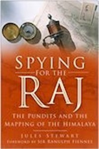
In the 1860s, Captain Thomas Montgomerie trained natives to be surveyors, and had them explore the region covertly. These men, known as pundits, were disguised as lamas (holy men). This book talks about these servants of the Raj who managed to map the Himalayas and Tibet, helping the British to consolidate their rule in the Indian sub-continent.
Sie lesen das E-Book in den Legimi-Apps auf:
Seitenzahl: 350
Veröffentlichungsjahr: 2006
Das E-Book (TTS) können Sie hören im Abo „Legimi Premium” in Legimi-Apps auf:
Ähnliche


SPYING FOR THE RAJ
SPYING FOR THE RAJ
The Pundits and the Mapping of the Himalaya
JULES STEWART
First published in 2006
The History PressThe Mill, Brimscombe PortStroud, Gloucestershire, GL5 2QGwww.thehistorypress.co.uk
This ebook edition first published in 2013
All rights reserved© Jules Stewart, 2006, 2013
The right of Jules Stewart to be identified as the Author of this work has been asserted in accordance with the Copyrights, Designs and Patents Act 1988.
This ebook is copyright material and must not be copied, reproduced, transferred, distributed, leased, licensed or publicly performed or used in any way except as specifically permitted in writing by the publishers, as allowed under the terms and conditions under which it was purchased or as strictly permitted by applicable copyright law. Any unauthorised distribution or use of this text may be a direct infringement of the author’s and publisher’s rights, and those responsible may be liable in law accordingly.
EPUB ISBN 978 0 7524 9586 6
Original typesetting by The History Press
To Spike
We shall not cease from explorationAnd the end of all our exploringWill be to arrive where we startedAnd know the place for the first time.
T.S. Eliot, ‘Little Gidding’
Contents
Foreword
Acknowledgements
Note on the Maps
1 To Tibet with a Cross
2 Mad Amirs and Englishmen
3 Enter the Pundit
4 All in the Family
5 Spies of the Wild Frontier
6 A Learned Man of Chittagong
7 The Holy Spy
8 Whither Flows the Tsangpo
Notes
Bibliography
Foreword
The task of intelligence gathering is facing its most serious challenge since the Second World War. The terrorist attacks of 11 September, and subsequent atrocities in Bali, Madrid, London and elsewhere, have revealed an alarming lack of preparedness for what is today a real threat to Western society.
Jules Stewart’s Spying for the Raj tells the tale of that incredibly courageous and resourceful corps of Indian secret agents who worked for the British in the nineteenth century. The book carries a relevant message to a world living in the shadow of terrorist violence. Satellite surveillance may be able to read a car number plate from miles above the Earth. But how useful is that to a security service that needs to know when and where Al Qaeda is planning to dispatch its next suicide bomber? Espionage tactics may need to shift ‘back to basics’ – that is, straight undercover work by skilled operatives – if we are to penetrate to the heart of the cells in which these plans are being hatched.
The Pundits provided the Government of British India with a wealth of Intelligence on the movement of Russian troops beyond the Himalaya and the devious machinations of Central Asian politics, as well as route surveys of totally unexplored territories. These men fixed the altitudes of peaks, traced rivers to their sources, kept secret logbooks of trade routes and mapped the exact location of territories and even cities that were previously blanks on the map. They were able to do so because they were prepared to spend months and sometimes years on the ground, travelling in disguise and suffering unspeakable hardships.
Like Kipling’s hero in Kim, a novel that is in fact filled with characters drawn from the Pundits, these men were able to step into a new identity, with their mastery of the local language and customs, and risk their lives as secret agents in the employ of the Great Trigonometrical Survey of India.
In this book we meet a panoply of colourful and bigger-than-life characters, from the Sikkimese monk Ugyen Gyatso who took secret readings in Lhasa sitting under the protection of an umbrella, to the illiterate tailor’s assistant Kintup, whose mission to solve the riddle of the link between the Tsangpo and Brahmaputra rivers turned into a four-year epic of pathos and personal tragedy.
The Pundits were key protagonists in the Great Game, that chess match of high intrigue played out on the roof of the world between Russia and Britain. They were explorers without parallel, fearless and determined to see the job through against all odds. They were the classic unsung heroes of the British Raj, living in a world of constant danger, with no hope of being rescued were their true identity to be detected by some bloodthirsty Central Asian potentate. Spying for the Raj is an entertaining and authoritative book that does justice to a band of men who risked all for the unfashionable ideals of duty and service.
Sir Ranulph FiennesJanuary 2006
Acknowledgements
I am indebted to the entire staff at the Royal Geographical Society for their help and advice in researching manuscripts and maps, and to Dr Andrew Cook at the British Library for sharing his mapping skills with me. Thanks are due to Charanjit Kaur Mamik in Dehra Dun for making available the extraordinary archives of the Survey of India, and to R.S. Tolia, an outstanding authority on the Pundit Nain Singh. I am grateful to my agent, Duncan McAra, for his support and suggestions, and to Sutton Publishing for their skill in seeing the work to fruition. Many thanks to R.S. Rawat for his valuable information on the Singh clan, and to Nick Creagh-Osborne for his logistical help. Special thanks to Mark Baillie for his enlightened comments on the manuscript, and to Helen Crisp, whose help with every aspect of the book proved invaluable.
Note on the Maps
This book tells the story of a group of explorer-spies whose Intelligence gathering enabled the Great Trigonometrical Survey of India to produce maps of hitherto uncharted regions. These documents are held in the Map Room of the Royal Geographical Society, a treasure trove of some one million maps and related documents dating back more than five centuries, and the largest private collection of its kind in the world. Special thanks are due to the Society for permission to redraw or reproduce in full the maps in this book.
Map 1. The trans-Himalaya area of exploration
Map 2. Greater Tibet, showing routes taken by the major pundits
Map 3. The North-West Frontier, showing routes taken by the Muslim pundits
CHAPTER 1
To Tibet with a Cross
A passing yak herder might have dismissed the odd-looking individual as one of those eccentric, perhaps slightly mad Buddhist pilgrims who were often to be found performing their mysterious tantric rites by the banks of Tibet’s sacred Tsangpo river. The shabby figure, clad in tattered sheepskin tunic and worn felt boots, crouched with his gaze fixed on the swiftly flowing water that rises on the Tibetan tableland to the west, to come crashing wildly across the bleak plateau, through the world’s deepest gorge, whence it emerges as the Brahmaputra, sluggishly wending its way down to the Bay of Bengal.
Every day, he would release fifty small logs into the river, each cut exactly a foot long. A keen-eyed observer might have been puzzled by the small tin tubes that were bound to each of the logs with strips of bamboo. Had he been a Tibetan official, this discovery would almost certainly have cost the enigmatic ‘pilgrim’ his life. For the man perched by the river bank was Kintup, an illiterate peasant from Sikkim and one of the British Government’s master spies, engaged on an espionage mission deep in Tibetan territory nearly 150 years ago.
The Tsangpo, which has yet to be navigated from its glacial source near Mount Kailash in western Tibet for the full length of its 1,800-mile course to its outlet in Bangladesh, was in the late nineteenth century an irritating conundrum to the geographers of the Great Trigonometrical Survey of India. Was this river, which zigzagged its way through the hidden canyons of southern Tibet, in fact linked to the Brahmaputra, thus ranking it among the world’s greatest waterways? To find the answer, the British recruited specially trained undercover agents, known as Pundits, men who risked life and limb to infiltrate the forbidden land of Tibet, to gather intelligence about this disturbing blank spot on the Survey’s map of Central Asia.
The Indian Pundits could by no means lay claim to being the first interlopers to penetrate terra incognita in High Asia. More than two centuries before the first Indian explorers set out to cross the Himalaya, a band of determined Catholic missionaries was suffering hunger, frostbite and highwaymen to salvage heathen souls in Tibet and China.
Tibet has exercised a magical power over travellers and religious pilgrims throughout history, from Marco Polo to Alexandra David-Neel, the early twentieth-century French opera singer-turned-Asian explorer. The pulse quickens at the mere mention of this mysterious land, the highest region on Earth, a vast, land-locked 14,000-foot-high plateau concealed behind frozen Himalayan ridges and barren, forbidding deserts. There is a compelling fascination about a people who carry their dead to mountaintops, their corpses to be dismembered and then devoured by hovering vultures, messengers who can run for days on end in a trance-like state of mind, their feet barely touching the ground, and holy men who are able to dip sheets into icy streams and dry them on their naked bodies while sitting cross-legged in the snow. The tantric practices of Tibet are chronicled in David-Neel’s highly readable travelogues of Tibet, christened by Westerners the Roof of the World, the Abode of Snow or the Third Pole, and more prosaically known to its inhabitants as Bohd, literally ‘followers of Bön’, the ancient animistic religion that pre-dates the introduction of Buddhism into Tibet around the eighth century AD. The name Tibet is itself generally believed to derive from a composite of terms used by early Arabic, Mongol and Chinese traders and conquerors.
Tibet has always represented an irresistible enigma to those wishing to penetrate its mysterious ways. Nearly four centuries were to pass after Columbus had placed the New World on the map before Europeans were to acquire an accurate knowledge of this country’s geography. As late as the mid-nineteenth century, the precise location of Lhasa was a subject of animated debate at meetings of the Royal Geographical Society.
As Britain expanded its rule over the Indian subcontinent, the Empire marching inexorably northward toward the Himalaya, with Russia methodically gobbling up the wild khanates of Central Asia on its southern borders, the matter of gaining a foothold in Tibet became a matter of urgency for the converging great European powers. But well before the celebrated Anglo-Russian rivalry, romantically dubbed the Great Game, began closing in on Tibet’s borders, Europeans had begun to gatecrash this hidden Buddhist sanctuary, and appropriately enough they were arriving on a wave of religious zeal. Some four centuries ago, a band of intrepid clerics emerged from Portugal, of all places, to carry the evangelising fervour of the Society of Jesus to unbelievers on the other side of the world. The overland journeys of these dauntless globe-trotters would today be no less fraught with hardship and peril than when the Jesuits set out to reach Tibet in the early seventeenth century.
The Jesuit missionaries spent more than a century trekking across Central Asia. It was not a quest for knowledge of uncharted territories, there was no desire to fill in white spots on the map or unearth forgotten cities. This was to come more than 300 years later through the laborious fieldwork of geographers and archaeologists such as Sir Aurel Stein, Sven Hedin and the early British explorers. The Portuguese clerics were first and foremost out to spread the Gospel.
Bento de Goes was 40 years old, a man well into middle age in 1602, when he stood before the ochre sandstone walls of Lahore, the Punjab capital of the great Moghul emperor Akbar, who had summoned the priest to his Court to learn about his curious form of worship. Brother Goes had marched more than 800 miles northward through the Indian desert from Goa, the Portuguese enclave where he had taken his Jesuit vows. At last he had arrived, fatigued and jubilant as he contemplated the splendour of the Moghul palaces, the hectic bustle of the bazaar, as well as the certainty that far more trying times lay ahead. For the priest’s objective was to carry on to Xathai (Cathay, or China) and in that far-away kingdom to find a lost community of Christians, whose existence was based on the flimsiest of evidence. A Muslim merchant had returned to the Punjab after months of wheeling and dealing in the Orient, bearing tales of a considerable population of Isauitae (followers of Jesus) living in the remotest reaches of Asia. This trader’s accounts, wholly unsubstantiated to be sure, were based on little more than a description of dress and custom that he had observed in his travels. They nevertheless aroused the Moghul emperor’s curiosity. Thus Akbar granted Goes permission to go on his quest. The Islamic merchant may have been led to believe he had stumbled across a congregation of Nestorians, the ancient Christians of Iraq, Iran and Malabar, in India. The name relates to Nestorius, an abbot of Antioch, whom the Emperor Theodosius II appointed as patriarch of Constantinople in 428. The Nestorian missions in Asia were persecuted nearly to extinction by the Chinese, Hindus and Muslims, leaving fewer than 100,000 Nestorians practising today. Nestorius outraged the Catholic world by opposing the use of the title Mother of God for the Virgin Mary, on the grounds that, while the Father begot Jesus as God, Mary bore him as a man. This heresy served as a fertile expedient for wholesale massacres of Nestorian communities by Kurds and Turks as late as the nineteenth and early twentieth centuries.
The great period of expansion of the Nestorian Church was from the seventh to the tenth centuries, when missions were established in India and China, but since that time little had been heard of this mysterious sect. It was known that a famous monument had been erected by Chinese Nestorians in Sian (the ancient Su-cheu) in 781, and it was thither, through the trackless wilds of the Pamirs and Tien Shan mountains, that Goes set his sights.
Trekking through parts of Afghanistan where even today only the suicidal would dare to set foot without an armed convoy, Goes wandered north into Kafiristan, the homeland of pagans who had not yet been converted to Islam. The blue-eyed, fair-haired Kafirs living in these isolated valleys were said to be descendants of soldiers who had marched into India with Alexander the Great in the fourth century BC. These people being wine-drinkers, unlike the Muslims, Goes happily surmised that he had come upon one of these mythical Christian enclaves. His spirits lifted by this encouraging discovery, the Jesuit pressed on, skirting the northern reaches of Tibet on his voyage to Cathay. During the many rigorous months, two years in fact, that it took him to reach the Great Wall, Goes variously was forced to perform a European dance before the 12-year-old king of East Turkestan, found himself caught up in horrific scenes of civil-war carnage in the Hindu Kush, and was threatened by the maharajah of Kashmir with being crushed under the feet of an elephant. Disregarding these annoyances, on he marched, moving by night to avoid an encounter with the Tartar bandits who made a habit of spreading terror along the caravan routes.
On Christmas Day of 1605 Goes, the first European since Marco Polo to set foot in China, rode into Su-cheu, having failed to save a single soul on his crossing or to lay eyes on a fellow Christian, Nestorian or otherwise. Two years later, while still in the Chinese city, the valiant Jesuit gave up his own soul in obscure circumstances and was buried in a grave now long-forgotten, laid to rest by a young Chinese convert sent by the Jesuit Fathers whose mission was already established in Peking.
The death of Goes was embroiled in controversy, arousing strong suspicions of foul play on the part of the Muslims with whom the Jesuit had shared part of his journey and in whose quarter of Su-cheu he spent his final months. ‘The hypothesis of poison . . . receives some confirmation from their action [the Muslims] after his death,’ says the Jesuit chronicler Cornelius Wessels.
Though not a scholar, Goes was a man of talent and a sharp observer. He kept an elaborate journal, in which he accurately noted down distances, roads and their condition, places and countries. But the same journal had recorded in its pages the sums of money advanced by Goes to several of his fellow travellers. This must have been known to them, for no sooner had he died than they possessed themselves of all his belongings, and as if by pre-concerted action first threw themselves on the diary.1
In a world immersed in treachery and intrigue, as was seventeenth-century Asia, this would have been a perfectly plausible sequence of events. Much later, the more factually documented murders of Western and mainly British explorers on trans-Himalayan missions became a prime incentive for employing native agents. With a dash of camouflage, these men ran a far smaller risk of coming to grief at the hands of fanatical Oriental potentates. Goes was nonetheless extremely lucky to have escaped persecution or worse on his voyage. The priest was determined that under no circumstances would he deny his Christian faith. ‘That as a European he might not at once have to meet opposition,’ writes Wessels, ‘he donned the garb of a Persian trader and let his hair and beard grow. That he was a Christian he neither might nor would conceal, as is sufficiently apparent from the name, Abdullah Isai (servant of God), which he adopted.’2
Exploring Central Asia in disguise was a device pioneered by Goes, and it is one of several ways in which Goes’s adventure, as well as the later travels of his Catholic brethren, is relevant to the story of the Indian Pundits. Hardly had the dust settled on Goes’s epic journey than another Jesuit in disguise was making his way toward the lush valleys of Kumaon province, west of Nepal, at the foot of the mountains that demarcated the northern limits of Hindustan in what is today Kashmir. Antonio de Andrade was 44 years old when in 1624 he rode out of Agra, fired like his predecessor by tales of Christians living in seclusion in Tibet. In Delhi he joined a party of Hindu devotees starting off on a pilgrimage to a sacred temple in the Himalaya. This was as good a subterfuge as any Andrade was likely to find, so, adopting a Hindu disguise that even his Jesuit coreligionists in Delhi failed to penetrate, he negotiated to link up with the caravan, taking with him a Christian companion and two servants.
The Hindus turned out to be more astute, or at least more mistrustful than the Jesuits of Delhi. Andrade’s expedition came within a whisker of ending in tragedy only several days’ march from the Moghul Court. The Jesuit spent a few anxious days when the Hindus, taking note of Andrade’s unusual mannerisms, snatched him from the caravan and blatantly accused him of being a spy. Andrade had been unmasked, but fortunately not undone. The priest was forced to admit that he was neither a Hindu pilgrim nor a travelling merchant, but thanks to an almost miraculous stroke of luck, he managed to persuade his captors of his bona fides as a man of God, albeit an alien divinity. It apparently made little difference to the Hindus whether the Muslim and Buddhist inhabitants of Tibet were converted from one religion to another. Once satisfied that espionage was not on the Portuguese missionary’s agenda, they allowed Andrade to rejoin the caravan.
After a terrifying journey across collapsing snow bridges, and inching their way along rock walls hundreds of feet above the swift-flowing waters of the Ganges, Andrade and his party at last reached Badrinath, the holy Hindu temple perched 10,500 feet above sea level in the Garwahl Himalaya. Here Andrade bid farewell to his Hindu travelling companions and struck out for Tibet, turning a deaf ear to death threats from the rajah of Srinagar, whose messengers had presented him with orders to turn back. He pushed on, sinking in snow drifts up to his shoulders on his ascent to the high passes. ‘The intense cold numbed their hands and feet and faces, so that Andrade, hurting his finger against something, lost part of it,’ says Wessels.3 Andrade’s body was so paralysed with cold that only the intense bleeding made him aware of his loss.
At last, one fine afternoon Andrade found himself gasping for breath on the summit of Mana Pass, with the Tibetan plateau laid out in bleak magnificence before his snow-blinded eyes. It was August 1624, and after a steep descent into the upper Sutlej river valley, Andrade became the first European to enter the Tibetan town of Tsaparang, situated at 15,800 feet above sea level, roughly the height of Mont Blanc. The wandering Jesuit returned to India bearing tales of red hat and yellow hat lamas, who wore necklaces made of human bones and used skulls as drinking vessels to remind themselves of death, along with a litany of doctrines and ceremonies that suggested a closer link with Christianity than Islam. None of these theories held water, of course, but they were sufficient to persuade the local Tibetan chieftain to lend his support to the Jesuits’ proselytising work. The mission established at Tsaparang was abandoned a few years later as hopeless, and within a decade of Andrade’s arrival the Jesuits’ presence in Tibet had withered to little more than a memory.
A trickle of Portuguese missionaries continued to ply the routes of the High Himalaya to Tibet well into the eighteenth century, in pursuit of converts and imaginary secret Christian communities. Their adventures, along with those of later Franciscan friars, were undeniably heroic achievements of great single-mindedness. But their exploits bore little consequence for another generation of explorers whose missions were undertaken in the name not of God, but of Empire.
A few hours on a steamy June afternoon in 1757 were all it took to seal the fate of the Indian subcontinent for the next two centuries. Sir Robert Clive, commanding a force of 3,000 British and native troops, joined battle with the Nawab of Bengal at Plassey, a small village and mango grove near Calcutta. The nawab, Siraj-ud Daula, had deployed a superior force of 50,000 men, including French artillery, in the field. The motive for the battle, at least from the British side, was the nawab’s attack on Calcutta the previous year, in which some of the British defenders had been cast into the city’s infamous Black Hole, whence a few were never to emerge alive. It was the pretext Clive was after to dethrone the nawab and take possession of the rich and fertile region of Bengal in the name of his employer, the East India Company.
The Bengal army opened hostilities with a sustained artillery barrage from the French gunners, a bombardment as ineffective as it was furious, until at midday a monsoon downpour on their poorly protected powder stores forced the nawab to retire his forces from the battlefield. Clive lost no time in launching a vigorous counter-attack. A general rout ensued; Clive’s troops scattered the panic-stricken Bengalis across the plains, pursuing them for 6 miles and picking up forty abandoned cannon along the way. The final tally was more than 500 Bengali troops killed, while Clive’s losses numbered only twenty-two. Among the enemy casualties was Siraj-ud Daula, who had been taken prisoner and stabbed to death by accomplices of Mir Jafir, the turncoat chieftain whom Clive now enthroned as puppet Nawab of Bengal.
Plassey was the battle that launched Britain on its imperial conquest of India. It was a resounding triumph for British arms, for, as well as crushing the nawab’s forces, Clive drove the remnants of his enemy’s allies, the French, out of northern India, thereby leaving the field free for Britain’s subjugation of the subcontinent. The sixty-year reign of George III, who was an imperialist by vocation, being the first British monarch since Queen Anne to be born in England, oversaw a swift expansion of East India Company rule in India. The Honourable Company steadily extended its dominion from a foothold in Bengal across a vast swathe of territory, stretching south from Delhi for nearly 2,000 miles and across the Bay of Bengal to Ceylon. The acquisition of new lands by definition creates new frontiers and these need to be defended. The imperial power must know what lies on the other side of its borders, for the purposes of defence and also in planning further expansion. In the early nineteenth century British India, preceded by its colossal paraphernalia of bullock carts laden with ammunition and stores, winding columns of red-coated infantry, gaggles of bureaucrats and a host of camp-followers, was slowly advancing toward the most formidable natural barrier on Earth, the mighty Himalaya range.
Like the early Jesuits, the British set off on their trans-Himalayan voyages with a deep sense of mission. These were not casual explorers, fortune-seekers or reckless adventurers. But it was not religious faith that carried them over the high mountain passes. For men like Goes the motivation was Christian evangelism at its purest and most enterprising. The driving force behind the early British and Indian exploits that carried on into the late nineteenth century was a more complex affair. They were inspired, or more often than not officially commissioned, in the name of scientific research, or in response to military imperatives, or not least of all to secure new trade routes for British India.
Colonel William Lambton, an infantry officer whose early life remains almost a total mystery, was the man who breathed life into the scheme for a scientific mapping of India, a task that was originally intended to cover the southern peninsula of India, from Coromandel to the Malabar coast, and that over the next decades crept its way up to the flanks of the Himalaya. Lambton’s plan was launched in the very early years of the nineteenth century as the Great Trigonometrical Survey of India and christened as such in 1818 by Warren Hastings, the Governor-General of Bengal. What a grand undertaking this was destined to become. For nearly three-quarters of a century, Lambton and his successors to the office of Superintendent laboured to construct this basic yet essential instrument of imperial expansion. The immediate task of the Great Trigonometrical Survey was the accurate determination of the position of important points, to form the basis for geographical and other surveys and maps.
Before Plassey, the only reputable map of India was, ironically, the work of a Frenchman, the renowned map-maker Jean Baptiste Bourguignon d’Anville, whose native country at the time posed the most serious threat to British expansion on the subcontinent. D’Anville was a cartographic prodigy who engraved his first map at the age of 15. His map of India appeared in 1852, a document modelled solely on reports from French explorers, traders and missionaries, for in his lifetime d’Anville never set foot outside Paris.
Lambton’s venture was conceived on a far grander scale. The Trigonometrical Survey, whose successor, the Survey of India, is today headquartered in rolling woodland in Dehra Dun on the approach to the Himalayan foothills, employed an extensive staff and came to hold a vast collection of measuring devices to carry out the surveyors’ work.
The project was submitted with the approval and recommendation of his [Lambton’s] commanding officer, Colonel Arthur Wellesley, later to become the Duke of Wellington, to the consideration of Lord Clive, who was then governor of Madras. Thus the Government was readily convinced of the necessity for a survey to be undertaken with the object of furnishing a basis for the geography of the peninsula, and for connecting the local surveys that were being commenced in the newly acquired provinces, with those of other portions of the Madras presidency that had been completed or were in progress.4
Lambton’s original tools were a theodolite, zenith sector and steel chains, or more accurately folding steel rods. The instruments were to suffer misadventures of their own even before they were landed at Madras. The French captured the theodolite, en route from England, on the high seas and carried it off to Mauritius. A volley of sharp diplomatic notes persuaded ‘the chivalrous French governor’ of this island enclave to send the instrument on to its destination, along with ‘a complimentary letter to the Governor of Madras’.5 The chains, meanwhile, had been previously sent to Peking as a gift with a British diplomatic embassy, but this common piece of ironmongery was unceremoniously spurned by the Chinese Emperor. The set was handed over to the mission’s astronomer, who carried it back to Madras with the zenith sector. There were further misfortunes in store for the Survey’s theodolite. During a morning’s routine surveying work, the 3-foot instrument met with near disaster. While it was being hoisted to a high pagoda on the plains, the bearing rope snapped and the instrument slammed into the wall with a violent crash, distorting the delicate optics badly enough to render the system useless. Never admitting defeat, Lambton took the instrument to pieces, and after six weeks of ceaseless labour in the steaming tropics, he succeeded in restoring the mechanism to its original shape using wedges, screws and pulleys.
Within two years of its creation, the Great Trigonometrical Survey team had got to work in earnest. In its simplest form, without taking into account the curvature of the Earth or three-dimensional measurements, the work consisted of laying out a network of triangles, each drawn from three points of reference and then stacked alongside one another. The chain of triangles can be protracted in any direction across a landmass for the purpose of measuring distance. In the case of the Trigonometrical Survey, this took the form of a Great Arc of the Meridian, tracing a line some 1,600 miles up the spine of the Indian subcontinent.
Lambton succumbed to the hardships of life in the Indian wilds in 1823. He was 70 at the time of his death, itself a testimonial to the man’s iron-willed determination to see a job through. In little more than twenty years of ceaseless work, Lambton completed the triangulation of 165,342 square miles in the peninsula of India, much of it unknown territory. He was remembered by his loyal servants and a small cadre of scientific followers, but otherwise the first Superintendent of the Great Trigonometrical Survey passed out of men’s memories. Not so the Survey’s second Superintendent and veteran surveyor, Sir George Everest, the man whose name will always be associated with a mountain that he neither discovered nor set foot on. Everest’s character was without doubt cast in the same mould as his predecessor’s in that, despite their very different characters, both were men of extreme determination and single-mindedness. The stern, patriarchal surveyor, whose flowing white beard bestowed on its wearer an almost biblical countenance, through twenty years of toil and suffering earned the accolade of ‘creative genius’. For Clements Markham, President of London’s Royal Geographical Society, ‘he had completed one of the most stupendous works in the whole history of science. No scientific man had ever had a grander monument to his memory than the Great Meridional Arc of India. The whole conception of the Survey, as it now exists, was the creation of his brain.’6 Writing in 1871, Markham cited as examples of Everest’s achievements the replacement of Lambton’s network method with a gridiron system, the switch from rods to parallel compensation bars for measuring base lines (duly tested by Everest himself in London at Lord’s cricket ground), and the design of triangulation towers.
A stiff upper lip was a gross understatement in Everest’s case. In the monsoon season of 1823, the year Everest took charge of the Survey, he reported being struck down by ‘a smart attack of bilious fever, owing to too much labour of computation’. His condition rapidly deteriorated a few days later as he was suddenly seized with ‘an uneasy sensation in my loins’. There followed a violent pain in all his bones, accompanied by a bout of typhoid fever. In the course of a few days the symptoms grew worse and he was deprived of the use of his limbs. ‘My mind became affected almost to delirium, dreadful paroxysms took place, in which my limbs were violently and involuntarily agitated. My skin peeled off, my nails gave way, the most frightful and hideous dreams disturbed me at night.’7 For six months afterwards Everest could only lie on his back, unable to sleep for more than three hours at a stretch. Yet he carried on with his surveying work, for ‘now or never, the question was to be decided whether the Great Arc should be carried through to Hindustan [in the Himalayan foothills] or terminate ingloriously in the valley of Berar [central India, between the Deccan and the Ganges plain]’.8
In 1876 the Survey produced a map on a scale of 96 miles:1 inch, displaying a web of triangles snaking their way across India, with an extension of secondary lines fixing the peaks of the Himalaya to the extreme north. By that year British India had been ruler of the Punjab for three decades, having vanquished the Sikh ruler Ranjit Singh, a mixed blessing as the government was soon to find out. For this acquisition included the unruly North-West Frontier belt of tribal land that was teeming with hostile Pathan tribes, and the British army was soon to have to cross this no man’s land as it prepared to fight the second of three wars that England waged with Afghanistan during the period of the Raj. In the lands that lay west of the Khyber Pass, borders were ill defined and often non-existent. This posed an uncomfortable state of affairs for Britain, with evidence piling up of a steady Russian advance toward Afghan territory and Tsarist designs on India itself. As for the lands north of the Himalaya, the English possessed only the sketchiest knowledge of likely invasion routes, the feasibility of supply lines, whence and to where the mighty rivers of Asia flowed, or even the precise location of the Tibetan capital of Lhasa. ‘It was inevitable that within a decade of Plassey, its officers [the East India Company’s] were vitally interested in the Himalayan states whose frontiers marched with its north-eastern borders,’ writes George Woodcock. ‘Aggressive rulers in these states might form a threat to territory. Friendly ones might offer the promise of profitable trade.’9
The age of trans-Himalayan travel began to swing into high gear with the advent of the Great Trigonometrical Survey in 1800. While the great Pundit explorers belong to the second half of the nineteenth century, and more properly to the Great Game era of espionage and high intrigue, a handful of Englishmen were to be found wandering through jungles and over high passes beyond the confines of British India in pre-Survey days. One such early voyager was George Bogle, a 28-year-old servant of the East India Company. Warren Hastings, who had recently arrived in Calcutta, so greatly admired this young Scotsman that he plucked him from his humdrum routine as Assistant Secretary of the Board of Revenue to take a diplomatic mission into Tibet. The purpose of this embassy was to conclude a ‘general treaty of amity and commerce’ with Bengal’s northern neighbour and open a commercial route through Bhutan. Bogle was endowed with just the nature required to negotiate a passage through the warlike hill tribes of Bhutan and treat the great political–spiritual leaders of Tibet with the requisite diplomacy. Hastings recognised these qualities in his protégé and he chose Bogle as his envoy ‘for the coolness and moderation of temper he seems to possess to an eminent degree’.10 Hastings saw an opportunity to expand British influence in a region that could open a valuable trade route into China. There was an urgent need to restore the East India Company’s balance sheet to health. The Company’s finances were in a parlous state because of massive expenditures made in combating the disastrous Bengal famine of 1769–70. It was also one year on from Britain’s annexation of Cooch Behar, a small principality bordering on Bengal, which the Company had brought under its sovereignty as part of an agreement to send military assistance to enable the Rajah to beat off a Bhutanese invasion. It was Tibet’s peace overtures on behalf of Bhutan that inspired Hastings to exploit this opportunity to send Bogle as his plenipotentiary to Tibet and Bhutan.
The party that set out from Calcutta at the height of the hot season in May 1774 was comprised of Bogle, the East India Company surgeon Alexander Hamilton and a swollen entourage of servants, plus one rather ambiguous character named Purangir Gosain. Gosain, or more properly ‘the Gosain’, rather than a surname is a Bengali term for holy man. The word derives from the Sanskrit goswami, and is applied to Hindu religious mendicants in general. This young Hindu quasi-priest was of a class of wanderers who could travel unchallenged throughout India and Tibet, recognised as they were as spiritual seekers on a pilgrimage to some holy shrine or site in the mountains. Two months before Bogle’s departure, the Gosain had arrived in Calcutta as representative of the Panchen Lama of Tibet, who was revered as a spiritual leader just below, or for some on an equal footing with, the Dalai Lama himself.
The Gosain did not travel equipped with the classic trappings of the later Pundits – he affected no disguise, carried no surveying equipment secreted in his saffron robes, nor was he on the British Government’s payroll. Yet any one of the great Pundits of the next century might have considered himself an incarnation of Purangir Gosain, who in many ways fulfilled the role of precursor to the celebrated company of native explorers. Accordingly,
Many of them [early explorers] took advantage of their immunity from interference to become traders, specialising in light and valuable items, and often accumulating considerable fortunes under the guise of devotion to religion. Their freedom of travel gave them opportunities to act as spies and envoys, and many of them became double or even multiple agents, making their services available to several rulers.11
So here we have an embryo of the Pundits, embodied in the figure of an equivocal Hindu guide-cum-go-between who was to lead a party of Englishmen deep into uncharted trans-Himalayan territory.
Bogle carried in his baggage a private commission from Hastings with a detailed brief, mostly of personal interest to the Governor-General. It was a most bizarre shopping list that Hastings delivered to Bogle in the guise of a ‘private commission’. Among the particulars detailed in his order, Hastings requested Bogle to bring back some carefully packed fresh ripe walnuts for seed, as well as one or more pairs of goats that produced the highly prized Tibetan shawl-wool, along with curiosities that might be acceptable to refined English society. Most revealing of the primitive state of imperial geography in the late eighteenth century was a request to ascertain what countries stood between the Tibetan capital of Lhasa and Siberia. Nearly two centuries after Sir Francis Drake had circumnavigated the globe, and with British redcoats fighting insurgents in the far-away wilds of the American colonies, what lay north of the Himalaya remained an almost total enigma. In all, the private commission consisted of nine specific instructions. But there was a tenth, and a most intriguing item, added almost as an afterthought, which appeared on the document below Hastings’s signature. Bogle was instructed to explore the Brahmaputra with a view to determining the river’s course and navigability, as well as to give information on the countries it traversed on its course to the Bay of Bengal.
The mystery of the Brahmaputra was later to turn into the siren’s call that launched some of the Pundits’ most heroic exploits. The romantic enterprise of searching for a river even captured the imagination of Rudyard Kipling, who used this device in Kim, his classic account of the Great Game, to send his hero into the shadowy world of Himalayan espionage. Extraordinary explorers like Kintup spent years toiling through unknown terrain at great risk to life and limb, in an attempt to resolve the mystery of whether the great Tsangpo and the Brahmaputra were at some point linked together. This was the great enigma that kept British geographers intrigued into the twentieth century. The eccentric adventurer Colonel Frederick M. Bailey in 1913 led a daring expedition into the Tsangpo Gorge, the deepest chasm on Earth, to attempt to lay to rest once and for all the debate over what became of this river after it ran off the Tibetan plateau. A decade later, the no less intrepid botanist–adventurer Francis Kingdon-Ward managed to penetrate deeper into the gorge than any of his predecessors. Although he found it humanly impossible to navigate the last few miles of this canyon, which at one point was only 15 feet across and several thousand deep, his findings were taken as conclusive that the Tsangpo and the Brahmaputra were one.
Bogle’s cavalcade met with some resistance in its attempt to cross the mountain border into Bhutan, a country that even today allocates its tourist visas with the parsimony of an eye-dropper. Bogle and Hamilton spent weeks trekking about the hills outside Tassisudon, the country’s ancient capital, in anticipation of a report from the Gosain, who had raced ahead to negotiate arrangements for their visit to the Bhutanese ruler, the Deb Rajah. It was only through the Gosain’s persistent efforts that the party was eventually allowed to proceed to Tassisudon, a large town crowded with one-storey wooden houses sprawled under the shadow of golden domes of Buddhist shrines and lamaseries. Bogle was lodged for several days in ‘one of the better houses near the palace’, when the royal summons finally arrived. The British party had to jostle its way through a street crowd of some 3,000 ogling Bhutanese who had never before laid eyes on a Westerner, before being hustled into the Buddhist monarch’s throne room. ‘The Deb Rajah again urged Bogle to return to Calcutta, but the Scotsman dug in his heels, using the expectation of letters from the Panchen Lama as an excuse to stay in Tassisudon and to find out what he could in the meantime about Bhutan, its people and its possibilities as a source of trade.’12


