Erhalten Sie Zugang zu diesem und mehr als 300000 Büchern ab EUR 5,99 monatlich.
- Herausgeber: Phillimore & Co Ltd
- Kategorie: Sachliteratur, Reportagen, Biografien
- Serie: Phillimore Editions
- Sprache: Englisch
Tavistock has cast its spell over generations of visitors. Attractively set between two significant natural barriers, the River Tamar to the west and Dartmoor to the east, residents and visitors today would still recognise the truth of what one impressed tourist wrote in 1892: 'The town has a leisurely and beautiful appearance, and the people do not seem to need to kill themselves and slay each other in the mad rush of life which spoils so many other towns.' However, being relaxed is not the same as being sleepy. The economic and social life of the town has, at each stage of its development, been dynamic. The designation 'Ancient Stannary Town' on the welcoming road signs, for example, is a reminder of the long association with the tin industry, and the oft-quoted description 'The Gothic town of the West' brings to mind the great age of copper mining and the changes to the town centre that accompanied it. This fully illustrated account brings the modern resident and visitor face to face with the factors that have influenced the development of this unique and fascinating corner of Devon.
Sie lesen das E-Book in den Legimi-Apps auf:
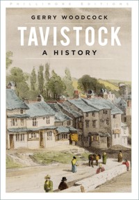
Seitenzahl: 218
Veröffentlichungsjahr: 2022
Das E-Book (TTS) können Sie hören im Abo „Legimi Premium” in Legimi-Apps auf:
Ähnliche


Aerial view of the town centre in the 1980s
First published 2008
This paperback edition published 2022
The History Press
97 St George’s Place, Cheltenham,
Gloucestershire, GL50 3QB
www.thehistorypress.co.uk
© Gerry Woodcock, 2008, 2022
The right of Gerry Woodcock to be identified as the Author of this work has been asserted in accordance with the Copyright, Designs and Patents Act 1988.
All rights reserved. No part of this book may be reprinted or reproduced or utilised in any form or by any electronic, mechanical or other means, now known or hereafter invented, including photocopying and recording, or in any information storage or retrieval system, without the permission in writing from the Publishers.
British Library Cataloguing in Publication Data.
A catalogue record for this book is available from the British Library.
ISBN 978 1 8039 9068 2
Printed and bound in Great Britain by TJ Books Limited, Padstow, Cornwall.
eBook converted by Geethik Technologies
Contents
List of Illustrations
Acknowledgements
One
Beginnings: Up to 1066 1
Two
The Medieval Town: 1066 – 1539
Three
The Russells Arrive: 1539 – 1700
Four
The Duke’s Borough: 1700 – 1800
Five
The Boom Years: 1800 – 1850
Six
Victorian Tavistock: 1850 – 1900
Seven
Wars and Worries: 1900 – 1950
Eight
Years of Growth: From 1950
Bibliography
In gratitude to, and in memory of, the peopleof Tavistock past and present whose actionsare recorded herein.
List of Illustrations
Frontispiece: Aerial view of the town centre in the 1980s
1. The River Tavy
2. The ‘West Street Stone’
3. The ‘Buckland Stone’
4. The ‘Roborough Down Stone’
5. Ordulph: A Tomb
6. Ordulph: A Coffin
7. Ordulph: An Image
8. A Viking Fleet
9. The Seal of Tavistock Abbey
10. A Benedictine Monk
11. Domesday Extract
12. A Plan of Tavistock Abbey
13. Henry I
14. Henry I’s Re-affirmation of Support for the Abbot’s Market
15. The ‘Great Bridge’ in the 1740s
16. Richard Edgcumbe, MP for Tavistock
17. List of Tin Workings in 1582
18. An 18th-century Tucking Mill
19. The Parish Church of St Eustachius
20. A Carving in the Church Depicting the Conversion of Eustachius
21. Henry II’s Offer of Protection for the Abbey
22. Abbey Remains: Cloister
23. Abbey Remains: Court Gate
24. Abbey Remains: Abbey Wall
25. Abbey Remains: Still Tower
26. Abbey Remains: Abbey Chapel
27. Abbey Remains: Betsy Grimbal’s Tower
28. The Title-Page of ‘The Tavistock Boethius’
29. The Last Page of ‘The Statutes of the Stannary’
30. Remains (of an Abbot?) Uncovered in Bedford Square
31. Henry VIII’s Grant to John Russell
32. John Russell, 1st Earl of Bedford (c.1486-1555)
33. Francis, 2nd Earl of Bedford (1527-1585)
34. Edward, 3rd Earl of Bedford (1572-1627)
35. Francis, 4th Earl of Bedford (1593-1641)
36. Tribute to ‘the martyred William’
37. Nicholas Watts’s Will
38. The Maynard’s Charity Almshouses
39. William, 5th Earl and 1st Duke of Bedford (1613-1700)
40. The Tavistock Coat-of-Arms
41. Thomas Larkham
42. The Fitz Tomb
43. Lady Mary of Fitzford
44. The Fitzford Gatehouse
45. The Glanville Memorial
46. John Glanville senior (1542-1600)
47. John Glanville junior (1586-1661)
48. Kilworthy House
49. Drake: The Town Hall Picture
50. Drake: The Statue
51. Drake: The Unveiling of the Statue
52. Drake: The Birthplace
53. Richard Peeke’s Tract ‘Three to One’
54. Memorial Slab for Richard Browne
55. John Pym
56. West Street
57. Tavistock in 1752, Based on John Wynne’s Map
58. Market Street
59. Turnpike Trust Proposals 1761
60. Map of Turnpike Gates and Toll Houses
61. West Bridge Toll House
62. Pixton Gate Toll House
63. Weir Bridge Toll House
64. Hawkins’s Shop (Toll House)
65. Ford Street Toll House
66. West Bridge
67. Abbey Bridge
68. List of Anti-Bedford Voters 1715
69. John, 4th Duke of Bedford (1710-1771)
70. Election Expenses 1788
71. The Crown and Cushion
72. The Queen’s Head
73. The ‘Honour Oak’
74. Mrs Bray
75. Mr Bray
76. Map: Mining in the Area
77. Copper/Arsenic Pyrites
78. Mine Workers
79. Mine Owners and Managers
80. Wheal Anderton Mine: Sale Notice
81. Wheal Anderton Mine: Section
82. Devon Great Consols Mine
83. Wheal Betsy Engine House
84. Mining Company Tokens
85. Morris Window in the Parish Church
86. The Bedford Iron Works
87. John Taylor
88. The Tavistock Canal: Route
89. The Tavistock Canal: Plan
90. The Tavistock Canal: The Company Seal
91. The Tavistock Canal: The Wharf
92. Concern About the Water
93. The Old Workhouse: Mount Ford
94. The Union Workhouse: Bannawell Street
95. Guildhall Square in 1860
96. Statue of the 7th Duke (1788-1861)
97. The View from the Duke’s Statue in the 1880s
98. The Town Hall in 1880
99. Contemporary Plan of West Bridge Cottages 1850
100. West Bridge Cottages Today
101. Railway Links
102. Tavistock North Station Building
103. The Opening of the Railway Station, 1859
104. The Departure of the Last Train, 1968
105. Fitzford Church
106. The Congregational Church 1873-1964
107. William Beal’s Application for the Grammar School Headship, 1837
108. Edward Spencer’s Retirement Party, 1888
109.Tavistock Gazette: Masthead of First Edition
110. Map Showing Positions of Twenty Residences
111. Abbotsfield Hall in 1900
112. The Manor House in 1910
113. Mount Tavy House in 1911
114. The Priory in 1910
115. The Vicarage in 1970
116. Walreddon Manor in 1922
117. Grenofen House in 1932
118. Holwell Manor in 1960
119. St John’s House in 2002
120. Sortridge House in 1965
121. Herbrand, the 11th Duke (1858-1940)
122. The First Lot in the Duke’s Sale – 1911
123. The New Market Hotel
124. The Bedford Hotel
125. Visit of Princess Elizabeth 1949
126. Visit of Prince of Wales 1977
127. Michael Heseltine MP
128. J. J. Alexander with School Staff and Football Team 1925
129. The Rev Hugh Bickersteth with the Bishop of Exeter 1933
130. Tavistock Territorials Marching out of the Town, August 1914
131. Tavistock Members of the Royal North Devon Hussars, 1915
132. Concert-party Formed in the Neurological Hospital in the First World War
133. Tablet in Town Hall Records Gratitude of Belgian Refugees
134. Unveiling of the War Memorial 1921
135. The American Forces Club in 1943
136. General Eisenhower Inspects Troops in Bedford Square
137. The Grammar School War Memorial
138. The Auction-Room of Ward and Chowen
139. The Staff of Creber’s in 1979
140. The Arrival of a Computer at Tavistock School 1970
141. The Opening of St Peter’s School, 1976
142. Girls Attending Kelly College in the 1970s
143. Tavistock’s First Playgroup, 1969
144. Harewood House
145. Meeting of Bee-Keeping Association
146. Annual Exhibition of Group of Artists 1969
147. The 1st Scout Troop, 1909
148. A Red Cross Team of Cup Winners 1936
149. Dartmoor Rescue Team on Exercise.
150. Fire Brigade, 1970s
151. A 1970s Goose Fair Scene
152. A 1980s Goose Fair Scene
153. Signing of the Tavistock-Celle Twnning 1977
154. A Twinning Occasion in Pontivy, 1978
Acknowledgements
I am grateful to the following for permission to use photographs or other illustrative material: British Museum (13); Dartington Amenity Research Trust (77, 78, 79); Devon County Records Office (14, 17, 21, 31, 59, 68, 70, 81, 89, 90, 92, 107); Duke of Bedford (32, 33, 34, 35, 36, 121); Exeter College, Oxford (28, 29); J.H.P. Finberg (12); Mary Freeman (57); Graham Kirkpatrick (26, 72, 91); Masters of Lincoln’s Inn (46, 47); South West Water (30); Tavistock Museum (71, 95, 99, 102); Tavistock Subscription Library (41, 87); Tavistock Town Council (16, 49, 69); Trustees of Watts Charity (37); Vicar of Tavistock (20, 85); Victoria and Albert Museum (55); Gerald Wasley (136).
Chapter One
Beginnings: Up to 1066
The interpretation of place-names can usually be relied upon to divide historians. The study does, however, offer useful clues, and can unlock the occasional door. What, then, of Tavistock? The first of the two elements that make up the name is straightforward. ‘Tavi’ is the river on the banks of which the settlement was sited. It is one of some forty rivers in Devon, including the Tamar, that have names of Celtic origin. ‘Stock’ presents more problems. It can be spelt in a number of ways, and different meanings have been attached to it. One theory, that the term denotes a monastery cell, can be dismissed, since the name almost certainly pre-dates the foundation of the abbey. Then there is the suggestion that ‘stocc’, an Old English term for a stockade, was applied to fortified places or strongholds. There is, however, no reason to believe that Tavistock, or many other ‘stocks’, had this characteristic. Some writers have preferred to invoke the word as an Old English term for a secondary settlement, and have claimed that Plymstock and Calstock, for example, were outlying farms and settlements colonised from more significant centres, Plympton and Callington. In this case, presumably, Tavistock was a dependency of Mary Tavy or Peter Tavy, some distance upriver. It is a fact that most ‘stocks’ are low-lying and near rivers, and were therefore ideal places to which cattle could be driven for rich summer grazing. The versatile ‘stoc’ has, however, one further meaning in Old English. It can be translated as, simply, ‘a place of settlement’. The ‘settlement by the Tavy’ may be too obvious an explanation for some, but, after all, that is what it was, and that is what it is.
The Tavy descends on Tavistock after a long Dartmoor journey in which she has been fed by countless moorland streams. Her moods are variable and her behaviour unpredictable. A prolonged period of dry weather will leave her calm, gentle and benign. A few days of heavy rain or a snowfall can turn her into an ill-tempered swaggerer, noisily threatening all around her. Of those who, over the years, have delighted in her company, the most profuse was William Browne, the renowned 17th-century poet, who was born in Tavistock. He opened his Britannia’s Pastorals with a reference to his beloved river:
1The Tavy in a boisterous mood.
I that while ere near Tavy’s straggling springUnto my seely sheep did used to sing.
Some 100, 000 words later he signed off by returning to his theme:
And Tavy, in my rimesChallenge a due, let it thy glorye be,That famous Drake and I were born of thee.
A century on, and the Rev. John Swete, on one of his rambles, stood to admire ‘the rich and beautiful valley through which the Tavy winded its foaming streams’. In the 19th century another visitor, Arthur Norway, wrote of his experience of ‘hearing the noisy river singing over stones and boulders of all the wonders it has seen upon the moor’, while Rachel Evans, a resident, described it as ‘rendering fertile every spot of ground within the influence of its liquid stores’. The Tavy was not only a picturesque river, but an abundant source, for those who lived on its banks, of both water and fish. A navigable trading highway, however, it was not. For communication purposes the picture of Tavistock in prehistoric times is one of primitive trackways. Some writers believed that there was a major highway, albeit of primitive construction, running west-east from Cornwall, crossing Dartmoor, and going on to Salisbury Plain, and that this track, the so-named Great Central Trackway, crossed the Tavy within a mile of the present town. They have, however, been unable to trace much of it, and its existence must remain doubtful. That there was, from the later Bronze Age (say from 1000 B.C. to 500 B.C.), a network of trackways covering the area between the Tamar valley and the foothills of Dartmoor need not, however, be doubted. The link with the tin industry that was thriving in that area at that period is clear. The association of the town with tin extraction was to remain a feature of its development to the present day, when visitors continue to be welcomed with signs proclaiming, accurately, that Tavistock is an ancient stannary town. That Dartmoor was rich in tin deposits, and that something could be done about it, was known to prehistoric man, and there is archaeological evidence to show many examples, on the western side of the moor, of large early settlements lying close to tin streamworks. In spite of this, prehistoric Tavistock appears to have been neither a primary settlement nor a staging-post on a long route. The old trackway that ran from the coast at Plymouth northwards to Okehampton did not pass through Tavistock, but by-passed it by taking a direct route across Whitchurch Down from the Walkham at Horrabridge to the Tavy at Harford Bridge. Tavistock was served by a minor road, or branch route, that ran through it from east to west, linking the Tavy at Harford Bridge and the Tamar near New Bridge.
When the Romans arrived in Devon, in the first century A.D., the county was part of a loosely linked collection of tribal communities known as Dumnonia. This ‘kingdom’ was to survive beyond the long period of Roman occupation, and into the tenth century. In the middle of that period Christianity arrived. First brought to Devon in the late fourth century, its early history is as shrouded in mist as are the lives of many of the Celtic saints. Over the next two centuries the county received the determined attentions of fellow-Celtic missionaries from, predominantly, Wales, Ireland and Brittany. Their successful efforts at conversion produced a lasting and indelible mark on communities throughout the area. The four centuries of the Roman occupation left a more limited legacy, since the Romans ventured beyond Exeter only to establish outposts of defence and develop trade channels. It may be that the imperial authorities and successive rulers of Dumnonia entered into formal or informal agreements. The two experiences, of embracing Christianity and being touched by Rome, are reflected in three extraordinary finds that are now located in the garden of Tavistock Vicarage. They are inscribed memorial stones, all of them found in the middle of the 19th century, one in the town and the others at Buckland Monachorum and nearby on Roborough Down. Their discovery, rescue and preservation, by the vicar, the Rev. Bray, is a remarkable story. One had served for centuries as part of the paving of West Street, with, fortunately, the inscription underneath so that the lettering had been protected from the attentions of foot and wheel. The second was found abutting a corner of a blacksmith’s shop close to Buckland Monachorum church. The third was a gatepost on farmland on the Down. Each bears, in Latin, a name, the dedications being to ‘Nepranus son of Conbevus’, to ‘Sabinus son of Maccodechet’, and to ‘Dobunnus the smith son of Enabarrus’. They date from the fifth or sixth centuries. It may be claimed that, whoever they were, the three men so honoured in their deaths were the first local residents of whom we have some record.
2The ‘West Street Stone’.
3The ‘Buckland Stone’.
From the same period that gives us the three funereal standing-stones, we have the first indications of community settlements in the immediate area. The names of two spots provide the first clues of Celtic settlement. Two miles to the south of Tavistock lies Walreddon, the name ‘Weala-raeden’ meaning ‘community of Welshmen’. One mile to the north-east of the town, lying on either side of the old road out to Exeter, can be found The Trendle. The Saxons gave it the name, which means ‘The Ring’. A two-and-a-half-acre site enclosed by an earth rampart, it is close by the spot where the Wallabrook (the ‘stream of the Welsh’) feeds the Tavy. Here archaeological evidence, in the form of bronze tools, pins, and brooches, indicates a settlement of the late Celtic period. The site is bisected, not only by the road, but by the now disused railway track. Those who believe in the Great Central Trackway argue that The Trendle was on this highway, and that the Tavy must have been bridged close by. It is more likely that the settlement was located on the branch road that also passed through the site of the present town, linking Harford Bridge to the east with New Bridge to the west.
4The ‘Roborough Down Stone’.
5Ordulph remembered in the parish church.
Leaving aside the current controversies among historians surrounding the origins of the Celts and the spread to Britain of Celtic culture and languages, it is reasonable to continue to use the term ‘the Celtic period’ to describe, as far as the Tavistock district was concerned, the era from the sixth century B.C., when the first Celtic invasions are thought to have occurred, to the eighth century A.D. The Saxons conquered the area in about the year A.D. 750, roughly a century after they had first arrived in the eastern parts of the county. Some writers have suggested that since the south-west of Devon was the last part of the county to fall to the invader there must have been stern Celtic resistance, and fanciful tales have been woven of heroic guerrilla warfare on river banks and wild moorland. There is no evidence of anything of the kind. The hold of the kingdom of Wessex on the area, and on Cornwall beyond, was secured in the early years of the ninth century by King Egbert. He overcame the resistance of the Cornish, who received occasional support from both the king of Mercia and the Danes, in successive battles at Galford, near Lewdown, and at Hingston Down, above Callington. Local folklore has Egbert, before the latter engagement, marching his army through Tavistock. Combat was, in fact, rare. The Saxon occupation should be seen more in terms of peaceful penetration than of military invasion. Settlements in the area before the occupation were few and small. With few exceptions the Dumnonii, in their scattered communities, faced with the newcomers, either moved on or, realising that there was enough land for everyone, accommodated themselves to the ways of the new arrivals and their language. There are, significantly, rivers apart, virtually no Celtic place-names in Devon.
Close to the tower arch in Tavistock parish church, in the floor is a stone slab, which is inscribed ‘Ordulf Founder of Tavistock Abbey 981’. Beneath have lain, since 1934, two thigh-bones, one abnormally long. These remains were discovered in a stone sarcophagus in the early 18th century when work was being done on the foundations of the building that was later to be the Bedford Hotel. Both the appearance of the sarcophagus, and its location on the site of the abbey cloisters, suggested that its occupant had been someone of note. Moreover, it was attested that Ordulf was a man of considerable stature. Educated guesses were made, and the remains of the founder, if it be he, and possibly of his wife, came to their final resting place in the parish church. The sarcophagus sits in the surviving southern tower of the monastery known as Betsy Grimbal’s Tower. It should be added that Ordulf had a descendant of the same name who was a benefactor of the abbey in the middle of the 11th century. He was also reputed to be of exceptional size (perhaps a family characteristic) and would surely have qualified for a distinctive burial place within the abbey. A keen and fearless huntsman, this second Ordulf met a premature death that gave rise to stories that he had died of exposure after losing his way on Dartmoor. One of the most enduring of local legends has a young nobleman in the 11th century falling a victim to a Dartmoor snowstorm while on a hunting trip. Killing and disembowelling his horse, he huddled within its skin for warmth. His body was found four days later. The spot is marked to this day by a granite cross which the maps will tell you is ‘Childe’s Tomb’. Since ‘Childe’ was an honorary title denoting heirship to a dignity, and since this description fits this Ordulf, his career may have been the inspiration for the myth. There can be little doubt, however, that he was buried in Tavistock Abbey and not close to Fox Tor.
6Ordulph Remembered: in Betsy Grimbal’s Tower.
Who, then, was the first Ordulf? And why should he found a monastic house at Tavistock?
7Ordulph Remembered: in a holiday advertisement.
Edgar, the Saxon ruler of Wessex from 959 to 975, was the first ruler confidently to call himself ‘King of England’. He was married twice, his second wife being Elfrida, the daughter of a nobleman named Ordgar, who had an important position as ealdorman, or viceroy, with responsibility for implementing royal policy in both of the south-west counties. He owned substantial property in the Tavistock area, and it seems likely that he had a home here, in which case his daughter, Elfrida, and his son, the mighty Ordulf, were reared here. Ordulf was thus the king’s brother-in-law, as well as the heir apparent to a powerful ealdermanship. Some writers have insisted he was prompted into action by a heavenly sign in the skies as he stood overlooking Tavistock from above the Old Exeter Road. Alternatively, the inspiration for his enterprise may have been a political imperative, urged on him by his brother-in-law, to help stabilise and unify the kingdom by instituting communities which would bring law, order and effective economic management to large areas of the country, functions that Benedictine monasteries could discharge admirably. Let us suppose that it was one of the many examples of the Word of God and the political interests of the king of England happily coinciding.
There was a small riverside community in Tavistock before the arrival of Ordulf’s monastery. It had already undergone conversion, and had a small chapel dedicated to St Matthew, situated a few yards away to the east of the site of the present parish church. The abbey was founded in 974, Ordulf and his wife making substantial contributions to its endowments from their estates. The original, wooden, buildings were completed by 981, and in that year the abbey received its charter from the young King Ethelred, the son of Edgar and Elfrida and the nephew of Ordulf. Originally it was dedicated solely to the Virgin Mary. She was later joined by Rumon, a sixth-century saint and evangelist whose bones were transferred in the 12th century from their original Cornish resting-place at Ruan Lanihorne to the abbey that now bore his name. They were entombed in some splendour in the abbey church, and became the object of veneration and pilgrimage and the inspiration for a miracle or two. The bejewelled shrine was dismantled at the time of the dissolution in 1539, but it may be assumed that the remains of the saint still lie some feet below the swirling traffic of Bedford Square.
8A 19th-century view of Viking ships under sail. Is this how they looked as they sailed up the Tamar? (Artist: Hans Gude).
In 997, only 16 years after its formal constitution, the abbey received the attentions of marauding Danish raiders. According to the Anglo-Saxon Chronicle, ‘they went into the mouth of the Tamar, and then went up until they came to Hlidaford, and burned and destroyed everything which they met with; and they burned Ordulf’s minster at Tavistock and brought unspeakable booty with them to their ships.’ That the recovery from this disaster was so rapid was due principally to the persistence of Ordulf, to the support of the royal government, and to the energy and determination of two abbots. The first of these was Aelfmaer, who was in office when the raids took place, and who launched an ambitious programme of restoration. He was succeeded in 1009 by Lyfing, who in the following 18 years carried through the project so successfully as to earn for himself the distinction of being described as the abbey’s second founder. One of the leading churchmen of his age, he was a close friend and adviser of King Cnut. Contacts like this, at the highest level, helped to establish Tavistock Abbey as a major feature of the local scene, and an institution of recognised significance nationally.
9The Great Seal of Tavistock Abbey.
Lyfing relinquished the abbacy in 1027 when he was appointed Bishop of Crediton. Crediton was at that time the seat of the diocese in which Tavistock, and the whole of Devon, lay. It was replaced in 1050 by Exeter. Successive bishops of Exeter were to claim they had certain rights and powers with regard to the administration of the abbey, and of other religious institutions within their diocese. This often met with resistance from the abbot. These two grandees, bishop and abbot, were to exercise ecclesiastical authority. Secular government was the province of the abbot. He was the lord of the manor.
The manor of Tavistock consisted of a number of hamlets and settlements in an area of about eighteen square miles, extending from the Bere peninsula in the south to the untamed wastes of Heathfield in the north, and bounded on west and east by the Tamar and the Tavy. The land included pasture, arable, moorland, and woodland. The rich riverside meadows provided ideal pasture land, while the south-facing slopes above West Street and Ford Street offered ideal conditions for growing corn. Over a period there was intake from the moor, at places that can be identified by the suffix ‘worthy’. There were also examples of woodland clearance, suggested by the suffix ‘leigh’ or ‘ley’. Kilworthy could be taken as an example of the former and Nutley of the latter. Part of this land was reserved by the lord, the abbot, as his own demesne, where much of the work was done by a dozen slaves. The rest was divided between the holdings of peasants, who paid rents in kind and with their labour, and the lands of four thegns, whose high social rank was reflected in substantial land occupancy and a direct duty to support the king in battle. The abbot presided over a manorial court, where the customs and by-laws of the manor were enforced. As the principal unit of local administration the manor was to survive until the 12th century.
10A Benedictine monk.
11Extract from Domesday Book.


