Erhalten Sie Zugang zu diesem und mehr als 300000 Büchern ab EUR 5,99 monatlich.
- Herausgeber: The History Press
- Kategorie: Sachliteratur, Reportagen, Biografien
- Sprache: Englisch
The America Ground: 8½ acres of Hastings town centre that in the early nineteenth century was an open section of beach, apparently beyond the borough boundary and with no obvious owner. Free from the rules of local authority and taxes, this almost lawless area was gradually occupied by a thousand or more people, many of them squatters, who lived and worked there – until they were all evicted by the government in 1835. This is the story of that beach, which became almost 'independent' of the ancient town (like America had of England), but ultimately played a crucial role in expanding the old fishing port into a modern seaside resort.
Sie lesen das E-Book in den Legimi-Apps auf:
Seitenzahl: 248
Veröffentlichungsjahr: 2021
Das E-Book (TTS) können Sie hören im Abo „Legimi Premium” in Legimi-Apps auf:
Ähnliche


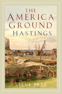
Front cover image: The America Ground in 1811.
Back cover image: The old brig Noah’s Ark, converted into a home. (Hastings Museum)
First published 2021
The History Press
97 St George’s Place,
Cheltenham,
Gloucestershire,
GL50 3QB
www.thehistorypress.co.uk
© Steve Peak, 2021
The right of Steve Peak to be identified as the Author of this work has been asserted in accordance with the Copyright, Designs and Patents Act 1988.
All rights reserved. No part of this book may be reprinted or reproduced or utilised in any form or by any electronic, mechanical or other means, now known or hereafter invented, including photocopying and recording, or in any information storage or retrieval system, without the permission in writing from the Publishers.
British Library Cataloguing in Publication Data.
A catalogue record for this book is available from the British Library.
ISBN 978 0 7509 9776 8
Typesetting and origination by Typo•glyphix, Burton-on-Trent Printed in Turkey by Imak
eBook converted by Geethik Technologies
CONTENTS
Acknowledgements
Image Credits
Introduction
Summary
Chapter 1 The Shingle Ground
Chapter 2 Pre-1820: The Early Years
Chapter 3 The 1820s: Boom Town
Chapter 4 The American Life
Chapter 5 1827–30: The Inquisition
Chapter 6 1830–35: The Last Years
Chapter 7 1836–49: The Desert
Chapter 8 The 1850s: The Robertson Ground
Appendix 1 The Ground’s Names
Appendix 2 Houses and Buildings Transferred
Appendix 3 The American People
Appendix 4 Thomas Brett
Appendix 5 The Rock Fair
Appendix 6 Patrick Robertson
Appendix 7 The Briscos
Appendix 8 Listed Buildings
Appendix 9 The Hastings Obserer
Appendix 10 Key Dates
Notes
Bibliography
ACKNOWLEDGEMENTS
The three people who gave me the most help with this book are unfortunately no longer with us: Barry Funnell, Ion Castro and Davd Padgham. I helped Barry when he was researching and writing his large pamphlet The America Ground, published in 1989, the first and only reliable history of the America Ground to date. Shortly before Barry died, he offered to help me produce another history of the America Ground by drawing on new material that had come to light since 1989. He also passed on to me copies of many of his pictures and documents, as did my friends and local historians Ion and David when I told them what I was hoping to do. Both have since died.
Also giving me very useful help have been Ken Brooks, Denis Collins, Professor Fred Gray, Bob Hart, Brian Lawes, Bill Montgomery and Ian Shiner, plus the Hastings Reference Library (especially Gill Newman), Hastings Museum and Art Gallery, The Keep at Falmer and the Old Hastings Preservation Society.
I am a retired journalist and writer/publisher, and have spent most of my life in Hastings. I have written several local history books, including Fishermen of Hastings (first published in 1985), A Pier Without Peer (on the history of the Hastings and St Leonards piers) and Mugsborough Revisited (describing the local background to Robert Tressell’s famous novel The Ragged Trousered Philanthropists, which was set in Hastings and St Leonards). I am the honorary curator of the Hastings Fishermen’s Museum, and have been on Hastings Council’s Museum Committee for over 30 years.
Steve Peak, 2021
IMAGE CREDITS
Many of the pictures in this book come from a collection put together by the author over many years, including the generous donations from the archives of Barry Funnell, Ion Castro and David Padgham. The pictures that do not come from that multi-person collection have been kindly loaned by the following people and organisations:
Hastings Museum
202224282932343944 (both)47505255 (both)6275778996101 (right)107 (top)138 back cover
Hastings Reference
Library
8213094101 (left)113123139
The Keep,
Brighton
5984
British Museum
73
Ken Brooks
80 (left)
Ordnance Survey
10
The America Ground in 1829.
INTRODUCTION
The ‘America Ground’ is 8½ acres of Hastings town centre that in the early nineteenth century was an open piece of beach, apparently beyond the borough boundary and with no obvious owner, which was gradually occupied by a thousand or more people (many of them squatters) who lived and worked there – until they were all evicted by the government in 1835.
But in the first three decades of the nineteenth century, the Ground – despite being ‘out of town’ – played a key role in the expansion of Hastings during a crucial period in its 1,200-year history. The Ground was a combined industrial and housing estate providing many services to the town’s developers, plus much housing for the many workers that were needed. The Ground’s seeming freedom from local authority control also created something of a radical libertarian atmosphere, and one of the names the Ground acquired was ‘America’, after the newly independent former British colony.
However, the Ground’s apparently almost uncontrolled sovereignty meant there was often conflict between the actual occupants as they tried to settle which of them was going to occupy what piece of landlord-free land. The increasing frequency of these clashes eventually prompted central government – the probable legal owner of the Ground – to take control of it in 1828. All the settlers were given notice to quit, and from 1850 what was once almost a new American state on British soil became an upmarket suburb of the increasingly popular seaside resort of Hastings.
There follows a summary of the America Ground’s history, all of which is described in more detail in the rest of this book.
Hastings town centre. The America Ground was the coloured area, between Harold Place in the east and The Alley in the west, going as far inland as Cambridge Road.
SUMMARY
The America Ground lies in the Priory Valley, which around the time of the Battle of Hastings in 1066 was a natural harbour, with the town of Hastings then based on top of the White Rock headland, on the west side of the Valley. Over the following centuries the harbour gradually silted up, and Hastings moved into the Bourne Valley, where the Old Town is today.
In 1578 some prominent local townspeople persuaded Queen Elizabeth to fund the turning of the marshy Priory Valley into a ‘haven’, a sheltered closedin dock, like a marina. But after £2,000 (about £920,000 in today’s money) had been spent on the scheme in about 1580, the rest of the finance went missing and construction stopped. However, a raised embankment had been built across most of the mouth of the Valley from the west side, lying roughly where Cambridge Road is today, as a barrier providing defence from the sea. This embankment immediately created a valuable road out of Hastings to the west, and as such was also to become the inland boundary of the America Ground two centuries later.
But the embankment also blocked some of the Valley’s drainage channels, turning the bottom of it into marshland. This had a major effect on the expansion of the town, as the Valley could not be built upon until the mid-nineteenth century.
By the early 1700s the Priory Valley had become a mixture of this low-lying marsh, with farmland on the slopes, and much shingle piled up against the c.1580 embankment. The Priory Stream ran down the east side of the Valley into the sea where Harold Place is now.
Then, in the 1790s, what had been the small fishing port of Hastings for the past two centuries started becoming a popular seaside resort, and much development began in the early 1800s. As the town could not expand to the east, it started spreading west under the Castle Cliff and into the Priory Valley, going as far as the Priory Stream. On the other side of the Stream were the marshes inland of the embankment, too wet to build on, while south of the embankment were the mostly unused acres of what was to become the America Ground. At that time it was usually known as the Priory Ground, named after the priory that had stood in the Valley from around 1190 until 1417, and which had owned much of it.
At the end of the eighteenth century the roads linking Hastings with London and elsewhere were poor quality, so the town was heavily dependent on seagoing vessels to transport people and goods. In 1800 the leading local shipowners, the Breeds family, took over a large part of the Priory Ground and built on it a 150yd-long ropewalk, for making the extended rope that was essential to all sailing craft, plus storage warehouses and workshops. It is believed that they arranged a lease for the land with the Earl of Chichester, who it was thought (wrongly, it transpired) to be the owner of the Ground.
BOOMTOWN
The expansion of Hastings speeded up from 1814, and work started in 1816 on building upmarket housing in Wellington Square and Castle Street, followed in 1820 by Pelham Place, and then Pelham Crescent from 1823. All this construction work on the east side of the Stream needed many labourers, skilled workers, workshops and stores, and as there were few available places in the existing town, the handy Priory Ground west of the Stream started becoming both a housing and industrial estate.
By 1820 the boom had accelerated, and the need for somewhere to live became especially urgent. At around that time it became clear that Hastings Corporation was not exercising any local authority rights it might have had over the Priory Ground, and, as the possible landlord, the Earl of Chichester, had a low public profile, people began squatting unchallenged on the Ground.
As the Ground appeared to be lying outside the town’s border and had no clear landlord, so its residents and businesses had no taxes and little (if any) rent to pay. This meant that the financial overheads of running a trade or living there were low, while at the same time their employers could pay them less than usual, giving the developers more to invest – a mutually beneficial arrangement.
The Priory Ground started acquiring the name ‘America’ in the early 1820s for three reasons. First, there was a spirit of ‘Americanism’ among some of the squatters – they felt free of the town of Hastings in the same way that the Americans felt liberated from England after the Revolutionary War of 1775–83 and the War of 1812. Secondly, the Ground could only be approached from Hastings by going over some water (the Priory Stream, like crossing the Atlantic); and thirdly the name ‘Priory’ sounded similar to the American ‘prairie’.
Although the boomtown was known occasionally as just ‘America’ in the 1820s and ‘30s, it does not seem to have been until the 1840s, after the clearance by the Crown, that it started being called ‘the America Ground’ – the Ground that had once been America.
There is no contemporary record of independence being declared by the ‘Americans’, and the only known occasion when the Stars and Stripes flag was flown was during the major town-wide celebrations of the passing of the 1832 Reform Act, which made parliamentary representation more democratic. On that day, a procession from the Ground carried a modified version of the Stars and Stripes during the celebrations – and then it was donated to the town hall by the not-so-independent ‘Americans’.
The occupants of the Ground were too dependent on the jobs, economy and culture of Hastings to become truly independent of the town, in the same way that today Wales is too reliant on England to break away from it. And by no means all of the Ground’s people were rebellious. Over a third of the Ground was in the hands of prominent members of the local establishment, most notably the three Breeds brothers, whose priority was maintaining good profit-generating ties with the many residents and businesses of Hastings and the surrounding countryside.
There have been claims that the Ground was home to many drunks, criminals, smugglers and loose-living women, and that it was quite unsafe for any visitor to venture near it after dark. But if it was sometimes unattractive, there is no evidence that the Ground was any worse than Hastings Old Town, where there were many more pubs, plus there was serious overcrowding, no sanitation, little fresh water and smugglers frequently going about their ‘business’. A contemporary journalist who lived in the Old Town said everyday life on the Ground was little different from that in the Old Town.
However, it was the skirmishes over who could occupy which pieces of the Ground that alerted Whitehall in 1826 to the fact that possibly some form of anarchy was taking place on what was probably the Crown’s land.
In response, the government in 1827 began preparing a legal enquiry into the Ground by carrying out a survey. This was to be followed by another survey in early 1829, which recorded a great mix of houses, tenements, workshops, stables, coach houses, piggeries, forges, warehouses, slaughterhouses, laundries, carpentries, bakers, sail lofts, rope works, saw pits and builders' yards (but very few pubs). The 1831 national census recorded 1,074 people living in the Holy Trinity Parish, nearly all of whom would have been on the Ground.
THE INQUISITION
The 1827 survey was followed by an ‘inquisition’ – a public inquiry – in the George Inn in Battle in December 1827, where anyone claiming to own any of the Ground was invited to prove it. As no one could do so (or, perhaps, wanted to), the jury ruled in favour of the Crown, which in law owned all English and Welsh foreshore by default if no other party could prove otherwise. All parties at the inquiry then had a very enjoyable meal at the Inn, the owners of which are believed to have been the Breeds family, the most prominent occupants of the Ground.
In mid-1828 legal notices to quit were given to all the occupants of the Ground, but with seven-year leases before enforcement. So the freedom followers occupying the once semi-independent America Ground had become tenants of the British government.
The Crown was taking a lenient approach with the long notices because of the money and labour many of the ‘illegal’ occupiers had invested in creating their premises, and in those seven years it seems that little (if any) rent collecting actually took place. The Breeds family would have been happy with the situation, as they could carry on running their large-scale businesses while only paying a minimal rent as a form of security (perhaps this had been arranged over dinner at the George?).
By coincidence, also in 1828 construction began of the new upmarket town of St Leonards, a mile to the west of the Ground. Initially many of the building workers in St Leonards squatted on the Ground, but then in the early 1830s land became available on the east side of the new St Leonards where they could build their own houses. Quite a few Ground residents then dismantled their existing homes and transported them to the new Shepherd Street/Norman Road area, where they were rebuilt, and where many are still standing.
The deadline for clearing the Ground was Christmas 1835, and the Crown’s Commission of Woods and Forests then took possession of it. For the following fourteen years it was an open unused space, a piece of derelict ‘ground’ that was remembered as often being called ‘America’ – hence the name the ‘America Ground’ that gradually came into use in the 1840s.
But one part of the Ground was not cleared. This was Mr Boykett Breeds Jnr’s large yard, with warehouses, storage sheds, a lime kiln and caves, which took up all the west side of today’s Claremont. Mr Breeds and his father Mark had created the yard and Claremont itself in 1822 by cutting back the hill that sloped down from Prospect Place, forming the vertical cliff beside The Alley, on top of which the old Observer building stands. His yard covered all the level ground between the rock face and Claremont, where the Library and other buildings are today.
The Crown initially believed that they owned the piece of this Breeds’s land that was nearer Claremont, because it was on shingle, but their cut-back hill to the west was not. In the end, Messrs Breeds were allowed to stay where they were.
In 1830 Boykett Breeds Jnr went bankrupt and had to sell most of his extensive property interests. These included his Bohemia House and large estate on the east side of Bohemia Road (including the site of today’s Hastings Museum and Art Gallery), which were bought by the wealthy slave-owning Brisco family. Their history is in Appendix 7. From the 1870s the Breeds family focused their business activity on a large brewery they had in the Old Town.
The only surviving relic of the pre-1836 America Ground that is still in situ and visible today is the Breeds cliff face in The Alley, with one or more of the Breeds’ caves in that cliff, but it is not known which. All the Ground’s buildings had been demolished by 1836, although some were rebuilt in White Rock and central St Leonards. The known survivors of the 1830s ‘house removals’ that can still be seen today are listed in Appendix 2.
CROWN LAND
As the town expanded steadily in the 1830s, the Crown decided they had to protect their increasingly valuable potential building site from the sea. So in 1836–37 they built a large defensive sea wall from what is now Harold Place to the end of Robertson Street. This can still be seen inside the underground car park, forming all of the inland wall, a rare surviving example of how sea defences were built almost two centuries ago.
Not much happened on the America Ground – officially called the Crown Land – until 1849, when a wealthy Scottish businessman, Patrick Robertson, took a ninety-nine-year lease on most of it. Earlier he had become affluent from a controversial form of drug trading in the Far East, selling opium to the people of China, which enabled him to semi-retire to Hastings in 1847. Locally he became known as a gentlemanly benefactor of the poor, and he was elected as a liberal-oriented Conservative MP for Hastings from 1852. His life story is in Appendix 6.
In the early 1840s, the land north of the c.1580 embankment – where the Priory Meadow shopping centre is today – was still soggy undeveloped marshland, awaiting proper drainage.
However, by 1849 Robertson had seen the potential of creating what was to become known as the Regent Street of Hastings – Robertson Street – because of the imminent arrival of the railway in Hastings. The first railway line, from London via Lewes, had reached Bulverhythe in 1846, and in 1849 work was well under way on cutting the tunnels through hilly St Leonards to the station that was about to be built near the America Ground.
Robertson believed the trains would boost the town’s economy, and therefore high-quality housing and shops near the station would be both popular and profitable. By 1850 the overspill from the cutting of the railway tunnels had been spread over the marshland, making it fit for development as the new town centre, and reinforcing his vision of the future.
Robertson employed the Crown Commission’s architects Reeks & Humbert to design and oversee the layout and construction of the Ground. He obtained from the Crown two statues on plinths – one a lion, the other a unicorn – that had been made for the major redesign of Buckingham Palace then taking place. He placed them at either end of Robertson Terrace, where they still are today.
By the end of the 1850s most of the buildings now standing on the America Ground had been built. In later years the most significant changes were to be the erection of the Queens Hotel in 1863, the rebuilding in 1927 of the east end of Robertson Street as the Plummer Roddis department store (later Debenhams), the widening of the seafront with a car park underneath it in 1931, and bomb damage in the Second World War.
1
THE SHINGLEGROUND
The America Ground is based on shingle, which covers the entrance to what was a deep tidal estuary at the end of the Iron Age two millennia ago.
At that time Britain had between 1.5 million and 2.5 million people, living as farmers or small tribal groups, but with safeguarded areas (known as ‘Iron Age forts’) where they could meet for cultural, religious and security purposes. The East Hill (and possibly the West Hill) ) was one such place, covering 60 acres in what is today part of Hastings Country Park. When the Romans invaded England they may have experienced little conflict in Kent and Sussex, as indigenous traders had had a working cross-Channel relationship with them for many years. It appears that the Romans allowed the existing way of life to continue where possible, in a period that saw the reorganisation and expansion of settlement across Sussex.
Hastings as it may have been soon after 1066. The town of Hastings is on top of White Rock, on the left, and the Priory Valley is a natural harbour, overlooked by the Castle.
In Roman times there was no actual town of Hastings. The Priory Valley was a natural harbour formed by several watercourses running into the sea, mainly as the Priory Stream, between the West Hill and White Rock, which were then promontories extending much further into the sea than today. White Rock provided shelter from the predominant south-westerly winds, so trading vessels could moor safely alongside its east-facing slopes, where Claremont is today.
The Priory Valley in Roman and Anglo-Saxon times was one of only a handful of English harbours available for cross-Channel traffic, and this was probably the main reason why the town of Hastings was created in the ninth century, as a new national economy began to emerge based on increased trading and transport. The town itself was on top of White Rock, mostly on the section that has now been lost to the sea. No archaeological remains of the original Hastings have been found, although it is clear that an early medieval church called St Michael’s stood just to seaward of where St Michael’s Place is today.
The Priory Valley remained the port for Hastings through the Norman invasion of 1066 until around 1200, when the harbour entrance began silting up. From this time onwards Hastings would suffer from both constant coastal erosion, which ate into the cliffs, and from the long-shore west-to-east movement of shingle (the ‘long-shore drift’) that steadily blocked up the Priory Valley harbour.
During the thirteenth century the town of Hastings moved from White Rock into the Bourne Valley, but severe storms later that century forced the ‘new town’ of Hastings to move further up the Bourne Valley, to create what is now called the Old Town – even though it is the youngest ‘town’ of Hastings.
The Priory Valley was named after the Holy Trinity Priory, a small monastery that was set up around c.1189–99 by Walter de Scotney for the Augustinians (the Black Canons). Their lives involved preaching, administering the sacraments, tending the sick and giving hospitality to pilgrims and travellers.
The Priory itself was located where the southern end of Cambridge Gardens and the ESK Warehouse are today, at a much lower level than the existing buildings. Along the west side of the valley the Priory owned many acres of farmland, which formed the parish of Holy Trinity. The Priory had been dedicated to the Holy Trinity: the Father (God), the Son (Jesus) and the Holy Spirit (the power of God at work on Earth). The word ‘trinity’ comes from the word ‘tri’ meaning ‘three’ and ‘unity’ meaning ‘one’ – the three as one.
Part of the late twelfth-century Priory, on display in Hastings Museum and Art Gallery.
But the Priory had been built close to sea level, and although by the end of the fourteenth century the valley had partly filled with shingle, there were still strong surges of the sea into the Valley. These were so damaging that in 1417 the Canons abandoned the buildings and moved the Priory inland to Warbleton, near Rushlake Green in East Sussex.
The name of the Priory lives on in several placenames, especially Priory Road, one of the oldest roads in the town. For travellers coming into town from the Ridge, it provided access to the Priory via the West Hill when the sea was blocking the track along the beach below the Castle.
The Priory’s new land at Warbleton had been donated by Sir John Pelham. The Pelhams were wealthy landowners in Sussex over many centuries, and they were to play a significant role in the history of the America Ground. As will be described later, Henry Thomas Pelham (1804–86), the third Earl of Chichester, son of Thomas (1756–1826), the second Earl, was to be involved in the Crown’s key inquiry into the ownership of the America Ground in the late 1820s that resulted in it being cleared by 1835, when the government took possession of it.
By the fifteenth century the Priory Valley was unusable as a harbour, and from then through to the late nineteenth century there were repeated attempts to build a harbour arm-cum-breakwater in the sea on the west side of the Bourne Valley, roughly just to the west of today’s harbour arm. The aim was to provide some shelter from the prevailing south-westerly wind for the fishing boats and trading vessels that worked off the beach in front of the town. But these harbours suffered repeated damage from the sea, so they needed constant repair, as was seen as recently as 2017–18 when today’s harbour arm, built 1896–98, had to have major work carried out on it.
Some stones of the Priory survived in parts of buildings of the Priory Farm, seen here in the early nineteenth century.
In 1578 a petition was sent from the townspeople to Queen Elizabeth, saying that ‘of late time the … harborough was at a sudden, by the great violence and extreme rage of the sea, broken downe and caried awaie. Sithence which time the Towne is much decayed.’ Abandoning the idea of a harbour arm, the prominent Hastingers sought Her Majesty’s backing for making the Priory Valley useable by vessels again. Their proposal was to turn the valley into a ‘very good hauen [haven] … for the arriuing and sauegard of shippes, barkes, crayers and boates, to the great reliefe of the inhabitants and all merchants and travellers sayling along the narrowe seas [the English Channel].’ 1 Its estimated cost was £4,000, about £1.84 million in today’s money.
A ‘haven’ is a closed-in dock, like a marina, rather than a harbour arm projecting into the open sea. Queen Elizabeth gave her blessing, authorising the local establishment to start collecting funding for the scheme, and so work began. Within a year £2,000 had been spent, but then the money that the local businessmen had obtained went missing and construction had to stop. Historian William Camden wrote in 1586 that ‘the contribution was quickly converted into private purses, and the publicke good neglected’. 2
It seems that in about 1580 a sea wall of soil, and possibly rock, had been built across the Valley near the sea, roughly where Cambridge Road is today. This may have been put on top of an already-existing trackway across the valley, which is likely to have been formed by people travelling along the coast once the Priory Valley had partly filled with shingle and silt. This trackway was probably on a 60ft-long embankment that had been laid in 1439 below the Priory, probably to help access across the valley. This suggests that by the early fifteenth century the valley had partly silted up. 3
Prior to that, when the valley had been a natural harbour, travellers would have had to go inland along both sides of the valley to a point where they could cross the Priory Stream, probably in today’s Alexandra Park. Stonefield Road may have been the main trackway along the east side of the valley in those years.
Parallel to the c.1580 sea wall across the valley, there appears to have been another wall further inland, where South Terrace is now. These two walls and the hillsides to the east and west of them would have formed the deep-water haven, where the Priory Meadow shopping centre is today.
There are no written records of the c.1580 haven, but several maps show that it existed. The first record is in the 1595 map by John Norden, showing ‘The intended haven of Hastings’.
A century and a half later, two plans show that around 1750 the haven was still a clear geographical feature. Both plans were by local surveyor Samuel Cant, with that of 1746 (on page 28) being part of his survey of the borough boundaries. The 1750 plan is part of his depiction of the estate of local landowner John Collier.
John Norden’s 1595 map, with the ‘intended haven’ between White Rock and the Castle.
John Collier’s 1750 plan, showing the remains of the c.1580 haven. White Rock, top left, has a windmill on it. The bridge is where today the streets come together in the town centre.


