9,99 €
Mehr erfahren.
- Herausgeber: The History Press
- Kategorie: Sachliteratur, Reportagen, Biografien
- Sprache: Englisch
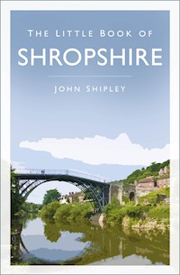
The Little Book of Shropshire is an intriguing, fast-paced, fact-packed compendium of places, people and events in the county, from its earliest origins to the present day. Here you can read about the important contributions Shropshire has made to the history of the nation, and meet some of the great men and women, the eccentrics and the scoundrels with which its history is littered. Packaged in an easily readable 'dip-in' format, visitors and locals alike will find something to remind, surprise, amuse and entertain them in this remarkably engaging little book.
Das E-Book können Sie in Legimi-Apps oder einer beliebigen App lesen, die das folgende Format unterstützen:
Veröffentlichungsjahr: 2015
Ähnliche


First published 2015
Reprinted 2016, 2019
This paperback edition published 2023
The History Press
The Mill, Brimscombe Port
Stroud, Gloucestershire, GL5 2QG
www.thehistorypress.co.uk
© John Shipley, 2015, 2023
The right of John Shipley to be identified as the Author of this work has been asserted in accordance with the Copyright, Designs and Patents Act 1988.
All rights reserved. No part of this book may be reprinted or reproduced or utilised in any form or by any electronic, mechanical or other means, now known or hereafter invented, including photocopying and recording, or in any information storage or retrieval system, without the permission in writing from the Publishers.
British Library Cataloguing in Publication Data.
A catalogue record for this book is available from the British Library.
ISBN 978 0 75096 342 8
Typesetting and origination by The History Press
Printed by TJ International Ltd, Padstow, Cornwall.
eBook converted by Geethik Technologies
CONTENTS
Introduction
Acknowledgements
1. How it all Started
2. Places
3. Royal Shropshire
4. Shropshire First and Last
5. The Size Debate
6. Crime, Punishment and the Poor
7. Shropshire Riots
8. Quirky Facts and Oddities
9. Sporting Shropshire
10. Shropshire Murders
11. Ghosts, Myths and Legends
12. Battles, Skirmishes and Sieges
13. People
14. Literary Shropshire
15. Shropshire Victoria Crosses
16. Miscellaneous
17. Military Connections
18. Water and Waterways
19. Castles and Fortifications
20. Abbeys and Churches
21. Hills and Valleys
22. Transport
23. Disasters, Accidents and Tragedies
24. Wartime Shropshire
25. Musical Shropshire
26. Education
Postscript
INTRODUCTION
Many counties may lay claim to the title of the prettiest in England, but despite their many and undoubted charms, few can aspire to the unique diversity to be found in the county of Shropshire.
Take an extended walk through what has been called ‘The Secret County’ and along the way you will discover timeless villages with ancient churches, historic abbeys and castles, a Roman city, breath-taking views, colourful market towns, teashops and numerous country inns. The county is home to not one but two UNESCO World Heritage Sites: the Ironbridge Gorge, and the Pontcysyllte Aqueduct and Canal.
This Little Book of Shropshire is a vibrant, fast-paced, fact-packed compendium of compelling information filled with the frivolous and fantastic, unbelievable and downright strange details about the county of Shropshire. It includes a plethora of eccentric individuals who have inhabited Shropshire, its famous sons and daughters, heroes and villains, royal connections and a pile of facts about Shropshire’s history, its beautiful landscape, towns and villages, plus a collection of bizarre historical trivia. All this comes together in an easy-to-carry pocket-sized book that is essential reading for visitors and locals alike.
The ceremonial border county of Shropshire, estimated population in 2011 of 473,900, separates much of central England from Mid-Wales, an area that in older, more violent times was policed by a group of noblemen known as ‘The Marcher Lords’.
In England, the county shares borders with Cheshire, Staffordshire, Worcestershire and Herefordshire, and in Wales with Powys and Wrexham, covering an area of 1,346 square miles (3,487 sq km).
The snaking River Severn, Britain’s longest river, divides the county and, together with the western hills and the mysterious and evocative Offa’s Dyke, has for centuries provided a natural barrier to racial conflict. The other major river in the county is the Teme.
Within the timeless Shropshire landscapes there are charming market towns, each with its own distinctive character, such as: Ellesmere, Market Drayton, Oswestry, Bishops Castle, Ludlow, Much Wenlock and Bridgnorth. Among enticing streets and alleyways you will find antique and craft shops, inns and teashops rubbing shoulders with traditional grocers, butchers and bakers.
In the very heart of Shropshire lies the historic county town of Shrewsbury, one of the finest Tudor towns in England, and to the east – in the UNESCO World Heritage Site of Ironbridge – the ten museums of the Ironbridge Gorge celebrate the birthplace of the Industrial Revolution.
So whether you’re seeking horticultural sanctuary or historical stimulation, amusement or distraction, Shropshire has something for everyone: award-winning museums, renowned gardens, distinctive National Trust and English Heritage properties, fascinating farm attractions, abbeys and churches, street markets, speciality shops and craft centres, and unspoilt countryside to explore.
My wife and I have lived in Bridgnorth since 1968 – having emigrated from Wednesbury in the Black Country – raised a family and now call the place home. Bridgnorth was one of the riverside places that Black Country people came to for their holidays. My family did. I first fell in love with my adopted county on these annual holidays, but never dreamt I would have the chance to live here.
Collecting information and assembling this book has given me much pleasure. I hope that reading it will give you even more enjoyment.
John Shipley, 2015
ACKNOWLEDGEMENTS
I would like to take this opportunity to publicly thank and acknowledge all the people, individuals and organisations who have helped with the compilation of material for this book and without whom the project could not have been completed: international ice hockey legend and percussionist supreme Chuck Taylor; television’s Gary Newbon; Adrian Pearce of the Shropshire History website (www.shropshirehistory.com); Sarah Davis, Archivist at Shropshire Archives; Martin Davis and David Gittins at Shrewsbury Railway Heritage Trust; Elizabeth Bailey, Secretary of the Dawley History Group; the Shropshire Library Service; the staff at Bridgnorth Public Library; Martin Wood, author and Shrewsbury Town Crier; the Ironbridge Gorge Museum Trust; the Broseley History Society; BBC Shropshire; and Anne Williams at the Bog Visitor Centre.
My son, Peter Shipley, for his immense contribution – rewrites, additional facts and proof checking. Plus, of course, my long-suffering, proofreading wife, Kate, and friends Eric Smith and Mike Thomas for their input.
And to Matilda Richards and Naomi Reynolds at The History Press.
The material for this book has been compiled and assembled from personal research, archive material, various websites and printed matter, and, of course, word of mouth, all of which has been used in good faith. The majority of illustrations are by the author; all others are The History Press’s collection.
Whilst every effort has been made to check and recheck the facts and items in this book, the publisher and author bear no responsibility for the content. Where possible, permission has been sought.
And lastly, please forgive me if I have not included any of your particular favourite Shropshire facts.
1
HOW IT ALL STARTED
Evidence from radiometric dating indicates that our Earth, formed by accretion from the solar nebula, is around 4,540 million (4.54 billion) years old, a lifespan that is divided into thirteen separate geological periods, eleven of which are represented in the modern-day county of Shropshire by different rocks and scenery. Just as a snapshot for comparison, Snowdonia has only three of these different periods.
The Precambrian period, covering all of Earth’s history up to around 570 million years ago, is when Shropshire’s oldest rocks were formed: volcanic ash and lava formed the hills known as the Wrekin and the Lawley, and Caer Caradoc, plus many others on the eastern side of the Church Stretton Valley, and Earl’s Hill, near Pontesbury. Contrary to local popular belief, the Wrekin is not an extinct volcano, though it is made up of volcanic rock. Later in the Precambrian period, Shropshire was covered by a shallow sea, during which time the county’s extensive sandstone beds, such as the Long Mynd plateau, were laid down.
Also during this period, a major break, or fault, appeared in the Earth’s crust, known as the Church Stretton Fault – a line along which violent earthquakes occurred for many millions of years, but which has lain dormant for around 200 million years. Following this, during the Cambrian, Ordovician and Silurian periods, between c. 570 and c. 400 million years ago, the county lay almost continuously under the sea: shallow in the east, deeper in the west. Only the tops of the Long Mynd and Stiperstones would have been visible, standing out above the level of the water like islands.
One of the first inhabitants of the area was the lizard-like Rynchosaur, a diapsid reptile that grew up to 2m in length. This herbivore existed in the Triassic period around 240 million years ago. Fossils and footprints of this creature have been found in the county, the latter in a quarry at Grinshill.
Prior to the last Ice Age, what is now the River Severn flowed in the opposite direction, flowing northwards to the River Dee estuary, but of course the arrival of the ice froze up the flow, then, when the ice retreated, the meltwater that was left behind became trapped, forming a series of large lakes, eventually merging to form Lake Lapworth in present-day Leicestershire. When this lake overflowed, the water carved out the Ironbridge Gorge, creating a natural passage for the present course of the Severn.
During the last Ice Age, Shropshire was covered by a dense sheet of ice up to 300m thick until around 20,000 years ago. At this time the only part of today’s county above the level of the ice was the Stiperstones Ridge.
Amazingly, in those far-off days great mammoths roamed the county. And to prove it, remains of these giant creatures were found in 1986 in a quarry at Condover. The oldest was dated to around 12,700 years old.
Between 4,000 and 2,500 BC, Britain was inhabited by Neolithic (new Stone Age) tribes, and there is evidence of farming in Shropshire at this time.
The earliest known example of a Stone Age settlement in Shropshire is thought to be the Roveries hill fort in the south-west of the county. Excavations have suggested that the hill was inhabited some 2,000 years before the Iron Age hill fort was constructed, as fragments of pottery and a hearth dating back to the Neolithic period were found.
Evidence of the existence of Stone Age residents in Shropshire can be seen in the numerous tumuli (stone burial chambers), plus the many standing stones and stone circles that are dotted around the county.
In Neolithic times anyone wishing to travel far kept well clear of the densely forested valleys, preferring the safer and easier crests of hills known as ridgeways. A fine example of this is the Portway, a major ridgeway across the Long Mynd, used by Neolithic axe traders, and still recognised as the King’s Highway up until the Middle Ages.
The Clun area has seen the discovery of a plethora of artefacts: over 1,000 flint tools and weapons. It seems that the area around Clun was as popular then as it is today.
The Neolithic peoples were followed by bronze-using Celts, dwelling in huts or on artificial mounds surrounded by lakes or pools, such as those found at Berth, near Baschurch. Bronze implements have been found at Bagley, near Hordley, and dugout canoes have been found at Crose Mere and Marton Pool, near Chirbury.
In 54 BC Julius Caesar came across from Gaul and gave the indigenous peoples of our island the name Britons, whose distinctive circular fortifications seem to crown almost every hill in Shropshire, and can be found at Gaer Ditches, Titterstone, Abdon Burf and Bury Ditches. At the time of the Roman invasion, Shropshire was most likely sparsely inhabited by the Cornovii, whose lands straddled much of the county, and the Ordovices in the west, mostly in Wales. The lands of the Cornovii are believed to have stretched from Merseyside down to the West Midlands, plus parts of Herefordshire – their capital may have been the hill fort on the Wrekin. Other impressive examples of their hill forts are at Old Oswestry and Bury Ditches, but upon dusting off your Ordinance Survey maps you will notice that there are hill forts all over Shropshire, possibly fifty or more.
Roman history of the county only really starts a century after Julius Caesar’s landing. The Roman general Ostorius established fortified camps along the Severn Valley, but in Shropshire the Romans met with fierce resistance, particularly from the Ordovices.
It is believed that the famous British chieftain Caratacus of the Belgic Catuvellauni tribe, who led the resistance to the Roman invasion of Britain, may have suffered his final defeat in Shropshire at the Battle of Caer Caradoc. This may well have been fought on the hill of this name near Church Stretton. Other places in Shropshire and elsewhere, such as Briedden just across the county’s north-west border, have been suggested for the site of this battle, however my personal favourite is Caer Caradoc with its ancient hill fort and incredible views (more about Caratacus and this battle later).
The Romans under the general Julius Agricola finally defeated the Ordovices in AD 78. The county lands thus passified, the Romans quickly settled into what they did best – building. Shropshire has a handful of Roman towns, the principle one being Viroconium Cornoviorum (Wroxeter, near Shrewsbury), which became the fourth largest town of Roman Britain with a population of around 6,000 at its peak in the second century. Other principle towns were Mediolanum (Whitchurch) and Vxacona (Redhill, Oakengates). It’s also worth mentioning the town of Bravonium (Leintwardine, Herefordshire), which is only a Roman mile or two from the Shropshire border.
There are many Roman roads in Shropshire, the most notable being Watling Street, which was originally an ancient British pathway route developed and paved over by the 14th Legion.
Of Roman Villas, that iconic insight into Roman rural life, there are traces, but sadly fewer than in more southern and eastern counties of the UK. Examples include Acton Scott, Yarchester near Wenlock, Lea Cross near Pontesbury, Ashford Carbonell near Ludlow, Cruckton near Shrewsbury and Whitley Grange near Shrewsbury. Traces of other Roman buildings have been discovered at Oakengates (Vxacona), Bury Walls near Hawkstone, Old Oswestry, Linley, Stanton Lacy and Rushbury. Fortified posts probably of Roman date can be found at Norton Camp on Whettlebury Hill, Nordy Bank, Chesterton Walls, Llanymynech, Caynham, Edbury Camp near Haughmond and possibly Wall Camp near Kinnersley.
The Romans used slaves to mine lead on the Stiperstones, and copper and lead at Llanymynech.
Much of what we know today about Roman Britain comes from the writings of the celebrated Roman geographer and astrologer, Claudius Ptolemaeus, who lived in the second century AD, during the reigns of Emperors Hadrian and Antonine. Ptolemaeus, more widely known as Ptolemy, was Greek by descent, but hailed from the Egyptian city of Alexandria. He published several books on astronomy, but his seven-volume work Geographia, became the standard textbook on all things geographical until the fifteenth century. The British Isles are mentioned early in volume two. In chapter two, entitled ‘Albion island of Britannia’, Ptolemy describes mainland Britain, listing major landmarks, the coastline, rivers and estuaries, the names of the British tribes and the names of their principal towns. He also tells us the names of the neighbouring tribes of the Cornovii: the Brigantes to the north-east, the Corianti to the east, the Dobunni to the south, the Demetae to the west and the Deceangi in the north-west. (The poor old Ordovices don’t get a mention.)
He and other Roman writers have also given us the names of the larger rivers:
• Seteia Aestuarium (the Mersey), which formed the natural border between the lands of the Cornovii and the Brigantes.
• Deva Fluvius (the Dee), which, with the next two names, come directly from the Latin.
• Trisantona Fluvius (the Trent).
• Sabrina Fluvius (the Severn).
He also tells us that the principle tribal centre was at Civitas Cornoviorum (Viroconium Cornoviorum, or Wroxeter if you prefer).
After the Romans abandoned Britain around AD 410, Angle and Saxon invaders from Northern Germany and Denmark filled the power vacuum and began to settle in Britain. One of the invading tribes established the Kingdom of Mercia, which incorporated modern-day Shropshire, centred around Staffordshire, with its capital at Tamworth. Unfortunately, not much is known after this until AD 577, when Ceawlin, King of Wessex marched north up the Severn Valley. Then in AD 584, a force of West Saxons sacked and destroyed Viroconium, attacking again in AD 661 and defeating the Mercians in a great battle at Pontesbury.
The Saxons left their mark on the county in the form of place names:
• Tun (a settlement) such as at Culmington (the tun of Culming)
• Ley (a clearing) such as at Billingsley
• Hall (a house/dwelling) such as at Bonninghall
• Wardine (an estate) such as at Shrawardine (the estate of the sheriff)
During the period AD 500–850, often referred to as ‘The Dark Ages’, a number of Anglo-Saxon kingdoms were established. From AD 527–879 Shropshire was part of the Kingdom of Mercia, one of seven kingdoms known collectively as the Heptarchy (this term derived from the Greek has been in use since the sixteenth century). The other six were Northumbria, East Anglia, Essex, Kent, Sussex and Wessex.
From AD 879–918 Mercia was an independent kingdom, after that it became a client state of Wessex.
The two Mercian peoples were the Hecani in the west, later known as the Magonsaete (those that lived around Magana/Maud Bryan in Herefordshire) and the Wreocensaete (who lived around the Wrekin).
The new shire of Shropshire was created some time between AD 900 and 925 as part of the defence of English Mercia against the Danes, who had settled in eastern England.
Having looked at our ancient beginnings, let’s turn our attention to how the county got its name …
WHAT’S IN A NAME?
A lot of people I know – those who harbour the misguided idea that I might know a thing or two, and probably loads who think I don’t – ask me how to pronounce the name of our beloved county town (which, incidentally, in my humble view, should be a city). Let me say right off that as a bloke born and bred in the Black Country, a place where we say most English words incorrectly, I am the wrong chap to ask.
The debate continues: does one pronounce it Shrewsbury (with the ‘ew’ as in ‘sew’, or as in ‘shrew’ – the small long-nosed rodent), or Shroesbury, Shrewsbry, Shewsbury, Shewsbry, Shoesbry or Shrowsbury (with the ‘ow’ as in show)? And so it goes on.
I have lived in Bridgnorth for almost fifty years, and in that time I have heard all of these pronunciations, and some of them have been used on maps in the past. So which pronunciation is correct? Probably all of them. I will have to leave it to the individual reader to decide; begging forgiveness if I missed out your favourite.
The name Shropshire is derived from the Old English word ‘Shrobbesbyrigscir’, which means Shrewsburyshire – in the Anglo-Saxon Annals it was ‘Scrobbesbyrig-scyre’ and ‘Scrobb-scire’. Later writers called it ‘Scrop-scire’, and ‘Salopschire’ and subsequently ‘Schropshire’.
The Old English name for Shrewsbury was ‘Scrobbesburh’ or ‘Scrobbesbyrig’, meaning ‘fort in the scrub-land region’; or ‘Scrobb’s fort’, meaning ‘shrubstown’ or ‘the town of the bushes’. This name gradually evolved in three directions, into ‘Sciropscire’, which morphed into Shropshire; into ‘Sloppesberie’, which became Salop/Salopia (an alternative name for both town and county); and from ‘Ciropsberie’ into ‘Schrosberie’, which eventually became the town’s name, Shrewsbury. The Normans called it ‘Salopsberia’ or ‘Salopescira’. In 1888 the county council was known as Salop County Council, but in 1980 this was changed to Shropshire County Council. Salop is no longer used.
The Shropshire dialect is not heard so much these days, but not so long ago its distinctive vocabulary and accent was present throughout the county. Here are just a few Shropshire colloquialisms to provide a flavour of the dialect:
Aunti-praunty
High spirited
Acker (ak’ur’)
To tremble with passion
Badger (bajur)
A huckster or middleman
Barley child
A child born out of wedlock
Castrel (kastrel)
A worthless person
Chit-up
A forward girl
Dacky (daki)
A suckling pig
Daggly
Showery weather
Fumey
Passionate, hasty
Fussock
A big, dirty, greasy woman
Gammocks
Rough play
Gid
A dizziness that sheep are liable to
Gird
To pull violently
Noggling
Bungling, blundering
Onder
Afternoon
Onshooty
Uneven
Oontyump
A molehill
Poon
Hit
Potch
To poke, to thrust, to make a hole
Quank
Still, quiet
Quite
A woodpigeon
Sclemgut
To be greedy


