Erhalten Sie Zugang zu diesem und mehr als 300000 Büchern ab EUR 5,99 monatlich.
- Herausgeber: The History Press
- Kategorie: Sachliteratur, Reportagen, Biografien
- Sprache: Englisch
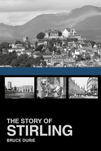
Written by well-known writer, broadcaster and genealogist Bruce Durie, this book tells the amazing story of Stirling's history from earliest times to the modern day. Some of the most pivotal moments in Scottish history occurred in the city's surroundings, including the Battle of Bannockburn – the greatest military victory in Scottish memory. But there is more to central Scotland's premier city than a battle, Robert Bruce and William Wallace. Illustrated with over 120 pictures – including 16 colour plates – and filled with curious, interesting and quirky facts throughout, The Story of Stirling will interest anyone who knows and loves this part of Scotland.
Sie lesen das E-Book in den Legimi-Apps auf:
Seitenzahl: 267
Veröffentlichungsjahr: 2014
Das E-Book (TTS) können Sie hören im Abo „Legimi Premium” in Legimi-Apps auf:
Ähnliche


Grey Stirling, bulwark of the north
Parent of monarchs, nurse of kingly race,
The lofty palace, from its height, looks down
On pendant walls, that guard the lower town;
While royal title gives it noble grace.
Friendly to all, whatever be their name,
Inmate or foe, or real friend or feigned.
Danger to profit yields. How oft (of shame!)
Has noble blood her territory stained!
Hapless in this alone, to none she yields
The bliss of genial air and fertile fields.
Anon, quoted in The History of Stirlingshire by William Nimmo
Nimmo’s The History of Stirlingshire was first published in 1777 by William Creech, Edinburgh, and Thomas Cadell, London. In 1817, the book was revised and updated by the Revd William Macgregor Stirling, minister of Port. This book is, in a small way, a homage to their efforts.
If Willie hasn’t been in touch since 1905, when this postcard was sent, he’s probably a lost cause. Let’s hope he enjoyed Stirling.
CONTENTS
Title
Introduction
one The First 600 Million Years
two Stirling Castle – From Citadel to Royal Palace
three The Coming of the Stewarts
four The Shaping of Stirling Burgh
five Guilds, Trades & Industry
six A Most Desirable Destination
seven The Twentieth Century
epilogue Stirling Homecoming 2014 and Bannockburn 700
Acknowledgements & Picture Credits
Plates
Copyright
A montage of Stirling showing the bridge, Holy Rude, the castle and Mercat Cross. (Courtesy of Owain Kirby)
INTRODUCTION
A loop of the Forth is worth an Earldom in the north.
A popular local rhyme
The story of Stirling is the story of its geography. Castle, royal palace and burgh – for centuries the three were synonymous. Now it is a heritage centre and a living, working city, but for the same reasons as when it was once the fortified hub of the Scottish nation. Stirling is what it is because Stirling is where it is.
The two great river inlets into Scotland’s interior – the Forth from the east and the Clyde from the west – are separated by a flat isthmus which for most of its history has been impassable marshland. Too wide to cross to the east, the Forth looped its way westward until it narrowed sufficiently to provide a convenient fording place where a bridge could be built. This was also as far as sailing vessels could travel up the Forth, making Stirling a natural port as well as a river crossing, and the obvious place to start when taking goods overland to or from the River Clyde in the west. But fate and nature also conspired to place this near a large volcanic outcrop. All roads therefore led through what would become Stirling Bridge and the commanding rock thrown up by volcanoes was a natural place to erect a fort as a safe haven for Iron Age warriors, Roman commanders and later Scots kings.
As the retreating glaciers ground their way across the land they carved out the romantic grandeur of the Trossachs, whose hills and lochs were the inspiration for Scott and Stevenson, a wealth of landscape artists and a burgeoning tourism industry. What was once an easily shut gateway between the Lowlands and Highlands, calmer times have seen evolve into a welcoming turnstile to the tourist centres of the north and a triumphant monument to Scotland’s heritage. Now travellers pass by on their way to tartan mills, whisky tours and a scone up the Trossachs. And, with luck, they will stop and spend a little money while enjoying the amenities.
These two views, from early postcards, show Stirling as seen from the Abbey Craig, site of the National Wallace Monument. The upper picture shows the characteristic crag and tail formation of a volcanic plug with debris deposited when glaciers slid over and around it. The top of the dolerite crag is the obvious site for a castle and the burgh naturally developed down the tail, later surrounding the hill on flatter land. (BD)
The nearby hills have provided wealth in the form of Ochil silver and copper for the small coins called ‘bawbees’, water for commerce and manufacture, shelter from the worst of the weather and a hiding place for rebels and outlaws. The Carse of Stirling provided clay for pottery, grain and fruits for sustenance and the country’s best hay for racehorses. The rich coal seams to the south and east fuelled the Industrial Revolution. And if the microclimate is, to say the least, idiosyncratic, it is tolerant of agriculture and industry alike.
The loops and windings of the River Forth are uncrossable until it narrows in Stirling itself. It is easy to imagine these fields, now drained and cultivated, as impassable marshlands. This was a barrier to travel north and south and accounts for Stirling’s early strategic importance and its later significance in trade and as a gateway to the Highlands. (SCLS)
Stirling is, of course, in Scotland. And it is a kind of cultural capital for Scotland. It makes much of its living from the reputation of three of the four most potent Scottish cultural icons – William Wallace, Robert Bruce and Mary, Queen of Scots – the other being Robert Burns, who has a statue in the town and engraved a poem on a pub window, so even he can be claimed. Add Kenneth MacAlpin, Bonnie Prince Charlie and Rob Roy and it seems like a microcosm of all Scottish history. And the history is due in large measure to the people who lived it.
Who on Earth are the Scots?
Scotland is a rather unique place. Geologically, it has more in common with Newfoundland and the Appalachians than with the rest of Britain. Culturally, it is a different planet – England has no national costume and Wales has no national drink, while Scotland has both in abundance. Politically it is a world away from Westminster. Scotland is a nation, but not yet a state. The Scots have governance but not full government, depending on the outcome of a Referendum in September 2014. There is a unified civil society but a diverse ethnic and linguistic admixture, stemming from its origins in settlements of Celts, Picts, Britons, Romans, Gaels, Vikings, Anglo-Saxons and Anglo-Normans.
Stirling is inland, yet it was a thriving port for imports and exports and later – as seen in this 1900s postcard – the pleasure-boating trade. (SCLS)
Despite its apparent cohesiveness, Scotland remains stubbornly heterogeneous – the urban Stirling city-dweller of today has little in common with the Gaelic-speaking West Highland Free Church minister or the Kelvinside-accented Glasgow merchant, who in turn have few points of contact with the Borders farmer or the Lallans-talking East Neuk fisherman. This is one of many reasons why Scotland has proved so difficult to subjugate, legislate for, rule over, control or pacify. Wha’s like us, eh?
When Stirling ceased to be a royal palace, the town had to find its own way as a burgh, and gradually spilled down the castle rock. As tourism and industry grew in importance, Stirling naturally became the administrative and commercial fulcrum for the Forth Valley and in the 1960s home to a university. In 2002, the historical and contemporary importance of Stirling was recognised in its new status as a city. It certainly has a better claim to this singular honour than Paisley, Ayr or Dumfries, and possibly more so than Inverness or Perth.
In 2014, it was the site of re-enactments of the Battle of Bannockburn 700 years before and a twenty-first-century argument about which party was trying hardest to politicise the events.
The great thing about Stirling, its crowning virtue, is precisely that it isn’t anywhere else. Because if it were, it just wouldn’t be Stirling.
THE FIRST 600 MILLION YEARS
The Physical Geography of Stirling
In 1603 Scotland took over England, when James VI became James I. By the Union of Parliament in 1707, it was practically a client state of the Westminster Parliament. Almost 400 years later in 1998, the beginnings of re-separation were evident in Scottish devolution. But Scotland and England have always been very distinct. Even the very rocks from which they are made came from different parts of the world, brought together by plate tectonics. Today Scotland and England are firmly joined in the earth’s temperate zone, but in the Cambrian period 550 million years ago, when multi-cellular life started to proliferate, they were both in the southern hemisphere.
To the south was what became England, Wales and southern Ireland, while 3,000 miles north was the American continent, and the rocks of Scotland. Newfoundland marks where one of the earth’s great continental plates split apart about 600 million years ago and then collided again some 200 million years later. Scotland bumped into Europe, and stuck. The join occurs, interestingly, not far from where Hadrian’s Wall was later built. Mud from the vanished ocean was squeezed and raised, becoming the hills of the Borders, while the collision threw up the Caledonian Mountains. Their eroded remains are now the Scottish Highlands which start not far north of Stirling.
The melting crust of 500 and 400 million years ago formed underground vats of molten rocks which cooled and became the characteristic granites. An ice cap developed at the South Pole and four-legged vertebrates evolved in the coal swamps near the equator, where Scotland was now positioned. Scotland carried on north past the equator until, in the Carboniferous era about 340 million years ago, corals lived in the tropical coastal seas and central Scotland was dominated by volcanoes, including the ones that formed the rocks of Edinburgh Castle and Stirling Castle. Volcanic lava produces fertile soil and the tropical forests eventually became Scotland’s coal and oil.
Where once there was ice, now sheep may safely graze. Glaciers scoured the land flat, producing a fertile flood plain. This 1901 postcard shows how the land now called the King’s Park was suitable initially for hunting and later for grazing. It is Scotland’s largest and most-used park, with a wide range of leisure facilities. (BD)
By 260 million years ago, Britain had moved north again. The high lava plateaus and the great Scottish desert saw very little life, and there was no Atlantic Ocean. Reptiles spread across the face of the Pangaea supercontinent but the greatest extinction event ever wiped out 99 per cent of all life. Those reptiles that would later dominate as the dinosaurs started to develop in the coal swamps to fill the niche. Further land movements opened the Atlantic Ocean as the American plate drifted away, leaving behind the rock that became Scotland but pulling away its geological cousin, Newfoundland. By the time the large dinosaurs died out (or rather, evolved) 65 million years ago, volcanoes began to cool, leaving great crags of lava outcrops. Scotland was near its present position and the stage was set for the great Ice Age.
The Scottish mountains were then as high as the much younger Himalayas are now. But huge sweeps of ice gouged and scraped the land, eroding the mountains to the mere 3,000-foot stumps we see today. The landscape was still in the grip of frost 12,000 years ago, until the glaciers – moving rivers of ice – receded northwards, leaving behind a completely barren country. There were no trees, not even grass, but rainfall washing soil off the denuded hillsides into the newly formed lochs and valleys. Although the earth’s average surface temperature has remained a more or less constant 20 ºC for most of the 3,600 million years life has existed, an ice age happens every 150 million years or so, with glacials and interglacials (cold and warm phases) lasting 100,000 years or so per cycle. The current interglacial began in perhaps 10,000 BCE (Before Common Era, that is before the year 0) and defined what we consider the Holocene (historical) epoch.
From the Stone Age to the Iron Age
Liberated of 300 feet of ice, the land lifted and as the melt water started to fill what would become the North Sea, the terrain of central Scotland was exposed. On their way to the ocean, the retreating glaciers had swept around and between the dolerite crags of Stirling Rock and Abbey Craig – site of the Wallace Monument – leaving flat marshes swept by the loops of the River Forth. The melting ice deposited its debris on the far side of the volcanic plug, leaving the distinctive crag and tail formations evident today.
Wind-blown seeds created vegetation and habitats where birds and other animals could live. Following the animals, human hunter-gatherer groups arrived, probably originating in Asia and passing through Europe before reaching Britain and Ireland. The climate was several degrees warmer than today so these peoples could live comfortably in caves or temporary structures while hunting the plentiful reindeer, mammoth and bison, which were eventually replaced by woodland species such as red deer and wild boar.
During the Neolithic period (4400–2000 BCE) there was very little difference between the Neolithic inhabitants and the incoming ‘Beaker People’. But where did they get bronze? Scotland had several sources of both copper and gold. Copper was found in the Ochil Hills near Stirling and elsewhere, but bronze requires tin and the only source of this in Britain is in Cornwall. This indicates contact between Scotland and the south-west of England (as well as Ireland, where finished artifacts have been found).
A warrior aristocracy, now known as Celtic, appeared in about 700 BCE, or at least it is assumed they came. Just because we have Japanese cars, televisions and children’s games does not mean the Japanese have invaded Britain. The Celts were not an ethnic group, but a culture and a language. Undoubtedly there was acculturation, with the techniques and practices of the Celts filtering into the lives of the Bronze Age inhabitants. One thing they certainly brought with them was the Iron Age and new weapons like swords and shields. As Winston Churchill put it, ‘Men armed with iron entered Britain and killed the men of bronze.’ This inevitably led to a need for easily defended settlements. The Celts, an enlightened, cultured people with a talent for metal-working and agriculture, introduced some typical structures – ‘crannogs’ (artificial islands usually found in lochs); ‘duns’ (oval or circular stone-walled forts); timber forts; and later hundreds of ‘brochs’ (large towers built of stone with internal walls divided into compartments). It is inconceivable that a natural citadel like Stirling rock would not be the site of a defended settlement.
At Julius Caesar’s first invasion of Britain in 55 BCE, Scotland was divided between a number of warring Iron Age tribes, who spent their time raiding each other, growing oats and barley, raising sheep, fishing for river salmon and hunting deer. It would be half a dozen generations or so before the Romans reached Scotland and made their presence felt near Stirling. However, news of the vast army of well-disciplined warriors must have reached the people they would later write into their history as the Picts.
The Romans are Coming!
In Scotland the Romans left very little behind compared with the network of roads, aqueducts, camps and villas that cover England. Their dominion over Britain never extended much further north than Stirling, and their presence even that far was sporadic and fragile. However, they effectively caused the disparate tribes to forge themselves into more or less a nation, centred near Stirling, possibly in Fortriu (Forteviot). Pictland, if it ever existed as such, was a response to Roman aggression and led directly to the creation of the Scottish realm.
There is considerable evidence of Roman presence in Stirlingshire – a string of forts (praesidia), from the west coast to Camelon and Castlecary, a paved road along the same route then north through Stirling and, best known of all, the Antonine Wall. But it is not clear to what extent the Romans occupied Stirling itself. There are records of an inscription on a stone opposite the old gate of the castle, found by the eighteenth-century doctor and antiquarian Sir Robert Sibbald, but now obliterated. It read ‘In Excv. Agit. Leg. II.’, which Sibbald suggests is ‘In excubias agitantes legionis secunda’ – ‘for the daily and nightly watch of the Second Legion’.
Gnaeus Julius Agricola, during whose time the Roman invasions of Scotland began, is seen here in a whimsical engraving of the eighteenth century. (BD)
How others see us – a fanciful depiction of a ‘fierce Caledonian’ from a sixteenth-century travel book, based on Roman descriptions. (BD)
There is every reason why the Romans would have occupied the crag of the castle rock. If it were already a hill fort of the local Celtic tribes, it would need to be taken before the legions could proceed northwards. If unoccupied, it is unlikely the Romans would not have seen its defensive potential. Possibly the best evidence that it was already a fortified citadel is that the Romans did not include it in their string of defences along the isthmus between the rivers they called Glota (Clyde) and Bodotria (Forth) or in the Antonine Wall. Perhaps they had had to establish themselves a little way to the south in order to mount a campaign against it. They may, however, have sited a fort nearby at Allauna (sometimes identified with Bridge of Allan but possibly further north).
The Romans produced the first written accounts of the peoples of Scotland. In 79 CE (Common Era, that is after the year 0) the eleventh Roman Governor of Britannia, Gnaeus Julius Agricola, was ordered by Emperor Titus to advance north. Tacitus, Agricola’s son-in-law, biographer and propagandist, recorded his various campaigns in the north in about 98 CE.
THE ANTONINE WALL
Hadrian had built his wall between the Solway and the Tyne in about 117–122 CE, effectively declaring it the northern extent of the Roman Empire. Hadrian’s successor, Antoninus Pius, determined to push the frontier north to the Forth–Clyde isthmus and commanded the construction of his own wall, the Antonine. This was built by Lollius Urbicus in about 142–144 CE and ran for some 40 miles from Velunia (Carriden) on the River Forth to Credigone (Old Kilpatrick) on the Clyde. The Sixth and Twentieth legions, with additional auxiliary troops, took two years to construct the 36 miles of ditch, rampart and roadway and the twenty or so forts. The engineers who later built the Forth–Clyde Canal and the Edinburgh–Glasgow Railway used the same line.
The wall would have consisted of a turf rampart to a height of about 20 feet on a 24-foot stone base behind a deep defensive ditch on its northern side, 20 feet deep and 40 feet wide, which could have been filled with water in the case of attack. A road atop ran for 39,726 Roman paces (36 miles, 620 yards), which had about 20 forts along its length – 3 at each end and 1 every 2 miles between – and some 40 praesidia and other defensive structures, some possibly sited on forts used by Agricola before his invasion of Scotland in 83 CE. Beacons positioned strategically along the wall were a warning system in the event of aggression. The forts were connected by a Roman military way, running along the southern side.
The Antonine Wall was intended to protect the province of Britannia from the Caledonian tribes. To traverse the wall they would have to cross the ditch, breach the defences and mount the wall itself. If they managed that, the Romans would cut them off by moving troops along the military way from the larger garrisons. The wall was also a customs post where trade had to pass through the gates of the forts and pay tolls. Settlements near the forts would undoubtedly have made a living from supplying the troops with local merchandise as well as cross-border trade. This was also a way to gather intelligence.
The Antonine Wall stretched across the Clyde–Forth isthmus from Old Kilpatrick on the Clyde to Carriden on the Forth.
This neat propaganda piece is taken from a distance stone, depicting a cavalryman from the Second Legion ‘Augusta’ dispatching the local barbarians. The Second Legion built this section of the wall, near Bridgeness and may have occupied Stirling Castle rock.
Soon after the Emperor Antoninus died, his successor, Marcus Aurelius, moved the frontier back south to the more easily defended Hadrian’s Wall. The Antonine Wall was built mainly for the prestige of expanding the Empire and the glory of Antoninus as Emperor. It bore little reality to the strategic or political needs of the Roman occupation of Britain. The symbol of Antoninus’s ‘conquest’ was neither necessary nor required. If anything, it was an embarrassing reminder of failure. It was occupied for just twenty-five years. One of the best preserved areas of the ditch is at Watling Lodge, near Stirling.
If the intention of the Antonine Wall was to ensure peace, it worked in a sense. For most of the next two centuries the border was peaceable and the Romans traded with the tribes north of Hadrian’s Wall. But it also had the effect of uniting the British Votadini and Selgovae of the Borders, the Dumnonii of Strathclyde, the Novantae of Galloway and possibly the Picts around Stirling into a confederation collectively known as the Maeatae (this name survives in Dumyat and Myot Hill, near Stirling). The Romans and the locals left each other alone from 164 to 197 CE, until the natives grew restless and started pressing the invaders at Hadrian’s Wall. It was roughly at this time when Dio Cassius makes reference to the Maeatae, living just beyond the Antonine Wall, and the Caledonians further north. During the three-year period from 208 to 211 CE the local tribes waged guerrilla war against the Emperor Septimus Severus, who came in person with his sons Caracalla and Geta to deal with the insurrection. He based himself at Carpow on the southern bank of the Tay (near what is now Abernethy, about 35 miles north-west of Stirling) and may have reached as far north as Stonehaven. He briefly reoccupied and repaired portions of the Antonine Wall, but again could not hold it. The Caledonii and Maeatae had to come to terms, but when Severus died in 211 his sons returned to Rome and the border again reverted to Hadrian’s Wall. The campaign ended and there was no further frontier conflict for a century.
In the second century CE the geographer Ptolemy drew up the first known map of Scotland, which identified seventeen tribal territories, on what basis we do not know. Other descriptions show that the Romans regarded the ‘barbarian’ Picts with their customary mixture of fear, contempt and glimpses of awe. Dio Cassius wrote in 197 CE that: ‘They live in huts, go unclothed and unshod. They have a mainly democratic government, and are addicted to robbery. They can withstand hunger and cold and all hardships; they will retreat into their marshes and stand firm for days with only their heads above water, and in the forests they will live on barks and roots.’ That may be.
The fact remains that the Romans made little headway into Scotland and never subdued it as they had the rest of Britain.
Agricola’s legions may well have based themselves at Camelon, about 10 miles south of Stirling and near present-day Falkirk. From there his boats could bring supplies from the Forth by the River Carron. The Pictish Caledonian tribes around Stirling and further north, faced with imminent invasion by the most efficient military machine in the world, decided not to take it lying down as their cousins in the south of Britain largely had. According to Tacitus, the Caledonians ‘turned to armed resistance on a large scale’ – they attacked Roman forts, mounted skirmishing raids against the legions and, in one nocturnal surprise attack, very nearly wiped out the whole ninth legion. In any event, Agricola was retired and Lucullus named governor in his stead. All forts in the Forth and Clyde Valley were abandoned and the perimeter of the Empire was just north of the Cheviot hills. Later, this was consolidated into the Antonine Wall (see p. 16).
The Emergence of the Picts
Ptolemy identified as many as twelve different tribes inhabiting northern Britain at the time of the Roman invasions. It has been suggested that the presence of the Romans, in a sense, created the Picts, forcing the various northern tribes to unite into one confederation in self-defence, as happened with the Maeatae.
The names of the Pictish kingdoms come from various places and are roughly in accord with the foundation myth of seven Pictish kings descended from the ‘first’ Pict, known in Gaelic sources as Cruithne (also the Gaelic name for the Picts in general). One of these is no less an authority than St Columba, whose stanza appears in the eleventh-century Irish Lebor Bretnach (Book of Britain) and Lebor Gabála Érenn (Book of the Taking of Ireland):
The 1,373-foot Dumyat Hill, in the Ochils near Stirling, may be named from the Celtic/Pictish Maeatae. It serves as a warning beacon, a trig point for surveys, a cairn and a memorial, emphasising the continuity of use from pre-history until now. (NP)
Morsheiser do Cruithne clainn
raindset Albain i secht raind:
Cait, Ce, Cirig, cetach clann,
Fib, Fidach, Fotla, Fortrenn.
This might be translated as:
Seven of Cruithne’s children
divided Alba into seven parts:
Cait, Ce, Cirig (Circinn, children with hundreds of possessions),
Fib, Fidach, Fotla and Fortriu.
Some of these names survive – for example Caithness (Cait), Atholl (Fotla), Glenfiddich (Fidach) and Fife (Fib). Fortriu – the Pictish kingdom that would have included Stirling – might be cognate with Verturiones (the Roman name for an earlier tribe) and with the name of the River Forth.
The Roman Legions Depart and Scotland Invents England
Faced with an alliance of Picts, Scots and Saxons, the Romans basically gave up trying to control the land north of Hadrian’s Wall. In 411 CE the legions left to deal with the barbarian crisis at home. The Romanised Britons (who by now considered themselves more Roman than British) appealed constantly for help to no avail and eventually had to hire other ‘barbarians’ – in this case, the Angles and Saxons – to assist them. These Germanic tribes later settled and eventually dominated the land south of Hadrian’s Wall. It is surely one of history’s greatest ironies that the Roman civilisation all but disappeared and that the solution to Scottish tribal raids actually brought into Britain the very people who would create ‘England’.
The power vacuum left by the Romans boiled for almost three centuries, culminating in the crushing victory of King Brudei and his Picts over King Ecgfrith of Northumbria in the mid-600s. The Northumbrian army was routed, most of them killed or enslaved, ‘English’ influence retreated south of the Forth and a unified state was starting to emerge in northern Britain. This would be consolidated over the next two centuries, culminating in the kingdom of Scotland under Kenneth MacAlpin, in which Stirling played so great a part.
Recently, Dark Age Stirling thrust itself into history when it was discovered that there had been a timber-laced fortress on Abbey Craig dating from 500 to 780 CE. Found while workmen were laying cables for floodlights at the Wallace Monument, the citadel has all the signs of a heavily fortified tribal capital. Stirling was clearly an important centre at just about the time Scotland as a political entity was coming into existence.
STIRLING CASTLE – FROM CITADEL TO ROYAL PALACE
A huge brooch, clasping Highlands and Lowlands together.
Alexander Smith, 1856
Stirling is the greatest of Scotland’s castles. Superficially alike in shape and layout to its larger but less appealing cousin in Edinburgh, it occupies a similar position – atop a large volcanic crag – and for similar reasons. The castle dominates the skyline of the area and affords an uninterrupted view for miles around in every direction. It commands the lowest crossing point of the River Forth and the highest navigable point. The Romans knew this when they fortified Camelon so that their fleet could bring provisions up the River Carron to within a short distance. Its site is also near the shortest land distance between the Forth and Clyde, but to the west and north the marshes were practically impassable. Stirling Castle is therefore at the crossroads of both the strategic way north–south and the trade routes on land and water. For this reason, Stirling played a crucial part in the early forging of Scotland as a nation. Not for nothing has it been called ‘the key to Scotland’.
Scotland and Alba
Some time before 850, the Picts of central and east Scotland and the Gaelic Scots of Dalriada (roughly present-day Argyll) came together as one nation. Scottish history is often depicted as starting with the death of Alpin and the ascendancy of his son Kenneth MacAlpin who ruled Dalriada from 834 and Pictavia from about 841 to 849, but this is more a convenience rather than an historical milestone. Almost nothing is known of Alpin, save his birth possibly in 810 and his crushing defeat of the Picts in 834. Kenneth, although never actually crowned king, is generally given credit for uniting the Scots and the Picts in 844 and history has dubbed him Kenneth I. In fact, there had been many intermarriages and alliances between the various Scot and Pictish tribes or kingdoms for centuries before and Kenneth also had a claim to the Pictish throne through matrilineal succession (his mother was a Pictish princess).
The origin of the name Stirling may be Stryveling, meaning ‘strife’, from the many contests of which it was the subject and the scene. Another theory is that is refers to the ‘strife’ at the confluence of three rivers – the Forth, the Teith and Allan Water. Alternatively, the source may be from the Gaelic Strulia, meaning a river crossing. (BD)
Legend tells that Kenneth besieged a stronghold at Stirling some time after 842, which suggests a fort already existed on the castle site, or perhaps at the Abbey Craig site mentioned on p. 13. One battle is said to be connected with a ‘Gathering Stone’ on land that once belonged to Airthrey Castle but is now owned by the University of Stirling. The Gathering Stone itself is wreathed in confusion. It is said to have been used either as a mustering point for the Picts in a battle with Alpin in 834, or his son Kenneth MacAlpin in 843, or raised as a monument to either of their victories. More likely, it is an older standing stone. There is no proven connection with the battle and no real evidence that a battle actually took place at Airthrey at all. However, this has not prevented the stone becoming the site and subject of a later struggle. In 2002 the university decided on the need for two new rugby pitches and, after consultations with Historic Scotland and Stirling Council planners, was given permission to lay these near the stone. The university has pledged to preserve and protect the stone, with a 15-metre ‘exclusion zone’ and a path to improve public access, but there was a vigorous protest at the time.
The Gathering Stone. It was possibly a mustering point for the Picts during the ninth century. (University of Stirling)


