Erhalten Sie Zugang zu diesem und mehr als 300000 Büchern ab EUR 5,99 monatlich.
- Herausgeber: Origin
- Kategorie: Sachliteratur, Reportagen, Biografien
- Sprache: Englisch
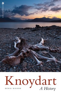
Knoydart – the northern edge of the 'Rough Bounds' is one of the most evocative names in Scotland. This text offers a history of Knoydart from the earliest times to the present day. A remote and desolate peninsula, its name derives from Viking settlers who only reckoned it worth three ouncelands – compared to five for the island of Eigg. Its warlike but impoverished inhabitants caused endless problems for their neighbours during the 17th century before becoming notorious in the 18th century under the leadership of Coll of Barrisdale. His protection racket has bequeathed the word 'blackmail' to the English language and he was notorious across Scotland. For the Jacobites, as well, Knoydart was a fertile recruiting ground. In the 18th and 19th centuries the area suffered large scale emigration, partly as a result of the brutal clearances of 1853. A further long century of decline followed, during which sheep and then deer were preferred to people. In 1948 discontent swelled again and it became the scene of the famous land-raid by the 'Seven men from Knoydart'. It has changed hands more often in the last 150 years than in the previous 700 years. The land continues to lie at the heart of the Knoydart problem and the book attempts to place events in their larger historical context.
Sie lesen das E-Book in den Legimi-Apps auf:
Seitenzahl: 312
Veröffentlichungsjahr: 2011
Das E-Book (TTS) können Sie hören im Abo „Legimi Premium” in Legimi-Apps auf:
Ähnliche


Knoydart
Knoydart
Denis Rixson
This edition published in 2011 byBirlinn LtdWest Newington House10 Newington RoadEdinburgh EH9 1BQS
First published in 1999 by Birlinn Ltd, Edinburgh
www.birlinn.co.uk
© Denis Rixson 1999 and 2011
All rights reserved. No part of this publication may be reproduced, stored, or transmitted in any form, or by any means, electronic, mechanical or photocopying, recording or otherwise, without the express written permission of the publisher.
ISBN 978 1 84158 957 2
British Library Cataloguing-in-Publication DataA Catalogue record of this book is available from the British Library
Facsimile origination by Brinnoven, LivingstonPrinted and bound in the UK by CPI
CONTENTS
Foreword
Introduction
Acknowledgements
1. Geography and Topography
2. Prehistoric and Early Christian
3. Knut’s Fjord – Knoydart and the Norse
4. Knoydart in the Early Middle Ages
5. Knoydart in the Later Middle Ages
6. The Jacobites in Knoydart
7. A Forfeited Estate
8. The Population Problem and Emigration
9. The 1853 Clearance
10. From 1853 to 1891
11. Knoydart in the Twentieth Century
Epilogue
Postscript
Reading List
FIGURES
1. Knoydart’s Settlements
2. The Macsorleys
3. The Macdonalds of Knoydart
4. Population Statistics
5. Eviction and Emigration from Knoydart
6. Categories of Employment – 1841
7. Categories of Employment – 1891
MAPS
1. The Rough Bounds
2. Prehistoric Fortifications (Glenelg, Sleat, Knoydart, Morar and Arisaig)
3. Picts and Scots
4. The MacSorley Estate
5. Pennyland Map of Knoydart
6. Fragmentation of the Macruari Estate
7. Population Distribution 1851
8. Population Distribution 1861
9. Population Distribution 1891
LIST OF PLATES
1. Knoydart from space
2. Knoydart in Blaeu
3a. and 3b. Early Christian cross-slab, Kilchoan
4. Mediaeval cross, Kilchoan
5a. Daniel?
5b. Sword on mediaeval cross, Kilchoan
6. Knoydart in Roy’s Protracted Copy
7. Inverie farm-plan, 1771, by William Morison
8. Daniell: The Bay of Barrisdale in Loch Hourne
FOREWORD
This book was first published in 1999, the year of the Knoydart community buyout. At the time I was criticised by some locals, and a reviewer, for some of my comments in the last pages of the book – particularly those concerning subsidy. It is only right to address such issues and I have attempted this in a postscript to the Epilogue. My comments are informed by the fact that I live in the small fishing village of Mallaig, just across the waters of Loch Nevis, and over the last decade I have followed the progress of the community with great interest. During these years I have had many conversations with Knoydart residents. It would be invidious to name them individually but they know who they are and I am extremely grateful to them for sharing some of their thoughts with me. Nevertheless, I must acknowledge a particular debt to Roger Trussell for the time and trouble he has taken in answering my queries so thoroughly. However none of the people of Knoydart are responsible for the views expressed in these pages – with which they may well disagree.
One thing, though, is obvious. Whatever the doubts and scepticism of outsiders like myself – Knoydart has been a success. The problems and fears which may emerge are often those associated with success; in particular, how to prevent success from spoiling things. It is in this spirit that I have written these extra paragraphs. Knoydart is a success story to set against the long-term decline of many Highland communities. Long may it continue.
INTRODUCTION
Knoydart is a remote and barren peninsula with little recorded history. It lies on the northern edge of what was known in Gaelic as ‘na Garbh-Chriochan’ - the Rough Bounds – an aptly descriptive term for the area from Moidart to Knoydart (SeeMap 1). Its very name has become something of a byword for ‘the Highland problem’ – aided by the beauty of its landscape, its desolation and our sentiment. This book attempts to assess what we know or can surmise about its past – and how this informs our present views. It is not a catalogue of every recorded fact about Knoydart. There are long periods for which we know next to nothing and here I have tried to set the history of the area in its wider Highland context. At other times our sources of information are more abundant – as for instance in the eighteenth century. In such cases I have not tried to duplicate the work done by other researchers but have given an overview and a guide to the available material.
My approach is thematic. I have used the various types of evidence – place-names, land-assessment units, sculpture, documentary records and census returns – to unlock the past. Current views about Knoydart depend upon our responses to codewords such as ‘Jacobite’, ‘Clearance’, ‘emigration’ or ‘landlord’. They are informed by generations of history-makers who have dwelt on the romance of Bonnie Prince Charlie, the cruelty of the Clearances, the sadness of emigration, the iniquities of landlordism. I am not going to try and pretend any of these away. There is truth in each of these perspectives but equally there are other truths in Highland history which are overshadowed or obscured by our sentimental, and therefore rather distorted, view of the past. We like our history to be leavened by an emotional investment, even if this leaves it unbalanced or incomplete. Our historical understanding helps to shape current political perspectives; in turn our writing of history reflects modern concerns with freedom and equality. For a truer appreciation of Knoydart’s history, it is essential to look beyond these partial and contemporary views and try to place the area in its geographical and historical context. Once we do so other truths become available to us.
To modern eyes, tutored by urban landscapes, Knoydart appears beautiful. It is remote, desolate, appealing – and a knowledge of its history lends it an aura of tragedy. If we could go back a thousand years and see it through the eyes of a Norse settler then its beauty becomes less important than its agricultural potential. It was never remote to such a seafarer and its previous history was irrelevant. To a practical colonist, sentiment was self-indulgence. The critical questions were: Is there cultivable land, fresh water, access to the sea, shelter and fuel? By exploring these other approaches we can place our emotional investment in Highland history in a longer, wider context. It is not my intention to reduce the moral intensity with which we approach the politics of landlordism today; but it is my purpose to challenge the relevance of some of our current views when looking at the past. Once we have mourned the loss of a culture, the removal of a people; once we have seen past the individual tragedies, the collective grief; once we have condemned the landlords and cursed the factors; once we have looked beyond the issue of ownership; we still face the problem of self-sufficiency or subsidy.
Since the eighteenth century, the surge in population and expectations have upset an equilibrium that was maintained in Knoydart for thousands of years previously. This balance was not always stable; in years of scarcity, privation had always to be subsidised by theft. The last 250 years have overturned the old relationships between population and resources, in Knoydart as in so many other places in the Highlands. Predation is no longer an option and solutions have usually been imposed from outside. We are left with a sense of tragedy, in terms of individual suffering, in terms of the decline of a whole culture. While the visible effects draw our sympathy, it is important to look beyond these to the underlying causes. What was it about Knoydart society and the nature of the Highland landscape that made it such a victim of change compared to other parts of Scotland? Why did the Highlands not evolve new economic forms as other regions of Britain?
ACKNOWLEDGEMENTS
I should like to thank the staff of Highland Council Library Service for their ready assistance. I am grateful to John Bruce, Norman Newton, Gail Priddice, and in particular to Lorna Skelly of the Library Support Unit for all her patient help in tracing books and references for me. I am also grateful to Nicola Beech of the British Library for her help with the Roy maps and to Dr Jeffrey Stone for his generous advice about Timothy Pont. In addition, my thanks are due to Norman Macdonald (Edinburgh), Alasdair Roberts (Bracara), and Marianne McLean and Ralph Coram (Canada), for help with particular items of information.
I gratefully acknowledge the permission of the Keeper of the Records of Scotland to reproduce the plan of Inveruie Farm (E741/47 f10v).
I am grateful to the Scottish Gaelic Texts Society for permission to quote the English translation of the Dean of Knoydart’s poem from W. J. Watson’s Scottish Verse from the Book of the Dean of Lismore, published by Scottish Academic Press, Edinburgh (1978).
Chapter 1
GEOGRAPHY AND TOPOGRAPHY
Physically, Knoydart appears like an extended knuckle stretching westwards from Loch Quoich. It is bounded on the north by Loch Hourn, on the south by Loch Nevis and to the west by the Sound of Sleat. To the east lie high mountains and the freshwater Loch Quoich. Seton Gordon reports that three cairns beside the track at Mam na Cloich Airde (NM 8994) mark the boundaries of the lands of Lovat (N Morar to the WSW), Lochiel (Loch Arkaig to the ESE) and Glengarry (NE and NW). Since Glengarry held both Knoydart and Glengarry, he was presumably not concerned with the boundary between his two territories.
Most of Knoydart is incapable of agriculture. Very little land lies below 200 feet and most of this is confined to the coastal strip and the major glens (SeePlate 1). Relief has always dictated the district’s settlement pattern which concentrated on pockets of land along the coast and in the river valleys of Barrisdale, Guseran, Inverie and Carnach.
Geography has also determined Knoydart’s orientation and communications. Access to the east is by steep, rocky passes from Kinloch Hourn, Barrisdale or Carnoch to Loch Quoich, or from Sourlies to Loch Arkaig. These are so harsh and inaccessible as to effectively prohibit commercial traffic through the ages. Men and animals can walk these routes, but little can be carried. Even today only the first of these passes has a road. Knoydart’s communications, and therefore orientation, have always been seawards; west to Skye, north across Loch Hourn to Glenelg, or south to Morar. Boats can carry heavy loads and the distances involved are not great, usually only a mile or two to Glenelg or North Morar, about three to Skye.
Climate, Soils and Geology
Knoydart’s climate is also unfavourable to agriculture. Along with other parts of the west coast it is affected by the warm-water currents of the Atlantic Gulf Stream. It enjoys relatively mild winters, especially on the coast, with a great deal of wet and windy weather. This favours pastoral, rather than arable, farming although in past times the climate was not always as it is now. The Vikings, in particular, enjoyed a climatic optimum between about 800 and 1200 AD.
Knoydart’s natural resources are limited. It has only a tiny amount of cultivable land, with plenty of rough grazing of varied quality. It has some woodland but, as we shall see later, this was not always of economic value. Its rivers support some salmon and it has peat. It is surrounded on three sides by the sea and this has always been its richest resource. The underlying rocks, as for the rest of the Rough Bounds, are an intractable mix of Moinian schists. The soils are thin, patchy, and heavily leached by the incessant rain. The only mineral of any value is mica, which was exploited briefly during the Second World War.
Until the eighteenth century, Knoydart was inhabited on the basis of agricultural potential alone. There were attempts by the Forfeited Estates Commissioners to establish a fishing industry but these ended in failure. It is only in the recent past that sporting interests, or the desire to have a good view, have become determinants in settlement. Any historical summary must reflect this agricultural orientation. People settled here, not for the mineral resources or the presence of local industry, not because of strategic ports and harbours or established trade patterns, but because they could grow crops and graze animals.
Early Topography and Cartography
Our earliest visual impression of Knoydart comes from Holland. In 1654, Blaeu published Volume 5 of his Atlas Novus and made Scotland one of the best-mapped countries in the world. In this volume, on a map showing ‘Braid-Allaban’, Knoydart appears; not quite as we visualise it today, but with the deep embayment at Inverie instantly recognisable. Kilchoan is marked as a settlement and the glens named at Meadail, Guseran and Barrisdale (SeePlate 2). Although this map is attributed to Robert Gordon of Straloch, there is good evidence that the groundwork for the western coastline was done by Timothy Pont, the father of Scottish cartography, at the end of the sixteenth century. Pont, minister of Dunnet in Caithness from about 1600, was responsible for the majority of Blaeu’s maps of Scotland. He travelled the length and breadth of the country, making sketches and writing descriptions of the areas he surveyed. His motives are not known, although Jeffrey Stone has suggested that it may have been in connection with the newly reformed church in Scotland.
The Rough Bounds
Certainly some of the great statistical and analytical surveys in Scottish history are connected with the Protestant Kirk. Webster’s population survey in 1755, the Old and New Statistical Accounts, the collection of ‘Moral Statistics’ by the Inverness Society for the Education of the Poor in the Highlands in 1822, are all good examples of this appetite for data. Whether it was because the new church needed and wanted the information, or whether it was because ministers were among the few with the education, and the leisure, with which to conduct such investigations, is a matter of almost theological nicety. At any rate, clergymen were always at the forefront of surveys in the Western Isles, from Dean Munro in 1549 to John Walker in 1765 and John Buchanan in the 1780s.
After his death, some of Pont’s papers passed to Robert Gordon of Straloch, who had known Pont personally, and thence to Robert’s son, James Gordon of Rothiemay. Others among them went to Holland where they became background material for Blaeu’s Atlas. There is a collection of his surviving manuscript maps in the National Library of Scotland. Pont not only drew maps, he also made notes of what he saw, as an aide-memoire and to help him in the later process of composition. Not all his original jottings have survived, but in the Sibbald Collections are copies of some of his notes as made by James Gordon. In 1907, Sir Arthur Mitchell edited further copies of these amongst the Macfarlane Papers and pointed out James Gordon’s contribution. ‘There is no doubt that James Gordon was largely copying when he wrote, but he commented, deleted, and amplified as he copied’. Nevertheless, Mitchell attributed the great bulk of these notes to Timothy Pont, giving them ‘exceptional value’. This is an important issue. If the notes which appear in Macfarlane are really Pont’s then this makes them the earliest description of Knoydart by at least 100 years. They were probably made between 1583 and 1610 and give us a glimpse of the area as it emerged from the Middle Ages.
Pont’s notes survive in two forms, a long and a short version, both of which are printed in Macfarlane. The short version is James Gordon’s copy, but bears such a striking resemblance to the long version that it is obvious that they each derive from the same original. It is likely that both Macfarlane versions are later copies of Pont, James Gordon’s being contracted and perhaps more polished. (Phrases like ‘abundance of milk’ become ‘abundance of pasture’.) Knoydart is described four times. Two of these are essentially contractions of the other two and so in each case I give the longer, anonymous, version. James Gordon adds virtually no detail and, in the one place he does, his editing is probably an error. (He creates an extra sea-loch in Loch Hourn called Loch-Voirne.)
Knodeard is a very rough countrey full of mountaines, Glens and sundrie litle rivers wherin is abundance of salmond fish slaine — And in the sea of Knodeord there is abundance of all kind of fish slaine, and bigg mountains on everie syde of this countrie and some of the lands theroff doeth lye southward, some other pairts West and some North forgainst Glenelge, The lands which are in Loghneves forgainst Morrour is rough being the southsyde of the Countrey. The midst of the countrey lyeth westward foregainst Sleit, and this is the most plain and pleasant place of the countrey The Northsyde forgainst Glenelg is verie rough and abundance of salmond fish and herrings and other kynd of fish is slaine in that Logh called Loghuirne, in some little rivers at the syd of the Logh in a glen called Glenbaristill and another river at the head of the Logh And there are great store of deare and rae in Knoidord.
(Mitchell, A. (ed.), Macfarlane’s Geographical Collections, Vol II, 1907)
(In 1793 Reverend Colin Maciver, Minister of Glenelg, wrote for the Old Statistical Account ‘The deer and roe still frequent the hills and woods on Lochurn-side’.)
The other description contains some interesting differences:
this countrey of Knoidort is very fertill of corne, and abundance of milk and all kynd of fishes in this Countrey. There is sundrie litle rivers and speciallie fyve litle rivers. two of them at the head of Loghneves [Carnach & Finiskaig] And there is a bigg mountaine betwixt these two rivers [Sgurr na Ciche] and the river which doeth lye on the Northwestsyde of this high bigg mountaine [Carnach] and it doeth run through a glen and there is abundance of fish in this glen. There are other two Rivers. One of them running through a glen called Meddill. and there is ane fresh water Logh wherthrou another litle river doeth run and there is abundance of fish in this fresh water Logh [Loch an Dubh-Lochain?] and the two waters doe meet togidder and they runn by th parish church of the said Countrie callit Kilghoan and this is the principall dwelling toune of the Superior of that Countrie. And there is abundance of salmond fish slaine in this water of Killhoan, And on the Northsyde of this Countrey there is a verie profitable glen for guids and cattell to feed, And there is a river runneing throwgh this glen And there is abundance of salmond fish slaine therin and this river is called Gaisiron, and the glen is called after that name Glen-gaisiran. There is one Logh of saltwater on the Northsyde of Knoidart, and it goeth farr up above eastward. There is abundance of herrings, salmond and sundrie other fishes slaine in this Logh it is called Loghvoirne. There is one glen at the southestsyde and there is ane litle river or glen therintill. [Barrisdale?]
(Mitchell, A. (ed.), Macfarlane’s Geographical Collections, Vol II, 1907)
It appears from the above that Pont visited Knoydart twice. The way the notes are laid out suggests that on one of these visits he travelled north by sea since his descriptions move in a geographically coherent manner from Ardnamurchan to Moidart, Arisaig, Morar and Knoydart. If he landed, he probably only walked as far as Loch an Dubh-Lochain. The fact that he does not give a detailed list of settlements as he does for, say, Trotternish in Skye, suggests he did not spend much time ashore. His description gives the impression of being written by somebody who saw the area by boat; which was, and is, the easiest way to travel.
Proof that the notes really were written by Pont comes in his reference to the ‘Superior’ of the country living at Inverie. In the immediately preceding section he specifically points out that North Morar belonged to Glengarry – who lived by Loch Oich in the Great Glen. Knoydart did not become Glengarry’s until 1611. This is about the time of Pont’s death and the fact that he differentiates between the Laird of Glengarry and the Laird of Knoydart establishes that, at the time of writing, these two people were different. This is long before James Gordon made his copy, probably between 1661 and 1686. Gordon made some literary changes, but he evidently did not know enough about the area to edit this much more important fact about ownership.
Assuming then that these notes were written by Pont, can we relate them to the map that appears in Blaeu? In particular, what grounds do we have for ascribing the Knoydart section of Blaeu’s map to Pont rather than Gordon of Straloch as indicated on the map itself?
Pont was the source for most of Blaeu’s maps of Scotland. This is particularly true of the west coast where Pont is credited with the maps of Kintyre, Knapdale, Lorn, Islay, Jura, Mull, the Small Isles, Skye and Uist. We even have his manuscript maps of South Uist, Loch Linnhe, and parts of the north-west and western coastline as far south as Loch Duich. Blaeu’s map of ‘Braid-Allaban’ etc., though credited to Robert Gordon, is essentially a composite. Blaeu had written in 1642 that his coverage of Scotland was incomplete and specified the areas he was lacking – which included Argyll and Lochaber. Robert Gordon’s map was a response to this and since he was already an old man it is likely that he was dependent on Pont’s notes and sketches, which he had to hand, for coverage of the west coast. Gordon had probably never seen Knoydart, Pont certainly had.
A characteristic feature of Knoydart, and Blaeu’s map, is the deep embayment at Inverie. To anyone approaching by sea this is their first impression, along with the shape of Sgurr na Ciche, which Pont also mentions. Pont must have anchored in Inverie Bay and left some sort of sketch for Gordon whose outline of the coast is otherwise pretty inaccurate. It is also telling that the names that appear in Blaeu match perfectly with Pont’s descriptions of the Rough Bounds contained in the Macfarlane Collections. If we include the lands of Moidart, Arisaig, Morar and Knoydart, then exactly the same names occur in the literary and cartographic descriptions, the only exceptions being Lochs Hourn and Nevis which Blaeu omitted. Curiously, these are the very features where Gordon was weakest geographically and makes it feasible that Blaeu also had access to a sketch by Pont which made him doubt Gordon’s accuracy in respect of these lochs.
We can understand the nature of Pont’s work better if we put it into a contemporary context. The reigns of Elizabeth I in England and James VI & I in Scotland and England saw an explosion of interest in both the wider world and the remoter corners of their own kingdoms. This is the period of the Elizabethan onslaught on Gaelic Ireland, the plantations in Ulster, the colony of Fife Adventurers in Lewis. Ambitious and powerful men dreamt of and pursued fabulous wealth. Alongside the opportunists and adventurers there were also those who had an intellectual interest in the area concerned; those who wished to describe it, map it or assess its economic potential. Such a man was Timothy Pont. We can only admire his stamina and courage. This was a period of bloody clan battles, such as Loch Gruinart between the Macdonalds and Macleans in Islay. This was a time when the Laird of Balcomie, one of the Fife Adventurers, was kidnapped by Murdoch Macleod. This was when Highland fleets travelled to Ireland as mercenaries and engaged with the English off the Copeland Islands. Travelling in the Hebrides was not for the fainthearted and Pont must have enjoyed good relations with at least some of the Highland chiefs. How has his description of Knoydart stood the test of time?
To answer this question we may compare Pont’s visual and literary description of Knoydart with its latest image – a satellite photograph (SeePlate 1). The striking features in the satellite image are the high mountains which show up very white, particularly on their sunlit southern flanks. The freshwater lochs of Bhraomisaig and Dubh-Lochain are well-defined, as are the rivers at Inverie and Inverguseran. The deep embayment at Inverie is obvious and it is apparent that the terrain in the westernmost section of Knoydart, west of a line between Inverguseran and Scottos, is significantly lower-lying. Now let us assess these findings against the earliest descriptions we have of Knoydart – Blaeu’s map and Macfarlane’s notes – both of which derive from Pont.
The area of the Rough Bounds as portrayed in Blaeu’s map of ‘Braid-Allaban’ is geographically weak. We have the district names of Moidart, Arisaig, Morar and Knoydart, but little other detail. Eilean Tioram is the only site marked in Moidart, Kilmory likewise in Arisaig; no settlements at all are marked in Morar. The alignments north-south are better than those east-west and the whole coastline is only a coarse approximation to reality. Knoydart, however, does surprisingly well. Three of the glens are named. Two of these lead down to the sea and the third, Glen Meadail, is clearly visible from Inverie Bay. The sea-lochs which separate Knoydart from North Morar and Glenelg are also well-defined. The deep embayment at Inverie must have been sketched by Pont for Gordon to include it.
If we turn to Pont’s written description, we find he had noted that the ‘most plain’ (i.e. flattest) part of the country lay facing Sleat, precisely the area that was most densely populated at the time of the Clearance in 1853. Inverie, by Kilchoan, is still the ‘principall dwelling toune’; the shores of Loch Hourn and Loch Nevis are yet ‘verie rough’. The views of Glen Meadail and Sgurr na Ciche from Loch Nevis are as striking now as they were then. Salmon and deer remain economically important, although for sporting interests rather than as a source of food. Geography does not change greatly and Pont’s analysis of the essentials is as telling now as it was when he made it, 400 years ago.
Chapter 2
PREHISTORIC AND EARLY CHRISTIAN
We have very little evidence for prehistoric settlement in Knoydart; this can mean one of two things. Either the evidence does not exist because Knoydart was not populated; or it has not been recognised. The former is inherently unlikely. We have evidence for prehistoric settlement in Skye, Glenelg and Arisaig. Throughout the West Highlands and Hebrides we find cairns and chambered cairns, standing-stones and cup-and-ring marks, kists, crannogs, duns, forts and brochs. These monuments are associated with different phases of the Stone, Bronze and Iron Ages over a period of perhaps 2500 years. It is only to be expected that there will be considerable variation in the distribution patterns of all these classes of monument. Large cairns, for instance, could only be constructed by relatively numerous and settled agricultural populations. The lack of cultivable land in the Rough Bounds meant that this area was always less likely to support such monuments. Kists, standing-stones and cup-and-ring marks are also scarce, but there are several forts and duns. These prove that the Rough Bounds were settled by the Iron Age.
Glenelg has a cluster of fortified sites as well as two exceptionally well-preserved brochs at Dun Telve and Dun Troddan. (A third is said by Leyden to have been demolished and the stones used to build the barracks at Bernera.) Southern Skye is littered with duns, including at least nine between Isle Ornsay and Sleat Point on the coastline facing Knoydart. North and South Morar share Knoydart’s archaeological poverty but Arisaig and the neighbouring islands have four forts, a cup-marked stone, a crannog and possibly two cairns. It is unlikely that there are any undiscovered forts, duns or brochs in Knoydart. These structures are usually situated at strategic points and imposing enough to be recognisable. Cairns, though, can be robbed; standing stones toppled, moved or broken up; crannogs submerged; burial kists lost. At first sight Knoydart looks to have almost no prehistoric monuments. They may once have existed in proportion to the area’s agricultural value, but have since been hidden from view. The area has been subject to little archaeological investigation. Few roads have been built in Knoydart, and few houses constructed, even today. Peat, moss and bracken swiftly conceal ancient monuments from the casual eye.
If we compare Knoydart with neighbouring areas of land we can put its archaeological legacy into context (SeeMap 2). With regard to large-scale defensive structures such as brochs, forts, duns and crannogs, which represent a community effort, Knoydart has little to offer. By contrast, Glenelg has at least twelve and Arisaig at least five. Only North and South Morar are poorer. This suggests that, to prehistoric communities, Knoydart had little agricultural value and was unattractive for settlement. We should bear this in mind in the context of later land-valuations. If we take the longer historical view we find that Knoydart was regarded as impoverished by prehistoric, Dark Age, Norse and mediaeval rulers. In later times, our evidence takes the form of low land-values, in prehistoric times we have an absence of communal structures.
North Morar is in a similar situation, seemingly without a single structure earlier than the eighteenth century. However, a number of small circular platforms have recently come to light near Sean-achaidh (Old-field). These are not thought to belong to charcoal-burners. Similar sites elsewhere in Scotland have been dated variously between the Bronze Age and mediaeval times. At the time of discovery the Morar platforms were the furthest north and west of a type with more than 3000 examples. It is most unlikely that North Morar represents a northern boundary for such structures. It may well be that Knoydart has a number of hitherto unrecognised monuments, simply reflecting the fact that its landscape has escaped the attention of surveyors and the excavations of builders or archaeologists. The mouths of the river valleys at Inverie, Inverguseran and Barrisdale are the most likely locations. Since these were also centres of population in later times, any earlier traces may well have been lost by over-building or stone-robbing. The name Sean-achaidh is recorded in Knoydart in 1637 and may, as in Morar, reflect a much older settlement. To earn the name ‘Old-field’ in 1637 suggests that we are dealing with a site that is at least mediaeval. At the same time, we must recognise that Knoydart’s agricultural poverty argues against either quantity or scale for prehistoric monuments.
Prehistoric fortifications around Knoydart
Dun Ban
We have one definite prehistoric site in Knoydart – Dun Ban (White Fort) at Doune (NG 701036). The name Doune itself comes from the Gaelic word dun meaning fort, of which there are hundreds of examples throughout Scotland. Some, like Dundee, Dunkeld, Dumbarton or Dumfries, became important centres. Others, such as Doune, represent settlements that never grew beyond a cluster of families. Without excavation we have no means of dating this site, though it is likely to be Iron Age in origin and falling within the period 500 BC to 500 AD. It measures about 74 metres by 49 metres and, like the forts in Arisaig, has a heavily vitrified wall. It occupies a strategic site on the coastline facing Sleat (Skye).
The only other site in Knoydart with a possible prehistoric context is an enigmatic mound at Inverie (NM 776991). It is marked on the earliest Ordnance Survey map as the site of a castle, but there is absolutely no evidence to support this. On the contrary, it is noteworthy that there is no record of any castle in Knoydart. At first glance this seems puzzling. We might expect such a large area to support one, although other districts with greater agricultural value, such as Eigg, also lack a castle. In the early mediaeval period Knoydart belonged to the Macruaris and their successors, the Macdonalds of Clanranald. Their headquarters was traditionally Castle Tioram in Moidart which dates from the thirteenth century. The Rough Bounds were too impoverished to support more than one such structure. After ownership passed to the Macdonells of Glengarry in the early seventeenth century it is understandable that they decided against sustaining two castles, one at either end of their lands. They already had a base at Invergarry on Loch Oich and would be reluctant to invest in Knoydart unless it was necessary. Knoydart was one of many Macdonald estates on the west coast and possibly less prone to external attack. Invergarry lay in the thoroughfare of the Great Glen, close to the lands of several other clans.
As Knoydart became more independent from Clanranald during the fifteenth and sixteenth centuries we might expect some sort of fortified structure at its most important settlement, Inverie. It may well have been wooden. The mound near Kilchoan could represent a prehistoric site, or mediaeval, or both. It consists of a circular turf-covered mound which measures c. 20 metres in diameter and c. 1.5 metres high. There is no trace of a surrounding ditch and bank. Without excavation we can say nothing definite. This is potentially a very important site since it lies at the heart of what was always the most favourable agricultural location in the whole peninsula.
Prior to the arrival of the Norse, c. 800 AD, historians have defined four main cultural groups in Scotland. In the south-eastern corner were Anglian settlers from Northern England. In Strathclyde and the extreme south-west were the Britons, based on Dumbarton. Both of these groups are irrelevant to our current purpose. In Argyll were the Scots from the Kingdom of Dal Riata in Northern Ireland. They had colonised the area from about 500 and by about 800 had established themselves in three well-defined tribal groupings. The tribe of Angus held Islay, Gabran had Kintyre and Loarn occupied Lorn. In the East were the Picts whose territory extended from the Firth of Forth to Orkney and who may themselves have been divided into two groups, North and South.
By comparison with these well-defined cultures there is very little we can say about the north-west. There is almost no recorded history for the area before the arrival of the Norse. We have a few references to the missionary exploits of the early Irish saints but that is virtually all. In the absence of facts the best we can do is make some sensible general observations on the basis of what little evidence does survive.
Picts and Scots
From their new home in Dalriada the Scots gradually extended their influence eastwards. They eventually overwhelmed the Picts and created the new kingdom of Scotland during the ninth century. They may well have extended their influence north along the west coast but we know absolutely nothing of any political process involved, only something about their religious penetration.
In later centuries Ardnamurchan was regarded as a sort of geographical dividing line; was perhaps even a long-standing northern boundary to Dalriadic expansion (SeeMap 3). This might suggest stable native groups to the north and west who were not easily overwhelmed by the Dalriadic Scots. Or it may simply be that the area was regarded as infertile and unattractive for settlement and expansion, especially when compared to eastern Scotland.
After about 800, the whole of north-west Scotland, mainland and insular, was subject to Norse invasion. Effective political control must have passed to the Norse during the ninth century, but the period between 500 and 800 is largely a mystery. Was the area Pictish, rather than Scottish? Or was it neither, but subject to influences from both? We have evidence from each perspective.
The Pictish Evidence
The neighbouring, and much richer, area of Glenelg may well have been Pictish territory. It dominates the main east-west route between Inverness and Skye, possesses better-quality agricultural land and is seldom more than a mile or two from Knoydart across Loch Hourn. Glen Beag contains two extremely well-constructed brochs in Dun Telve and Dun Troddan. Although these and Dun Grugaig, a semi-broch further up the glen, are pre-Pictish, they argue for a powerful and well-established local dynasty which patronised substantial building projects evolving over many years. Glenelg is almost the only area in the north-west which contains a recognizable pit name, viz. Petamain or Pitalman in Glen More. This no longer occurs on the map, but lay between Cnoc Fhionn and Moyle and is probably represented by Bailanailm, where Gaelic baile or township has replaced Pictish pett, which meant a piece or portion of land.
Pit-names are associated with Pictish settlement and are


