Erhalten Sie Zugang zu diesem und mehr als 300000 Büchern ab EUR 5,99 monatlich.
- Herausgeber: The History Press
- Kategorie: Sachliteratur, Reportagen, Biografien
- Serie: Little History of
- Sprache: Englisch
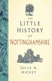
From prehistory to present times, Nottinghamshire has been shaped by Romans, marauding Danes, Norman barons, rebel armies, radicals and industrialists. The medieval wool trade was superseded by coal and textiles, while John Player's tobacco, Raleigh bicycles and Boots' pharmaceuticals have also played their part in the region's economy. The county boasts Sherwood Forest, monastic houses, a medieval 'dance of death', castles, workhouses and pumping stations, as well as its industrial heritage. Robin Hood and his merry men, the 'mad, bad and dangerous to know' poet Lord Byron, the Pilgrim Fathers and D.H. Lawrence are all part of Nottinghamshire's unique legacy. It is a place where freedom of speech and the right to vote have been fought for across the centuries; where innovation and technology helped to forge the modern world; and where people come to explore a legendary past.
Sie lesen das E-Book in den Legimi-Apps auf:
Seitenzahl: 243
Veröffentlichungsjahr: 2025
Das E-Book (TTS) können Sie hören im Abo „Legimi Premium” in Legimi-Apps auf:
Ähnliche


First published 2025
The History Press
97 St George’s Place, Cheltenham,
Gloucestershire, GL50 3QB
www.thehistorypress.co.uk
© Julia A. Hickey, 2025
The right of Julia A. Hickey to be identified as the Author of this work has been asserted in accordance with the Copyright, Designs and Patents Act 1988.
All rights reserved. No part of this book may be reprinted or reproduced or utilised in any form or by any electronic, mechanical or other means, now known or hereafter invented, including photocopying and recording, or in any information storage or retrieval system, without the permission in writing from the Publishers.
British Library Cataloguing in Publication Data.
A catalogue record for this book is available from the British Library.
ISBN 978 1 83705 039 0
Typesetting and origination by The History Press.
Printed and bound in Great Britain by TJ Books, Padstow, Cornwall.
eBook converted by Geethik Technologies
The History Press proudly supports
www.treesforlife.org.uk
EU Authorised Representative: Easy Access System Europe
Mustamäe tee 50, 10621 Tallinn, Estonia
CONTENTS
About the Author
1. The Beginning of Nottinghamshire
2. Norman Nottinghamshire
3. Medieval Nottinghamshire
4. Tudor Nottinghamshire
5. Stuart Nottinghamshire
6. Georgian Nottinghamshire
7. Victorian Nottinghamshire
8. The World at War
9. Modern Times
Bibliography
ABOUT THE AUTHOR
Julia Hickey’s interest in Nottinghamshire began at the age of 5 years when her father read her Robin Hood, The Prince of Outlaws: A Tale of the Fourteenth Century based on the ‘Lytell Geste’, a ballad that is one of the earliest-surviving stories about the legendary outlaw. She first visited Nottingham Castle and the Major Oak in 1976. In later times she lived in Edwinstowe and enjoyed long walks in Sherwood Forest with the family’s springer spaniel, Cracker, who loved the opportunities those walks provided for rolling in muddy puddles.
Julia’s passion for history, sparked by stories of medieval outlaws and derring-do, means that she is at her happiest exploring ruins, churches, castles and museums. She has worked in a variety of educational settings including at Sheffield Hallam University and for the Workers’ Educational Association. She is currently a writer, freelance tutor and blogger at thehistoryjar.com. Julia has written six history books as well as short stories for magazines that often draw their inspiration from the surroundings in which she finds herself. The Little History of Derbyshire was published in 2024.
1
THE BEGINNING OF NOTTINGHAMSHIRE
Nottinghamshire lies on a north–south axis between the Pennines to the north-west and fertile arable lowlands to the south and east. About 250 million years ago, during the Triassic period, when the United Kingdom was part of a supercontinent found much closer to the equator, the region was covered with a warm, shallow sea. Over time, rivers deposited their loads of silt and mud into the sea, creating layers of sedimentary sandstones.
Temperatures changed over millennia, becoming hot and arid, causing the shallow waters to evaporate. The terrain became marshy as the sea turned into a lake that continued to evaporate, causing the formation of a mineral called gypsum. Depending on the climate and global sea levels, the water levels either rose, flooding the land again, or shrank. Rivers, inland seas and lagoons came and went while the geological layers that make up Nottinghamshire’s bedrock continued to build. To the north-west of the region rivers, flowing from what today would become the Pennines, gradually slowed, twisted and braided to form deltas. As sea levels dropped, trees and ferns thrived. When they died and rotted, they became compressed in their turn, the land subsided, and the sea reclaimed the area as the cycle repeated itself, creating bands of compacted mud, clay and sandstones. Transformed plant remains formed a layer known as the Pennine Coal Measures. In Nottinghamshire the coal lies to the north-west of the county, running from near Nottingham to Kirkby-in-Ashfield and from there into Derbyshire and South Yorkshire. The coal, which dips eastwards beneath younger rock formations, is mingled with thin sandstone beds, shales and mudstones that tell the story of slow-moving rivers and repeated cycles of changing sea levels.
The ridge that Nottingham Castle sits upon, Sherwood Sandstone, was laid down during a period of some 30 million years. As well as grains of sediment, the layer contains pebbles, rocks and fragments of quartzite carried by a vast river until it slowed and deposited everything it held from boulders to minerals. Unlike many sedimentary rocks, the Sherwood Sandstone deposited between Nottingham and Mansfield was never compressed, so some of its layers remained relatively soft. These have been excavated, quarried and tunnelled into for different reasons throughout Nottinghamshire’s history.
NOTTINGHAMSHIRE’S DINOSAURS
The Jurassic period, which began 200 million years ago and lasted for about 45 million years, was a time when much of Nottinghamshire lay beneath a vast braided river. An incomplete plesiosaur fossil, a long-necked marine reptile, discovered in a limestone quarry at Cropwell Bishop, to the south of the county, in 1884 dates from this time. The plesiosaur is on display at Wollaton Hall Natural History Museum near Nottingham as part of its timeline of fossils, many of which were discovered in Nottinghamshire. A footprint of a Pseudosuchia, a giant crocodile-like reptile, was discovered at Mapperley, to the north-east of Nottingham, in 1910. This and other dinosaur tracks found during quarrying in and around Mansfield tell the tale of ancient reptiles walking through an unrecognisable landscape, even though no corresponding dinosaur fossils have yet been found within the county.
THE HEMLOCK STONE, STAPLEFORD, AND THE DRUID STONE, BLIDWORTH
The Hemlock Stone is an outcrop of red sandstone, standing 8.5m tall, deposited more than 200 million years ago. The column is made from bands of sandstone laid down at different times. The bottom layer of the rock erodes more easily than its top layers, which are coarser and more firmly cemented together by the mineral barytes, acting like a cement. It means that the lower part of the stone is more eroded and is responsible for the waisted shape. The upper part is no longer its original colour because of a coating of industrial filth from the nineteenth and twentieth centuries that has not been eroded away.
In the past it was thought that the stone was created as a result of erosion and glaciation but it is now thought that it was due to quarrying. It has been suggested that it was carved out by Druids during the Iron Age. In the Middle Ages it was believed that the Devil threw the stone at nearby Lenton Priory from Castleton in Derbyshire, some 40 miles away, because the sound of the monks praying irritated him.
J.A.H.
The Druid Stone, which is on private land but visible from a nearby footpath, has attracted its own share of stories. The 4m-tall rock formation has a narrow man-made hole cut into its middle. According to tradition, sick children were passed through the stone to heal them of rickets and whooping cough. The hole also aligns with sunrise on 1 May, or Beltane, which lends itself to the idea of Druid rituals.
ICE AND WATER
During the last 700,000 years the region was subject to repeated glaciation, which saw ice sheets hundreds of metres thick scouring the landscape, turning it into an icy wilderness, wearing away rocks and changing patterns of river drainage. About 450,000 years ago, when the ice sheets covering Nottinghamshire were approximately a mile thick, a river that ran eastwards through the Vale of Belvoir and from there to the North Sea somewhere in East Anglia became blocked. A new drainage pattern shaped a northerly course when the ice melted. The resulting river, the Trent, which rises in Staffordshire and passes through Nottinghamshire, draining into the Humber Estuary, is one of the longest in Britain and forms a natural divide between the southern lowlands and northern hills.
EARLY NOTTINGHAMSHIRE INHABITANTS
Between 55,000 and 40,000 years ago Nottinghamshire looked more like Siberian grassland tundra than the landscape of today. Fossil remains tell us that herds of woolly mammoths, rhinos, deer and bison came north following the river valleys and floodplains in search of grazing. Small groups of Neanderthal people, who preceded modern humans, Homo sapiens, came in search of food despite near-Arctic conditions. Their population was small and almost all traces of them in Nottinghamshire have been obliterated by repeated glaciation.
Archaeological evidence shows that they visited Creswell Crags. It was not always a safe location as the cave dwellers shared their home with bears, cave lions and wolves. Today it is one of the most important Palaeolithic sites in the whole country, lying on the border between Nottinghamshire and Derbyshire. A natural gorge runs on an east–west axis, with the crags and caves on the southern side of the gap being in Nottinghamshire.
The men and women who lived at Creswell hunted their prey at close range with spears before returning to their caves or camps, where they butchered the meat in the light of fires built for warmth and to drive off dangerous animals. Animal skins provided clothing and blankets while their teeth and claws were worn as decoration. Inhabitants of the caves crafted tools from bones and antlers as well as knapping flint from cores they carried with them to make hand axes, scrapers and arrowheads.
Evidence for Neanderthal occupation anywhere stops about 36,000 years ago. It is unclear why the species became extinct. It has been suggested that they were adapted to cold temperatures and could not adjust to the warming climate at the end of the last Ice Age. More significantly, perhaps, their disappearance from the archaeological record coincides with the arrival of Homo sapiens in Europe from Africa. It is uncertain whether early modern humans brought new diseases with them or if the two groups competed for limited resources. Homo sapiens migrants began to use the same caves that the Neanderthal inhabited at Creswell about 29,000 years ago. At around the same time, hunters started using bows and arrows rather than relying only on spears.
About 25,000 years ago, the ice returned and it was too cold for anyone to live so far north. Eventually though, the climate began to warm once more and life returned to Nottinghamshire. Herds of woolly mammoth and rhinoceros did not reappear as the ice retreated. Instead, deer, horses, bison and smaller mammals including hare and lemming were on the menu for the men and women who followed after them, as well as fish and wildfowl from the rivers and wetlands.
About 11,500 years ago the Ice Age finally came to an end. The River Trent and its tributaries became raging torrents carrying water from melted ice sheets into the North Sea. Ocean levels rose as water was released, cutting Britain off from the rest of Europe. Over time, the Trent slowed once more. It deposited silts, sands and gravel as it cut through existing rock formations, creating a wide, fertile floodplain. The name ‘Trent’ is thought to be derived from two Celtic words translating as ‘the trespasser’ or ‘wandering invader’, meaning to flood. In Nottinghamshire, the Trent still meanders and remains prone to overflowing its banks.
A forest landscape developed, covering most of the country. Initially, the environment was not favourable for permanent residence but hunters and gatherers roamed the area, moving their camps with the seasons and the herds that provided them with food. Between 4000 and 3500 BC, people began to make permanent homes in Nottinghamshire. Neolithic farmers cleared trees with stone and flint axes to cultivate the fertile Trent Valley. They made enclosures to keep cattle and fields to help edible plants and roots grow. The land remained prone to flooding, so the people who lived there chose to make their homes on elevated ground.
THE BRONZE AGE (C.2300 BC–800 BC)
A new group of settlers arrived in Nottinghamshire, possibly originating from an area of modern Spain. They intermarried with the pre-existing population and developed new practices. The skill of smelting copper and tin to make bronze gradually spread across Nottinghamshire but only wealthy members of society could afford such weapons, tools, buckles and jewellery. Bronze swords were symbols of power and wealth. Most people carried on using stone, bone and antlers to make the tools they needed to hunt and to farm.
In 1938 evidence was discovered at Clifton Grove, on the east bank of the Trent, of wooden stakes driven into the riverbed, forming the foundations for a stilted, or pile, settlement at the water’s edge. Further excavation revealed two dugout canoes, which were later given to Nottingham City Council. One of the boats was more than 8m long and made from a single oak. Skulls, bronze spearheads, swords, daggers and knives were also uncovered. As well as providing resources and a communication network, the river – or the gods and goddesses who were thought to live within it – was venerated. The metal finds may have been given to the river as sacrificial offerings. More than 200 pieces of metalwork have been recovered from the Trent and its associated wetlands during dredging and development work. The Highfields Sword, discovered in 1902, and the Holme Pierrepont Sword, discovered in 1966, are both rare, high-status Bronze Age weapons.
IRON AGE NOTTINGHAMSHIRE (800 BC–AD 50)
By the time of the late Bronze Age, inhabitants of Britain began to build hill forts. An increasing population, changing climate, limited amounts of food and better weapons meant that there was more need for groups of people to mark their territory and to protect themselves. In Nottinghamshire, earthworks were built at Coombs Farm at Farnsfield, Lonely Grange at Oxton, and Cockpit Hill, Arnold. They, and places like Beacon Hill Camp at Gringley on the Hill, dominate the landscape around them, but none of them could be described as fortresses in the way that Mam Tor in Derbyshire or Burrough Hill in Leicestershire might be. The largest, and best preserved, of Nottinghamshire’s forts is Oldox Camp, at Oxton near Southwell. It is overlooked on three sides despite its protective banks and ditches. The earthworks, some of which may not even date from the Iron Age, could have been gathering points, enclosures for animals, or even a boundary marker designed to stand out in the landscape.
A tribe known as the Corieltauvi occupied much of Nottinghamshire, especially the fertile lands in the Trent Valley. They cleared the land, grew crops and herded animals. Their farms and settlements, revealed by crop marks, were often surrounded by banks and ditches, to keep their herds safe as well as to provide protection. Excavations have revealed evidence of roundhouses and domestic activities including pottery, quern stones for grinding wheat and loom weights. Excavations at places like Clifton and Gameston near West Bridgford uncovered extensive Iron Age settlements with enclosed fields and trackways.
Fewer people lived to the north and the west of the River Trent, where the land was less easy to farm. Even further to the north of the region, the dominant group were the more warlike Brigantes, a federation of tribes who controlled much of northern England.
ROMANO-BRITISH NOTTINGHAMSHIRE (C.AD 43–350)
In AD 43 the Roman army under the command of Emperor Claudius invaded Britain. The Fosse Way was built in AD 47, running from modern-day Lincoln to Exeter, through Nottinghamshire. The road, together with the River Trent, marked a temporary frontier between the Romans and the Corieltauvi and Brigantes tribes. It was lined at regular intervals by military posts. Four of these stations are in modern Nottinghamshire: Crococalana at Brough, near Newark; Ad Pontem near East Stoke; Margidunum at East Bridgford and Veremetum at Willoughby-on-the-Wolds.
In AD 48, Queen Cartimandua of the Brigantes, a client of the Romans, caused a rebellion among her people when she gave Caratacus, chieftan of the neighbouring Catuvellauni tribe, who continued to fight the invaders, to them after he sought safety with her people. The revolt and the subsequent military campaign were described by the historian Tacitus. The Romans pushed northwards through Nottinghamshire into the territory of the Brigantes, building temporary camps and forts as they went. Hexgreave Park near Farnsfield provides evidence of a so-called marching camp on the hill there. In places the ditch and its vallum, or earthwork wall, can still be seen. It is possible that the legions occupied the high ground that had formerly been occupied by the Britons. It is only 2½ miles west of Osmanthorpe, where the legions built another temporary fort that was probably garrisoned by the legendary IX Hispana, whose main station was at Lincoln. The forts that were built at this time, including the one at Osmanthorpe, were soon abandoned once peace was restored. The Corieltauvi, unlike their neighbours, offered little or no resistance to the Romans.
Nottinghamshire became part of a civitas, an administrative district, governed from modern Leicester. A network of roads linked Nottinghamshire to the rest of the Roman province of Britannia. Ermine Street joined London to the East Midlands, Lincoln and York, while the Fosse Way, the modern A46, stretched across the south-east of Nottinghamshire from Willoughby-on-the-Wolds to Brough. At Scraftworth, on the border with South Yorkshire, the Romans created an offshoot, known as Roman Road 28, from Ermine Street running in the direction of Doncaster, which was laid on a raft of logs to stabilise the boggy ground. They built a small fort further west near Bawtry to protect the road where it crossed the River Idle. The marshy ground around it made the location unsuitable for settlement but there is evidence of a shrine containing pottery from the third and fourth centuries AD that corresponds to a second phase of Road 28’s construction.
Nottinghamshire’s population continued to work the land along the Trent Valley and to live in small enclosed settlements. Margidunum, on the Fosse Way at East Bridgford, halfway between Leicester and Lincoln, evolved from a fortress into a settlement with outlaying villas and farms. Like the Iron Age inhabitants before them, the Romans settled along both sides of the Trent. Excavation at places like Holme Pierrepont, Hoveringham and Besthorpe reveal that Iron Age and Romano-British settlements overlay one another. It seems likely that communities who lived in Nottinghamshire before the Romans arrived continued to work the land but their homes became more Romanised. Instead of roundhouses, the wealthiest among their numbers lived in aisled farmhouse buildings or villas.
On occasion low-lying settlements were inundated with floods from the Trent. A Roman wheel was found at Holme Pierrepont alongside flat-bottomed Iron Age boats. Some settlements, like the one at Littleborough, or Segelocum, on Roman Road 28, were permanently abandoned because of rising water levels. The ford was replaced by a ferry but in 1933, during a drought, the Roman ford with its paving was once again revealed. Today Littleborough is a hamlet but it is included on the Antonine Itinerary, created after Britannia was divided into two provinces by Septimius Severus in AD 197, which lists 225 stopping places along a network of roads inside the Roman Empire.
Wealthy Roman settlers, or Romanised Britons, chose to live in villas with underfloor heating and bath houses. The best known of these are associated with mosaic pavements uncovered at Southwell and Mansfield Woodhouse in the eighteenth and nineteenth centuries. The latter was discovered in 1786 by Major Hayman Rooke when he excavated a large dwelling with an ornate mosaic in patterns of red, white, grey and yellow, in the villa’s dining room. Inside Southwell Minster today, it is possible to look down on to part of a mosaic floor that was laid down in a villa built around a courtyard. Building work during the nineteenth century revealed the extent of the Roman buildings to the east of the minster. It also uncovered the remains of a bath house that included painted wall plaster depicting fish, seaweed and Cupid wearing a cloak.
Other villas were less grand and might be best described as farmhouses. At Cromwell, nearly 5 miles north of Newark, excavations revealed a Roman house standing inside an enclosure of double ditches. The later building overlaid Iron Age hut circles. At Babworth, near Retford, excavation and aerial photography exposed a brickwork field system of ditched plots that may date from the Roman period. These small regular fields leant themselves to mixed farming and can be found across Nottinghamshire.
Besides farming, Nottinghamshire’s Romano-British population smelted ironstone using limestone quarried at Cropwell Bishop; mined coal from open seams at Sutton-in-Ashfield; quarried sandstone at places like Besthorpe; and extracted sand and gravel from the Trent’s banks. In 1848, at Hexgrave Park, near Mansfield, a pig of lead bearing the inscription ‘Property of Gius Julius Protus’ was uncovered. It came from the metal-working centre at Lutudarum, in modern-day Derbyshire. For Nottinghamshire, Romano-British mining was the beginning of more than a thousand years of commerce and industry.
COIN HOARDS AND THE END OF ROME
By the third century the Roman Empire was in economic difficulties. The amount of silver in the coins was reduced to make bullion go further. This led to inflation and civil unrest. In about AD 260, Britannia, together with Gaul and Spain, broke away from the rest of the Roman Empire under the leadership of Emperor Postumus. A hoard of 1,500 coins found at Honeywood, near Newstead, dates to this time, as does a cache discovered in 1959 at Calverton containing a similar number of coins placed in a flagon. Another collection discovered at Kirkby contains coins minted by Postumus.
The so-called Gallic Empire was reabsorbed into the Roman Empire in AD 274. The following year, Emperor Aurelian reformed the currency, which had the effect of devaluing it. As a result, the inhabitants of Britannia, including Nottinghamshire, experienced further economic difficulties and began to mint their own copies of coins. A hoard found at Meering, near Newark, contained coins from the second half of the fourth century and included more than 300 local imitations, reflecting the continuing problems of the period.
From AD 402 no more Roman coinage was imported to Britannia. The date marks the end of the Empire’s economic relationship with the province. In AD 410, Emperor Honorius recalled the legions to Rome. The Romano-British population of Britannia were left to face whatever difficulties might befall them by themselves.
Archaeological evidence indicates that the population initially underwent a decline. It was not long before Nottinghamshire’s villas were either abandoned or re-purposed. People returned to older ways of living that did not involve urban settlement or a coin-based economy. It would not be until the seventh century that inhabitants of Nottinghamshire began to use coins to transact business once more. The transition from being part of a Roman province to an Anglo-Saxon kingdom had begun.
SAXON NOTTINGHAMSHIRE
By the middle of the fifth century Saxon invaders began to settle and to build their own homes in Nottinghamshire. Understanding of Saxon settlement patterns comes mainly from the origin of place names and discovery of Anglo-Saxon cemeteries, such as the ones at Millgate, near Newark, and at Cotgrave, 5 miles south-east of Nottingham. Many of the cremations and burials that have been excavated lie on top of Romano-British buildings or near earlier burials. It is impossible to know if Nottinghamshire’s story was one of invasion, absorption into the existing population or a combination of both. Sometimes the new settlers reused Roman buildings, as at Southwell or at Flawford where the Saxon church was built on top of a villa. In about AD 600 an Anglian tribe, the Snotingas, settled in Snotengham, which would become Nottingham. Snott and his extended family made their home, complete with a defensive ditch, on a hill that was not liable to flooding.
KING EDWIN’S LAST BATTLE
By the seventh century, seven independent kingdoms, known as the Heptarchy, were established in England. King Penda of Mercia, of which Nottinghamshire was a part, was ambitious to expand his territory and to be recognised as the most important of the country’s Saxon rulers – the Bretwalda. At that time, King Edwin of Northumberland, who controlled Bernicia and Deira, modern-day Northumberland and Yorkshire, was most dominant. In 633, Penda and his ally, Cadwallon of Gwynedd, confronted Edwin and his men at Hatfield Chase with their combined armies. At the end of the battle Edwin was among the dead.
The exact location of the confrontation is disputed. It is possible that rather than in South Yorkshire, as is most usually supposed, the clash took place in the Sherwood Forest region of Nottinghamshire. Cuckney near Mansfield is one of the alternatives, suggested based on the discovery in 1951 of 200 skeletons beneath St Mary’s Church. It is thought that they were the victims of a slaughter. Nearby Edwinstowe, meaning Edwin’s holy, or resting, place, is named after the king and St Edwin’s Chapel, a former hermitage, at Clipstone, also suggest a connection with the monarch. Local legend states that Edwin’s body was hidden near Edwinstowe after the defeat before being conveyed to Whitby Abbey. Without archaeological evidence it is impossible to be certain where the king met his end. But it would not make sense for the Northumbrians to move their leader’s body south, into the territory of their enemies, before taking his remains north for burial.
NOTTINGHAMSHIRE BECOMES CHRISTIAN
After Penda’s victory, the Kingdom of Mercia stretched from south of the Humber Estuary to south of the River Trent. Offa’s Dyke separated it from its neighbouring Welsh kingdoms to the west. Its neighbour to the east was the kingdom of East Anglia. Penda went on, in 642, to kill King Edwin’s successor and then, in 653 or 654, to kill the East Anglian king, Anna. Mercia was the most powerful kingdom in the country and Penda was the Bretwalda until his death in 655.
J.A.H.
Penda’s successor, Paeda, married the daughter of the King of Northumbria and the county began to become more Christian. The population started to build richly decorated, free-standing crosses. Those that remain have lost their cross-heads. There are four fragments of an inscribed cross at Rolleston, Holy Trinity Church, near Newark, which were reused during building work on the church, serving as a door jamb. A section of cross was discovered at Shelford Church in one of its buttresses during work in the 1870s. Dating to about 900, it has been described as one of the most interesting examples of early figure sculpture in England, depicting the Virgin and Child on one side and a bearded archangel on another. The most impressive example of a cross shaft can be found in St Helen’s Churchyard at Stapleford. Mercian in design, it is unclear how old the cross shaft actually might be. Nottinghamshire County Council describes it as the most important pre-Conquest monument in the area.
VIKING NOTTINGHAMSHIRE
Over time the kingdom of Wessex became more prominent than Mercia. It was their rulers who became kings of the whole of England. One of the reasons for Mercia’s loss of supremacy was the arrival of a new group of invaders. In 865 the Great Heathen Army, or Great Viking Army, arrived in East Anglia. The aim of the Danes was not merely to raid but to occupy the lands they invaded. East Anglia and York fell to the army before they marched into Mercia and overwintered in Nottingham in 868.
Burgred, the King of Mercia, asked the West Saxons, led by Æthelred who was Alfred the Great’s older brother, for help. The Anglo-Saxon Chronicle records that the Mercians and the King of Wessex took their armies to Nottingham and besieged the Vikings inside the town. Neither side wanted open battle despite the occasional brutal skirmish. Instead, a compromise was reached and the Vikings returned to York in exchange for payment. In 873 Burgred was driven from his throne by a rival claimant, Ceolwulf, who, according to the Anglo-Saxon Chronicle, became a puppet of the Vikings. By the end of the decade, Ceolwulf disappeared from the record and the Vikings took control of much of Mercia as well as Nottingham.
In the spring of 878 King Alfred of Wessex, who had succeeded his brother in 871, won the Battle of Edington, which was fought in Wiltshire against the Vikings. The signing of the Treaty of Wedmore, between Alfred and the Danish leader, Guthrum, saw the River Trent becoming a boundary between the two groups because neither side was strong enough to defeat the other. Nottinghamshire lay inside the Danelaw, which stretched up the east of England from London to Yorkshire. The Danes made their homes in Nottinghamshire, bringing their beliefs, language and culture with them. Bleasby was once the home of Blesi. Skegby near Mansfield was a farm belonging to Skeggi, while Clipstone was Klippr’s farm. Any village or town ending in ‘by’ comes from the Norse for settlement.
Farmers measured their lands according to the amount that could be ploughed by a team of eight oxen in one season. In Nottinghamshire, and the rest of Danelaw, this was known as a carucate, while in Saxon controlled regions it was known as a hide. The languages and traditions of the people who lived in Nottinghamshire became entangled with one another and a new identity began to emerge. Evidence for this can be found in artefacts dating from the end of the tenth century, such as a Scandinavian-style hogback grave cover, thought to be carved from a Roman column, at St Luke’s Church, Hickling, which depicts muzzled bears as well as a cross.


