Erhalten Sie Zugang zu diesem und mehr als 300000 Büchern ab EUR 5,99 monatlich.
- Herausgeber: THP Ireland
- Kategorie: Sachliteratur, Reportagen, Biografien
- Serie: Little Book of
- Sprache: Englisch
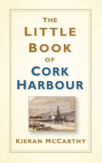
Cork Harbour is the second largest natural harbour in the world. It is a historical wonder, surrounded by villages, forts, towers and churches, all of which combine to tell the colourful story of Ireland's largest county. A reliable reference book and a quirky guide, this book by author and historian Kieran McCarthy can be dipped into time and again to uncover new landmarks, people and stories from this stunning part of the world.
Sie lesen das E-Book in den Legimi-Apps auf:
Seitenzahl: 253
Veröffentlichungsjahr: 2019
Das E-Book (TTS) können Sie hören im Abo „Legimi Premium” in Legimi-Apps auf:
Ähnliche


First published 2019
The History Press
The Mill, Brimscombe Port
Stroud, Gloucestershire, GL5 2QG
www.thehistorypress.co.uk
© Kieran McCarthy, 2019
The right of Kieran McCarthy to be identified as the Author of this work has been asserted in accordance with the Copyright, Designs and Patents Act 1988.
All rights reserved. No part of this book may be reprinted or reproduced or utilised in any form or by any electronic, mechanical or other means, now known or hereafter invented, including photocopying and recording, or in any information storage or retrieval system, without the permission in writing from the Publishers.
British Library Cataloguing in Publication Data.
A catalogue record for this book is available from the British Library.
ISBN 978 0 7509 8805 6
Typesetting and origination by The History Press
Printed in Great Britain
eBook converted by Geethik Technologies
CONTENTS
Acknowledgements
About the Author
1. Introduction
2. Archaeology, Antiquities and Ancient Towers
3. Forts and Fortifications
4. Journeys through Coastal Villages
5. Houses, Gentry and Estates
6. People, Place and Curiosities
7. Connecting a Harbour
8. Tales of Shipping
9. The Industrial Harbour
10. Recreation and Tourism
ACKNOWLEDGEMENTS
My thanks to the editorial staff at The History Press Ireland and the staff of Cork City and County Libraries for their help. I would also like to thank Mairéad, my family and friends for their continued support.
ABOUT THE AUTHOR
For over twenty years, Kieran has actively promoted Cork’s heritage with its various communities and people. He has led and continues to lead successful heritage initiatives through his community talks, City and County school heritage programmes, walking tours, newspaper articles, books and his work through his heritage consultancy business.
For the past nineteen years, Kieran has written a local heritage column in the Cork Independent on the history, geography and its intersection of modern day life in communities in Cork City and County. He holds a PhD in Cultural Geography from University College Cork and has interests in ideas of landscape, collective memory, narrative and identity structures.
Kieran is the author of twenty local history books: Pathways Through Time, Historical Walking Trails of Cork City (2001), Cork: A Pictorial Journey (co-written 2001), Discover Cork (2003), A Dream Unfolding, Portrait of St Patrick’s Hospital (2004), Voices of Cork: The Knitting Map Speaks (2005), In the Steps of St Finbarre, Voices and Memories of the Lee Valley (2006), Generations: Memories of the Lee Hydroelectric Scheme (co-written, 2008), Inheritance, Heritage and Memory in the Lee Valley, Co. Cork (2010), Royal Cork Institution, Pioneer of Education (2010), and Munster Agricultural Society, The Story of the Cork Showgrounds (2010), Cork City Through Time (co-written, 2012), Journeys of Faith, Our Lady of Lourdes Church Ballinlough, Celebrating 75 Years (2013), West Cork Through Time (co-written, 2013), Cork Harbour Through Time (co-written, 2014), Little Book of Cork (2015), North Cork Through Time (co-written, 2015), Ring of Kerry, The Postcard Collection (2015), Cork 1916: A Year Examined (co-written, 2016), Cork City Centre Tour (2016) and Secret Cork (2017).
In June 2009 and May 2014, Kieran was elected as a local government councillor (Independent) to Cork City Council. He is also a member of the EU’s Committee of the Regions.
More on Kieran’s work can be seen at www.corkheritage.ie and www.kieranmccarthy.ie.
Location map of Cork Harbour
1
INTRODUCTION
THE TIDES OF TIME
Cork Harbour is a beautiful region of southern Ireland. It possesses a rich complexity of natural and cultural heritage. This is a little book about the myriad of stories within the second largest natural harbour in the world. It follows on from a series of my publications on the River Lee Valley, Cork City and complements the Little Book of Cork (The History Press Ireland, 2015). It is not meant to be a full history of the harbour region but does attempt to bring some of the multitude of historical threads under one publication. However, each thread is connected to other narratives and each thread here is recorded to perhaps bring about future research on a site, person or the heritage of the wider harbour.
The book is based on many hours of fieldwork and also draws on the emerging digitised archive of newspapers from the Irish Newspaper Archive and from the digitalised Archaeological Survey of Ireland’s National Monument’s Service. Both digitised sources have, more than ever, made reams and reams of unrecorded local history data accessible to the general public.
For centuries, people have lived, worked, travelled and buried their dead around Cork’s coastal landscapes. The sea has been used as a source of food, raw materials, a means of travel and communications and a place of very distinct localities and communities. Some are connected to each other through recreational amenities such as rowing or boating and some exist in their own footprint with a strong sense of pride. Some areas, such as Cobh and the military fortifications, have been written about frequently by scholars and local historians; whilst some prominent sites have no written history, or just a few sentences accorded to their development.
Chapter 2, Archaeology, Antiquities and Ancient Towers, explores the myriad of archaeological finds and structures, which have survived from the Stone Age to post-medieval times. Five thousand years ago, people made their homes on the edges of cliffs and beaches surrounding the harbour. In medieval times, they strategically built castles on the ridges overlooking the harbour.
Chapter 3, Forts and Fortifications, explores the development of an impressive set of late-eighteenth-century forts and nineteenth-century coastal defences. All were constructed to protect the interests of merchants and the British Navy in this large and sheltered harbour.
Chapter 4, Journeys through Coastal Villages, takes the reader on an excursion across the harbour through some of the region’s colourful towns. All occupy important positions and embody histories including native industries, old dockyards, boat construction, market spaces, whiskey making and food granary hubs. Each adds its own unique identity in making the DNA of the harbour region.
Houses, Gentry and Estates (Chapter 5) and People, Place and Curiosities (Chapter 6) are at the heart of the book and highlight some of the myriad of people and personalities who have added to the cultural landscape of the harbour.
Chapter 7, Connecting a Harbour, describes the ways the harbour was connected up through the ages, whether that be through roads, bridges, steamships, ferries, or winch-driven barges. Tales of Shipping (Chapter 8) attempts to showcase just a cross-section of centuries of shipping which frequented the harbour; some were mundane acts of mooring and loading up goods and emigrants but some were eventful, with stories ranging from convict ships and mutiny to shipwrecks and races against time and the tide.
Chapter 9, The Industrial Harbour, details from old brickworks and ship building to the Whitegate Oil refinery. Every corner of the harbour has been affected by nineteenth-century and twentieth-century industries.
Chapter 10, Recreation and Tourism, notes that despite the industrialisation, there are many corners of the harbour where the Gaelic Athletic Association (GAA) and rowing can be viewed, as well as older cultural nuggets such as old ballrooms and fair grounds. This for me is the appropriate section to end upon. Cork Harbour is a playground of ideas about how we approach our cultural heritage, how we remember and forget it, but most of all how much heritage there is to recover and celebrate.
Enjoy!
Kieran McCarthy
2
ARCHAEOLOGY, ANTIQUITIES AND ANCIENT TOWERS
The Mesolithic Harbour
About ten thousand years ago, the first human settlers – hunter-gatherers of the Mesolithic or Late Stone Age era – came to Cork Harbour. Just over twenty-five shell midden sites are marked on maps created by the Archaeological Inventory of Cork Harbour – some of these have not survived; some survive just in local folklore. Some have been excavated throughout the twentieth century. There have also been unrecorded sites eroded away by the tide or by cliff collapse. Shell midden sites consist of refuse mounds or spreads of discarded seashells, and are normally found along the shoreline. Shellfish were exploited as a food source and sometimes as bait or to make dye. In Ireland, shell middens survive from as early as the Late Mesolithic period, but many of the Cork Harbour oyster middens have also been dated to medieval times, while some have produced post-medieval pottery dates.
Some of the shell middens are very extensive; for example, on a beach at Curlane Bank in Ringaskiddy, a lens of midden material extends for 30m north–south along the shoreline just above high tide mark, and measures 0.1m in thickness. The deposit contains cockles, limpets and winkles with some oyster and razor shells. At Ballintubbrid West, to the south west of Midleton, it is about 50m in length and over 1.5m thick.
Over a quarter of all identified middens in the Cork Harbour area are to be found at eight locations in Carrigtwohill parish. Brick lsland, in the estuary to the north of Great Island, is joined to mainland by narrow neck of land. When surveyed by the archaeologist Reverend Professor Power in 1930, the midden measured 5 or 6ft thick at the terrace edge and extended along the foreshore for over 180 yards, and inland for 70 or 80ft. It contained almost purely oyster shells with occasional cockle, mussel, whelk and other marine shells. Thin layers of charcoal were visible in many places and stone pounders or shell openers.
In 2001, archaeological monitoring of a 15-hectare greenfield site at Carrigrenan, Little Island, was carried out prior to the construction of a waste water treatment plant by Cork Corporation. Two shell spreads along the western seashore perimeter of the site were noted. A polished stone axe was recovered during topsoil monitoring and has been given a possible late Mesolithic date. All other finds were random pottery, eighteenth to twentieth century in date.
Smaller middens, for example at Currabinny, Currabally and Rathcoursey, reflect shorter periods of use. At the western end of Carrigtwohill in 1955, archaeologist M.J. O’Kelly (prior to the construction of a new school) excavated oyster shells, a few animal bones and fragments of glazed pottery dating to the late thirteenth/early fourteenth century.
The Bell-Beaker Pottery Sherd
During the preparation works for Mahon Point Shopping Centre in 2003, an area of prehistoric activity was identified during testing by archaeologists Sheila Lane & Associates, in a development area known as Zone C. Features revealed during the excavation included a hearth surrounded by fifty stake-holes. Further west again, seven pits were found. A number of finds were recovered from them, including a possible quartz scraper, a fragment of a small flint bladelet, a flint flake, a type of flint plano-convex slug knife, two pieces of amethyst (one of which has a usable cutting edge), and a small shard of possible Bell Beaker pottery. The Bell Beaker culture, c. 2900–1800 BC, is the term for a widely scattered ‘archaeological culture’ of prehistoric western Europe, starting in the late Neolithic or Chalcolithic and running into the early Bronze Age.
Postholes of Prehistory
In 1992, a significant Bronze Age settlement was discovered at Fota Island. The archaeological investigation there began at the invitation of the developer, and lasted for a total of ten weeks. It was carried out under the aegis of Archaeological Development Services Ltd, Dublin, initially as a watching brief in advance of the construction of a golf course. Definite archaeological remains were found in nine separate areas during the construction work, at depths varying between 0.2m and 0.4m below the topsoil horizon. Three of these could be dated to the prehistoric period, and were fully excavated.
The first, Area 1, proved to be a porched house site of probably Bronze Age date. It consisted of a hearth, two large and amorphous pits, two stake slots, ten regularly cut post holes, and a number of shallow depressions and stake holes.
The second site, Area 4, occupied the summit of a low rise in the middle of the island. It consisted of fourteen pits of varying capacities. Its date is likely to be similar to, or slightly older than, the house in Area 1. The large oval pit in the middle of the site had survived to a depth of almost 1in and had been clay-lined twice during the course of its life. A post hole in the base of the pit may mean that a wooden gantry or platform was raised over it. Several humanly struck flints were recovered, a rare commodity on Fota, but the presence of two whetstones from a nearby feature may indicate that bronze blades were being sharpened in the vicinity. The four-posted structure may have been a grain platform.
Bronze Age Carrigaline
In 2014, Archaeologist Rob O’Hara discovered three Bronze Age-dated pits at Kilmoney, Carrigaline. Located in the floodplain of the Owenboy River, the published report denotes that in each pit charcoal and heat-fractured stone were present. A sample of alder charcoal was radiocarbon dated and showed activity on the site between 2456 BC and 2205 BC.
Carrignafoy’s Cooking Complex
An excavation of a large fulacht fia, a Bronze Age cooking site, took place in April–May 2007 at Carrignafoy, on the north-east outskirts of Cobh. A spread of burnt stone, approximately 18m by 20m, was noted during site clearance at a greenfield development site, County Cork. As the development was already under way, full excavation of the site was recommended by the local authority. The site was located at c. 60m above mean sea level on the east slope of a 91m-high hill, which dominates the town of Cobh.
The uppermost level of the spread of burnt and heat-shattered stone was removed to reveal a trough connected by a shallow channel to two further troughs, all of which had been cut into the natural boulder clay. The sides of the trough were lined with a rough layer of sandstones, and two horizontal oak timbers were recorded at the base of the trough. A circular structure enclosed the trough. It was 5m in diameter and consisted of a series of seven post-holes, slot-trenches and stake-holes.
Eskers, Migrations and the Castle Mary Tomb
The eastern region of Cork Harbour became well known to archaeologists because of the number of chance finds discovered during the late nineteenth century and early twentieth century. The researches and publications of three scholars, T.J. Westropp, Rev P. Canon Power and M.J. O’Kelly, are still prominent sources for research. The former dealt with the headland forts along its coast and the latter with some of the place-names and antiquities in the inland terrain. Professor M.J. O’Kelly, in his 1945 publication in the Journal of the Cork Historical and Archaeological Society, states that the stone circles and alignments, which occur frequently in the west of County Cork, are entirely absent in the harbour region. However, there are but two chambered tombs in the area.
Professor O’Kelly explained that the dearth of chambered tombs in the section of Cork Harbour can be explained by environmental conditions in Bronze Age Ireland. At the time of greatest colonisation by the tomb-builders, the limestone river plains of the south occupying the east–west synclinal folds were very heavily forested, and this applied especially to the lower valleys of the Lee and Blackwater. The material equipment of the society of the Late Mesolithic Age could make but a little impression upon the dense woodlands of east Cork. So people migrated westward to the open uplands where, without any preliminary clearance of the ground, they were able immediately to practise early forms of agriculture and herding. Early Bronze Age settlers, though, somehow found a foothold near the coast at the western end of the Cloyne valley.
Professor O’Kelly outlines that an esker (an outcome of the melting Glaciation epoch) consisting of a series of detached mounds and ridges of gravel, runs from the eastside of the Castlemary demesne along the Saleen depression to Cork harbour. The esker would constitute an area of light soil unlikely to have supported a dense growth of timber in Bronze Age times; the two tombs are located upon or very near these gravels. Their position so near the coast suggests that this was the point of entry of at least one group of the early colonists.
The Castle Mary tomb must once have been an imposing monument. Its present state is not due to accidental collapse but to the deliberate clearing away of its earthen covering mound and the removal and breaking up of the stones of the tomb. There are now five stones on the site, four of which are side-stones of the chamber and the fifth a very large capstone. No trace of the small closed eastern chamber usually found in this type of tomb now exists. The wedge-shaped tomb belongs principally to the south and west of Ireland. The classic example of the tomb type for the whole country lies at Labbacallee, near Fermoy, County Cork.
Castlemary tomb, 1875 from M. Cusack, A History of Cork (source: Cork City Library)
The Mystery of the Rostellan Dolmen
To Cork and Irish archaeologists, the reasons behind the construction of the dolmen in Rostellan is a mystery. It has three upright stones and a capstone, which at one time fell down but was later re-positioned. It has a similar style to portal tombs but such style of tombs are not common at all to this region of the country. For the visitor, the site is difficult to access. The beach upon it sits gets flooded at high tides and access across the local mudflats is difficult and dangerous. It is easier to get to it with a guide through the adjacent Rostellan wood. The dolmen maybe a folly created by the O’Briens, former owners of the adjacent estate of Rostellan House on whose estate an extensive wooded area existed. The house was built by William O’Brien (1694–1777) the 4th Earl of Inchiquin in 1721. Notably, on the former estate grounds there is a definitive folly in the shape of a castle tower, named Siddons Tower, after the Welsh-born actress Sarah Siddons.
The Giant’s Circle
The name Curraghbinny in Irish is Corra Binne, which is reputedly named after the legendary giant called Binne. Legends tells that his cairn (called a corra in Irish) is located in a burial chamber atop the now wooded hill. The cairn is not marked in the first edition Ordnance Survey map, but its existence was noted during the original survey in the Name Books compiled at that time. John Windle, the well-known Cork writer and antiquarian of the early nineteenth century, mentions the site in his publications. There is no record, though, in his printed works or in his manuscripts preserved in the Royal Irish Academy Library of any digging having taken place at the cairn.
In 1932, archaeologist Seán P.Ó. Riordáin and his team excavated the cairn. On beginning work, he found the cairn was thickly overgrown with bracken and brambles. He measured the diameter as about 70ft, and its greatest height was 7½ft above that of the surrounding area. The excavation was carried out by cutting off the cairn in narrow vertical sections parallel to an arbitrary base line to the east of the monument.
Except for a slight outer accumulation of soil, the cairn was composed of stone, most of which was local sandstone, there being only two pieces of limestone. As O’Riordáin’s team worked into the cairn, several large boulders lying on the ground came into view. It soon became apparent that the boulders formed part of a circle running concentric with the outer edge of the mound.
As the archaeologists worked nearer the centre they found a further series of stones lying in situ on the clay floor of the cairn. These were found to form the arc of a circle, and the stones used were smaller than those of the outer circle, and less continuous, since part of the line was formed by an irregular mass of stones and clay.
On one flat stone forming part of the inner arc they found a group of about one hundred pebbles, water-rolled, and such as would come from a brook, while a second group of about sixty pebbles was found just north of the western end of the arc. At the centre of the mound they came upon a peculiar structure of stones and clay. The clay was raised to a height of about 4in above the surrounding surface, and the stones were embedded in it.
Beyond a thick deposit of charcoal, nothing was found among the stones, though two teeth and a piece of cow bone were found above them. The finds yielded by the cairn were few. A small bronze ring, about five-eighths of an inch in diameter, was found outside the kerb on the south-east side. Shells, mostly oyster with some cockle, were found at various depths varying from 9in under the surface of the cairn down to 6in above ground level.
The most interesting discovery was made on the south side of the cairn. In a space between two stones of the kerb and a third lying just inside it the team found, mixed with a thick layer of charcoal, some burnt bone fragments. Examination proved these to be human. The charcoal deposit with which the bones were found mixed did not extend under the neighbouring large stones. This showed that the fire was lit after the boulders had been placed in position. The cremated human bone found nearby was carbon dated roughly to be 4,000 years old.
The Legend of Neimheidh
The Annals of the Four Masters relate that one of the first colonists of Ireland was Neimheidh, who sailed into Cork Harbour over 1,000 years BC. One colourful tale holds that he was a descendant of Noah. The Great Island was known in Irish as Oileán Ard Neimheadh because of its association with him. Later it became known as Crích Liatháin because of the Lehane tribe who were rulers of it. It subsequently became known as Oileán Mór An Barra, (the Great Island of Barry & Barrymore) after the Barry family who inherited it. Local folklore records that a 15ft-high mound barrow grave existed on a hilltop at Corbally on Great Island, 1km north of Ballymore. It is said to mark the burial spot of Neimheadh. The barrow was sadly levelled in the 1890s, at which time three graves containing human remains were found.
The Cork Horns
The Cork Horns artefacts were discovered in reclamation deposits near the south jetties in the Victoria Road area of Cork city in 1909. When the excavations for a large tank had gone below river level, and while the workmen were working in water, one of them brought up on his shovel a very slender metal cone. Later in the day, two other similar cones, attached by metal to each other, were dug up at the same place. From a study of several of the old maps of Cork City, it is clear that in early times this particular area was a tidal salt marsh, if not an actual mud flat. Some mud inside the horns resembled the grey mud of slobland along the river. Two of the cones were joined by metal to each other. It appears that the horns were, in fact, helmet ornaments and perhaps date from the Iron Age. The horns are now on public display in Cork Public Museum.
The Kilmoney Ringfort
In 2002, Cork County Council commenced the construction of forty houses at Kilmoney, Carriagline. Monitoring of the initial breaking of the ground was needed. In the subsequent and published archaeological report by Catyrn Power, she did not find any objects or extra features. The ringfort was also cleared of overgrowth and the County Council took the decision to preserve and protect the fort for exploration and appreciation by the general public.
A Round Tower and its Cathedral
The foundation of the See of Cloyne was established by St Colman, who died in AD 604. In AD 707, an abbey was constructed on the west side of the cathedral, which was raided in 978 by the people of Ossory, and again, in 1089, by Dermot, the son of Fiordhealbhach O’Brien. The tower is unique as it is one of only two round towers in County Cork, which have survived the test of time (the other in Kinneigh near Enniskeane in West Cork). The sandstone tower has a suggested construction date of tenth–eleventh century AD and is over 30m high and 5.17m in diameter at the base. Its foundations are on a rocky outcrop, which is evident from the west side. Round towers are described by archaeologists as ecclesiastical bell towers and storage spaces. At one time there were over seventy round towers in the country. In the Cloyne tower, internal ladders provided access for a bell ringer to get to the bell floor of the towers.
On another site of older monastic buildings St Colman’s Cathedral was built. The building dates from the thirteenth century. The Berkeley Chapel in the North Transept contains a marble effigy of the distinguished philosopher and Kilkenny-born George Berkeley, who was Bishop of Cloyne 1734–1753. In 1709, he published An Essay Towards a New Theory of Vision. In this book, Berkeley set out his theory on Immaterialism, which is about the boundaries of human vision. His theory was that the proper objects of sight are not material objects but comprise light and colour.
Cloyne village, from Grand Jury Map of Cork, 1811 (source: Cork City Library)
Postcard of Cloyne Round Tower, c.1900 (source: Cork City Museum)
St Colman’s Cathedral is a significant historical structure in the Cork Region. Through the centuries it has experienced several additions and reductions. Up to the year 1706 there were battlements on the walls of the nave which were then thought to be too weighty and thus taken down, moving the style of the building away from its original appearance. There is evidence that there was at one time a tower at the juncture of the transepts. Previously the Cathedral of the Diocese of Cloyne, it is now one of three cathedrals in the Church of Ireland United Dioceses of Cork, Cloyne and Ross.
Belvelly Castle
Built by the Hodnett family in the fifteenth century, Belvelly Castle is located on a very narrow piece of land on Great Island, bound by Belvelly bridge on one side and the shore on the other. This typical medieval four-storey square tower was the only castle of the Hodnett family in Cork.
The Hodnetts, a Shropshire family, appeared on the Great Island shortly after the Anglo–Norman Invasion. They built Belvelly castle to guard the entrance to the island. They acquired land near Carrigtwohill at Ballyannon and Ballyvodock and built two further castles. A branch of the Hodnett family founded Courtmacsherry.
On Great Island the Hodnetts remained undisputed lords of the adjacent territory until the end of the fourteenth century, when the Barrys and the Roches were gaining in power. On 16 May 1329, the castle was besieged by the combined forces of the Barrys and the Roches and, after a fierce conflict which lasted many days, the castle was taken, Lord Philip Hodnett and 140 of his men-at-arms being slain. After the siege the lands of Great Island fell into the hands of the Barrys, in whose possession it was for centuries.
In 1807–09, a bridge was built across the bay and thus Great Island lost its island status. Early in the nineteenth century Garret Barry owned Belvelly Castle. The Shaws bought it in 1859. Smith Barry bought it later and it remained in their ownership until 1984. A Frenchman named Gilles Darnieges bought it from Smith Barry and he established a Society of the Friends of Belvelly Castle Trust to restore it. Unfortunately, he was transferred to North Korea, as he was attached to the French Embassy, and his restoration plans were shelved. It was last occupied in the military sense during the Second World War. A number of window lights were replaced by horizontal concrete slits, built by the Irish Army during World War II. In 2018, the tower was undergoing restoration with an aim to return to being a private residence.
Belvelly Castle, from Cork Camera Club archives, c.1900 (source: Cork City Museum)
Barryscourt Castle, from Cork Camera Club archives, c.1900 (source: Cork City Museum)
Blackrock Castle
Blackrock castle was built in 1582 by the citizens of Cork to safeguard ships against pirates, who would come into the harbour and steal away the vessels. Its position overlooks a strategic point where the River Lee meets Lough Mahon as the river begins to widen towards the harbour estuary. Another reason for building a fort was the fear of a Spanish invasion. Spain for a long time posed a serious threat to the British Empire. The King, James I, could see clearly that Ireland could be used as a platform for attacks on Britain. In 1604, England’s Lord Deputy Mountjoy defended himself against the citizens of Cork, who were rebelling against King James I of England. The Deputy wanted the citizens to acknowledge their new monarch. In 1608, the citizens of Cork regained the fort at Blackrock because of James I’s first charter. Indeed Cork, Youghal and Kinsale, with several other towns in Munster, obtained new charters from the King which gave the local authority and people further privileges. The fort, which was then a circular tower, was used as a beacon light from a turf fire to guide shipping.
In 1722, the old tower was destroyed by fire and a new one built by the citizens. Again, the new tower was circular and was used as a beacon on top of an adjoining tower. Apart from functioning as a type of lighthouse, Admiralty Courts were held at Blackrock Castle. It was in 1759 that the first court of this kind was held there. It was also the court’s job to organise an important ceremony called Throwing the Dart. This was an ancient rite by which the Mayor of Cork threw a metre-long dart into the water of Cork Harbour in order to show his authority over the port and harbour.


