Erhalten Sie Zugang zu diesem und mehr als 300000 Büchern ab EUR 5,99 monatlich.
- Herausgeber: THP Ireland
- Kategorie: Sachliteratur, Reportagen, Biografien
- Sprache: Englisch
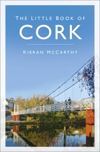
Did You Know? - Cork's Lord Mayors still annually perform the traditional 'Throwing the Dart' ceremony to signify their authority over the port and harbour. - On the corner of the Grand Parade and Tuckey Street, embedded into the pavement, is a cannon that was reputedly used during the Siege of Cork. - In November 1930 a world speed record was set by Joseph S. Wright when he rode his motorcycle at 150mph up the Carrigrohane Straight Road in Cork. The Little Book of Cork is a compendium of fascinating, obscure, strange and entertaining facts about Cork City. Here you will find out about Cork's buildings and businesses, its proud sporting heritage, its hidden corners and its famous (and occasionally infamous) men and women. Through its bustling thoroughfares and down winding laneways, this book takes the reader on a journey through Cork and its vibrant past, recalling the people and events that shaped this great city. A reliable reference book and a quirky guide, this can be dipped into time and again to reveal something new about the people, the heritage and the secrets of Cork.
Sie lesen das E-Book in den Legimi-Apps auf:
Seitenzahl: 215
Veröffentlichungsjahr: 2015
Das E-Book (TTS) können Sie hören im Abo „Legimi Premium” in Legimi-Apps auf:
Ähnliche


Dedicated to those who stopand say hello on Cork’s streets
First published 2015, reprinted 2016
This edition published 2024
The History Press
97 St George’s Place, Cheltenham,
Gloucestershire, GL50 3QB
www.thehistorypress.co.uk
© Kieran McCarthy, 2024
The right of Kieran McCarthy to be identified as the Author of this work has been asserted in accordance with the Copyright, Designs and Patents Act 1988.
All rights reserved. No part of this book may be reprinted or reproduced or utilised in any form or by any electronic, mechanical or other means, now known or hereafter invented, including photocopying and recording, or in any information storage or retrieval system, without the permission in writing from the Publishers.
British Library Cataloguing in Publication Data.
A catalogue record for this book is available from the British Library.
ISBN 978 0 75096 585 9
Typesetting and origination by The History Press
Printed and bound in Great Britain by TJ Books Limited, Padstow, Cornwall.
eBook converted by Geethik Technologies
CONTENTS
Acknowledgements
Introduction: Built on a Swamp
1. A City and its Phases
2. Public Spaces and Buildings
3. The People Who Shaped Cork
4. Hidden Corners
5. Crime and Punishment
6. The Working Life
7. Poverty, Famine and Emigration
8. Leisure and Entertainment
9. The Sporting City
ACKNOWLEDGEMENTS
Thanks to the staff of Local Studies of Cork City Library, Cork City and County Archives and Cork Public Museum for their patience in dealing with so many of my queries over the past twenty years. Thanks to The History Press for their experience and professionalism with this book.
INTRODUCTION: BUILT ON A SWAMP
Cork City’s growth on a swamp is an amazing story. The city is constructed on a shift-shaping landscape – sand and gravel, rushes and reeds – a wetland knitted together to create a working port through the ages. It also provides the foundation for the multifaceted narratives that tie this place together. There is a huge depth to this city’s development. It was a combination of native and outside influences, primarily people who shaped its changing townscape and society since its origins as a settlement. The city possesses a unique character derived from a combination of its plan, topography, built fabric and its location on the lowest crossing point of the River Lee as it meets the tidal estuary and the second largest natural harbour in the world. Indeed, it is also a city that is unique among other Irish cities: it is the only one that has experienced all phases of Irish urban development, from around AD 600 to the present day. There is a very diverse set of archive and library records, some of which are very complete and some which are very fractious. Hence there are many diverse public spaces, historical structures and characters listed in this book.
Standing in the city’s central Bishop Lucey Park, for example, are multiple monuments – remnants of the town walls, the arches for the old Corn Market gates (once behind City Hall), the smiling shawlie within Seamus Murphy’s statue, and the swans of the fountain representing Cork 800. The fountain was placed there in 1985, a nod to the city’s celebration of 800 years since the city’s first charter in 1185. Then there is the imposing sinking tower of Christ Church and its ruinous graveyard. There is the ghostly feel of the buildings that once stood at the park’s entrance. Along the latter stretch, living memory has recorded Jennings furniture shop, destroyed by fire in 1970; the toy shop of Percy Diamond who was cantor (a singer of liturgical music) at the Jewish synagogue; and the Fountain Café over which the famous hurler Christy Ring had a flat for a time. Of course when I mention just these strands, there are other layers I have not mentioned. The layered memories at times and their fleshed-out contexts are endless and often seem timeless.
The presence of all these monuments in the park often plays with my own mind on my walking tours – there is so much one can show and say. These urban spaces seem to slide between the past and present, between material and symbolic worlds. The past does play on the imagination; it interconnects between spaces and times into our present and future. Memories flow and bend across the story of the development of this North Atlantic big hearted small city.
The displayed lower sections of the town walls are from the thirteenth century. During its excavation shards of pottery from Normandy, from the Saintonge region of France, from England, and from other parts of Ireland were also found during the excavation of the wall. For nearly 500 years (1170s to 1690), the town wall symbolised the urbanity of Cork and gave its citizens an identity within the town itself. The walls served as a vast repository of symbolism, iconography and ideology and as symbols of order.
The former town walls like this city were rebuilt in parts by inhabitants through hundreds of years. The river and the tide eroded at their base taking away the various sandstone and limestone blocks and perhaps re-shaping the more resistant ones. The surviving section in Bishop Lucey Park invites the visitor to reflect on life and resistance within the town and how layered the city’s story is. There is wear and tear on the stones presented, which cross from the era of the walled town to the modern city. It invokes the imagination and if anything the wear and tear on our built heritage allows our minds to wonder and reflect on the life and times of people of the past and offers us ideas to take into our future world.
This book begins by delving into the multiple phases of Cork’s development, its tie in to wider Irish history and to a degree how Cork branded itself through the centuries. From the creation of the first port, the city’s coat of arms, to building international confidence as one of the self-proclaimed Venices of Northern Europe, Cork’s historical development and ambition knew no bounds! However, certainly colonists such as the Vikings and Anglo-Normans and immigrant groups (and eventually citizens in their own right) such as Huguenots and Quakers led the settlement to have a role in the wider North Atlantic trade and beyond. All were involved in physically altering the townscape, constructing new buildings and quays and improving the interface with the river and the sea. Some key events such as Cork’s role in the Irish War of Independence in the early twentieth century also led to changes to the city’s fabric. The Burning of Cork incident led to many of its main street buildings, City Hall and Library being destroyed. The city rose from the ashes with a rebuild plan plus also strategies for the growing population and their requests for new housing areas.
Section 2 focuses on the array of public spaces and buildings that the city possesses. You can get lost in and around the multiple narrow streets and broad thoroughfares. Every corner presents the visitor with something new to discover. The pigeon-filled medieval tower of the Augustinian Red Abbey and the ruinous room of an old Franciscan well are rare historical jigsaw pieces that have survived the test of time. The dark dungeon at Blackrock Castle, with its canon opes, dates back to 1585 whilst the star-shaped structure of Elizabeth Fort has stonework stretching way back to the early seventeenth century. The city does not have much eighteenth century built heritage left. What does exist such as the Queen Anne ‘Culture House’ on Pope’s Quay, represents an age where Dutch architecture was all the rage. A high pitched roof and elaborate and beautiful brickwork combines to make a striking structure. The legacy of the city’s golden age of markets is present in the English Market, written about and critiqued since 1788.
Many architects have come and gone over the centuries but the rivalry of The Pain Brothers and the Deane family in the early nineteenth century inspired both families to excel in the design of some of the most gorgeous stone-built buildings from banks to churches to the quadrangle of University College Cork (UCC). All were embellished with local limestone, which on a sunny day, when the sun hits such a stone, lights up to reveal its splendour and the ambition of Ireland’s second city. The settlement is also a city of spires linking back 1,400 years to the memory of the city’s founding saint, Finbarre. The old medieval churches of St Peter and Christ Church are now arts centres but many of elements of their ecclesiastical past can be glimpsed and admired. Couple these with the beautiful St Anne’s church tower and the scenery from the top of its pepper pot tower, the nineteenth-century splendour of the spires and stained glass of St Fin Barre’s Cathedral and the sandstone block work of SS Mary’s and Anne’s North Cathedral, and the visitor can get lost in a world of admiration and wider connections to global religions. Then there is the determination that led the city to also possess the longest building in Western Europe – the old Cork Lunatic Asylum or Our Lady’s Hospital and the tallest building in the country – County Hall, and only in recent years surpassed by the Elysian Tower.
Then there are the buildings which belong to the people. The current City Hall, the second building on the site, is the home of Cork City Council, formerly Corporation, which was established in Anglo-Norman times. The building is a memorial to the first building, which burned down in 1920, and to the memory of two martyred lord mayors, Terence McSwiney and Tomás MacCurtain. Terence died on a hunger strike and Tomas was shot in his house in Blackpool, both dying for the Irish War of Independence cause. The train station, Kent Station, also links through its name to Irish Easter Rising martyr, Tomas Kent. The station is the last of six railway stations, which travelled out into the far reaches of County Cork.
Cork’s ambition was also displayed and carried by its people – its famous sons and daughters, who are explored in section three. Cork can boast connections to the wider world through its artists, architects and sculptors. They were renowned in their day, not just in Ireland but wider afield. Artists like James Barry and Daniel Maclise brought their own unique style into Britain’s art worlds and galleries. Sculptors like John Hogan’s and later Joseph Higgins and Seamus Murphy inspired a generation of artists to take up their own artistic endeavours and created an international audience who wanted to see their work.
Here is a city as well that brought forward great writers of international standing such as Denny Lane, Daniel Corkery, Seán O’Faoláin, Frank O’Connor, and Seán Ó Riordáin. Composers range from Seán O’Riada to Aloys Fleischmann. Rory Gallagher, the famous electric guitar star of his day, is also remembered and his legend recalled regularly. Dancing into memory is the great ballet dancer and director Joan Denise Moriarty.
Amongst the city’s eminent list of social reformers are Nano Nagle, Mary Aikenhead, Thomas Dix Hincks, Fr Theobald Mathew, Fr Christy O’Flynn and Br James Burke. All sought to help the city’s impoverished. Amongst the remembered political leaders is Jack Lynch who became the city’s first Taoiseach or Irish Prime Minister. Then there are the local heroes who gave the citizens employment, promoted freedom of expression, and above all showed that Cork is well able to fight for its position as Ireland’s southern capital.
I have often walked around Cork in an attempt to get lost in its hidden corners, to be a tourist in my city, reading clues from bye-gone ages. The city does remember historical events which section four attempts to explore – the enormous temperance campaign of Fr Mathew is immortalised in his statue on St Patrick’s Street, the National Monument commemorating Irish struggles against the British Empire before Independence. The First World War memorial on the South Mall is nestled into a nice green area and is set against the backdrop of the boardwalk.
However, weaving in and out of side streets and laneways, the visitor can get lost in the world of historical tales. Check out the city’s former Mayoral House, a street made for a cornmarket, a graveyard for deceased sailors, stories of steamships, educational morals in an art gallery, casts from the Vatican Art Gallery and tales of immigrants and their experiences from other parts of the world. Cork can boast to have a National Sculpture Factory in an old tramway engine house, colourful Harry Clarke windows, a former nineteenth-century waterworks made into a science centre, and an old famine relief project road, which turned into the site of world record motorcycle speed test attempt in the early twentieth century.
There is an underbelly to Cork’s history as revealed in section five. It’s a city where its ambition was pushed forcefully through takeover and colonisation. One image that always strikes me are the heads on spikes in the 1575 Pacata Hibernia map of the city. As a centre of power it created tensions between those who lived within its walls and those outside. Eventually the strength of the walled town succumbed to attack by Irish and Jacobite forces and in turn they were attacked and the city heavily damaged. Out of that event and an enlarging economy and population came crime in abundance. Many crimes were attempts to attain food for impoverished families. Watchmen patrolled the city’s area where most offences occurred. Many were interred in Cork City Gaol. The more malicious criminals such as murderers and anti-crown supporters were hung at Gallows Green off Bandon Road, one of the city’s large southern approach roads.
A look at the working life of Cork in section six reveals a very busy city through the ages. From medieval craft-making to creating the largest butcheries in the island of Ireland, Cork citizens were dedicated to making the port of Cork the premier harbour in the North Atlantic. Cork possessed the largest brewery and butter market in the country, hence hosting large-scale employment and inspiring other businesses to root themselves in the city and region. In the twentieth century, the firms of Fords and Dunlops gave employment to thousands of Cork people whilst creating a production empire of tractors, cars, tyres and even golf balls!
Not everyone was involved in the economic boom. Life in the city for the poorer classes was a struggle as outlined in section seven. Built across a swamp, life was damp – the streets were flooded regularly by the river and the tide. Economic boom brought a population explosion. Those who were not successful in securing employment filled the hallways of the poor house of the House of Industry in Blackpool and later during the Great Famine years and beyond, the Cork Union Workhouse on Douglas Road. Many left from ships on Cork’s quays bound for countries such as Great Britain and further afield such as America. The story of Annie Moore and her adventure to the metropolis of New York is representative of hundreds of thousands of people who became part of Ireland’s diaspora legacy.
Scattered across the city are several sites, which have entertained the combined masses over many centuries as showcased in section eight. Take a stroll at the Mardyke, the Marina, and the Lough – they are institutions in the southern city. Barracka and Buttera Bands seem to have been around for time immemorial, entertaining citizens since the nineteenth century. Grabbing a ticket and sitting in Cork Opera House, Everyman Palace, the Firkin Crane and the Cork Arts Theatre, the visitor can see the depth of dramatic talent and an opportunity to see the citizen uniting to support music, drama and the wider arts. This section also takes a glance at two of Cork’s oldest cinema sites, the Pavilion and Savoy. The ideas of creating a spectacle, Cork has always taken to heart. It can also boast of building show grounds, viewing towers, Turkish baths, and world fairs!
Section nine gives an overview of Cork’s prowess in sport since the records began. From rowing on the River Lee to tennis, cricket to the ball games of Gaelic Irish football and hurling, rugby and soccer, the city excels in several sports to great success. The section explores the highs and lows of this success, charting the heroes of Cork sport, from the bowling prowess of Mick Barry to the exemplary hurling skills of Christy Ring, to soccer legend Roy Keane, track athletes like Sonia O’Sullivan and Rob Heffernan, to rugby legends such as Ronan O’Gara and Peter Stringer.
So much to see, so much to do – welcome to the ‘real capital’ of Ireland!
Kieran McCarthy, 2024
1
A CITY AND ITS PHASES
ST FINBARRE, PATRON SAINT OF CORK
A legend records that the origins of Cork City begins at the source of the Lee in the scenic Shehy Mountains at the heart of which lies the cherished pilgrimage site of Gougane Barra (Finbarre’s rocky cleft). Cork City’s patron saint, St Finbarre, reputedly established one of his earlier monasteries on an island in the middle of Gougane Lake. Legend has it that he then left to walk the river valley at the mouth of which he established the monastery at what is now the site of St Fin Barre’s Cathedral in Cork City. His myth endures in the valley and it is the legacy of St Finbarre that gives the city and valley its core spiritual identity and an origins story. Across the valley, there are churches named after Finbarre and a number of memorials depicting the saint in churches in the form of stained-glass windows and statues.
There are several ways of spelling the saint’s name, but Finbarre is the most common. His connection seems rooted in several religious sites across the Lee Valley from source (Gougane Barra) to mouth (Cork City). Finbarre’s Life was initially composed in Latin and was then passed down along three principal lines, each resulting in a major revision of the original text. In all, Finbarre’s Life survives in thirty-five manuscripts and twenty-one copies in early vernacular. Finbarre’s written vernacular life has undergone little major change between its earliest and latest extant copies. These date respectively from about 1450 to 1874. Finbarre’s original Life seems to have been composed, perhaps as part of a collection, in Cork between AD 1196 and 1201, some twenty-five years after the arrival of the Normans in south Munster. This was a time of reform in the Catholic Church.
St Finbarre, depicted in stained-glass window in church of the Immaculate Conception, Farran, County Cork.
Finbarre’s hermitage was located around the area of present-day Gillabbey Street. It grew to be an important religious centre in southern Munster, providing ecclesiastical services in the form of a church and graveyard, and secular services in the form of a school, hospital and hostel. The annals record that languages such as Latin were taught at the school and that it was one of the five primary sites in Ireland in terms of size and influence. Word quickly spread of the monastery’s valuable contribution to society, and it became necessary to expand the site. Between AD 600 and 800, a larger hermitage was constructed east of the original site, on open ground now marked by St Fin Barre’s Cathedral. It is believed that over the subsequent centuries this hermitage grew to a point where it extended along the northern district of the lough, and extended on both sides of Gillabbey Street and College Road about as far as the locality now occupied by University College Cork (UCC).
Around the year AD 623 St. Finbarre died at the monastery of his friend, St Colman, at Cloyne in east Cork. His body was returned to his hermitage and his remains were encased in a silver shrine. Here they remained until 1089 when they were stolen by Dermod O’Brien. The shrine and the remains have never been recovered. Legend has it that the location of his tomb is just to the south-east of the present cathedral, overlooked by the famous Golden Angel. St Finbarre’s feast day is celebrated on 25 September. As the city’s patron saint he is still greatly revered.
VICIOUS VIKINGS
All that is known of the first recorded attack on the monastery at Corcach Mór na Mumhan was that it occurred in AD 820 and that the most valuable treasures were plundered. It is also known that it was raided four to five times in the ensuing 100 years. The marshy environment would not have been entirely welcoming, but the Vikings nonetheless established a settlement or longphort here. We cannot be sure of the exact location of the Viking town, but it is known that in AD 848 a settlement called Dún Corcaighe (Fort of the Marshes) was besieged by Olchobar, King of Caiseal from north Munster. It is thought that it was located on an island, the core of which could be marked by South Main Street, an area that was developed in ensuing centuries by other colonialists. With this in mind, Dún Corcaighe would have been located strategically near the mature stage of the River Lee, and therefore would have controlled the lowest crossing-point of the river, whilst being sheltered by the valley sides. The Norse invaders established a maritime network with other Viking ports, namely those at Dublin, Waterford, Wexford, and Limerick.
The Viking presence in Corcach Mór na Mumhan was interrupted by invaders from Denmark around AD 914 who also attacked other Viking towns in Ireland and gained control of them. In Cork, these new invaders – the Danish Vikings – started off by raiding the monastery on the hillside but soon turned their attention to wealthier and more powerful Gaelic kingdoms in Munster. The Danes decided to settle in Ireland. They took over and adapted existing Norwegian bases and constructed additional ones to a similar but larger design. Unfortunately, the historical and archaeological information available regarding a Danish settlement at Cork is poor compared to that arising from excavations in Waterford and Dublin. Nevertheless, there are some clues that give an insight into the location, structure and society of Danish Viking-Age Cork. It is known that there were at least three main areas of settlement: firstly, they lived on the southern valley side next to the monastery, the core area of which is present-day Barrack Street; secondly, they settled on a marshy island now the location of South Main Street, the Beamish and Crawford Brewery, Hanover Street and Bishop Lucey Park; and thirdly they settled on the adjacent northern valleyside, now the area of John Street in Lower Blackpool.
The publication Archaeological Excavations in South Main Street 2003–2005 (2014) records Hiberno Norse structures found under South Main Street area. Two to three metres underneath our present-day city, archaeologists exposed the remains of timber structures. The dendrochronological dates of the timbers found on the site suggest that there was continuous felling of trees and construction of buildings and reclamation structures from the late eleventh century. So here on a swamp 900 years ago, a group of settlers decided to make a real go at planning, building, reconstructing and maintaining a mini town of timber on a sinking reed-ridden, riverine tidal space.
A SAFE HARBOUR FOR SHIPS
By the early 1170s the Anglo-Normans had taken control of large tracts of land from Waterford to Dublin. In 1172 they turned their attention to Cork. Two Anglo-Norman lords, Milo de Cogan and Robert Fitzstephen, were despatched to Corcach Mór na Mumhan with a small land force to confront and dispossess the Vikings and chief of the McCarthys, Dermod McCarthy, of his lands in counties Cork and Kerry. Once they had been defeated, Fitstephen and De Cogan began the transformation of the settlement into an Anglo-Norman town. It was to become one of fifty-six early Anglo-Norman walled towns established in Ireland, some re-founded on adapted and extended Viking settlements sites. Initially, they noted that the Danish settlement on the marshy island was ‘fortified’ and had a gate (‘porta’) leading into it. The nature of the fortification, whether it was stone or timber, was not recorded. Incorporating elements of the old settlement, the newcomers instigated many fundamental changes to the town.
The name of the town was shortened to Corke. The renaming was significant as it was the first instance of the anglicising of a Gaelic name. In the late 1100s, Henry II chose Bristol as the model to be followed in developing manorial towns in Ireland, especially in issues such as liberties, privileges and immunities. Corke was to have its own mayor, sheriffs, and a corporation of councillors. The city still possesses these legacies. The term is now Lord Mayor and the Corporation a City Council.
Between the 1170s and 1300s, a stone wall, on average 8 metres high, became the new perimeter fence for the old Viking settlement area on the island, which was accessible via a new drawbridge built on the site of the Viking bridge, Droichet. Beyond this wall, a suburb called Dungarvan (now the area of North Main Street) was established on a nearby island.
By 1317 the full circuit, which included the extension of the wall around Dungarvan, was complete. Thus the redevelopment of the town walls created one single walled settlement (6½ha. in extent) instead of a walled island with an unfortified island settlement and Dungarvan outside it. Within the town a channel of water was left between the old walled settlement and the newly encompassed area of Dungarvan, with access between the two provided by an arched stone bridge called Middle Bridge. A millrace dominated the western half of this channel, while the remaining eastern half was the town’s central dock.


